19th Century Maps
to
1,669
2,188
75
2,266
72
9
9
4
2
2
1
1
2,936
2,266
475
3
290
34
10
126
10
37
9
2
5
4
3
3
2,228
71
33
12
10
335
174
106
106
102
2,266
2,266
2,266
104
23
9
8
7
Period: 19th Century
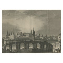
Old and Rare Antique Print of Moscow in Russia, 1841
Located in Langweer, NL
Antique print titled 'Moskou'. Old print of Moscow, Russia. This print originates from 'Nederlandsch museum: geschied- en letterkundige merkwaardigheden'.
Artists and Engravers: E...
Category
Antique 19th Century Maps
Materials
Paper
$180 Sale Price
20% Off
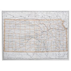
Large Original Antique Map of Kansas, USA, 1894
Located in St Annes, Lancashire
Fabulous map of Kansas
Original color
By Rand, McNally & Co.
Published, 1894
Unframed
Free shipping.
Category
American Antique 19th Century Maps
Materials
Paper
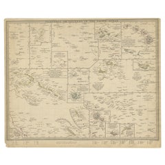
Antique Map of Polynesia by Walker, 1840
Located in Langweer, NL
Antique map titled 'Polynesia or Islands in the Pacific Ocean'. This map depicts various islands including the Lousiade Archipelago, Tahiti, Pitcairn Island, Juan Fernandez, The low ...
Category
Antique 19th Century Maps
Materials
Paper
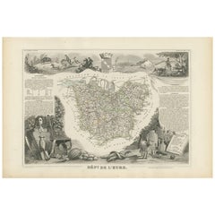
Antique Map of Eure ‘France’ by V. Levasseur, 1854
Located in Langweer, NL
Antique map titled 'Dépt. de l'Eure'. Map of the French department of Eure, France. This region of France is home to Giverny, where impressionist Claude Monet’s home and garden can b...
Category
Antique 19th Century Maps
Materials
Paper
$171 Sale Price
20% Off
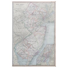
Large Original Antique Map of New Jersey, USA, circa 1900
Located in St Annes, Lancashire
Fabulous map of New Jersey
Original color
Engraved and printed by the George F. Cram Company, Indianapolis.
Published, circa 1900
Unframed
Repairs to minor edge tears
Category
American Antique 19th Century Maps
Materials
Paper
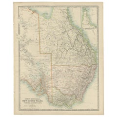
Antique Detailed Map of New South Wales, Queensland & Victoria, Australia, 1865
Located in Langweer, NL
Antique map Australia titled 'South Australia, New South Wales, Victoria & Queensland'. Old map depicting South Australia including New South Wal...
Category
Antique 19th Century Maps
Materials
Paper
$333 Sale Price
20% Off
Decorative Print of the Belgium Army with Ambulance Troops in the Field, 1833
Located in Langweer, NL
One nicely hand coloured print of an original serie of 23 plates, published in 1833. Rare.
From a serie of beautiful lithographed plates with Belgian military...
Category
Antique 19th Century Maps
Materials
Paper
$304 Sale Price
20% Off
Antique Map of The United States of North America, 1882
Located in Langweer, NL
This is a historical map titled "The United States of North America, Central Part" from the 1882 Blackie Atlas. It depicts the continental United States with a high level of detail, ...
Category
Antique 19th Century Maps
Materials
Paper
$237 Sale Price
20% Off
Antique Map of the British Isles with Outline Coloring
Located in Langweer, NL
Antique map titled 'Iles Britanniques'. Attractive map of the British Isles. Details England, Scotland and Ireland as well as parts of neighboring France. Upper right corner features...
Category
Antique 19th Century Maps
Materials
Paper
$104 Sale Price
20% Off
Antique Map of Southern Italy and Sardinia by Johnston, 1882
Located in Langweer, NL
"Antique map titled 'South Italy and the Island of Sardinia'. Old map of Southern Italy and the island of Sardinia. With an inset map of the Bay ...
Category
Antique 19th Century Maps
Materials
Paper
$95 Sale Price
20% Off
Colorful Detailed Antique Map of The British Islands and `The North Sea, 1882
Located in Langweer, NL
Discover 'The British Islands and The North Sea' Map with Insets of Orkney, Shetland, and Channel Islands! This captivating original antique map offers a detailed view of the British...
Category
Antique 19th Century Maps
Materials
Paper
$180 Sale Price
20% Off
Large Original Antique Map of Maine, USA, C.1900
Located in St Annes, Lancashire
Fabulous map of Maine
Original color
Engraved and printed by the George F. Cram Company, Indianapolis.
Published, C.1900
Unframed
Free shipping.
Category
American Antique 19th Century Maps
Materials
Paper
Antique Map of Scandinavia by Lapie, 1842
Located in Langweer, NL
Antique map titled 'Carte de la Scandinavie comprenant les Royaumes de Suède de Norwege et de Danemark'. Map of Scandinavia including Sweden, Norway and Denma...
Category
Antique 19th Century Maps
Materials
Paper
$523 Sale Price
20% Off
Antique Map of South Africa by Wyld '1845'
Located in Langweer, NL
Antique map titled 'South Africa'. Original antique map of South Africa.
This decorative original old map originates from 'An Atlas of th...
Category
Antique 19th Century Maps
Materials
Paper
$190 Sale Price
20% Off
Antique Map of Southern Syria by Fullarton & Co, circa 1860
Located in Langweer, NL
Antique map titled 'Syria south part'. Published by Fullarton & Co, Glasgow, circa 1860.
- Title: Syria South Part
- Publisher: Fullarton & Co, Glasgow
- Date of Publication: Circa ...
Category
English Antique 19th Century Maps
Materials
Paper
Antique Map of the Northern Part of South America by Delamarche, 1806
Located in Langweer, NL
Antique map titled 'Terre-Ferme, Perou, Bresil, Pays de L'Amazone.' This map shows the northern part of South America with Peru, Brazil, Guyana etc. By Robert de Vaugondy, revised an...
Category
Antique 19th Century Maps
Materials
Paper
$166 Sale Price
20% Off
Antique County Map, Dorset, English, Framed Engraving, Cartography, Lithography
Located in Hele, Devon, GB
This is an antique lithography map of Dorset. An English, framed atlas engraving of cartographic interest, dating to the mid 19th century and later.
Superb lithography of Dorsetshi...
Category
British Victorian Antique 19th Century Maps
Materials
Glass, Wood, Paper
Original Antique Coloured Map of Western Africa, Published in 1882
Located in Langweer, NL
This is a map of Western Africa from the 1882 Blackie & Son atlas. The map details the West African coast from the Sahara Desert in the north down to the Gulf of Guinea, including a ...
Category
Antique 19th Century Maps
Materials
Paper
$237 Sale Price
20% Off
Mediterranean Encounters: From the Punic Wars to the Hannibalic War, 1880
Located in Langweer, NL
The map, with the title "MARE INTERNUM cum populis adiacentibus a bello Hannibalico usque ad Vespasiani M. princip," depicts the Mediterranean Sea and its surrounding territories, ex...
Category
Antique 19th Century Maps
Materials
Paper
$352 Sale Price
20% Off
Antique Map of Asia in the 12th, 13th and 14th Century, 1877
Located in Langweer, NL
Antique map titled 'Azie in de 12de, 13de en 14de eeuw.' (Asia in the 12th, 13th and 14th century). Historic map of Asia. This original antique map origi...
Category
Antique 19th Century Maps
Materials
Paper
$71 Sale Price
20% Off
Imperium Romanum: A Detailed Map of the Roman Empire in its Zenith, 1880
Located in Langweer, NL
This original antique map, titled "IMPERIVM ROMANVM", is a detailed depiction of the Roman Empire at the height of its power. The main map encompasses the vast expanse of the Roman territories, stretching from the British Isles in the northwest to the deserts of Arabia and the northern fringes of Africa in the southeast.
**Key Features of the Map:**
1. **Territorial Colors**: The map uses different colors to distinguish the various provinces of the Roman Empire. These color-coded areas are to represent the administrative divisions within the Empire.
2. **Topography**: It shows a considerable amount of topographical detail, with mountain ranges, rivers, and bodies of water such as the Mediterranean Sea, prominently displayed.
3. **Cities and Settlements**: Cities are marked, with symbols indicative of their size or importance. Major cities such as Rome, Constantinople, Alexandria, and Carthage are highlighted.
4. **Road Networks**: There appear to be lines connecting various cities and towns, which could represent the famous Roman road network that facilitated trade and military movements.
5. **Latin Text...
Category
Antique 19th Century Maps
Materials
Paper
$352 Sale Price
20% Off
Old Original Map of Africa and Arabia, 1848
Located in Langweer, NL
Antique map titled 'Africa et Arabia'.
Old map of Africa and Arabia originating from 'Orbis Terrarum Antiquus in usum Scholarum'.
Artists and Engravers: Published by Justus P...
Category
Antique 19th Century Maps
Materials
Paper
$123 Sale Price
20% Off
Antique Map of Canada, The Province of Ontario and Part of Quebec, 1882
Located in Langweer, NL
This is a historical map from the 1882 Blackie Atlas, this time detailing "The Province of Ontario, and Part of Quebec" in Canada. The map presents a detailed illustration of Ontario...
Category
Antique 19th Century Maps
Materials
Paper
$237 Sale Price
20% Off
Antique Map of the Northern Part of South America by J. Tallis, circa 1851
Located in Langweer, NL
A decorative and detailed mid-19th century map of the northern part of South America (including modern day Venezuela, Colombia, Ecuador, Guyana, Suriname and French Guiana) which was drawn and engraved by J. Rapkin (vignettes by H. Winkles & W. Lacey) and published in John Tallis & Co.'s The Illustrated Atlas (London & New York: circa 1851).
The Illustrated Atlas, published from 1849 onwards, was the last decorative world atlas. The 'Venezuela, New Granada...' map was typical of the many Fine ones which appeared in this work with its decorative border and attractive vignettes. Illustrated are views of Mount Chimborazo, Ecuador; the 'Fall of the Bagota' (Tequendama Falls, Colombia); Rheas and a prospect of Paramaribo Harbour (Dutch Guiana...
Category
Antique 19th Century Maps
Materials
Paper
$261 Sale Price
20% Off
Small Map of St. Anna Bay and Willemstad, Curaçao – Dutch Colonial View, c. 1880
Located in Langweer, NL
Map of St. Anna Bay and Willemstad, Curaçao – Dutch Colonial View, c. 1880
This attractive late 19th-century map titled “De St. Anna-baai en de hoofdstad van Curaçao” offers a detai...
Category
Antique 19th Century Maps
Materials
Paper
Antique Map of South America by Reichard, 1820
Located in Langweer, NL
Antique map titled 'Süd America'. Decorative antique map of South America with an inset map of Ecuador. Artists and Engravers: Published b...
Category
Antique 19th Century Maps
Materials
Paper
$82 Sale Price
20% Off
Original Antique Map of New Brunswick and Nova Scotia, 1889
Located in St Annes, Lancashire
Great map of New Brunswick and Nova Scotia
Drawn and Engraved by W. & A.K. Johnston
Published By A & C Black, Edinburgh.
Original colour
Unfr...
Category
Scottish Victorian Antique 19th Century Maps
Materials
Paper
Antique Map of New Zealand, 1895
Located in Langweer, NL
Antique map titled 'Neu-Seeland.' Map of New Zealand. With inset maps of the large cities. This attractive original old antique print / plate / map ...
Category
Antique 19th Century Maps
Materials
Paper
$114 Sale Price
20% Off
Antique Map of North America by Lapie '1842'
Located in Langweer, NL
Antique map titled 'Carte de l'Amérique septentrionale'. Map of North America, with an inset map of the Aleutian Islands. This map originates from 'Atlas universel de géographie anci...
Category
Antique 19th Century Maps
Materials
Paper
$570 Sale Price
20% Off
Original Antique English County Map, Leicestershire, J & C Walker, 1851
Located in St Annes, Lancashire
Great map of Leicestershire
Original colour
By J & C Walker
Published by Longman, Rees, Orme, Brown & Co. 1851
Unframed.
Category
English Other Antique 19th Century Maps
Materials
Paper
Steel Engraved Map of the United States with Inset Map of Florida
Located in Langweer, NL
Antique map titled 'United States'. Steel engraved map of the United States. With small inset map of the continuation of Florida. Source unknown, to be determined. Published circa 1843.
Category
Antique 19th Century Maps
Materials
Paper
$152 Sale Price
20% Off
Northern Australia Map with The Routes of Explorers Ringwood and McMinn, 1878
Located in Langweer, NL
Antique map titled 'Neue Aufnahmen in Nord-Australien'.
Old map of Northern Australia showing the 'new routes' of the exploration of Ringwood and McMinn. Covers as far east as pa...
Category
Antique 19th Century Maps
Materials
Paper
$123 Sale Price
20% Off
Antique Map of Limburg, The Southern Most Province in The Netherlands, c.1870
Located in Langweer, NL
Antique map titled 'Limburg'. Map of the province of Limburg, the Netherlands. This map originates from 'F. C. Brugsma's Atlas van het Koninkrijk der Nederlanden (..)'. Artists and E...
Category
Antique 19th Century Maps
Materials
Paper
$123 Sale Price
20% Off
Original Antique Map of Greece and Epirus after the Persian Wars, Published 1880
Located in Langweer, NL
The map titled "GRAECIA, EPIRUS post bella Persica," translates to "Greece and Epirus after the Persian Wars." It covers the regions of ancient Greece and Epirus following the Greco-Persian Wars, a series of conflicts between the Greek city-states and the Persian Empire during the 5th century BC.
What makes this map interesting:
1. **Historical Context**: The period after the Persian Wars was pivotal for ancient Greece, leading to the rise of Athens as a major power and the Golden Age of Athens.
2. **Inset Maps**: Detailed insets, such as the one showing the Acropolis of Athens, provide close-up views of historically significant locations.
3. **Topography**: It features the diverse terrain of Greece, from the rugged mountain ranges to the intricate coastlines and islands, influencing the development of Greek city-states.
4. **City-States**: The map likely details the various polis or city-states, such as Athens, Sparta, Thebes, and others, which played critical roles in the Persian Wars.
5. **Battle Sites**: It might mark important battle sites from the wars, like Marathon, Thermopylae, Salamis, and Plataea.
6. **Latin Labels**: The use of Latin for place names and descriptions adds to the map's scholarly quality.
7. **Cultural Landmarks**: The map may include locations of significant cultural and historical landmarks from the era, such as temples, theatres, and agoras.
This map is from the "Spruner-Menke Atlas Antiquus," compiled by Karl Spruner von Merz and edited by Theodorus Menke. The atlas, known for its detailed maps of historical and ancient geographies, was a significant educational tool in the 19th century.
The Greco-Persian Wars, which included famous battles such as Marathon and Salamis, were crucial for the preservation of Greek independence...
Category
Antique 19th Century Maps
Materials
Paper
$352 Sale Price
20% Off
Original Antique Map of Central America / Florida, Arrowsmith, 1820
Located in St Annes, Lancashire
Great map of Central America.
Drawn under the direction of Arrowsmith.
Copper-plate engraving.
Published by Longman, Hurst, Rees, Orme and Brown, 1820
Unframed.
Category
English Antique 19th Century Maps
Materials
Paper
1839 Map of Karte Des "Russischen Reiches in Europa Und Asien" Ric.R0013
Located in Norton, MA
1839 map of Karte Des
"Russischen Reiches in Europa and Asien"
Ric.r013
Map of the European and Asian parts of Russian Empire. Karte der Russischen Reiches in Europa und Asien...
Category
Unknown Antique 19th Century Maps
Materials
Paper
Antique Map of Africa by Lapie, 1842
Located in Langweer, NL
Antique map titled 'Carte d'Afrique'. Map of Africa. This map originates from 'Atlas universel de géographie ancienne et moderne (..)' by Pierre M. Lapie...
Category
Antique 19th Century Maps
Materials
Paper
$570 Sale Price
20% Off
Large Original Antique Map of Australia by Sidney Hall, 1847
Located in St Annes, Lancashire
Great map of Australia
Drawn and engraved by Sidney Hall
Steel engraving
Original colour outline
Published by A & C Black. 1847
Unframed
Free shipping.
Category
Scottish Antique 19th Century Maps
Materials
Paper
Antique Map Depicting Sydney and Surrounding Areas, Known as Port Jackson, c1889
Located in Langweer, NL
An antique map depicting Sydney and its surrounding areas, known as Port Jackson, dating from around 1889. It was produced by E. Reclus and is part of the "Nouvelle géographie univer...
Category
Antique 19th Century Maps
Materials
Paper
$333 Sale Price
20% Off
Original Antique Map of Part of the Bahar Region (India), 1834
Located in Langweer, NL
Antique map titled 'India X'. Old steel engraved map of part of the Bahar region, it also shows part of Nepal.
Artists and Engravers: Engraved by J. & C. Walker. Published under th...
Category
Antique 19th Century Maps
Materials
Paper
$275 Sale Price
20% Off
Original Map of Greece at the Time of the Dorian Migration, Published in 1880
Located in Langweer, NL
The map titled "GRAECIA TEMPORI MIGRATIONIS DORICAE," translates to "Greece at the Time of the Dorian Migration." This map showcases the regions of ancient Greece during the period f...
Category
Antique 19th Century Maps
Materials
Paper
$352 Sale Price
20% Off
Antique Map of Asia from the Middle East to the Coast of Alaska, 1816
Located in Langweer, NL
Antique map titled ‘L’Asie‘. This is an original antique map of Asia, by Hérisson, taken from atlas ""Nouv. Abrége de Géographie"". An engraved map with coloring of Asia from the Mid...
Category
Antique 19th Century Maps
Materials
Paper
$152 Sale Price
20% Off
Large Original Antique Map of Poland by Sidney Hall, 1847
Located in St Annes, Lancashire
Great map of Poland
Drawn and engraved by Sidney Hall
Steel engraving
Original colour outline
Published by A & C Black. 1847
Unframed
...
Category
Scottish Antique 19th Century Maps
Materials
Paper
Antique Map of the World by Johnson, '1872'
Located in Langweer, NL
Antique map titled 'Johnson's World. Original world map. This map originates from 'Johnson's New Illustrated Family Atlas of the World' by A.J. John...
Category
Antique 19th Century Maps
Materials
Paper
$445 Sale Price
25% Off
Antique Map Showing the Division and Distribution of Reptiles by Johnston '1850'
Located in Langweer, NL
Antique map titled 'Geographical division and distribution of reptilia and ophidia. Original antique map showing the geographical division and distribution of reptiles and serpents. ...
Category
Antique 19th Century Maps
Materials
Paper
$190 Sale Price
20% Off
A Decorative Map of Nova Scotia and Newfoundland by John Tallis, 1851
Located in Langweer, NL
The map is part of the series created by John Tallis & Company, known for their mid-19th-century maps. This particular map illustrates the regions of Nova Scotia and Newfoundland and...
Category
English Antique 19th Century Maps
Materials
Paper
Authentique Map by Pilon of The French Colonies in The West Indies, 1876
Located in Langweer, NL
The 1876 map titled "Carte des Colonies Françaises aux Antilles" represents a significant contribution to cartography within the "Grand Atlas Départemental de la France de L'Algérie ...
Category
Antique 19th Century Maps
Materials
Paper
$228 Sale Price
20% Off
Antique Map of Alabama
Located in Langweer, NL
Antique map titled 'Alabama'. Original antique map of Alabama, United States. This print originates from 'Encyclopaedia Britannica', Ninth Editi...
Category
Antique 19th Century Maps
Materials
Paper
$275 Sale Price
20% Off
Old Map of Mediterranean Powers: Pompey to Actium (66-31 BC), Published in 1880
Located in Langweer, NL
This is a historical map that depicts the Mediterranean region during a specific timeframe in Roman history, from the return of Pompey the Great after...
Category
Antique 19th Century Maps
Materials
Paper
$352 Sale Price
20% Off
Decorative Antique Map of Eastern Canada, Published in 1882
Located in Langweer, NL
This is a historical map from the 1882 Blackie Atlas, focused on eastern Canada and the maritime provinces. The map is titled "Canada. No. 2. Provinces of Nova Scotia, New Brunswick,...
Category
Antique 19th Century Maps
Materials
Paper
$237 Sale Price
20% Off
Large Original Antique Map of The Environs of Dublin, Ireland, circa 1880
Located in St Annes, Lancashire
Great map of The Environs of Dublin
Published circa 1880
Unframed
Free shipping.
Category
Scottish Antique 19th Century Maps
Materials
Paper
Antique Map of South Australia, Victoria, Queensland and New South Wales, c.1860
Located in Langweer, NL
Antique map Australia titled 'South Australia, New South Wales, Victoria & Queensland'. Old map depicting South Australia including New South Wal...
Category
Antique 19th Century Maps
Materials
Paper
$323 Sale Price
20% Off
Old Map of Southern India and Ceylon 'Sri Lanka', 1882
Located in Langweer, NL
Antique map titled 'India (Southern Sheet)'.
Old map of Southern India and Ceylon (Sri Lanka). With an inset map of the South-Eastern Provinces of India. This map originates from...
Category
Antique 19th Century Maps
Materials
Paper
$275 Sale Price
20% Off
Antique Map of South America by Kelly, 1835
Located in Langweer, NL
Antique map titled 'South America'. Old map of South America engraved by A. Findley. With decorative border. Artists and Engravers: Published by Thomas Kelly, London.
Artist: Publ...
Category
Antique 19th Century Maps
Materials
Paper
$68 Sale Price
20% Off
Pl. 465 Antique Print of Roof Structures by Bell, c.1810
Located in Langweer, NL
Antique print titled 'Plate CCCCLXIV Roofs'. Old print depicting various roof structures. This print originates from 'Encyclopedia Britannica'. Artists and Engravers: Engraved by A. ...
Category
Antique 19th Century Maps
Materials
Paper
$57 Sale Price
20% Off
Nice Decorative Black and White Small Antique Map of Europe, 'circa 1834'
Located in Langweer, NL
Antique French map titled 'Europe par A.H. Dufour'. Uncommon map of Europe.
Published by or after A.H. Dufour, circa 1834. Source unknown, to be d...
Category
Antique 19th Century Maps
Materials
Paper
$190 Sale Price
20% Off
Antique Map of Asia Showing Its Political Divisions, 1874
Located in Langweer, NL
Antique map titled 'Map of Asia showing its Gt. Political Divisions and also the various routes of Travel between London & India, China & Japan & c'. This map covers from the Arabian...
Category
Antique 19th Century Maps
Materials
Paper
$85 Sale Price
20% Off
Large Antique Map of New York State with Inset Maps
Located in Langweer, NL
Antique map titled 'Johnson's New York' Large map of New York State. With insets of Albany, Oswego, Buffalo, Rochester, Syracuse, Troy and NYC. Published by Johnson and Browning, 186...
Category
Antique 19th Century Maps
Materials
Paper
$466 Sale Price
20% Off
Antique Map of the Western Part of the German Empire by Levasseur, '1875'
Located in Langweer, NL
Antique map titled 'Empire d'Allemagne (..)'. Large map of the western part of the German Empire. This map originates from 'Atlas de Géographie Moderne Physique et Politique' by A. L...
Category
Antique 19th Century Maps
Materials
Paper
$237 Sale Price
50% Off
Antique Map of the Islands in the Atlantic Ocean including Bermuda & Cape Verde
Located in Langweer, NL
Antique map titled 'Islands in the Atlantic'. Steel engraved map of the islands in the Atlantic Ocean. It shows 16 individual maps on one sheet. Covers the Azores or Western Isles, Faeroe Isles, Madeira Isles, Princes Island, Canary Islands, Fernando Po, Anno Bon, St. Thomas, Bermuda Isles, Trinidade Isles, Fernando Noronha, Cape Verde Isles, Ascension Island, St. Helena, Tristan d'Acunha Isles and the Falkland Isles.
Engraved by J. & C. Walker. Published by George Cox...
Category
Antique 19th Century Maps
Materials
Paper
$275 Sale Price
20% Off
