1850s Collectibles and Curiosities

to
90
153
48
201
20
3
3
1
1
1
4,371
6,576
13,269
2,710
3,496
4,589
3,008
518
314
589
736
463
893
863
890
653
566
129
45
28
12
12
78
50
30
25
24
201
201
201
1
1
1
1
1
Period: 1850s
Exquisite 1850s Vintage Map of North America: A Victorian Cartographic Treasure
Located in Langweer, NL
Ornate 19th-Century Map of North America by J. Rapkin, Published by J & F Tallis This stunning 19th-century map of North America, created by renowned cartographer J. Rapkin and ...
Category

Antique 1850s Collectibles and Curiosities

Materials

Paper

Victorian Visions of the New World: A Detailed Tallis Map of North America, 1851
Located in Langweer, NL
The map presented here is an intricate example from the series of maps produced by John Tallis & Company. Tallis maps are known for their detailed and elaborate style, often includin...
Category

Antique 1850s Collectibles and Curiosities

Materials

Paper

1852 Map of Haut-Rhin: An Illustrated Gateway to Alsace's Viticultural Splendors
Located in Langweer, NL
This original hand-colored map is from the "Atlas National Illustré," a work by Victor Levasseur, a French geographer and cartographer known for his richly illustrated maps. The map...
Category

Antique 1850s Collectibles and Curiosities

Materials

Paper

Antique English Mahogany Cased Compass by Stanley, London
By Stanley & Co., London 1
Located in Bath, GB
A very handsome Victorian military explorer's compass dating to around 1840 / 1860 set in a hinged mahogany block measuring 2" square. The compass has a shapely blued-steel needle (...
Category

British Victorian Antique 1850s Collectibles and Curiosities

Materials

Wood

Exquisite 1850s Vintage Map of North America: A Victorian Cartographic Treasure
Located in Langweer, NL
Ornate 19th-Century Map of North America by J. Rapkin, Published by J & F Tallis This stunning 19th-century map of North America, created by renowned cartographer J. Rapkin and ...
Category

Antique 1850s Collectibles and Curiosities

Materials

Paper

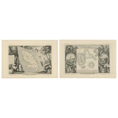
French Colonies in the Caribbean: Maps of Martinique and Guadeloupe (1852)
Located in Langweer, NL
This pair of maps, published in 1852, provides a detailed representation of the French Caribbean colonies, specifically Martinique and Guadeloupe. They were part of the *Atlas Univer...
Category

Antique 1850s Collectibles and Curiosities

Materials

Paper

Antique Cased Octant, Scottish, Ebony, Navigation Instrument, Sextant, Victorian
Located in Hele, Devon, GB
This is an antique cased octant. A Scottish, ebony navigational instrument, dating to the Victorian period, circa 1850. Appealing navigation ins...
Category

British Early Victorian Antique 1850s Collectibles and Curiosities

Materials

Ebony, Walnut

Plays & Poems of Shakespeare A J Valpy Pictorial Edition 10 Vol Antique Book Set
Located in Dayton, OH
The Plays and Poems of Shakespeare According to the Improved Text of Edmund Malone - Edited by A.J. Valpy - Valpy's Pictorial Edition - Volumes I-X of XV - Published by Henry G. Bohn...
Category

Antique 1850s Collectibles and Curiosities

Materials

Fabric, Paper

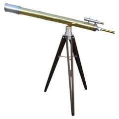
French Brass & Polished Steel Telescope w/ Spotting Scope on Tripod Stand C 1850
Located in Charleston, SC
French brass and polished steel telescope with removable lens cap, spotting scope, and mounted on folding tripod stand, 19th Century. Signed on focal tube by prolific telescope make...
Category

French Louis Philippe Antique 1850s Collectibles and Curiosities

Materials

Brass, Steel

19th Century Wooden English Barometer Antique Forecast Weather Instrument
Located in Milan, IT
Wooden barometer measuring instrument English manufacture made in the mid 19th century, silver-plated brass dial engraved with meteorological indicati...
Category

British Antique 1850s Collectibles and Curiosities

Materials

Wood

Map of French Colonies in the Americas: St. Martin, French Guiana and St. Pierre
Located in Langweer, NL
This is an intricately detailed map from 1852 titled *Colonies Françaises en Amérique*, depicting several key French colonies in the Americas. The map focuses on regions such as Fr...
Category

Antique 1850s Collectibles and Curiosities

Materials

Paper

19th C. French Provincial Carved Cherry Prie-Dieu with Woven Rush Seat
Located in New Orleans, LA
A charming 19th century French Provincial prie-dieu/chair of carved cherry wood and handwoven rush seating, having lovely, scalloped details. The top chair seat pulls up in order to ...
Category

French French Provincial Antique 1850s Collectibles and Curiosities

Materials

Cherry, Rush

19th Century Hand Written Persian Book
Located in London, GB
19th century oil on board of a Blacksmith Of rectangular form, the papier Mache and ebonised cover is finely painted, covered in flowers and a circular motif to the central section...
Category

Unknown Folk Art Antique 1850s Collectibles and Curiosities

Materials

Paper

31-Star Printed American Flag, Celebrating California Statehood, Circa 1850
Located in Colorado Springs, CO
This is a rare 31-star medallion printed American flag, celebrating the addition of California to the Union. The flag is printed on silk and has a spectacular “Great Star” canton pat...
Category

American Antique 1850s Collectibles and Curiosities

Materials

Silk

The Works of William H. Prescott - 11 vols. - IN A FULL POLISHED CALF BINDING
Located in Hillsborough, NJ
AUTHOR: PRESCOTT, William H.. TITLE: The Works of William H. Prescott. Ferdinand & Isabella - Philip The Second - Charles The Fifth - Conquest Of Peru - Conquest Of Mexico. PUBLIS...
Category

British Antique 1850s Collectibles and Curiosities

Materials

Leather

Nineteenth Century Ships Octant
Located in Norwell, MA
Ships octant from circa 1850 with an engraved scale to 100 degrees. With peepsight, mirrors, colored lenses, etc. Fitted to a step up box. Some old repairs and replacement wood to li...
Category

North American Antique 1850s Collectibles and Curiosities

Materials

Brass

Map of New Zealand Showing Maori Culture and Early Colonial Settlements, 1851
Located in Langweer, NL
John Tallis & Company were renowned for their ornate and detailed maps in the mid-19th century. Their works often featured elaborate borders, decorative motifs, and insets of vignett...
Category

Antique 1850s Collectibles and Curiosities

Materials

Paper

Gold Rush Era Masterpiece: The Tallis & Rapkin Rare Map of Pre-Queensland, 1851
Located in Langweer, NL
The image is an original historical map of Australia from the year 1851, created by John Rapkin with illustrations by J. Marchant and engravings by J. B. Allen. The map was published...
Category

Antique 1850s Collectibles and Curiosities

Materials

Paper

The Life of George Washington by Jared Sparks, Later Printing, 1854
Located in Colorado Springs, CO
Sparks, Jared. The Life of George Washington. Auburn and Buffalo: Miller Orton & Mulligan, 1854. Later printing. Two volumes in one. Octavo. Rebound in 1/4 brown leather and cloth boards, with gilt titles, tooling, and raised bands. New archival cloth slipcase. Presented is a later edition of Jared Sparks’ esteemed biography, The Life of George Washington. First published in 1839, Sparks’ The Life of George Washington is one of the earliest and most intimate biographies of our first President. This printing was published in Auburn and Buffalo by Miller Orton & Mulligan, in 1854. Impressively detailed, the biography is embellished with 14 engraved plates of portraits, views, and battle plans...
Category

American Federal Antique 1850s Collectibles and Curiosities

Materials

Leather, Paper

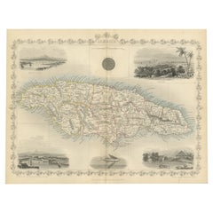
An Ornate and Historical Tallis Map of Jamaica with Decorative Vignettes, 1851
Located in Langweer, NL
This original antique map of Jamaica is part of the renowned series created by the Tallis Company, known for their detailed and decorative maps ...
Category

Antique 1850s Collectibles and Curiosities

Materials

Paper

Antique Decorative Truncheon, Scottish, Beech, Edinburgh Police Baton, Victorian
Located in Hele, Devon, GB
This is an antique decorative truncheon. A Scottish, beech Edinburgh police baton with handpainted detail, dating to the Victorian period, circa 1850. Fa...
Category

British Victorian Antique 1850s Collectibles and Curiosities

Materials

Beech

EXQUISITE EDWARD & JONES COROMANDEL WOOD CRiBBAGE SET DE LARUE & CO CARDS
Located in West Sussex, Pulborough
Royal House Antiques Royal House Antiques is delighted to offer for sale this absolutely stunning, Museum Quality, near new old stock circa 1850 Edward & Jones of 161 Regent Street ...
Category

English Early Victorian Antique 1850s Collectibles and Curiosities

Materials

Wood, Silk

Levasseur's 1852 Cartographic Portrait of Gironde: Celebrating the Bordeaux Wine
Located in Langweer, NL
This original hand-colored map is from the "Atlas National Illustré," a work by Victor Levasseur, a French geographer and cartographer known for his richly illustrated maps. The map is a steel engraving, which was a common and precise method for creating maps at the time. The inclusion of the publisher's name, A. Combette from Paris, and the addresses of the various contributors to the map's creation, like the engravers Laguillermie and Rainaud, adds to the historical context of the piece. The margins of the map are adorned with detailed illustrations that serve as a visual encyclopedic reference to the region's geography, economy, and notable figures. The use of color along the boundaries makes the map not only a tool for navigation but also an educational resource, providing insights into the department's landscape, economy, and cultural significance. The text included in the map's design provides statistical information, a map legend, and discussions about the land, local curiosities, notable personalities, products, and commerce, which would have been invaluable for education and reference at the time. The 'Atlas National Illustré' is celebrated for its combination of cartographic detail and artistic embellishment, making it a valuable cultural artifact. It represents the height of decorative map-making in the 19th century, alongside the works of John Tallis and Archibald Fullarton. This uploaded image is a detailed and colored map of the Département de la Gironde from Victor Levasseur's "Atlas National Illustré." Similar to the other maps from this series, it features a central map with the title 'Dépt. de la Gironde' at the bottom. Surrounding the map are decorative vignettes and elements that bring to life the cultural and economic aspects of the Gironde department. On the left, there is likely statistical information about the department and its subdivisions, reflecting the population and administrative details. This is framed by images that may represent the local industries and natural resources, such as wine, which is a central feature of the Bordeaux region located within Gironde. The right side of the map contains a textual history and descriptions of the region, coupled with portraits of notable figures, possibly historic personages or contributors to the region's cultural and economic development. The illustrations often include agricultural products, symbols of commerce, and scenes of daily life, as well as architectural landmarks. The presence of wine bottles, barrels, and vineyards in the illustrations would be indicative of the Gironde's prominence in wine production, particularly Bordeaux wines, which are esteemed worldwide. These engravings serve to emphasize the richness of the land and the sophistication of its products. Maps from this era, especially those by Levasseur, are notable for their combination of art and education, providing a snapshot not only of the geography but also of the societal and economic conditions of the time. The detailed engravings also suggest that this map was as much a decorative piece as it was a functional one, intended for display and reference by those interested in the illustrated region. The Gironde department in France is renowned for its significant contribution to the wine industry, particularly through the Bordeaux wine region. A bit more about the important places within Gironde and the types of wine the area is known for: 1. **Bordeaux**: The capital city of the department and the heart of the wine region. It's not only an urban center but also a hub for the wine trade. 2. **Médoc**: North of Bordeaux, known for prestigious châteaux and wines like Margaux, Saint-Julien, Pauillac, and Saint-Estèphe. 3. **Saint-Émilion**: East of Bordeaux, recognized for its full-bodied red wines and the picturesque medieval town. 4. **Pomerol**: Also near Saint-Émilion, smaller than its neighbor but equally renowned, particularly for Château Pétrus...
Category

Antique 1850s Collectibles and Curiosities

Materials

Paper

Gold Rush Era Masterpiece: The Tallis & Rapkin Rare Map of Pre-Queensland, 1851
Located in Langweer, NL
The image is an original historical map of Australia from the year 1851, created by John Rapkin with illustrations by J. Marchant and engravings by J. B. Allen. The map was published...
Category

Antique 1850s Collectibles and Curiosities

Materials

Paper

Antique Mahogany Gun Case
Located in Oxfordshire, GB
Williams & Powell Wooden Sporting Gun Case. A mahogany single gun case by Williams & Powell, Liverpool, the green baize lined case with dividers and fitted for a double barrel shotgu...
Category

British Georgian Antique 1850s Collectibles and Curiosities

Materials

Wood

Map of New Zealand Showing Maori Culture and Early Colonial Settlements, 1851
Located in Langweer, NL
John Tallis & Company were renowned for their ornate and detailed maps in the mid-19th century. Their works often featured elaborate borders, decorative motifs, and insets of vignett...
Category

Antique 1850s Collectibles and Curiosities

Materials

Paper

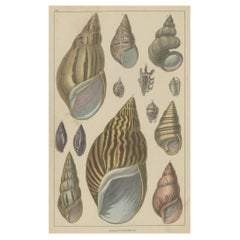
Original Old Handcolored Print Featuring Various Sea Shells, ca. 1852
Located in Langweer, NL
Untitled antique print featuring various sea shells. This print originates from 'A History of the Earth and Animated Nature' by O. Goldsmith. Goldsmith's Animated Nature went thr...
Category

Antique 1850s Collectibles and Curiosities

Materials

Paper

Map of Independent Tartary with Vignettes of the Region's Culture, 1851
Located in Langweer, NL
The map of Independent Tartary is part of the collection by John Tallis & Company, which were unique for their elaborate decorative elements and detailed illustrations. **The Maker ...
Category

Antique 1850s Collectibles and Curiosities

Materials

Paper

Decorative 1850s Map of Eastern Canada and New Brunswick with Historic Vignettes
Located in Langweer, NL
Decorative 1850s Map of Eastern Canada and New Brunswick with Historic Vignettes This beautifully crafted 19th-century map of Eastern Canada and New Brunswick, drawn and engrave...
Category

Antique 1850s Collectibles and Curiosities

Materials

Paper

Levasseur's 1852 Cartographic Portrait of Gironde: Celebrating the Bordeaux Wine
Located in Langweer, NL
This original hand-colored map is from the "Atlas National Illustré," a work by Victor Levasseur, a French geographer and cartographer known for his richly illustrated maps. The map is a steel engraving, which was a common and precise method for creating maps at the time. The inclusion of the publisher's name, A. Combette from Paris, and the addresses of the various contributors to the map's creation, like the engravers Laguillermie and Rainaud, adds to the historical context of the piece. The margins of the map are adorned with detailed illustrations that serve as a visual encyclopedic reference to the region's geography, economy, and notable figures. The use of color along the boundaries makes the map not only a tool for navigation but also an educational resource, providing insights into the department's landscape, economy, and cultural significance. The text included in the map's design provides statistical information, a map legend, and discussions about the land, local curiosities, notable personalities, products, and commerce, which would have been invaluable for education and reference at the time. The 'Atlas National Illustré' is celebrated for its combination of cartographic detail and artistic embellishment, making it a valuable cultural artifact. It represents the height of decorative map-making in the 19th century, alongside the works of John Tallis and Archibald Fullarton. This uploaded image is a detailed and colored map of the Département de la Gironde from Victor Levasseur's "Atlas National Illustré." Similar to the other maps from this series, it features a central map with the title 'Dépt. de la Gironde' at the bottom. Surrounding the map are decorative vignettes and elements that bring to life the cultural and economic aspects of the Gironde department. On the left, there is likely statistical information about the department and its subdivisions, reflecting the population and administrative details. This is framed by images that may represent the local industries and natural resources, such as wine, which is a central feature of the Bordeaux region located within Gironde. The right side of the map contains a textual history and descriptions of the region, coupled with portraits of notable figures, possibly historic personages or contributors to the region's cultural and economic development. The illustrations often include agricultural products, symbols of commerce, and scenes of daily life, as well as architectural landmarks. The presence of wine bottles, barrels, and vineyards in the illustrations would be indicative of the Gironde's prominence in wine production, particularly Bordeaux wines, which are esteemed worldwide. These engravings serve to emphasize the richness of the land and the sophistication of its products. Maps from this era, especially those by Levasseur, are notable for their combination of art and education, providing a snapshot not only of the geography but also of the societal and economic conditions of the time. The detailed engravings also suggest that this map was as much a decorative piece as it was a functional one, intended for display and reference by those interested in the illustrated region. The Gironde department in France is renowned for its significant contribution to the wine industry, particularly through the Bordeaux wine region. A bit more about the important places within Gironde and the types of wine the area is known for: 1. **Bordeaux**: The capital city of the department and the heart of the wine region. It's not only an urban center but also a hub for the wine trade. 2. **Médoc**: North of Bordeaux, known for prestigious châteaux and wines like Margaux, Saint-Julien, Pauillac, and Saint-Estèphe. 3. **Saint-Émilion**: East of Bordeaux, recognized for its full-bodied red wines and the picturesque medieval town. 4. **Pomerol**: Also near Saint-Émilion, smaller than its neighbor but equally renowned, particularly for Château Pétrus...
Category

Antique 1850s Collectibles and Curiosities

Materials

Paper

An Ornate and Historical Tallis Map of Jamaica with Decorative Vignettes, 1851
Located in Langweer, NL
This original antique map of Jamaica is part of the renowned series created by the Tallis Company, known for their detailed and decorative maps ...
Category

Antique 1850s Collectibles and Curiosities

Materials

Paper

Map of Independent Tartary with Vignettes of the Region's Culture, 1851
Located in Langweer, NL
The map of Independent Tartary is part of the collection by John Tallis & Company, which were unique for their elaborate decorative elements and detailed illustrations. **The Maker ...
Category

Antique 1850s Collectibles and Curiosities

Materials

Paper

Ornate 1850s Map of the United States: Featuring Iconic Landmarks and Portrets
Located in Langweer, NL
Ornate 1850s Map of the United States: Featuring Iconic Landmarks and Historical Portraits This decorative 19th-century map of the United States, created by J. Rapkin and publishe...
Category

Antique 1850s Collectibles and Curiosities

Materials

Paper

1855 Astronomical Plate of Distance of the Planets by FJ Huntington New York
Located in Milan, IT
Plate of the distance of the planets “Entered according to Act of Congress in the year 1855 by F.J. Huntington in the Clerk's Office of the District Court of the United States for th...
Category

American Antique 1850s Collectibles and Curiosities

Materials

Glass, Wood, Paper

Antique Engravings on One Sheet Depicting Ruins in Mexico, 1857
Located in Langweer, NL
Two images on one sheet depicting ruins in Mexico. This print originates from 'Die Kunstwerke vom Alterthum bis auf die Gegenwart, oder, Wegweiser durch das ganze Gebiet der bild...
Category

Antique 1850s Collectibles and Curiosities

Materials

Paper

Mid 19th Century Renaissance style Walnut Cased Thermometer
Located in Atlanta, GA
Michael A. Finnel Mid 19th Century Renaissance Revival style Walnut Cased Thermometer with leaf decorated crest, printed marks. Thermometer not workin...
Category

American Renaissance Revival Antique 1850s Collectibles and Curiosities

Materials

Glass, Wood

Antique Iron Greek Revival Kylix E.W. Wyon Crystal Palace Great Exhibition 1851
Located in Portland, OR
A very good antique Greek Revival cast iron kylix, by the celebrated sculptor Edward William Wyon (1811-1885), for the Great Exhibition at Crysta...
Category

English Greek Revival Antique 1850s Collectibles and Curiosities

Materials

Iron

Gateway to the Steppes: Tallis's Masterpiece Map of Indepent Tartary, 1851
Located in Langweer, NL
The map is of "Independent Tartary," a historical region in Central Asia that covered parts of what are now Kazakhstan, Uzbekistan, Turkmenistan, and surrounding areas. The map was p...
Category

Antique 1850s Collectibles and Curiosities

Materials

Paper

Biblical Journeys: Apostle Paul's Voyages and the Israelites' Exodus, 1856
Located in Langweer, NL
Two maps in matting board. From the Pictorial Bible Atlas, published in 1856. Title for Map 1: Voyages and Travels of Apostle Paul – Illustrated Antique...
Category

Antique 1850s Collectibles and Curiosities

Materials

Paper

A 19th-Century Map of West Canada with Niagara Falls and Indigenous Scenes
Located in Langweer, NL
Decorative 19th-Century Map of West Canada with Niagara Falls and Indigenous Scenes This detailed 19th-century map of West Canada, drawn and engraved by J. Rapkin and published by...
Category

Antique 1850s Collectibles and Curiosities

Materials

Paper

Ornate 1850s Map of South America: A Masterpiece of Exploration & Art by Rapkin
Located in Langweer, NL
Decorative 19th-Century Map of South America by J. Rapkin, Published by J & F Tallis Description: This beautifully detailed map of South America, drawn and engraved by J. Rapkin a...
Category

Antique 1850s Collectibles and Curiosities

Materials

Paper

19th-Century Decorative Map of British America with Arctic and Pacific Vignettes
Located in Langweer, NL
19th-Century Decorative Map of British America with Arctic and Pacific Vignettes This 19th-century map of British America, drawn and engraved by J. Rapkin and published by J & F T...
Category

Antique 1850s Collectibles and Curiosities

Materials

Paper

Victorian Bronze Imperial Standard Bushel Measure
Located in Essex, MA
Impressively large bushel measure for the County Of Gloucester, England. Inscribed "Imperial Standard Bushel". "County Of Gloucester". Made by Bate of London. Dated 1853 and 1834. ...
Category

English Victorian Antique 1850s Collectibles and Curiosities

Materials

Bronze

Fine Pair of 19th Century English Barrel Bronze Cannon on Oak Carriages
Located in Lymington, Hampshire
Fine pair of mid-19th century English bronze cannon with tapering 41" barrels and flared muzzles, the top of each breech engraved with the family crest o...
Category

English Antique 1850s Collectibles and Curiosities

Materials

Bronze

1855 Colton's Map of Patagonia with South Atlantic Islands Insets
Located in Langweer, NL
Title: 1855 Colton's Map of Patagonia with South Atlantic Islands Insets Description: This is an 1855 map titled "Colton's Patagonia," published by J.H. Colton & Co. in New York. Th...
Category

Antique 1850s Collectibles and Curiosities

Materials

Paper

French Guiana and Cayenne: Mid-19th Century Map from France Pittoresque Series
Located in Langweer, NL
This map titled "Guyane" is part of the France Pittoresque series and provides a detailed view of French Guiana along with a plan of the city of Cayenne. Features: - The map showcases the broader region of French Guiana, indicating key rivers, settlements, and the coastline along the Atlantic Ocean. - To the left, there's an inset labeled "Plan de la Ville de Cayenne", which shows the street layout, squares, and main buildings of the capital city, Cayenne. This inset provides a more detailed view of the urban area, highlighting its geometric grid layout near the coast. - The larger map outlines geographical features such as rivers (e.g., Oyapock and Maroni), forests, and territories in the surrounding area, including the neighboring Brazilian Empire...
Category

Antique 1850s Collectibles and Curiosities

Materials

Paper

Map of Polynesia Highlighting Cultural Landscapes and Maritime Activities, 1851
Located in Langweer, NL
John Tallis & Company was a London-based map publisher that flourished during the 19th century. Their maps, characterized by elaborate borders and decorative vignettes, are some of t...
Category

Antique 1850s Collectibles and Curiosities

Materials

Paper

Antique Print of a Ruin of a Temple of the Inca's in Mexico, 1857
Located in Langweer, NL
Untitled print of a ruin in Mexico. This print originates from 'Die Kunstwerke vom Alterthum bis auf die Gegenwart, oder, Wegweiser durch das ganze Gebiet der bildenden Kunst : entha...
Category

Antique 1850s Collectibles and Curiosities

Materials

Paper

Gold Rush Pocket Scale in an Green enameled Tin, ca 1850
Located in York County, PA
EXCEPTIONAL GOLD RUSH POCKET SCALE WITH GREEN, ENAMELED TIN, GILT EAGLE & LETTERING THAT READS: “MADE EXPRESSLY FOR CALIFORNIA,” circa 1850 “Miners' Improved Gold Scale,” made circ...
Category

American Antique 1850s Collectibles and Curiosities

Materials

Metal

Map of Tasmania with Illustrations of Local Fauna and Colonial Landmarks, 1851
Located in Langweer, NL
John Tallis & Company was renowned for their detailed and ornate maps during the 19th century. Their maps are distinguished by the intricate borders and vignettes that are as informa...
Category

Antique 1850s Collectibles and Curiosities

Materials

Paper

Antique Map of the Malay Archipelago with Images of Indigenous People, 1851
Located in Langweer, NL
John Tallis & Company, often simply known as Tallis, was renowned for the production of maps and illustrated geographical publications in the mid-19th century. Tallis maps, such as t...
Category

Antique 1850s Collectibles and Curiosities

Materials

Paper

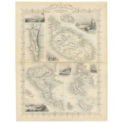
Old Map of British Mediterranean Territories with Images of Historic Sites, 1851
Located in Langweer, NL
John Tallis & Company was a British map-making firm that gained widespread acclaim in the 19th century, particularly known for their detailed and artistically embellished maps. The f...
Category

Antique 1850s Collectibles and Curiosities

Materials

Paper

The Illustrated Map of the Var Department from the Atlas National Illustré, 1856
Located in Langweer, NL
This original hand-colored map is from the "Atlas National Illustré," a work by Victor Levasseur, a French geographer and cartographer known for his richly illustrated maps. The map...
Category

Antique 1850s Collectibles and Curiosities

Materials

Paper

The Scarlet Letter by Nathaniel Hawthorne, Second Ed., Tipped-in Signature, 1850
Located in Colorado Springs, CO
Hawthorne, Nathaniel. The Scarlet Letter, A Romance. Boston: Ticknor, Reed, and Fields, 1850. Printed Cambridge: Metcalf and Company. Second edition...
Category

American Antique 1850s Collectibles and Curiosities

Materials

Paper

Mid-19th Century Decorative Map of India with Cultural and Natural Vignettes
Located in Langweer, NL
The Tallis maps, including the one of India, are known for their detailed and ornamental style. They were produced during the mid-19th century, a time when cartographic publishing became as much an art form as a means of geographic representation. John Tallis & Company, founded by John Tallis, was known for creating maps with elaborate borders and vignettes surrounding the map itself. These maps often included illustrations that depicted scenes representative of the region's culture, significant local wildlife, architectural landmarks, and portraits of indigenous peoples...
Category

Antique 1850s Collectibles and Curiosities

Materials

Paper

1852 Map of Haut-Rhin: An Illustrated Gateway to Alsace's Viticultural Splendors
Located in Langweer, NL
This original hand-colored map is from the "Atlas National Illustré," a work by Victor Levasseur, a French geographer and cartographer known for his richly illustrated maps. The map...
Category

Antique 1850s Collectibles and Curiosities

Materials

Paper

Nelson's Guide to the City of New York and its Neighbourhood, 1858
Located in Langweer, NL
"Nelson's Guide to the City of New York and its Neighbourhood," published in 1858 by T. Nelson in London and New York, serves as an invaluable resource for exploring the historical a...
Category

Antique 1850s Collectibles and Curiosities

Materials

Paper

Adolphus Trollope, Girlhood of Catherine De' Medici. 1st Ed 1856 Leather Bound
Located in Hillsborough, NJ
AUTHOR: TROLLOPE, T. Adolphus. TITLE: The Girlhood of Catherine De' Medici. PUBLISHER: London: Chapman & Hall, 1856. DESCRIPTION: FIRST EDITION. 1 vol., 8" x 5-3/8", fronti...
Category

British Antique 1850s Collectibles and Curiosities

Materials

Leather

Antique Map of Scotland With an Inset Map of the Shetland Islands, 1854
Located in Langweer, NL
Stunning Map of Scotland that will look beautiful in any setting framed on the wall. Description: Large Antique map titled 'Scotland with its Islands, drawn from the Topographical surveys...
Category

Antique 1850s Collectibles and Curiosities

Materials

Paper

Miniature Psyche and Love after François Gérard (1770-1837)
Located in Paris, FR
Rectangular miniature depicting Psyche and Love (Louvre) after François Gerard (1770-1837) signed J. Barret du Coudert, titled lower right and dated 1859. Wooden frame and gilded stu...
Category

French Antique 1850s Collectibles and Curiosities

Materials

Wood

Map of Rhône: Culture and Commerce in Lyon's Silk and Wine Legacy, 1852
Located in Langweer, NL
This original hand-colored map is from the "Atlas National Illustré," a work by Victor Levasseur, a French geographer and cartographer known for his richly illustrated maps. The map...
Category

Antique 1850s Collectibles and Curiosities

Materials

Paper

Old Lithograph of Bullfighting with The Bull Tossing The Picador & Horse, 1852
Located in Langweer, NL
Antique print titled 'The Bull tossing the Picador and Horse'. Old lithograph showing a bullfighting scene. Artists and Engravers: Made after an ...
Category

Antique 1850s Collectibles and Curiosities

Materials

Paper

Victorian Visions of the New World: A Detailed Tallis Map of North America, 1851
Located in Langweer, NL
The map presented here is an intricate example from the series of maps produced by John Tallis & Company. Tallis maps are known for their detailed and elaborate style, often includin...
Category

Antique 1850s Collectibles and Curiosities

Materials

Paper

Old Hand-Colored Print with a View of Marseille, France, ca.1885
Located in Langweer, NL
Antique print titled 'Marseille aus der Vogelschau'. Old print with a view of Marseille, France. This print originates from a German illustrated newsletter, published circa 1885. ...
Category

Antique 1850s Collectibles and Curiosities

Materials

Paper

19th Century Santos Head
Located in London, GB
19th Century Santos Head We are proud to offer a rare example of a religious 19th Century hand carved Santos head. With polychrome paint still intact in...
Category

French Edwardian Antique 1850s Collectibles and Curiosities

Materials

Pine

Fine French Antique 1856 Hand Watercolour Map of Dept Des Hautes Pyrenees
Located in West Sussex, Pulborough
We are delighted to offer for sale this stunning 1856 hand watercolour map of the Austrian Alps titled Dept Des Hautes Pyrenees taken from the Atlas Nat...
Category

French Early Victorian Antique 1850s Collectibles and Curiosities

Materials

Paper

19th Century Life-Size Corpus Christi Figure Leg
Located in London, GB
19th century life-size corpus Christi figure leg We are proud to offer a very unusual religious artifact, dating from early to mid-19th century and either Spanish or Italian in orig...
Category

Spanish Early Victorian Antique 1850s Collectibles and Curiosities

Materials

Oak, Paint

Read More

Medal-Worthy Memorabilia from Epic Past Olympic Games

Get into the games! These items celebrate the events, athletes, host countries and sporting spirit.

Ahoy! You’ve Never Seen a Collection of Sailor Art and Kitsch Quite Like This

French trendsetter and serial collector Daniel Rozensztroch tells us about his obsession with objects related to seafaring men.

Pamela Shamshiri Shares the Secrets behind Her First-Ever Book and Its Effortlessly Cool Interiors

The sought-after designer worked with the team at Hoffman Creative to produce a monograph that beautifully showcases some of Studio Shamshiri's most inspiring projects.

Moroccan Artworks and Objects Take Center Stage in an Extraordinary Villa in Tangier

Italian writer and collector Umberto Pasti opens the doors to his remarkable cave of wonders in North Africa.

Montecito Has Drawn Royalty and Celebrities, and These Homes Are Proof of Its Allure

Hollywood A-listers, ex-pat aristocrats and art collectors and style setters of all stripes appreciate the allure of the coastal California hamlet — much on our minds after recent winter floods.

Whaam! Blam! Pow! — a New Book on Pop Art Packs a Punch

Publishing house Assouline and writer Julie Belcove have teamed up to trace the history of the genre, from Roy Lichtenstein, Andy Warhol and Yayoi Kusama to Mickalene Thomas and Jeff Koons.

The Sparkling Legacy of Tiffany & Co. Explained, One Jewel at a Time

A gorgeous new book celebrates — and memorializes — the iconic jeweler’s rich heritage.

What Makes a Gem-Encrusted Chess Set Worth $4 Million?

The world’s most opulent chess set, weighing in at 513 carats, is literally fit for a king and queen.
Recently Viewed

View All