18th Century and Earlier Collectibles and Curiosities

to
2,707
3,888
557
4,480
215
93
41
35
30
13
10
7
4
2
2
2
1
1
1
6,805
13,491
2,732
3,517
4,705
3,079
514
297
604
745
482
904
903
902
660
593
3,383
601
523
139
127
1,351
273
265
222
182
4,480
4,480
4,480
58
21
14
13
12
Period: 18th Century and Earlier
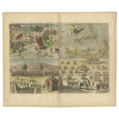
Antique Engravings of Mauritius and Indonesia, incl de Banda Islands, c.1730
Located in Langweer, NL
Title on page: "Ins. de Cerno a. Nostatibus Mauritius Nominata [on sheet with] Gunnanappi Labetacq [and] Civitas Gammelamme [and] Rex Tubatus", Le Clerc, Jean This sheet includes fo...
Category

Antique 18th Century and Earlier Collectibles and Curiosities

Materials

Paper

1700 Guillaume Delisle Map: Western Mediterranean & Moorish North Africa
Located in Langweer, NL
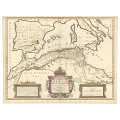
1700 Guillaume Delisle Map: Western Mediterranean & Moorish North Africa This hand-colored map from 1700 by Guillaume Delisle, titled "In Notitiam Ecclesiasticam Africae Tabula Geographica," offers a detailed look at the regions under Moorish control during the later medieval period. It encompasses the northern African coast from Morocco to Libya, the Iberian Peninsula, and the western Mediterranean, including notable islands such as Sardinia, Corsica, Malta, the Balearics, and Sicily, where a smoking Mount Etna is depicted. The map is embellished with three decorative cartouches, adding artistic flair to the detailed geographical renderings. Engraved by Jean Baptiste Liebaux, the map measures 25.2 inches wide by 19.1 inches high. It features a sharp impression with contemporary outline color, later enhanced cartouches, and is printed on a bright sheet with a Society of Jesus watermark. The condition is very good, with an archivally repaired centerfold separation at the bottom and light toning along the edges. Keywords: - Guillaume Delisle map - Western Mediterranean historical map - Northern Africa map...
Category

Antique 18th Century and Earlier Collectibles and Curiosities

Materials

Paper

Detailed Decorative Antique Map of the Coast of Malabar and Coromandel, India
Located in Langweer, NL
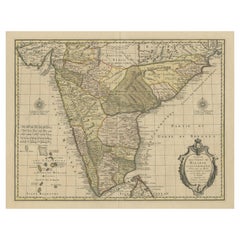
Antique map titled 'Carte des Côtes de Malabar et de Coromandel'. Finely engraved map of the southern part of India, first issued in 1723 by acclaimed French mapmaker Guillaume De L’Isle. It focuses on trade routes within India, as well as the Coromandel and Malabar Coasts...
Category

Antique 18th Century and Earlier Collectibles and Curiosities

Materials

Paper

Antique Map of Greece, Turkey and surroundings with original coloring
Located in Langweer, NL
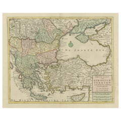
Antique map titled 'Nieuwe Kaart van Europisch Turkyen na de alderlaatste ontdekking in t licht gebracht'. Antique map of Greece with Crete and Cyprus, Turkey and the Black Sea. Publ...
Category

Antique 18th Century and Earlier Collectibles and Curiosities

Materials

Paper

Antique Architecture Print of a Composite Portico by Neufforge, c.1770
Located in Langweer, NL
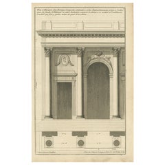
Antique print titled 'Plan et Elevation d'un Portique Composite (..)'. Old print showing the design of a Composite portico. This print originates from 'Recueil Élémentaire d?Architec...
Category

Antique 18th Century and Earlier Collectibles and Curiosities

Materials

Paper

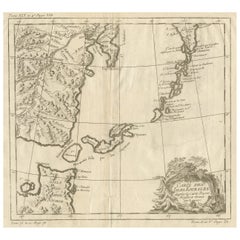
Old Map of The Kurile Islands, from Hokkaido, Japan to Kamchatka, Russia, c.1750
Located in Langweer, NL
Antique map titled 'Carte des Iles Kouriles'. Original antique map of the Kuril Islands. The Kuril Islands or Kurile Islands are a volcanic archipelago that stretches approximate...
Category

Antique 18th Century and Earlier Collectibles and Curiosities

Materials

Paper

Map of Europe Highlighting Ancient and Modern Geographical Divisions (1794)
Located in Langweer, NL
Map of Europe Highlighting Ancient and Modern Geographical Divisions (1794). Germany, France, Italy, Spain, and the British Isles – Map by D’Anville (1794). This detailed 18th-cent...
Category

Antique 18th Century and Earlier Collectibles and Curiosities

Materials

Paper

Antique Map of Manchuria and the Northeast Portion of Tartary
Located in Langweer, NL
Antique map titled 'Carte de la Tartarie Orientale (..)'. Detailed map of Manchuria and the Northeast portion of Tartary, including Sagallan Anga Hata--Isle de la Bouche...
Category

Antique 18th Century and Earlier Collectibles and Curiosities

Materials

Paper

Scarce Antique Map of the Middle East, Surrounded by Latin Text, 1624
Located in Langweer, NL
Antique map titled 'Lumen Historium per Orientem (..).' Scarce map of the Middle East, surrounded by Latin text. The two insets show Israel and an oval world map. This map (from the last edition of Ortelius Theatri Orbis Terrarum Parergon, 1624) was engraved by Franciscus Hareio. Later, this map was copied by Hornius for his World Atlas (1653). Artists and Engravers: Franciscus Haraeus (Latinised form of Franciscus Verhaer; also known as Frans Verhaer), (Utrecht 1555? - Leuven, 11 January 1631), was a Dutch theologian, historian, and cartographer. He is best known for his history (from a Catholic point of view) of the Dutch Revolt...
Category

Antique 18th Century and Earlier Collectibles and Curiosities

Materials

Paper

Original Antique Map showing Southern India, Northern Sri Lanka & Malabar, 1652
Located in Langweer, NL
Antique map titled 'Presqu'Isle de l'Inde deca le Gange (..)'. Old map showing the southern part of India, including the northern part of Sri Lanka. With inset map of Southern India (Malabar). This map covers the subcontinent from the Bay of Bengal and the Gulf of Cambay to Ceylon. The Mogul Empire can be found in the north. Further south...
Category

Antique 18th Century and Earlier Collectibles and Curiosities

Materials

Paper

Antique Print of a Bathroom Design for Hotel De Jansen in Paris, France, c.1785
Located in Langweer, NL
Antique print titled 'Projets d'une Salle de Bains'. Copper engraving showing the design of a bathroom. This print originates from 'Jardins Anglo-Chinois à la Mode' by Georg Louis le...
Category

Antique 18th Century and Earlier Collectibles and Curiosities

Materials

Paper

Dutch Conquest of Rio Grande, Brazil (1633) Under Prince Frederick Hendrick
Located in Langweer, NL
The image is an engraving titled “VEROVERINGE VAN RIO GRANDE IN BRASIL ANNO 1633.” This historical print depicts the Dutch conquest of Rio Grande in Brazil, known today as Natal, dur...
Category

Antique 18th Century and Earlier Collectibles and Curiosities

Materials

Paper

Rare Part of a Poem of the Battle of Ptolemy against Alexander the Great, 1721
Located in Langweer, NL
Antique print titled 'Mr. A. Alewyns dichtkundige uitbreiding over den Veldslag van Ptolomeus tegens Alexander (..)'. Antique print depicting the Battle of Ptolemy against Alexander the Great. This print originates from 't Groot waerelds tafereel, waar in de heilige en waereldsche geschiedenissen en veranderingen zedert de schepping des waerelds'. Artists and Engravers: Published by J...
Category

Antique 18th Century and Earlier Collectibles and Curiosities

Materials

Paper

Antique Map of the Kingdom of Tunisia, Africa, 1773
Located in Langweer, NL
Antique map titled 'Kaart van het Koningryk van Tunis'. Old map of the Kingdom of Tunisia. Originates from the first Dutch editon of an interesting travel account of Northern Africa ...
Category

Antique 18th Century and Earlier Collectibles and Curiosities

Materials

Paper

Antique Print of the City of Kancheu in China, 1668
Located in Langweer, NL
Antique print China titled 'Kancheu'. Old print depicting a view on the Chinese city of Kancheu with its ramparts. This print originates from the L...
Category

Antique 18th Century and Earlier Collectibles and Curiosities

Materials

Paper

1625 Petrus Plancius / Cloppenburg Map of the Holy Land with Biblical Vignettes
Located in Langweer, NL
1625 Petrus Plancius / Johannes Cloppenburg Map of the Holy Land with Biblical Vignettes This exquisite 1625 map by Petrus Plancius and Johannes Cloppenburg represents the Holy Lan...
Category

Antique 18th Century and Earlier Collectibles and Curiosities

Materials

Paper

Original Antique Map of the Road from Bristol to Weymouth
Located in Langweer, NL
Antique map titled 'The Road from Bristol to Weymouth (..)'. Original antique map of the road from Bristol to Weymouth. Plate 60 from Ogilby's 'Britannia', the first road atlas of En...
Category

Antique 18th Century and Earlier Collectibles and Curiosities

Materials

Paper

Two Charts of The English Channel, Each Adorned with Nice Compass Roses, ca.1700
Located in Langweer, NL
Antique map titled 'Hydrographia Canalis Marini Inter Angliam et Galiiam de Fluentis.' Sheet with with two charts of the English Channel, each adorned with beautiful compass rose...
Category

Antique 18th Century and Earlier Collectibles and Curiosities

Materials

Paper

Antique Print of Apollo and Diana Killing Niobe's Children with Arrows, 1733
Located in Langweer, NL
Antique print titled 'Les Enfans de Niobé Tués (..)'. This print depicts Apollo and Diana killing Niobe's Children with their arrows. In Greek mytholo...
Category

Antique 18th Century and Earlier Collectibles and Curiosities

Materials

Paper

Antique Map of the Rethelois or Rethel Region in France by Janssonius, ca.1650
Located in Langweer, NL
Antique map of France titled 'Dioecese de Rheims et le Païs de Rethel'. Detailed map, centered on the River Ayne and the River Velle and sowing Reims, Chalons, Rethel, Sedan, Cha...
Category

Antique 18th Century and Earlier Collectibles and Curiosities

Materials

Paper

18th Century Carved And Painted Wooden Crucifix From France
Located in Haddonfield, NJ
An early 18th Century antique hand carved and polychromed hand painted table crucifix from France with its original patina preserved. This crucifix could possible date back as early ...
Category

French Baroque Antique 18th Century and Earlier Collectibles and Curiosities

Materials

Fruitwood

Original Copper Engraving Depicting Dutch Merchants visting China, ca.1700
Located in Langweer, NL
Title: 'The departure of the Empirour Hockflieuw to the Emprial Court at Peking' with further description in Dutch. The Dutch man Pieter van Hoorn, his son...
Category

Antique 18th Century and Earlier Collectibles and Curiosities

Materials

Paper

Antique Map of Friesland Also Know as the Peacock Map, C.1580
Located in Langweer, NL
Antique map titled ?Frisia Occidentalis?. Original antique map of the province of Friesland, the Netherlands. Includes a fascinating inset of ancient Friesland with a peacock and myt...
Category

Antique 18th Century and Earlier Collectibles and Curiosities

Materials

Paper

Alnmått (Cubit measure) in Birch with a Noble Crown. Gustavian, dated 1783
Located in Knivsta, SE
Rare Alnmått (Cubit measure) made in Birch with a Noble Crown. From the Gustavian period of the late 1700s, roughly corresponding to the Louis XVI period in France, made in Sweden an...
Category

Swedish Gustavian Antique 18th Century and Earlier Collectibles and Curiosities

Materials

Brass

A Handsome & Detailed Map of the Duchy of Mecklenburg & Pomerania, Germany, 1680
Located in Langweer, NL
Antique map titled 'Ducatus Meklenburgicus in quo sunt Ducatus Vandaliae et Meklenburgi Ducatus et Comitatus Swerinensis.' A handsome and detailed map of the Duchy of Mecklenburg...
Category

Antique 18th Century and Earlier Collectibles and Curiosities

Materials

Paper

French 18th Century Balance Scale
Located in Round Top, TX
A handsome French 18th century balance scale in iron and brass. The balance mechanism is in iron. The foot and the plates are in brass. The...
Category

French Antique 18th Century and Earlier Collectibles and Curiosities

Materials

Brass, Iron

18th Century Gold French Gilded Wood Barometer, Antique Parisian Thermometer
Located in West Palm Beach, FL
A rare antique finely worked French barometer with lyre shaped crest thermometer above a large hexagonal framed barometer. The Parisian décor piece is m...
Category

French Empire Antique 18th Century and Earlier Collectibles and Curiosities

Materials

Giltwood

18th Century Baroque Style Baptismal Charger in Brass
Located in Haddonfield, NJ
An 18th century baptismal plate in brass with beveled flower decoration to celebrate the birth of the infant or perhaps as in French is called "Plat a offrandes", which means "Plate ...
Category

European Baroque Antique 18th Century and Earlier Collectibles and Curiosities

Materials

Copper, Gold Plate

Antique Map of the Netherlands and Belgium by Homann, circa 1710
Located in Langweer, NL
Antique map titled 'Tabula Generalis Totius Belgii Provinciae XVII. Infer. Germaniae (..)'. Map of the Benelux countries by Johann Baptist Homann. Shows the area between the Seine es...
Category

German Antique 18th Century and Earlier Collectibles and Curiosities

Materials

Paper

The Antient City of Jerusalem and Places Adjacent, Hand-Colored Map, 1699
Located in Langweer, NL
Title: "1699 Hand-Colored Bird's-Eye Plan of Jerusalem with Ancient and Biblical Landmarks" This beautifully hand-colored, imaginary bird's-eye plan of Jerusalem, published in 1699,...
Category

Antique 18th Century and Earlier Collectibles and Curiosities

Materials

Paper

Antique Chart of the Mid-Pacific Ocean by Anson, 'c.1784'
Located in Langweer, NL
Antique map titled 'Carte de la Mer du Sud ou Mer Pacifique'. Original chart of the mid-Pacific Ocean, includes voyage tracks of Anson’s Centurion and the ship he stalked, the Spanish treasure...
Category

Antique 18th Century and Earlier Collectibles and Curiosities

Materials

Paper

Antique Map of Italy, Corsica, Sardinia and Sicily, ca.1780
Located in Langweer, NL
Description: Antique map titled 'L'Italie.' Map of Italy, Corsica, Sardinia and Sicily. Highly detailed, showing towns, rivers, some topographical features and political boundari...
Category

Antique 18th Century and Earlier Collectibles and Curiosities

Materials

Paper

Antique Map of France by Covens & Mortier, c.1730
Located in Langweer, NL
Antique map titled 'Nova regni Galliae (..) La France'. Old map of France with large decorative title cartouche. With great detail. Artists and Engravers: Pieter und David Mortie...
Category

Antique 18th Century and Earlier Collectibles and Curiosities

Materials

Paper

1634 Mercator/Jansson Map: Eastern Austria with Vienna, Hand-Colored
Located in Langweer, NL
1634 Mercator/Jansson Map: Eastern Austria with Vienna, Hand-Colored This hand-colored map from 1634, titled "Austria Archiducatus," by Mercator and Jansson, depicts the eastern reg...
Category

Antique 18th Century and Earlier Collectibles and Curiosities

Materials

Paper

Original Antique Map of the Virgin Islands with Insets of Caribbean Isles, 1787
Located in Langweer, NL
Antique map titled 'Supplément pour les Isles Antilles (..)'. Original old map of the Virgin Islands, with insets of Barbuda, St. Kits, Antigua, Dominica, St. Lucia, Barbados, St. Vi...
Category

Antique 18th Century and Earlier Collectibles and Curiosities

Materials

Paper

Antique Map of Batavia 'Jakarta, Indonesia' by Montanus, 1679
Located in Langweer, NL
Fine early plan of Batavia (Jakarta), published by Arnoldus Montanus. This map has a vignette at the bottom showing Jakarta from the sea with the volcanoes Mount Gede, Mount Pangrnago and Mount Salak in the background. The plan is based on the earlier, much larger map of Batavia published by Clement de Jonghe...
Category

Unknown Antique 18th Century and Earlier Collectibles and Curiosities

Materials

Paper

Antique Print of the Batavia Massacre 'Present-Day Jakarta', Indonesia
Located in Langweer, NL
Antique print titled 'Tableau de la Partie de Batavia, ou s'est fait proprement le terrible Massacre des Chinois (..)'. Original antique print of the Batavia massacre. The 1740 Batav...
Category

Antique 18th Century and Earlier Collectibles and Curiosities

Materials

Paper

Antique Map of part of Central and Southern Asia
Located in Langweer, NL
Antique map titled 'Carte de la Partie Superieure de l'Inde en deca du Gange. Comprise entre la Cote du Concan et celle d'Orixa, avec l'Empire du Mogol, le Bengale, le R. d'Asham, pa...
Category

Antique 18th Century and Earlier Collectibles and Curiosities

Materials

Paper

Antique View of the Holy Sepulchre Church in Jerusalem, Ca.1778
Located in Langweer, NL
Description: Antique print titled 'A perspective View of the Church of the Holy Sepulchre at Jerusalem and other Structures'. A view of the Holy Sep...
Category

Antique 18th Century and Earlier Collectibles and Curiosities

Materials

Paper

Antique Print of a Fort on the Ivory Coast and Axim, Africa, 1748
Located in Langweer, NL
Antique print titled 'Vue de la Cote pres de Rio San Andero - Gezigt van de Kust van Rio San Andero' and 'Fort St. Antoine a Axim - Fort St. Antoni, te Axim'. View of the Ivory coast...
Category

Antique 18th Century and Earlier Collectibles and Curiosities

Materials

Paper

1654 Nicolas Sanson Map of Southern India and Southeast Asia
Located in Langweer, NL
1654 Nicolas Sanson Map of Southern India and Southeast Asia - Partie Meridionale de L'Inde This 1654 map by Nicolas Sanson, titled "Partie Meridionale de L'Inde en deux Presqu'Is...
Category

Antique 18th Century and Earlier Collectibles and Curiosities

Materials

Paper

Navigating the Spice Trade: A Maritime Chart of the Banda Sea, 1799
Located in Langweer, NL
This original antique map is an 18th-century nautical chart by Laurie & Whittle, a well-known British firm that was involved in the publication of maps, charts, and maritime books. ...
Category

Antique 18th Century and Earlier Collectibles and Curiosities

Materials

Paper

Rare Small Antique Map of the Persian Empire, 1692
Located in Langweer, NL
Antique map titled 'Perse'. Small engraved map of the Persian Empire, decorated with a simple cartouche and armorial shield. This map originates from 'L'Atlas en Abrege, ou Nouvelle ...
Category

Antique 18th Century and Earlier Collectibles and Curiosities

Materials

Paper

Antique Map of South America by Conder, c.1775
Located in Langweer, NL
Antique map titled 'South America agreeable to the most approved maps and charts'. Rare map of South America depicting Chili, La Plata, Paraguay, Brazil, Peru, the Amazon and surroun...
Category

Antique 18th Century and Earlier Collectibles and Curiosities

Materials

Paper

Italian 18th Century Gilt Bronze Reliefs Christ and Virgin Mary after Girardon
Located in Milano, MI
Pair of Gilt bronze reliefs of early 18th century, after François Girardon (1628-1715) The original model for these two profiles of the Virgin and Christ dates from 1691. These works...
Category

Italian Louis XIV Antique 18th Century and Earlier Collectibles and Curiosities

Materials

Bronze

Antique Map of the Bahia Todos Santos 'Brazil' by Tirion, circa 1750
Located in Langweer, NL
Antique map titled 'Kaart Van De Aller-Heiligen Baay Waar aan de Hoofdstad legt van Brazil.', Detailed map of the Bahia Todos Santos in Brazil, with a lar...
Category

Antique 18th Century and Earlier Collectibles and Curiosities

Materials

Paper

Exquisite 1600 Ortelius Map of Artois, France: A Collector’s Piece
Located in Langweer, NL
Exquisite 1600 Ortelius Map of Artois, France: A Collector’s Piece with Rich Historical Detail Description of the Map: This map, titled "Atrebatum Regionis Vera Descriptio," create...
Category

Antique 18th Century and Earlier Collectibles and Curiosities

Materials

Paper

Antique Map of Herefordshire 'England' by R. Morden, 1708
Located in Langweer, NL
This antique County map of Herefordshire by Robert Morden was first published in 1701 in a work entitled 'The New Description and State of England'...
Category

Antique 18th Century and Earlier Collectibles and Curiosities

Materials

Paper

Antique Map of Cities Nanking and Suzhou in the Jiangsu Region, China, c.1758
Located in Langweer, NL
Antique map titled 'Plan de l' Enceinte de la Ville de Nan-King ou Kyang-Ning-Fou et plan de la ville de Su-Tcheou-Fou.' A map of the city of Nanking or Nanjing. A second map shows S...
Category

Antique 18th Century and Earlier Collectibles and Curiosities

Materials

Paper

Sea Chart of Central America and the Northwest Coast of South America, ca.1745
Located in Langweer, NL
Antique map titled 'Novae Hispaniae, Chili, Peruviae et Guatamala Littorae.' Sea chart of Central America and the northwest coast of South America, oriented to the east, by Reinier & Joshua Ottens (after Frederick de Wit - 1675) in 1745 ('Atlas van de Zeevaart'). The map shows all or parts of the coasts of Peru, Chili, Honduras, Costa Rica and Mexico as well as the western Caribbean and the Galapagos...
Category

Antique 18th Century and Earlier Collectibles and Curiosities

Materials

Paper

Crete Map 1749 – Homann Heirs Engraving of Candia with Aegean Islands
Located in Langweer, NL
Crete Map 1749 – Homann Heirs Engraving of Candia with Aegean Islands This fine 1749 map titled 'Insula Creta hodie Candia' presents an 18th-century cartographic portrait of the isl...
Category

German Antique 18th Century and Earlier Collectibles and Curiosities

Materials

Paper

Beautiful Antique Handcolored Map of Switzerland with 33 Coats of Arms, ca.1705
Located in Langweer, NL
Antique map Switerzland titled 'La Suisse Divisee en ses Treze Cantons, ses Alliez & ses Sujets (..)'. Beautiful map of Switzerland with 33 coats of arms. The map is dedicated to t...
Category

Antique 18th Century and Earlier Collectibles and Curiosities

Materials

Paper

Old Map of North India From Kandahar East to Burma 'Pegu' and South to Goa, 1776
Located in Langweer, NL
Description: Antique map titled 'Indes Iere Feuille'. Old map of northern India. Covers the subcontinent from Kandahar east as far as Burma (Pegu) and south to just past Goa. Names...
Category

Antique 18th Century and Earlier Collectibles and Curiosities

Materials

Paper

Hainaut Map Ortelius 1590 – Rare Hand-Colored French-Belgian Border Map
Located in Langweer, NL
Decorative 16th Century Map of Northern France by Ortelius, circa 1590 This richly colored antique map titled *Nobilis Hannoniae Comitatus Descriptio* depicts the County of Hainaut ...
Category

Belgian Antique 18th Century and Earlier Collectibles and Curiosities

Materials

Paper

The Valley of Inspruck: An 18th-Century Engraved Perspective, 1792
Located in Langweer, NL
Title: "The Valley of Inspruck: An 18th-Century Engraved Perspective" This elegant original antique engraving, titled "The Valley of Inspruck," showcases a serene view of the Innsbruck Valley. The artwork is delicately rendered, capturing the grandeur of the mountains and the pastoral tranquility of the valley. The print depicts a detailed landscape scene, replete with towering craggy peaks that loom over a peaceful settlement nestled in the valley. A striking feature is the contrast between the ruggedness of the natural environment and the cultivated lands and architecture, indicating a harmonious coexistence of humanity with nature. It was published as directed on January 1, 1792, by T & G Egerton of Whitehall for the author. Albanis Beaumont is credited with the original design ('Del.' for delineavit, indicating he drew the initial illustration), and Cornelis Apostool is noted for the engraving work ('Sculp.' for sculpsit, indicating he engraved the image). The publication of this print during the late 18th century aligns with a time when there was a heightened interest in natural beauty and the picturesque, reflected in the art and literature of the Romantic period. This print would have appealed to those with an appreciation for both the aesthetic and the sublime qualities of the European landscape. The publication by T & G Egerton, a reputable firm known for their work in the arts, and the involvement of a skilled artist and engraver like Beaumont and Apostool, respectively, underline the quality and desirability of the print. It is a piece that would attract collectors of fine engravings and admirers of European landscapes, offering a window into the aesthetic values and artistic endeavors of the late 18th century. As a historical piece, this print offers a view into the past, inviting contemplation of the rich cultural and natural heritage of the Innsbruck area. It is a valuable collectible for enthusiasts of antique maps and prints...
Category

Antique 18th Century and Earlier Collectibles and Curiosities

Materials

Paper

Original Antique Map of the Ancient Netherlands and Belgium, c.1750
Located in Langweer, NL
Description: Antique map titled 'Naauwkeurige Kaart van het Oude Nederland (..)'. Original antique map of the Netherlands and Belgium. This map originates from 'Vaderlandsche his...
Category

Antique 18th Century and Earlier Collectibles and Curiosities

Materials

Paper

Antique Map of the Pacific Ocean by Renneville, 1725
Located in Langweer, NL
Rare map of the Southern Pacific, illustrating Le Maire's tracks, extending from the La Maire Straits to Nova Guinea, with a large inset of the northern Coastline of New Guinea and a...
Category

Antique 18th Century and Earlier Collectibles and Curiosities

Materials

Paper

Original Hand-colored Antique Map of the Southern Part of India
Located in Langweer, NL
Antique map titled 'Orarum Malabariae, Coromandelae &c Tabula Accuratissima - Carte des Cotes de Malabar et de Coromandel'. Beautiful map of the southern part of India. It focuses on trade routes within India, as well as the Coromandel and Malabar Coasts...
Category

Antique 18th Century and Earlier Collectibles and Curiosities

Materials

Paper

Antique Genealogy Chart of the Duchy of Anhalt Dessau, Bernburg and Zerbst, 1732
Located in Langweer, NL
Antique print titled 'Genealogie de la Maison d'Anhalt'. Chart of the genealogy of the house of the Duchy of Anhalt. Two coats of arms, on the left Anhalt-...
Category

Antique 18th Century and Earlier Collectibles and Curiosities

Materials

Paper

Antique Map of The Nile, Egypt and the Red Sea by Bachiene, 1765
Located in Langweer, NL
Antique map titled 'De XIde Landkaart verbeeldende Egypte en de Woestyne der Schelf-Zee (..).' Map of Biblical Egypt and the Red Sea. With title cartouche, compass rose and scale. Th...
Category

Antique 18th Century and Earlier Collectibles and Curiosities

Materials

Paper

Read More

Medal-Worthy Memorabilia from Epic Past Olympic Games

Get into the games! These items celebrate the events, athletes, host countries and sporting spirit.

Ahoy! You’ve Never Seen a Collection of Sailor Art and Kitsch Quite Like This

French trendsetter and serial collector Daniel Rozensztroch tells us about his obsession with objects related to seafaring men.

Pamela Shamshiri Shares the Secrets behind Her First-Ever Book and Its Effortlessly Cool Interiors

The sought-after designer worked with the team at Hoffman Creative to produce a monograph that beautifully showcases some of Studio Shamshiri's most inspiring projects.

Moroccan Artworks and Objects Take Center Stage in an Extraordinary Villa in Tangier

Italian writer and collector Umberto Pasti opens the doors to his remarkable cave of wonders in North Africa.

Montecito Has Drawn Royalty and Celebrities, and These Homes Are Proof of Its Allure

Hollywood A-listers, ex-pat aristocrats and art collectors and style setters of all stripes appreciate the allure of the coastal California hamlet — much on our minds after recent winter floods.

Whaam! Blam! Pow! — a New Book on Pop Art Packs a Punch

Publishing house Assouline and writer Julie Belcove have teamed up to trace the history of the genre, from Roy Lichtenstein, Andy Warhol and Yayoi Kusama to Mickalene Thomas and Jeff Koons.

What Makes a Gem-Encrusted Chess Set Worth $4 Million?

The world’s most opulent chess set, weighing in at 513 carats, is literally fit for a king and queen.

Tauba Auerbach’s Geometric Pop-Up Book Is Mighty Rare, Thanks to a Hurricane

This sculptural art book has an epic backstory of its own.
Recently Viewed

View All