18th Century and Earlier Collectibles and Curiosities

to
2,718
3,858
557
4,447
215
93
41
35
30
13
10
5
4
2
2
2
1
1
1
6,815
13,496
2,735
3,520
4,704
3,076
513
301
602
744
482
905
900
901
659
594
3,354
601
522
138
127
1,316
265
241
222
182
4,447
4,447
4,447
59
21
14
13
12
Period: 18th Century and Earlier
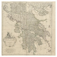
Large Scale Map of Greece with Inset Map of Macedonia, c.1786
Located in Langweer, NL
Antique map titled 'Graeciae Antiquae'. Large scale map of Greece, extends south to the island of Cythera. Inset map shows details of Macedonia. Publis...
Category

Antique 18th Century and Earlier Collectibles and Curiosities

Materials

Paper

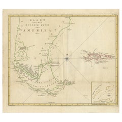
Antique Map of South America by J. Cook, 1775
Located in Langweer, NL
Antique map titled 'Kaart van het Zuidlyk Eind van Amerika'. Map of the sourthern part of South America, focusing on Cook's tracks around the Cape Horn and T...
Category

Antique 18th Century and Earlier Collectibles and Curiosities

Materials

Paper

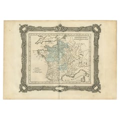
Antique Map of France under the Reign of Philip II by Zannoni, 1765
Located in Langweer, NL
Antique map France titled 'Carte de l'accroissement du Domaine sous Philippe Auguste (..)'. Beautiful old map of France. This map originates from 'Atlas Historique de la France Ancie...
Category

Antique 18th Century and Earlier Collectibles and Curiosities

Materials

Paper

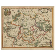
Antique Map of Lower Silesia of The Famous Mapmaker Blaeu, c.1650
Located in Langweer, NL
Antique map titled 'Ducatus Silesiae Wolanus'. \ Antique map depicting lower Silesia with the cities of Wolow (Wohlau), Winsko (Winzig), Herrnstadt, Chobie (Koben), Lubin (Lüben), R...
Category

Antique 18th Century and Earlier Collectibles and Curiosities

Materials

Paper

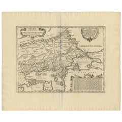
Antique Map of Thracia ‘Greece’ by J. Janssonius, circa 1650
Located in Langweer, NL
This antique map of Thracia is engraved and published by J. Janssonius after the cartographical sources by Abraham Ortelius. Ornated in the upper left corner with a title cartouche a...
Category

Antique 18th Century and Earlier Collectibles and Curiosities

Materials

Paper

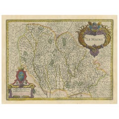
Map of Le Maine by H. Hondius, 1633, Hand-Colored, Decorative and Historic
Located in Langweer, NL
Map of Le Maine by H. Hondius, 1633, Hand-Colored, Decorative and Historic This rare and beautifully executed antique map titled 'Le Maine' was published in 1633 by Henricus Hondius...
Category

Antique 18th Century and Earlier Collectibles and Curiosities

Materials

Paper

Original Normandy Map by Frederick de Wit, 1705, with Inset of Channel Islands
Located in Langweer, NL
Normandy Map by Frederick de Wit, 1705, with Inset of Channel Islands Description: This beautifully engraved and hand-colored map, titled Duché et Gouvernement General de Normandie,...
Category

Antique 18th Century and Earlier Collectibles and Curiosities

Materials

Paper

Antique Map of Eastern Mediterranean and Asia Minor by a Benedictine, c.1725
Located in Langweer, NL
Antique map titled 'Byzondere Afbeelding der Landschappen, van de Apostelen bevaren en doorwandelt om het Evangelium J. C. te Prediken.' Map of the lands travelled by the Apostles to...
Category

Antique 18th Century and Earlier Collectibles and Curiosities

Materials

Paper

Coloured Antique Map of Sicily, Sardinia, Corfu, Elba, Malta and Zerbi (Jerba)
Located in Langweer, NL
Antique map titled 'Insularum Aliquot Maris Mediterranei Descriptio'. A very attractive example of Ortelius' map combining, on one page, maps of the islands of Sicily, Sardinia, Corfu, Elba, Malta and Zerbi (Jerba, off the coast of Tunisia.) The maps detail fortifications on the islands and other major features. (Jerba, for instance, is shown connected to the mainland by a causeway.) The waters are attractively engraved and are sailed by ships. A shipwreck, north of Malta, indicates the point at which St. Paul is thought to have shipwrecked. Volcanoes are indicated in the Sicily map...
Category

Antique 18th Century and Earlier Collectibles and Curiosities

Materials

Paper

Antique Map of the Region of Oldenburg, Germany
Located in Langweer, NL
Antique map titled 'Oldenburg Comitatus'. Detailed old map of Oldenburg, Germany. The map also shows Bremen and the Jade Bight. Published by W. Blaeu, circa 1640. Willem Jansz. Blaeu...
Category

Antique 18th Century and Earlier Collectibles and Curiosities

Materials

Paper

Antique Map of Germany by Hederichs 'circa 1740'
Located in Langweer, NL
Antique map titled 'Germania'. Rare miniature map of Germany and surroundings. This map covers the entirety of those lands traditionally occupied by Germanic peoples, from the Blatic...
Category

Antique 18th Century and Earlier Collectibles and Curiosities

Materials

Paper

Antique Roman Battle Print of Scipio's Front by Duncan, c.1753
Located in Langweer, NL
Antique battle map showing Scipio's Front. With detailed legend explaining the various elements of the print. This print most likely originates fro...
Category

Antique 18th Century and Earlier Collectibles and Curiosities

Materials

Paper

Large Antique Lithography Map of Kent, English, Cartography, Robert Morden, 1700
Located in Hele, Devon, GB
This is a large antique lithography map of Kent. An English, framed atlas engraving of cartographic interest by Robert Morden, dating to the early 18th century and later. Superb li...
Category

British Queen Anne Antique 18th Century and Earlier Collectibles and Curiosities

Materials

Glass, Wood, Paper

Attractive Hand-Tinted Antique Map of Japan, Published in 1752
Located in Langweer, NL
Nice decorative hand tinted map of Japan with the title (in French): Carte de L'Empire du Japon Bellin, 1752 This antique map is engraved with very attractive title cartouche. ...
Category

Antique 18th Century and Earlier Collectibles and Curiosities

Materials

Paper

The Principality of Dombes: A 17th-Century Cartographic Jewel by Jan Jansson
Located in Langweer, NL
The text on the map "La principaute de Dombes; J. van den Eynde sculpit.; La Principavte de Dombes" indicates that it is a map of the principality of Dombes, engraved by J. van den E...
Category

Antique 18th Century and Earlier Collectibles and Curiosities

Materials

Paper

Antique Print of Richmond Place by Woolfe, c.1770
Located in Langweer, NL
Antique print titled 'Elevation of Sir Asgill's Villa at Richmond in Surry (..)'. Plan and facade of Richmond Place or Asgill House, Richmond, London. This print originates from 'Vit...
Category

Antique 18th Century and Earlier Collectibles and Curiosities

Materials

Paper

Original Decorative Antique Map of Prussia, 1628
Located in Langweer, NL
Antique map titled 'Prussia'. Original antique map of Prussia, a historically prominent German state that originated in 1525 with a duchy centered on th...
Category

Antique 18th Century and Earlier Collectibles and Curiosities

Materials

Paper

Decorative Antique Sea Chart of Zeeland, a Province of the Netherlands, ca.1730
Located in Langweer, NL
Antique map titled 'Comitatus Zelandiae Tabula emendata a Frederico De Wit'. Decorative sea chart of Zeeland, a province of the Netherlands. Although the title reads F. de Wit, thi...
Category

Antique 18th Century and Earlier Collectibles and Curiosities

Materials

Paper

Antique Print of Caesar's Camp, A Roman Battle Print, c.1753
Located in Langweer, NL
Antique battle map of Caesar's Camp. With detailed legend explaining the various elements of the print. This print most likely originates from an edition of 'The Commentaries of Caesar, Translated into English. To Which is Prefixed a Discourse Concerning The Roman Art of War...
Category

Antique 18th Century and Earlier Collectibles and Curiosities

Materials

Paper

Rare Old English Sea Chart of Part of Indonesia with Java, Madura and Bali, 1711
Located in Langweer, NL
Antique map titled 'A Large Draught of the East End of Java and Madura shewing the Streights of Bally.' Rare early example of this working English Sea Chart of part of Indonesia ...
Category

Antique 18th Century and Earlier Collectibles and Curiosities

Materials

Paper

Charting Eastern Tartary: An 18th-Century Jesuit and English Collaboration, 1757
Located in Langweer, NL
The antique map titled 'Carte de la Tartarie Orientale pour Servir a l'Histoire Generale des Voyages Tiree des Cartes Levees par les P.P. Jesuites' is an original old map that covers...
Category

Antique 18th Century and Earlier Collectibles and Curiosities

Materials

Paper

Decorative Early Hand-Colored Map of the Northeast of England, ca.1620
Located in Langweer, NL
Antique map titled 'Eboracum, Lincolnia, Derbia, Staffordia, Notinghamia, Lecestria, Rutlandia et Norfolcia'. Decorative early map of the northeast of England, comprising the cou...
Category

Antique 18th Century and Earlier Collectibles and Curiosities

Materials

Paper

Exceptional 18th Century Italian Altar Frame Mirror
Located in Round Top, TX
An exceptional 18th century Northern Italian Altar frame, now as a mirror. Magnificently constructed, water gilded and polychromed Florentine detail to bas...
Category

Italian Antique 18th Century and Earlier Collectibles and Curiosities

Materials

Wood

Old Original Map of Chormandel & Malabar, India & Ceylon, Now Sri Lanka, 1726
Located in Langweer, NL
Antique map titled 'Nieuwe Kaart van Choromandel ende Malabar'. Antique map depicting the southern part of India and the northern tip of Ceylon, Sri Lanka. This map originates from...
Category

Antique 18th Century and Earlier Collectibles and Curiosities

Materials

Paper

Antique Map of Tibet, The Gobi Desert and China by Bellin, circa 1764
Located in Langweer, NL
Antique map titled 'Carte de l'Empire de Hya et Partie de Tangut'. Old map of Tibet, Gobi desert and China depicting the Great Wall of China and caravan routes. Originates from Prevo...
Category

Antique 18th Century and Earlier Collectibles and Curiosities

Materials

Paper

Old Antique Print of the City of Groningen, The Netherlands, by Münster, c.1600
Located in Langweer, NL
Antique print titled 'Groeninga'. View of the city of Groningen, the Netherlands. This map originates from 'Cosmographia' published by Münster. Artists and Engravers: Sebastian Münster...
Category

Antique 18th Century and Earlier Collectibles and Curiosities

Materials

Paper

Antique Map of Nova Zembla by Janssonius, c.1650
Located in Langweer, NL
Antique map titled 'Nova Zemla, waygats fretum Nassovi cum et terra Samoiedum singula omnium emendatissime descripta'. This map depicts Nova Zembla and the northern continental coast...
Category

Antique 18th Century and Earlier Collectibles and Curiosities

Materials

Paper

Antique Print of Horseheath Hall in Cambridgeshire, England, 1725
Located in Langweer, NL
Antique print titled 'General front of Horse heath Hall in Cambridgeshire (..)'. Old engraving of Horseheath Hall, Cambridgeshire. The original Hall was the home of the Alington family and was visited by Queen Elizabeth 1...
Category

Antique 18th Century and Earlier Collectibles and Curiosities

Materials

Paper

Attractive Antique Hand-Coloured Map of South America, ca.1765
Located in Langweer, NL
Antique map titled 'Kaart van het Onderkoningschap van Peru zig uitstrekkende: over Chile, Paraguay en andere Spaansche Landen als ook van Brazil en verdere Bezittingen van Portugal ...
Category

Antique 18th Century and Earlier Collectibles and Curiosities

Materials

Paper

Antique Map of Quinam and the Côn ?ao Islands by Sayer, 1778
Located in Langweer, NL
Antique map titled 'A Chart of a part of the Coast of Cochinchina' and 'Plan of Pulo Condor'. Two maps on one sheet. The upper map shows part of the coast of Cochinchina from Cham Co...
Category

Antique 18th Century and Earlier Collectibles and Curiosities

Materials

Paper

Antique Map of the Netherlands and Belgium by Keizer & De Lat, 1788
Located in Langweer, NL
Antique map titled 'Nouvelle Carte des XVII Provinces du Païs Bas (..)'. Uncommon antique map of Holland and Belgium. This map originates from ...
Category

Antique 18th Century and Earlier Collectibles and Curiosities

Materials

Paper

Scarce Engravings of the Ancient of Days of God from the Bible Book of Daniel
Located in Langweer, NL
Antique print titled 'Antiquus dierum sedit - S. Francisca Romana'. Scarce plate showing the 'Ancient of Days' i.e. God from the bible book of Daniel. Below Frances of Rome, Obl.S.B....
Category

Antique 18th Century and Earlier Collectibles and Curiosities

Materials

Paper

Old Map of Awatska Bay on the Coast of Kamchatka Peninsula, Russia by Cook, 1784
Located in Langweer, NL
Antique map Awatska titled 'Plan of the Bay of Awatska (..)'. Antique map of Awatska Bay on the east coast of the Russian peninsula of Kamtschatka. Inset plan of St. Peter’s and St. ...
Category

Antique 18th Century and Earlier Collectibles and Curiosities

Materials

Paper

Print of a Dutch VOC Fort on the Peninsula Trincomalee, Ceylon (Sri Lanka), 1726
Located in Langweer, NL
Dutch print with the title: Platte Grond van t'Fort Tricoen male met de daar aangelegen Pagoods-Berg (Trincomalee, Sri Lanka) The map is taken from: 'Oud en Nieuw Oost-Indiën' van...
Category

Antique 18th Century and Earlier Collectibles and Curiosities

Materials

Paper

Antique Map of South East Asia, Australia and the Indian Ocean, 1726
Located in Langweer, NL
Antique map titled 'Tabula Indiae Orientalis'. Beautiful detailed map of Australia, Southeast Asia and the Indian Ocean. The map features a fine depiction of the outlines of the western two-thirds of Australia, based on the discoveries of explorers working for the Dutch East India Company (the VOC). These include Willem Jansz's discoveries in the Gulf of Carpentaria in 1606; the encounters of Dirk...
Category

Dutch Antique 18th Century and Earlier Collectibles and Curiosities

Materials

Paper

Original Antique Bird's-Eye View of Colmar, Alsace, France, 1552
Located in Langweer, NL
Antique map titled 'La Paincture de la cité de Colmar & du pais circonuoisin'. Original antique bird's-eye view of Colmar, Alsace, France. This map originates from 'La Cosmograph...
Category

Antique 18th Century and Earlier Collectibles and Curiosities

Materials

Paper

18th Century French engraving represents a Grand Guard by Blarenberghe
Located in Delft, NL
18th Century French engraving represents a Grand Guard by Blarenberghe Engravings by Louis Nicolas van Blarenberghe, French 1716-1794. In four Tableaux Dated 1775, language in Franc...
Category

Antique 18th Century and Earlier Collectibles and Curiosities

Materials

Glass, Paper

Decorative Antique Map of the Region of Cambrai, France, ca.1630
Located in Langweer, NL
Antique map titled 'l'Archevesche de Cambray'. Decorative map of the region of Cambrai, France. Includes the cities of Cambrai, Valencienes, Douai, and Bouchain. Artists and Engravers: Henricus...
Category

Antique 18th Century and Earlier Collectibles and Curiosities

Materials

Paper

Antique Architectural Print of Cobham Hall in Kent, England, 1717
Located in Langweer, NL
Antique print titled 'The Elevation of Cobham Hall in Kent (..)'. Elevation of the entrance facade of Cobham Hall, Kent. This print originates from 'Vitruvius Britannicus' by Colen...
Category

Antique 18th Century and Earlier Collectibles and Curiosities

Materials

Paper

Antique Map of Carta Soura, Headquarter of the Javanese Nobility, 1706
Located in Langweer, NL
Antique map titled 'Carta Soera de Nigrita'. Early map of the town of Carta Soura, also known as Kartosuro and Karta Soera de Nigrat, located in the interior of central Java, headqua...
Category

Antique 18th Century and Earlier Collectibles and Curiosities

Materials

Paper

Detailed Antique Map of Friesland, Groningen and Drenthe, The Netherlands, c1735
Located in Langweer, NL
Antique map titled 'Frisia Dominum (?) Friesland, verdeeld in de hoof-delen van Oostergoo, Westergoo en Sevenwolde (?) XXX Grietenijen.' Detailed map of Friesland, Groningen and Dren...
Category

Antique 18th Century and Earlier Collectibles and Curiosities

Materials

Paper

Old Map of the East Indonesian Islands Borneo, Celebes, New Guinea, Bali, 1792
Located in Langweer, NL
Antique map titled 'Partie de la Nouvelle Grande Carte des Indes Orientales, contenant les Isles de Borneo, Iava, Celebes, Mindanao (..)'. Detailed map of the Indonesian islands ...
Category

Antique 18th Century and Earlier Collectibles and Curiosities

Materials

Paper

Antique Maps of Manipa, Nusa-Laut, Saparua and Haruku in Maluku, Indonesia 1726
Located in Langweer, NL
Antique map titled 'Caart van het Eyland Manipa, Noessa-Laoet, Honimoa, Oma. Der Manipesen dracht, een Orangkaya van Manipa.' Four maps of islands and two figures in native dress. Th...
Category

Antique 18th Century and Earlier Collectibles and Curiosities

Materials

Paper

Original Antique Map of the Road from Marlborough to Huntspil
Located in Langweer, NL
Antique map titled 'The Continuation of the Road from London to Bristol (..)'. A strip map of the continuation of the road from London to Bristol, this particular sheet showing the r...
Category

Antique 18th Century and Earlier Collectibles and Curiosities

Materials

Paper

Antique Map of the Diocese of Toul by Covens & Mortier, circa 1720
Located in Langweer, NL
Antique map titled 'Civitas Leucorum sive Pagus Tullensis'. Detailed map of the Diocese of Toul, France. Centered on the cities of Nancy and Toul and including Metz, Verdun, S. Dizie...
Category

Antique 18th Century and Earlier Collectibles and Curiosities

Materials

Paper

Rare Handcolored Map of Isle de Juan Fernandes 'Robinson Crusoe Island', Chili
Located in Langweer, NL
Antique map titled 'Die Insel Iuan Fernandes in der Sudsee (..)'. This map depicts Robinson Crusoe, one of the Juan Fernández Islands. Robinson Crusoe Island, formerly known as Más a Tierra, is the second largest of the Juan Fernández Islands. From 1704 to 1709, the island was home to the marooned sailor Alexander Selkirk, who at least partially inspired novelist Daniel Defoe's fictional Robinson Crusoe in his 1719 novel, although the novel is explicitly set in the Caribbean. This was just one of several survival stories from the period of which Defoe would have been aware. To reflect the literary lore associated with the island and attract tourists, the Chilean government renamed the place Robinson Crusoe Island in 1966. This map originates from a German edition of 'Voyage around the World...
Category

Antique 18th Century and Earlier Collectibles and Curiosities

Materials

Paper

Large German Chart of the Islands of the Philippines with Hand-Colored Borders
Located in Langweer, NL
Original antique map titled 'Karte von dem Canal in den Philippinischen Inseln (..)'. Large detailed chart of the islands of the Philippines. One of the most detailed charts of the Philippines of the era. Shows Islands, bays, reefs, soundings tracks of the Manila Galleon route, etc. Includes a large compass rose and rhumb lines. Originates from a German edition of "Voyage around the World...
Category

Antique 18th Century and Earlier Collectibles and Curiosities

Materials

Paper

Antique Map of the Duchy of Westphalia, Germany
Located in Langweer, NL
Original antique map titled 'Westphalia Ducatus'. Fine map of the Duchy of Westphalia, Germany. The map is centered on Meschede and includes Arensberg, Beelick, and Brilon. Published...
Category

Antique 18th Century and Earlier Collectibles and Curiosities

Materials

Paper

Antique Map of the Artois Region of France by Ortelius, 'circa 1590'
Located in Langweer, NL
Antique map titled 'Artesia'. Original antique map of the Artois region, France. Published by A. Ortelius, circa 1590.
Category

Antique 18th Century and Earlier Collectibles and Curiosities

Materials

Paper

18th Century Italian Bronze Pestle for a Mortar, 9 Inches Long
Located in Stamford, CT
If you've got the mortar, I have the pestle! There are so many mortars out there, and so few pestles. It's nice to have both. Here is your opportunity to marry this large scale pestl...
Category

Italian Baroque Antique 18th Century and Earlier Collectibles and Curiosities

Materials

Bronze

Antique Map of the British Isles and Part of Europe by Chatelain, c.1720
Located in Langweer, NL
Antique map titled 'Carte pour l'Intelligence de l'Histoire d'Angleterre (..)'. Decorative map showing the British Isles and the various regions conquered in Europe. Includese two elaborate family trees for the House of York...
Category

Antique 18th Century and Earlier Collectibles and Curiosities

Materials

Paper

Antique Map of the Duchy of Saxony by De Wit, c.1680
Located in Langweer, NL
Antique map titled 'Circuli Saxoniae Superior Pars Meridionalis in qua sunt Ducatus Saxoniae, Comitatus Mansfeldiae, et Voitlandiae, Landgraviat Thuringiae, Marchionatus Misniae Prin...
Category

Antique 18th Century and Earlier Collectibles and Curiosities

Materials

Paper

Antique Map of Guyenne, Gascony and Béarn, France
Located in Langweer, NL
Antique map titled 'Guyenne et Gascogne et Bearn'. Original old map of Guyenne (or Guienne), Gascony and Béarn, France. This map originates from 'Le Petit Atlas Maritime Recueil De C...
Category

Antique 18th Century and Earlier Collectibles and Curiosities

Materials

Paper

Decorative Map of the Empire of China, Korea, Japan, Taiwan, Lucon, Macau, 1780
Located in Langweer, NL
Antique map titled 'Carte de L'Empire de la Chine.' Decorative map of the Empire of China, depicting China, Corea ( Korea ), Japan, Tonquin and the Philippine island Lucon. Source unknown, to be determined. Artists and Engravers: Rigobert Bonne (1727-1795 ) was one of the most important cartographers of the late 18th century. In 1773 he succeeded Jacques Bellin as Royal Cartographer to France in the office of the Hydrographer at the Depôt de la Marine. Working in his official capacity Bonne compiled some of the most detailed and accurate maps of the period. Bonne's work represents an important step in the evolution of the cartographic ideology away from the decorative work of the 17th and early 18th century towards a more detail oriented and practical aesthetic. With regard to the rendering of terrain Bonne maps...
Category

Antique 18th Century and Earlier Collectibles and Curiosities

Materials

Paper

Antique Map of Ambon Island in the Moluccas, Indonesia, c.1760
Located in Langweer, NL
Antique map Ambon titled 'Carte Particuliere de l 'Isle Amboine'. Old map showing Ambon, in the Moluccas Islands, better known as the Spice Islands. Ambon was the headquarters of the...
Category

Antique 18th Century and Earlier Collectibles and Curiosities

Materials

Paper

French Antique Map of France and Western Europe, 1765
Located in Langweer, NL
Antique map titled 'Carte de tous les Lieux, célébres dans l'Histoire (..)'. Beautiful old map of France and western Europe. This map originates from 'Atlas Historique de la France A...
Category

Antique 18th Century and Earlier Collectibles and Curiosities

Materials

Paper

Coppia di Fregi Italiani Dorati e Intagliati con la Figura di San Michele 1750s
Located in Milano, MI
Coppia Di Fregi Dorati riccamente intagliati in legno di tiglio con un tableau centrale ovale raffigurante San Michele mentre impugna la spada con la mano destra e regge la bilancia ...
Category

European Antique 18th Century and Earlier Collectibles and Curiosities

Materials

Giltwood

18th Century French Oil on Canvas Painting "Sixth Station of the Cross"
Located in Dallas, TX
Decorate a wall with this colorful religious antique painting. Created in France, circa 1780, the artwork is set in the original frame and depicts the 6th station of the cross " Vero...
Category

French Antique 18th Century and Earlier Collectibles and Curiosities

Materials

Canvas

Rare Antique Engraving of Mount Fuji During an Earthquake in Tokyo, Japan, 1669
Located in Langweer, NL
Antique print, titled: 'Aertbeevinge tot Jedo.' - ('Earthquake in Edo'). A temple falls to ruins because of an earthquake in Yedo (or Edo, Jeddo; now Tokyo). Men and women lament...
Category

Antique 18th Century and Earlier Collectibles and Curiosities

Materials

Paper

Antique Map of the Southern Lorraine Region by Mercator, c.1625
Located in Langweer, NL
Antique map titled 'Lotharingiae Ducatus'. Old map of the southern portion of the Lorraine region, France. Lorraine is a cultural and historical region in north-eastern France, now l...
Category

Antique 18th Century and Earlier Collectibles and Curiosities

Materials

Paper

Read More

Medal-Worthy Memorabilia from Epic Past Olympic Games

Get into the games! These items celebrate the events, athletes, host countries and sporting spirit.

Ahoy! You’ve Never Seen a Collection of Sailor Art and Kitsch Quite Like This

French trendsetter and serial collector Daniel Rozensztroch tells us about his obsession with objects related to seafaring men.

Pamela Shamshiri Shares the Secrets behind Her First-Ever Book and Its Effortlessly Cool Interiors

The sought-after designer worked with the team at Hoffman Creative to produce a monograph that beautifully showcases some of Studio Shamshiri's most inspiring projects.

Moroccan Artworks and Objects Take Center Stage in an Extraordinary Villa in Tangier

Italian writer and collector Umberto Pasti opens the doors to his remarkable cave of wonders in North Africa.

Montecito Has Drawn Royalty and Celebrities, and These Homes Are Proof of Its Allure

Hollywood A-listers, ex-pat aristocrats and art collectors and style setters of all stripes appreciate the allure of the coastal California hamlet — much on our minds after recent winter floods.

Whaam! Blam! Pow! — a New Book on Pop Art Packs a Punch

Publishing house Assouline and writer Julie Belcove have teamed up to trace the history of the genre, from Roy Lichtenstein, Andy Warhol and Yayoi Kusama to Mickalene Thomas and Jeff Koons.

What Makes a Gem-Encrusted Chess Set Worth $4 Million?

The world’s most opulent chess set, weighing in at 513 carats, is literally fit for a king and queen.

Tauba Auerbach’s Geometric Pop-Up Book Is Mighty Rare, Thanks to a Hurricane

This sculptural art book has an epic backstory of its own.
Recently Viewed

View All