Early 1700s More Furniture and Collectibles

to
46
54
11
65
2
2
5,203
10,402
31,471
15,174
6,677
13,594
6,636
934
576
1,130
1,384
1,026
2,840
2,902
2,595
1,218
797
53
6
3
3
3
14
6
3
1
1
65
65
65
Period: Early 1700s
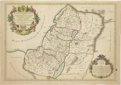
1709 Map of the Holy Land - Twelve Tribes of Israel, Hand-Colored, Antique Map
Located in Langweer, NL
This is a beautiful 1709 map of the Holy Land, titled "Iudaea seu Terra Sancta quae Hebraeorum sive Israelitarum in suas duodecim Tribus divisa," by Guillaume Sanson and Alexis Huber...
Category

Antique Early 1700s More Furniture and Collectibles

Materials

Paper

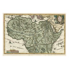
Very Decorative Rare Antique Map of the Northern Part of Africa, 1702
Located in Langweer, NL
Antique map titled 'Africae Pars Borealis.' Very decorative antique map of the northern part of Africa by Heinrich Scherer. The map is full of the spurious geography of the perio...
Category

Antique Early 1700s More Furniture and Collectibles

Materials

Paper

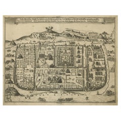
Spectacular Antique Original Engraving of a Town Plan of Jerusalem, 1708
Located in Langweer, NL
Description: Antique map titled 'Erster Abriss der Stadt Jerusalem wie sie Furnemblich zur Zeit des Hernn Christi beschaffen (..).' Spectacular town plan...
Category

Antique Early 1700s More Furniture and Collectibles

Materials

Paper

[MISSAL]. L'Office De La Semaine Sainte. GILT ARMS OF PHILIPPE II DUC D'ORLEANS
Located in Hillsborough, NJ
AUTHOR: [MISSAL]. TITLE: The Office of Holy Week, According to the Messel & Roman Breviary;... PUBLISHER: Paris: By the Company of Booksellers assigned to the Book of Holy Week, 1...
Category

British Antique Early 1700s More Furniture and Collectibles

Materials

Leather

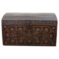
Studded Leather Travel Chest
Located in Greenwich, CT
Very fine early 18th century leather travel chest or trunk in beautiful brass and iron studded Spanish leather, having elaborate geometric floral ...
Category

Spanish Antique Early 1700s More Furniture and Collectibles

Materials

Leather

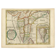
1705 Sanson Map of Southern India and Malabar with an Inset Map
Located in Langweer, NL
Title: 1705 Sanson Map of Southern India and Malabar with an Inset Map Description: This finely engraved and beautifully hand-colored antique map, published in 1705, depicts south...
Category

Antique Early 1700s More Furniture and Collectibles

Materials

Paper

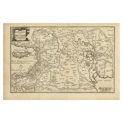
Original Antique Map of Canaan, Armenia, Syria, Mesopotamia and Arabia, 1709
Located in Langweer, NL
Antique map titled 'Descriptio Paradisi et Terrae Canaan'. Original antique map of Canaan, Armenia, Syria, Mesopotamia and Arabia. It displays the Middle East from the eastern Mediterranean Sea to the Persian Gulf...
Category

Antique Early 1700s More Furniture and Collectibles

Materials

Paper

Flemish Tapestry Three Panel Screen
Located in Essex, MA
Three tapestry fragments mounted in a late 19c carved walnut frame.
Category

French Baroque Antique Early 1700s More Furniture and Collectibles

Materials

Tapestry, Walnut

Scarce Latin Edition of Guillaume Delisle's 1700 Map of North America
Located in Langweer, NL
Scarce German Edition of Guillaume Delisle's 1700 Map of North America This beautifully colored and highly detailed map is a rare Latin edition of Guillaume Delisle's influential 17...
Category

Antique Early 1700s More Furniture and Collectibles

Materials

Paper

Royal circa 1707-1714 Hand Carved Polychrome Painted Armorial Crest Coat of Arms
Located in West Sussex, Pulborough
We are delighted to offer for sale this very rare, large for its type, Royal coat of arms / Armorial Crest circa 1707-1714 with original Polychrome paint This is an exceptionally we...
Category

English Queen Anne Antique Early 1700s More Furniture and Collectibles

Materials

Wood

Map Holy Land La Terre Sainte Engraved van Loon Published N de Fer 1703 French
Located in BUNGAY, SUFFOLK
La Terre Sainte, The Holy Land, Tiree Des Memoires De M.De.La Rue. Par N. de Fer. Geographe de Sa Majeste Catoliq et de Monseigneur le Dauphin. Avec Privil du Roi 1703 Detailed map of the Holy Land from Nicholas de Fer's L'Atlas Curieux ou le Monde. East is oriented at the top. MAKER Nicolas de Fer 1646-1720 The French cartographer and engraver, Nicolas de Fer, was a master at creating maps that were works of art. The maps that he published were printed during the Baroque period when the decorative arts were characterized by ornate detail. De Fer’s detailed maps and atlases were valued more for their decorative content than their geographical accuracy. Nicolas de Fer was born in 1646. His father, Antoine de Fer, owned a mapmaking firm. At the age of twelve, Nicolas was apprenticed to a Parisian engraver named Louis Spirinx. The family business was starting to decline when his father died in 1673. Nicolas de Fer’s mother, Genevieve, took over the business after the death of her husband. In 1687 the business was passed on to Nicolas and the profits increased after he took over the firm. Nicolas de Fer was a prolific cartographer who produced atlases and hundreds of single maps. He eventually became the official geographer to King Louis XIV of France and King Philip V...
Category

French Louis XIV Antique Early 1700s More Furniture and Collectibles

Materials

Paper

Unusual Swiss Oak Rustic Table with Hinged Doors, 17th-18th Century
Located in Atlanta, GA
Constructed entirely of a light oak, the table has a two board rectangular top above a conforming cabinet housing two hinged doors, the cabinet supported by trestle legs on elongated...
Category

Swiss Baroque Antique Early 1700s More Furniture and Collectibles

Materials

Oak

Rare Town Plan of Jerusalem, Includes an Extensive Key to Locations etc, 1708
Located in Langweer, NL
Antique map titled 'Eigentliche Vorstellung der Statt Jerusalem und derselben umliegenden Gegenden zu Salomonis auch zu und kurtz nach Christi Zeiten.' Rare town plan...
Category

Antique Early 1700s More Furniture and Collectibles

Materials

Paper

Antique Engraving of Thomas Müntzer, a Reformation-Era German Theologian, 1701
Located in Langweer, NL
Antique portrait titled 'Thomas Muntzer'. Portrait of Thomas Müntzer. Thomas Müntzer was an early Reformation-era German theologian, who became a rebel leader during the Peasants' War. He turned against Luther with several anti-Lutheran writings, and supported the Anabaptists. In the Battle of Frankenhausen, Müntzer and his followers were defeated. He was captured, tortured and decapitated. This print originates from 'Historie der kerken en ketteren van den beginne des Nieuwen Testaments tot aan het jaar onses Heeren 1688 ... In het Neederduyts vertaald' by G. Arnold. Artists and Engravers: Gottfried Arnold (1666 – 1714) was a German Lutheran...
Category

Antique Early 1700s More Furniture and Collectibles

Materials

Paper

(NIVARDUS) - The Crafty Courtier: Or the fable of Reinard the Fox - 1706
Located in Hillsborough, NJ
AUTHOR: [NIVARDUS, Hartmann Schopper]. TITLE: The Crafty Courtier: Or the fable of Reinard the Fox: Newly done into English Verse, from the Antient Latin Iambics of Hartm. Schopper...
Category

British Antique Early 1700s More Furniture and Collectibles

Materials

Leather

Original Copper Engraving with View of the Palace and Chinese Emperor, ca.1700
Located in Langweer, NL
Title: "The Station used by the great Mandaryns Staetsie der groote Mandarijns / The Station used by the great Mandaryns Staetsie der groote Mandarijns. 1665. The richly illustrat...
Category

Antique Early 1700s More Furniture and Collectibles

Materials

Paper

Map of the Holy Land Divided into 12 Tribes, the Travels of Jesus Christ, 1700
Located in Langweer, NL
Antique map titled 'Het Heylige Land verdeeld in de Twaalf Stammen Israels (..)'. Decorative and detailed map of the Holy Land divided into 12 Tribes, sh...
Category

Antique Early 1700s More Furniture and Collectibles

Materials

Paper

Antique Print of An Ancient Roman Tomb and a Floor Plan in Rome, Italy, 1704
Located in Langweer, NL
Description: Antique print, untitled. This original old antique print shows an ancient Roman tomb and a floor plan in Rome, Italy. This original old ant...
Category

Antique Early 1700s More Furniture and Collectibles

Materials

Paper

Ca.1700 Antique Brussels Tapestry Pillow 19'' X 14''
Located in Los Angeles, US
Ca.1700 Antique Brussels Tapestry Pillow - 19'' X 14'', Wool, Empire Traditional, Handmade and Needlework,
Category

Belgian Empire Antique Early 1700s More Furniture and Collectibles

Materials

Wool

Period Louis XIV Oak and Iron Domed Trunk, Northeast France, Circa 1700
Located in Dallas, TX
A fantastic example of a period Louis XIV trunk, the oak body, which features a domed top, is bound with ornate iron strapwork. The trunk originated in northeast France and was hand-...
Category

French Louis XIV Antique Early 1700s More Furniture and Collectibles

Materials

Metal, Iron

Pair of French Patinated Bronze Putti Heads On Sea Green Marble Plinths, C. 1700
Located in Dallas, TX
These French, patinated bronze putti heads surrounded by spiral fluting are mounted on geometrically shaped marble plinths. Dating to circa 1700, the rising busts feature a cherub wi...
Category

French Antique Early 1700s More Furniture and Collectibles

Materials

Marble, Bronze

Original Antique Engraving of A Jewish Priest, 1709
Located in Langweer, NL
Antique print titled 'La Representation du Grand Pontise'. Old print depicting a Jewish Priest. This print originates from 'Introduction à l'écriture sainte, où l'on traite tout ...
Category

Antique Early 1700s More Furniture and Collectibles

Materials

Paper

1700 Guillaume Delisle Map: Western Mediterranean & Moorish North Africa
Located in Langweer, NL
1700 Guillaume Delisle Map: Western Mediterranean & Moorish North Africa This hand-colored map from 1700 by Guillaume Delisle, titled "In Notitiam Ecclesiasticam Africae Tabula Geographica," offers a detailed look at the regions under Moorish control during the later medieval period. It encompasses the northern African coast from Morocco to Libya, the Iberian Peninsula, and the western Mediterranean, including notable islands such as Sardinia, Corsica, Malta, the Balearics, and Sicily, where a smoking Mount Etna is depicted. The map is embellished with three decorative cartouches, adding artistic flair to the detailed geographical renderings. Engraved by Jean Baptiste Liebaux, the map measures 25.2 inches wide by 19.1 inches high. It features a sharp impression with contemporary outline color, later enhanced cartouches, and is printed on a bright sheet with a Society of Jesus watermark. The condition is very good, with an archivally repaired centerfold separation at the bottom and light toning along the edges. Keywords: - Guillaume Delisle map - Western Mediterranean historical map - Northern Africa map...
Category

Antique Early 1700s More Furniture and Collectibles

Materials

Paper

Old Map of Ancient Assyria Divided into Syria, Mesopotamia, Babylonia & Assyria
Located in Langweer, NL
This map, "Assyria vetus diuisa in Syriam, Messopotamiam, Babyloniam, et Assyriam", by Pierre Mortier, is a late 17th-century depiction of the historical Middle East. Title: Ancie...
Category

Antique Early 1700s More Furniture and Collectibles

Materials

Paper

Original Normandy Map by Frederick de Wit, 1705, with Inset of Channel Islands
Located in Langweer, NL
Normandy Map by Frederick de Wit, 1705, with Inset of Channel Islands Description: This beautifully engraved and hand-colored map, titled Duché et Gouvernement General de Normandie,...
Category

Antique Early 1700s More Furniture and Collectibles

Materials

Paper

Antique Map of Lotharingia (Lorraine) by Danckerts, c. 1700 – Hand-Colored
Located in Langweer, NL
Antique Map of Lotharingia (Lorraine) by Theodorus Danckerts circa 1700 Hand-Colored This beautifully detailed antique map of Lotharingia, now the Lorraine region in northeastern ...
Category

Antique Early 1700s More Furniture and Collectibles

Materials

Paper

Antique Engraving of Majorinus, Bishop of Carthage of the Donatist Sect, 1701
Located in Langweer, NL
Antique print, titled: 'Majorinus Numida' Majorinus was a bishop of Carthage in dispute with Ceacilianus. He favored the so-called Donatist sect. Het died ca. 329 AD. The background to the controversy was the wave of persecutions of Christians by the Roman Emperor Diocletian. At that time some Church leaders - unwilling to endure torture or death and become martyrs - had been ready to take such acts as worshipping the gods of the old pantheon, considered idols by Christians, or surrendering church books and property to the imperial authorities. Such people became known as 'traditors' ("surrenderers"). One of these "traditors", named Caecilian, had returned to the fold of the Church once the persecutions ended, and was consecrated Bishop of Carthage and Primate of North Africa. Those of the faithful who refused to accept the authority of such a spiritual leader raised Majorinus as a rival bishop; however, Majorinus died shortly after being consecrated, and it fell to Donatus to take his place and continue the struggle. This rare print originates from: 'Historie der Kerken en Ketteren van den beginne des Nieuwen Testaments tot aan het Jaar onses Heeren 1688. Onzydig in 't Hoogduytsch beschreeven, door den Hoog-geleerden Heer Godfried Arnold, Voor deezen Hoog-Leeraar in de Historien tot Giesen. In het Neederduyts vertaald. Vercierd met verscheyde Koopere Plaaten door den Heer Romeyn de Hooghe.' (transl.: History of Churches and Heretics from the start of the New Testament until the year of our lord 1688 ...), by Godfried Arnold, Dutch edition published by Sebastiaan Petzold, Amsterdam 1701. This edition contains portraits of heretic figures, etched by the reknown Romeyn de Hooghe. Artists and Engravers: Made by 'Romeyn de Hooghe' after an anonymous artist. Gottfried Arnold (pseud. Christophorus Irenaeus) was an important representative of the so-called radical Pietism, publicist, church historian and chants writer (so he was believed to have written the well-known Church song 'O Durchbrecher aller Bande'). Arnold studied theology in Wittenberg. From the Lutheran Orthodoxy he converted, through writings of Spener, to Pietism, associating later into a circle around the court preacher Sprögel, who was influenced by Jakok Böhm. Many medieval mystics were later re-issued by him. In addition he was clearly influenced by Grotius and the early enlightenment. His quest for the 'true' Christianity rightly brought him in the early Church. So he arranged an edition containing the sermons of the desert father Macarius. Arnold was a skilled patristicus, although he did not escape from the creation of an ideal image of the Christian life in the early Church, in his view a flowering time which ended with the reign of Constantine. His first study of the early Church ('Die erste Liebe der Gemeinen Jesu Christi') provided him a professor position in Gießen, a post which he soon left, disappointed by what he called the 'Ruhmsachtige Vernunftwesen des akademischen Lebens'. He continued as an individual scientist and he published books and poems. His main work is 'Unparteiischen Kirchen- und Ketzerhistorie' (1699-1700), of which this is the Dutch translation. He adapts in this study the reformatory decay theory, where the censure lies no longer with Constantine, but the post-Apostolic time. The decay is temporarily lifted with the Reformation, but occurres again soon, so that even the contemporary institutional Protestantism lies under the fire of his criticism. On the other hand he favours the 'Church of the spirit' that existed in all times (invisible) and is characterised by avoiding the world and asceticism. Not the orthodoxy, but the subjectivity of religious man...
Category

Antique Early 1700s More Furniture and Collectibles

Materials

Paper

1705 Golfe de Mexico and Florida Framed Map
Located in Stamford, CT
Framed map of Mexico & Florida circa 1705, Paris. Small map with Mexico and the Gulf Coast. Inset text indicating Panama, Acapulco, Mexico City and the Mississippi. Extends North to ...
Category

French Spanish Colonial Antique Early 1700s More Furniture and Collectibles

Materials

Glass, Wood, Paper

Highly Decorative Map of The Eastern Mediterranean and The Middle East, ca.1700
Located in Langweer, NL
Antique map titled 'Byzondere Kaart van de Landen Daar de Apostelen Het Evangelium Gepredikt Hebben (..).' Highly decorative map of the eastern Mediterranean...
Category

Antique Early 1700s More Furniture and Collectibles

Materials

Paper

Beautiful Antique Handcolored Map of Switzerland with 33 Coats of Arms, ca.1705
Located in Langweer, NL
Antique map Switerzland titled 'La Suisse Divisee en ses Treze Cantons, ses Alliez & ses Sujets (..)'. Beautiful map of Switzerland with 33 coats of arms. The map is dedicated to t...
Category

Antique Early 1700s More Furniture and Collectibles

Materials

Paper

Hibernia Regnum Map by Carel Allard, 1700: Hand-Colored Provinces of Ireland
Located in Langweer, NL
This is a historical map of Ireland created by Carel Allard around 1700, titled "Hibernia Regnum in Quatuor Provincias Ultoniam, Connaciam, Lageniam, et Momoniam". The map is hand-colored and engraved. It includes two large decorative cartouches. The map is part of an atlas by Carel Allard, an Amsterdam-based cartographer. Here are the detailed points about the map: Maker: Carel Allard - a prominent Dutch cartographer and publisher from Amsterdam. Atlas: Source Atlas - Likely part of an atlas published by Carel Allard, but specific title of the atlas isn't mentioned. Interesting Features 1. Decorative Cartouches: The map features two large, ornate cartouches. One in the upper left depicts a classical figure and British Royal arms...
Category

Antique Early 1700s More Furniture and Collectibles

Materials

Paper

Original Antique Bird's Eye View Plan of Hoorn, The Netherlands by Blaeu, c.1700
Located in Langweer, NL
Antique map titled 'Horna vulgo Hoorn'. Bird's eye view plan of Hoorn, The Netherlands. With title cartouche, coats of arms and key. From an atlas published by De Wit, ca. 1698-1...
Category

Antique Early 1700s More Furniture and Collectibles

Materials

Paper

Historical Map of the Black Sea and Surrounding Regions, 1705
Located in Langweer, NL
Title: "Map of Turcomania, Georgia, and Comania" This print presents an intricately detailed map of the Caucasus region, titled “Turcomania, Georgien Commanie,” by the esteemed cart...
Category

Antique Early 1700s More Furniture and Collectibles

Materials

Paper

Rare Sea Chart of the East Frisian Islands or Watten and the North Sea, c.1700
Located in Langweer, NL
Description: Antique map titled 'Paskaarte van de rievier de Elve streckende van Oldenbroek tot Hamburgh.' Rare and interesting chart of the East Frisian Islands (or Watten) and ...
Category

Antique Early 1700s More Furniture and Collectibles

Materials

Paper

Original Copper Engraving Depicting Dutch Merchants visting China, ca.1700
Located in Langweer, NL
Title: 'The departure of the Empirour Hockflieuw to the Emprial Court at Peking' with further description in Dutch. The Dutch man Pieter van Hoorn, his son...
Category

Antique Early 1700s More Furniture and Collectibles

Materials

Paper

Hand-Colored City Plan of Cologne by Nicolas de Fer, 1705
Located in Langweer, NL
Title: Hand-Colored City Plan of Cologne by Nicolas de Fer, 1705 This hand-colored map, titled "Cologne Ville Considerable Situee sur le Bord Occidentale du Rhein Capit. de l'Electo...
Category

Antique Early 1700s More Furniture and Collectibles

Materials

Paper

Old Sea Chart of Northern Norway, also depicting Part of Lapland & Russia, 1702
Located in Langweer, NL
Antique map titled 'The Coast of Norway and Lapland, from North kyn to the River Kola'. Sea Chart of Northern Norway, also depicting part of Lapland and Russia. The map covers from the Kola river to what the map calls Fishers Island...
Category

Antique Early 1700s More Furniture and Collectibles

Materials

Paper

Decorative Engraving of VOC Battle Ships Attacking Palembang in Sumatra, ca.1700
Located in Langweer, NL
Antique print titled 'La Ville de Palimbang dans L’Ile de Sumatra.' A very decorative, impressive engraving of Palembang in Sumatra. Two views on one sheet. In the upper part the...
Category

Antique Early 1700s More Furniture and Collectibles

Materials

Paper

Early 18th Century Map of Denmark in Old Coloring, Published in 1706
Located in Langweer, NL
Denmark. Schenk (Petrus), Dania Regnum Ducatus Holsatia. et Slesvicum Insulae Danicae et Provinciae Jutia Scania etc. Amsterdam, 1706, engraved reticulated map on thick paper with co...
Category

Antique Early 1700s More Furniture and Collectibles

Materials

Paper

Antique Map of the Sunda Islands Including Sumatra, Java, and Borneo, 1705
Located in Langweer, NL
Title: “Antique Map of the Sunda Islands Including Sumatra, Java, and Borneo” This print is a beautifully detailed and relatively rare map of Western Indonesia, encompassing the reg...
Category

Antique Early 1700s More Furniture and Collectibles

Materials

Paper

Two Charts of The English Channel, Each Adorned with Nice Compass Roses, ca.1700
Located in Langweer, NL
Antique map titled 'Hydrographia Canalis Marini Inter Angliam et Galiiam de Fluentis.' Sheet with with two charts of the English Channel, each adorned with beautiful compass rose...
Category

Antique Early 1700s More Furniture and Collectibles

Materials

Paper

Old Map of the Namibia and South Africa Coasts & Inset of Saldanha Bay, ca.1700
Located in Langweer, NL
Antique map titled 'Carte particuliere des Costes de l'Afrique'. Map of the coasts of Namibia and South Africa. With an inset map of Saldanha Bay. Artists and Engravers: Publ...
Category

Antique Early 1700s More Furniture and Collectibles

Materials

Paper

Cartographic Elegance of the Mughal Dominion in a Hand-Colored Antique Map, 1705
Located in Langweer, NL
This original antique map titled “'T Ryk van den Grooten Mogol” by Nicolas Sanson from 1705 is an interesting historical artifact. It depicts the extent of the Mughal Empire in North...
Category

Antique Early 1700s More Furniture and Collectibles

Materials

Paper

Map of the Mozambique and Tanzania Coast & Inset Map of Anjouan Island, ca.1700
Located in Langweer, NL
Antique map titled 'Carte particuliere des Costes de l'Afrique'. Depicts the coasts of Mozambique and Tanzania. With an inset map of Anjouan Island. Artists and engravers: Pub...
Category

Antique Early 1700s More Furniture and Collectibles

Materials

Paper

Antique Engraving of Circus Flaminius, a Circular Area in Ancient Rome, 1704
Located in Langweer, NL
Description: Antique print, titled: 'Circus Flaminius (…)' - This original old antique print shows a reconstruction of Circus Flaminius, a large, circular area in ancient Rome, l...
Category

Antique Early 1700s More Furniture and Collectibles

Materials

Paper

Early Bird's-Eye View of Rio Di Janeiro and Guanabara Bay, Brazil, 1702
Located in Langweer, NL
Antique print titled 'Rio Janeiro'. Bird's-eye view of Rio di Janeiro and Guanabara Bay, Brazil. From the French edition (translation by Renneville) of Commelin's 'Recueil des Vo...
Category

Antique Early 1700s More Furniture and Collectibles

Materials

Paper

Spectacular Large Map of Upper and Lower Austria between Passau and Wien, c.1700
Located in Langweer, NL
Antique map titled 'Austriae Archiducatus pars superior in omnes ejusdem (..).' Spectacular large map of Upper and Lower Austria between Passau and Wien with figurative cartouche a...
Category

Antique Early 1700s More Furniture and Collectibles

Materials

Paper

Map of the Electorate of Bavaria, Incl Lake Constance, by Jesuit Scherer, c.1700
Located in Langweer, NL
Antique map titled 'Electorat Bavariae.' Map of the Electorate of Bavaria by the Jesuit Heinrich Scherer. The lower map shows the Lake Constance. Source unknown, to be determined. ...
Category

Antique Early 1700s More Furniture and Collectibles

Materials

Paper

Original Antique Copper Engraving of a Portrait of John the Evangelist, 1708
Located in Langweer, NL
Antique print, titled: 'Das Bildnus des H. Evangelisten Johannis (…).' - This original antique plate shows a portrait of John the Evangelist. From: Biblia : das ist die gantze He...
Category

Antique Early 1700s More Furniture and Collectibles

Materials

Paper

Framed View of the Brouwersgracht in Amsterdam, the Netherlands, 1708
Located in Langweer, NL
Antique print titled 'Societatis Indiae Occident (..) - West Indisch Huys op Raapenburg (..)'. Despite the title suggesting this print is a view of the West-Indisch House in Amst...
Category

Antique Early 1700s More Furniture and Collectibles

Materials

Paper

Colourful Antique Map Centered on Nuremberg and Bamberg in Germany, ca.1703
Located in Langweer, NL
Antique map titled 'Circuli Franconiae pars Occidentalis, exhibes simul integrum fere Electoratum Moguntinum (..)'. Antique map centered on Nuremberg and Bamberg. Extends from th...
Category

Antique Early 1700s More Furniture and Collectibles

Materials

Paper

Detailed Antique Map of the Province of Overijssel in the Netherlands, ca.1700
Located in Langweer, NL
Antique map titled 'La Seigneurie d'Over-Yssel subdivisee en Trois Parties, Sallant, Twente, et Drente.' Detailed map of the province of Overijssel in the Netherlands. From Jaill...
Category

Antique Early 1700s More Furniture and Collectibles

Materials

Paper

Beautiful Hand-Coloured Miniature Map of the Island of Java, Indonesia, ca.1702
Located in Langweer, NL
Antique map of Java titled‚ Iava Maior‘. Beautiful hand-coloured miniature map of the island of Java. This map originates from ‘Recueil des Voyages qui ont servi a l'etablissemen...
Category

Antique Early 1700s More Furniture and Collectibles

Materials

Paper

Highly Detailed Antique Map of Brabant, Province of the Netherlands, ca.1700
Located in Langweer, NL
Antique print, titled: 'Brabantiae Batavae Pars Occidentalis : sive Antuerpiensis Tetrarchiae Pars Septentrionalis comprehendens Baroniam Bredanam, Marchionatum Bergensem ad Zoman al...
Category

Antique Early 1700s More Furniture and Collectibles

Materials

Paper

Attractive Original Map of the Province of Overijssel, the Netherlands, Ca.1700
Located in Langweer, NL
Antique print, titled: 'Transisalania Provincia vulgo Over-yssel.' Attractive original handcoloured map of the province of Overijssel, The Netherlands. With beautiful title cartouc...
Category

Antique Early 1700s More Furniture and Collectibles

Materials

Paper

Important Lock in Sheet Steel from the 17th or 18th Century
Located in Beuzevillette, FR
Very large lock mechanism in forged iron and handcut, formerly painted black. All the elements are riveted, some rivets are extensions of the cups This lock most likely comes from a church or castle door...
Category

French Antique Early 1700s More Furniture and Collectibles

Materials

Iron

Framed Engraving By Matthaus Seutter Of Sphaerae Artificiales
Located in Essex, MA
Cartographer from Germany 1678-1757. Hand colored. Gilt wood frame. Estate of William Hodgins.
Category

German Antique Early 1700s More Furniture and Collectibles

Materials

Paper

Uncommon Antique Map of the English Channel Coastline, ca.1709
Located in Langweer, NL
Antique map titled 'Partie de L'Angleterre' Uncommon map of the English Channel coastline with many boats on the sea. Source unknown, to be determined. Artists and Engravers: Made...
Category

Antique Early 1700s More Furniture and Collectibles

Materials

Paper

Read More

Medal-Worthy Memorabilia from Epic Past Olympic Games

Get into the games! These items celebrate the events, athletes, host countries and sporting spirit.

Ahoy! You’ve Never Seen a Collection of Sailor Art and Kitsch Quite Like This

French trendsetter and serial collector Daniel Rozensztroch tells us about his obsession with objects related to seafaring men.

39 Incredible Swimming Pools

It's hard to resist the allure of a beautiful pool. So, go ahead and daydream about whiling away your summer in paradise.

Pamela Shamshiri Shares the Secrets behind Her First-Ever Book and Its Effortlessly Cool Interiors

The sought-after designer worked with the team at Hoffman Creative to produce a monograph that beautifully showcases some of Studio Shamshiri's most inspiring projects.

Moroccan Artworks and Objects Take Center Stage in an Extraordinary Villa in Tangier

Italian writer and collector Umberto Pasti opens the doors to his remarkable cave of wonders in North Africa.

Montecito Has Drawn Royalty and Celebrities, and These Homes Are Proof of Its Allure

Hollywood A-listers, ex-pat aristocrats and art collectors and style setters of all stripes appreciate the allure of the coastal California hamlet — much on our minds after recent winter floods.

Whaam! Blam! Pow! — a New Book on Pop Art Packs a Punch

Publishing house Assouline and writer Julie Belcove have teamed up to trace the history of the genre, from Roy Lichtenstein, Andy Warhol and Yayoi Kusama to Mickalene Thomas and Jeff Koons.

The Sparkling Legacy of Tiffany & Co. Explained, One Jewel at a Time

A gorgeous new book celebrates — and memorializes — the iconic jeweler’s rich heritage.
Recently Viewed

View All