By Siro Antonio Africa
Located in Milano, IT
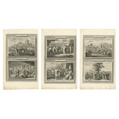
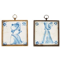
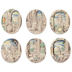
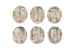
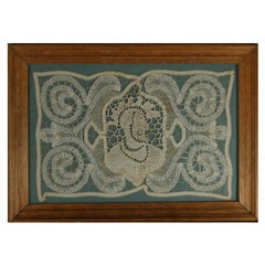
Six maiolica “ambrogette” (tiles)
Rampini manufactory, painter probably Siro Antonio Africa
Pavia, 1693-1704
a) 6.88 x 5.51 in (17.5 x 14 cm); 0.55 lb (252 g)
b) 7.08 x 5.70 in (18 x 14.5 cm); 0.51 lb (233 g)
c) 6.88 x 5.70 in (17.5 x 14.5 cm); 0.54 lb (245 g)
d) 6.81 x 5.51 in (17.3 x 14 cm); 0.50 lb (230 g)
e) 6.88 x 5.51 in (17.5 x 14 cm); 0.50 lb (229 g)
f) 7.08 x 5.70 in (18 x 14.5 cm); 0.51 lb (233 g)
State of conservation: intact.
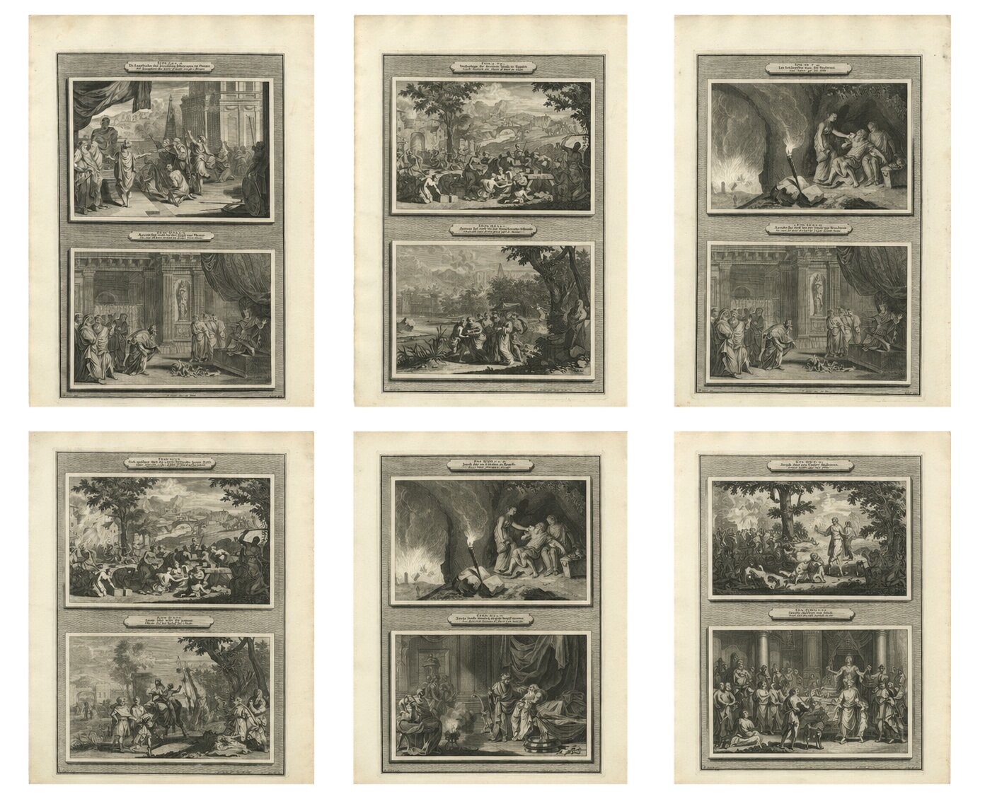
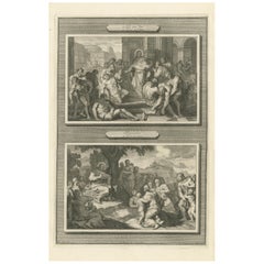
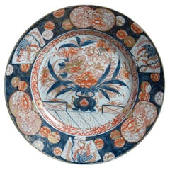
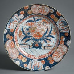
These six ”maiolica fina” small “ambrogette” belong to a family of ceramic works considered among the finest produced between the 17th and 18th centuries. For a long time, this type of maiolica was attributed to the Venetian village of Angarano, but later it was definitively attributed to the pottery factories in Pavia. A fundamental study ascribed this production specifically to Pavia through an analysis of Lombard collections and a comparison with archaeological remains found near the two main manufacturing sites in the city. (E. Pelizzoni - M. Forni - S. Nepoti, La maiolica di Pavia tra Seicento e Settecento, Milano 1997).
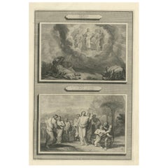
The six small oval tiles have rounded edges and are decorated with a historiated motif. They were created using high-fired polychrome technique, with a predominance of cool tones and a dominance of gray and blue, interspersed with manganese, citrine yellow, orange-yellow, and green. The six small “ambrogette” are characterized by the same stylistic features, with a similar decorative design.
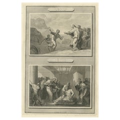
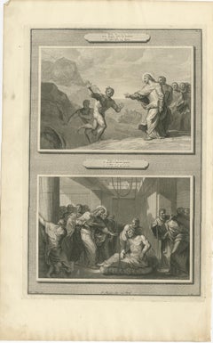
The first tile (a) depicts a female figure, holding a stiletto and sitting near a pedestal supporting a relief-decorated baluster vase. Behind her, a child is holding a chalice, while through the arches of a portico, a glimpse of a mountainous landscape can be seen in the background. The female figure could possibly be Lucretia, an example of virtue in ancient Roman culture.
In the second “ambrogetta” b), the Biblical episode of Judith and Holofernes is depicted through canonical iconography: the decapitated body of Holofernes lies on the bed in the background, while the protagonist, Judith, is seen placing his head into a sack held by a maidservant. Through an archway a shining slice of the moon gives the perception of nighttime. Surprisingly, within the narrative, there is the presence of a basin in the shape of a large shell, closely resembling the products of Pavia's factories.
The third small plaque (c) depicts a female figure standing on a plinth and framed by an architectural arch with a vast mountainous landscape in the background. The woman, with her breasts exposed, is accompanied by two children: one approaching her as if wanting to be picked up, and the other seated with an apple in his hand. The protagonist lends herself to different interpretations: perhaps she represents Rea Silvia with the two twin founders of Rome, or perhaps she is an allegory for the Pietà, a common theme depicted on maiolica.
In the fourth tile (d), three characters are depicted near a column. The main figure is an old man with a sad expression, holding a cup, while a woman, wearing a turban on her head, also holds a cup in her right hand and a pitcher in her left. A second woman with her hair bound holds another pitcher behind the old man: at his feet a traveller's bag can be seen, along with some apples and a slice of cheese on a rectangular base. It is likely the sad Biblical episode of Lot and his daughters...
Category
Italian Baroque Antique Early 1700s Furniture