Europe Maps
to
4,213
5,472
200
5,471
1
67
33
9
8
3
2
1
1
1
2,869
2,188
414
1
267
14
3
120
4
30
3
3
3
1
5,410
74
35
21
16
685
328
216
139
83
5,472
5,472
5,472
104
59
28
20
15
Item Ships From: Europe
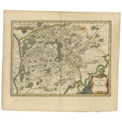
Antique Map of the Region of Valois by Hondius, circa 1630
Located in Langweer, NL
Antique map titled 'Le Pais de Valois'. Old map of the historic region of Valois, France. It corresponds to the southeastern quarter of the modern département of Oise, with an adjace...
Category
Mid-17th Century Antique Europe Maps
Materials
Paper
$475 Sale Price
20% Off
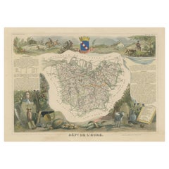
Hand Colored Antique Map of the Department of Eure, France
By Victor Levasseur
Located in Langweer, NL
Antique map titled 'Dépt. de l'Eure'. Map of the French department of Eure, France. This region of France is home to Giverny, where impressionist Claude Monet’s home and garden can...
Category
Mid-19th Century Antique Europe Maps
Materials
Paper
$323 Sale Price
20% Off
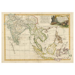
Antique Map of Southeast Asia with Decorative Allegorical Cartouche
Located in Langweer, NL
Antique map titled 'Les Indes Orientales et leur Archipel'. Old map of Southeast Asia, the Straits of Malaca, Philippines, Sumatra, Java, India etc., extending north to Canton and Ma...
Category
Mid-18th Century Antique Europe Maps
Materials
Paper
$894 Sale Price
20% Off
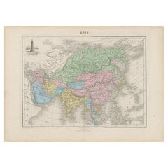
Antique Map of Asia with the Porcelain Tower at Nanjing, China, 1884
Located in Langweer, NL
Antique map titled 'Asie'. Map of the Asian continent, with an illustration of the porcelain tower at Nanjing, China. Migeon's Geographie Universelle, ...
Category
19th Century Antique Europe Maps
Materials
Paper
$209 Sale Price
20% Off
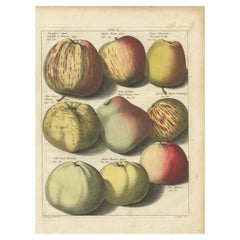
Antique Print of Various Apples by Knoop, 1758
Located in Langweer, NL
Antique print depicting apple variaties including the Framboos-Appel, Herfst Bloem-Soete, Somer-Parmain, Peer-Soete, Soete Dolphyn, Roode Herfst-Striepeling, Witte Soete Silverling, ...
Category
18th Century Antique Europe Maps
Materials
Paper
$304 Sale Price
20% Off
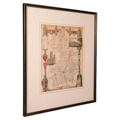
Antique Lithography Map, Cambridgeshire, English, Framed Cartography, Victorian
Located in Hele, Devon, GB
This is an antique lithography map of Cambridgeshire. An English, framed atlas engraving of cartographic interest, dating to the mid 19th century and later.
Superb lithography of C...
Category
Mid-19th Century British Victorian Antique Europe Maps
Materials
Glass, Wood, Paper
Antique Map of Switzerland by A & C. Black, 1870
Located in Langweer, NL
Antique map titled 'Switzerland'. Original antique map of Switzerland. This map originates from ‘Black's General Atlas of The World’. Published by A & C. Black, 1870.
Category
Late 19th Century Antique Europe Maps
Materials
Paper
$166 Sale Price
20% Off
American Election Map and 1960 Presidential Fact Sheet, Published 1960
Located in Langweer, NL
Title: “The 50 United States of America”
Subject: United States, Presidential Elections
Date: 1960 (dated)
Color: Printed Color
Size: 24.9 x 17.9 inches (63.2 x 45.5 cm)
This colorful map of the United States was drawn by Lorin Thompson and published by the General Foods Corporation. The map has an unusual coloring style with symbols of American history including past presidents, Native Americans, important buildings (White House, Statue of Liberty, Alamo), agriculture, industry, and more. Includes inset maps of Hawaii and Alaska with small American flags...
Category
1960s Vintage Europe Maps
Materials
Paper
$570 Sale Price
20% Off
Intriguing Antique Map of Europe, Asia and Africa by Scherer, c.1703
Located in Langweer, NL
Two maps on a single sheet showing Europe, Asia and Africa, each depicting nearly the same area. On close examination there are slight differences. Major cities are located. Printed ...
Category
18th Century Antique Europe Maps
Materials
Paper
$285 Sale Price
20% Off
Original Antique Engraving of Kannur 'or Cannanore', Kerala, India, 1726
Located in Langweer, NL
Antique print, titled: 'Cananor' - This is a print of a view of Kannur (or Cannanore), Kerala, India. From the monumental: "Oud en Nieuw Oost-Indiën ..." ...
Category
1720s Antique Europe Maps
Materials
Paper
$523 Sale Price
20% Off
Antique Map of Suffren Island by Cook, 1803
Located in Langweer, NL
Antique map Australia titled 'Gezigt van het Eil. Suffren'. Antique map of Suffren Island. Originates from 'Reizen Rondom de Waereld door James C...
Category
19th Century Antique Europe Maps
Materials
Paper
$171 Sale Price
20% Off
Genuine Antique Engraved Map of Helvetia or Switzerland, 1729
Located in Langweer, NL
Decorative early 18th century engraved map of Switzerland.
Title: Helvetia Conterminarumq terra rum antiqua.
Translated from Latin: Switzerland is an ancient land
Description: Switzerland, antique copperplate engraved map with hand coloring and a decorative title cartouche. Two figures greatly enhances visual appeal.
Author: Phillip Cluver, or Philip Cluverius, Philipp Clüver, Latinized as Philippus Cluverius studied law in Leiden and settled over there in 1615.
We only sell Guaranteed Absolutely Original authentic Maps and Prints.
A Certificate of Authenticity ( COA ) will be supplied on request.
We ship our antique maps and prints...
Category
1720s Antique Europe Maps
Materials
Paper
$371 Sale Price
20% Off
Antique Map of the Turkish Empire by Tirion 'c.1760'
Located in Langweer, NL
Antique map titled 'Nieuwe Kaart van het Turksche Ryk gelegen in Europa, Asia en Africa'. Original antique map of the Turkish Empire. The map is centered on the Mediterranean Sea but...
Category
Mid-18th Century Antique Europe Maps
Materials
Paper
$1,332 Sale Price
20% Off
Antique Map of the Eastern Part of the World
Located in Langweer, NL
Antique map titled 'Nieuwe Kaart van het Oostelykste Deel der Weereld, diendende tot aanwyzing van de Scheepstogten der Nederlanderen Naar Oostindie'. This finely engraved map of the...
Category
Mid-18th Century Antique Europe Maps
Materials
Paper
$627 Sale Price
20% Off
Antique Map Dedicated to British Merchants Trading to North America, ca.1746
Located in Langweer, NL
Description: Antique map titled 'A New Chart of the Coast of New England, Nova Scotia, New France or Canada, with the islands of Newfoundland, Capte Breton, St John's (..)'. Map stre...
Category
1740s Antique Europe Maps
Materials
Paper
$808 Sale Price
20% Off
Original Antique Map of The Austrian Empire, 1882
Located in Langweer, NL
Step into the past with an original Antique Map of The Austrian Empire from the esteemed 'Comprehensive Atlas and Geography of the World,' meticulously crafted in 1882. This intricat...
Category
1880s Antique Europe Maps
Materials
Paper
$199 Sale Price
20% Off
Original Antique Map of Russia in Europe, 1882
Located in Langweer, NL
Embark on an enthralling journey with an original Antique Map of European Russia from the esteemed 'Comprehensive Atlas and Geography of the World,' meticulously crafted in 1882. Thi...
Category
1880s Antique Europe Maps
Materials
Paper
$180 Sale Price
20% Off
Antique Map of France Divided into Departments, with Original Hand Coloring
Located in Langweer, NL
Antique map titled 'A New Map of France (..)'. Original old map of France, divided into departments. With original/contemporary hand coloring. Published by John Cary, 1799. John Cary was an important and prolific London map seller...
Category
Late 18th Century Antique Europe Maps
Materials
Paper
$418 Sale Price
20% Off
Antique Map of the Eastern Mediterranean and the Balkans
Located in Langweer, NL
Antique map titled 'La Turquie d'Europe et celle d'Asie'. Attractive double page map of the Eastern Mediterranean and the Balkans by R. Bonne. Originates from 'Atlas de Toutes les Pa...
Category
Late 18th Century Antique Europe Maps
Materials
Paper
$513 Sale Price
20% Off
Original Antique Map of Spain and Portugal, 1882
Located in Langweer, NL
Embark on a historical voyage with an original Antique Map of Spain and Portugal from the esteemed 'Comprehensive Atlas and Geography of the World,' meticulously crafted in 1882. Thi...
Category
1880s Antique Europe Maps
Materials
Paper
$161 Sale Price
20% Off
Bay of Arguin, West Coast of Africa from Cape Blanco to Tanit, Africa, 1747
Located in Langweer, NL
Antique map titled 'Carte De La Coste Occidentale D'Afrique (..)
Kaart van de Westkust van Afrika (..)'. Original antique map of the western coast of Africa. Shows the area aroun...
Category
1740s Antique Europe Maps
Materials
Paper
$275 Sale Price
20% Off
Antique Map of the Archdiocese of Cologne, Germany
Located in Langweer, NL
Antique map titled 'Archevesche et Eslectorat de Cologne avec ses Enclaves'. Original old map of the Archdiocese of Cologne with the course of the Rhine from Andernach to Wesel with ...
Category
Late 17th Century Antique Europe Maps
Materials
Paper
$409 Sale Price
20% Off
Detailed Antique Map of the Western Sumatra, Indonesia, circa 1825
Located in Langweer, NL
Antique map titled 'Partie de l'Ile de Sumatra'. Chart showing the western part of Sumatra. Originates from 'Atlas Universel' by P.M. Vandermaelen.
Artists and Engravers: Philipp...
Category
19th Century Antique Europe Maps
Materials
Paper
$399 Sale Price
20% Off
Antique Miniature Map of Java by Bertius '1618'
Located in Langweer, NL
Antique miniature map titled 'Iava Maior'. Rare miniature map of Java, Indonesia. This map originates from 'Tabularum Geographicarum Contractarum Libri s...
Category
Early 17th Century Antique Europe Maps
Materials
Paper
$618 Sale Price
20% Off
Antique Map of the Township of Coevorden in The Netherlands, 1865
Located in Langweer, NL
Drenthe - Gemeente Coevorden, Padhuis, Wijnhars. These scarse detailed maps of Dutch Towns originate from the 'Gemeente-atlas' of Jacob Kuyper. This atlas of all towns in the Netherl...
Category
19th Century Antique Europe Maps
Materials
Paper
$142 Sale Price
20% Off
Antique Map of the Region of Utingeradeel by Meijer & Schaafsma, 1906
Located in Langweer, NL
Antique map titled 'Gemeente Friesland. Gemeente Utingeradeel'. This map illustrates part of Friesland (The Netherlands) depicting Akkrum, Terkaple, Lekkerterp, Oldeboorn and more. Published by Tresling & Co, Amsterdam.
Artists and Engravers: Tresling and Co., Dutch Lithographers...
Category
20th Century Europe Maps
Materials
Paper
$82 Sale Price
20% Off
Antique Map of the Region involved in the Conquest of Cyrus the Great
Located in Langweer, NL
Antique map titled 'Tabula Itineris Decies Mille (..)'. This historical map illustrates the region involved in the conquest of Cyrus the Great (558-528 BC), the founder of the Persia...
Category
Mid-17th Century Antique Europe Maps
Materials
Paper
$656 Sale Price
20% Off
Antique Print of Batavia, Capital of the Dutch East Indies or Indonesia, '1726'
Located in Langweer, NL
Antique print Indonesia titled 'Batavia in 't Verschiet'. Large panoramic view on Batavia, present day Jakarta, Indonesia. Originates from 'Oud en Nieuw Oost-Indiën (..)' by François...
Category
18th Century Antique Europe Maps
Materials
Paper
$1,189 Sale Price
20% Off
Antique Map of Guadelupe in the Caribbean, 1759
By Jacques-Nicolas Bellin
Located in Langweer, NL
Antique map titled 'Carte De L'Isle De La Guadeloupe'. Detailed map of Guadalupe, Mari-Galante and the Isles de Saintes. Produced by Nichlas Bellin for Prevost d'Exiles influential t...
Category
Mid-18th Century French Antique Europe Maps
Materials
Paper
Detailed Antique Map of Santa Domingo, Puerto Rico, Eastern Bahamas, ca. 1780
Located in Langweer, NL
Description: Antique map titled 'L'Isle De St. Domingue, et celle De Porto-Rico.'
Detailed map of Santa Domingo, Puerto Rico, etc. Includes substanti...
Category
1780s Antique Europe Maps
Materials
Paper
$666 Sale Price
20% Off
Antique Map of Kerguelens Island Coast by Cook, 1784
By James Cook
Located in Langweer, NL
Antique print titled 'Kerguelen's Land (..)'. Antique map of Kerguelens island coast, known today as the Desolation islands. Originates from 'A Voyage to the Pacific Ocean: Undertaken, by the Command of His Majesty, for Making Discoveries in the Northern Hemisphere (..)' published in Dublin.
Artists and Engravers: James Cook...
Category
18th Century Antique Europe Maps
Materials
Paper
$321 Sale Price
25% Off
Antique Map extending from the Spice Islands to the west of Papua New Guinea
Located in Langweer, NL
Antique map titled 'Kaart van de Papoasche Eilanden'. Beautiful original old map extending from the Spice Islands (Sallawatty, Patenta, Gammen, Land van Waigeeuw, Popo, Misool, and part of Seram) to the western end of Papua New Guinea. Many smaller islands are detailed, and depth soundings are shown near Seram and to the east of Misool. This map originates from 'Nieuwe en Beknopte Hand-Atlas, bestaande in eene Verzameling van eenige der algemeenste en nodigste Landkaarten' by I. Tirion. Published circa 1770.
Tirion was born in Utrecht in 1705. He moved to Amsterdam in 1725 and set up shop on Damrak as a book publisher. Tirion quick rose in prominence by publishing pamphlets, historical works, and, most importantly...
Category
Late 18th Century Antique Europe Maps
Materials
Paper
$466 Sale Price
20% Off
Antique Print of Zeus at Olympia by Knight, 1835
Located in Langweer, NL
Antique print titled 'The Jupiter of Phidias'. Old print of a statue of Zeus at Olympia by Phidias, as imagined by engraver John Jackson. This print ori...
Category
19th Century Antique Europe Maps
Materials
Paper
$69 Sale Price
20% Off
Antique Map of the Province of Kilan by Olearius '1662'
Located in Langweer, NL
Antique map titled 'A Map of ye Province of Kilan as it lies on ye Caspian Sea'. Rare map of the province of Kilan, near the Caspian Sea. Originates from 'The voyages and travells of the Ambassadors sent by Frederick Duke of Holstein, to the Great Duke of Muscovy, and the King of Persia...
Category
Mid-17th Century Antique Europe Maps
Materials
Paper
$1,141 Sale Price
20% Off
Antique Map of the Township of Dwingelo in The Netherlands, 1865
Located in Langweer, NL
Drenthe: Gemeente Dwingelo, Eemster, Lhee. These scarse detailed maps of Dutch Towns originate from the 'Gemeente-atlas' of Jacob Kuyper. This atlas of all towns in the Netherlands w...
Category
19th Century Antique Europe Maps
Materials
Paper
$161 Sale Price
20% Off
Antique Map of Belgium and Luxembourg by Homann Heirs, 1747
Located in Langweer, NL
Antique map titled 'Belgium Catholicum seu Decem provinciae Germaniae Inferioris cum confiniis Germaniae sup. et Francia (..).' Detailed map of Belgium ...
Category
18th Century Antique Europe Maps
Materials
Paper
$451 Sale Price
20% Off
Antique Map of the Dutch East Indies by Van den Bosch '1818'
Located in Langweer, NL
Antique map titled 'Kaart der Nederlandsche Bezittingen in Oost-Indiën'.
Rare and attractive map of the Dutch East Indies, it shows the Dutch possessions in the 19th century. This ...
Category
Early 19th Century Antique Europe Maps
Materials
Paper
$1,332 Sale Price
20% Off
Antique Lithography Map, Durham, English, Framed, Cartography, Early Georgian
Located in Hele, Devon, GB
This is an antique lithography map of Durham. An English, framed engraving of cartographic interest, dating to the early 18th century and later, circa 1720.
Superb lithography of Du...
Category
Early 18th Century British Georgian Antique Europe Maps
Materials
Wood
Antique Plan of Grave, The Netherlands, Showing the Siege of Grave in 1602
Located in Langweer, NL
Antique map titled 'Die Stat Grave' Bird's eye view plan of Grave, The Netherlands, Holland. Showing the siege of Grave in the year 1602 by Prince Maurits of The Netherlands. Source ...
Category
16th Century Antique Europe Maps
Materials
Paper
$418 Sale Price
20% Off
Antique Political Map of the Japanese Empire, 1922
Located in Langweer, NL
Antique map of Japan titled 'Japanese Empire - Political Map'. Old map of Japan depicting Japan, Korea and surroundings. This map originates from 'The Ti...
Category
20th Century Europe Maps
Materials
Paper
Antique Map of Turkey and Greece, 1852
Located in Langweer, NL
Antique map titled 'Europisch Turkije en Griekenland'. Map of Turkey in Europe and Greece. This map originates from 'School-Atlas van alle deelen der Aar...
Category
19th Century Antique Europe Maps
Materials
Paper
$114 Sale Price
20% Off
Antique Map of the Rhineland and Alsace Region with Original Hand Coloring
Located in Langweer, NL
Antique map titled 'Palitinat du Rhein, Alsace, et partie de Souabe de Franconie (..)'. Double-page engraved map of the Rhineland and Alsace with original/contemporary hand coloring....
Category
Mid-17th Century Antique Europe Maps
Materials
Paper
$294 Sale Price
20% Off
Original French Antique Print of Villa Boulevard De Boulogne, Chabat, C.1900
Located in Langweer, NL
Antique print titled 'Villa Boulevard de Boulogne (Seine) Mr. L. Magne, Architecte'. This print depicts the design of a villa in France. Originates from 'La Brique et La Terre Cuite'...
Category
20th Century Europe Maps
Materials
Paper
Antique Map of Russia in Europe on Two Sheets from an Old German Atlas, Ca.1825
Located in Langweer, NL
Description: Antique map titled 'Europäisches Russland'.
Two individuel sheets, joined together they depict Russia in Europe. These maps originate from 'Stielers Handatlas'. Publis...
Category
1820s Antique Europe Maps
Materials
Paper
$428 Sale Price
20% Off
Antique Map of Flanders, France Incl the Cities Lille, Tournai, Douai, c.1730
Located in Langweer, NL
Antique map titled 'Flandriae comitatus pars Australis'. Decorative antique map of the southern portion of Flanders, France. It shows the cities of Lille (Rijsel), Douai, Tournai (Do...
Category
18th Century Antique Europe Maps
Materials
Paper
$451 Sale Price
20% Off
Antique Map of Batavia 'Jakarta', Indonesia by Montanus, circa 1669
Located in Langweer, NL
Antique map Batavia titled 'Ware Affbeeldinge wegens het Casteel ende Stadt Batavia'. Antique print of the castle and city of Batavia on the Island of Java'. Rare edition with Englis...
Category
17th Century Antique Europe Maps
Materials
Paper
$1,189 Sale Price
20% Off
Old Engraving of A Panoramic Bird's Eye View of Miaco 'Kyoto', Japan, 1669
Located in Langweer, NL
Description: Antique print, titled: 'Miako.' - A panaromic bird's eye view of Miaco (Kyoto). Arnoldus Montanus' "Gedenkwaerdige Gesantschappen der Oost-Indische Maatschappy in 't Ver...
Category
1660s Antique Europe Maps
Materials
Paper
$685 Sale Price
20% Off
Antique Map of Fort Saint Louis and Santiago de Cuba, 1748
Located in Langweer, NL
Antique map titled 'A plan of the town, fort and harbour of St Louis in the Isle of Hispaniola, or St Domingo / A plan of the town and bay of St. Jago, in the Isle if Cuba'. Two woodcut maps on one sheet, illustrating Admiral Sir Charles Knowles’ successful attack on Fort Saint Louis de Sud...
Category
18th Century Antique Europe Maps
Materials
Paper
$180 Sale Price
20% Off
Old Map of the French department of Tarn, France
By Victor Levasseur
Located in Langweer, NL
Antique map titled 'Dépt. du Tarn'. Map of the French department of Tarn, France. This area produces a variety of traditional wines, including Cahors, Mauzac, Loin de l’Oeil and Onde...
Category
Mid-19th Century Antique Europe Maps
Materials
Paper
$323 Sale Price
20% Off
Antique Print of Batavia Castle in Nowadays Jakarta, Indonesia, circa 1770
Located in Langweer, NL
Antique print titled 'Vue a Batavie du côte de la Courtine du Château - Prospect zu Batavia längst der Courtine des Castels'. Scarce view of Batavia Castle, present day Djakarta, Ind...
Category
18th Century Antique Europe Maps
Materials
Paper
$523 Sale Price
20% Off
Antique Map of the Township of Emmen, Drenthe in The Netherlands, 1865
Located in Langweer, NL
Drenthe: Gemeente Emmen, Roswinkel, Werdinge, Zuidbarge. These scarse detailed maps of Dutch Towns originate from the 'Gemeente-atlas' of Jacob Kuyper. This atlas of all towns in the...
Category
19th Century Antique Europe Maps
Materials
Paper
$161 Sale Price
20% Off
Antique Map of Idaarderadeel, Township In Frieslands, The Netherlands, 1868
Located in Langweer, NL
Antique map titled 'Provincie Friesland - Gemeente Idaarderadeel'.
Map of the township of Idaarderadeel including Grou, Idaard, Warrega and many other villages. This map originat...
Category
19th Century Antique Europe Maps
Materials
Paper
$133 Sale Price
20% Off
Antique Map of the United Kingdom and Ireland, c.1873
Located in Langweer, NL
Antique map titled 'Groot Brittanje en Ierland'. Old map depicting the United Kingdom and Ireland, with inset maps of London and factory districts of the UK. This map originates from...
Category
19th Century Antique Europe Maps
Materials
Paper
$118 Sale Price
20% Off
Villa Salamandre – French Architectural Print from La Brique, Baumier, c.1900
Located in Langweer, NL
Villa Salamandre – French Architectural Lithograph from La Brique, Baumier, c.1900
This elegant antique architectural lithograph features the striking "Villa Salamandre" located in ...
Category
20th Century French Europe Maps
Materials
Paper
Eason's War Map of Europe, circa 1914
Located in Langweer, NL
Antique map titled 'Eason's War Map of Europe'. Printed in Ireland. Source unknown, to be determined.
Artists and Engravers: Anonymous.
Condition: Good, ...
Category
20th Century Europe Maps
Materials
Paper
$523 Sale Price
20% Off
Antique Map of the Passage Between the Atlantic and Pacific Oceans, circa 1753
Located in Langweer, NL
Antique print, titled: 'Carte du Detroit de le Maire (…)' - This chart illustrates the important passage between the Atlantic and Pacific oceans. Jacob Le Maire and Willem Schouten d...
Category
18th Century Antique Europe Maps
Materials
Paper
$218 Sale Price
20% Off
Old Map of Southern Australia, with an Inset Map of Cape York Peninsula, 1882
Located in Langweer, NL
Antique map titled 'South Australia, New South Wales, Victoria & Queensland'.
Old map of Southern Australia, with an inset map of Cape York Peninsula. This map originates from 'T...
Category
1880s Antique Europe Maps
Materials
Paper
$275 Sale Price
20% Off
Original Antique Map of Southern India and Ceylon 'Present-Day Sri Lanka'
By Jakob van der Schley
Located in Langweer, NL
Antique map titled 'Suite de la Carte de l'Indoustan (..) - Vervolg van de Kaart van Hindoestan (..)'. Original antique map of Southern India and Ceylon (present-day Sri Lanka). This...
Category
Mid-18th Century Antique Europe Maps
Materials
Paper
$799 Sale Price
20% Off
Old Map of Morocco, The Canary Islands, Madeira, Inset of Penon de Velez, 1605
Located in Langweer, NL
Antique map titled 'Fessae et Marocchi Regna'. Original antique map of Morocco, extending south to Cape Bojador and , north to the Spanish Coast. Inset of Penon de Velez. Artists and...
Category
17th Century Antique Europe Maps
Materials
Paper
$1,189 Sale Price
20% Off
Antique Map of Egypt and Arabia Petraea by A & C. Black, 1870
Located in Langweer, NL
Antique map titled 'Egypt and Arabia Petraea'. Original antique map of Egypt and Arabia Petraea. This map originates from ‘Black's General Atlas of The World’. Published by A & C. Bl...
Category
Late 19th Century Antique Europe Maps
Materials
Paper
$145 Sale Price
30% Off
Recently Viewed
View AllMore Ways To Browse
Antique Buddha Laos
Antique Captains Chest
Antique Crutches
Antique Curved Front Dresser
Antique Dressing Table With 3 Mirrors
Antique Fire Guard Screen
Antique Fire Guards Brass
Antique Fire Markers
Antique Fireplace Coal Basket
Antique Folding Card Table 20th Century
Antique French Lavabo
Antique French Marble Top Server Buffet
Antique German Mugs
Antique Gun Cabinet
Antique Horse Crop
Antique Hubley Cast Iron
Antique Indonesian Ikat
Antique Iron Pot Rack
