Collectibles and Curiosities on Sale

to
5,462
1,377
6,852
41
41
350
168
91
80
65
50
41
40
35
27
24
17
15
10
8
7
5
3
2,707
2,347
1,798
82
540
698
282
112
30
79
124
69
147
129
89
64
29
4,943
1,188
604
280
237
1,281
499
451
279
258
6,934
6,930
6,930
104
55
21
18
13
Sale Items
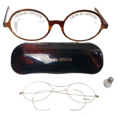
Giorgio Armani Eyeglass Display Collectors Items
By Giorgio Armani
Located in Albano Laziale, Rome/Lazio
Collectors items vintage Giorgio Armani advertising / Eyeglass Display. Oversized large eyeglasses and case. The tortoise pairs lenses have slots to d...
Category

1990s International Style Models and Miniatures

Materials

Metal

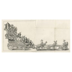
Remarkable Antique Print of a Horse Drawn Float with Religious Figures, 1775
Located in Langweer, NL
Antique print of a horse drawn float with religious figures. Double page with joined sheets and original folding lines. This print originates fro...
Category

Antique 1770s Prints

Materials

Paper

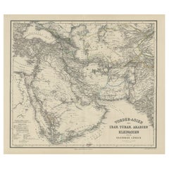
Old German Antique Map of Iran and Arabia, 1866
Located in Langweer, NL
Antique map titled 'Vorder-Asien oder Iran, Turan, Arabien, Kleinasien und die Kaukasus Länder'. Large map centered on Iran. It shows the area from Turkey to Mumbai in India. Include...
Category

Antique 19th Century Maps

Materials

Paper

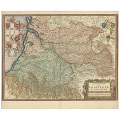
Cartographic Treasures: A Journey Through the Gascogne and Guyenne Regions, 1680
Located in Langweer, NL
The antique map titled "Gouvernement de La Guienne & Gascogne" depicts the region of Gascogne and Guyenne, known for their wine production, in France. This map is a rare edition, u...
Category

Antique Late 17th Century Maps

Materials

Paper

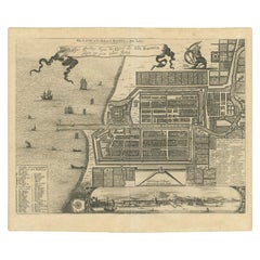
Antique Map of the City of Batavia by Van der Aa 'c.1730'
Located in Langweer, NL
Antique map titled 'Plan de la Ville et du Chateau de Batavia en l'Isle de Iava - Ware affbeeldinge wegens het Casteel ende Stadt Batavia gelegen op groot Eylant Java'. Detailed plan...
Category

Antique Mid-18th Century Maps

Materials

Paper

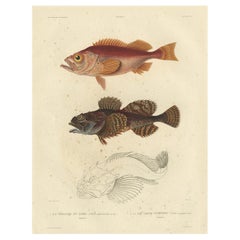
Rare Fish Print of the Norway Redfish 'Sebastes Viviparus' and the Sculpin, 1842
Located in Langweer, NL
Antique print, titled: 'Poissons Plate 9 - La Sebaste du Nord (Sebastes septentrionalis) - Le Cotte Scorpion (Cottus scorpius).' - This rare plate shows the Norway redfish (Sebastes ...
Category

Antique 1840s Prints

Materials

Paper

Antique Map of French Polynesia by Cook Showing His Route, 1803
Located in Langweer, NL
Antique map Tahiti titled 'Kaart van de Eilanden in den omtrek van Otahiti (..)'. Antique map of French Polynesia with the tracks around the island of Tahiti by Captain Byron, Wallis...
Category

Antique 19th Century Maps

Materials

Paper

Antique Map of the Sunda Islands Sumatra, Java, Malay Peninsula & Borneo (1739)
By Isaak Tirion
Located in Langweer, NL
Antique map titled 'Nieuwe kaart van de Sundasche Eilanden als Borneo, Sumatra en Groot Iava & c'. Detailed map of the Sunda Islands, Southeast Asia, extending from the tip of Cambod...
Category

Antique Mid-18th Century Maps

Materials

Paper

Antique Map Colton's United States of America
Located in Langweer, NL
Antique map titled 'Colton's United States of America'. Show railroads, canals, state capitals, major cities and towns, military posts, historic trails, Pony Express and U.S. mail routes; Dakota [Territory] extending deep into Nebraska, and Idaho [Territory] encompassing [modern day] Montana and Wyoming; Indian Territory...
Category

Antique Mid-19th Century Maps

Materials

Paper

Ropes and Tackle for 19th Century Waling Vessel
Located in Huntington, NY
Tools ropes and tackle for 19th century waling vessel.
Category

Antique 19th Century American American Classical Nautical Objects

Materials

Rope, Maple

Antique Map Showing the Locations of Native American Tribes in 1899
Located in Langweer, NL
Antique map titled 'Map showing the Indian Reservations within the Limits of the United States'. Large folding map of the United States showing the Indian Reservations. The present m...
Category

Antique Late 19th Century Maps

Materials

Paper

Antique Map of Utrecht in The Netherlands, 1883
Located in Langweer, NL
Antique map titled 'Utrecht'. Map of Utrecht, a province of the Netherlands. This map originates from 'Atlas van Nederland volgens de nieuwe spelregels' by J. Kuyper. Artists and En...
Category

Antique 19th Century Maps

Materials

Paper

Antique Map of the Queen Charlotte Islands, Haida Gwaii
Located in Langweer, NL
Antique map titled 'Isles de la Reine Charlotte (..)'. Original old map of the Queen Charlotte Islands, based upon the explorations of James Cook, Juan Perez, and other contemporary European explorers. The map shows only partial coastal detail along the north end of the main island, and includes two insets of navigable bays and depth measurements. Now called Haida Gwaii, after the local native population, the islands situated off Canada’s coast, south of Vancouver played an important role in the late 18th and early 19th century maritime...
Category

Antique Late 18th Century Maps

Materials

Paper

Antique Map of the Low Countries by Seutter, c.1745
Located in Langweer, NL
Antique map titled ‘XVII Provinciae Belgii sive Germaniae Inferioris (..)’. Detailed hand colored map of the Low Countries. Includes colored decorative cartouche, compass rose and co...
Category

Antique 18th Century Maps

Materials

Paper

The Lay of the Land: A 1901 Topographic Map of Oviedo, Asturias
Located in Langweer, NL
The province depicted on the historical map on offer, Oviedo, corresponds to the modern-day autonomous community of Asturias in northwestern Spain. Here are some points about Asturia...
Category

Antique Early 1900s Maps

Materials

Paper

Antique Map of Asia and the East Indies and Korea as a Peninsula, ca.1660
Located in Langweer, NL
Antique map titled 'Asiae nova delineatio'. Decorative map of Asia and the East Indies. The map shows Korea as a peninsula. In China the Great Wall is depicted, as well as a long str...
Category

Antique 17th Century Maps

Materials

Paper

19th Century Afghan Silver Shabbat Oil Lamp
Located in New York, NY
Silver Sabbath oil lamp, Afghanistan, late 19th century. Featuring a rimmed bowl elevated on a paneled stem, with larger drip pan below, resting on three feet. Extended piece of han...
Category

Antique Late 19th Century Afghan Religious Items

Materials

Silver

La Coruña 1901: A Cartographic View of Galicia's Maritime Province
Located in Langweer, NL
This antique map for sale showcases the province of La Coruña (in Galician, A Coruña), located in the northwest of Spain, within the autonomous community of Galicia, as of the year 1...
Category

Antique Early 1900s Maps

Materials

Paper

Antique Religion Print of the Blessing of Christ, 1913
Located in Langweer, NL
Large antique print of the Blessing of Christ. Published by Mosella-Verlag, 1913. This print originates from a series titled 'Kathol. Schulbibelwerk von Dr. Ecker'.
Category

Early 20th Century Prints

Materials

Paper

Old Antique Map of Borneo 'Kalimantan Indonesia, Sabah Malaysia & Brunei'
Located in Langweer, NL
Antique map titled 'Kaart van het Eyland Borneo'. Original antique map of the island of Borneo. Published 1724-1726 by Joannes van Braam and Gerard Onder de ...
Category

Antique Early 18th Century Maps

Materials

Paper

Masonic Brass Enamel Chain, Pewter Inkwell, Cloth Regalia
Located in Miami, FL
20th century brass enamel chain and monogrammed black cloth regalia was worn by the Knights Templar of the Masonic fraternity for ceremonial meetings. Offered with a pewter and glass...
Category

20th Century French Historical Memorabilia

Materials

Gold, Pewter, Gold Plate

Colonial Crossroads: Angola and Mozambique in 1903
Located in Langweer, NL
The image for sale is an original historical map from 1903 that shows the Portuguese colonies of Angola on the left and Mozambique on the right. These two territories on the African ...
Category

Antique Early 1900s Maps

Materials

Paper

18-Karat Gold Pocket Watch Made by Order of King Victor Emmanuel
Located in Hamilton, Ontario
King Victor Emmanuel of Italy Swiss Richard pocket watch. Made by order of King Victor. Early 20th century fine 18-karat gold and three color enamel keyless watch in original pres...
Category

20th Century Collectible Jewelry

Materials

Gold

Antique Plan of the Siege of Grave by Guicciardini, c.1608
Located in Langweer, NL
Antique map titled 'Hic est situs oppidi Grauiae (..)'. Bird's eye view plan of Grave, The Netherlands, Holland. Showing the siege of Grave in the year 1602. Source unknown, to be de...
Category

Antique 17th Century Maps

Materials

Paper

Old Map of the Great Lakes and Upper Mississippi Valley, Northern America, c1780
Located in Langweer, NL
Antique map titled 'Partie Occidentale du Canada'. A fine example of Rigobert Bonne and Guilleme Raynal's 1780 map of the Great Lakes and upper Mississippi Valley. A map of c...
Category

Antique 1780s Maps

Materials

Paper

Old Prints of Costumes of Hungary, Tyrol, Sweden, Romania, Holland, Etc., Ca1875
Located in Langweer, NL
Antique costume print including many different costumes including costumes of Hungary, Tyrol, Sweden and others. This print originates from 'Blätter für Kostümkunde. Historische ...
Category

Antique 1870s Prints

Materials

Paper

Antique Map of Senegal, West Africa
Located in Langweer, NL
Original antique map titled 'Carta del Senegal'. Antique map of Senegal, West Africa. This map originates from 'Compendio della storia generale dei viaggi (..)'. Published by De la Harpe...
Category

Antique Mid-18th Century Maps

Materials

Paper

Engraving of Roman Punishments of Mass Crucifixion Outside the City Wall, 1690
Located in Langweer, NL
Antique print titled 'd'Aal-oude Kruis-straffen der Romeinen: hoedanige door Constantyn de Groot, uit eerbied voor het Kruis des Saligmakers, afgeschaft zyn'. Antique print of the ancient punishment by crucifixion which was abolished by Constantine the Great in deference to the cross of Jesus...
Category

Antique 17th Century Prints

Materials

Paper

Danish Modernist Leaf Brooch in Gold and with Akoya Pearl by Herman Siersbøl
Located in Esbjerg, DK
A delicate Danish brooch in shape of a 8-carat gold leaves balanced with Akoya Pearl. Designed by Herman Siersbøl in Denmark during the 1960s. It is st...
Category

Vintage 1960s Danish Scandinavian Modern Collectible Jewelry

Materials

Gold

BENEY 1940 Art Deco Penge Model Petrol Pocket Lighter In Chromed Steel
Located in Miami, FL
Petrol pocket lighter designed by Robert Ernest Beney. This is an unusual petrol pocket lighter, created in London England by the Beney company back in the 1940. This lighter is the Penge semiautomatic model and has been crafted with modernist art deco patterns in solid chromed steel with engine turned geometric designs. The lighter is in near mint condition with very little trace of use. This lighter is a treasure from the past, that embodies the elegance and style of its era, making it a must-have for collectors and enthusiasts alike. Brand & Model: Beney, Penge Mechanism: Petrol, push button semi-automatic. Material: Chrome, steel and brass. Year: 1940-1946. Weight: 49.5 Grams, (31.75 Dwt). Measurements: 53 mm by 40 mm by 10 mm (2.09 x 1.58 x 0.39 Inches). Hallmarks: The lighter is stamped at the base with British marks and signed in full, "BENEY PENGE MODEL MADE IN ENGLAND". The Beney Company The Beney Company was founded by Robert Ernest Beney in 1918, who invented and sold the first Beney mechanical lighter in 1919, three years prior to Dunhill. Beney also designed an automatic mechanism for Dunhill's hunting horn lighter...
Category

Vintage 1940s English Art Deco Sports Equipment and Memorabilia

Materials

Brass, Steel, Chrome

Imperium Romanum: A Detailed Map of the Roman Empire in its Zenith, 1880
Located in Langweer, NL
This original antique map, titled "IMPERIVM ROMANVM", is a detailed depiction of the Roman Empire at the height of its power. The main map encompasses the vast expanse of the Roman territories, stretching from the British Isles in the northwest to the deserts of Arabia and the northern fringes of Africa in the southeast. **Key Features of the Map:** 1. **Territorial Colors**: The map uses different colors to distinguish the various provinces of the Roman Empire. These color-coded areas are to represent the administrative divisions within the Empire. 2. **Topography**: It shows a considerable amount of topographical detail, with mountain ranges, rivers, and bodies of water such as the Mediterranean Sea, prominently displayed. 3. **Cities and Settlements**: Cities are marked, with symbols indicative of their size or importance. Major cities such as Rome, Constantinople, Alexandria, and Carthage are highlighted. 4. **Road Networks**: There appear to be lines connecting various cities and towns, which could represent the famous Roman road network that facilitated trade and military movements. 5. **Latin Text...
Category

Antique 1880s Maps

Materials

Paper

Antique Folding Map of England and Wales
Located in Langweer, NL
Antique map titled 'England and Wales'. Original folding map of England and Wales. Publishes by A. & C. Black, circa 1890.
Category

Antique Late 19th Century Maps

Materials

Paper

Antique Map of Ambon Island in the Moluccas, Indonesia, c.1760
Located in Langweer, NL
Antique map Ambon titled 'Carte Particuliere de l 'Isle Amboine'. Old map showing Ambon, in the Moluccas Islands, better known as the Spice Islands. Ambon was the headquarters of the...
Category

Antique 18th Century Maps

Materials

Paper

Antique Print with Coastal Views of Islands Near The American Coast by Cook
Located in Langweer, NL
Antique print America titled 'Gezigten der Landen van de West-Kust van Amerika, ten westen van Cook's Voyage'. Coastal views of various islands of the American coast, near Cook's riv...
Category

Antique 19th Century Prints

Materials

Paper

Roman Italy and Provinces: A Cartographic Snapshot, 1880
Located in Langweer, NL
The map titled "ITALIA, Gallia Cisalpina, Sicilia, Sardinia, Corsica" focuses on Italy and its surrounding regions during Roman times. It offers a detailed depiction of the Italian peninsula, the Po Valley (Gallia Cisalpina), and the islands of Sicily, Sardinia, and Corsica. Produced as part of the "Spruner-Menke Atlas Antiquus" by Karl Spruner von Merz and edited by Theodorus Menke, this map reflects the 19th-century European scholarship on ancient geography and history. The period represented is likely during the Roman Republic or early Roman Empire, suggested by the level of detail in regions like Latium and Campania, which were central to Roman culture and power. This era was marked by Roman expansion and consolidation of the Italian peninsula, as well as the Punic Wars, which led to Roman dominance over the Mediterranean. What makes this map interesting is its: 1. **Rich Detail**: The map delineates the intricate network of Roman roads, cities, and colonies, showing the infrastructure that facilitated Roman administration and control. 2. **Strategic Locations**: It identifies strategic locations like harbors and passes, crucial for trade and military campaigns. 3. **Geographic Accuracy**: It reflects the geographical knowledge of the time, with an accurate representation of the topography that shaped the development of these regions. 4. **Cultural and Historical Sites**: Insets of important sites like Syracuse offer a closer look at places of historical significance. 5. **Educational Purpose**: The map was designed to aid in the study of Roman history, providing a visual tool for understanding the ancient world...
Category

Antique 1880s Maps

Materials

Paper

Antique Map of the Province of Gelderland, the Netherlands, c.1690
Located in Langweer, NL
Antique map titled 'Ducatus Geldriae novissima descriptio'. Map of Gelderland, The Netherlands. Shows many cities (like Arnhem, Nijmegen, Eindhoven, Zutphen, Zwolle, etc), roads, riv...
Category

Antique 17th Century Maps

Materials

Paper

Antique Map of Jamaica and Hispaniola (Saint-Domingue and Santo Domingo), 1802
Located in Langweer, NL
This is an original antique map titled "Carte des Isles de la Jamaïque et de St. Domingue," depicting the islands of Jamaica and Saint-Domingue (modern-day Haiti and the Dominican Re...
Category

Antique Early 1800s Maps

Materials

Paper

Nice Decorative Black and White Small Antique Map of Europe, 'circa 1834'
Located in Langweer, NL
Antique French map titled 'Europe par A.H. Dufour'. Uncommon map of Europe. Published by or after A.H. Dufour, circa 1834. Source unknown, to be d...
Category

Antique Mid-19th Century Maps

Materials

Paper

Antique Map of Spain by Covens & Mortier, c.1740
Located in Langweer, NL
Antique map Spain titled 'L?Espagne dressée sur la Description qui en a eté faite par Rodrigo Mendez Sylva (..)'. Beautiful map of Spain with decorat...
Category

Antique 18th Century Maps

Materials

Paper

Antique Map of Martinique, Showing Roads, Houses, Sugar Plantations, etc. c.1750
Located in Langweer, NL
Antique map titled 'Carte de l'Isle de la Martinique'. Detailed map of Martinique. Shows hilly terrain, forests, roads, houses, and even the sugar plantations. The island was to ...
Category

Antique 18th Century Maps

Materials

Paper

Antique Map of the City of Verdun by Merian, c.1650
Located in Langweer, NL
Antique map titled 'Verdun'. Orginal antique map of Verdun, a small city in the Meuse department in Grand Est in northeastern France. This map originates from 'Topographia Germaniae'...
Category

Antique 17th Century Maps

Materials

Paper

Antique Map of Southern Asia with India, the Maldives, Ceylon and Arabia, c.1700
Located in Langweer, NL
Stunning Old Map of Asia. Description: Two-sheet map of Asia, joined. The left part of this antique map is titled 'Partie occidentale d'une partie d'Asie ou sont les Isles de Zoco...
Category

Antique Early 18th Century Maps

Materials

Paper

Antique Map of the Region of Cologne and Liege by Scherer, 1699
Located in Langweer, NL
Antique map titled 'Archpiescopatus Coloniensis (..) Episcopatus Leodiensis (..).' Detailed uncommon map of the Archbishopric of Cologne and the Bishopric of Liege/Luik. Source unkno...
Category

Antique 17th Century Maps

Materials

Paper

Antique Religion Print of the Seven Sacraments, Anointing of the Sick '1913'
Located in Langweer, NL
Large antique print of the seven sacraments. Published by Mosella-Verlag, 1913. This print originates from a series titled 'Kathol. Schulbibelwerk von Dr. Ecker'.
Category

Early 20th Century Prints

Materials

Paper

Antique Map of Greece, Albania, Macedonia and Parts of Turkey and Cyprus, c.1745
Located in Langweer, NL
Antique map titled 'Accurata Totius Archipelagi Et Graeciae Universae Tabula'. Detailed map of Greece. Includes Albania, Macedonia and parts of Turkey and Cyprus. With compass rose...
Category

Antique 18th Century Maps

Materials

Paper

Classic Victoria Littlejohn Hand Thrown Mid Century Pottery Vessel Dish Ashtray
By Victoria Littlejohn
Located in Miami, FL
An enticing pottery design by Victoria Littlejohn, hand thrown Dish with a wonderful neutral oatmeal color glaze with a central red orange crystalline thick glaze surrounded by a cri...
Category

Vintage 1970s American Mid-Century Modern Tobacco Accessories

Materials

Clay, Earthenware, Pottery

Pl. XX Villa Mon Caprice, Chabat, c.1900
Located in Langweer, NL
Antique print titled 'Villa mon Caprice Villers-Sur-Mer. Mr. E. Macé, Architecte'. This print depicts the design of a building in France. Originates from 'La Brique et La Terre Cuite...
Category

20th Century Prints

Materials

Paper

Antique Map of the World on Mercator's Projection, 1788
Located in Langweer, NL
Antique map titled 'Kaart van de Geheele Wereld (..)'. Uncommon small world map on Mercator's projection. Nice detail of the islands throughout the wor...
Category

Antique Late 18th Century Maps

Materials

Paper

Antique Map of Algeria and the French Colonies, 1875
Located in Langweer, NL
Antique map titled 'Algérie et Colonies Francaises'. Large map of Algeria and the French Colonies. This map originates from 'Atlas de Géographie Moderne Physique et Politique' by A. ...
Category

Antique Late 19th Century French Maps

Materials

Paper

Antique Print of 'The Adoration of the Magi' Made after Fabriano 'c.1890'
Located in Langweer, NL
Antique print titled 'The Adoration of the Magi'. Original antique print on chine collé, made after the painting by Gentile da Fabriano. Source unknown, to be determined. Published c...
Category

Antique Late 19th Century Prints

Materials

Paper

Antique Map of the Sunda Islands by Tirion 'c.1760'
Located in Langweer, NL
Antique map titled 'Nuova Carta delle Isole di Sunda come Borneo, Sumatra e Iava Grande'. Detailed map of the Sunda Islands, Southeast Asia, extending from the tip of Cambodia to Jav...
Category

Antique Mid-18th Century Maps

Materials

Paper

Jean-Michel Basquiat: 1981. The Studio of the Street (exhibition catalog)
By (after) Jean-Michel Basquiat
Located in Brooklyn, NY
Jean-Michel Basquiat: 1981. The Studio of the Street: A scare, beautifully illustrated, hardcover 2007 exhibition catalogue published on the occasion of: Jean-Michel Basquiat: 1981. ...
Category

Vintage 1980s Books

Materials

Paper

Map of Saint Helena Island: Early 18th-Century Copper Engraving by F. Bernard
Located in Langweer, NL
Map of Saint Helena Island: Early 18th-Century Copper Engraving by F. Bernard This rare and beautifully detailed copper engraving of Saint Helena Island dates from around 1722 and...
Category

Antique 1720s Maps

Materials

Paper

Antique Print of the Fortress at the Nile 'Damietta, Egypt' by C. Niebuhr, 1774
Located in Langweer, NL
Antique print titled 'Castelle an dem Ausflus des Nîls nicht weit von Damiât'. Translated: 'Fort at the estuary of the Nile near Damietta, Egypt'. This print originates from 'Reisebe...
Category

Antique Late 18th Century Maps

Materials

Paper

Antique Map of Prussia and Mecklenburg by W. G. Blackie, 1859
Located in Langweer, NL
Antique map titled 'Prussia and Mecklenburg'. Original antique map of Prussia and Mecklenburg with inset map of East Prussia. This map originates from ‘Th...
Category

Antique Mid-19th Century Maps

Materials

Paper

Late 19th Century Iraqi Silver Hanukkah Lamp
Located in New York, NY
Unique silver Hanukkah lamp, Iraq, circa 1880. On four feet, a handmade silver tray with nine candle holders for eight days of Hanukkah, and one for t...
Category

Antique Late 19th Century Iraqi Religious Items

Materials

Silver

Original Antique Map of Hungary and Transylvania 'Modern Day Romania', C.1710
Located in Langweer, NL
Antique map titled 'Hungary and Transilvania'. Original antique map of Hungary and Transylvania (modern day Romania), centered on Budapest. Artists and Engravers: Herman Moll ...
Category

Antique 1710s Maps

Materials

Paper

Mid-19th Century Polish Brass Hanukkah Lamp
Located in New York, NY
Cast brass Hanukkah lamp, Poland, circa 1860. "Bench" style Hanukkah lamp, fronted with oil fonts. The backplate is cast with lions, a crown, and...
Category

Antique Mid-19th Century Polish Religious Items

Materials

Brass

Antique Print of the Melville House in Fife, Scotland, 1725
Located in Langweer, NL
Antique print titled 'The Elevation of Melvin House in the Shire of Fyfe (..)'. Old engraving of Melville House in Fife, Scotland. This print originates from 'Vitruvius Britannic...
Category

Antique 18th Century Prints

Materials

Paper

Antique Decorative Coloured Map Marocco, Algeria and Tunis, 1882
Located in Langweer, NL
The maps is from the 1882 atlas by Blackie & Son and offers a detailed view of the North African regions as understood in the late 19th century. **Map of Morocco, Algeria, and Tun...
Category

Antique 1880s Maps

Materials

Paper

Read More

Medal-Worthy Memorabilia from Epic Past Olympic Games

Get into the games! These items celebrate the events, athletes, host countries and sporting spirit.

Ahoy! You’ve Never Seen a Collection of Sailor Art and Kitsch Quite Like This

French trendsetter and serial collector Daniel Rozensztroch tells us about his obsession with objects related to seafaring men.

Pamela Shamshiri Shares the Secrets behind Her First-Ever Book and Its Effortlessly Cool Interiors

The sought-after designer worked with the team at Hoffman Creative to produce a monograph that beautifully showcases some of Studio Shamshiri's most inspiring projects.

Moroccan Artworks and Objects Take Center Stage in an Extraordinary Villa in Tangier

Italian writer and collector Umberto Pasti opens the doors to his remarkable cave of wonders in North Africa.

Montecito Has Drawn Royalty and Celebrities, and These Homes Are Proof of Its Allure

Hollywood A-listers, ex-pat aristocrats and art collectors and style setters of all stripes appreciate the allure of the coastal California hamlet — much on our minds after recent winter floods.

Whaam! Blam! Pow! — a New Book on Pop Art Packs a Punch

Publishing house Assouline and writer Julie Belcove have teamed up to trace the history of the genre, from Roy Lichtenstein, Andy Warhol and Yayoi Kusama to Mickalene Thomas and Jeff Koons.

What Makes a Gem-Encrusted Chess Set Worth $4 Million?

The world’s most opulent chess set, weighing in at 513 carats, is literally fit for a king and queen.

Tauba Auerbach’s Geometric Pop-Up Book Is Mighty Rare, Thanks to a Hurricane

This sculptural art book has an epic backstory of its own.
Recently Viewed

View All