Collectibles and Curiosities on Sale

to
5,502
1,229
6,740
42
39
313
146
80
80
65
50
40
40
29
27
24
17
15
10
8
7
5
3
2,711
2,346
1,683
81
522
606
271
107
36
66
98
51
130
111
81
62
26
4,944
1,086
604
242
230
1,259
412
369
274
255
6,821
6,817
6,817
104
55
21
18
13
Sale Items
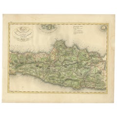
Antique Map of Central and East Java by Van den Bosch, 1818
Located in Langweer, NL
Antique map titled 'Kaart van de Keizers en Sultans Landen benevens de Strand Regentschappen op het Eiland Java'. Map of three central and easterly provinces of the island of Java. O...
Category

Antique Early 19th Century Maps

Materials

Paper

Antique Map of the Caucasus by Seale, 1799
Located in Langweer, NL
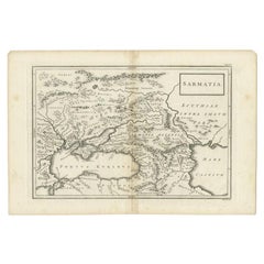
Antique map titled 'Sarmatia'. Old map of the Caucasus with the Caspian and Black Sea. Originates from 'Geographia Antiqua (..)'. Artists and Engravers: Richard William Seale (1703-1...
Category

Antique 18th Century Maps

Materials

Paper

Antique Sea Chart of the Coast of Sumatra, Indonesia, circa 1775
Located in Langweer, NL
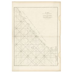
Antique map titled 'Carte de la Côte Occidentale de l'Isle Sumatra'. Sea chart of the part of the south-western coast of Sumatra with the Nassau (Nias) and Fortune isles. Artists ...
Category

Antique 18th Century Maps

Materials

Paper

Antique Map of Spain and Portugal by Harris, 1802
Located in Langweer, NL
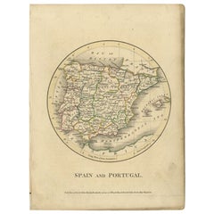
"Antique map titled 'Spain and Portugal'. Uncommon circular map of Spain and Portugal. Artists and Engravers: Published by J. Harris, 1802. Artis...
Category

Antique 19th Century Maps

Materials

Paper

Antique Print of Cape or Cabo Verde, Africa, c.1750
By Jakob van der Schley
Located in Langweer, NL
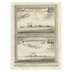
Antique print titled 'Gezigt van Kabo Verde' and 'Zydelings Gezigt van Kabo Verde'. Old print of Cabo Verde with a double view of the island coast. Engraved...
Category

Antique 18th Century Prints

Materials

Paper

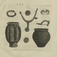
Old Engraving of Antiquities found in a Bed of Chalk, Winchester, England, 1789
Located in Langweer, NL
Antique print titled 'Antiquities found in a bed of chalk, near Winchester, 1789'. Antique print depicting antiquities found near Winchester. Artists and Engravers: Made by J. Basire...
Category

Antique 18th Century Prints

Materials

Paper

Antique Map of the Region of Tokyo and Nagasaki in Japan, 1922
Located in Langweer, NL
Antique map of Japan titled 'Japan - Environs of Tokio & Nagasaki'. Old map of Japan, includes inset maps of Tokyo, Nagasaki and surroundings. This map or...
Category

20th Century Maps

Materials

Paper

Antique Map of the Region of Martigues, France
Located in Langweer, NL
Title: "Etang de Martigues et Environs: Antique Map of the Martigues Region, France" Description: This antique map, titled "Etang de Martigue et Environs," offers a detailed view of...
Category

Antique Mid-18th Century Maps

Materials

Paper

Antique Map of Westphalia, West Orientation
Located in Langweer, NL
Antique map titled 'Nova totius Westphaliae Descriptio'. Detailed map of Westphalia, Northern Germany. Oriented to the west. The area shown extends from Ha...
Category

Antique Late 17th Century Maps

Materials

Paper

Old Print with a View of the Cape of Good Hope and Table Bay, South Africa, 1750
Located in Langweer, NL
Antique print titled 'Gezigt van de Kaap de Goede-Hoop'. Old print with a view of the Cape of Good Hope and Table Bay. Engraved by J. van Schley for a Du...
Category

Antique 1750s Maps

Materials

Paper

Mid-19th Century Map of Australasia by Carl Flemming - 1855
Located in Langweer, NL
Title: "Mid-19th Century Map of Australasia by Carl Flemming - 1855" Description: This original 1855 antique map from the Sohr-Berghaus Atlas, created by Carl Flemming, is a detaile...
Category

Antique 1850s Maps

Materials

Paper

Antique Map of the Israel Township of Ohio by Titus '1871'
Located in Langweer, NL
Antique map titled 'Israel'. Original antique map of Israel, Ohio. This map originates from 'Atlas of Preble County Ohio' by C.O. Titus. Published 1871.
Category

Antique Late 19th Century Maps

Materials

Paper

Antique Map of the Region of 'Île de France' by Janssonius, 1657
By Johannes Janssonius
Located in Langweer, NL
Antique map of France titled 'Ager Parisiensis vulgo l'Isle de France'. Old map of Paris and adjacent regions. This map originates from 'Atlas Novus, ...
Category

Antique 17th Century Maps

Materials

Paper

1720 Johann Baptist Homann Map of the Austrian Circle and Surrounding Regions
Located in Langweer, NL
"1720 Johann Baptist Homann Map of the Austrian Circle and Surrounding Regions" Description of the Map: This map, crafted by the renowned cartographer Johann Baptist Homann around...
Category

Antique 1720s Maps

Materials

Paper

Rare 16th Century Original Handcolored Miniature Map of Java, Indonesia, 1616
Located in Langweer, NL
Very handsome original old coloured copper engraving by Bertius of the island of Java in the early days of the Dutch colonisation - at that time named The Dutch East Indies or nowada...
Category

Antique 1610s Maps

Materials

Paper

Alicante in a 1901 Antique Map: Maritime Gateway of Spain's Costa Blanca
Located in Langweer, NL
An original antique map of the province of Alicante, dated 1901. It is part of the atlas series by D. Benito Chias y Carbo, featuring cartographic elements. Here are some characteri...
Category

Antique Early 1900s Maps

Materials

Paper

Circa 1659 Johannes Blaeu Map: Ducatus Silesiae Ligniciensis, Legnica Region
Located in Langweer, NL
Circa 1659 Johannes Blaeu Map: Ducatus Silesiae Ligniciensis, Legnica Region This hand-colored map from circa 1659 by Johannes Blaeu, titled "Ducatus Silesiae Ligniciensis," depicts the region centered around Legnica (Lignitz) in southwestern Poland. It extends to include the cities of Lublin, Jawor, and Lwówek Śląski. The map features decorative elements such as a title cartouche adorned with a putto, garlands of fruit, and birds, and a distance scale cartouche that includes a hunter with his dogs. This map is dedicated to Georgius Rodulfus, the Duke of Silesia, by Ionas Scultetus, reflecting the map's historical context and noble patronage. It includes Spanish text on the verso, indicating publication between 1659 and 1672. Measuring 20.9 inches wide by 16.3 inches high, the map is in excellent condition with a sharp impression, full contemporary color, and a large watermark of the god Atlas. Minor details include a bit of printer's ink residue at the right and slight marginal soiling. Keywords: - Johannes Blaeu map - Silesia historical map - Legnica (Lignitz) map - 17th-century Poland map...
Category

Antique 1650s Maps

Materials

Paper

Antique Map of Africa and Arabia with Inset Map of Ethiopia and Eritrea, 1845
Located in Langweer, NL
Antique map titled 'Mittel- und Nord-Africa (östl. Theil) und Arabien'. This map depicts North and Central Africa and Arabia with an inset map of Habesch (Ethiopia and Eritrea). Ar...
Category

Antique 19th Century Maps

Materials

Paper

Old Print of a Religious Ceremony for Corpus Christi Day and Palm Sunday, 1725
Located in Langweer, NL
Two images on one sheet titled 'La Procession des Palmes le Dimanche des Rameaux' and 'La Procession du Saint Sacrement le jour de la Dête-Dieu'. The upper image depicts Palm Sunday...
Category

Antique 1720s Prints

Materials

Paper

Leather Vaulting Horse, 1960s
Located in Ljubljana, SI
Vintage leather Vaulting horse Period: 1960s Country of production: Slovenia, Yugoslavia Material: steel, leather, filling Condition: very g...
Category

Vintage 1960s Slovenian Mid-Century Modern Sports Equipment and Memorabilia

Materials

Metal

Leather Vaulting Horse, 1960s
$1,868 Sale Price
20% Off
Antique Map of Three Cities of China's Hubei and Hunan Provinces by Bellin
By Jacques-Nicolas Bellin
Located in Langweer, NL
Antique print titled 'Plans de Quelques villes de la province de Hou-Quang.' Three bird's-eye view plans of walled cities in what are now China's Hubei (Hou-Quang) and Hunan Province...
Category

Antique Mid-18th Century Maps

Materials

Paper

Antique Print of a Chestnut by Knoop, 1758
Located in Langweer, NL
Antique print of a chestnut. Originates from 'Pomologia' by J. H. Knoop. Artists and Engravers: Published by Johann Hermann Knoop (c.1700-1769). Condition: Good, general age-re...
Category

Antique 18th Century Maps

Materials

Paper

Journal of Voyages and Travels '2 Vol.' by Tyerman & George Bennet, '1831'
Located in Langweer, NL
Two volumes 'Journal of Voyages and Travels (..)' by Tyerman (Rev. Daniel) & George Bennet. First edition, engraved portrait frontispieces and 12 plates, tissue guards, lacking adver...
Category

Antique Mid-19th Century Books

Materials

Paper

Old Map of the Empire of the Assyriens & the Tigres and Euphrates Rivers, 1683
Located in Langweer, NL
Antique map titled 'Empire des Assyriens' and 'Assyrie Chaldee et Mesopotamie selon les Anciens'. Two maps on one sheet, the upper sheet showing the Empire of the Assyriens and the second showing the region of the Tigres and Euphrates Rivers. This map originates from Alain Manesson Mallet's 'Description de l 'Univers'. Artists and engravers: Alain Manesson Mallet (1630–1706) was a French cartographer and engineer. He started his career as a soldier in the army of Louis XIV, became a Sergeant-Major in the artillery and an Inspector of Fortifications. He also served under the King of Portugal, before returning to France, and his appointment to the court of Louis XIV. His military engineering and mathematical background led to his position teaching mathematics at court. His major publications were Description de L'Univers (1683) in 5 volumes, and Les Travaux de Mars ou l'Art de la Guerre (1684) in 3 volumes. His Description de L'Universe contains a wide variety of information, including star maps...
Category

Antique 1680s Maps

Materials

Paper

Antique Map of West Kalimantan (Schwaner Mountains), Borneo, Indonesia, 1900
Located in Langweer, NL
Antique map of West Kalimantan, Borneo. It shows the region of the Schwaner Mountains. This map originates from 'Atlas van Nederlandsch Oost- en West-Indië' by I. Dornseiffen. Arti...
Category

20th Century Maps

Materials

Paper

Antique Map of Loire ‘France’ by V. Levasseur, 1854
Located in Langweer, NL
Antique map titled 'Dépt. de la Loire'. Map of the French department of Loire, France. This area of France is part of the Loire Valley wine growing region. The area includes 87 appel...
Category

Antique Mid-19th Century Maps

Materials

Paper

Antique Map of Russia in Europe by A & C, Black, 1870
Located in Langweer, NL
Antique map titled 'Russia in Europe'. Original antique map of Russia in Europe. This map originates from ‘Black's General Atlas of The World’. Published by A & C. Black, 1870.
Category

Antique Late 19th Century Maps

Materials

Paper

Rare Map of Kildin Island in Russia Plus Engraving of Seal Hunting, 1614
Located in Langweer, NL
Insula Kilduyn. Orig. copper-engraving after details from J. H. van Linschoten's map taken from his account of the three expeditions undertaken by Willem Barents in 1594, in an attem...
Category

Antique Early 17th Century Maps

Materials

Paper

Map of the Region of Basel and Northern Switzerland by Ortelius, circa 1603
Located in Langweer, NL
Two original antique maps on one sheet titled 'Basiliensis Territorii Descriptio Nova [with] Circulus sive Liga Sueviae'. The first centers on Basel, Switzerland, located on the Rhine River...
Category

Antique Early 17th Century Maps

Materials

Paper

Antique Plan of Duinkerke or Dunkirk in France by Guicciardini, 1612
Located in Langweer, NL
Antique map Duinkerke titled 'Duijnkerken'. Small plan of the city of Duinkerke/Dunkerque, France. Artists and Engravers: Lodovico Guicciardini (1521-1589): an Italian merchant fr...
Category

Antique 17th Century Maps

Materials

Paper

Physical & Political Map of Switzerland: Late 18th Century - Mentelle Atlas
Located in Langweer, NL
Antique Map with Title: 'Carte Physique et Politique de la Suisse' **Publication Details:** - **Atlas Title:** Nouvel Atlas Universel de Géographie Ancienne et Moderne - **Purpose:...
Category

Antique 1790s Maps

Materials

Paper

Old Map of the French Department of Cantal, France
By Victor Levasseur
Located in Langweer, NL
Antique map titled 'Dépt. du Cantal'. Map of the French department of Cantal, France. This area of France is known for its production of Cantal, a firm cheese, named after the region...
Category

Antique Mid-19th Century Maps

Materials

Paper

Original Antique Map of England, Ireland, Scotland and Wales
Located in Langweer, NL
Antique map titled 'Les Isles Britanniques, ou sont les Royaumes d Angleterre (..)'. Detailed map of England, Ireland, Scotland and Wales, with French coast and part of the Netherlan...
Category

Antique Early 18th Century Maps

Materials

Paper

Antique Map of France by Johnston (1909)
Located in Langweer, NL
Antique map titled 'France'. Original antique map of France. With inset maps of France in provinces, part of the Riviera and Corsica. This map or...
Category

Early 20th Century Maps

Materials

Paper

Antique Map of the Dutch Province of Gelderland, 1725
Located in Langweer, NL
Antique map titled 'Frisiae Haereditariae seu Trajectini Episcopatus Gelria?. Map of the province of Gelderland, the Netherlands. This map originates from 'Atlas Descriptio, secundum...
Category

Antique 18th Century Maps

Materials

Paper

Antique Map of the Ancient Greek Colonization
Located in Langweer, NL
Antique map titled 'Map I containing the Western Division of the Grecian Colonies & Conquests'. Original antique map of the ancient Greek colonization. Frontispiece map of 'The Histo...
Category

Antique Late 18th Century Maps

Materials

Paper

Copper Engraving with a Panoramic View of Mexico City, 1754
Located in Langweer, NL
Antique print titled 'Nouveau Mexico'. Copper engraving with a panoramic view of Mexico city. This print originates from 'Histoire générale des voyages, ou nouvelle collection de...
Category

Antique 1750s Prints

Materials

Paper

Antique Map of Jefferson County 'Ohio' by Titus, 1871
Located in Langweer, NL
Antique map titled 'Jefferson'. Original antique map of Jefferson, Ohio. This map originates from 'Atlas of Preble County Ohio' by C.O. Titus. Published 1871.
Category

Antique Late 19th Century Maps

Materials

Paper

Antique Map of the Netherlands and IJmuiden by Beekman & Schuiling, 1927
Located in Langweer, NL
Two maps on one sheet titled 'Nederland Landbouwkaart' and 'Nederland Groote Verkeerswegen'. With an inset map of the harbour of IJmuiden (The Netherlands). This map originates from ...
Category

20th Century Maps

Materials

Paper

Antique Print of the Book of Hours by Gibb, 1890
Located in Langweer, NL
Antique print titled 'Book of Hours'. Chromolithographic plate originating from 'The Royal House of Stuart. Illustrated By a Series of Forty Plates in Co...
Category

Antique 19th Century Prints

Materials

Paper

Map of Denmark Proper & Jutland: Early 19th Century from the 1802 Tardieu Atlas
Located in Langweer, NL
Antique Map with Title: "Royaume de Danemarck: Deuxieme Carte. Danemarck Propre, le Jutland et les Isles" Publication Details: - **Atlas Title:** Nouvel Atlas Universel de Géograp...
Category

Antique Early 1800s Maps

Materials

Paper

20th Century Child Jesus with Royal Globe with Elizabethan Frame
Located in Miami, FL
20th century child Jesus with Royal globe with Elizabethan frame.
Category

Antique 1870s Italian Elizabethan Religious Items

Materials

Walnut

Antique Print of 'The Cowper Madonna' Made after Raphael 'c.1890'
Located in Langweer, NL
Antique print titled 'The Cowper Madonna'. Original antique print on chine collé, made after the painting by Raphael. Source unknown, to be determined. Published circa 1890.
Category

Antique Late 19th Century Prints

Materials

Paper

Old Colourful Decorative Map of Turkey in Europe, 1846
Located in Langweer, NL
Antique map titled 'Turkey in Europe'. Old map of Turkey in Europe. This map originates from 'A New Universal Atlas Containing Maps of the various Em...
Category

Antique 1840s Maps

Materials

Paper

Decorative Antique Map of the Southern Part of South America, 1806
Located in Langweer, NL
Description: Antique map titled 'Paraguay, Chili, Terre Magellan?' Decorative map of the southern part of South America by Robert de Vaugondy, revised and published by Delamarche. Source unknown, to be determined. Artists and Engravers: Charles Francois Delamarche (1740-1817) founded the important and prolific Paris based Maison Delamarche map publishing firm in the late 18th century. A lawyer by trade Delamarche entered the map business with the acquisition from Jean-Baptiste Fortin of Robert de Vaugondy's map plates...
Category

Antique Early 1800s Maps

Materials

Paper

Original 1859 Map of Asia from W.G. Blackie's Imperial Atlas of Modern Geography
Located in Langweer, NL
Antique map titled 'Asia'. Original antique map of Asia. This map originates from ‘The Imperial Atlas of Modern Geography’. Published by W. G. Blackie, 1859. The "Classic Cartograph...
Category

Antique Mid-19th Century Maps

Materials

Paper

Narrative of the Expedition of an American Squadron by M.C. Perry, '1857'
Located in Langweer, NL
'Narrative of the expedition of an American squadron to the China Seas and Japan; performed in the years 1852, 1853, and 1854' by M.C. Perry. Complete narrative with tinted lithograp...
Category

Antique Mid-19th Century Books

Materials

Paper

Original Antique Map of the Empire of Japan, Centered on the Bay of Osaka, c1752
Located in Langweer, NL
Antique map titled 'Carte de L'Empire de Japon (..).' Map of the Empire of Japan. Centered on the Bay of Osaka, this map covers from Hirado (here identified as I. Firando) and Na...
Category

Antique 1750s Maps

Materials

Paper

Antique Map of the Northern Hemisphere, 1782
Located in Langweer, NL
Antique map titled 'Hémisphère Septentrional pour voir plus distinctement les Terres Arctiques (..)'. Map of the Northern Hemisphere, originall...
Category

Antique 1780s Maps

Materials

Paper

Ancient Cartography of Britannia and Hibernia, Published in 1880
Located in Langweer, NL
This map depicts the geographical area of Great Britain and Ireland, labeled "BRITANNIA et HIBERNIA." It is a historical map, as indicated by the Latin titles and the classical names of regions and tribes. In the main section of the map, Great Britain is depicted in fine detail, with topographical features such as mountains and rivers. The map is color-coded, to differentiate political or tribal boundaries. Various Roman place names are indicated, such as "Londinium" for London. To the left of Great Britain is Ireland, referred to as "Hibernia," similarly detailed with its own topographical features and ancient...
Category

Antique 1880s Maps

Materials

Paper

Antique Plan of Meaco, Kyoto, Japan
Located in Langweer, NL
Antique map titled 'Plan de la Ville de Meaco - Platte-Grond van de Stad Miaco'. Detailed and unusual antique copper engraved plan of Kyoto, ancient named Meaco, when it was the capi...
Category

Antique Mid-18th Century Maps

Materials

Paper

Antique Map of the Netherlands by N. Visscher, 1684
Located in Langweer, NL
Antique map titled 'Comitatus Hollandiae Tabula Pluribus Locis Recens Emendata a Nicolao I. Visschero'. West to the top. Lower left inset of the Wadden Islands, Texel, Vlieland, Ters...
Category

Antique Late 17th Century Maps

Materials

Paper

Antique Print of 'The Adoration of the Magi' Made after Ghirlandajo 'c.1890'
Located in Langweer, NL
Antique print titled 'The Adoration of the Magi'. Original antique print on chine collé, made after the painting by Ghirlandajo. Source unknown, to be determined. Published circa 1890.
Category

Antique Late 19th Century Prints

Materials

Paper

Antique Map of the Berchtesgaden Region by Scherer, 1699
Located in Langweer, NL
Antique map titled 'Principat et praepositura Berchtesgadensis (..).' Detailed uncommon map of the Berchtesgaden region in southern Bavaria, Germany. Source unknown, to be determined...
Category

Antique 17th Century Maps

Materials

Paper

Antique Map of South America by Scherer, c.1700
By Thomas Kitchin
Located in Langweer, NL
Antique map of part of South America. Two maps on a single sheet, each depicting nearly the same area. On close examination there are slight differences in the rivers, lakes and moun...
Category

Antique 18th Century Maps

Materials

Paper

Detailed Regional Map of the Gulf of Bengal and the Lower Ganges River, ca.1750
Located in Langweer, NL
Title of this original and rare antique map: Nouvelle Carte Du Royaume De Bengale Mapmaker: Jacques-Nicolas Bellin (1703-1772). He was among the most important mapmakers of the eighteenth century. In 1721, at only the age of 18, he was appointed Hydrographer to the French Navy. In August 1741, he became the first Ingénieur de la Marine of the Dépôt des cartes...
Category

Antique 1750s Maps

Materials

Paper

Colorful Detailed Antique Map of Europe, Published in 1882
Located in Langweer, NL
"The Antique Map of Europe from 'The Comprehensive Atlas and Geography of the World,' published in 1882 by Blackie & Son, is a testament to meticulous cartography and scholarly preci...
Category

Antique 1880s Maps

Materials

Paper

1876 Antique Map of New York State with Niagara and Hudson River Insets
Located in Langweer, NL
Title: Detailed Map of New York State - 1876 by Samuel Augustus Mitchell Jr. Description: This is a hand-colored map of the state of New York from 1876, created by Samuel Augustus ...
Category

Antique 1870s Maps

Materials

Paper

Antique Print of the Giants Attempting to Scale Heaven, 1733
Located in Langweer, NL
Antique print titled 'Les Géans ou les Titans (..)'. This print depicts the Giants attempting to Scale Heaven by piling mountains upon one another. Giants were the children of Gaia o...
Category

Antique 18th Century Prints

Materials

Paper

Antique Uncommon Map of Bohemia, Moravia and Silesia, 1699
Located in Langweer, NL
Antique map titled 'B. V. Boleslaviensis in Bohemia, Moravia et Silesia (..).' Detailed uncommon map of the Bohemia, Moravia and Silesia. Source unknown, to be determined. Artists...
Category

Antique 17th Century Maps

Materials

Paper

Read More

Medal-Worthy Memorabilia from Epic Past Olympic Games

Get into the games! These items celebrate the events, athletes, host countries and sporting spirit.

Ahoy! You’ve Never Seen a Collection of Sailor Art and Kitsch Quite Like This

French trendsetter and serial collector Daniel Rozensztroch tells us about his obsession with objects related to seafaring men.

Pamela Shamshiri Shares the Secrets behind Her First-Ever Book and Its Effortlessly Cool Interiors

The sought-after designer worked with the team at Hoffman Creative to produce a monograph that beautifully showcases some of Studio Shamshiri's most inspiring projects.

Moroccan Artworks and Objects Take Center Stage in an Extraordinary Villa in Tangier

Italian writer and collector Umberto Pasti opens the doors to his remarkable cave of wonders in North Africa.

Montecito Has Drawn Royalty and Celebrities, and These Homes Are Proof of Its Allure

Hollywood A-listers, ex-pat aristocrats and art collectors and style setters of all stripes appreciate the allure of the coastal California hamlet — much on our minds after recent winter floods.

Whaam! Blam! Pow! — a New Book on Pop Art Packs a Punch

Publishing house Assouline and writer Julie Belcove have teamed up to trace the history of the genre, from Roy Lichtenstein, Andy Warhol and Yayoi Kusama to Mickalene Thomas and Jeff Koons.

What Makes a Gem-Encrusted Chess Set Worth $4 Million?

The world’s most opulent chess set, weighing in at 513 carats, is literally fit for a king and queen.

Tauba Auerbach’s Geometric Pop-Up Book Is Mighty Rare, Thanks to a Hurricane

This sculptural art book has an epic backstory of its own.
Recently Viewed

View All