Collectibles and Curiosities on Sale

to
5,720
1,300
7,006
52
52
421
157
104
86
75
51
46
40
35
27
25
16
15
10
8
7
4
4
2,718
2,354
1,934
104
540
769
337
119
32
67
101
72
228
136
109
72
49
4,996
1,176
661
263
224
1,416
473
430
264
261
7,110
7,105
7,105
104
56
18
17
13
Sale Items
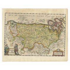
Antique Map of Flanders, Belgium, 1630
Located in Langweer, NL
Antique map titled 'Comitatus Flandria'. Original antique map of Flanders, Belgium. This map originates from 'Vyerige Colom verthonende de 17 Nederlandsche Provintien' published 1630...
Category

Antique 17th Century Maps

Materials

Paper

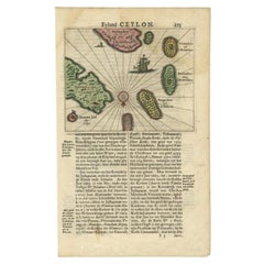
Antique 17th Century Map of the Islands Near Ceylon or Sri Lanka, 1672
Located in Langweer, NL
Antique map titled 'Eyland Ceylon.' Map of the islands near Ceylon or Sri Lanka. Dutch text on verso. Source unknown, to be determined. Artists and Engravers: Philip Baldaeus (1632-...
Category

Antique 17th Century Maps

Materials

Paper

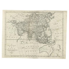
Antique Map of Asia and Australia with a Speculative Coastline, 1777
Located in Langweer, NL
Antique map titled 'A New & Accurate Map of Asia'. Detailed map of Asia and Australia, shows a still largely speculative Southern Australian coastline. Originates from Middleton's 'C...
Category

Antique 18th Century Maps

Materials

Paper

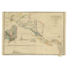
Antique Map of Central America Showing the Communication Lines, 1850
Located in Langweer, NL
Antique map titled 'Map of Central America Shewing the Different Lines of Atlantic & Pacific Communication'. A most unusual U.S. Government edition of this handsome map of Central Am...
Category

Antique 19th Century Maps

Materials

Paper

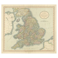
Large Antique Map of England Hand Colored by Counties
Located in Langweer, NL
Antique map titled 'A New Map of England from the latest Authorities'. Large map of England, hand colored by counties. Published by John Cary, 1821. John Cary (1755-1835) was a B...
Category

Antique Early 19th Century Maps

Materials

Paper

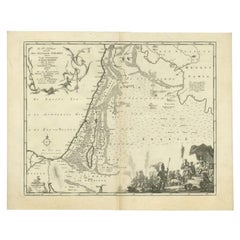
Antique Map of the Biblical Kingdom of Israel by Lindeman, c.1758
Located in Langweer, NL
Antique map titled 'De IVde Landkaart vertoonende het Koningryk Israels benevens deszelfs overheerde Landschappen (..).' Map of the biblical Kingdom of Israel under the Kings Saul, D...
Category

Antique 18th Century Maps

Materials

Paper

19th c. Varvill & Son York Moving Filletster Plane circa 1829-1840
Located in San Francisco, CA
ABOUT Solid boxwood carpenter's wood plane with steel and bronze accents. Stamped "Varvill & Sons York" on both sides. CREATOR Varvill & Sons York, England. DATE OF MANUF...
Category

Antique 19th Century Industrial Scientific Instruments

Materials

Bronze

Plaster Virgin Traditional Figure, circa 1950
Located in Barcelona, ES
Traditional religious plaster figure of a virgin. Made in traditional Catalan atelier in Olot, Spain, circa 1950. In original condition, with minor wear consistent with age and...
Category

Vintage 1950s Spanish Modern Religious Items

Materials

Plaster

Antique Map of the Region of Batavia by Van Schley, c.1750
Located in Langweer, NL
Antique map titled 'Carte des environs de Batavia - Kaart van de Buitenstreken van Batavia'. Map of the Batavia area (Jakarta) in Indonesia. With cartouche, scale and compass rose. P...
Category

Antique 18th Century Maps

Materials

Paper

Un Flic
Located in London, GB
Original Japanese special Deneuve style poster for the 1972 film Un Flic. This film was written and directed by Jean-Pierre Melville, and stars Alain Delon, Ri...
Category

Vintage 1970s Japanese Posters

Materials

Paper

Un Flic
Un Flic
$1,041 Sale Price
20% Off
Plaster Virgin Traditional Figure, circa 1950
Located in Barcelona, ES
Traditional religious plaster figure of a virgin. Made in traditional Catalan atelier in Olot, Spain, circa 1950. In original condition, with minor wear consistent with age and...
Category

Vintage 1950s Spanish Modern Religious Items

Materials

Plaster

Original Antique Map of the West Indies by J. Arrowsmith, 1842
Located in Langweer, NL
Title: "J. Arrowsmith's 19th Century Map of the West Indies" This original antique map, crafted by J. Arrowsmith, details the West Indies with a focus on the Caribbean Sea and its s...
Category

Antique Early 19th Century Maps

Materials

Paper

Antique Print of 'The Circumcision' Made after Signorelli 'c.1890'
Located in Langweer, NL
Antique print titled 'The Circumcision'. Original antique print on chine collé, made after the painting by Signorelli. Source unknown, to be determined. Published circa 1890.
Category

Antique Late 19th Century Prints

Materials

Paper

Antique Map of the Region Around the Baltic Sea by Cordier, c.1670
Located in Langweer, NL
Antique map titled 'Illyricum Orientis: In quo Partes II Moesia et Thracia'. Engraved map of the area west of the Baltic Sea, present day Bulgaria, Romania, and Turkey. The map is ba...
Category

Antique 17th Century Maps

Materials

Paper

Zamora: A Mosaic of Romanesque Heritage and Natural Wonders in Spain, 1901
Located in Langweer, NL
This authentic antique print is a historical map of the province of Zamora, Spain, from the year 1901. The title on the map is "ZAMORA. 1901." As with the previous map, it displays t...
Category

Antique Early 1900s Maps

Materials

Paper

Antique Print of the Feeding Chair of King James VI by Gibb, 1890
Located in Langweer, NL
Antique print titled 'Feeding Chair of King James VI'. Chromolithographic plate originating from 'The Royal House of Stuart. Illustrated By a Series of F...
Category

Antique 19th Century Prints

Materials

Paper

Old Map of Asia Depicting Asia in the 6th through the 9th Centuries, ca. 1855
Located in Langweer, NL
Antique map Asia titled 'Asien vom VIten bis in die erste Haelfte des IXten Jahrhundert’s Zeit der grossfen Ausdehnung des Ralifen Reiches; des Reiche...
Category

Antique 19th Century Maps

Materials

Paper

Antique Print of Hagley Hall in Worcestershire, England, ca.1770
Located in Langweer, NL
Antique print titled 'Principal Front of Hagley'. Main facade of Hagley Hall, Worcestershire. Hagley Hall is a Grade I listed 18th-century house in Hagley, Worcestershire, the ho...
Category

Antique 18th Century Prints

Materials

Paper

Barados and St Christopher or St Kitts and Nevis Islands in the Caribbean, 1748
Located in Langweer, NL
This original map, a copperplate engraving by Le Rouge, presents two significant areas in the Caribbean. Titled "Isle St. Christophle une des Antilles aux anglois" and "La Barbade. d...
Category

Antique Mid-18th Century Maps

Materials

Paper

Basquiat Keith Haring The Paris Review (set of 2)
By (after) Jean-Michel Basquiat
Located in Brooklyn, NY
Jean-Michel Basquiat, Keith Haring: The Paris Review 1982-1990 (set of 2): Vintage editions of The Paris Review, with one uniquely featuring brilliant Keith Haring 1982 cover art &...
Category

Vintage 1980s Art Nouveau Books

Materials

Paper

Northern Schleswig and Haderslev Map by Johannes Mejer and Johannes Blaeu, 1662
Located in Langweer, NL
The map shows the Duchy of Schleswig, which spans the area between the North Sea coast, Kolding, and Flensburg. The maps were originally published by Johannes Mejer in the regional a...
Category

Antique 1660s Maps

Materials

Paper

Set of Four Traditional Vintage Spanish Soda Syphon, Circa 1970
Located in Barcelona, ES
Vintage metal and glass traditional catalan soda syphon. By unknown manufacturer, made in circa 1990. In original condition, with minor wear consistent with age and use, preser...
Category

Vintage 1970s French Rustic Historical Memorabilia

Materials

Metal

The Cavalry of the Dutch-Belgian Army 1841-1849, Published in 1900
Located in Langweer, NL
Antique print, titled: '2e Regiment Lansiers 1841-1849. Limburgsch Bonds-Contingent. Jagers te paard 1842-1849.' - This plate shows the 2nd. Regiment Lanciers (Cavalry) of the Dutch/Belgian army...
Category

20th Century Prints

Materials

Paper

Antique Map of the Indonesian and Philippine Archipelagos by R. de Vaugondy
Located in Langweer, NL
Striking and highly detailed map of the region from Sumatra and Malaca and Southern China to the Philipines, New Guinea and Northern Australia, centered on Borneo. Includes a large i...
Category

Antique Mid-18th Century Maps

Materials

Paper

Antique Map of the World in 12 Globe Gores by Scherer, 'circa 1702'
Located in Langweer, NL
Antique map titled 'Typus Totius Orbis Terraquei Geographice Delineatus, Et Ad Usum Globo Materiali Superinducendus'. Beautiful example of Scherer's map of the World, configured in 12 globe gores. California is shown as an island. Fascinating Northwest Passage...
Category

Antique Early 18th Century Maps

Materials

Paper

Cuenca 1901: A Historical Cartographic Detailing of High Plains and Mountains
Located in Langweer, NL
The original antique map displays the province of Cuenca, located in the autonomous community of Castilla-La Mancha in central Spain, as of 1901. Here are some of its features: It i...
Category

Antique Early 1900s Maps

Materials

Paper

Antique Map of England & Wales by Wyld '1845'
Located in Langweer, NL
Antique map titled 'England & Wales'. Original antique map of England & Wales. This map originates from 'An Atlas of the World, Comprehending Se...
Category

Antique Mid-19th Century Maps

Materials

Paper

Antique Print of a Domestic Scene on Java, Indonesia, c.1840
Located in Langweer, NL
Antique print Java titled 'Indien de Java courant un Much'. This print depicts a scene on Java, Indonesia. Source unknown, to be determined. Artists and Engravers: Anonymous. C...
Category

Antique 19th Century Prints

Materials

Paper

Anrtique Map of the Province of Valladolid, Central Spain, 1902
Located in Langweer, NL
A historical or archival map of the province of Valladolid, Spain, from the year 1902. Valladolid is a province located in the central part of Spain, within the autonomous community ...
Category

Antique Early 1900s Maps

Materials

Paper

Historical Map Depicting the Continent of Asia, 1882
Located in Langweer, NL
This 1882 map presents a meticulously detailed representation of the continent of Asia, a testament to the cartographic skills of the era. Published as a...
Category

Antique 1880s Maps

Materials

Paper

Old Map of the Kingdom of Tonga, Also Known as the Friendly Islands, ca.1780
Located in Langweer, NL
Antique print, titled: 'Carte des Isles des Amis.' Map of the Kingdom of Tonga, also known as the Friendly Islands, and one of the last hereditary monarchies. Cook named this gro...
Category

Antique 1780s Maps

Materials

Paper

Antique Map of the Burgundy Region by Merian '1646'
Located in Langweer, NL
Antique map titled 'Utriusque Burgundiae tum Ducatus tum Comitatus descriptio'. Old map of the Burgundy (Bourgogne) region of France. This map originates from 'Neuwe Archontologia co...
Category

Antique Mid-17th Century Maps

Materials

Paper

Antique Map of Paraguay by A. Montanus, circa 1671
By Arnoldus Montanus
Located in Langweer, NL
Antique map titled 'Paraquaria Vulgo Paraguay Cum adjacentibus'. Antique map extending from Rio de Janiero to the Rio de la Plata basin. The map include...
Category

Antique Mid-17th Century Maps

Materials

Paper

Antique Map of New Zealand by A & C. Black, 1870
Located in Langweer, NL
Antique map titled 'New Zealand'. Original antique map of New Zealand with inset Maps of Australia, New Zealand and Tasmania. This map origi...
Category

Antique Late 19th Century Maps

Materials

Paper

WWII Sweetheart P-47 Thunderbolt Fighter Airplane Brooch Silver Tone
Located in Van Nuys, CA
This striking WWII-era sweetheart brooch features a detailed Republic P-47 Thunderbolt and is a fantastic addition to any vintage aviation or WWII sweetheart jewelry collection. Craf...
Category

Vintage 1940s American Collectible Jewelry

Materials

Metal

Albacete, Spain - 1902: A Cartographic Depiction of Landscape and Infrastructure
Located in Langweer, NL
Albacete, Spain - 1902: A Cartographic Depiction of Landscape and Infrastructure An original and historical map of the province of Albacete, dated 1902, from the "Atlas Geográfico I...
Category

Antique Early 1900s Maps

Materials

Paper

‘Picasso The Early Years 1881-1907’ Hardcover Art Book by Palau i Fabre
Located in Toronto, ON
Pablo Picasso Book by Palau I Fabre detailing Picasso’s work from 1881 to 1907. Published by Rizzoli, New York in 1981. This hardcover book comes with a hardcover sleeve. The book it...
Category

20th Century American Other Books

Materials

Paper

Original Antique Map Showing the Mountain Ranges in Asia and Europe, 1849
Located in Langweer, NL
Antique map titled 'Bergketten in Asien und Eüropa'. Original antique map showing the mountain ranges in Asia and Europe. In outline color with inset maps of Java, Luzon, and Reguain...
Category

Antique 1840s Maps

Materials

Paper

Large Sea Chart of the Zuyder Zee & The Northsea with the Wadden Islands, 1773
By H. van Loon
Located in Langweer, NL
The copper engraving by Herman van Loon, published by Pieter Mortier in 'Le Neptune François' in Amsterdam, is a remarkable piece within the realm of seventeenth-century cartography....
Category

Antique Late 18th Century Maps

Materials

Paper

Antique Bird's-Eye Plan of Tutecoryn (Tuticorin or Thoothukudi), India, 1672
Located in Langweer, NL
Antique map, titled: 'Tutecoryn.' Bird's-eye plan of map of Tutecoryn (Tuticorin or Thoothukudi), India. This map originates from 'Naauwkeurige Beschryvinge van Malabar en Choroman...
Category

Antique 1670s Maps

Materials

Paper

Antique Map of Greece and Ionian Islands by A & C. Black, 1870
Located in Langweer, NL
Antique map titled 'Hellas or Greece'. Original antique map of Greece and Ionian Islands with inset map of Corfu. This map originates from ‘Black's General Atlas of The World’. Publi...
Category

Antique Late 19th Century Maps

Materials

Paper

Map of Constantinople, Bosphorus, the Coasts of Greece and the Archipelago, 1785
Located in Langweer, NL
This is a large 1785 map titled "Carte de la Ville de Constantinople et du Bosphore de Thrace", which includes detailed maps of Constantinople (modern-day Is...
Category

Antique 1780s French Maps

Materials

Paper

Large Scale Map of Greece, Extending to Cythera with Inset of Macedonia, ca.1786
Located in Langweer, NL
Antique map titled 'Graeciae Antiquae'. Large scale map of Greece, extends south to the island of Cythera. Inset map shows details of Macedonia. Pu...
Category

Antique 1780s Maps

Materials

Paper

Burgos 1902: Geographic Map of Castile's Historic Heartland in Spain
Located in Langweer, NL
The map of the province of Burgos in the autonomous community of Castile and León in Spain, dated 1902. It includes the following features: The map highlights the varied terrain wit...
Category

Antique Early 1900s Maps

Materials

Paper

Antique Map of the Malay Archipelago by Walker, 1911
Located in Langweer, NL
Antique map titled 'Malay Archipelago'. Old map of the Malay Archipelago including Borneo, Celebes, New Guinea, Java, Timor and others. This map ...
Category

Early 20th Century Maps

Materials

Paper

Rare Antique Engraving of Microscopes, 1749
Located in Langweer, NL
Antique print titled 'A true Representation of sveral microscopes with some objects (..)'. Print of various microscopes, illustrating several microscope parts. This print originates ...
Category

Antique 18th Century Prints

Materials

Paper

Navarra in Cartographic Detail: A 1902 Map of the Crossroads of Northern Spain
Located in Langweer, NL
The original antique map for sale shows the Spanish province of Navarra as it was in 1902. Here's a brief description and a potential title for the map: Description: - The map detai...
Category

Antique Early 1900s Maps

Materials

Paper

Perpetual Maritime Date Calendar in Bronze, 1970s
Located in Esbjerg, DK
A nautically themed date calendar in bronze. It features a ship in waves at the top, an anchor at the bottom and a sliding N/S/E/W disc that sets the dat...
Category

Vintage 1970s Scandinavian Mid-Century Modern Nautical Objects

Materials

Bronze

Original Antique Map of the Region of Picardy, France, ca.1602
Located in Langweer, NL
Antique map titled 'Picardiae Belgicae regionis descriptio'. Original antique map of the region of Picardy, France. Superb example of the decorative style of Ortelius and filled ...
Category

Antique Early 1600s Maps

Materials

Paper

Ávila in a Historical Map of 1902: A Geographic and Administrative Overview
Located in Langweer, NL
The map is of the province of Ávila, one of the provinces of the autonomous community of Castile and León in Spain, and it is dated from 1902. The map illustrates several geographic ...
Category

Antique Early 1900s Maps

Materials

Paper

Antique Map of Southern Asia, the East Indies and the Indian Ocean, ca.1840
Located in Langweer, NL
Original antique map of Southern Asia, the East Indies and the Indian Ocean. Also shows part of Australia. Published circa 1840. Artists and Engravers: ...
Category

Antique 1840s Maps

Materials

Paper

Antique Map of the Netherlands by Brugsma, 1864
Located in Langweer, NL
Antique map titled 'Het Koningrijk der Nederlanden'. Map of the Netherlands. This map originates from 'F. C. Brugsma's Atlas van het Koninkrijk ...
Category

Antique 19th Century Maps

Materials

Paper

Interesting Map of Great Britain and Northern Europe with various Illustrations
Located in Langweer, NL
Antique map titled 'Itinera Varia Auctoris'. Very interesting map of Great Britain and Northern Europe. The map shows Edwards' journeys between 1716-1730 to study his beloved birds a...
Category

Antique Mid-18th Century Maps

Materials

Paper

Victorian Visions of the New World: A Detailed Tallis Map of North America, 1851
Located in Langweer, NL
The map presented here is an intricate example from the series of maps produced by John Tallis & Company. Tallis maps are known for their detailed and elaborate style, often includin...
Category

Antique 1850s Maps

Materials

Paper

Old Map of the Russian Empire, with English Language Text, Ca.1820
Located in Langweer, NL
Antique map titled 'Geographical, Statistical and Historical Map of Russia'. Old map of the Russian Empire, encompassed on three sides by English language text. Originates from L...
Category

Antique 1820s Maps

Materials

Paper

Antique Map of Barradeel, a County in Friesland, The Netherlands, 1868
Located in Langweer, NL
Antique map titled 'Provincie Friesland - Gemeente Barradeel or Barradiel. Map of the township Barradeel including Sexbierum, Harlingen and many other villages. This map originates f...
Category

Antique 19th Century Maps

Materials

Paper

Antique Map of Germany by Johnston '1909'
Located in Langweer, NL
Antique map titled 'Empire of Germany'. Original antique map of Germany. With inset maps of Frankfurt and Munich. This map originates from the ‘...
Category

Early 20th Century Maps

Materials

Paper

Antique Brochure Weapon Catalogue for Pietro Beretta '1906'
Located in Langweer, NL
An original 1906 brochure catalogue for Pietro Beretta. A detailed catalogue offering many weapons available to purchase at the time. Incredibly rare, only a few later catalogues off...
Category

20th Century Arms, Armor and Weapons

Materials

Paper

Antique Map of Fortification of Bellingwolderschans, The Netherlands, 1673
Located in Langweer, NL
Antique map titled 'Bellingwolderschans'. Original map of the fortification of Bellingwolderschans, the Netherlands. This map originates from 'Teatro del Belgio', by G. Gualdo Priora...
Category

Antique 17th Century Maps

Materials

Paper

Antique Map of Alentejo: Land of Tradition and Tranquility, 1903
Located in Langweer, NL
The image is a historical original antique map of the Alentejo region in Portugal. This map includes the topographical layout of the region, with its complex network of roads and wat...
Category

Antique Early 1900s Maps

Materials

Paper

Read More

Medal-Worthy Memorabilia from Epic Past Olympic Games

Get into the games! These items celebrate the events, athletes, host countries and sporting spirit.

Ahoy! You’ve Never Seen a Collection of Sailor Art and Kitsch Quite Like This

French trendsetter and serial collector Daniel Rozensztroch tells us about his obsession with objects related to seafaring men.

Pamela Shamshiri Shares the Secrets behind Her First-Ever Book and Its Effortlessly Cool Interiors

The sought-after designer worked with the team at Hoffman Creative to produce a monograph that beautifully showcases some of Studio Shamshiri's most inspiring projects.

Moroccan Artworks and Objects Take Center Stage in an Extraordinary Villa in Tangier

Italian writer and collector Umberto Pasti opens the doors to his remarkable cave of wonders in North Africa.

Montecito Has Drawn Royalty and Celebrities, and These Homes Are Proof of Its Allure

Hollywood A-listers, ex-pat aristocrats and art collectors and style setters of all stripes appreciate the allure of the coastal California hamlet — much on our minds after recent winter floods.

Whaam! Blam! Pow! — a New Book on Pop Art Packs a Punch

Publishing house Assouline and writer Julie Belcove have teamed up to trace the history of the genre, from Roy Lichtenstein, Andy Warhol and Yayoi Kusama to Mickalene Thomas and Jeff Koons.

What Makes a Gem-Encrusted Chess Set Worth $4 Million?

The world’s most opulent chess set, weighing in at 513 carats, is literally fit for a king and queen.

Tauba Auerbach’s Geometric Pop-Up Book Is Mighty Rare, Thanks to a Hurricane

This sculptural art book has an epic backstory of its own.
Recently Viewed

View All