Maps on Sale
to
4,206
18
4,229
1
3
2
2
1
1
1
1
2,334
1,663
232
1
130
12
1
67
1
3
4
2
4,220
10
8
7
7
148
44
39
32
27
4,230
4,230
4,230
104
55
18
13
11
Sale Items
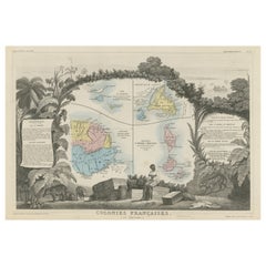
Original Steel Engraved Map of French Colonies in America, 1854
Located in Langweer, NL
Antique map titled 'Colonies Francaises (en Amerique)'. Detailed map bordered by vignettes showing local animals, produce and activities of the various French Colonies in America. Th...
Category
Antique Mid-19th Century Maps
Materials
Paper
$304 Sale Price
20% Off
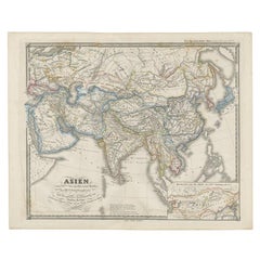
Old Map of Asia Depicting Asia in the 6th through the 9th Centuries, ca. 1855
Located in Langweer, NL
Antique map Asia titled 'Asien vom VIten bis in die erste Haelfte des IXten Jahrhundert’s Zeit der grossfen Ausdehnung des Ralifen Reiches; des Reiche...
Category
Antique 19th Century Maps
Materials
Paper
$237 Sale Price
20% Off
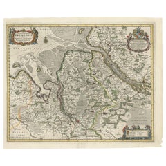
Johannes Janssonius' 17th-Century Map of the Duchy of Bremen in Germany
Located in Langweer, NL
The map titled "Ducatus olim Episcopatus Bremensis et ostiorum Albis et Visurgis Fluviorum novissima Descriptio" by Johannes Janssonius provides a rich historical and geographical il...
Category
Antique 1650s Maps
Materials
Paper
$732 Sale Price
20% Off
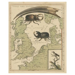
Interesting Map of Great Britain and Northern Europe with various Illustrations
Located in Langweer, NL
Antique map titled 'Itinera Varia Auctoris'. Very interesting map of Great Britain and Northern Europe. The map shows Edwards' journeys between 1716-1730 to study his beloved birds a...
Category
Antique Mid-18th Century Maps
Materials
Paper
$418 Sale Price
20% Off
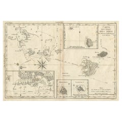
Old Map of the Kingdom of Tonga, Also Known as the Friendly Islands, ca.1780
Located in Langweer, NL
Antique print, titled: 'Carte des Isles des Amis.'
Map of the Kingdom of Tonga, also known as the Friendly Islands, and one of the last hereditary monarchies. Cook named this gro...
Category
Antique 1780s Maps
Materials
Paper
$247 Sale Price
20% Off
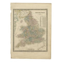
Antique Map of England & Wales by Wyld '1845'
Located in Langweer, NL
Antique map titled 'England & Wales'. Original antique map of England & Wales. This map originates from 'An Atlas of the World, Comprehending Se...
Category
Antique Mid-19th Century Maps
Materials
Paper
$134 Sale Price
24% Off
Imperial Frontiers: A 19th Century Map of Southern Russia and the Caucasus, 1882
Located in Langweer, NL
This map, sourced from the comprehensive 1882 atlas by Blackie & Son, delineates the southern part of Russia and the Caucasus region, reflecting the geopolitical contours and topogra...
Category
Antique 1880s Maps
Materials
Paper
$304 Sale Price
20% Off
Antique Map of New Zealand by A & C. Black, 1870
Located in Langweer, NL
Antique map titled 'New Zealand'. Original antique map of New Zealand with inset Maps of Australia, New Zealand and Tasmania. This map origi...
Category
Antique Late 19th Century Maps
Materials
Paper
$166 Sale Price
20% Off
Original Antique Map Showing the Mountain Ranges in Asia and Europe, 1849
Located in Langweer, NL
Antique map titled 'Bergketten in Asien und Eüropa'. Original antique map showing the mountain ranges in Asia and Europe. In outline color with inset maps of Java, Luzon, and Reguain...
Category
Antique 1840s Maps
Materials
Paper
$266 Sale Price
20% Off
Antique Bird's-Eye Plan of Tutecoryn (Tuticorin or Thoothukudi), India, 1672
Located in Langweer, NL
Antique map, titled: 'Tutecoryn.'
Bird's-eye plan of map of Tutecoryn (Tuticorin or Thoothukudi), India. This map originates from 'Naauwkeurige Beschryvinge van Malabar en Choroman...
Category
Antique 1670s Maps
Materials
Paper
$342 Sale Price
20% Off
Original Old Composite of Several Maps of the Ancient World on One Sheet, 1880
Located in Langweer, NL
This original antique map is from Karl Spruner von Merz's "Atlas Antiquus", later edited by Theodorus Menke. The map is a detailed depiction of the ancient world. The atlas it comes ...
Category
Antique 1880s Maps
Materials
Paper
$352 Sale Price
20% Off
Large Scale Map of Greece, Extending to Cythera with Inset of Macedonia, ca.1786
Located in Langweer, NL
Antique map titled 'Graeciae Antiquae'.
Large scale map of Greece, extends south to the island of Cythera. Inset map shows details of Macedonia. Pu...
Category
Antique 1780s Maps
Materials
Paper
$589 Sale Price
20% Off
Antique Map of Greece and Ionian Islands by A & C. Black, 1870
Located in Langweer, NL
Antique map titled 'Hellas or Greece'. Original antique map of Greece and Ionian Islands with inset map of Corfu. This map originates from ‘Black's General Atlas of The World’. Publi...
Category
Antique Late 19th Century Maps
Materials
Paper
$166 Sale Price
20% Off
Antique Map of the Burgundy Region by Merian '1646'
Located in Langweer, NL
Antique map titled 'Utriusque Burgundiae tum Ducatus tum Comitatus descriptio'. Old map of the Burgundy (Bourgogne) region of France. This map originates from 'Neuwe Archontologia co...
Category
Antique Mid-17th Century Maps
Materials
Paper
$237 Sale Price
20% Off
Antique Map of the Indonesian and Philippine Archipelagos by R. de Vaugondy
Located in Langweer, NL
Striking and highly detailed map of the region from Sumatra and Malaca and Southern China to the Philipines, New Guinea and Northern Australia, centered on Borneo. Includes a large i...
Category
Antique Mid-18th Century Maps
Materials
Paper
$1,108 Sale Price
20% Off
Antique Map of the Netherlands by Brugsma, 1864
Located in Langweer, NL
Antique map titled 'Het Koningrijk der Nederlanden'. Map of the Netherlands. This map originates from 'F. C. Brugsma's Atlas van het Koninkrijk ...
Category
Antique 19th Century Maps
Materials
Paper
$94 Sale Price
20% Off
Antique Map of Cher in France, 1854
By Victor Levasseur
Located in Langweer, NL
Antique map titled 'Dépt. des Bses. Pyrénées'. Map of the French department of Basses Pyrenees, France. This department includes the Jurancon wine region, famous for its production d...
Category
Antique Mid-19th Century Maps
Materials
Paper
$171 Sale Price
20% Off
Original Antique Map of the Region of Picardy, France, ca.1602
Located in Langweer, NL
Antique map titled 'Picardiae Belgicae regionis descriptio'.
Original antique map of the region of Picardy, France. Superb example of the decorative style of Ortelius and filled ...
Category
Antique Early 1600s Maps
Materials
Paper
$618 Sale Price
20% Off
Old World Map Featuring Captain Cook's Exploration Routes and Polar Views, 1787
Located in Langweer, NL
1786 World Map with Polar Projections - "Globo Terrestre" by Giovanni Maria Cassini
This 1786 map titled "Globo Terrestre" by Giovanni Maria Cassini offers a fascinating and detai...
Category
Antique 1860s Maps
Materials
Paper
$1,807 Sale Price
20% Off
Antique Map of Paraguay by A. Montanus, circa 1671
By Arnoldus Montanus
Located in Langweer, NL
Antique map titled 'Paraquaria Vulgo Paraguay Cum adjacentibus'. Antique map extending from Rio de Janiero to the Rio de la Plata basin. The map include...
Category
Antique Mid-17th Century Maps
Materials
Paper
$570 Sale Price
20% Off
Antique Map of Southern Asia, the East Indies and the Indian Ocean, ca.1840
Located in Langweer, NL
Original antique map of Southern Asia, the East Indies and the Indian Ocean. Also shows part of Australia. Published circa 1840.
Artists and Engravers: ...
Category
Antique 1840s Maps
Materials
Paper
$304 Sale Price
20% Off
Old Map of the Russian Empire, with English Language Text, Ca.1820
Located in Langweer, NL
Antique map titled 'Geographical, Statistical and Historical Map of Russia'.
Old map of the Russian Empire, encompassed on three sides by English language text. Originates from L...
Category
Antique 1820s Maps
Materials
Paper
$513 Sale Price
20% Off
Jaén 1902: A Cartographic Depiction of Andalusia's Olive Heartland
Located in Langweer, NL
This original antique map displays the province of Jaén, located in the autonomous community of Andalusia in southern Spain, as of the year 1902. It contains various geographic and i...
Category
Antique Early 1900s Maps
Materials
Paper
$275 Sale Price
20% Off
Córdoba 1901: A Cartographic Journey Through Andalusia’s Heartland in Spain
Located in Langweer, NL
The map provided is of the province of Córdoba, part of the autonomous community of Andalusia in southern Spain, as of the year 1901. It details various elements:
The map displays the varied terrain of Córdoba, including the Sierra Morena to the north and the beginning of the Subbaetic Range to the south. It shows blue lines indicating rivers, most likely including the Guadalquivir River, which runs through the province. Red lines represent the transportation network of roads and railways, detailing how the province is interconnected.
Symbols on the map mark the locations of cities, towns, and villages, with the capital city of Córdoba highlighted. Dotted lines suggest the borders of the province within the region of Andalusia. A legend (Signos Convencionales) details the symbols used for provincial capitals, roads, railways, and other features. A scale in kilometers is included to assist in measuring distances between points on the map.
The coat of arms of Córdoba is prominently featured, displaying a castle and a lion, which are common heraldic symbols with historical significance to the region.
About the province of Córdoba:
Córdoba is historically significant, known for its cultural heritage, particularly during the time when it was the capital of the Islamic Emirate and then Caliphate of Córdoba. This period left a lasting architectural mark, notably the Mezquita-Catedral (Mosque-Cathedral), which is a UNESCO World Heritage site. The province's geography is diverse, with fertile valleys in the Guadalquivir basin and extensive olive groves, making it one of the most important areas for olive oil production...
Category
Antique Early 1900s Maps
Materials
Paper
$323 Sale Price
20% Off
Antique Map of Barradeel, a County in Friesland, The Netherlands, 1868
Located in Langweer, NL
Antique map titled 'Provincie Friesland - Gemeente Barradeel or Barradiel. Map of the township Barradeel including Sexbierum, Harlingen and many other villages. This map originates f...
Category
Antique 19th Century Maps
Materials
Paper
$133 Sale Price
20% Off
Detailed Antique Map of the Region of Gujarat and Mumbai in India, C.1825
Located in Langweer, NL
Antique map titled 'No. 93 Guzerate, Chandeish et Aurungabad'. Detailed map of the region of Gujarat and the region of Mumbay. Originates from 'Atlas Universel' by P.M. Vandermaelen....
Category
Antique 19th Century Maps
Materials
Paper
$466 Sale Price
20% Off
Antique Print of Kupang or Koepang in the East Indies, Now West-Timor, Indonesia
Located in Langweer, NL
Antique print Timor titled 'De Stad Koepang, La Ville de Koepang'. View of the town of Koepang / Concordia / Kupang on the Island of Timor, Indonesia. Originates from 'Gezigten uit Neerlands Indie, naar de natuur geteekend en beschreven.', by C.W.M. van de Velde, published in Amsterdam, Frans Buffa en Zonen (1844-1845).
Artists and Engravers: Charles William Meredith van de Velde (1818-1898) was a Dutch...
Category
Antique 19th Century Prints
Materials
Paper
$390 Sale Price
20% Off
Cartographic Elegance: The Art and Science of 17th-Century Asian Maps, ca.1681
Located in Langweer, NL
This original antique map is an artifact from a pivotal era in cartography, reflecting not only the geographical knowledge of its time but also the intertwining of art and science in...
Category
Antique 1680s Maps
Materials
Paper
$371 Sale Price
20% Off
Antique Map of Germany by Johnston '1909'
Located in Langweer, NL
Antique map titled 'Empire of Germany'. Original antique map of Germany. With inset maps of Frankfurt and Munich. This map originates from the ‘...
Category
Early 20th Century Maps
Materials
Paper
$237 Sale Price
20% Off
Cartographic Depiction of Flensburg and Surrounding Territories, Anno 1648
Located in Langweer, NL
Title: Landtcarte Vonn dem Ambte Flensborg, ohne Nordgoeßherde. Anno 1648.
Description:
This exquisitely detailed and old coloured map of Flensburg was crafted by the noted cartogr...
Category
Antique 1640s German Maps
Materials
Paper
$1,179 Sale Price
20% Off
Antique Map of the Malay Archipelago by Walker, 1911
Located in Langweer, NL
Antique map titled 'Malay Archipelago'. Old map of the Malay Archipelago including Borneo, Celebes, New Guinea, Java, Timor and others. This map ...
Category
Early 20th Century Maps
Materials
Paper
$85 Sale Price
20% Off
Large Sea Chart of the Zuyder Zee & The Northsea with the Wadden Islands, 1773
By H. van Loon
Located in Langweer, NL
The copper engraving by Herman van Loon, published by Pieter Mortier in 'Le Neptune François' in Amsterdam, is a remarkable piece within the realm of seventeenth-century cartography....
Category
Antique Late 18th Century Maps
Materials
Paper
$1,165 Sale Price
30% Off
Antique Map of Fortification of Bellingwolderschans, The Netherlands, 1673
Located in Langweer, NL
Antique map titled 'Bellingwolderschans'. Original map of the fortification of Bellingwolderschans, the Netherlands. This map originates from 'Teatro del Belgio', by G. Gualdo Priora...
Category
Antique 17th Century Maps
Materials
Paper
$190 Sale Price
20% Off
Antique Map of the Mediterranean and the Persian Gulf by Danckerts, c.1718
Located in Langweer, NL
Antique map titled 'De Gelegentheyt Van't Paradys en 't Landt Canaan.' Dutch Bible map covering the region between the Mediterranean and the Persian Gulf, f...
Category
Antique 18th Century Maps
Materials
Paper
$390 Sale Price
20% Off
Old Map of the Western Region of the Kingdom of Algiers, Algeria, 1773
Located in Langweer, NL
Antique map titled 'Kaart van het Westelyk Gedeelte van het Ryk van Algiers'.
Old map of the western region of the Kingdom of Algiers, Algeria. Originates from the first Dutch ed...
Category
Antique 1770s Maps
Materials
Paper
$361 Sale Price
20% Off
Antique Map of the Region of Namen by Veelwaard, c.1840
Located in Langweer, NL
Antique map titled 'Kaart van Namen'. Original antique map of the region of Namen (Namur), Belgium. Source unkown, to be determined. Published circa 1840.
Artists and Engravers:...
Category
Antique 19th Century Maps
Materials
Paper
$118 Sale Price
20% Off
Old Engraving of The Catching of Horses on Jafnapatnam, Ceylon 'Sri Lanka', 1672
Located in Langweer, NL
Antique print, titled: 'Paardevangst op Jafnapatnam' - This plate shows the catching of horses on Jafnapatnam. The province of Jaffna , and specially the fort at Jaffnapatnam were th...
Category
Antique 1670s Prints
Materials
Paper
$504 Sale Price
20% Off
Beautiful Decorative Hand-Colored Antique Map of West Canada, 1851
Located in Langweer, NL
Description: Antique map of Canada titled 'West Canada'.
With decorative vignettes titled Kingston and Falls of Niagara. Originates from 'The Illustrated Atlas, And Modern History Of The World Geographical, Political, Commercial & Statistical, Edited By R. Montgomery Martin'. Published; John Tallis London, New York, Edinburgh & Dublin. 1851.
Drawn and Engraved by J. Rapkin.
Artists and Engravers: John Tallis (1817-1876) was a British map...
Category
Antique 1850s Maps
Materials
Paper
$903 Sale Price
20% Off
Antique Map of the Arabian Peninsula by Bonne 'c.1780'
Located in Langweer, NL
Antique map titled 'Carte de l'Arabie, du Golfe Persique, et de la Mer Rouge (..)'. Original antique map of the Arabian Peninsula, including the horn...
Category
Antique Late 18th Century Maps
Materials
Paper
$523 Sale Price
20% Off
Original Antique Print of Decorative Art in the Middle Ages, 1869
Located in Langweer, NL
Old print of decorative art in the Middle Ages. This print originates from 'L'Ornement polychrome'. A beautiful work containing about...
Category
Antique 19th Century Prints
Materials
Paper
$142 Sale Price
20% Off
Antique Map of the Region of Sarlat in France by Janssonius, 1657
By Johannes Janssonius
Located in Langweer, NL
Antique map of France titled 'Le Diocese de Sarlat dioccesis Sarlatensis'. Decorative map of the Sarlat region, part of the Dordogne department. This map originates from 'Atlas Novus...
Category
Antique 17th Century Maps
Materials
Paper
$523 Sale Price
20% Off
Antique Map of British North America, The Dominion of of Canada, 1882
Located in Langweer, NL
This map is titled "British North America, Dominion of Canada," from the 1882 Blackie Atlas. It features the geographical area that comprises modern-day Canada, with notable features...
Category
Antique 1880s Maps
Materials
Paper
$237 Sale Price
20% Off
Antique Map of the Gulf of Tomini by Winkler Prins, 1878
Located in Langweer, NL
Antique map titled 'Kaart van de Golf van Tomini of Gorontalo.' (Map of the Gulf of Tomini or Gorontalo.) This map shows the Gulf of Tomini near the Island of Sulawesi, Indonesia. Wi...
Category
Antique 19th Century Maps
Materials
Paper
$176 Sale Price
20% Off
Antique Map of the Lemsterland Township 'Friesland' by Halma, 1718
Located in Langweer, NL
Antique map Friesland titled 'Lemsterland de Seste Grietenije der Zevenwolden (..)'. Old map of Friesland, the Netherlands. This map depicts the region of Lemsterland and includes ci...
Category
Antique 18th Century Maps
Materials
Paper
$231 Sale Price
20% Off
Antique Map of Russia and Surroundings by Stieler, 1874
Located in Langweer, NL
Antique map titled 'Nord- & Mittal-Asien, Ubersicht des Russischen Reiches.' A map of Russia in scale 1:20.000.000. The depicted area spans from Iran and Sweden in the left edge of t...
Category
Antique 19th Century Maps
Materials
Paper
$66 Sale Price
20% Off
Large Antique Map of the City of Bremen and Surroundings, Germany
Located in Langweer, NL
Original antique map titled 'Prospect und Grundris der Keiserl Freyen Reichs und Ansee Stadt Bremen (..)'. This is a superb chart of the city of Bremen and the surrounding small villages with particular emphasis on the many rivers and canals...
Category
Antique Early 18th Century Maps
Materials
Paper
$1,284 Sale Price
20% Off
Small Detailed Antique Map of France, with Decorative Title Cartouche, 1754
Located in Langweer, NL
Antique map France titled 'An Accurate Map of France drawn from the best authorities'.
Small, detailed map of France. With decorative title cartouche.
...
Category
Antique 1750s Maps
Materials
Paper
$228 Sale Price
20% Off
1720 Johann Baptist Homann Map of the Austrian Circle and Surrounding Regions
Located in Langweer, NL
"1720 Johann Baptist Homann Map of the Austrian Circle and Surrounding Regions"
Description of the Map:
This map, crafted by the renowned cartographer Johann Baptist Homann around...
Category
Antique 1720s Maps
Materials
Paper
$732 Sale Price
20% Off
Antique Map of the United States of North America by Wyld '1845'
Located in Langweer, NL
Antique map titled 'Map of The United States of North America'. Original antique map of the United States of North America. This map originates from 'An Atlas of the World, Comprehen...
Category
Antique Mid-19th Century Maps
Materials
Paper
$237 Sale Price
20% Off
Antique Map of Europe in the Year 800 and 1500, Published in 1842
Located in Langweer, NL
Antique map titled 'Carte de l'Europe'. Two maps of Europe. The upper map depicts Europe in the year 800, the lower map depicts Europe in 1500. This map originates from 'Atlas univer...
Category
Antique 19th Century Maps
Materials
Paper
$380 Sale Price
20% Off
Circa 1659 Johannes Blaeu Map: Ducatus Silesiae Ligniciensis, Legnica Region
Located in Langweer, NL
Circa 1659 Johannes Blaeu Map: Ducatus Silesiae Ligniciensis, Legnica Region
This hand-colored map from circa 1659 by Johannes Blaeu, titled "Ducatus Silesiae Ligniciensis," depicts the region centered around Legnica (Lignitz) in southwestern Poland.
It extends to include the cities of Lublin, Jawor, and Lwówek Śląski.
The map features decorative elements such as a title cartouche adorned with a putto, garlands of fruit, and birds, and a distance scale cartouche that includes a hunter with his dogs.
This map is dedicated to Georgius Rodulfus, the Duke of Silesia, by Ionas Scultetus, reflecting the map's historical context and noble patronage.
It includes Spanish text on the verso, indicating publication between 1659 and 1672. Measuring 20.9 inches wide by 16.3 inches high, the map is in excellent condition with a sharp impression, full contemporary color, and a large watermark of the god Atlas. Minor details include a bit of printer's ink residue at the right and slight marginal soiling.
Keywords:
- Johannes Blaeu map
- Silesia historical map
- Legnica (Lignitz) map
- 17th-century Poland map...
Category
Antique 1650s Maps
Materials
Paper
$1,046 Sale Price
20% Off
Antique Map of the Coast of Guinea and the Cape Verde Islands
Located in Langweer, NL
Antique map titled 'Carte de la Guinée (..)'. This map was originally part of a 2 sheet larger map of Eastern Africa, showing the Cape Verde Islands and Senegal. This map originates ...
Category
Antique Late 18th Century Maps
Materials
Paper
$456 Sale Price
40% Off
Antique Map of the Province of Overijssel, the Netherlands
Located in Langweer, NL
Original antique map titled 'Ditio Trans-Isulana'. Original old map of the province of Overijssel, the Netherlands. With coat of arms and two decorative cartouches. Published by J. J...
Category
Antique Mid-17th Century Maps
Materials
Paper
$466 Sale Price
20% Off
Antique Detailed Map of Jerusalem in Israël with Extensive Key and Scale, 1698
Located in Langweer, NL
Antique map titled 'Jerusalem.'
Plan of the ancient city of Jerusalem. With extensive key and scale. Source unknown, to be determined.
Artists and Engravers: Made by 'Cornelis de...
Category
Antique 17th Century Maps
Materials
Paper
$618 Sale Price
20% Off
Rare Small Map of Sumatra, Java, Borneo, Macassar, Madura, Bali, 1614
Located in Langweer, NL
One of the first maps of the Indonesia islands of Java, Bali, Sumbawa etc. in early days of the Dutch Indies. Also showing Banten, Jakarta (Jacatra), Indr...
Category
Antique Early 17th Century Maps
Materials
Paper
$713 Sale Price
20% Off
Old Print of the Governor-General's Residence in Batavia, Indonesia, 1739
Located in Langweer, NL
Antique print titled 'Ein Prospect Sr. Hoch-Edelheit des Herrn Gen: Gouverneurs Hoff und Wohnhausses in dem Castel Batavia wie dasselbe von innen anzusehen'.
Old print with a view of the Governor-General's residence in Batavia. This print originates from from 'Allerneuester Geographische- und Topographischer Schau-platz, von Africa und Ost-Indien'.
Artists and Engravers: Johann Wolfgang Heydt, a German artist who worked for the Dutch East India...
Category
Antique 1730s Prints
Materials
Paper
$742 Sale Price
20% Off
Original Antique Engraving of a Horse Race at a Japanese Racing Track, 1669
Located in Langweer, NL
Description: Antique print, titled: 'Japansche Ren-baanen.' -
View of a race at a Japanese (horse) racing track. A man runs beside a horse (the horse's rein in his hand). A man w...
Category
Antique 1660s Prints
Materials
Paper
$428 Sale Price
20% Off
Antique Map of the Islands of Banda, Indonesia from a Very Rare Edition, 1725
Located in Langweer, NL
Antique map titled 'Les Iles de Banda (..).' (The islands of Banda, Indonesia.)
Extremely rare in this edition. This plate originates from the very scarse: 'La galerie agreable d...
Category
Antique 1720s Maps
Materials
Paper
$846 Sale Price
20% Off
Antique Map of South American, The West Indies & Most of Africa, Ca.1775
Located in Langweer, NL
Antique map titled 'Carte pour Servir a l' Histoire Philosophique et Politique des Etablissemens et du Commerce des Europeens dans les deux Indes'.
This map is roughly centered o...
Category
Antique 1770s Maps
Materials
Paper
$723 Sale Price
20% Off
Rare Antique Map of Friesland in Roman Times, Published 1778
Located in Langweer, NL
Antique map titled 'Carte de la Frise, entre les Embouchures du Rhin & de l'Eems, ij compris l'isle Bataves, dressée selon leur ancienne position le Gouvernement des Romains & des Fr...
Category
Antique 18th Century Maps
Materials
Paper
$903 Sale Price
20% Off
Recently Viewed
View AllMore Ways To Browse
Statutes And Sculptures
Swedish Gustavian Glass Cabinet
Swiss Chalet Chairs
Tea Cup Art Nouveau
Tea Cup Holder
Teak Buddha
Teak Gentlemans
Thomasville Hollywood Regency
Thomire Clock
Three Legged Vessel
Three Tier Serving Trays
Tibet Earring
Tibetan Antique Cabinet
Tiffany And Co China
Tiffany Blue Rims
Tiffany Sterling Ice Tea Spoons
Torchiere Sculpture
Tortoise Christian Dior
