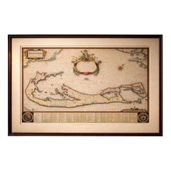
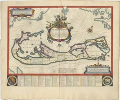
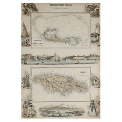
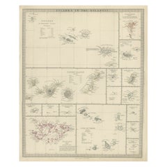
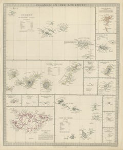
Antique Map Bermuda

Blaeu Bermuda Map, Somers Isles, Atlantic Chart, Hand-Colored, c.1642

Blaeu Bermuda Map, Somers Isles, Atlantic Chart, Hand-Colored, c.1642

Located in Langweer, NL

The elongated format lends itself well to horizontal placement above a desk or console, or as a refined standalone focal point within a curated wall of early maps. Technique: Copper...

Category

Antique Mid-17th Century Dutch Maps

Materials

Paper

The Caribbean & Gulf of Mexico – Rigobert Bonne’s Antilles Map, c.1780

The Caribbean & Gulf of Mexico – Rigobert Bonne’s Antilles Map, c.1780

Located in Langweer, NL

Keyword block: Antique Caribbean map, Antilles map 18th century, Gulf of Mexico antique map, Rigobert Bonne, French colonial cartography, copper engraved map, maritime history map, E...

Category

Antique Late 18th Century French Maps

Materials

Paper

French Guiana & Suriname – Rigobert Bonne’s Colonial Map of the Guianas, c.1780

French Guiana & Suriname – Rigobert Bonne’s Colonial Map of the Guianas, c.1780

Located in Langweer, NL

Keyword block: Antique Caribbean map, Antilles map 18th century, Gulf of Mexico antique map, Rigobert Bonne, French colonial cartography, copper engraved map, maritime history map, E...

Category

Antique Late 18th Century French Maps

Materials

Paper

Recent Sales

Antique Map of Bermuda by Hondius, 'circa 1630'

Antique Map of Bermuda by Hondius, 'circa 1630'

Sold

H 17.13 in W 21.38 in D 0.02 in

Antique Map of Bermuda by Hondius, 'circa 1630'

Located in Langweer, NL

Antique map titled 'Mappa Aestivarum Insularum Alias Barmudas dictarum (..)'.

Category

Antique Mid-17th Century Maps

Materials

Paper

Original Antique Decorative Map of Bermuda & Jamaica, Fullarton, C.1870

Original Antique Decorative Map of Bermuda & Jamaica, Fullarton, C.1870

Located in St Annes, Lancashire

Great map of Bermuda and Jamaica Wonderful figural border From the celebrated Royal Illustrated Atlas Lithograph. Original color. Published by Fullarton, Edinburgh. C.18...

Category

Antique 1870s Scottish Maps

Materials

Paper

Get Updated with New Arrivals
Save "Antique Map Bermuda", and we’ll notify you when there are new listings in this category.

Read More