Geographical Map
91
to
216
1,401
538
592
546
516
372
372
368
288
166
144
118
116
113
90
87
70
64
50
48
45
44
41
39
38
37
37
24
22
21
20
18
17
17
17
15
15
14
11
9
9
9
9
9
8
8
8
6
6
6
5
5
5
5
4
4
4
3
3
2
2
2
1
139
79
40
37
25
Sort By
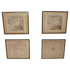
Set of 4 Antique Geographical Maps French-German War 1870-71
Located in Casale Monferrato, IT
Elegant late 19th century set of four antique geographical maps relating to the positioning of the
Category
Antique 1890s Italian Maps
Materials
Paper
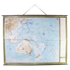
Late 20th Century Educational Geographic Map - Australasia
Located in Hook, Hampshire
Late 20th Century Educational Geographic Map – Australasia
Late 20th Century Educational Geographic
Category
Late 20th Century Czech Posters
Materials
Cotton
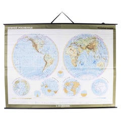
Late 20th Century Educational Geographic Map - Hemispheres
Located in Hook, Hampshire
Late 20th Century Educational Geographic Map – Hemispheres
Late 20th Century Educational Geographic
Category
Late 20th Century Czech Posters
Materials
Cotton
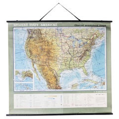
Late 20th Century Educational Geographic Map - USA Topography
Located in Hook, Hampshire
Late 20th Century Educational Geographic Map – USA Topography
Late 20th Century Educational
Category
Late 20th Century Czech Posters
Materials
Cotton
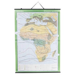
Late 20th Century Educational Geographic Map - African Climate
Located in Hook, Hampshire
Late 20th Century Educational Geographic Map – African Climate
Late 20th Century Educational
Category
Late 20th Century Czech Posters
Materials
Cotton
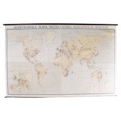
Late 20th Century Educational Geographic Map - Worlds Resources
Located in Hook, Hampshire
Late 20th Century Educational Geographic Map – Worlds Resources
Late 20th Century Educational
Category
Late 20th Century Czech Posters
Materials
Cotton
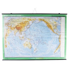
Late 20th Century Educational Geographic Map - Worlds Oceans
Located in Hook, Hampshire
Late 20th Century Educational Geographic Map – Worlds Oceans
Late 20th Century Educational
Category
Late 20th Century Czech Posters
Materials
Cotton
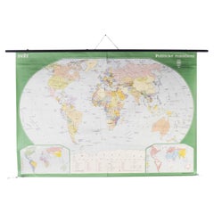
Late 20th Century Educational Geographic Map - World Atlas
Located in Hook, Hampshire
Late 20th Century Educational Geographic Map – World Atlas
Late 20th Century Educational Geographic
Category
Late 20th Century Czech Posters
Materials
Cotton
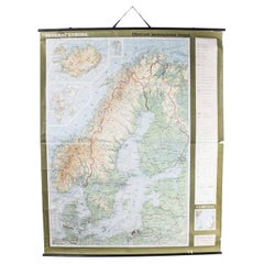
Late 20th Century Educational Geographic Map - Scandinavian Topography
Located in Hook, Hampshire
Late 20th Century Educational Geographic Map – Scandinavian Topography
Late 20th Century
Category
Late 20th Century Czech Posters
Materials
Cotton
H 73.23 in W 59.85 in D 0.4 in
Late 20th Century Educational Geographic Map - Earths Lithosphere
Located in Hook, Hampshire
Late 20th Century Educational Geographic Map – Earths Lithosphere
Late 20th Century Educational
Category
Late 20th Century Czech Posters
Materials
Cotton
Late 20th Century Educational Geographic Map - Japan - Korea
Located in Hook, Hampshire
Late 20th Century Educational Geographic Map – Japan – Korea
Late 20th Century Educational
Category
Late 20th Century Czech Posters
Materials
Cotton
Late 20th Century Educational Geographic Map - European Countries
Located in Hook, Hampshire
Late 20th Century Educational Geographic Map – European Countries
Late 20th Century Educational
Category
Late 20th Century Czech Posters
Materials
Cotton
Late 20th Century Educational Geographic Map - Atlantic Currents
Located in Hook, Hampshire
Late 20th Century Educational Geographic Map – Atlantic Currents
Late 20th Century Educational
Category
Late 20th Century Czech Posters
Materials
Cotton
Late 20th Century Educational Geographic Map - South Asia Topography
Located in Hook, Hampshire
Late 20th Century Educational Geographic Map – South Asia Topography
Late 20th Century Educational
Category
Late 20th Century Czech Posters
Materials
Cotton
Late 20th Century Educational Geographic Map - African Industry (1728.2)
Located in Hook, Hampshire
Late 20th Century Educational Geographic Map – African Industry (1728.2)
Late 20th Century
Category
Late 20th Century Czech Posters
Materials
Cotton
H 63.78 in W 46.07 in D 0.4 in
Late 20th Century Educational Geographic Map - European Countries (1728.14)
Located in Hook, Hampshire
Late 20th Century Educational Geographic Map – European Countries (1728.14)
Late 20th Century
Category
Late 20th Century Czech Posters
Materials
Cotton
H 68.51 in W 63 in D 0.4 in
Late 20th Century Educational Geographic Map - African Industry (1728.1)
Located in Hook, Hampshire
Late 20th Century Educational Geographic Map – African Industry (1728.1)
Late 20th Century
Category
Late 20th Century Czech Posters
Materials
Cotton
H 64.18 in W 46.07 in D 0.4 in
Late 20th Century Educational Geographic Map - Continent Of Americas Industry
Located in Hook, Hampshire
Late 20th Century Educational Geographic Map – Continent Of Americas Industry
Late 20th Century
Category
Late 20th Century Czech Posters
Materials
Cotton
H 73.23 in W 51.58 in D 0.4 in
Late 20th Century Educational Geographic Map - Australia Topography And Economy
Located in Hook, Hampshire
Late 20th Century Educational Geographic Map – Australia Topography And Economy
Late 20th Century
Category
Late 20th Century Czech Posters
Materials
Cotton
H 66.15 in W 57.88 in D 0.4 in
Late 20th Century Educational Geographic Map - South African Topography (1728.5)
Located in Hook, Hampshire
Late 20th Century Educational Geographic Map – South African Topography (1728.5)
Late 20th Century
Category
Late 20th Century Czech Posters
Materials
Cotton
H 64.18 in W 45.28 in D 0.4 in
Late 20th Century Educational Geographic Map - South African Topography (1728.4)
Located in Hook, Hampshire
Late 20th Century Educational Geographic Map – South African Topography (1728.4)
Late 20th Century
Category
Late 20th Century Czech Posters
Materials
Cotton
H 70.48 in W 45.28 in D 0.4 in
Vintage Wall Chart of a Landscape and Geographic Map, circa 1955
Located in Langweer, NL
geographic map. Published by J.B. Wolters, circa 1955.
Category
Mid-20th Century Prints
Materials
Paper
Burgos 1902: Geographic Map of Castile's Historic Heartland in Spain
Located in Langweer, NL
The map of the province of Burgos in the autonomous community of Castile and León in Spain, dated
Category
Antique Early 1900s Maps
Materials
Paper
Free Shipping
H 14.77 in W 20.08 in D 0 in
Italian modern Topographic geographical map in wood frame of Europe, 1950s-1990s
Located in MIlano, IT
Italian modern Topographic geographical map in wood frame of Europe, 1950-1990s
Three-dimensional
Category
Late 20th Century Italian Modern Decorative Art
Materials
Wood, Paper
H 28.94 in W 38.98 in D 0.79 in
Vintage Geographical Map of the World Map, Vallardi Milan, Early 20th Century
Located in Cuneo, Italy (CN)
Vintage geographical map or planisphere, published by Vallardi publisher for the municipality of
Category
20th Century Italian Prints
Materials
Paper
H 66.93 in W 118.12 in D 3.94 in
Wave Hill - Hand Made Paper Work With Geographical Maps From Wave Hill in NYC
By Tessa Grundon
Located in New York, NY
create her pieces, Grundon uses an array of materials and artifacts relating to specific geographical
Category
21st Century and Contemporary Contemporary Abstract Drawings and Waterco...
Materials
Handmade Paper, Mixed Media, Wax
1880s Map of The Italian Alps from Milan to Lake Garda
Located in Roma, IT
Geographical Map of the Profile and Elevation of the Italian Alps from Milano to Lake Garda. The
Category
Antique 1880s Italian Maps
Materials
Parchment Paper
Antique Map of the Westphalia region of Germany
Located in Langweer, NL
Danckerts family created one of the leading Dutch geographical map and atlas publishing houses.
Category
Antique Late 17th Century Maps
Materials
Paper
1850 Old French Map Depicting the Entire Earth's Surface Divided into Two Parts
Located in Milan, IT
Geographical map depicting the entire earth's surface divided into two parts that correspond to the
Category
Antique Mid-19th Century French Maps
Materials
Glass, Wood, Paper
H 18.31 in W 27.45 in D 0.79 in
Decorative Antique Map of Germany, 1846
Located in Langweer, NL
as a teacher before turning to publishing geography textbooks and maps. He became involved in
Category
Antique 1840s Maps
Materials
Paper
Colourful Antique Map of Switzerland, 1846
Located in Langweer, NL
. Mitchell worked as a teacher before turning to publishing geography textbooks and maps. He became involved
Category
Antique 1840s Maps
Materials
Paper
Old Colourful Map of Sweden and Norway, 1846
Located in Langweer, NL
geographer. Mitchell worked as a teacher before turning to publishing geography textbooks and maps. He became
Category
Antique 1840s Maps
Materials
Paper
Old Map of Spain and Portugal, with an Inset Map of the Region of Madrid, 1846
Located in Langweer, NL
before turning to publishing geography textbooks and maps. He became involved in geography after teaching
Category
Antique 1840s Maps
Materials
Paper
H 13.78 in W 17.13 in D 0 in
Old Colourful Decorative Map of Turkey in Europe, 1846
Located in Langweer, NL
geographer. Mitchell worked as a teacher before turning to publishing geography textbooks and maps. He became
Category
Antique 1840s Maps
Materials
Paper
Colourful Old Map of the Austrian Empire, with an Inset Map of Vienna, 1846
Located in Langweer, NL
textbooks and maps. He became involved in geography after teaching and realizing that there were so many
Category
Antique 1840s Maps
Materials
Paper
H 13.78 in W 17.13 in D 0 in
1850 Old French Map Depicting the Entire Earth's Surface Divided into Two Parts
Located in Milan, IT
Geographical map depicting the entire earth’s surface divided into two parts that correspond to the
Category
Antique Mid-19th Century French Maps
Materials
Glass, Wood, Paper
H 18.19 in W 25.87 in D 0.79 in
Antique Map of Spain and Portugal by Mitchell, 1846
Located in Langweer, NL
publishing geography textbooks and maps. He became involved in geography after teaching and realizing that
Category
Antique 19th Century Maps
Materials
Paper
Antique Map of Sweden and Norway by Mitchell, 1846
Located in Langweer, NL
worked as a teacher before turning to publishing geography textbooks and maps. He became involved in
Category
Antique 19th Century Maps
Materials
Paper
Old Antique Colourful Decorative Map of Northern Italy, 1846
Located in Langweer, NL
American geographer. Mitchell worked as a teacher before turning to publishing geography textbooks and maps
Category
Antique 1840s Maps
Materials
Paper
Antique Map of Denmark, Original and Decorative, c.1846
Located in Langweer, NL
before turning to publishing geography textbooks and maps. He became involved in geography after teaching
Category
Antique 19th Century Maps
Materials
Paper
1850 Old French Map Depicting the Entire Earth's Surface Divided into Two Parts
Located in Milan, IT
Geographical map depicting the entire earth's surface divided into two parts that correspond to the
Category
Antique Mid-19th Century French Maps
Materials
Glass, Wood, Paper
H 18.51 in W 25.99 in D 0.79 in
16-Inch Terrestrial Globe 1986 National Geographic
By National Geographic
Located in Ottawa, Ontario
A 16-INCH TERRESTRIAL GLOBE 1986
NATIONAL GEOGRAPHIC
Large terrestrial globe with paper gores
on a
Category
Late 20th Century American Modern Maps
Materials
Metal
Antique Map of Germany from an American 19th Century Atlas, 1846
Located in Langweer, NL
before turning to publishing geography textbooks and maps. He became involved in geography after teaching
Category
Antique 19th Century Maps
Materials
Paper
Antique Nicely Colored Map of Holland and Belgium, 1846
Located in Langweer, NL
geographer. Mitchell worked as a teacher before turning to publishing geography textbooks and maps. He became
Category
Antique 19th Century Maps
Materials
Paper
Antique Map of Old European Russia, 1846
Located in Langweer, NL
. Mitchell worked as a teacher before turning to publishing geography textbooks and maps. He became involved
Category
Antique 19th Century Maps
Materials
Paper
Geographical Antique Map of Principality of Monaco
By Bruno Santini
Located in Alessandria, Piemonte
ST/609 - Interesting antique color map of Monaco Principality in French language : "Carte qui
Category
Antique Late 18th Century Italian Other Maps
Materials
Paper
1859 Classic Map of France: Blackie's Imperial Geographic Masterpiece
Located in Langweer, NL
The "Antique Map of France" from 'The Imperial Atlas of Modern Geography', published in 1859 by W
Category
Antique Mid-19th Century Maps
Materials
Paper
H 21.26 in W 14.57 in D 0.02 in
Álava in Northern Spain: The Geography of Basque Heritage and Terrain, 1902
Located in Langweer, NL
. Benito Chias y Carbo, a known cartographer.
The map features various elements common to geographic maps
Category
Antique Early 1900s Maps
Materials
Paper
Free Shipping
H 14.77 in W 20.08 in D 0 in
Antique Geographical, Historical and Statistical Map of Massachusetts, 1822
Located in Langweer, NL
extensive text outlining the geography, climate, and political composition of the state. The map, designed
Category
Antique 1820s Maps
Materials
Paper
H 17.13 in W 21.46 in D 0 in
French Geographical, Statistical and Historical Map of Pensylvania, 1825
Located in Langweer, NL
Maryland, Delaware, New York and New jersey. Printed on the same page as the map is geographical
Category
Antique 1820s Maps
Materials
Paper
H 20.08 in W 25.99 in D 0 in
Girona 1902: Geographic and Infrastructural Map of Catalonia’s Northern Province
Located in Langweer, NL
The map provided is of the province of Girona (in Catalan, Girona), located in the northeast of
Category
Antique Early 1900s Maps
Materials
Paper
Free Shipping
H 14.77 in W 20.08 in D 0 in
1859 Vintage Maps of England and Wales: Blackie's Imperial Geographic Detail
Located in Langweer, NL
The "Antique Map of England & Wales" from 'The Imperial Atlas of Modern Geography', published by W
Category
Antique Mid-19th Century Maps
Materials
Paper
H 14.57 in W 21.26 in D 0.02 in
1859 Vintage Map of Holland and Belgium: Blackie's Imperial Geographic Insight
Located in Langweer, NL
The "Antique Map of Holland and Belgium" from 'The Imperial Atlas of Modern Geography', published
Category
Antique Mid-19th Century Maps
Materials
Paper
H 21.26 in W 14.57 in D 0.02 in
Ávila in a Historical Map of 1902: A Geographic and Administrative Overview
Located in Langweer, NL
and León in Spain, and it is dated from 1902. The map illustrates several geographic and man-made
Category
Antique Early 1900s Maps
Materials
Paper
Free Shipping
H 14.77 in W 20.08 in D 0 in
School Chart or Pull Down Map of Geography of the Netherlands, 1950s
Located in Hemiksem, VAN
A beautiful old school map of the Netherlands, painted on linen. The map shows the 3 different
Category
Vintage 1950s Belgian Mid-Century Modern Maps
Materials
Linen, Paint
Antique Map of the British Isles According to the Geography of the Roman Empire
Located in Langweer, NL
Antique map titled 'Insulae Britannicae'. Interesting map of Britain, Scotland, and Ireland. It
Category
Antique Late 18th Century Maps
Materials
Paper
H 8.08 in W 10.24 in D 0.02 in
Original 1859 Map of Asia from W.G. Blackie's Imperial Atlas of Modern Geography
Located in Langweer, NL
Modern Geography', published in 1859. This map offers a comprehensive and detailed representation of the
Category
Antique Mid-19th Century Maps
Materials
Paper
H 14.57 in W 21.26 in D 0.02 in
Large Antique Map of Asia The Royal Atlas of Modern Geography by Johnston, 1882
Located in Langweer, NL
Atlas of Modern Geography, Exhibiting, in a Series of Entirely Original and Authentic Maps, the Present
Category
Antique 19th Century Maps
Materials
Paper
H 19.53 in W 24.22 in D 0 in
Yonne Map - Original Lithograph - 19th Century
Located in Roma, IT
good with some foxing.
An interesting piece of art in this geographical map, with precise borders and
Category
19th Century Modern Figurative Prints
Materials
Paper, Lithograph
Vintage Geographic Splendor: 1859 Spain and Portugal
Located in Langweer, NL
The "Vintage Geographic Splendor: 1859 Spain and Portugal" map is an original antique piece from
Category
Antique Mid-19th Century Maps
Materials
Paper
- 1
- ...
Get Updated with New Arrivals
Save "Geographical Map", and we’ll notify you when there are new listings in this category.
Geographical Map For Sale on 1stDibs
At 1stDibs, there are many versions of the ideal geographical map for your home. Each geographical map for sale was constructed with extraordinary care, often using paper, wood and fabric. You’ve searched high and low for the perfect geographical map — we have versions that date back to the 18th Century alongside those produced as recently as the 20th Century are available. Each geographical map bearing Mid-Century Modern hallmarks is very popular. You’ll likely find more than one geographical map that is appealing in its simplicity, but Bruno Santini, Delamarche and Dien and Denoyer-Geppert produced versions that are worth a look.
How Much is a Geographical Map?
Prices for a geographical map start at $225 and top out at $9,800 with the average selling for $1,014.
More Ways To Browse
Champagne Map
Topographical Survey
Antique Office Furniture Sydney
Antique Map New Jersey
New Jersey Antique Map
Antique Map Of New Jersey
Antique Maps Of New Jersey
Map Of Peru
Antique Canadian Maps
Antique Map Of Canada
Hungary Antique Map
Argentina Map
Atlas Map Relief
Antique Quebec
Map Of Rhode Island
Nicolas Baier
Rhode Island Map
Sardinia Map
