Maps
to
4,241
5,459
195
5,659
3
75
35
18
14
6
5
5
4
4
3
1
1
2,927
2,257
475
3
290
34
10
126
10
37
9
2
5
4
3
3
5,572
123
55
34
32
742
331
218
150
148
5,662
5,662
5,662
104
59
28
21
15
Maps For Sale
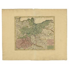
Antique Map of Upper Saxony in Germany by Tirion, circa 1740
By Isaak Tirion
Located in Langweer, NL
Antique map titled 'Nieuwe Kaart van de Opper Saxise Kreits (..).' Attractive detailed map showing Upper Saxony, Germany with Meissen, Thuringen, Anhalt, Brandenburg, Pommeren etc. S...
Category
18th Century Antique Maps
Materials
Paper
$453 Sale Price
20% Off
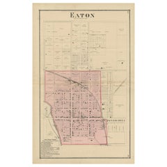
Antique Map of Eaton 'Ohio' by Titus, 1871
Located in Langweer, NL
Antique map titled 'Eaton'. Original antique map of Eaton, Ohio. This map originates from 'Atlas of Preble County Ohio' by C.O. Titus. Published 1871.
Category
Late 19th Century Antique Maps
Materials
Paper
$377 Sale Price
20% Off
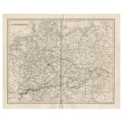
Antique Map of Germany by Balbi '1847'
Located in Langweer, NL
Antique map titled 'Allemagne'. Original antique map of Germany. This map originates from 'Abrégé de Géographie (..)' by Adrien Balbi. Published...
Category
Mid-19th Century Antique Maps
Materials
Paper
$141 Sale Price
20% Off
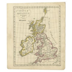
Antique Map of the United Kingdom and Ireland, circa 1825
Located in Langweer, NL
Antique map titled 'Insula Britannicae'. Old map of the United Kingdom and Ireland originating from 'Atlas der Oude Wereld'.
Artists and Engravers: Published by C. Ph. Funke and W. v...
Category
19th Century Antique Maps
Materials
Paper
$132 Sale Price
20% Off
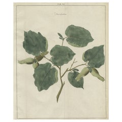
Antique Hand-Colored Print of the Common Hazel, 1758
Located in Langweer, NL
Antique print of the common hazel. Originates from 'Pomologia' by J. H. Knoop.
Artists and Engravers: Published by Johann Hermann Knoop (c.1700-1769).
Condition: Good, general ...
Category
18th Century Antique Maps
Materials
Paper
$311 Sale Price
20% Off
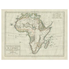
Antique Map of Africa with Mountain Ranges and other details
Located in Langweer, NL
Antique map titled 'Carte générale et Politique de l'Afrique'. Original antique map of Africa. Highlights numerous mountain ranges, lakes and rivers, regions, countries and places. P...
Category
Late 18th Century Antique Maps
Materials
Paper
$755 Sale Price
20% Off
Map of England and Surrounding Regions: Early 19th Century - 1802 Tardieu Atlas
Located in Langweer, NL
Title: Isles Britanniques. Troisieme Carte, Angleterre
Publication Details:
- **Atlas Title:** Nouvel Atlas Universel de Géographie Ancienne et Moderne
- **Purpose:** For the Nouve...
Category
Early 1800s Antique Maps
Materials
Paper
$359 Sale Price
20% Off
Bird’s-Eye View Map of Gallipoli: Fortified Ionian Gem by Mattheus Merian, 1688
Located in Langweer, NL
Bird’s-Eye View Map of Gallipoli: Fortified Ionian Gem by Mattheus Merian
Description:
This exquisitely detailed map of Gallipoli, crafted by the renowned engraver Mattheus Merian,...
Category
1680s German Antique Maps
Materials
Paper
The Hudson, by Wallace Bruce, 1st Ed
Located in valatie, NY
The Hudson by Wallace Bruce. New York: Bryant Literary Union, 1894. 1st Ed hardcover. Illustrated by Alfred Fredericks. Alfred Frederick's photo-engravings ...
Category
1890s American Antique Maps
Materials
Paper
Antique Engraving of the Islands Wanooa, Wateeoo, Mangeea, Toobouai, Cook, 1803
Located in Langweer, NL
Antique map South Pacific Islands, Polynesia. Originates from 'Reizen Rondom de Waereld door James Cook (..)'.
Artists and Engravers: Translated by J.D. Pasteur. Published by Hon...
Category
19th Century Antique Maps
Materials
Paper
$264 Sale Price
20% Off
Original Antique Engraved Map of the Russian Empire, 1778
Located in Langweer, NL
Description: Antique map titled 'A New and Correct Map of the Russian Empire'.
Original antique map of the Russian Empire. This map originates from Moore's 'New and Complete Coll...
Category
1770s Antique Maps
Materials
Paper
$519 Sale Price
20% Off
Detailed Antique Map of Southeast England, incl Warwickshire and Hampshire, 1690
Located in Langweer, NL
Antique map titled 'Orientalior districtus Regni Angliae (..)'.
Detailed map of southeast England encompassing the country from Lincolnshire and the Wash south and including Warw...
Category
1690s Antique Maps
Materials
Paper
$803 Sale Price
20% Off
Pl. XXVIII Ecuries, Chabat, c.1900
Located in Langweer, NL
Antique print titled 'Ecuries (Boulevard Beauséjour) Mr. Pierre Chabat Architecte'. This print depicts the design of buildings in France. Originates from 'La Brique et La Terre Cuite...
Category
20th Century Maps
Materials
Paper
$113 Sale Price
20% Off
Antique Map of Great Britain and Ireland by Brion de la Tour, 1766
Located in Langweer, NL
Antique map titled 'Les Isles Britanniques (..).'
Attractive map of Great Britain surrounded by an engraved border printed from a separate coppe...
Category
18th Century Antique Maps
Materials
Paper
$519 Sale Price
20% Off
Original Antique English County Map, Kent. J & C Walker, 1851
Located in St Annes, Lancashire
Great map of Kent
Original colour
By J & C Walker
Published by Longman, Rees, Orme, Brown & Co. 1851
Unframed.
Category
1850s English Other Antique Maps
Materials
Paper
Attractive Detailed Authentic Map Showing Bavaria, Germany and Austria, c.1740
Located in Langweer, NL
Antique map titled 'Nieuwe Kaart van de Beyersche en Oostenryksche Kreits (..).' Attractive detailed map showing Bavaria, Germany and Austria. Source unknown, to be determined.
Ar...
Category
18th Century Antique Maps
Materials
Paper
$566 Sale Price
20% Off
Antique Map of South East Asia, Australia and the Indian Ocean, 1726
By F. Valentijn
Located in Langweer, NL
Antique map titled 'Tabula Indiae Orientalis'.
Beautiful detailed map of Australia, Southeast Asia and the Indian Ocean. The map features a fine depiction of the outlines of the western two-thirds of Australia, based on the discoveries of explorers working for the Dutch East India Company (the VOC). These include Willem Jansz's discoveries in the Gulf of Carpentaria in 1606; the encounters of Dirk...
Category
Mid-18th Century Dutch Antique Maps
Materials
Paper
$6,803 Sale Price
20% Off
Antique Map of Germany with the Empire of Austria by Wyld '1845'
Located in Langweer, NL
Antique map titled 'The Confederated States of Germany with the Empire of Austria, and The Kingdoms of Prussia and Poland'. Original antique map of ...
Category
Mid-19th Century Antique Maps
Materials
Paper
$283 Sale Price
20% Off
Black Sea & Eastern Mediterranean Map: Eastern Roman Empire, Tardieu Atlas, 1802
Located in Langweer, NL
Antique Map with Title: "Partie Orientale de l'Empire Romain ou du Monde connu des Anciens"
Publication Details:
- **Atlas Title:** Nouvel Atlas Universel de Géographie Ancienne e...
Category
Early 1800s Antique Maps
Materials
Paper
$491 Sale Price
20% Off
Antique Map of Buru Island, Indonesia, c.1725
Located in Langweer, NL
Antique map titled 'Boero'. Original antique map of Buru island. With an inset of the lake on top of the inland mountain. This map originates from Valentyn's 'Oud en Nieuw Oost Indie...
Category
18th Century Antique Maps
Materials
Paper
$519 Sale Price
20% Off
Rare Map of the Philippines; Joseph Freewills Island & Mindanao South End, 1773
Located in Langweer, NL
Three charts on one sheet titled '1) A Dangerous Shoal 2) Joseph Freewills Island 3) The South End of Mindanao'.
It shows Captain Carteret's voyage: Saint George's Channel to Min...
Category
1770s Antique Maps
Materials
Paper
$226 Sale Price
20% Off
Guadeloupe and Dependencies: Mid-19th Century Map from France Pittoresque Series
Located in Langweer, NL
This map titled "Guadeloupe et Dépendances" is part of the France Pittoresque series and provides a detailed view of the island of Guadeloupe and its surrounding dependencies.
Features:
- The map shows the two main landmasses of Guadeloupe: Basse-Terre and Grande-Terre, separated by a narrow channel.
- Several smaller islands, including Marie-Galante, Les Saintes, and La Désirade, are also depicted.
- The main cities, towns, and geographical features are labeled, with emphasis on the island's mountain ranges and rivers, particularly on Basse-Terre.
- An inset at the bottom right provides a detailed plan of Pointe-à-Pitre, a major city and port on the island. The grid layout of the streets is clearly shown, reflecting urban planning of the time.
Artistic and Cartographic Details:
- The map uses clear linework to differentiate between the different islands and the sea, with significant natural features such as mountains and rivers carefully depicted.
- The map was drawn by Monin and engraved by Jacqueline and Barrière, whose names appear in the lower right corner.
- The scale in the lower left corner is measured in leagues, showing distances both by land and sea.
Historical Context:
- This map likely dates to the mid-19th century, a period when Guadeloupe was a key French colony in the Caribbean. Guadeloupe was known for its sugar and coffee plantations, which played a significant role in France's colonial economy.
- Maps like this were often used for administrative, military, and educational purposes to give a comprehensive view of France's overseas territories.
The map of Guadeloupe et Dépendances from the France Pittoresque series likely dates to the mid-19th century, around 1840 to 1860. This period corresponds to the height of French colonial influence in Guadeloupe, and the map's style, detailed urban planning, and cartographic techniques are consistent with maps produced in that era.
The specific publication date could be further narrowed down if the map was part of a known edition of the France Pittoresque atlas, but based on the cartographic style and historical context, 1840–1860 is a reasonable estimate.
Here are some relevant keywords people might use when searching for a map of Guadeloupe and its surrounding areas:
1. Guadeloupe map
2. Basse-Terre and Grande-Terre map
3. French Caribbean islands map...
Category
1850s Antique Maps
Materials
Paper
$113 Sale Price
20% Off
Antique Map of Vienne 'France' by V. Levasseur, 1854
Located in Langweer, NL
Antique map titled 'Dépt. de la Vienne'. Decorative antique map of the French Department of Vienne, with its capital of Poitiers and small engraved vignette of the battle of Poitiers...
Category
Mid-19th Century Antique Maps
Materials
Paper
$170 Sale Price
20% Off
Original Antique Engraving of the Creation of the World According to Mozes, 1725
Located in Langweer, NL
Antique map titled 'De Schepping der Wereldt volgens de Beschryving van Mozes' - This plate shows the creation of the world according to Moses. The upper depiction shows the world wi...
Category
18th Century Antique Maps
Materials
Paper
$623 Sale Price
20% Off
Map of the Kingdom of Württemberg, Oberamt Tettnang in Germany, circa 1885
Located in Langweer, NL
Administrative Map of the Kingdom of Württemberg, Oberamt Tettnang, circa 1885
This detailed antique map titled "Handkarte von dem Königl. Württ. Oberamt Tettnang" was created by G....
Category
1880s Antique Maps
Materials
Paper
Original Antique Map of England and Wales, with Decorative Cartouche
Located in Langweer, NL
Antique map titled 'England and Wales from the best Authorities'. Original antique map of England and Wales, with decorative cartouche. Engraved by T. Conder. Published circa 1790.
Category
Late 18th Century Antique Maps
Materials
Paper
$151 Sale Price
20% Off
Original Hand-Colored Antique County Map of Durham, England, 1804
Located in Langweer, NL
Antique county map of Durham first published c.1800. Villages, towns, and cities illustrated include Gateshead, South Shields, and Darlington.
C...
Category
Early 1800s Antique Maps
Materials
Paper
$307 Sale Price
20% Off
Antique Plan of the Siege of Grave by Guicciardini, c.1608
Located in Langweer, NL
Antique map titled 'Hic est situs oppidi Grauiae (..)'. Bird's eye view plan of Grave, The Netherlands, Holland. Showing the siege of Grave in the year 1602. Source unknown, to be de...
Category
17th Century Antique Maps
Materials
Paper
$453 Sale Price
20% Off
Antique Map of Sweden and Norway by Johnston, 1882
Located in Langweer, NL
Antique map titled 'Sweden & Norway (Scandinavia)'. Old map of Sweden and Norway, with inset map of Stockholm. This map originates from 'The Royal Atlas ...
Category
19th Century Antique Maps
Materials
Paper
$127 Sale Price
20% Off
Large Scale Map of Greece with Inset Map of Macedonia, c.1786
Located in Langweer, NL
Antique map titled 'Graeciae Antiquae'. Large scale map of Greece, extends south to the island of Cythera. Inset map shows details of Macedonia. Publis...
Category
18th Century Antique Maps
Materials
Paper
Old Bird's Eye View of the European Trading Posts at Sabi, Benin, Africa, 1748
Located in Langweer, NL
Antique print titled 'Vue des comtoirs Europeins de Xavier ou Sabi (..) - Gezigt der Europese Faktooryen, te Xavier of Sabi (..)'.
Bird's eye view of the European trading posts a...
Category
1740s Antique Maps
Materials
Paper
$264 Sale Price
20% Off
Pl. 494 Antique Print of Ship Structures by Archibald, c.1810
Located in Langweer, NL
Antique print titled 'Plate CCCCXCIV Ship-Building'. Old print depicting various ship building structures. This print originates from 'Encyclopedia Britannica'. Artists and Engravers...
Category
19th Century Antique Maps
Materials
Paper
$55 Sale Price
20% Off
Antique Map of Lower Silesia of The Famous Mapmaker Blaeu, c.1650
Located in Langweer, NL
Antique map titled 'Ducatus Silesiae Wolanus'. \
Antique map depicting lower Silesia with the cities of Wolow (Wohlau), Winsko (Winzig), Herrnstadt, Chobie (Koben), Lubin (Lüben), R...
Category
17th Century Antique Maps
Materials
Paper
$803 Sale Price
20% Off
Antique European War Folding Map, ‘circa 1915’
Located in Langweer, NL
Antique folding map of the European War (1914-1915) titled 'The Eastern Campaign '. From Petrograd to Berlin, geographically colored. Published on linen b...
Category
Early 20th Century Maps
Materials
Paper
$708 Sale Price
20% Off
Decorative Dutch Antique Map of North and South America, 1841
Located in Langweer, NL
Description: Antique map titled 'Amerika'. Small map of North and South America.
This map originates from the Dutch publication 'De Aarde, beschouwd in haren Natuurlijken Toestan...
Category
1840s Antique Maps
Materials
Paper
$330 Sale Price
20% Off
Antique Map of Germany by Lapie, 1842
Located in Langweer, NL
Antique map titled 'Carte de la Germanie Ancienne'. Map of Germany. This map originates from 'Atlas universel de géographie ancienne et moderne (..)' by...
Category
Mid-19th Century Antique Maps
Materials
Paper
$472 Sale Price
20% Off
Old Views of Cabo Santa Maria & Tierra del Fuego, Chile, 1749
Located in Langweer, NL
Antique print titled 'Kaap Sint Maria aan 't begin van de Straat Magellaan (..)'. Coastal views of Cabo Santa Maria and Tierra del Fuego on the Argent...
Category
18th Century Antique Maps
Materials
Paper
$179 Sale Price
30% Off
Antique Map of Eastern Mediterranean and Asia Minor by a Benedictine, c.1725
Located in Langweer, NL
Antique map titled 'Byzondere Afbeelding der Landschappen, van de Apostelen bevaren en doorwandelt om het Evangelium J. C. te Prediken.' Map of the lands travelled by the Apostles to...
Category
18th Century Antique Maps
Materials
Paper
$283 Sale Price
20% Off
Antique Map of Noord-Holland and the Island Texel in The Netherlands, c.1870
Located in Langweer, NL
Antique map titled 'De Provincie Noord-Holland'. Map of the province of Noord-Holland, the Netherlands. This map originates from 'F. C. Brugsma's Atlas van het Koninkrijk der Nederla...
Category
19th Century Antique Maps
Materials
Paper
$132 Sale Price
20% Off
Antique Map of the Diocese of Toul by Covens & Mortier, circa 1720
Located in Langweer, NL
Antique map titled 'Civitas Leucorum sive Pagus Tullensis'. Detailed map of the Diocese of Toul, France. Centered on the cities of Nancy and Toul and including Metz, Verdun, S. Dizie...
Category
Early 18th Century Antique Maps
Materials
Paper
$685 Sale Price
20% Off
Antique Map of the Mongol Empire, 1767
Located in Langweer, NL
Antique map titled 'The Moguls Empire divided into its principal governments'. Old map of India, Bangladesh, and parts of eastern China.
Artists and Engravers: Published in the G...
Category
18th Century Antique Maps
Materials
Paper
$97 Sale Price
20% Off
Antique Map of the West-Frisian Part of Independant Friesland by Halma, 1718
Located in Langweer, NL
Antique map Friesland titled 'Pars I Frisiae Liberae (..)'. Old map of Friesland, the Netherlands. This map depicts the West-Frisian part of independant Friesland. Originates from 'U...
Category
18th Century Antique Maps
Materials
Paper
Antique Map of France under the Reign of Philip II by Zannoni, 1765
Located in Langweer, NL
Antique map France titled 'Carte de l'accroissement du Domaine sous Philippe Auguste (..)'. Beautiful old map of France. This map originates from 'Atlas Historique de la France Ancie...
Category
18th Century Antique Maps
Materials
Paper
$139 Sale Price
20% Off
1839 Map of Karte Des "Russischen Reiches in Europa Und Asien" Ric.R0013
Located in Norton, MA
1839 map of Karte Des
"Russischen Reiches in Europa and Asien"
Ric.r013
Map of the European and Asian parts of Russian Empire. Karte der Russischen Reiches in Europa und Asien...
Category
19th Century Unknown Antique Maps
Materials
Paper
Antique View of Syracuse, Sicily, Italy, 1837
Located in Langweer, NL
Antique print titled 'Syracus'. View of Syracuse, Sicily, Italy. Originates from 'Meyers Universum'.
Artists and Engravers: Joseph Meyer (May 9, 1796 - June 27, 1856) was a Germa...
Category
1830s Antique Maps
Materials
Paper
Antique Map of the Sinai Peninsula, '1895'
Located in Langweer, NL
Antique map titled 'Peninsula of Sinaï'. Lithographed map of the Sinai Peninsula, a peninsula in Egypt, and the only part of the country located in Asia. It is situated between the M...
Category
Late 19th Century Antique Maps
Materials
Paper
$94 Sale Price
20% Off
Decorative Antique Sea Chart of Zeeland, a Province of the Netherlands, ca.1730
Located in Langweer, NL
Antique map titled 'Comitatus Zelandiae Tabula emendata a Frederico De Wit'.
Decorative sea chart of Zeeland, a province of the Netherlands. Although the title reads F. de Wit, thi...
Category
1730s Antique Maps
Materials
Paper
$1,086 Sale Price
20% Off
Antique Hand-colored Map of Brandenburg, Germany
Located in Langweer, NL
Antique map titled 'Marchionatus Brandenburgicus'. Original antique map of Brandenburg, with Königsberg and Stettin, Germany. Published by J. Janssonius, circ 1650.
Jan Janssonius ...
Category
Mid-17th Century Antique Maps
Materials
Paper
$396 Sale Price
20% Off
Original Decorative Antique Map of Prussia, 1628
Located in Langweer, NL
Antique map titled 'Prussia'. Original antique map of Prussia, a historically prominent German state that originated in 1525 with a duchy centered on th...
Category
1620s Antique Maps
Materials
Paper
$519 Sale Price
20% Off
Ancient Iberia: Hispania Map from Spruner-Menke Atlas Antiquus, 1880
Located in Langweer, NL
This map is titled "HISPANIA," indicating it is a historical map of ancient Spain.
It is an original antique map from the "Spruner-Menke Atlas Antiquus," a 19th-century historical a...
Category
1880s Antique Maps
Materials
Paper
$349 Sale Price
20% Off
Rare Old English Sea Chart of Part of Indonesia with Java, Madura and Bali, 1711
Located in Langweer, NL
Antique map titled 'A Large Draught of the East End of Java and Madura shewing the Streights of Bally.'
Rare early example of this working English Sea Chart of part of Indonesia ...
Category
1710s Antique Maps
Materials
Paper
$1,559 Sale Price
20% Off
Detailed Map of Southeast Asia From the Tip of Cambodia to Java, 1739
Located in Langweer, NL
Antique map titled 'Nieuwe kaart van de Sundasche Eilanden als Borneo, Sumatra en Groot Iava & c'.
Detailed map of Southeast Asia, extending from the tip of Cambodia to Java. Thi...
Category
1730s Antique Maps
Materials
Paper
$611 Sale Price
24% Off
Antique Bible Map of the Middle East by A. Schut, 1743
Located in Langweer, NL
Antique map titled 'De Gelegentheyt van 't Paradys en 't Landt Canaan'. Dutch Bible map covering the region between the Mediterranean and the Persian Gulf, ...
Category
Mid-18th Century Antique Maps
Materials
Paper
$519 Sale Price
20% Off
Decorative Early Hand-Colored Map of the Northeast of England, ca.1620
Located in Langweer, NL
Antique map titled 'Eboracum, Lincolnia, Derbia, Staffordia, Notinghamia, Lecestria, Rutlandia et Norfolcia'.
Decorative early map of the northeast of England, comprising the cou...
Category
1620s Antique Maps
Materials
Paper
$633 Sale Price
20% Off
Antique Map Showing the Religions Around the World by Johnston '1854'
Located in Langweer, NL
Antique map titled 'Moral & Statistical Chart showing the Geographical Distribution of Man According to Religious Belief'. Rare large-size thematic map on the distribution of religio...
Category
Mid-19th Century Antique Maps
Materials
Paper
$921 Sale Price
35% Off
Set of 4 Antique Maps of part of the United States of America
Located in Langweer, NL
Set of four individual antique maps of part of the United States. Published as part of a set of six individual maps.
These maps originate from Stielers Handatlas, published circa 1...
Category
Mid-19th Century Antique Maps
Materials
Paper
$706 Sale Price / set
35% Off
Antique Map of the Artois Region of France by Ortelius, 'circa 1590'
Located in Langweer, NL
Antique map titled 'Artesia'. Original antique map of the Artois region, France. Published by A. Ortelius, circa 1590.
Category
16th Century Antique Maps
Materials
Paper
$566 Sale Price
20% Off
Attractive Antique Hand-Coloured Map of South America, ca.1765
Located in Langweer, NL
Antique map titled 'Kaart van het Onderkoningschap van Peru zig uitstrekkende: over Chile, Paraguay en andere Spaansche Landen als ook van Brazil en verdere Bezittingen van Portugal ...
Category
1760s Antique Maps
Materials
Paper
$1,181 Sale Price
20% Off
Old Original Map of Chormandel & Malabar, India & Ceylon, Now Sri Lanka, 1726
Located in Langweer, NL
Antique map titled 'Nieuwe Kaart van Choromandel ende Malabar'.
Antique map depicting the southern part of India and the northern tip of Ceylon, Sri Lanka. This map originates from...
Category
1720s Antique Maps
Materials
Paper
$519 Sale Price
20% Off
Girona 1902: Geographic and Infrastructural Map of Catalonia’s Northern Province
Located in Langweer, NL
The map provided is of the province of Girona (in Catalan, Girona), located in the northeast of Spain, within the autonomous community of Catalonia, as of the year 1902. Here are the...
Category
Early 1900s Antique Maps
Materials
Paper
$368 Sale Price
20% Off
Recently Viewed
View AllMore Ways To Browse
Antique Wellington Chests
Antonio Cassi Ramelli
Archimede Seguso Birds
Art Deco Coasters
Art Deco Footballer
Art Deco Music Cabinet
Art Deco Waterfall Bedroom Furniture
Art Deco Waterfall Bedroom
Art Deco Whisky
Art Foulard
Art Nouveau Sunflower
Arts And Crafts Silver Coffee Pot
Asian Pink Bowl
Avesn Vase
Baccarat Carafe
Bakelite Bird
Bakelite Cocktail Picks
Bamboo Ikebana Vase
