18th Century Maps
to
1,513
1,845
17
1,864
26
1
1
2,929
2,257
475
3
290
34
10
126
10
37
9
2
5
4
3
3
1,851
19
11
3
1
157
45
43
38
26
1,864
1,864
1,864
21
13
12
11
11
Period: 18th Century
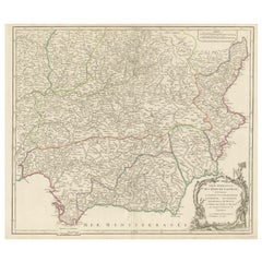
Detailed Engraving Highlighting Key Regions of Southern Spain and Castile, 1752
Located in Langweer, NL
Antique map titled 'Partie Meridionale Des Etats de Castille (..)'. Decorative and highly detailed map of the southern part of Castile, Spain, including a decorative cartouche. Publi...
Category
Antique 18th Century Maps
Materials
Paper
$623 Sale Price
20% Off
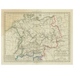
Historical Map of Ancient Germany (1787): Tribes and Territories by Mentele
Located in Langweer, NL
This antique map, titled "Carte Ancienne d'Allemagne," represents ancient Germany and surrounding regions. It was published by the well-known Parisian mapmakers and publishers Jean-Baptiste-Louis Clouet and Alexandre Aimé Vuillemin in the late 18th century, specifically in 1787.
The map covers the extensive geographical area of ancient Germany, highlighting various tribes and regions known at the time. Key features include:
1. **Geographical Boundaries**: The map outlines the territorial extents of ancient Germany, bordered by Gallia (France) to the west, Sarmatia (parts of Eastern Europe) to the east, and the Italian regions to the south. The northern boundary reaches the Oceanus Germanicus (North Sea) and the Sarmatian Sea (Baltic Sea).
2. **Tribal Regions**: It details numerous ancient Germanic...
Category
Antique 18th Century Maps
Materials
Paper
$340 Sale Price
20% Off
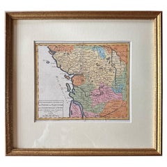
Original Antique Map of West Central France in Frame, 1748
Located in Langweer, NL
A nicely framed and hand-coloured decorative map titled "Gouvernemens Generaux De Poitou et De Saintonge" and engraved by M. Robert. This historical international map includes several specific locations, such as the Isle Dieu, Bretagne, Anjou, Touraine, Angoumois, Perigold, Saintonge, Mer de Gascogne (Bay of Biscay), Poitou, Aunis, Guienne, la Garonne Riviere (Garonne River), and Loudunois, as well as the Tour de Cordouan (Cordouan Lighthouse).
Featured towns on this map include Tonnay, Talmont, Loudun, Mortemer, Poitiers, Chalais, Riberac, Angoule, Marton, Blaye, and Monbrun.
This antique map represents the west-central region of France.
The theme of the atlas from which this map originates is the "Atlas Portatif Universel Et Militaire" by M. Robert. The source description indicates that this atlas is a portable, universal, and military collection...
Category
Antique 18th Century Maps
Materials
Paper
$274 Sale Price
20% Off
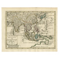
Authentic Old Map of Southeast Asia with Original Border Coloring, 1745
Located in Langweer, NL
Title: "Kaartje van Oost-Indien na de stelling van den Heer Guillaume de L'Isle"
Translates to "Map of the East-Indies based on the work of Mr. Guillaume de L'Isle." Guillaume de L...
Category
Antique 18th Century Maps
Materials
Paper
$415 Sale Price
20% Off
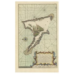
Antique Engraving of the Island Nzwani or Anzuany of the Comoros Islands, 1726
Located in Langweer, NL
Historical titles: Ansjouan, Ansuany, Anjouan, Anzuani, Anzuany
Country: Comoros
The map is taken from: 'Oud en Nieuw Oost-Indiën' van François Valentyn.
1) Ottens, Frederik (engraver / etcher)
2) Braam, J. van (publisher)
3) Linden, Gerard onder de (publisher)
Anjouan is an island to the north-west of Madagascar. It is one of the Comoros Islands. The Company made regular voyages from Cape of Good Hope to Madagascar, Anjouan and the east coast of Africa to take slaves. These slaves were used as labourers in the Cape colony and Batavia. Anjouan was also employed as a staging post; it supplied VOC ships...
Category
Antique 18th Century Maps
Materials
Paper
$283 Sale Price
20% Off
Original Antique Engrving of Chinese Tartary in the 18th Century, 1737
Located in Langweer, NL
The antique map titled " Ozieme feuille particuls de la Tartarie Chinoise, qui contient un pays dependant de la russie aucouchant de NIPTCHOU " translates to "Sixth sheet of parts of...
Category
Antique 18th Century Maps
Materials
Paper
$415 Sale Price
20% Off
Large Decorative Map of the Iberian Peninsula
Located in Langweer, NL
Antique map titled 'L'Espagne (..)'. Large map of the Iberian Peninsula, including the Balearic Islands and part of the north coast of Africa. The map is based on the cartography of ...
Category
Antique 18th Century Maps
Materials
Paper
$746 Sale Price
20% Off
Large Antique Map of Ancient Spain and Portugal, Published in circa 1760
Located in Langweer, NL
Antique map titled 'Hispania Antiqua (..)'. Map of ancient Spain and Portugal. Engraved by G. Delahaye. Published circa 1760, by or after Sanson & Vaugondy.
Category
Antique 18th Century Maps
Materials
Paper
$415 Sale Price
20% Off
Map of Asia Minor & Cyprus with Medallions – Weigel Engraving c.1720
Located in Langweer, NL
Map of Asia Minor & Cyprus with Medallions – Weigel Engraving c.1720
This finely engraved antique map, titled Asiae Peninsula sive Asia intra Taurum, presents an early 18th-century ...
Category
German Antique 18th Century Maps
Materials
Paper
$444 Sale Price
20% Off
Large Antique Plan of St. Philiou Bay or Sant Feliu Catalonia Spain, circa 1746
Located in Langweer, NL
This antique map is a black and white harbor chart, specifically a port plan of St. Philiou, which is likely associated with Sant Feliu, Spain. This historical cartographic piece ori...
Category
Antique 18th Century Maps
Materials
Paper
$510 Sale Price
20% Off
Antique Map of Northern Asia, with Russia, Korea and Northern Japan
Located in Langweer, NL
Antique map titled 'Nieuwe Kaart van Tartarie'. Map op Siberia and Chinese tartary. In the north Novaya Zemlya curls back to attach itself to the mainland by a narrow isthmus. In the...
Category
Antique 18th Century Maps
Materials
Paper
$760 Sale Price
34% Off
Antique Map of the Area centered on the Rhine River with original coloring
Located in Langweer, NL
Antique map titled 'Uterque Rheni Circulus Superior (..)'. Fine old color map of the area centered on the Rhine River, from Strassbourg to Wesel and Duisburg, Germany. The map also c...
Category
Antique 18th Century Maps
Materials
Paper
$557 Sale Price
20% Off
Antique Map of both sides of the Central Rhine River, Germany
Located in Langweer, NL
Antique map titled 'Mappa Geographica continens Archiepiscopatum et Electoratum Coloniensem (..)'. Decorative map of region on either side of the Central Rhine River, showing Dusseld...
Category
Antique 18th Century Maps
Materials
Paper
$510 Sale Price
20% Off
Antique Map of the Rhine centered on Cologne, Germany, with outline coloring
Located in Langweer, NL
Antique map titled 'Archiepsiscopatus et Electoratus Coloniensis (..)'. Original antique map of the Rhine river, centered on Cologne, Germany. The Rhine River cuts across this map fr...
Category
Antique 18th Century Maps
Materials
Paper
$453 Sale Price
20% Off
Antique Map of Wuxi and Huzhou in China, 1746
Located in Langweer, NL
Antique map titled 'Vusihyen. Hu Chew Fu'. Plans of Wuxi and Huzhou, China. Originates from Prévost's 'Histoire générale des voyages'.
Artists and Engravers: Antoine François Prévo...
Category
Antique 18th Century Maps
Materials
Paper
$141 Sale Price
20% Off
Plan of Hulst with its Forts and Outworks, Holland, War of Spanish Succession
Located in Langweer, NL
Antique map titled 'Plan of Hulst with its Forts and Outworks (..)' Plan of Hulst with its Forts and Outworks, Holland, War of Spanish Succession, 1729 - With details of the area including forts and outworks. The map features a very large and decorative legend naming specific forts and the direction of cannon fire...
Category
Antique 18th Century Maps
Materials
Paper
$321 Sale Price
20% Off
Antique Plan of Batavia in the Dutch East Indies or Nowadays Jakarta, Indonesia
Located in Langweer, NL
Rare plan of Batavia titled 'Batavia'. With 'IHS' monogram, symbolizing Jesus Christ. Source unknown, to be determined.
Artists and Enrgavers: Anonymous.
Condition: Very good,...
Category
Antique 18th Century Maps
Materials
Paper
$841 Sale Price
20% Off
Antique Map of Port Pallisers & Kersmis by Cook, 1784
Located in Langweer, NL
Antique map Kerguelen titled 'Sketch of Port Palliser on Kerguelen's Land (..)'. Antique map of Port Pallisers & Kersmis, Kerguelen or Desolation Islands. Originates from an edition ...
Category
Antique 18th Century Maps
Materials
Paper
$207 Sale Price
20% Off
Antique Map of Suffren Island by Cook, 1784
Located in Langweer, NL
Antique map titled 'View of Sulphur Island (..)'. Antique map and view of Suffren Island. Originates from an edition of Cook's Voyages.
Artists and Engravers: Published by Nicol, ...
Category
Antique 18th Century Maps
Materials
Paper
$141 Sale Price
20% Off
Antique Plan of the Harbour of Taloo by Cook, 1784
Located in Langweer, NL
Antique map titled 'Sketch of the Harbours on the North Side of Eimeo (..)'. Plan of the harbour of Taloo in the Island of Moorea, one of the Society Islands, French Polynesia. Origi...
Category
Antique 18th Century Maps
Materials
Paper
$179 Sale Price
20% Off
Antique Sea Chart of the Coast of Sumatra, Indonesia, circa 1775
Located in Langweer, NL
Antique map titled 'Carte de la Côte Occidentale de l'Isle Sumatra'. Sea chart of the part of the south-western coast of Sumatra with the Nassau (Nias) and Fortune isles.
Artists ...
Category
Antique 18th Century Maps
Materials
Paper
$510 Sale Price
20% Off
Antique Map of Alkmaar, City Know for Its Cheese Market, Netherlands, circa 1740
Located in Langweer, NL
Antique map titled 'Alkmaar'. Old map of the city of Alkmaar, the Netherlands. This map originates from 'Hedendaagsche Historie of Tegenwoordige staat van alle volkeren' by I. Tirion...
Category
Antique 18th Century Maps
Materials
Paper
$160 Sale Price
20% Off
Antique Plan of Ancient Syracuse, cicily, Italy, 1740
Located in Langweer, NL
Antique print titled 'Plan de l'Ancienne Ville de Syracuse'. Plan of ancient Syracuse, Sicily, Italy. Source unknown, to be determined.
Artists and Engravers: Anonymous.
Condit...
Category
Antique 18th Century Maps
Materials
Paper
$274 Sale Price
20% Off
Antique Map of Westergo in Friesland, 1791
Located in Langweer, NL
Antique map titled 'Westergo'. Map of the Westergo region, Friesland, the Netherlands. This map orginates from 'Schauplatz der fünf Theile der Welt'.
Artists and Engravers: Franz...
Category
Antique 18th Century Maps
Materials
Paper
Antique Plan of Batavia, Capital of the Dutch East Indies, by Van Der Aa, 1725
Located in Langweer, NL
Antique map titled 'Plan de Batavia'. (Plan of Batavia.) This plate shows a plan of the city of Batavia / Jakarta in Indonesia. With extensive legend, compass rose and scale. This pl...
Category
Antique 18th Century Maps
Materials
Paper
$538 Sale Price
20% Off
Antique Map of Suffren Island by Cook, c.1781
Located in Langweer, NL
Antique map titled 'View of Sulphur Island (..)'. Antique map and view of Suffren Island. Originates from an edition of Cook's Voyages.
Artists and Engravers: Engraved by Duff.
...
Category
Antique 18th Century Maps
Materials
Paper
$141 Sale Price
20% Off
Antique Print of Various Pears by Knoop, 1758
Located in Langweer, NL
Antique print depicting pear variaties including the Robine, Eyer-Peer, Kalmer-Peer, Rouselet, Orange Musque, Fondante Franse Canneel, Diamond Peer, Bergamot Suisse Longe, Hoe langer...
Category
Antique 18th Century Maps
Materials
Paper
$302 Sale Price
20% Off
Antique Map of the Waldeck Region of Germany by Homann Heirs, circa 1733
By Homann Heirs
Located in Langweer, NL
Antique map titled 'Waldecciae ac finitimorum Dominiorum (.)'. Map of the Waldeck region of Germany. With decorative cartouche depicting people mining, fishing and deer hunting with ...
Category
Antique 18th Century Maps
Materials
Paper
$311 Sale Price
20% Off
Antique Map of Vlaams-Brabant by Homann Heirs, c.1720
By Homann Heirs
Located in Langweer, NL
Antique map titled 'Ducatus Brabantiae Nova Tabula in qua (..).' Fully engraved copper plate map filled with details. Covers Flanders centered roughly on Ascot and delineating the wa...
Category
Antique 18th Century Maps
Materials
Paper
$396 Sale Price
20% Off
Antique Print of Various Pears by Knoop, 1758
Located in Langweer, NL
Antique print depicting pear variaties including the Besy de Chaumontel, Saint Germain, Foppen Peer, Poire de la Force, Winter Bergamot, Bergamotte d'Hyver, Colmar Incomparable, Gran...
Category
Antique 18th Century Maps
Materials
Paper
Antique Map of Turkey in Europe, c.1780
Located in Langweer, NL
Antique map titled 'Bowles's new pocket map of Turky in Europe divided into its Provinces'. Large map of Turkey in Europe. Source unknown, to be determined.
Artists and Engravers: Made by 'Thomas & Carington Bowles' after an anonymous artist. Thomas Bowles, born around 1712, was map publisher and seller in London...
Category
Antique 18th Century Maps
Materials
Paper
$340 Sale Price
20% Off
Antique Map of Southern India, the Maldives and Sri Lanka with Currents
Located in Langweer, NL
Antique map titled 'Carte de la Partie Inferieure De L'Inde En Deca Du Gange (..)'. Interesting map of Southern India, the Maldives and Sri Lanka. Includes a month by month charting ...
Category
Antique 18th Century Maps
Materials
Paper
$264 Sale Price
20% Off
Antique Map of Cap Providence, St. David's Cove and Surroundings
Located in Langweer, NL
Antique map titled 'Baye du Cap Upright (..)'. Eight charts on one sheet of Cap Providence, St. David's Cove, the Bay of the Island, Swallow's Haven, Puzzlin...
Category
Antique 18th Century Maps
Materials
Paper
$340 Sale Price
20% Off
Antique Map of Western Tartary, with Information from Kyrkov's Surveys
Located in Langweer, NL
Antique map titled 'Carte de la Tartarie Occidentale'. This map covers western Tartary with a focus on the region of present-day Mongolia. This map includes information from Kyrkov's...
Category
Antique 18th Century Maps
Materials
Paper
$292 Sale Price
20% Off
Antique Map Centered on Turkestan
Located in Langweer, NL
Antique map titled 'Carte de Karazm, Turkestan et Grande Bukarie'. Engraved map centered on Turkestan. Extends to include the Black and Caspian Seas, Uzbekistan, Tajikistan, Turkmeni...
Category
Antique 18th Century Maps
Materials
Paper
$321 Sale Price
20% Off
Antique Map of the West Coast of Africa, 1771
Located in Langweer, NL
Antique map titled 'Carte de la Guinee contenant les Isles du Cap Verd, le Senegal, la Cote de Guinee proprement dite, les Royaumes de Loango, Congo, Angola, et Benguela avec les Pay...
Category
Antique 18th Century Maps
Materials
Paper
$330 Sale Price
20% Off
Antique Map of the Vitim and Lena Rivers, Russia, 1768
By Prevost
Located in Langweer, NL
Antique map titled 'Carte du District de Witim et Phénomene (..)'. Map of the confluence of the Vitim and Lena rivers, and an illustration of atmospheric phenomena. This print origin...
Category
Antique 18th Century Maps
Materials
Paper
$226 Sale Price
20% Off
Attractive Small Map of the British Isles with Decorative Cartouche
Located in Langweer, NL
Antique map titled 'Isles Britaniques ou sont les Royaumes d'Angleterre, D'Escosse et d'Irlande'. Attractive small map of the British Isles with decorative cartouche. Published circa...
Category
Antique 18th Century Maps
Materials
Paper
$245 Sale Price
20% Off
Antique Map of Cordes Bay and Surroundings
Located in Langweer, NL
Antique map titled 'Baye et Havre de Cordes (..)'. Four maps on the one sheet of; Cordes Bay, Port Famine, Woods Pay, Port Gallant, Fortescue Bay, Chile based on the voyage of John B...
Category
Antique 18th Century Maps
Materials
Paper
$245 Sale Price
20% Off
Antique Map of New Ireland with 7 Coastal Profiles
Located in Langweer, NL
Antique print titled 'l'Isle St. Jean (..) - Cap St. George (..)'. Antique map of New Ireland, an island in the Bismarck Archipelago, New Guinea. Lying just north of New Britain, fro...
Category
Antique 18th Century Maps
Materials
Paper
$302 Sale Price
20% Off
Nicely Hand-Colored Antique Print of Various Apples, 1758
Located in Langweer, NL
Antique print depicting apple variaties including the Enkelste Griet, Witte Platte Appel, Bloem-Suir, Eyer-Appel, Brand-Appel, Heer-Appel, Pomme Rose, Rode Soete Jopen, Somer Striepe...
Category
Antique 18th Century Maps
Materials
Paper
$178 Sale Price
20% Off
Antique Map of England with Contemporary Hand Coloring
Located in Langweer, NL
Antique map titled 'l'Angleterre'. Original antique map of England, with original/contemporary hand coloring. Published by Crepy, circa 1767.
Category
Antique 18th Century Maps
Materials
Paper
$245 Sale Price
20% Off
Small Antique Map of England, Wales, Scotland and Ireland with Original Coloring
Located in Langweer, NL
Antique map titled 'Les Royaumes d'Angleterre d'Escosse et d'Irlande (..)'. A lovely, small map of England, Wales, Scotland and Ireland with a portion of the coastline of France and ...
Category
Antique 18th Century Maps
Materials
Paper
$434 Sale Price
20% Off
Antique Map of the British Isles, Insets of the Shetland Islands and Hebrides
Located in Langweer, NL
Antique map titled 'Great Britain and Ireland with ye Judges Circuits'. A scarce map of the British Isles, with inset maps of the Shetland Islands and The Hebrides. Large triangular ...
Category
Antique 18th Century Maps
Materials
Paper
$623 Sale Price
20% Off
Antique Map of the British Isles with Walls, Settlements and Other Features
Located in Langweer, NL
Antique map titled 'Insulae Britannicae'. Interesting map of Britain, Scotland, and Ireland. It shows a rudimentary outline of the islands according to the geography of the Roman Emp...
Category
Antique 18th Century Maps
Materials
Paper
$207 Sale Price
20% Off
Small Antique Map of England and Wales as It Was During the Heptarchy
Located in Langweer, NL
Antique map titled 'La Britannique dans sa Heptarchie Anglois Saxonique'. This little map shows England and Wales as it was during the Heptarchy, a phrase referring to the seven king...
Category
Antique 18th Century Maps
Materials
Paper
$274 Sale Price
20% Off
Interesting Small Map of the British Isles with Hand Coloring
Located in Langweer, NL
Antique map titled 'Insularum Britannicarum Tabula'. Interesting small map of the British Isles by Wells. This map originates from 'Oikumenes Periegesis, sive, Dionysii Geographia em...
Category
Antique 18th Century Maps
Materials
Paper
$359 Sale Price
20% Off
Antique Map of European Russia with Picture Frame Border
Located in Langweer, NL
Antique map titled 'La Moscovie Septentrionale (..)'. Decorative example of van der Aa's map of the northern part of European Russia. With the picture frame border, which appeared in...
Category
Antique 18th Century Maps
Materials
Paper
$359 Sale Price
20% Off
Large Antique Map England and Wales, with Part of the Coastlines
Located in Langweer, NL
Antique map titled 'A Map of England and Wales (..)'. Large antique map of England and Wales, with part of the continental and Irish coasts. Published J. Blair, circa 1779.
Category
Antique 18th Century Maps
Materials
Paper
$548 Sale Price
20% Off
Antique French Map of Asia Including China Indoneseia India, 1783
Located in Amsterdam, Noord Holland
Very nice map of Asia. 1783 Dedie au Roy.
Additional information:
Country of Manufacturing: Europe
Period: 18th century Qing (1661 - 1912)
Condition: Overall Condition B (Good Used)...
Category
European Antique 18th Century Maps
Materials
Paper
$648 Sale Price
20% Off
Antique Chart of the Friendly Islands or Nowadays Tonga, by Cook, 1784
By James Cook
Located in Langweer, NL
Antique print titled 'Chart of the Friendly Islands'. Antique map of the Friendly Islands depicting Rotterdam or Anamocka, Middelburg or Eaoowe and Amsterdam or Tongatabu. Originates...
Category
Antique 18th Century Maps
Materials
Paper
$321 Sale Price
20% Off
Antique Map of France by Tirion, c.1740
Located in Langweer, NL
Antique map titled 'Nieuwe Kaart van Frankryk.' - Attractive detailed map showing France. Title in block-style cartouche with a simple compass rose. Source unknown, to be determined....
Category
Antique 18th Century Maps
Materials
Paper
$425 Sale Price
20% Off
Original Antique Hand-Colored Print of Various Apples, 1758
Located in Langweer, NL
Antique print depicting apple variaties including Witte Kruid-Appel, Rode Somer-Calville, Rode Jopen, Witte Somer-Calville, Somer Citroen Appel, Somer Kroon, Engelse Carolyn, Roos-Ap...
Category
Antique 18th Century Maps
Materials
Paper
$302 Sale Price
20% Off
Antique Map of the Cocos or Keeling Islands, 1778
Located in Langweer, NL
Antique map titled 'Die Cocos Insel vom Capt. Wallis Bosawren. Die Verrather Islel von Capt. Wallis Keppel Genannt'. Also with French subtitles. Old map of the Cocos or Keeling Islan...
Category
Antique 18th Century Maps
Materials
Paper
$274 Sale Price
20% Off
Original Hand-Colored Antique Print of Various Apples, 1758
Located in Langweer, NL
Antique print depicting apple variaties including the Borsdorsser Appel, Goud-Reinet, Krappe-Kruin, Nelguin, Reinette de Montbron, Caracter Appel, Soete Veentje, Courtpendu Rouge, An...
Category
Antique 18th Century Maps
Materials
Paper
$302 Sale Price
20% Off
Antique Map of the Tunquin River and Bay, Siam, 1757
Located in Langweer, NL
Antique map titled ‘Carte du Cours de la Riviere de Tunquin Depuis Cacho jusqu'à la Mer’. Detailed map of the Tunquin River and Bay, extending north to Cacho, the capital city. Made ...
Category
Antique 18th Century Maps
Materials
Paper
$217 Sale Price
20% Off
Antique Print of the Old University Town Franeker in the Netherlands '1786'
Located in Langweer, NL
Antique print titled 'Franeker van den kant van Schalsum te zien'. Old print with a view on the city of Franeker, as seen from Schalsum. This print originates from 'Hedendaagsche His...
Category
Antique 18th Century Maps
Materials
Paper
$255 Sale Price
20% Off
Antique Plan of Plan of St. Julian's Harbour on the Coast of Patagonia
Located in Langweer, NL
Antique map titled 'Plan des Hafens St. Iulian auf der Küste von Patagonien'. Plan of St. Julian's Harbour on the Coast of Patagonia. This map originates from a German edition of 'Voyage around the World...
Category
Antique 18th Century Maps
Materials
Paper
$274 Sale Price
20% Off
Antique Print of the Battle of Camaret in the Nine Years War, Near Brest, France
Located in Langweer, NL
Antique print titled 'Plan of the Attack of Camaret Bay, on the Coast of Bretagne, thro which lies the Harbour of Brest'. Striking plan showing the details of the battle at the mouth of Cameret Bay. Includes a battle plan...
Category
Antique 18th Century Maps
Materials
Paper
$614 Sale Price
20% Off
Antique Print of the Churches of Cathay and Waranni in Ceylon 'Sri Lanka', 1703
Located in Langweer, NL
Antique print titled 'Cathay, Waranni'. Copper engraving of the churches of Cathay and Waranni, Sri Lanka (Ceylon). This print originates from 'A true and exact description of the mo...
Category
Antique 18th Century Maps
Materials
Paper
$179 Sale Price
20% Off
