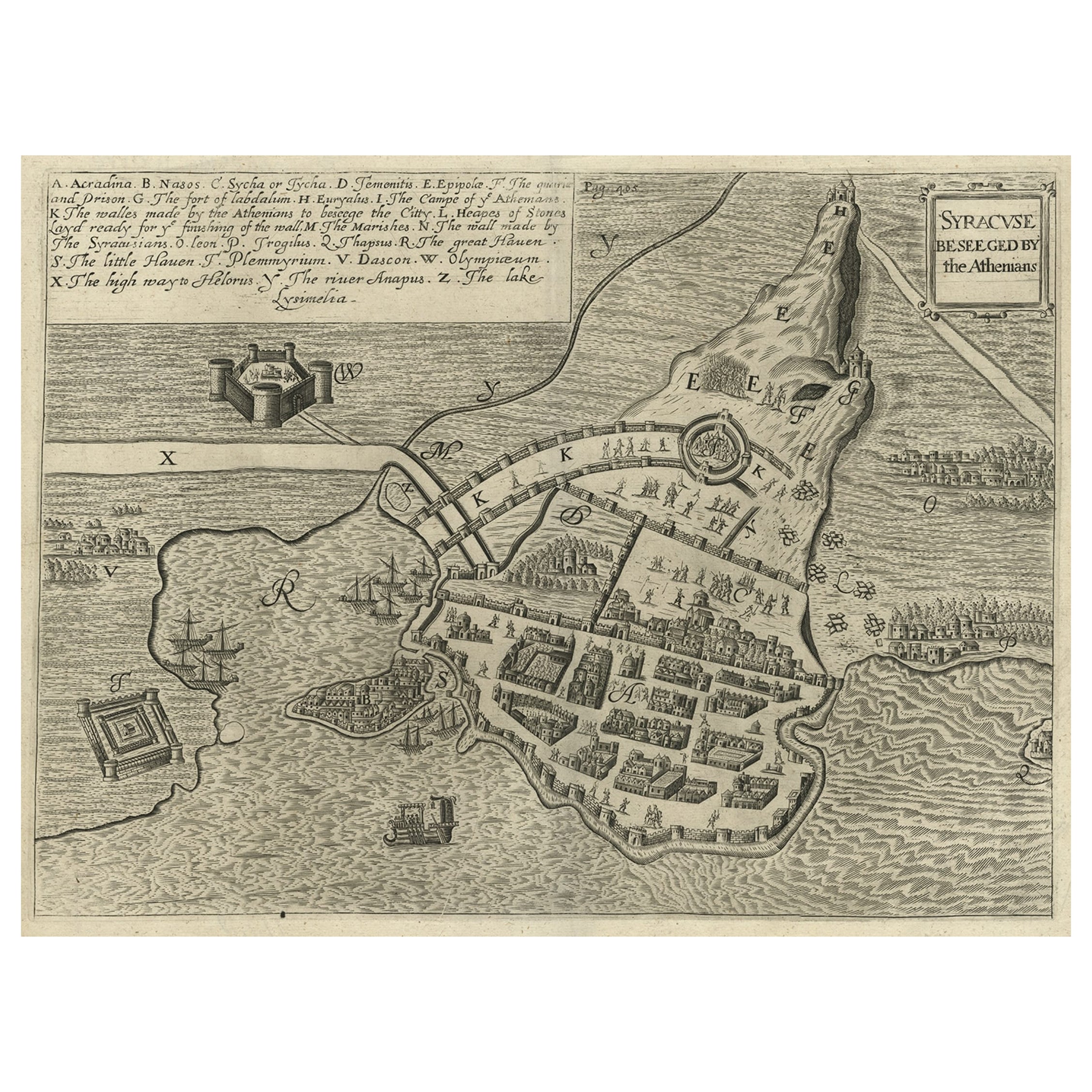
Items Similar to Antique Plan of Ancient Syracuse, cicily, Italy, 1740

Want more images or videos?
Request additional images or videos from the seller
1 of 6
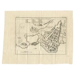
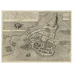
Antique Plan of Ancient Syracuse, cicily, Italy, 1740
About the Item
Antique print titled 'Plan de l'Ancienne Ville de Syracuse'. Plan of ancient Syracuse, Sicily, Italy. Source unknown, to be determined.
Artists and Engravers: Anonymous.
Condition: Very good, general age-related toning. Blank verso. Please study image carefully.
Date: circa 1740
Overall size: 32 x 25.5 cm.
Image size: 25 x 19 cm.
We sell original antique maps to collectors, historians, educators and interior decorators all over the world. Our collection includes a wide range of authentic antique maps from the 16th to the 20th centuries. Buying and collecting antique maps is a tradition that goes back hundreds of years. Antique maps have proved a richly rewarding investment over the past decade, thanks to a growing appreciation of their unique historical appeal. Today the decorative qualities of antique maps are widely recognized by interior designers who appreciate their beauty and design flexibility. Depending on the individual map, presentation, and context, a rare or antique map can be modern, traditional, abstract, figurative, serious or whimsical. We offer a wide range of authentic antique maps for any budget.
- Dimensions:Height: 10.04 in (25.5 cm)Width: 12.6 in (32 cm)Depth: 0 in (0.01 mm)
- Materials and Techniques:
- Period:
- Date of Manufacture:circa 1740
- Condition:Condition: Very good, general age-related toning. Blank verso. Please study image carefully.
- Seller Location:Langweer, NL
- Reference Number:
About the Seller
5.0
Platinum Seller
These expertly vetted sellers are 1stDibs' most experienced sellers and are rated highest by our customers.
Established in 2009
1stDibs seller since 2017
1,916 sales on 1stDibs
Typical response time: <1 hour
- ShippingRetrieving quote...Ships From: Langweer, Netherlands
- Return PolicyA return for this item may be initiated within 14 days of delivery.
More From This SellerView All
- Antique Plan of Ancient Syracuse, Plan of ancient Syracuse, Sicily, ItalyLocated in Langweer, NLAntique print titled 'Plan de l'Ancienne Ville de Syracuse'. Plan of ancient Syracuse, Sicily, Italy. This print originates from 'Histoire Universelle (..)'. Artists and Engravers...Category
Antique 18th Century Maps
MaterialsPaper
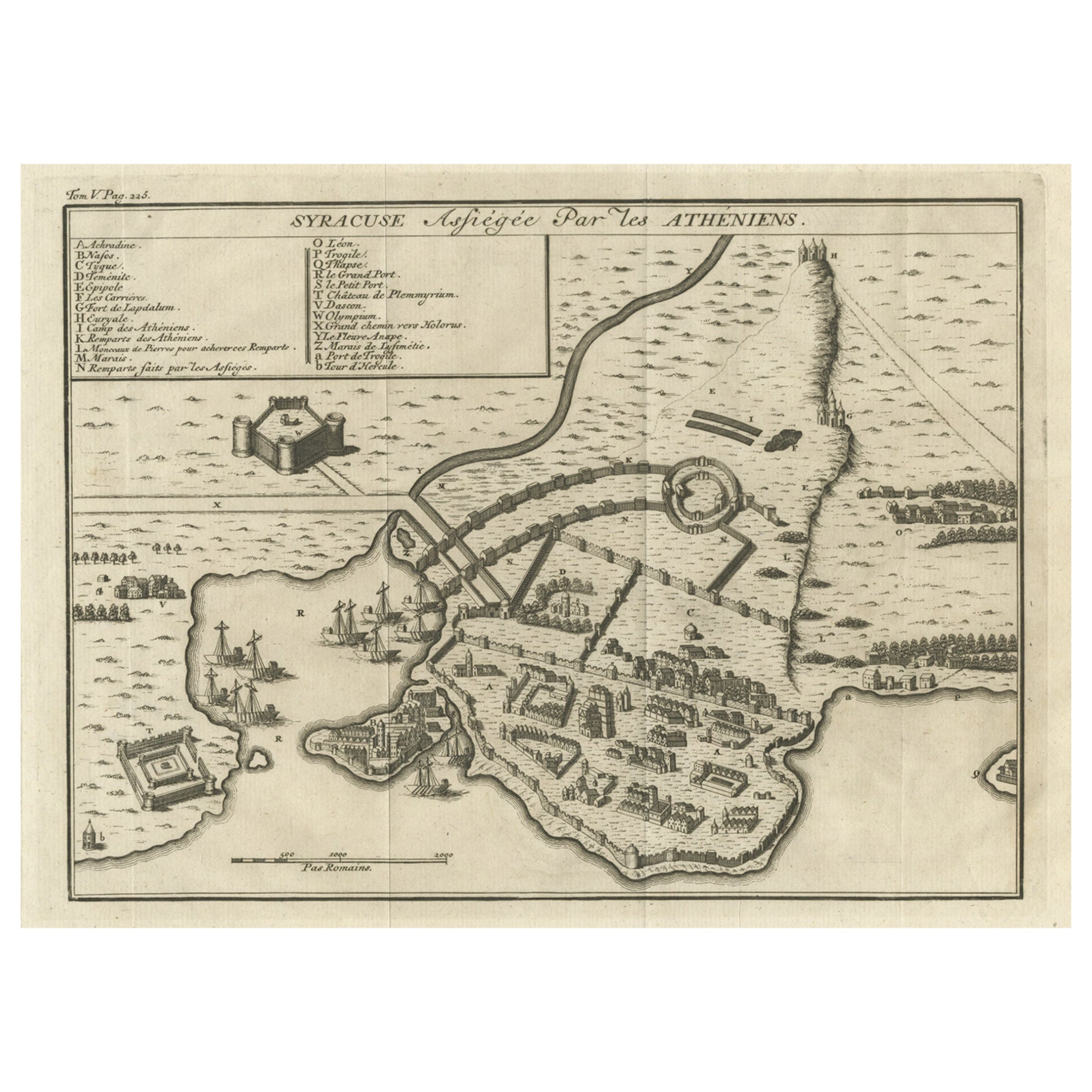
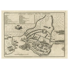
- Old Copper Engraving of the Siege of Syracuse, Sicily, Italy, Published, ca.1740Located in Langweer, NLAntique print titled 'Syracuse, Assiégée par les Atheniens'. Old print of the siege of Syracuse, Sicily, Italy. Source unknown, to be determined. The siege of Syracuse by the...Category
Antique 1740s Maps
MaterialsPaper
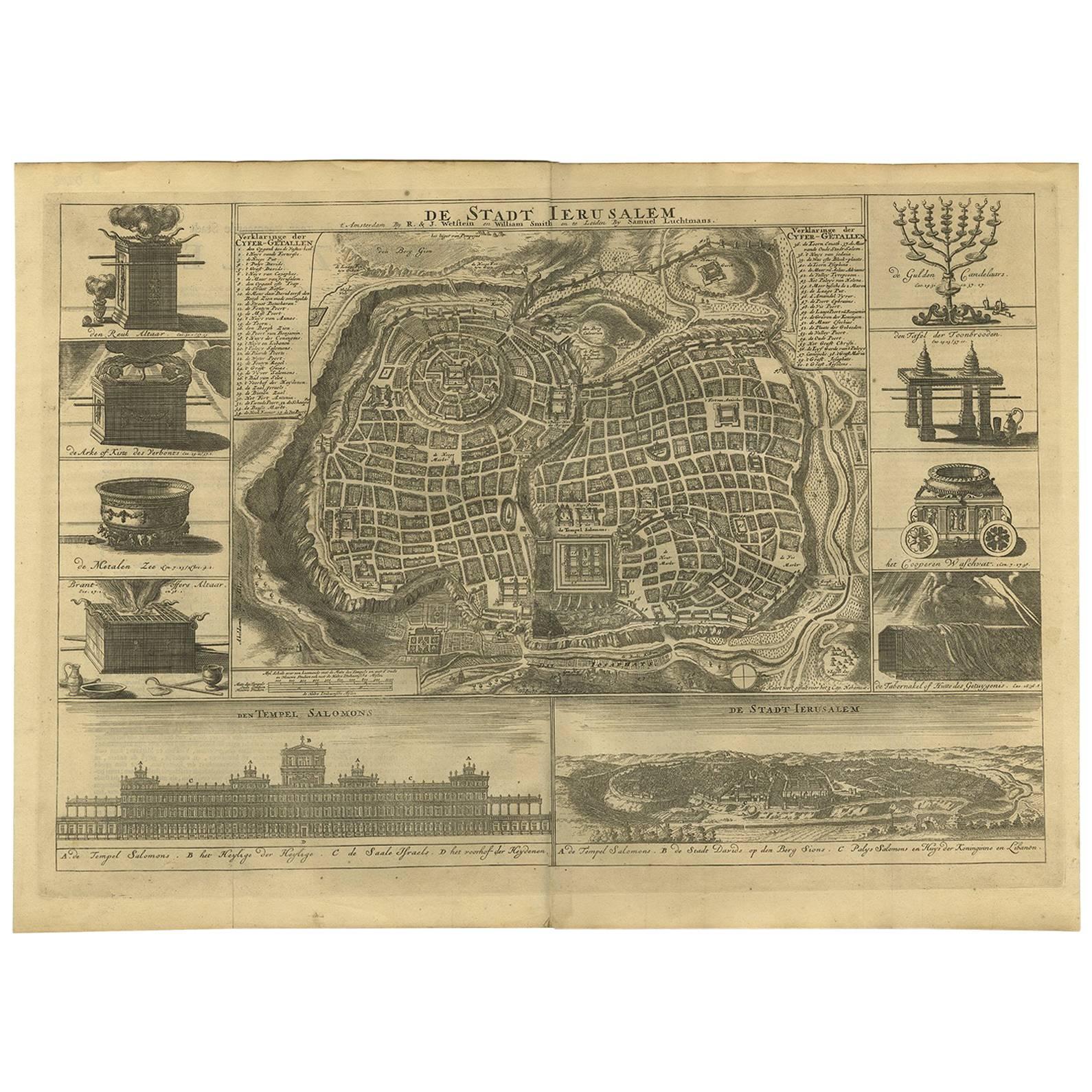
- Antique Bible Plan of Ancient Jerusalem, 1743Located in Langweer, NLThis plan originates from ‘Biblia Sacra, dat is, de H. Schriftuer van het Oude, en het Nieuwe Testament, naer de laetste Roomsche keure der gemeine Latijnsche overzettinge, in nederd...Category
Antique Mid-18th Century Maps
MaterialsPaper
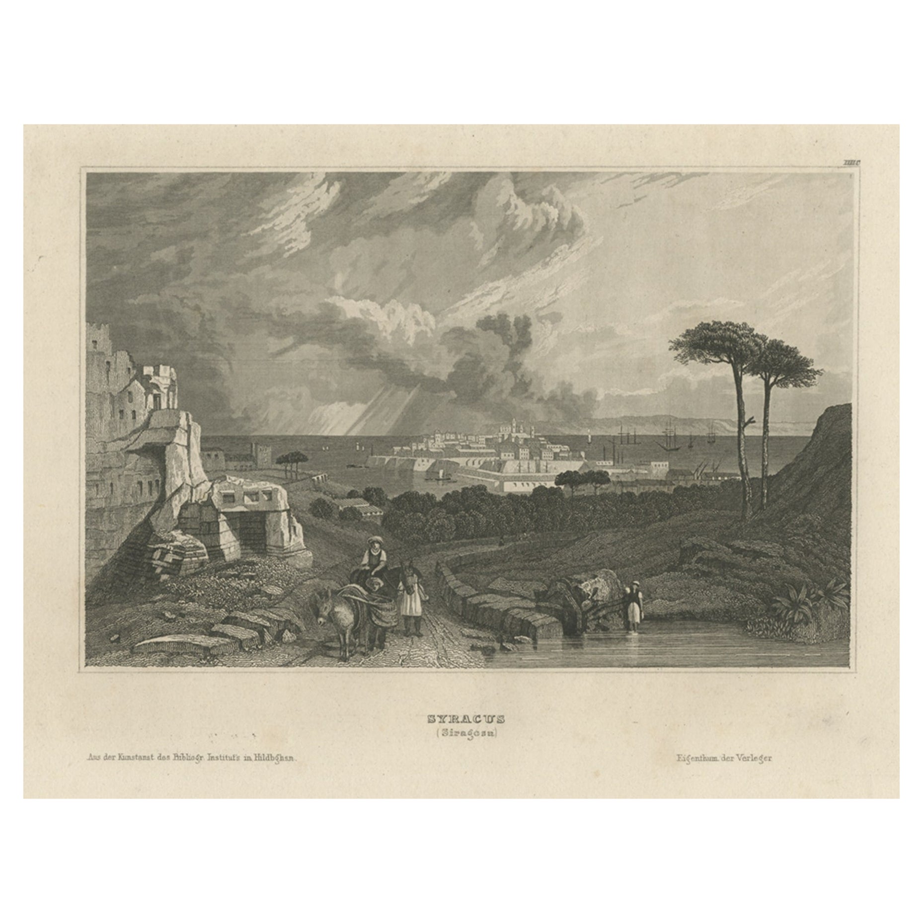
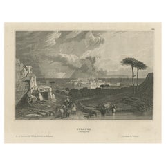
- Antique View of Syracuse, Sicily, Italy, 1837Located in Langweer, NLAntique print titled 'Syracus'. View of Syracuse, Sicily, Italy. Originates from 'Meyers Universum'. Artists and Engravers: Joseph Meyer (May 9, 1796 - June 27, 1856) was a Germa...Category
Antique 1830s Prints
MaterialsPaper
- Antique Map of the Siege of Syracuse, Sicilia, Italy, 'ca.1675'Located in Langweer, NLAntique map titled 'Syracus beseeged by the Athenians.' This original uncommon antique map shows the siege of Syracuse, Italy, by the Athenians. Key top left. The siege of Syracus...Category
Antique 1670s Maps
MaterialsPaper
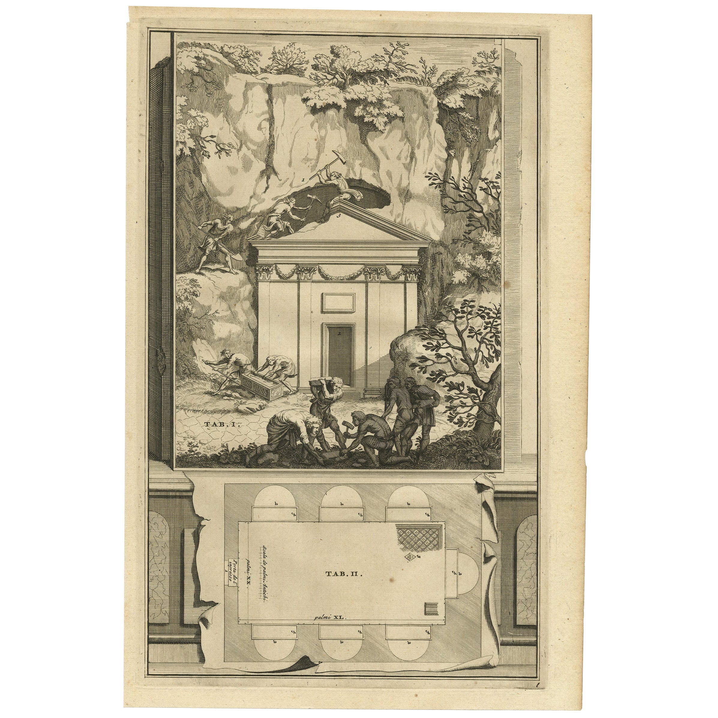
- Antique Print of An Ancient Roman Tomb and a Floor Plan in Rome, Italy, 1704Located in Langweer, NLDescription: Antique print, untitled. This original old antique print shows an ancient Roman tomb and a floor plan in Rome, Italy. This original old ant...Category
Antique Early 1700s Prints
MaterialsPaper


You May Also Like
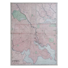
- Original Antique City Plan of Milwaukee, USA, 1894By Rand McNally & Co.Located in St Annes, LancashireFabulous colorful map of Milwaukee Original color By Rand, McNally & Co. Published, 1894 Unframed Free shipping.Category
Antique 1890s American Maps
MaterialsPaper
- Original Antique City Plan of Kansas City, USA. 1894By Rand McNally & Co.Located in St Annes, LancashireFabulous colorful map of Kansas City Original color By Rand, McNally & Co. Published, 1894 Unframed Slightly reduced bottom margin. Free shipping.Category
Antique 1890s American Maps
MaterialsPaper
- Large Original Antique City Plan of Baltimore, USA, 1894By Rand McNally & Co.Located in St Annes, LancashireFabulous colorful map of Baltimore Original color By Rand, McNally & Co. Published, 1894 Unframed Free shipping.Category
Antique 1890s American Maps
MaterialsPaper
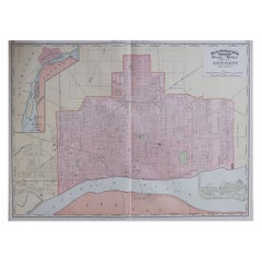
- Large Original Antique City Plan of Detroit, USA, 1894By Rand McNally & Co.Located in St Annes, LancashireFabulous colorful map of Detroit Original color By Rand, McNally & Co. Published, 1894 Unframed Free shipping.Category
Antique 1890s American Maps
MaterialsPaper
- Plan of Paris, France, by A. Vuillemin, Antique Map, 1845Located in Colorado Springs, COThis large and detailed plan of Paris was published by Alexandre Vuillemin in 1845. The map conveys a wonderful amount of information and is decorated throughout with pictorial vigne...Category
Antique 1840s American Maps
MaterialsPaper
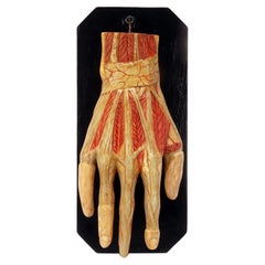
- Ancient anatomical model of the hand, Italy 1900.Located in Milan, ITAnatomical model for schools, educational use, depicting the hand swinging on a fork supported by a black lacquered wooden base. Made of plaster and finished entirely in colour. Ital...Category
Early 20th Century Italian Scientific Instruments
MaterialsPlaster, Wood


Recently Viewed
View AllMore Ways To Browse
Antique Map Argentina
Antique Map Of Argentina
John Acton
William Acton
Antique Map Norfolk
Antique Map Of Colombia
Antique Maps Hampshire
Antique Maps Norfolk
Colombia Map Antique
Durham Antique Map
Mozambique Antique Map
Nottinghamshire Antique Map
Patagonia Map
Antique Furniture Queensland
Gabon Antique Map
Minnesota Map
Moravia Map
Alabama Map