Items Similar to Plan of Hulst with its Forts and Outworks, Holland, War of Spanish Succession
Want more images or videos?
Request additional images or videos from the seller
1 of 6
Plan of Hulst with its Forts and Outworks, Holland, War of Spanish Succession
About the Item
Antique map titled 'Plan of Hulst with its Forts and Outworks (..)' Plan of Hulst with its Forts and Outworks, Holland, War of Spanish Succession, 1729 - With details of the area including forts and outworks. The map features a very large and decorative legend naming specific forts and the direction of cannon fire, cuts made by French and Dutch armies and a sluice. Source unknown, to be determined.
Artists and Engravers: Made by 'C. du bose' after an anonymous artist.
Condition: Good, given age. A few minor crinkles. Minor paper loss bottom right margin, not affecting image. Original folds as issued. General age-related toning and/or occasional minor defects from handling. Please study image carefully.
Date: c.1730
Overall size: 46 x 37 cm.
Image size: 43 x 33.5 cm.
We sell original antique maps to collectors, historians, educators and interior decorators all over the world. Our collection includes a wide range of authentic antique maps from the 16th to the 20th centuries. Buying and collecting antique maps is a tradition that goes back hundreds of years. Antique maps have proved a richly rewarding investment over the past decade, thanks to a growing appreciation of their unique historical appeal. Today the decorative qualities of antique maps are widely recognized by interior designers who appreciate their beauty and design flexibility. Depending on the individual map, presentation, and context, a rare or antique map can be modern, traditional, abstract, figurative, serious or whimsical. We offer a wide range of authentic antique maps for any budget.
- Dimensions:Height: 14.57 in (37 cm)Width: 18.12 in (46 cm)Depth: 0 in (0.01 mm)
- Materials and Techniques:
- Period:
- Date of Manufacture:circa 1730
- Condition:Condition: Good, given age. A few minor crinkles. Minor paper loss bottom right margin, not affecting image. Original folds as issued. General age-related toning and/or occasional minor defects from handling. Please study image carefully.
- Seller Location:Langweer, NL
- Reference Number:
About the Seller
5.0
Platinum Seller
These expertly vetted sellers are 1stDibs' most experienced sellers and are rated highest by our customers.
Established in 2009
1stDibs seller since 2017
1,929 sales on 1stDibs
Typical response time: <1 hour
- ShippingRetrieving quote...Ships From: Langweer, Netherlands
- Return PolicyA return for this item may be initiated within 14 days of delivery.
More From This SellerView All
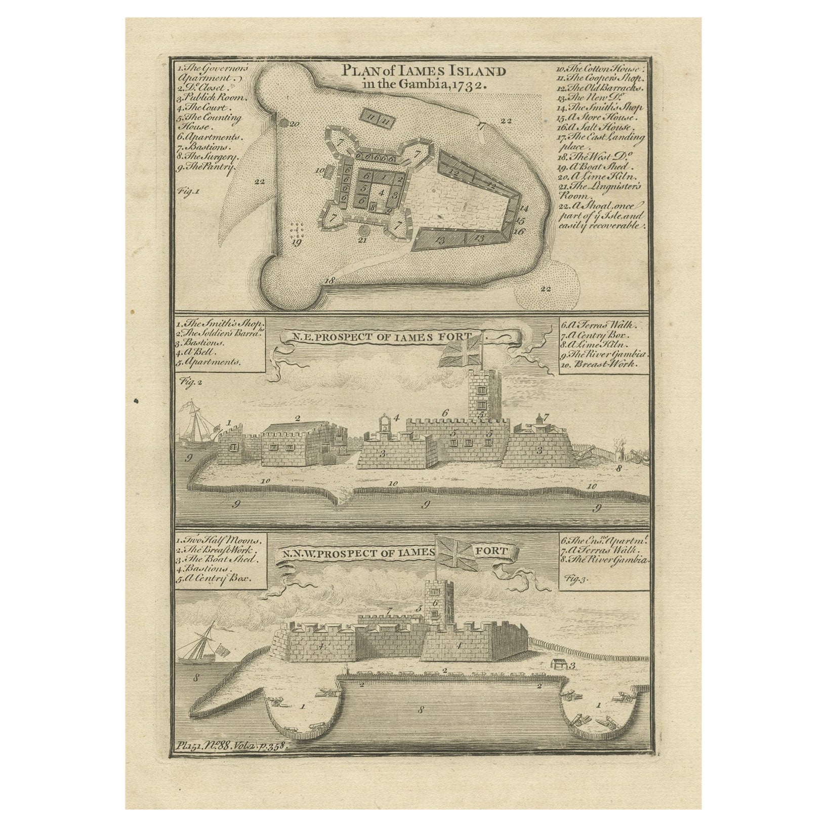
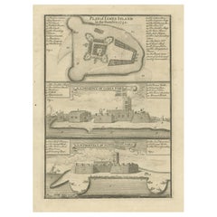
- Antique Print with a Plan of Kunta Kinteh Island and views of Fort James, GambiaLocated in Langweer, NLAntique print titled 'Plan of Iames Island in the Gambia - N.E. Prospect of Iames Fort - N.N.W. Prospect of Iames Fort'. Print with a plan of Kunta Kinteh I...Category
Antique Mid-18th Century Prints
MaterialsPaper
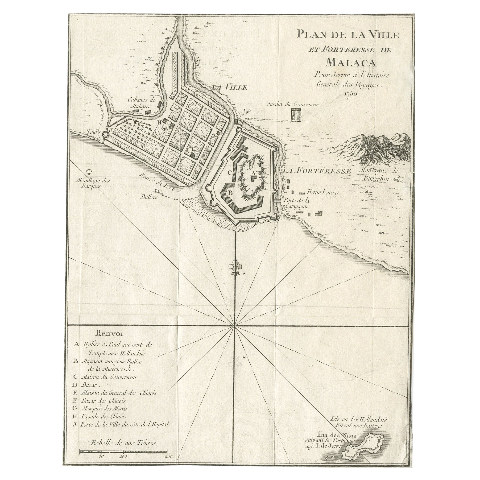
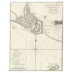
- Detailed Original Antique Plan of the City and Fort of Malacca, Malaysia, 1764Located in Langweer, NLDescription: Antique map titled 'Plan de la Ville et Forteresse de Malaca'. Detailed plan of the city and fort of Malacca on the southern Malay Peninsula, commanding the strategic st...Category
Antique 1760s Maps
MaterialsPaper
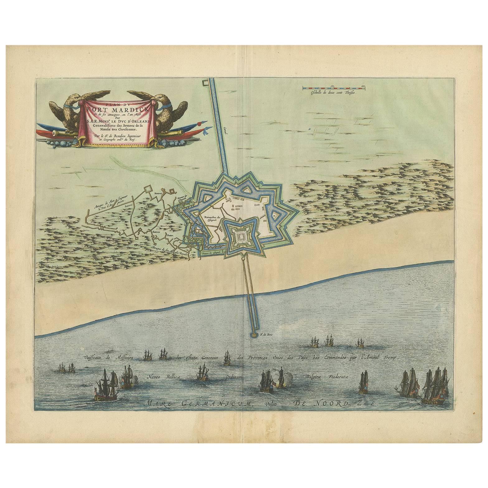
- Antique Plan of Fort Mardyck Mardijk, France by S. Beaulieu, 1649Located in Langweer, NLPlan of Fort Mardyck (Fort Mardijk) and surroundings by Sébastian de Pontault Beaulieu. Mardyck is a former commune in the Nord department in northern France. It is an associated com...Category
Antique Mid-17th Century Maps
MaterialsPaper
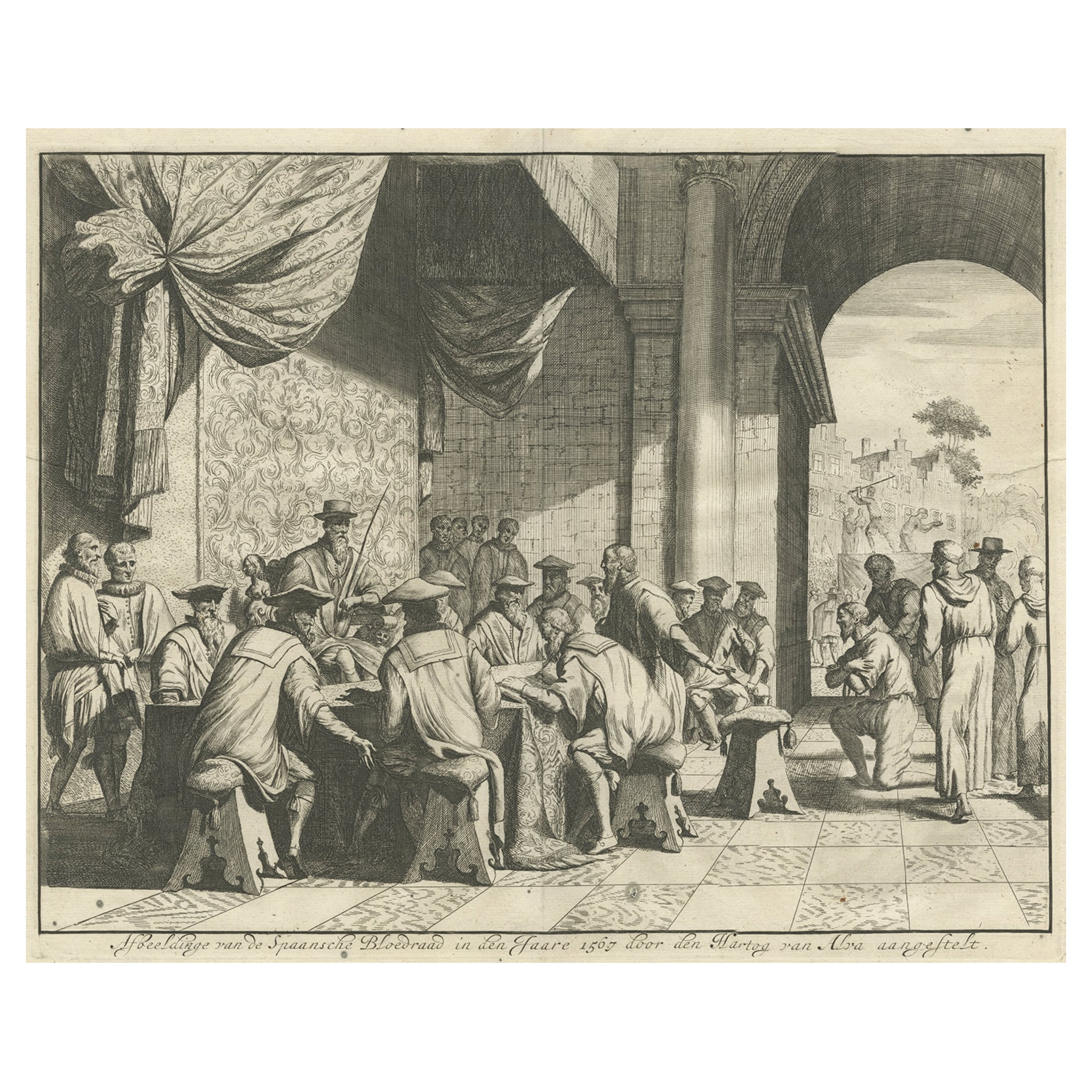
- The Iron Duke of Alva of Spain Planning the Atrocities Against the Dutch, c.1680Located in Langweer, NLAntique print titled ‘Afbeeldinge van de Spaansche Bloedraad in den Jaare 1567 door den Hartog van Alva aangestelt’. The Duke of Alva and his entourage seated at a table planning...Category
Antique 1680s Prints
MaterialsPaper
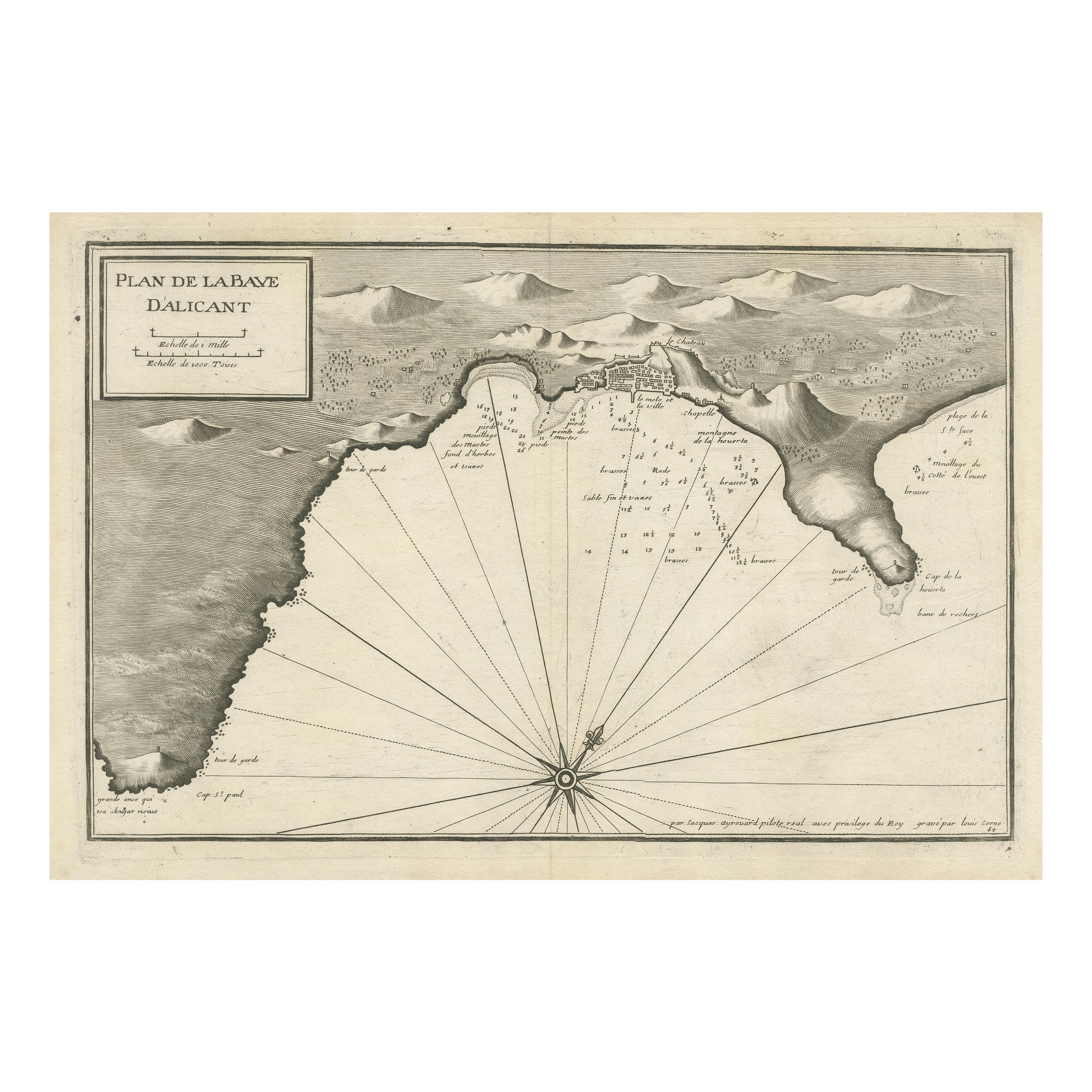
- Antique Plan of Alicante Bay, SpainLocated in Langweer, NLAntique map titled 'Plan de la Baye d'Alicant'. Black and white harbor chart /port plan of Alicante Bay, Spain. This map originates from the scarce atlas 'Recueil de Plusiers Plans d...Category
Antique Mid-18th Century Maps
MaterialsPaper
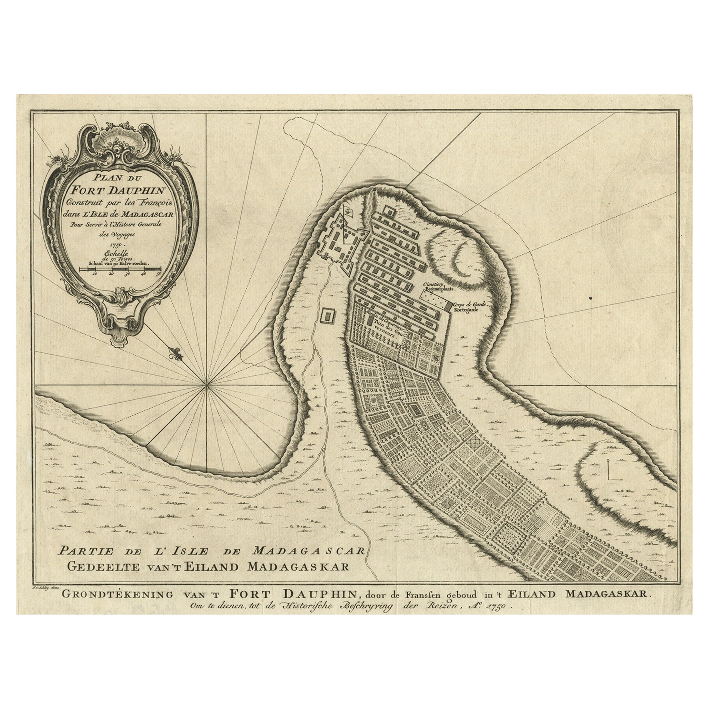
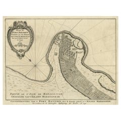
- Antique Plan of Fort Dauphin on Madagascar of the East Coast of Africa, 1756Located in Langweer, NLAntique map titled 'Plan du Fort Dauphin (..) - Grondtekening van 't Fort Dauphin'. Plan of Fort Dauphin on the island of Madagascar of the east coast of Africa. This print origi...Category
Antique 1750s Maps
MaterialsPaper


You May Also Like
- Spanish American War Commemorative Mirrored Hall RackLocated in West Palm Beach, FLSpanish American War Commemorative Mirrored Hall Rack USA, Circa 1900 An uncommon example of American historical memorabilia, This mirrored hall...Category
Early 20th Century American Victorian Hat Racks and Stands
MaterialsMetal
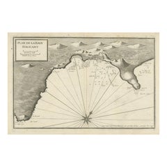
- Dutch Map and City Plan of La Roche-sur-Foron, France, 17th Century Hand ColoredBy Coenraet DeckerLocated in Alamo, CA"Rupes Allobrogum vulgo La Roche" by Dutch engraver Coenraet Decker (1650-1685) is from the atlas Theatrum Statuum Regiae Celestudinis Sabaudiae Ducis, published in 1682. This richly...Category
Antique Late 17th Century Dutch Maps
MaterialsPaper
- Books, Adolphus W. Ward's "The Electress Sophia and The Hanoverian Succession"Located in New York, NY1 volume. Folio. Bound in full green Morocco by Birdsall, with all edges gilt and ornate gilt on covers & spine, as well as a hand-colored frontispiece. Printed on fine paper. Profus...Category
Antique Early 1900s English Books
MaterialsLeather, Paper
- The Bennington Battle Monument Its Story and Its Meaning, circa 1925Located in valatie, NYThe Bennington Battle Monument Its Story and Its Meaning by John Spargo. The Tuttle Company, Rutland, Vermont, 1925. First Edition hardcover no dust jacket. An overview of the histor...Category
Vintage 1920s American Books
MaterialsPaper
- 1 Volume, Adolphus William Ward, The Electress Sophia and the Hanover SuccessionLocated in New York, NY1 Volume. Adolphus William Ward, The Electress Sophia and the Hanover Succession. Bound in full dark green morocco. Decorative gilt letter "S" and gilt tooling on covers. Raised band...Category
20th Century English Books
MaterialsLeather
- Colonial Williamsburg Its Buildings and GardensLocated in valatie, NYColonial Williamsburg : Its Buildings And Gardens; A Descriptive Tour Of The Restored Capital Of The British Colony Of Virginia. Distributed by Holt, Rinehart and Winston, New York, ...Category
Vintage 1970s American Books
MaterialsPaper


Recently Viewed
View AllMore Ways To Browse
Uruguay Antique Map
Nevada Antique Map
Arizona Map
Map Of Arizona
Panama Antique Map
Antique Iowa Map
Maltese Falcon
Map Of Dc
Map Of Iowa
Map Of Majorca
Metal Knight Statue
Antique Map Ontario
Antique Map Puzzle
Antique Maps Ontario
Antique Puerto Rico Map
Derbyshire Antique Map
Antique Furniture Oklahoma City
Antique Map Bermuda