16th Century Collectibles and Curiosities

to
89
177
39
216
7
4,376
6,576
13,268
2,710
3,491
4,590
3,011
515
314
588
736
463
893
863
890
656
567
118
62
51
18
16
102
30
19
14
11
216
216
216
3
2
1
1
1
Period: 16th Century
Mortar with handles. Bronze. 16th century.
Located in Madrid, ES
Mortar with handles. Bronze. 16th century. Bronze mortar with a tubular or cylindrical shape and a mouth flared on the outside in a curved moulding that has two handles with right a...
Category

Spanish Renaissance Antique 16th Century Collectibles and Curiosities

Materials

Bronze

Antique Map of North Africa by Ortelius, c.1580
Located in Langweer, NL
Antique map titled 'Barbariae et Biledulgerid Nova Descriptio'. Original antique map of North Africa. The map covers the regions of Barbaria and Biledulgerid, essentially the territo...
Category

Antique 16th Century Collectibles and Curiosities

Materials

Paper

Limburg Cityscape 1580: Historical Copper Engraving by Braun and Hogenberg
Located in Langweer, NL
Title: Limburgum Oppidum Galliae Belgicae, vulgo Lympurch, gallicè, Lembor Dr. Type: Print (Copper Engraving) Circa 1580 Technique: Colored Copper Engraving Medium: Handmade Paper S...
Category

Antique 16th Century Collectibles and Curiosities

Materials

Paper

1574 Sebastian Münster Woodcut Map of Europe: Early View of the Continent
Located in Langweer, NL
Title: Early Woodcut Map of Europe from Münster's Cosmographia, 1574 This is an original early woodcut map of Europe by the famed cartographer Sebastian Münster, printed in 1574 by ...
Category

Antique 16th Century Collectibles and Curiosities

Materials

Paper

16th Century Antique Map of Ven Framed in Gold
Located in Haddonfield, NJ
Ven (older Swedish spelling Hven), is a Swedish island in the Öresund strait laying between Skåne, Sweden and Zealand and Denmark. The island was historically under Danish rule. Dani...
Category

Danish Baroque Antique 16th Century Collectibles and Curiosities

Materials

Wood, Paper

Rare and Interesting Small Antique Woodcut Map of the Mediterranean, 1568
Located in Langweer, NL
Very rare untitled antique woodcut map showing the region of the missionary journeys of Apostle Paul. It shows the Mediterranean with Greece, Asia Minor (Turkey), Northern Africa, So...
Category

Antique 16th Century Collectibles and Curiosities

Materials

Paper

Mercator's Ptolemaic map of Taprobana, (Ceylon) Sri Lanka
Located in Langweer, NL
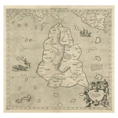
Antique map titled 'Asiae XII Tab'. Mercator's Ptolemaic map of Taprobana. The map shows Ptolemy's erroneous location of the island of Sri Lanka near the equator, with a bit of India...
Category

Antique 16th Century Collectibles and Curiosities

Materials

Paper

Coloured Antique Map of Sicily, Sardinia, Corfu, Elba, Malta and Zerbi (Jerba)
Located in Langweer, NL
Antique map titled 'Insularum Aliquot Maris Mediterranei Descriptio'. A very attractive example of Ortelius' map combining, on one page, maps of the islands of Sicily, Sardinia, Corfu, Elba, Malta and Zerbi (Jerba, off the coast of Tunisia.) The maps detail fortifications on the islands and other major features. (Jerba, for instance, is shown connected to the mainland by a causeway.) The waters are attractively engraved and are sailed by ships. A shipwreck, north of Malta, indicates the point at which St. Paul is thought to have shipwrecked. Volcanoes are indicated in the Sicily map...
Category

Antique 16th Century Collectibles and Curiosities

Materials

Paper

Antique Hand-Coloured Map of India, Sri Lanka, Maldives, ca.1599
Located in Langweer, NL
Title: Tabula Asiae XI - 1599 Very old and decorative map of India, Sri Lanka and the Maledives. Put this map in a frame on the wall and amaze your visitors. This original engravi...
Category

Antique 16th Century Collectibles and Curiosities

Materials

Paper

Mercator's Ptolemaic Map of the Holy Land, Cyprus and Syria, circa 1580
Located in Langweer, NL
Antique map titled 'Asiae IIII Tab'. Beautiful map of Mercator's Ptolemaic map of the Holy Land, Cyprus, Syria, etc. Originates from Mercator's 'Geograph...
Category

Antique 16th Century Collectibles and Curiosities

Materials

Paper

Arcimboldo by Roland Barthes (Book)
Located in North Yorkshire, GB
A beautifully produced book by Franco Maria Ricci, one of a limited edition of 3,000 numbered copies, this being 388. 175 pages with tipped in color plates with additional drawings and sketches, the text is in English. Arcimboldo has become best known for his portraits of human heads made up from vegetables, plants, fruits, sea creatures and tree roots, which were greatly admired by his contemporaries and remain of great fascination to this day. each was carefully constructed and as can be seen with the main image, the Librarian...
Category

Antique 16th Century Collectibles and Curiosities

Materials

Paper

Sebastian Münster's 16th Century Map of the British Isles, ca.1590
Located in Langweer, NL
GREAT BRITAIN -- "ENGELLANDT mit dem anstossenden Reich Schottlandt so vorzeiten Albion und Britannia haben geheissen". (Basel, c. 1590). Partly handcolored woodcut double-page map from S. Munster's 'Cosmographey'. 330 x 408 mm. (Lower margin cut short (touching the line), tiny hole in upper margin, sl. foxed/browned, lower right corner a bit thumbed). Sebastian Münster's 16th Century Map of the British Isles from 'Cosmographia Universalis...
Category

Antique 16th Century Collectibles and Curiosities

Materials

Paper

Rare and Very Old Antique Map of South East Asia, Published circa 1574
Located in Langweer, NL
A very fine impression of this map of the Malay Peninsula, Sumatra, Java, with Singapore denoted as 'Cinca Pula'. Highly distorted and inaccurate map by Girolamo Ruscelli after J...
Category

Antique 16th Century Collectibles and Curiosities

Materials

Paper

Ancient Course of the Ganges: A First Ptolemaic Map of India by Mercator, c.1584
Located in Langweer, NL
This remarkable map, titled "Asiae X Tab:", is a significant historical artifact that represents the convergence of knowledge and craftsmanship from two of the most esteemed figures in the history of geography and cartography. Created by Gerard Mercator and based on the geographical insights of Claudius Ptolemy, this map is part of the rare first issue published in Brussels in 1578. The map itself meticulously delineates the region between the Indus and Ganges rivers, an area of immense historical and geographical importance. It is an excellent representation of Ptolemy's second-century geographical data, which was fundamental in shaping the modern principles of mapmaking. Mercator, renowned for his precision and dedication to adhering closely to Ptolemy's original intentions, showcases this commitment through the detailed depiction of this significant Asian landscape. This edition stands out not only for its historical accuracy but also for its artistic execution. Gerard Mercator, who was also an innovator in the use of the italic hand for map lettering, first introduced this style in his "Literarum latinarum" in 1540. The use of italics in this map enhances its legibility and aesthetic appeal, which became a hallmark of the finest sixteenth and seventeenth-century Dutch maps, largely attributed to Mercator’s influence. The map measures 13 ½ x 18 inches and features fine hand coloring, which has been preserved in almost excellent condition alttough there some browning due to age. As a splendid example of the first issue from Mercator’s definitive edition of Ptolemy’s "Geographia", it not only serves as a testament to the rich history of geographical exploration but also stands as a beacon of the enduring legacy of its makers, shaping the future of cartographic design and precision. The map "Asiae X Tab:", focusing on the region between the Indus and Ganges rivers, highlights several areas and cities of historical and geographical importance that are likely of interest to scholars, historians, and collectors. Here are key locations depicted on the map: 1. **Indus River**: As one of the major rivers of Asia and a cradle of ancient civilizations like the Indus Valley Civilization, the Indus River holds significant historical importance. 2. **Ganges River**: Another crucial river not just for its cultural and religious significance in India, but also as a vital geographic feature in ancient and medieval maps...
Category

Antique 16th Century Collectibles and Curiosities

Materials

Paper

Bird’s-Eye View of Basel from Braun & Hogenberg’s Civitates Orbis Terrarum, 1575
Located in Langweer, NL
Bird’s-Eye View of Basel from Braun & Hogenberg’s "Civitates Orbis Terrarum" (Circa 1572-1617) This highly detailed map of Basel is a bird's-eye view, originally based on Sebastian Münster’s map...
Category

Antique 16th Century Collectibles and Curiosities

Materials

Paper

Disegno del Doni; Partito in più ragionamenti, ..scoltura e pittura
Located in Middletown, NY
FIRST and ONLY EDITION Doni, Anton Francesco Disegno del Doni; Partito in più ragionamenti, ne quali si tratta della scoltura et pittura .... Venice: Gabriel Giolito Di Ferrari, 15...
Category

English Antique 16th Century Collectibles and Curiosities

Materials

Leather, Paper

Antique Map of the Region of Boulogne and Peronne, France 'C.1590'
Located in Langweer, NL
Antique map titled 'Caletensium et Bononiensium (..)'. Two detailed regional maps on one sheet. The first map shows Belgian and French Coastal region, from Estaples to Gruerlinge...
Category

Antique 16th Century Collectibles and Curiosities

Materials

Paper

Book.Neu eröffnete Mahometanische Moschea.First German Translation of Quran 1703
Located in CADALSO, ES
Absolutly rare to find. First German Translation of the Quran from 1703 Author: NERRETER, DAVID. The book was rebound around 1900.
Category

German Baroque Antique 16th Century Collectibles and Curiosities

Materials

Paper

Old Ptolemaic Map of the Region Between the Persian Gulf and Caspian Sea, 1598
Located in Langweer, NL
"Tabula Asiae V", Ptolemy/Ruscelli Subject: Persia - Iran Period: 1598 (published) Publication: Geografia di Claudio Tolomeo Allessadrino… Claudius Ptolemy was a mathematician, ast...
Category

Antique 16th Century Collectibles and Curiosities

Materials

Paper

Gothic Period Carved Stone Statue of Saint Nicholas
Located in Atlanta, GA
A wonderful Gothic period hand carved stone statue of Saint Nicholas from the Avignon area of France. The now headless Saint Nicholas holds his staff an...
Category

French Antique 16th Century Collectibles and Curiosities

Materials

Stone

Antique Map of Spain including the Balearic Islands
Located in Langweer, NL
Antique map titled 'Hispania Nova Tabula'. Ruscelli's map of Spain, including the Balearic Islands. This map originates from 'Espositione & introduttioni universali di Gir. Ruscelli sopra tutta la Geografia di Tolomeo (..)' published by Girolamo Ruscelli, 1561. Girolamo Ruscelli (1500-1566) was a cartographer, humanist, and scholar from Tuscany. Ruscelli was a prominent writer and editor in his time, writing about a wide variety of topics including the works of Giovanni Boccaccio and Francesco Petrarch, Italian language, Italian poetry, medicine, alchemy, and militia. One of his most notable works was a translation of Ptolemy’s Geographia...
Category

Antique 16th Century Collectibles and Curiosities

Materials

Paper

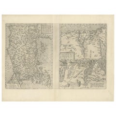
Three Antique Maps on One Folio: Turkey, Northern Egypt, and Ancient Carthage
Located in Langweer, NL
The map consists of three distinct sections on a single folio sheet: 1. **Map of Turkey**: - Orientation: The map is oriented with the east at the top, which is a common practic...
Category

Antique 16th Century Collectibles and Curiosities

Materials

Paper

Il pastor fido, tragicommedia pastorale - by G. B. Guarini - 1597
Located in Middletown, NY
Guarini, Giovanni Battista Il pastor fido; Tragicomedia pastorale Tours: Giametto Metaieri, 1592 12mo5 1/2 x 3 inches (140 x 76 mm); 146 pp. including a sonnet in French by R. Briss...
Category

European Antique 16th Century Collectibles and Curiosities

Materials

Gold Leaf

Late 16th Century Sheet with Copper Engravings of India, Pakistan, etc, 1598
Located in Langweer, NL
One sheet with two engraved maps, one on each site, and text in Italian. Late 16th century copper engravings in great condition, considering its age. "Tavola Decima Dell'Asia" - Tabula Asiae X" Plate X (10). Pakistan, Cashmir, Bangla Desh, North-India...
Category

Antique 16th Century Collectibles and Curiosities

Materials

Paper

Rare Original 16th Century Antique Map of Greece, 1598
Located in Langweer, NL
Beautiful and rare antique map of Greece with Albania, Mecedonia, Romania, Dalmatia and the peninsula of Salento to the Golf of Taranto. Also clearly shown the islands of the Aegaian...
Category

Antique 16th Century Collectibles and Curiosities

Materials

Paper

Old Antique Map of the Province of Friesland, the Netherlands, c.1580
Located in Langweer, NL
Antique map titled 'Frisia Occidentalis'. Old map of the province of Friesland, the Netherlands. This map is also known as the 'Pauwenkaart' ('peacock map'), referring to the peacock next to the inset map. Based on a manuscript map...
Category

Antique 16th Century Collectibles and Curiosities

Materials

Paper

Raising of Lazarus with Saint Roch and two donors. Oil on panel. 16th century
Located in Madrid, ES
Raising of Lazarus with Saint Roch and two donors. Oil on panel. Castilian School, 16th century. Oil on panel depicting an interior scene with semicircular arches and Ionic capital...
Category

Spanish Renaissance Antique 16th Century Collectibles and Curiosities

Materials

Other

Saint Anthony with the Child Jesus, Wood, Mechelen School, 16th Century
Located in Madrid, ES
Saint Anthony with the Child Jesus. Wood. Mechelen School, 16th century. Sculpture in carved wood worked, as was usual in that center, on the front because it was designed to be pla...
Category

European Renaissance Antique 16th Century Collectibles and Curiosities

Materials

Other

16th Century Spanish Carved & Polychrome Painted Saint Anne with the Infant Mary
Located in Miami, FL
This sculpture represents Santa Ana (Saint Anne) with the infant Mary. Verge
Category

European Baroque Antique 16th Century Collectibles and Curiosities

Materials

Wood

Old Antique Print of the City of Groningen, The Netherlands, by Münster, c.1600
Located in Langweer, NL
Antique print titled 'Groeninga'. View of the city of Groningen, the Netherlands. This map originates from 'Cosmographia' published by Münster. Artists and Engravers: Sebastian Münster...
Category

Antique 16th Century Collectibles and Curiosities

Materials

Paper

Very Old Antique Map of the Persian Empire by Magini, c.1597
Located in Langweer, NL
Antique map titled 'Persiae Regnum sive Sophorum Imperium'. Old map of the Persian Empire. This map originates from 'Geografia cioe Descrittione Universale della Terra' by G.A. Magin...
Category

Antique 16th Century Collectibles and Curiosities

Materials

Paper

Antique Map of Douai 'France' by Braun & Hogenberg, circa 1575
Located in Langweer, NL
Beautiful map in excellent condition. This map depicts the city of Douai (France) and originates from 'Civitates Orbis Terrarum'.
Category

Antique 16th Century Collectibles and Curiosities

Materials

Paper

Antique Map of the Picardy Region of France by Ortelius, 'circa 1590'
Located in Langweer, NL
Antique map titled 'Picardiae Belgicae regionis descriptio'. Original antique map of the Picardy region, France. Published by A. Ortelius, circa 1590.
Category

Antique 16th Century Collectibles and Curiosities

Materials

Paper

Antique Map of England by Mercator/Hondius, circa 1600
Located in Langweer, NL
Antique map titled 'Westmorlandia, Lancastria, Caernvan, Denbigh, Flint, Merionidh, Dalopia cum issulis Mania et Anglesey'. Original antique map of England...
Category

Antique 16th Century Collectibles and Curiosities

Materials

Paper

Antique Map of the Region Around the Nile and the City of Carthage
Located in Langweer, NL
Antique map titled 'Aegypti recentior descriptio - Carthaginis Celeberrimi sinus typus'. Two detailed regional maps by Ortelius. One map shows the region around the Nile, as far as A...
Category

Antique 16th Century Collectibles and Curiosities

Materials

Paper

Antique Plan of Grave, The Netherlands, Showing the Siege of Grave in 1602
Located in Langweer, NL
Antique map titled 'Die Stat Grave' Bird's eye view plan of Grave, The Netherlands, Holland. Showing the siege of Grave in the year 1602 by Prince Maurits of The Netherlands. Source ...
Category

Antique 16th Century Collectibles and Curiosities

Materials

Paper

Antique Map of Westfalia, Germany by Mercator/Hondius, circa '1620'
Located in Langweer, NL
Antique map titled 'Westfalia cum dioecelsi Bremensi'. Original antique map of Germany. Published by Mercator/Hondius, circa '1620' 17th Century antique detailled map of Westphali...
Category

Antique 16th Century Collectibles and Curiosities

Materials

Paper

Antique Map of France, based on the work of Ptolemy
Located in Langweer, NL
Antique map titled 'Gallia Nova Tabula'. Ruscelli's map of France. This map originates from 'Espositione & introduttioni universali di Gir. Ruscelli sopra tutta la Geografia di Tolomeo (..)' published by Girolamo Ruscelli, 1561. Girolamo Ruscelli (1500-1566) was a cartographer, humanist, and scholar from Tuscany. Ruscelli was a prominent writer and editor in his time, writing about a wide variety of topics including the works of Giovanni Boccaccio and Francesco Petrarch, Italian language, Italian poetry, medicine, alchemy, and militia. One of his most notable works was a translation of Ptolemy’s Geographia...
Category

Antique 16th Century Collectibles and Curiosities

Materials

Paper

Antique Map of the City of Bolsward, Friesland in The Netherlands, c.1598
Located in Langweer, NL
Antique map titled ‘Bolzvardia vetus in Frisia Foederis (..)’. Old map of the city of Bolsward, Friesland. Originally part of a sheet together with the cities of Stavoren, Harlingen ...
Category

Antique 16th Century Collectibles and Curiosities

Materials

Paper

17th-Century Alpine Wooden Christ Torso with Polychrome Traces
Located in Hamburg, DE
17th-Century Alpine Wooden Christ Torso with Polychrome Traces This finely carved wooden Christ torso, likely from the Alpine region and dating to the 17th century, is a remarkable p...
Category

Italian Baroque Antique 16th Century Collectibles and Curiosities

Materials

Wood

Rare Early Plate of a Woman from Venice, Italy in 16th Century Costume, 1577
Located in Langweer, NL
Antique print, titled: 'CXXII. Veneta Mulier' This rare early plate shows a woman from Venice, Italy in 16th century costume. From: 'Habitus praecipuorum populorum tam virorum qu...
Category

Antique 16th Century Collectibles and Curiosities

Materials

Paper

Antique Map of The Frisian Cities Leeuwarden and Franeker in Friesland, 1580
Located in Langweer, NL
Antique map titled 'Lewardum Occidentlis Frisiae Opp: 1580, Franicher Nobiliu hominum, in Frisia Occidentali, ut plurimum saedes'. This sheet contains two very detailed bird?s-ey...
Category

Antique 16th Century Collectibles and Curiosities

Materials

Paper

Very Old Original Antique Map of The City of Douai in France, ca.1575
Located in Langweer, NL
Antique Map of Douai (France) titled 'Duacum, Catuacorum Urbs, tam situ, quam incolis, et litterarum studijs elegantissime ornata'. This map depicts the city of Douai (France) an...
Category

Antique 16th Century Collectibles and Curiosities

Materials

Paper

Gilt Brass Alms Collecting Dish, Nuremberg, Germany, 16th Century
Located in Madrid, ES
Alms collection dish made of gilded brass decorated with a series of moldings and details both on the edge and towards the center. In this area there is a figurative motif in light r...
Category

German Renaissance Antique 16th Century Collectibles and Curiosities

Materials

Brass

16th Century Spanish Carved & Polychrome Painted Saint Anne with the Infant Mary
Located in Miami, FL
This sculpture represents Santa Ana (Saint Anne) with the infant Mary. Verge.    
Category

European Baroque Antique 16th Century Collectibles and Curiosities

Materials

Wood

Beautiful Decorative Antique Map of the City of Dordrecht, the Netherlands, 1581
Located in Langweer, NL
Antique map titled 'Dordrecht'. Map of the city of Dordrecht, the Netherlands. Bird's-eye plan view of the city, with many ships and two coats of arms in upper corners. This map ...
Category

Antique 16th Century Collectibles and Curiosities

Materials

Paper

Antique Print of the City of Rome, Italy by Münster, C.1580
Located in Langweer, NL
Antique print titled 'Abbildung der Statt Rom/wie sie von Romulo anfänge - Von Italia'. Woodcut of ancient Rome. This print originates from Munster's Cosmographia, one of the most in...
Category

Antique 16th Century Collectibles and Curiosities

Materials

Paper

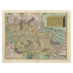
Very Old Original Hand-Colored Map of the Basel Region, Switzerland, Ca.1578
Located in Langweer, NL
Antique print titled 'Basiliensis territorii descriptio nova'. Old map of the Basel region, Switzerland. Originates from 'Theatrum Orbis Terrarum' by A. Ortelius. Artists and...
Category

Antique 16th Century Collectibles and Curiosities

Materials

Paper

Map of East Frisian Islands & Northwestern Tip of Germany, Ostfriesland, c.1595
Located in Langweer, NL
Antique map titled 'Frisia Orientalis'. Beautiful map of east Frisian islands and the northwestern tip of Germany, Ostfriesland. With people in local costumes. Ornamented inset of the Eems estuary. Based on a manuscript map...
Category

Antique 16th Century Collectibles and Curiosities

Materials

Paper

1592 Abraham Ortelius Map "Lorraine: Lotharingiae Nova Descripti, Ric.A005
Located in Norton, MA
1592 Abraham Ortelius map entitled "Lorraine: Lotharingiae Nova Descripti Ric.a005 Description: Ortelius is best known for producing the atlas from which this map comes from, "...
Category

Dutch Antique 16th Century Collectibles and Curiosities

Materials

Paper

Antique Map of the City of Hindeloopen by Braun & Hogenberg, c.1598
Located in Langweer, NL
Antique map titled 'Hindelopia'. Original antique map of the city of Hindeloopen, Friesland, the Netherlands. Originally published on one sheet together with other Frisian cities, trimmed. This print originates from the town atlas by Braun and Hogenberg...
Category

Antique 16th Century Collectibles and Curiosities

Materials

Paper

Print of the Fortress Julaof Tokay, Hungary, Surrounded by Turkish Troops, c1580
Located in Langweer, NL
Antique print Hungary titled 'Contrafehtung der Festung Tokay'. Birds eye view of the fortress Julaof Tokay, Hungary, surrounded with Turkish troops. Originates from a German edi...
Category

Antique 16th Century Collectibles and Curiosities

Materials

Paper

Unique Historical Horse Bit from the 16th-17th Century
Located in Nový Bor, CZ
Unique historical horse bit probably from the 16th or 17th century. It is very well preserved for its age, the condition corresponds to its age, there is no major mechanical or rust ...
Category

Renaissance Antique 16th Century Collectibles and Curiosities

Materials

Metal

Antique Map of Asia Minor, Region of the Nile and Region of the City of Carthage
Located in Langweer, NL
Three antique maps on one sheet titled 'Natoliae quae olim Asia Minor [with] Aegypti recentior descriptio [with] Carthaginis Celeberrimisinus Typus'. The first map covers Asia Minor,...
Category

Antique 16th Century Collectibles and Curiosities

Materials

Paper

Original Antique Bird's-Eye View of Colmar, Alsace, France, 1552
Located in Langweer, NL
Antique map titled 'La Paincture de la cité de Colmar & du pais circonuoisin'. Original antique bird's-eye view of Colmar, Alsace, France. This map originates from 'La Cosmograph...
Category

Antique 16th Century Collectibles and Curiosities

Materials

Paper

Antique Original Map of the City of Deventer, the Netherlands, 1588
Located in Langweer, NL
Antique map titled 'Liberae et Hanseaticae urbis Daventriensis delineatio'. Original bird's eye plan of the Dutch hanseatic city Deventer, on the situated IJssel river. This map ...
Category

Antique 16th Century Collectibles and Curiosities

Materials

Paper

Antique Map of the Netherlands by Guicciardini, 1582
Located in Langweer, NL
Antique map titled 'Hollandiae Cattorum Regionis Typus'. Early copper engraving of the Netherlands in the 2nd state, numbered 30 bottom right. This map originates from 'Description d...
Category

Antique 16th Century Collectibles and Curiosities

Materials

Paper

Antique Map of Denmark by Münster '1588'
Located in Langweer, NL
Antique map titled 'Beschreibung des Königreichs Dennmarck (..)'. Early map of Denmark. This map originates from 'Cosmographey Oder beschreibung Aller Länder (..)' by Sebastian Münster.
Category

Antique 16th Century Collectibles and Curiosities

Materials

Paper

Read More

Medal-Worthy Memorabilia from Epic Past Olympic Games

Get into the games! These items celebrate the events, athletes, host countries and sporting spirit.

Ahoy! You’ve Never Seen a Collection of Sailor Art and Kitsch Quite Like This

French trendsetter and serial collector Daniel Rozensztroch tells us about his obsession with objects related to seafaring men.

Pamela Shamshiri Shares the Secrets behind Her First-Ever Book and Its Effortlessly Cool Interiors

The sought-after designer worked with the team at Hoffman Creative to produce a monograph that beautifully showcases some of Studio Shamshiri's most inspiring projects.

Moroccan Artworks and Objects Take Center Stage in an Extraordinary Villa in Tangier

Italian writer and collector Umberto Pasti opens the doors to his remarkable cave of wonders in North Africa.

Montecito Has Drawn Royalty and Celebrities, and These Homes Are Proof of Its Allure

Hollywood A-listers, ex-pat aristocrats and art collectors and style setters of all stripes appreciate the allure of the coastal California hamlet — much on our minds after recent winter floods.

Whaam! Blam! Pow! — a New Book on Pop Art Packs a Punch

Publishing house Assouline and writer Julie Belcove have teamed up to trace the history of the genre, from Roy Lichtenstein, Andy Warhol and Yayoi Kusama to Mickalene Thomas and Jeff Koons.

The Sparkling Legacy of Tiffany & Co. Explained, One Jewel at a Time

A gorgeous new book celebrates — and memorializes — the iconic jeweler’s rich heritage.

What Makes a Gem-Encrusted Chess Set Worth $4 Million?

The world’s most opulent chess set, weighing in at 513 carats, is literally fit for a king and queen.

Recently Viewed

View All