17th Century Collectibles and Curiosities

to
820
1,099
152
1,259
85
3
1
1
1
4,378
6,589
13,340
2,719
3,508
4,613
3,040
518
305
588
733
464
897
880
904
659
578
1,033
120
110
34
31
298
61
55
48
43
1,259
1,259
1,259
63
12
11
11
6
Period: 17th Century
Antique Map of the Region of Bresse by Hondius, circa 1630
Located in Langweer, NL
Antique map titled 'Bresse'. Old map of the former region of Bresse, France. It is located in the regions of Auvergne-Rhône-Alpes and Bourgogne-Franche-Comté of eastern France. This ...
Category

Antique 17th Century Collectibles and Curiosities

Materials

Paper

Antique Map of Austria by N. Visscher, circa 1690
Located in Langweer, NL
Antique map titled 'Austriae Archiducatus pars superior in omnes ejusdem'. Spectacular large map of Upper and Lower Austria between Passau and Wien with figurative cartouche and armo...
Category

Antique 17th Century Collectibles and Curiosities

Materials

Paper

Detailed Original Antique Map of the Picardy Region of France, 1657
Located in Langweer, NL
Antique map of France titled 'Picardia vera et inferior'. Detailed map of the Picardy region of France. This map originates from 'Atlas Novus, Sive Theatrum Orbis Orbis Terrarum:...
Category

Antique 17th Century Collectibles and Curiosities

Materials

Paper

Antique Map of Aero by Blaeu, 'circa 1670'
Located in Langweer, NL
Antique map titled 'Aroe Insulae delineatio geometrica'. Old map of Aero, a small Danish island in the Baltic Sea. This map originates from a Spanish edition of 'Atlas Maior' by J. B...
Category

Antique 17th Century Collectibles and Curiosities

Materials

Paper

Beautiful Map of Arnhem and the Veluwe Region, Gelderland, The Netherlands, 1690
Located in Langweer, NL
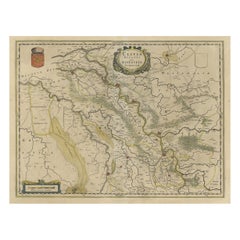
Antique map titled 'Ducatus Geldriae tetrachia Arnhemiensis sive Velavia'. Beautiful map of the region of Arnhem and the Veluwe region, Gelderland, t...
Category

Antique 17th Century Collectibles and Curiosities

Materials

Paper

Old Print of a Partridge in Front of The Walled City of Azemmour, Morocco, c1630
Located in Langweer, NL
Antique print, titled: 'Azaamurum.' - Caption in the top reads: 'Foenerari iniustum est'. A partridge in the foreground, with the walled city (Azemmour...
Category

Antique 17th Century Collectibles and Curiosities

Materials

Paper

Old Map of the Alsace 'Elzas' Region with Lotharingen 'Lorraine', France, c1650
Located in Langweer, NL
Antique map titled 'Alsatia superior cum Suntgoia et Brisgoia'. Old map of the Alsace (or Elzas) region with Lotharingen (Lorraine), Strassburg, Freiburg, Basel etc. Source unkno...
Category

Antique 17th Century Collectibles and Curiosities

Materials

Paper

Antique Map of Frisian Cities Sloten, Ylst, Workum and Hindelopen by Blaeu, 1652
Located in Langweer, NL
Antique print titled 'Slooten - Ylst - Worcum - Hinloopen'. Three plans and a bird's eye view on one sheet. The plans show the Frisian cities Sloten, IJlst, Workum and the view shows...
Category

Antique 17th Century Collectibles and Curiosities

Materials

Paper

Antique Map of Switzerland by N. Visscher, circa 1690
Located in Langweer, NL
Antique map titled 'Tabula Geogaphica qua Pars Meridionalis sive Superior Rheni, Mosae, et Mosellae (..)'. Published by N. Visscher, Amsterdam, circa 1690. Contemporary coloring.
Category

Antique 17th Century Collectibles and Curiosities

Materials

Paper

Antique Map of India and Southeast Asia by Sanson '1654'
Located in Langweer, NL
Antique map titled 'Partie Meridionale de l'Inde'. Early map of India and Southeast Asia. The map shows most of modern India, Bangladesh and Burma, the whole of Sri Lanka, Thailand, ...
Category

Antique 17th Century Collectibles and Curiosities

Materials

Paper

Antique Map of Portugal by J. De Ram, circa 1680
Located in Langweer, NL
A detailed map of Portugal. Embellished with beautiful cartouche, sailing vessels and many putti. Very rare edition by J. de Ram, circa 1680.
Category

Antique 17th Century Collectibles and Curiosities

Materials

Paper

Original Antique Sea Chart of the Maas 'or Meuse' River with Neptunes, 1684
Located in Langweer, NL
Antique map titled 'Paskaerte van het inkoomen van de Maes (..)'. Original antique sea chart of the Maas (or Meuse) river and part of the Dutch c...
Category

Antique 17th Century Collectibles and Curiosities

Materials

Paper

Original Antique Print of the Benedictine Abbey of Gembloux, Belgium, ca.1660
Located in Langweer, NL
Antique print titled 'Celebrrima et Antiquissima Cemblacensis Oppidi Abbatia Ordinis S. Benedicti in Gallo-Brabantia'. Original antique print of the Benedictine Abbey of Gembloux...
Category

Antique 17th Century Collectibles and Curiosities

Materials

Paper

Old Print of a Large Procession of the Emperor's Niece in Japan, 1669
Located in Langweer, NL
Antique print titled 'Groote Staatsie der Kaisarlyke Nicht.' This print shows a large procession of the Emperor's Niece. It shows a small carriage d...
Category

Antique 17th Century Collectibles and Curiosities

Materials

Paper

Antique Map of the Siege of Syracuse, Sicilia, Italy, 'ca.1675'
Located in Langweer, NL
Antique map titled 'Syracus beseeged by the Athenians.' This original uncommon antique map shows the siege of Syracuse, Italy, by the Athenians. Key top left. The siege of Syracus...
Category

Antique 17th Century Collectibles and Curiosities

Materials

Paper

Antique Map of the Region of Lake Geneva by Janssonius '1657'
Located in Langweer, NL
Antique map 'Das Wiflispur Gergow'. Detailed map of Switzerland showing Waadt and the Lake of Geneva and the city of Geneva, Fribourg and partly Bern. This map originates from 'Atlas...
Category

Antique 17th Century Collectibles and Curiosities

Materials

Paper

Old Print of Japanese Noblewoman Transported in a Rickshaw or Jinrikisha, 1669
Located in Langweer, NL
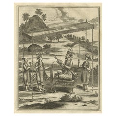
Untitled antique print of a Japanese noblewoman transported in a pushed rickshaw or jinrikisha. This print originates from Arnoldus Montanus' "Gedenkwaerdige Gesantschappen der O...
Category

Antique 17th Century Collectibles and Curiosities

Materials

Paper

Detailed Original Antique Map of Thuringia, Germany by J. Janssonius, ca.1650
Located in Langweer, NL
Antique map titled 'Thuringiae Nova Descriptio.' Detailed map of Thuringia, Germany by J. Janssonius. With one cartouche, coat-of-arms and a mileage scale. With Erfurt in the centre....
Category

Antique 17th Century Collectibles and Curiosities

Materials

Paper

Charming Map of Northeastern Spain with the Areas of Pamplona & Valladolid, 1634
Located in Langweer, NL
Antique map titled 'Biscaia, Guipiscoa, Navarra et Asturias de Santillana'. Charming map of Northeastern Spain with the areas of Pamplona and Valladolid. This map originates from...
Category

Antique 17th Century Collectibles and Curiosities

Materials

Paper

Map of the Shire of Westergo in the Province of Friesland, the Netherlands, 1664
Located in Langweer, NL
Antique map titled 'Westergoa Olim Westrachia.' Map of the shire of Westergo in the province of Friesland in the Netherlands, including Stavoren, Bolswar...
Category

Antique 17th Century Collectibles and Curiosities

Materials

Paper

Original Copperplate Engraved Detailed Map of South Africa, ca.1680
Located in Langweer, NL
Antique map titled 'Pays et Coste des Caffres Empires de Monomotapa (..)'. Detailed map of South Africa. Engraved by Antoine d'Winter for a Dutch edition of Sanson's pocket atlas...
Category

Antique 17th Century Collectibles and Curiosities

Materials

Paper

Original Hand-Colored Antique Map of Artois or Artesia, France, ca.1650
Located in Langweer, NL
Antique map titled 'Artesia Comitatus Artois'. Map of Artois or Artesia, France. Artois is former province located in the northwestern part of France, boarding Belgium (Flanders)...
Category

Antique 17th Century Collectibles and Curiosities

Materials

Paper

Antique Map of The Dutch Province of Groningen by De Wit, c.1680
Located in Langweer, NL
Antique map titled 'Tabulae dominii Groeningae quae et complecitur maximam partem Drentiae Emendata'. Old map of the province of Groningen, the Netherlands. With an inset map of th...
Category

Antique 17th Century Collectibles and Curiosities

Materials

Paper

Old Original Miniature View of the Skyline of Miaco 'Kyoto, Japan', 1683
Located in Langweer, NL
Antique print titled 'De l'Asie Figure XXV, Miaco'. Miniature view of the skyline of Miaco (Kyoto, Japan). This print originates from 'Description de l'Univers', published 1683. ...
Category

Antique 17th Century Collectibles and Curiosities

Materials

Paper

Original Antique Engraving of the Murder of Emperor Cubo in Kyoto, Japan, 1669
Located in Langweer, NL
Antique print, titled: ''t Vermoorde vande Keyser Cubus. Massacre de l'Empereur Cubo.' - ('Murder of the Emperor Cubo'). Two armies clash in Kyoto, where the reigning Emperor was...
Category

Antique 17th Century Collectibles and Curiosities

Materials

Paper

Antique Map of the Region of Maine by Janssonius, circa 1650
Located in Langweer, NL
Antique map of France titled 'Diocese du Mans vulgo le Mains'. Decorative map of the region of Maine, France. Published by J. Janssonius.
Category

Antique 17th Century Collectibles and Curiosities

Materials

Paper

Antique Map of Dutch & Belgium Provinces Limburg, Namen and Ardennes, ca.1635
Located in Langweer, NL
Antique print, titled: 'Leodiensis Dioecesis.' Detailed map including the Dutch and Belgium provinces Limburg and the Belgium province of Namen and Ardennes. Exquisitely engraved...
Category

Antique 17th Century Collectibles and Curiosities

Materials

Paper

Map of Region Near the Baltic Sea, Present Day Bulgaria, Romania & Turkey, c1670
Located in Langweer, NL
Antique map titled 'Illyricum Orientis: In quo Partes II Moesia et Thracia'. Engraved map of the area west of the Baltic Sea, present day Bulgaria, Romania, and Turkey. The map i...
Category

Antique 17th Century Collectibles and Curiosities

Materials

Paper

Decorative Early Hand-Colored Map of the Northeast of England, ca.1620
Located in Langweer, NL
Antique map titled 'Eboracum, Lincolnia, Derbia, Staffordia, Notinghamia, Lecestria, Rutlandia et Norfolcia'. Decorative early map of the northeast of England, comprising the cou...
Category

Antique 17th Century Collectibles and Curiosities

Materials

Paper

Antique Map of Myanmar titled 'Regna Pegu et Aracam by Mapmaker Janssonius, 1651
Located in Langweer, NL
Antique map titled 'Regna Pegu et Aracam'. Beautiful map of part of Myanmar from Jansson's edition of Mercator's Atlas Minor. North to the right of map. Artists and Engravers: Johann...
Category

Antique 17th Century Collectibles and Curiosities

Materials

Paper

Coat of Arms of Theodorus Van Bleiswijk, Mayor of Schiedam, Netherlands, Ca.1680
Located in Langweer, NL
Antique print, titled: 'De Heer en Mr. Theodorus van Bleyswijk, Hoogheemraadt, Regerendt Borgermeester der Stad Schiedam.' - Coat of arms of Theodorus van Bleiswijk, mayor of Sch...
Category

Antique 17th Century Collectibles and Curiosities

Materials

Paper

Original Old Map of Leeuwarden, European Cultural Capital 2018, Holland, 1649
Located in Langweer, NL
Antique print, titled: 'Leoverdia.' This map shows Leoverdia (Leeuwarden). Bird's-eye view plan of Leeuwarden in The Netherlands, with key to locations and coats of arms. Text in...
Category

Antique 17th Century Collectibles and Curiosities

Materials

Paper

Antique Map of Catalonia by Blaeu, circa 1650
Located in Langweer, NL
Antique map titled 'Catalonia'. Antique map of Catalonia, extending from C. De Romani on the Northern Coast to Alfachs and Panicola in Valencia on the southern end of the coast and s...
Category

Antique 17th Century Collectibles and Curiosities

Materials

Paper

Beautiful Map of the Region Naters and Pancrasgors, The Netherlands, ca.1697
Located in Langweer, NL
Antique map titled ‘Caarte der Heerlyckheyt van Naters ende Pancras Gors’. Beautiful map of the region Naters and Pancrasgors, The Netherlands. This ma...
Category

Antique 17th Century Collectibles and Curiosities

Materials

Paper

Map of Japanese Coast from Osaka to Tokyo & the Kyushu and Shikoku Islands, 1669
Located in Langweer, NL
Antique map titled 'De Land Reyse van Osacca to Iedo. De Water eyse van Nangasacqui tot Osacca.' Two maps on one sheet. The top map shows the Japanese coast from Osaka to Tokyo (Jedo). The lower map shows the strait between mainland Japan and the two large islands...
Category

Antique 17th Century Collectibles and Curiosities

Materials

Paper

Antique View of the Temple of Amidain Edo 'Tokyo' and the 7-Headed Horse, 1669
Located in Langweer, NL
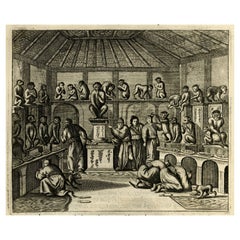
Antique print, titled: 'De tempel der goude Amida.' - Interior view of the Temple of Amida (also Amitabha) in Edo (also Yedo/Jeddo, now Tokyo). The statue shows the God seated on...
Category

Antique 17th Century Collectibles and Curiosities

Materials

Paper

Antique Map of the Coast of Angola Up to Port Elizabeth in South Africa, 1675
Located in Langweer, NL
Antique map titled 'Cimbebas et Caffariae Littora a Catenbela ad Promontorium Bonae Spei'. This map depicts the coast of Angola, South-West Africa and South Africa up to Port Elizabeth...
Category

Antique 17th Century Collectibles and Curiosities

Materials

Paper

Handsome Old Detailed Map of the Low Countries by Famous Mapmaker Blaeu, ca.1635
Located in Langweer, NL
Antique map titled 'Novus XVII Inferioris Germaniae Provinciarum Typus'. Handsome - and much sought after- detailed map of the Low Countries by the world most famous map maker Bla...
Category

Antique 17th Century Collectibles and Curiosities

Materials

Paper

17th-Century Original Antique Map of Hunan and Hubei Provinces, China – by Blaeu
Located in Langweer, NL
Title: 17th-Century Antique Map of Hunan and Hubei Provinces, China – "Hvqvang" by Blaeu, Richly Detailed and Illustrated Description: This beautiful 17th-century map of the regions that now comprise Hunan and Hubei Provinces, historically referred to as "Hvqvang," was created by Johannes Blaeu and published in 1655 as part of the *Novus Atlas Sinensis*. This map, drawn with input from Jesuit missionary Martino Martini, provides a meticulous representation of central China’s geography, capturing its rivers, towns, and mountainous terrain. The Yangtze River (Changjiang) is prominently featured, emphasizing the region’s importance as a vital waterway for trade and transportation. Wuhan, now a modern metropolis, and Changsha, the capital of Hunan Province, were historically significant cities that appear on the map. The area is also notable for its fertile lands and contributions to China’s agricultural prosperity, particularly in rice and tea production. The decorative cartouche in the lower-right corner features two figures in traditional Chinese attire standing amid bamboo, symbolizing the cultural and natural richness of the region. Blaeu’s map combines precision and artistry, with vibrant hand-coloring distinguishing boundaries and geographical features. The copperplate engraving ensures fine detail, making this map a remarkable historical artifact. Condition: Near excellent. Clean impression with vivid hand-coloring. Wide margins with minor age-toning appropriate for its age. Framing Tips: Use a neutral double mat and a gilt or dark wood frame to enhance the presentation. UV-protective glass is recommended to preserve the vivid hand-coloring and intricate engraving details. Hunan and Hubei, historically referred to as "Hvqvang," are known for their strategic location along the Yangtze River and their cultural and economic significance in Chinese history. The region’s fertile lands have supported extensive rice cultivation, earning it the title of one of China’s "breadbaskets." Hubei, with Wuhan at its center, has long been a hub of transportation and trade, owing to the convergence of the Yangtze and Han Rivers. Hunan, with Changsha as its capital, is known for its rich cultural heritage and contributions to Chinese literature and art. Important places in the region include Wuhan, an ancient trade center, and Changsha, known for its historical sites and cultural prominence. The Yangtze River, a key feature on the map, highlights the region’s historical importance as a major waterway for commerce and agriculture. Other notable features include Dongting Lake, a vital ecological and cultural landmark, and the surrounding mountainous areas that have shaped the region’s history and development. Keywords: antique map of Hunan, Hubei map, Hvqvang map, Yangtze River map, 17th-century Chinese map...
Category

Antique 17th Century Collectibles and Curiosities

Materials

Paper

OriginaAntique 17th-Century Map of Guizhou Province, China – (Qveichev) by Blaeu
Located in Langweer, NL
Title: Antique 17th-Century Map of Guizhou Province, China – "Qveichev" by Blaeu, Richly Illustrated and Colored Description: This remarkable map of Guizhou Province, historically known as "Qveichev," was created by Johannes Blaeu and published in 1655 as part of his *Novus Atlas Sinensis*. This atlas, developed in collaboration with Jesuit missionary Martino Martini, marked the first Western attempt at a comprehensive geographic representation of China. Blaeu’s map offers a detailed depiction of the mountainous terrain, rivers, and towns of Guizhou, a province known for its rugged beauty and cultural diversity. The map is adorned with two decorative cartouches, each reflecting the artistic and cultural influences of the time. The title cartouche in the lower-right corner features two figures in traditional Chinese attire, symbolizing the blend of European cartographic mastery and Chinese heritage. The upper-left corner includes a secondary cartouche with an explanatory key, adding a touch of elegance to the map’s functionality. Towns, mountains, and rivers are meticulously labeled in Latin, showcasing Blaeu’s dedication to detail and accuracy. Crafted using the copperplate engraving technique, this map demonstrates exceptional precision. The hand-coloring enhances its visual appeal, highlighting borders and geographic features with vibrant tones. Blaeu’s work is not only a tool for geographic understanding but also a piece of art that embodies the spirit of exploration during the Dutch Golden Age. Guizhou Province, historically known as "Qveichev," is renowned for its breathtaking natural landscapes, rich ethnic diversity, and historical significance. As one of China's most mountainous regions, Guizhou is characterized by dramatic karst formations, lush green hills, and cascading waterfalls. The province is also home to a variety of ethnic minority groups, including the Miao, Dong, and Bouyei, whose traditions, colorful costumes, and vibrant festivals make the region culturally significant. Famous features and important places include Huangguoshu Waterfall, one of Asia's largest and most iconic waterfalls, located near the city of Anshun. Zhijin Cave, a vast karst cave system, is celebrated for its stunning stalactites and stalagmites. Kaili is known as the cultural center of Miao traditions, with picturesque villages and celebrated festivals. Zunyi holds historical importance for the Zunyi Conference, a pivotal event in the Chinese Communist Party's history. Fanjing Mountain, a UNESCO World Heritage Site, stands out for its unique biodiversity and sacred Buddhist sites. Keywords: antique map of China, Guizhou map, Qveichev, 17th-century China map...
Category

Antique 17th Century Collectibles and Curiosities

Materials

Paper

Map of Warwickshire, England, Incl insets of Warwick and Coventry, c.1614
Located in Langweer, NL
Antique map titled 'The Counti of Warwick the Shire Towne and Citie of Coventre described'. Map of Warwickshire, England. Includes inset town plans of Warwick and Coventry. This map ...
Category

Antique 17th Century Collectibles and Curiosities

Materials

Paper

Antique Decorative Map of the Low Countries, '17 Provinces, Netherlands', c.1680
Located in Langweer, NL
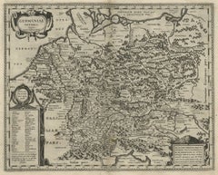
Description: Antique map titled 'Germaniae Inferioris XVII Provinciarum Accuratissima Tabula.' Map of the low countries (17 provinces, Netherlands). The map is dedicated to Theod...
Category

Antique 17th Century Collectibles and Curiosities

Materials

Paper

Large Panoramic View of Eisenerz, an Old Mining Town in Styria, Austria, c.1650
Located in Langweer, NL
Description: Antique print titled 'Der weyt berümpte Marckt und Bergwerck Eysenärtz im Hertzogtum Steyer'. Large panoramic view of Eisenerz, an old mining town in the Austrian st...
Category

Antique 17th Century Collectibles and Curiosities

Materials

Paper

Antique Map of the Region of Bretagne by Janssonius '1657'
Located in Langweer, NL
Antique map 'Duche de Bretaigne'. Detailed map of Bretagne, France. With decorative cartouches for the title, key and scale, a large armorial and several vignette galleons. This map ...
Category

Antique 17th Century Collectibles and Curiosities

Materials

Paper

Antique Hand-Colored Map of the Frisian City of IJlst, The Netherlands, 1649
Located in Langweer, NL
Antique hand-colored map titled 'Ylst'. Original antique map of the city of IJlst, Friesland, the Netherlands. This map originates from 'Novum Ac Magnum Theatrum Urbium Belgicae ...
Category

Antique 17th Century Collectibles and Curiosities

Materials

Paper

Antique Map of Central Europe "Centered on Germany" by F. de Wit, circa 1680
Located in Langweer, NL
A very detailed map of central Europe, centered on Germany. It extends from Belgium and The Netherlands through Pomerania in the north, and from eastern France to Croatia in the sout...
Category

Antique 17th Century Collectibles and Curiosities

Materials

Paper

Antique Map of the Dutch Province of Gelderland by Visscher, c.1670
Located in Langweer, NL
Antique map titled 'Ducatus Geldria et Zutphania Comitatus'. Map of the Duchy of Gelre (Gelderland) and the county of Zutphen, The Netherlands. Artists and Engravers: Made after the ...
Category

Antique 17th Century Collectibles and Curiosities

Materials

Paper

Rare Antique Map of the Imperial Court in Peking China, 1665
Located in Langweer, NL
Antique print titled 'Platte Grondt van s Keysers Hof in Pekin. Forme de la Cour Imperiale de Peking'. This print originates from 'Joan Nieuhof, Het Gezands...
Category

Antique 17th Century Collectibles and Curiosities

Materials

Paper

Antique Map of Leeuwarden, Capital of Friesland, the Netherlands, by Blaeu, 1649
Located in Langweer, NL
Antique map titled 'Leoverdia.' Bird's-eye view plan of Leeuwarden, Friesland, the Netherlands. With key to locations and coats of arms. Text in Dutch on verso. This plan origina...
Category

Antique 17th Century Collectibles and Curiosities

Materials

Paper

Antique Map of Western Africa and the Cape Verde Islands by Coronelli, 1691
Located in Langweer, NL
Antique map titled 'Bocche del Fiume Negro et Isole di Capo Verde'. Antique map of Western Africa with the Cape Verde Islands and an inset of Goree Island. Originates from 'Atlante V...
Category

Italian Antique 17th Century Collectibles and Curiosities

Materials

Paper

Antique Print of an Anatomy Display with a Human Skeleton, 1686
Located in Langweer, NL
Description: Antique print, titled: 'To Ralph Macro of Clapton (…)' This original old antique print shows people at an anatomy display with a human skeleton, ecorche, male body. ...
Category

Antique 17th Century Collectibles and Curiosities

Materials

Paper

Antique Map of Germany with Its Bordering Kingdoms and Provinces by N. Visscher
Located in Langweer, NL
Antique map covering the central part of Europe with Germany in the centre and the Netherlands in west. With one cartouche containing cherubs and coat of arms. Published in Amsterdam...
Category

Antique 17th Century Collectibles and Curiosities

Materials

Paper

Original Antique Map of Leros and Kalimnos, and other islands, Greece, 1687
Located in Langweer, NL
Antique map titled 'Lero, Calamo, Zanara e Levita, Amorgo.' heet with four maps on one page showing the islands Leros, Kalimnos, and other islands, Greece. Source unknown, to be de...
Category

Antique 17th Century Collectibles and Curiosities

Materials

Paper

Detailed Copper Engraved City Map of Enkuizen, the Netherlands, c.1620
Located in Langweer, NL
Antique map titled 'Die stadt Enchuijsen.' Detailed copper engraved city map of Enkuizen, the Netherlands, by Lodovico Guicciardini and published by Janssonius. Highly decorated with...
Category

Antique 17th Century Collectibles and Curiosities

Materials

Paper

Antique Map of France by Cluver, 1685
Located in Langweer, NL
Antique map titled 'Galliae Veteris Descriptio.' Charming miniature map of France from the pocket atlas 'Introductionis in Universam Geographiam tam Veterem quam novam .. Acessit P. ...
Category

Antique 17th Century Collectibles and Curiosities

Materials

Paper

Antique Map of Beauce by Janssonius, 1657
Located in Langweer, NL
Antique map 'Belsia vulgo la Beausse'. Decorative map of the region of Beauce, a natural region in northern France, located between the Seine and Loire rivers. This map originates fr...
Category

Antique 17th Century Collectibles and Curiosities

Materials

Paper

Miniature Antique Map of Glamorganshire, Wales, c.1646
Located in Langweer, NL
Antique map titled 'Glamorganshire'. Miniature map of Glamorganshire, Wales. Later, this map was used for 'England, Scotland and Ireland described and abridge (..)' by J. Speed. Arti...
Category

Antique 17th Century Collectibles and Curiosities

Materials

Paper

Antique Miniature Map of Borneo, incl Kalimantan, Indonesia, c.1610
Located in Langweer, NL
Antique map titled 'Descriptio Borneo Insulae'. Old miniature map of the Indonesian island of Borneo. North is orientated to the left. The Equator runs through the southern part of...
Category

Antique 17th Century Collectibles and Curiosities

Materials

Paper

Read More

Medal-Worthy Memorabilia from Epic Past Olympic Games

Get into the games! These items celebrate the events, athletes, host countries and sporting spirit.

Ahoy! You’ve Never Seen a Collection of Sailor Art and Kitsch Quite Like This

French trendsetter and serial collector Daniel Rozensztroch tells us about his obsession with objects related to seafaring men.

Pamela Shamshiri Shares the Secrets behind Her First-Ever Book and Its Effortlessly Cool Interiors

The sought-after designer worked with the team at Hoffman Creative to produce a monograph that beautifully showcases some of Studio Shamshiri's most inspiring projects.

Moroccan Artworks and Objects Take Center Stage in an Extraordinary Villa in Tangier

Italian writer and collector Umberto Pasti opens the doors to his remarkable cave of wonders in North Africa.

Montecito Has Drawn Royalty and Celebrities, and These Homes Are Proof of Its Allure

Hollywood A-listers, ex-pat aristocrats and art collectors and style setters of all stripes appreciate the allure of the coastal California hamlet — much on our minds after recent winter floods.

Whaam! Blam! Pow! — a New Book on Pop Art Packs a Punch

Publishing house Assouline and writer Julie Belcove have teamed up to trace the history of the genre, from Roy Lichtenstein, Andy Warhol and Yayoi Kusama to Mickalene Thomas and Jeff Koons.

The Sparkling Legacy of Tiffany & Co. Explained, One Jewel at a Time

A gorgeous new book celebrates — and memorializes — the iconic jeweler’s rich heritage.

What Makes a Gem-Encrusted Chess Set Worth $4 Million?

The world’s most opulent chess set, weighing in at 513 carats, is literally fit for a king and queen.

Recently Viewed

View All