1880s Collectibles and Curiosities

to
119
247
98
346
70
8
4
4
2
2
1
1
1
4,403
6,612
13,356
2,717
3,500
4,625
3,046
522
300
590
739
464
899
880
906
664
575
156
92
81
32
31
152
87
49
45
42
346
346
346
2
1
1
1
1
Period: 1880s
Susan B. Anthony Signed Handwritten Letter, Dated July 21, 1888
Located in Colorado Springs, CO
Presented is an original autographed letter, signed by women’s rights activist Susan B. Anthony. The letter, signed on a partial leaf of National Woman Suffrage Association stationar...
Category

Antique 1880s Collectibles and Curiosities

Materials

Paper

Antique Map of The United States of North America, 1882
Located in Langweer, NL
This is a historical map titled "The United States of North America, Central Part" from the 1882 Blackie Atlas. It depicts the continental United States with a high level of detail, ...
Category

Antique 1880s Collectibles and Curiosities

Materials

Paper

Old Map of Southern Russia, Incl the Extent of the Kingdom of Poland, 1882
Located in Langweer, NL
Antique map titled 'South-West Russia'. Old map of southern Russia, also showing the extent of the Kingdom of Poland. This map originates from 'The Royal Atlas of Modern Geography...
Category

Antique 1880s Collectibles and Curiosities

Materials

Paper

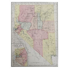
Original Antique Map of the American State of Nevada, 1889
Located in St Annes, Lancashire
Great map of Nevada Drawn and Engraved by W. & A.K. Johnston Published By A & C Black, Edinburgh. Original colour Unframed.
Category

Scottish Victorian Antique 1880s Collectibles and Curiosities

Materials

Paper

Leiden bottle from the second half of the 19th century holds electrical charges
Located in Milan, IT
Leiden bottle from the second half of the 19th century, this is an electrical component that accumulates and stores a high-voltage electrical charge by means of an external source ...
Category

Antique 1880s Collectibles and Curiosities

Materials

Glass

Ancient Cartography of the Indian Subcontinent, Published in 1880
Located in Langweer, NL
This map is titled "INDIA," and it provides a detailed view of the Indian subcontinent with various inset maps that offer additional historical and geographical context. The main ma...
Category

Antique 1880s Collectibles and Curiosities

Materials

Paper

Original Antique Map of Switzerland, 1882
Located in Langweer, NL
Embark on a historical journey with an original Antique Map of Switzerland from the renowned 'Comprehensive Atlas and Geography of the World...
Category

Antique 1880s Collectibles and Curiosities

Materials

Paper

Original Antique Coloured Map of Western Africa, Published in 1882
Located in Langweer, NL
This is a map of Western Africa from the 1882 Blackie & Son atlas. The map details the West African coast from the Sahara Desert in the north down to the Gulf of Guinea, including a ...
Category

Antique 1880s Collectibles and Curiosities

Materials

Paper

Antique Map of Central Europe Showing The Railways and The Political Bounderies
Located in Langweer, NL
Explore the Heart of Europe with the 'Central Europe' Map, Featuring Principal Railways and Political Boundaries! This map offers a captivating view of the dynamic landscapes and pol...
Category

Antique 1880s Collectibles and Curiosities

Materials

Paper

Antique Map of the Night Skies of the Northern and Southern Hemispheres, 1880
Located in Langweer, NL
Antique world map titled 'Planisphère en Céleste'. This map depicts the night skies of both the northern and southern hemispheres. This map originates from 'Géographie Universell...
Category

Antique 1880s Collectibles and Curiosities

Materials

Paper

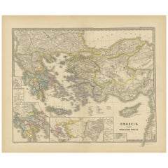
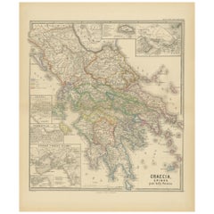
Original Antique Map of Greece and Epirus after the Persian Wars, Published 1880
Located in Langweer, NL
The map titled "GRAECIA, EPIRUS post bella Persica," translates to "Greece and Epirus after the Persian Wars." It covers the regions of ancient Greece and Epirus following the Greco-Persian Wars, a series of conflicts between the Greek city-states and the Persian Empire during the 5th century BC. What makes this map interesting: 1. **Historical Context**: The period after the Persian Wars was pivotal for ancient Greece, leading to the rise of Athens as a major power and the Golden Age of Athens. 2. **Inset Maps**: Detailed insets, such as the one showing the Acropolis of Athens, provide close-up views of historically significant locations. 3. **Topography**: It features the diverse terrain of Greece, from the rugged mountain ranges to the intricate coastlines and islands, influencing the development of Greek city-states. 4. **City-States**: The map likely details the various polis or city-states, such as Athens, Sparta, Thebes, and others, which played critical roles in the Persian Wars. 5. **Battle Sites**: It might mark important battle sites from the wars, like Marathon, Thermopylae, Salamis, and Plataea. 6. **Latin Labels**: The use of Latin for place names and descriptions adds to the map's scholarly quality. 7. **Cultural Landmarks**: The map may include locations of significant cultural and historical landmarks from the era, such as temples, theatres, and agoras. This map is from the "Spruner-Menke Atlas Antiquus," compiled by Karl Spruner von Merz and edited by Theodorus Menke. The atlas, known for its detailed maps of historical and ancient geographies, was a significant educational tool in the 19th century. The Greco-Persian Wars, which included famous battles such as Marathon and Salamis, were crucial for the preservation of Greek independence...
Category

Antique 1880s Collectibles and Curiosities

Materials

Paper

Antique Map of Canada, The Province of Ontario and Part of Quebec, 1882
Located in Langweer, NL
This is a historical map from the 1882 Blackie Atlas, this time detailing "The Province of Ontario, and Part of Quebec" in Canada. The map presents a detailed illustration of Ontario...
Category

Antique 1880s Collectibles and Curiosities

Materials

Paper

Lancel Bucket Bag - vintage - mustard yellow and brown leather - Paris France
Located in Beuzevillette, FR
Wonderful camel leather bag from Maison Lancel from the 1990s. This magnificent Lancel handbag is bucket-shaped: The bucket is a very famous bag from M...
Category

French Antique 1880s Collectibles and Curiosities

Materials

Leather

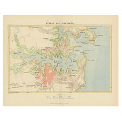
Antique Map Depicting Sydney and Surrounding Areas, Known as Port Jackson, c1889
Located in Langweer, NL
An antique map depicting Sydney and its surrounding areas, known as Port Jackson, dating from around 1889. It was produced by E. Reclus and is part of the "Nouvelle géographie univer...
Category

Antique 1880s Collectibles and Curiosities

Materials

Paper

Unusual Crystal Palace Band Competition Painted Glass Certificate of Merit 1883
Located in Bishop's Stortford, Hertfordshire
A very unusual, possibly unique, historical Certificate of Merit awarded at the drum and pipe band contest held at Crystal Palace between 1880 and 1883 and awarded in 1883. The certificate is hand-painted on a rectangular sheet of milk glass and is painted as a hanging cloth banner...
Category

English Victorian Antique 1880s Collectibles and Curiosities

Materials

Milk Glass

Original Map of Greece at the Time of the Dorian Migration, Published in 1880
Located in Langweer, NL
The map titled "GRAECIA TEMPORI MIGRATIONIS DORICAE," translates to "Greece at the Time of the Dorian Migration." This map showcases the regions of ancient Greece during the period f...
Category

Antique 1880s Collectibles and Curiosities

Materials

Paper

Charles GUITEAU. The Crime Avenged: or, Guiteau on the gallows. 1882.
Located in Hillsborough, NJ
AUTHOR: GUITEAU, Charles. TITLE: The Crime Avenged: or, Guiteau on the gallows. A sequel to "Guiteau's Crime" and "The Assassin's Doom," and forming with them a complete secret his...
Category

American Antique 1880s Collectibles and Curiosities

Materials

Paper

Arctic Exploration: An Original Map of the North Circumpolar Regions, 1882
Located in Langweer, NL
This map, extracted from the 1882 atlas by Blackie & Son, presents the North Circumpolar Regions in a projection centered on the North Pole, offering a unique view of the Arctic territories. The map's radial lines emanate from the pole, focusing on the northernmost parts of continents and the intricate archipelagos that are scattered across the Arctic Ocean. The territories of Canada, Greenland, Northern Europe, Russia, and the northern extremities of Asia are portrayed with careful detail, highlighting the geography known to Victorian explorers. Notably, the map's color palette is subdued, with the cold regions depicted in pale hues, while coastlines and political boundaries are traced in warmer tones, providing a stark contrast that emphasizes the frigid environment. The map likely served purposes both educational and navigational, capturing the extent of polar exploration at the time. Names of seas, straits, and islands honor explorers and patrons of the age of Arctic exploration, and the map also hints at the incomplete knowledge of the era, with some areas less detailed than others, reflecting the limits of exploration and cartographic knowledge of the Arctic region at that time. Moreover, the map includes longitudinal and latitudinal markers, which would have been crucial for navigation and expedition planning. The inclusion of such detail illustrates the growing interest in polar exploration during the late 19th century...
Category

Antique 1880s Collectibles and Curiosities

Materials

Paper

Antique Map of The German Empire (West Sheet), 1882
Located in Langweer, NL
Transport yourself to the heart of history with an original Antique Map of The German Empire (west sheet) from 'The Comprehensive Atlas and Geography of the World,' meticulously craf...
Category

Antique 1880s Collectibles and Curiosities

Materials

Paper

Black Sea in Antiquity: Pontus Euxinus Map, Published in 1880
Located in Langweer, NL
This map, titled "PONTUS EUXINUS," depicts the Black Sea region, historically known as the Pontus Euxinus. The Black Sea was central to ancient trade routes and cultural exchange, bo...
Category

Antique 1880s Collectibles and Curiosities

Materials

Paper

Old Map of Southern India and Ceylon 'Sri Lanka', 1882
Located in Langweer, NL
Antique map titled 'India (Southern Sheet)'. Old map of Southern India and Ceylon (Sri Lanka). With an inset map of the South-Eastern Provinces of India. This map originates from...
Category

Antique 1880s Collectibles and Curiosities

Materials

Paper

Ancient Cartography of Britannia and Hibernia, Published in 1880
Located in Langweer, NL
This map depicts the geographical area of Great Britain and Ireland, labeled "BRITANNIA et HIBERNIA." It is a historical map, as indicated by the Latin titles and the classical names of regions and tribes. In the main section of the map, Great Britain is depicted in fine detail, with topographical features such as mountains and rivers. The map is color-coded, to differentiate political or tribal boundaries. Various Roman place names are indicated, such as "Londinium" for London. To the left of Great Britain is Ireland, referred to as "Hibernia," similarly detailed with its own topographical features and ancient...
Category

Antique 1880s Collectibles and Curiosities

Materials

Paper

An Insightful 19th Century Map of Syria and the Surrounding Regions, 1882
Located in Langweer, NL
This map, titled "SYRIA (SOUTH DIVISION) including PALESTINE & THE HAUARAN," is a historical cartographic work from the late 19th century, specifically from the 1882 atlas by Blackie...
Category

Antique 1880s Collectibles and Curiosities

Materials

Paper

North African Coasts: Marmarica to Mauretania in Roman Times, Published in 1880
Located in Langweer, NL
The map with the title "MARMARICA, CYRENAICA, AFRICA, NUMIDIA, MAURETANIA secundum Italiam Poetarum" presents a historical geographical view of the northern coast of Africa, detailin...
Category

Antique 1880s Collectibles and Curiosities

Materials

Paper

Territories of Antiquity: The Northern Division of Syria, A Detailed 1882 Map
Located in Langweer, NL
This 19th-century map from the atlas published by Blackie and Son in 1882 is titled "SYRIA (NORTH DIVISION)" and covers the northern part of Syria, capturing its geographical and adm...
Category

Antique 1880s Collectibles and Curiosities

Materials

Paper

Mediterranean Tapestry: A 19th Century Map of the Mediterranean Shores, 1882
Located in Langweer, NL
This map, titled "The Shores of the Mediterranean," is part of the 1882 atlas by Blackie & Son, and it portrays the coastal regions that surround the Mediterranean Sea. It is a detailed representation of the diverse and historically rich countries that share the Mediterranean coastline, spanning from the Strait of Gibraltar in the west to the Levantine Sea in the east, and from the southern shores of Europe down to the northern coastlines of Africa. The map is a vivid document of the time, with each country along the Mediterranean basin meticulously outlined. The northern coast includes the southern parts of Europe, featuring Spain...
Category

Antique 1880s Collectibles and Curiosities

Materials

Paper

The World After the Battle of Corupedium: Hellenistic Kingdoms Map, 1880
Located in Langweer, NL
The map is titled "ORBIS TERRARUM post proelium Corupedinse," which translates to "The World after the Battle of Corupedium." This battle, which took place in 281 BC in Lydia, was th...
Category

Antique 1880s Collectibles and Curiosities

Materials

Paper

Imperial Frontiers: A 19th Century Map of Southern Russia and the Caucasus, 1882
Located in Langweer, NL
This map, sourced from the comprehensive 1882 atlas by Blackie & Son, delineates the southern part of Russia and the Caucasus region, reflecting the geopolitical contours and topogra...
Category

Antique 1880s Collectibles and Curiosities

Materials

Paper

19th Century Reprint of 16th Century Harbor Map of Copenhagen
Located in Haddonfield, NJ
This reprint of 1587 antique map of Copenhagen, Denmark retains its original mid-century mat and has been recently reframed in classic wood frame. The muted sepia colored map is a wo...
Category

Danish Baroque Antique 1880s Collectibles and Curiosities

Materials

Wood, Paper

Original Antique Map of The Austrian Empire, 1882
Located in Langweer, NL
Step into the past with an original Antique Map of The Austrian Empire from the esteemed 'Comprehensive Atlas and Geography of the World,' meticulously crafted in 1882. This intricat...
Category

Antique 1880s Collectibles and Curiosities

Materials

Paper

Colorful Detailed Antique Map of The World on Mercators Projection, 1882
Located in Langweer, NL
The 'World of Mercator's Projection' is a map with a stunning portrayal of global geography and maritime navigation from an era steeped in exploration and discovery. With meticulous detail and precision, this map showcases the world's continents on Mercator's famous projection, capturing the essence of a bygone era's cartographic expertise. Illustrating the courses of chief ocean currents and key navigation tracks between major ports, this map doesn't just depict landmasses but also reveals the vital maritime routes that shaped global trade and exploration. Each line and curve represents the pathways of ancient voyages and modern seafaring, connecting distant shores and continents. Crafted with the precision characteristic of Mercator's projection, this map offers a unique perspective on how sailors and explorers navigated the world's vast oceans. It stands as a testament to the artistry and scientific ingenuity of cartographers of that time, showcasing their commitment to accurate representation amid the challenges of mapping a spherical world on a flat surface. This map isn't just a historical document; it's a captivating piece of cartographic art...
Category

Antique 1880s Collectibles and Curiosities

Materials

Paper

Ancient Gaul: A Cartographic Overview of Gallic Tribes and Roman Provinces, 1880
Located in Langweer, NL
The print titled "GALLIA," is a historical map of ancient Gaul, which corresponds to modern-day France and parts of its surrounding countries. Here are the features and details noted...
Category

Antique 1880s Collectibles and Curiosities

Materials

Paper

Historical Map Depicting the Continent of Asia, 1882
Located in Langweer, NL
This 1882 map presents a meticulously detailed representation of the continent of Asia, a testament to the cartographic skills of the era. Published as a...
Category

Antique 1880s Collectibles and Curiosities

Materials

Paper

Original Antique Map of Russia in Europe, 1882
Located in Langweer, NL
Embark on an enthralling journey with an original Antique Map of European Russia from the esteemed 'Comprehensive Atlas and Geography of the World,' meticulously crafted in 1882. Thi...
Category

Antique 1880s Collectibles and Curiosities

Materials

Paper

Original Old Composite of Several Maps of the Ancient World on One Sheet, 1880
Located in Langweer, NL
This original antique map is from Karl Spruner von Merz's "Atlas Antiquus", later edited by Theodorus Menke. The map is a detailed depiction of the ancient world. The atlas it comes ...
Category

Antique 1880s Collectibles and Curiosities

Materials

Paper

Cartographic Elegance: The British Raj's India, 1882 Atlas by Blackie and Son
Located in Langweer, NL
These two maps are part of an 1882 atlas published by Blackie and Son, a notable publishing company in the 19th century known for their educational books and detailed atlases. The ma...
Category

Antique 1880s Collectibles and Curiosities

Materials

Paper

Antique 19th Century Map of China by Blackie & Son, 1882
Located in Langweer, NL
This map is an 1882 Blackie & Son map of China. The title "CHINA." is prominently displayed at the bottom. The map is colored to differentiate various regions, possibly indicating di...
Category

Antique 1880s Collectibles and Curiosities

Materials

Paper

Original Antique Map of Italy with an Inset of Sardinia, 1882
Located in Langweer, NL
Embark on a historical odyssey with an original Antique Map of Italy from the esteemed 'Comprehensive Atlas and Geography of the World,' meticulously crafted in 1882. This captivatin...
Category

Antique 1880s Collectibles and Curiosities

Materials

Paper

Colorful Detailed Antique Map of England and Wales (South Part), 1882
Located in Langweer, NL
Embark on a Journey Through the Southern Part of 'England and Wales' with this Exquisite Antique Map! This map provides a vivid portrayal of the captivating landscapes and cultural h...
Category

Antique 1880s Collectibles and Curiosities

Materials

Paper

Large Original Antique Map of The Environs of Dublin, Ireland, circa 1880
Located in St Annes, Lancashire
Great map of The Environs of Dublin Published circa 1880 Unframed Free shipping.
Category

Scottish Antique 1880s Collectibles and Curiosities

Materials

Paper

Antique English Silver Plated Tree Trunk Shaped Cigar or Cheroot Stand
Located in Bishop's Stortford, Hertfordshire
An unusual English late Victorian antique presentation silver plated tree trunk shaped cigar or cheroot stand with cutter dating from 1889. The sta...
Category

English Late Victorian Antique 1880s Collectibles and Curiosities

Materials

Silver Plate

Old Print with a View of Saint Petersburg, Russia, 1887
Located in Langweer, NL
Description: Antique print titled 'Birds-Eye View of St. Petersburg'. Old print with a view of Saint Petersburg, Russia. Originates from 'Voyages and Travels'. Artists and En...
Category

Antique 1880s Collectibles and Curiosities

Materials

Paper

Large Original Antique City Plan of Dublin, Ireland, circa 1880
Located in St Annes, Lancashire
Great city plan of Dublin Published circa 1880 Unframed Free shipping. .
Category

Scottish Antique 1880s Collectibles and Curiosities

Materials

Paper

Detailed Antique Cartography of Asian Russia, 1882
Located in Langweer, NL
This exquisite map, hailing from the year 1882, is a remarkable historical cartographic artifact, which was included as part of the prestigious 'Comprehensive Atlas and Geography of ...
Category

Antique 1880s Collectibles and Curiosities

Materials

Paper

Original Antique Map of Spain and Portugal, 1882
Located in Langweer, NL
Embark on a historical voyage with an original Antique Map of Spain and Portugal from the esteemed 'Comprehensive Atlas and Geography of the World,' meticulously crafted in 1882. Thi...
Category

Antique 1880s Collectibles and Curiosities

Materials

Paper

Antique Map of The German Empire (East Sheet), 1882
Located in Langweer, NL
Step into history with an authentic Antique Map of The German Empire (East Sheet) from the esteemed 'Comprehensive Atlas and Geography of the World,' meticulously crafted in 1882. Th...
Category

Antique 1880s Collectibles and Curiosities

Materials

Paper

Colorful Detailed Antique Map of The British Islands and `The North Sea, 1882
Located in Langweer, NL
Discover 'The British Islands and The North Sea' Map with Insets of Orkney, Shetland, and Channel Islands! This captivating original antique map offers a detailed view of the British...
Category

Antique 1880s Collectibles and Curiosities

Materials

Paper

Original Antique Map of New Brunswick and Nova Scotia, 1889
Located in St Annes, Lancashire
Great map of New Brunswick and Nova Scotia Drawn and Engraved by W. & A.K. Johnston Published By A & C Black, Edinburgh. Original colour Unfr...
Category

Scottish Victorian Antique 1880s Collectibles and Curiosities

Materials

Paper

Irish Pony Saddle
Located in Greenwich, CT
Unusual Irish 19th century specialty pony saddle with center harness by Rafferty of Dublin, in richly patinated leather, brass and timber and with padded t...
Category

Irish Folk Art Antique 1880s Collectibles and Curiosities

Materials

Brass

Old Original Antique Map of Western Canada, 1882
Located in Langweer, NL
Antique map titled 'Dominion of Canada'. Old map of Western Canada. This map originates from 'The Royal Atlas of Modern Geography, Exhibiting, in a ...
Category

Antique 1880s Collectibles and Curiosities

Materials

Paper

Original Antique Map Covering the Russian Empire in Asia, 1880
Located in Langweer, NL
Antique map titled 'Sibérie ou Russie d'Asie'. Migeon's map covers the Russian empire in Asia from european Russia and the Ural Mountains to the Bering Strait and from the Arctic...
Category

Antique 1880s Collectibles and Curiosities

Materials

Paper

British Military World War II Azimuth Circle in Box
Located in Norwell, MA
Vintage British military issue pattern 1880 Azimuth Circle in its original case with original paint on the circles and its filter frame. Lacquered brass trim. The sturdy timber box h...
Category

North American Antique 1880s Collectibles and Curiosities

Materials

Wood

Dutch Winter Landscape with Skaters on the Ice Passing Two Windmills, Ca.1880
Located in Langweer, NL
Antique print, untitled. A Dutch winter landscape with 10 skaters on the ice, circumventing a hole in the ice. Two windmills in the background. From one of the books by Alexander Ver...
Category

Antique 1880s Collectibles and Curiosities

Materials

Paper

Antique Chromolithograph Depicting Native Malays, Incl Dayaks of Borneo, 1882
Located in Langweer, NL
Antique print titled 'Malay Race'. Depicts 1. Saghai Dyak N.E. Coast. 2. Loondoo Dyak. S.W. Coast. Natives of Java- 3. Priest. 4. Lady. 5. Gentleman. Antique chromolithograph...
Category

Antique 1880s Collectibles and Curiosities

Materials

Paper

Old Hand-Colored Print With a View of the Louvre, France, ca.1885
Located in Langweer, NL
Antique print titled 'Anischt des Louvre mit seinen Galerien, in Paris'. Old print with a view of the Louvre, France. This print originates from a German illustrated newsletter, pu...
Category

Antique 1880s Collectibles and Curiosities

Materials

Paper

Bhor Ghat a Mountain Passage Between Karjat & Khandala, Maharashtra, India, 1883
Located in Langweer, NL
Plate: 'Bhor Ghat, 'Rampe du Chemin de fer, pres de Khandala'. This plate shows the Bhor Ghat a mountain passage located between Karjat and Khandala in Maharashtra, India. This plate...
Category

Antique 1880s Collectibles and Curiosities

Materials

Paper

Antique Print of Johannes Brahms, a German Composer, Pianist & Conductor, 1880
Located in Langweer, NL
Antique print titled 'Johannes Brahms'. Portrait of Johannes Brahms. Johannes Brahms was a German composer, pianist, and conductor of the Romantic period. Artists and Engraver...
Category

Antique 1880s Collectibles and Curiosities

Materials

Paper

Engraving of Allegorical Celebrations of the British Victories in America, 1880
Located in Langweer, NL
Antique print, untitled. Wonderful allegorical antique hand colored engraving depicting the celebrations of the British victories in America at the conclusion of the French & Indian ...
Category

Antique 1880s Collectibles and Curiosities

Materials

Paper

Read More

Medal-Worthy Memorabilia from Epic Past Olympic Games

Get into the games! These items celebrate the events, athletes, host countries and sporting spirit.

Ahoy! You’ve Never Seen a Collection of Sailor Art and Kitsch Quite Like This

French trendsetter and serial collector Daniel Rozensztroch tells us about his obsession with objects related to seafaring men.

Pamela Shamshiri Shares the Secrets behind Her First-Ever Book and Its Effortlessly Cool Interiors

The sought-after designer worked with the team at Hoffman Creative to produce a monograph that beautifully showcases some of Studio Shamshiri's most inspiring projects.

Moroccan Artworks and Objects Take Center Stage in an Extraordinary Villa in Tangier

Italian writer and collector Umberto Pasti opens the doors to his remarkable cave of wonders in North Africa.

Montecito Has Drawn Royalty and Celebrities, and These Homes Are Proof of Its Allure

Hollywood A-listers, ex-pat aristocrats and art collectors and style setters of all stripes appreciate the allure of the coastal California hamlet — much on our minds after recent winter floods.

Whaam! Blam! Pow! — a New Book on Pop Art Packs a Punch

Publishing house Assouline and writer Julie Belcove have teamed up to trace the history of the genre, from Roy Lichtenstein, Andy Warhol and Yayoi Kusama to Mickalene Thomas and Jeff Koons.

The Sparkling Legacy of Tiffany & Co. Explained, One Jewel at a Time

A gorgeous new book celebrates — and memorializes — the iconic jeweler’s rich heritage.

What Makes a Gem-Encrusted Chess Set Worth $4 Million?

The world’s most opulent chess set, weighing in at 513 carats, is literally fit for a king and queen.
Recently Viewed

View All