1880s Collectibles and Curiosities

to
111
239
97
338
68
8
4
4
2
2
1
1
1
4,468
6,757
13,496
2,699
3,523
4,685
3,093
512
300
606
748
484
902
879
905
662
592
155
90
80
32
31
148
87
49
43
41
338
338
338
2
1
1
1
1
Period: 1880s
The Royal Squadron Schooner Prize won by Miranda, 1877
Located in Lymington, Hampshire
The Royal Squadron Schooner Prize won by Miranda, 1877. This impressive trophy is a small replica of the classical Roman ‘Warwick Vase’. The body is cast and chased with fruiting vi...
Category

English Antique 1880s Collectibles and Curiosities

Materials

Silver

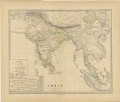
Ancient Cartography of the Indian Subcontinent, Published in 1880
Located in Langweer, NL
This map is titled "INDIA," and it provides a detailed view of the Indian subcontinent with various inset maps that offer additional historical and geographical context. The main ma...
Category

Antique 1880s Collectibles and Curiosities

Materials

Paper

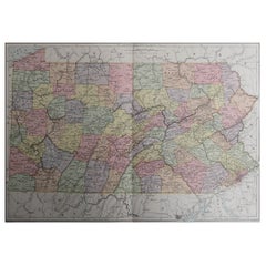
Original Antique Map of the American State of Pennsylvania, 1889
Located in St Annes, Lancashire
Great map of Pennsylvania Drawn and Engraved by W. & A.K. Johnston Published By A & C Black, Edinburgh. Original colour Unframed. Repair to a minor tear on bottom edge.
Category

Scottish Victorian Antique 1880s Collectibles and Curiosities

Materials

Paper

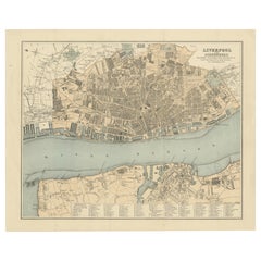
Map of Liverpool and Birkenhead by Bartholomew, circa 1880, with Key Buildings
Located in Langweer, NL
Map of Liverpool and Birkenhead by J. Bartholomew, circa 1880, with key buildings Detailed city plan titled 'Liverpool and Birkenhead with the surrounding districts', drawn by J. Ba...
Category

Antique 1880s Collectibles and Curiosities

Materials

Paper

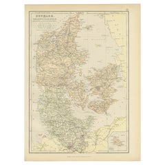
1882 Map of Denmark, Schleswig, and Holstein Highlighting Geographical Details
Located in Langweer, NL
This 1882 map of Denmark, Schleswig, and Holstein, published by Blackie and Son as part of the 'Comprehensive Atlas and Geography of the World,' provides a detailed representation of...
Category

Antique 1880s Collectibles and Curiosities

Materials

Paper

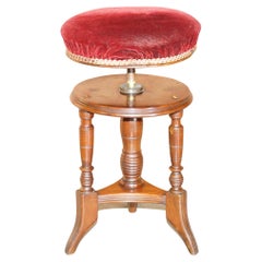
Antique Victorian Hardwood Piano Stool with Decorative Base Height Adjustable
Located in West Sussex, Pulborough
We are delighted to offer for sale this stunning hand carved Victorian circa 1880 Piano stool with height adjustable top A very good looking and well-made piano stool, its quite w...
Category

English Victorian Antique 1880s Collectibles and Curiosities

Materials

Upholstery, Hardwood

Daggett, Thomas F.. The Outlaw Brothers, Frank & Jesse James. SIXTH EDITION 1881
Located in Hillsborough, NJ
AUTHOR: [Daggett, Thomas F.] TITLE: The Outlaw Brothers, Frank and Jesse James. Lives and Adventures of the Scourges of the Plains. PUBLISHER: NY: Richard K. Fox, 1881. DESCRIPTIO...
Category

American Antique 1880s Collectibles and Curiosities

Materials

Paper

Original Antique Print of Crimean Costumes, Russia & Ukraine, ca.1880
Located in Langweer, NL
Antique print titled 'Die Krim - Trachten'. Original antique print of Crimean costumes. Source unknown, to be determined. Artists and Engravers: Anonymous.
Category

Antique 1880s Collectibles and Curiosities

Materials

Paper

Terrestrial Globe Ludwig Julius Heymann, Circa 1880
Located in Madrid, ES
Terrestrial Globe Ludwig Julius Heymann, Circa 1880 Globe 10 cm in diameter with a marble base held by metal putty. Nineteenth century. Dimensions: 46 cm high 7.14 cm diameter
Category

Antique 1880s Collectibles and Curiosities

Materials

Marble

1882 Map of Argentina, La Plata, Chile, Paraguay, Uruguay, and Patagonia
Located in Langweer, NL
This 1882 map, published as part of the 'Comprehensive Atlas and Geography of the World' by Blackie and Son, provides an intricate depiction of Argentina, La Plata, Chile, Paraguay, ...
Category

Antique 1880s Collectibles and Curiosities

Materials

Paper

1882 Cartographic Views of Ireland's North and South Regions
Located in Langweer, NL
Title: 1882 Maps of Ireland: Northern and Southern Regions These two maps provide a detailed representation of Ireland as it was in 1882, divided into the northern and southern regi...
Category

Antique 1880s Collectibles and Curiosities

Materials

Paper

Antique 1882 Antique Map of Peru and Bolivia: Andes Mountains and Amazon Rivers
Located in Langweer, NL
Antique 1882 Map of Peru and Bolivia: Andes Mountains, Amazon Rivers, Historic Borders This map from 1882 provides a detailed representation of the countries of Peru and Bolivia in ...
Category

Antique 1880s Collectibles and Curiosities

Materials

Paper

1880 Map of the Caribbean and Central America by Adolf Stieler
Located in Langweer, NL
This is a detailed map titled "West-Indien und Central-Amerika," created by Adolf Stieler and published in Gotha in 1880. The map covers the Caribbean islands and the Central America...
Category

Antique 1880s Collectibles and Curiosities

Materials

Paper

Original Antique Map Covering the Russian Empire in Asia, 1880
Located in Langweer, NL
Antique map titled 'Sibérie ou Russie d'Asie'. Migeon's map covers the Russian empire in Asia from european Russia and the Ural Mountains to the Bering Strait and from the Arctic...
Category

Antique 1880s Collectibles and Curiosities

Materials

Paper

1882 Map of the Pacific Ocean Highlighting Islands and Surrounding Regions
Located in Langweer, NL
This 1882 map of the Pacific Ocean, published by Blackie and Son as part of the 'Comprehensive Atlas and Geography of the World,' presents a detailed and fascinating overview of the ...
Category

Antique 1880s Collectibles and Curiosities

Materials

Paper

Antique Decorative Coloured Map of South Africa and Madagascar, 1882
Located in Langweer, NL
The map of South Africa is from the Blackie & Son Atlas, published in 1882. This historical map is quite interesting for several reasons: 1. **Historical Period**: This map was crea...
Category

Antique 1880s Collectibles and Curiosities

Materials

Paper

Antique Carved Burr Walnut Banjo Barometer, circa 1880
Located in Suffolk, GB
Outstanding carved burr walnut banjo Barometer having a lovely carved burr walnut case with a thermometer and a 12 inch round silver dial. Perfect workin...
Category

English Victorian Antique 1880s Collectibles and Curiosities

Materials

Walnut

Territories of Antiquity: The Northern Division of Syria, A Detailed 1882 Map
Located in Langweer, NL
This 19th-century map from the atlas published by Blackie and Son in 1882 is titled "SYRIA (NORTH DIVISION)" and covers the northern part of Syria, capturing its geographical and adm...
Category

Antique 1880s Collectibles and Curiosities

Materials

Paper

1882 Map of Queensland, New South Wales, and Victoria with Detailed Features
Located in Langweer, NL
This 1882 map of Queensland, New South Wales, and Victoria, published by Blackie and Son as part of the 'Comprehensive Atlas and Geography of the World,' provides a detailed depictio...
Category

Antique 1880s Collectibles and Curiosities

Materials

Paper

Ancient Realms of Northeast Africa: Arabia, Ethiopia, and Egypt, Published 1880
Located in Langweer, NL
This map, titled "ARABIA, AETHIOPIA, AEGYPTUS," illustrates the regions of ancient Arabia, Ethiopia, and Egypt. Features that make this map interesting include: 1. **Geographical ...
Category

Antique 1880s Collectibles and Curiosities

Materials

Paper

1882 Map of France Highlighting Political Boundaries, Cities, Insets of Corsica
Located in Langweer, NL
This 1882 map of France, published by Blackie and Son as part of the 'Comprehensive Atlas and Geography of the World,' offers a detailed depiction of the country during the late 19th...
Category

Antique 1880s Collectibles and Curiosities

Materials

Paper

1882 Map of Sweden and Norway Highlighting Geographical and Political Features
Located in Langweer, NL
This 1882 map of Sweden and Norway, published by Blackie and Son as part of the 'Comprehensive Atlas and Geography of the World,' provides a detailed depiction of the Scandinavian Pe...
Category

Antique 1880s Collectibles and Curiosities

Materials

Paper

1882 Map of Belgium and The Netherlands Highlighting Geographical Details
Located in Langweer, NL
This 1882 map of Belgium and The Netherlands, published by Blackie and Son as part of the 'Comprehensive Atlas and Geography of the World,' offers a detailed representation of the tw...
Category

Antique 1880s Collectibles and Curiosities

Materials

Paper

Antique Map Depicting Burma, Siam, Annam (Vietnam) and Japan, 1882
Located in Langweer, NL
The image shows two maps side by side from the 1882 atlas by Blackie & Son. On the left, the map is titled "BURMAH SIAM AND ANAM," while the one on the right is labeled "JAPAN." **B...
Category

Antique 1880s Collectibles and Curiosities

Materials

Paper

19th Century Reprint of 16th Century Harbor Map of Copenhagen
Located in Haddonfield, NJ
This reprint of 1587 antique map of Copenhagen, Denmark retains its original mid-century mat and has been recently reframed in classic wood frame. The muted sepia colored map is a wo...
Category

Danish Baroque Antique 1880s Collectibles and Curiosities

Materials

Wood, Paper

1882 Map of the North Atlantic Ocean Showing Cable Tracks and Trade Winds
Located in Langweer, NL
This 1882 map of the North Atlantic Ocean, published by Blackie and Son as part of the 'Comprehensive Atlas and Geography of the World,' provides an intricate depiction of one of the...
Category

Antique 1880s Collectibles and Curiosities

Materials

Paper

1882 Map of Brazil: Historic Borders, River Systems, and Coastal Regions
Located in Langweer, NL
Title: 1882 Map of Brazil: Historic Borders, River Systems, and Coastal Regions Description: This 1882 map presents a detailed cartographic view of Brazil, the largest country in S...
Category

Antique 1880s Collectibles and Curiosities

Materials

Paper

Antique Victorian Quality Mahogany Banjo Barometer by James H Kelly of Glasgow
Located in Suffolk, GB
Antique Victorian quality mahogany banjo barometer by James H Kelly of Glasgow Having a quality mahogany shaped banjo barometer with scroll shaped carving ci...
Category

Scottish Victorian Antique 1880s Collectibles and Curiosities

Materials

Other

Framed Collection of Papal Crests
Located in Los Angeles, CA
A remarkable, one-of-a-kind, hand-carved, gessoed, 22k gold gilded, hand-painted, foliate embellished serpentine, crest-form, 19th century, convex Italian frame inset with ink-on-vel...
Category

Italian Antique 1880s Collectibles and Curiosities

Materials

Giltwood, Paint

Imperial Frontiers: A 19th Century Map of Southern Russia and the Caucasus, 1882
Located in Langweer, NL
This map, sourced from the comprehensive 1882 atlas by Blackie & Son, delineates the southern part of Russia and the Caucasus region, reflecting the geopolitical contours and topogra...
Category

Antique 1880s Collectibles and Curiosities

Materials

Paper

Susan B. Anthony Signed Handwritten Letter, Dated July 21, 1888
Located in Colorado Springs, CO
Presented is an original autographed letter, signed by women’s rights activist Susan B. Anthony. The letter, signed on a partial leaf of National Woman Suffrage Association stationar...
Category

Antique 1880s Collectibles and Curiosities

Materials

Paper

Antique Map of Europe in the 12th Century - Malte-Brun & Sarrazin, 1880
Located in Langweer, NL
Title: Antique Map of Europe in the 12th Century - Malte-Brun & Sarrazin, 1880 Description: This is an antique map titled "Europe en 1100," depicting Europe as it was around the 12...
Category

Antique 1880s Collectibles and Curiosities

Materials

Paper

Large Portrait Photo of Luitpold Prince Regent of Bavaria 1886 Wood carved Frame
Located in Nuernberg, DE
An extraordinary Original Photograph of Luitpold Karl Joseph Wilhelm Ludwig, Prince Regent of Bavaria (12 March 1821 – 12 December 1912). Beautiful hand crafted Black Forest style fr...
Category

German Folk Art Antique 1880s Collectibles and Curiosities

Materials

Glass, Wood

Lady JACKSON. The French Court & Society. 2 VOLS. 1881 IN A FINE COSWAY BINDING
Located in Hillsborough, NJ
AUTHOR: JACKSON, Lady Catherine Charlotte. TITLE: The French Court and Society, Reign of Louis XVI and First Empire. PUBLISHER: London: Richard Bentley & Son, 1881. DESCRIPTION: EXTRA ILLUSTRATED COSWAY BINDING. 2 vols., 8" x 5-7/8", title pages printed in red and black, extra illustrated with the insertion of numerous additional tipped plates, some hand colored from contemporary sources, bound in full tan crushed morocco, ribbed gilt decorated spines, covers ruled and paneled with interlocking panels of gilt fillets, gilt dentelles, all edges gilt, green silk morie endpapers, green morocco doublures, volume 1 doublure with a fine inset oval watercolor miniature of a lady of court signed...
Category

British Antique 1880s Collectibles and Curiosities

Materials

Leather

Original Antique Print of Relics of Bonnie Prince Charlie. C.1880
Located in St Annes, Lancashire
Great image of relics belonging to Charles Edward Stuart, Bonnie Prince Charlie Fine steel engraving by Charles Lawrie Published by Blackie, Ed...
Category

English Antique 1880s Collectibles and Curiosities

Materials

Paper

An Insightful 19th Century Map of Syria and the Surrounding Regions, 1882
Located in Langweer, NL
This map, titled "SYRIA (SOUTH DIVISION) including PALESTINE & THE HAUARAN," is a historical cartographic work from the late 19th century, specifically from the 1882 atlas by Blackie...
Category

Antique 1880s Collectibles and Curiosities

Materials

Paper

Black Sea in Antiquity: Pontus Euxinus Map, Published in 1880
Located in Langweer, NL
This map, titled "PONTUS EUXINUS," depicts the Black Sea region, historically known as the Pontus Euxinus. The Black Sea was central to ancient trade routes and cultural exchange, bo...
Category

Antique 1880s Collectibles and Curiosities

Materials

Paper

North African Coasts: Marmarica to Mauretania in Roman Times, Published in 1880
Located in Langweer, NL
The map with the title "MARMARICA, CYRENAICA, AFRICA, NUMIDIA, MAURETANIA secundum Italiam Poetarum" presents a historical geographical view of the northern coast of Africa, detailin...
Category

Antique 1880s Collectibles and Curiosities

Materials

Paper

Map of the Kingdom of Württemberg, Oberamt Tettnang in Germany, circa 1885
Located in Langweer, NL
Administrative Map of the Kingdom of Württemberg, Oberamt Tettnang, circa 1885 This detailed antique map titled "Handkarte von dem Königl. Württ. Oberamt Tettnang" was created by G....
Category

Antique 1880s Collectibles and Curiosities

Materials

Paper

Smoking Set 4 pieces, tobacco cigar, solid bronze stamped, Historism 1880 Europe
Located in Wien, AT
Very nice multi-piece smoking set out of solid bronze, made around 1880, in the end of the 19. Century, in Central Europe. The set is consisting of 4 pieces, a serving tray, a toba...
Category

European Belle Époque Antique 1880s Collectibles and Curiosities

Materials

Brass, Bronze

Original Antique Map of the American State of Washington, 1889
Located in St Annes, Lancashire
Great map of Washington Drawn and Engraved by W. & A.K. Johnston Published By A & C Black, Edinburgh. Original colour Unframed.
Category

Scottish Victorian Antique 1880s Collectibles and Curiosities

Materials

Paper

Original Antique Map of Switzerland, 1882
Located in Langweer, NL
Embark on a historical journey with an original Antique Map of Switzerland from the renowned 'Comprehensive Atlas and Geography of the World...
Category

Antique 1880s Collectibles and Curiosities

Materials

Paper

Ancient Iberia: Hispania Map from Spruner-Menke Atlas Antiquus, 1880
Located in Langweer, NL
This map is titled "HISPANIA," indicating it is a historical map of ancient Spain. It is an original antique map from the "Spruner-Menke Atlas Antiquus," a 19th-century historical a...
Category

Antique 1880s Collectibles and Curiosities

Materials

Paper

Hand Carved Coquille Nut Egg Box 19th Century Flea Trap Pomander Needle Case
Located in Nuernberg, DE
A beautiful hand carved coquille nut egg box. Beautiful carving, great patina, unscrews at center to open. The original use was a flea trap, things were d...
Category

English Victorian Antique 1880s Collectibles and Curiosities

Materials

Wood

Roman Italy and Provinces: A Cartographic Snapshot, 1880
Located in Langweer, NL
The map titled "ITALIA, Gallia Cisalpina, Sicilia, Sardinia, Corsica" focuses on Italy and its surrounding regions during Roman times. It offers a detailed depiction of the Italian peninsula, the Po Valley (Gallia Cisalpina), and the islands of Sicily, Sardinia, and Corsica. Produced as part of the "Spruner-Menke Atlas Antiquus" by Karl Spruner von Merz and edited by Theodorus Menke, this map reflects the 19th-century European scholarship on ancient geography and history. The period represented is likely during the Roman Republic or early Roman Empire, suggested by the level of detail in regions like Latium and Campania, which were central to Roman culture and power. This era was marked by Roman expansion and consolidation of the Italian peninsula, as well as the Punic Wars, which led to Roman dominance over the Mediterranean. What makes this map interesting is its: 1. **Rich Detail**: The map delineates the intricate network of Roman roads, cities, and colonies, showing the infrastructure that facilitated Roman administration and control. 2. **Strategic Locations**: It identifies strategic locations like harbors and passes, crucial for trade and military campaigns. 3. **Geographic Accuracy**: It reflects the geographical knowledge of the time, with an accurate representation of the topography that shaped the development of these regions. 4. **Cultural and Historical Sites**: Insets of important sites like Syracuse offer a closer look at places of historical significance. 5. **Educational Purpose**: The map was designed to aid in the study of Roman history, providing a visual tool for understanding the ancient world...
Category

Antique 1880s Collectibles and Curiosities

Materials

Paper

Small Map of St. Anna Bay and Willemstad, Curaçao – Dutch Colonial View, c. 1880
Located in Langweer, NL
Map of St. Anna Bay and Willemstad, Curaçao – Dutch Colonial View, c. 1880 This attractive late 19th-century map titled “De St. Anna-baai en de hoofdstad van Curaçao” offers a detai...
Category

Antique 1880s Collectibles and Curiosities

Materials

Paper

1880s Iron And Brass Balancing Scale
Located in Tarrytown, NY
1880s iron and brass balancing scale.
Category

Antique 1880s Collectibles and Curiosities

Materials

Brass, Iron

Old Map of Southern India and Ceylon 'Sri Lanka', 1882
Located in Langweer, NL
Antique map titled 'India (Southern Sheet)'. Old map of Southern India and Ceylon (Sri Lanka). With an inset map of the South-Eastern Provinces of India. This map originates from...
Category

Antique 1880s Collectibles and Curiosities

Materials

Paper

Colorful Detailed Antique Map of The British Islands and `The North Sea, 1882
Located in Langweer, NL
Discover 'The British Islands and The North Sea' Map with Insets of Orkney, Shetland, and Channel Islands! This captivating original antique map offers a detailed view of the British...
Category

Antique 1880s Collectibles and Curiosities

Materials

Paper

Roman Balkans: Pannonia, Illyricum, Dacia, Moesia, Thracia, Macedonia and Thyris
Located in Langweer, NL
This original antique map showcases the Roman provinces in the Balkan region and parts of Central and Eastern Europe. The title "PANNONIA, ILLYRICUM DACIA, MOESIA, THRACIA, MACEDONIA...
Category

Antique 1880s Collectibles and Curiosities

Materials

Paper

Leiden bottle second half of the 19th century accumulates preserves electrical charges
Located in Milan, IT
Leiden bottle from the second half of the 19th century is about an electrical component that accumulates and stores a high-voltage electrical charge by means of an external source ...
Category

Antique 1880s Collectibles and Curiosities

Materials

Glass

Antique Old Map of Africa with Insets of Mauritius, Reunion and Natal, 1882
Located in Langweer, NL
The uploaded image is a historical map of Africa from the 1882 atlas by Blackie & Son. The map includes the entire African continent, with various countries, regions, and topographic...
Category

Antique 1880s Collectibles and Curiosities

Materials

Paper

Imperium Romanum: A Detailed Map of the Roman Empire in its Zenith, 1880
Located in Langweer, NL
This original antique map, titled "IMPERIVM ROMANVM", is a detailed depiction of the Roman Empire at the height of its power. The main map encompasses the vast expanse of the Roman territories, stretching from the British Isles in the northwest to the deserts of Arabia and the northern fringes of Africa in the southeast. **Key Features of the Map:** 1. **Territorial Colors**: The map uses different colors to distinguish the various provinces of the Roman Empire. These color-coded areas are to represent the administrative divisions within the Empire. 2. **Topography**: It shows a considerable amount of topographical detail, with mountain ranges, rivers, and bodies of water such as the Mediterranean Sea, prominently displayed. 3. **Cities and Settlements**: Cities are marked, with symbols indicative of their size or importance. Major cities such as Rome, Constantinople, Alexandria, and Carthage are highlighted. 4. **Road Networks**: There appear to be lines connecting various cities and towns, which could represent the famous Roman road network that facilitated trade and military movements. 5. **Latin Text...
Category

Antique 1880s Collectibles and Curiosities

Materials

Paper

Antique Map of The United States of North America, 1882
Located in Langweer, NL
This is a historical map titled "The United States of North America, Central Part" from the 1882 Blackie Atlas. It depicts the continental United States with a high level of detail, ...
Category

Antique 1880s Collectibles and Curiosities

Materials

Paper

Colorful Detailed Antique Map of Europe, Published in 1882
Located in Langweer, NL
"The Antique Map of Europe from 'The Comprehensive Atlas and Geography of the World,' published in 1882 by Blackie & Son, is a testament to meticulous cartography and scholarly preci...
Category

Antique 1880s Collectibles and Curiosities

Materials

Paper

Original Antique Map of New Brunswick and Nova Scotia, 1889
Located in St Annes, Lancashire
Great map of New Brunswick and Nova Scotia Drawn and Engraved by W. & A.K. Johnston Published By A & C Black, Edinburgh. Original colour Unfr...
Category

Scottish Victorian Antique 1880s Collectibles and Curiosities

Materials

Paper

Mediterranean Encounters: From the Punic Wars to the Hannibalic War, 1880
Located in Langweer, NL
The map, with the title "MARE INTERNUM cum populis adiacentibus a bello Hannibalico usque ad Vespasiani M. princip," depicts the Mediterranean Sea and its surrounding territories, ex...
Category

Antique 1880s Collectibles and Curiosities

Materials

Paper

Original Antique Map of the American State of Oregon, 1889
Located in St Annes, Lancashire
Great map of Oregon Drawn and Engraved by W. & A.K. Johnston Published By A & C Black, Edinburgh. Original colour Unframed.
Category

Scottish Victorian Antique 1880s Collectibles and Curiosities

Materials

Paper

Original Antique Coloured Map of Western Africa, Published in 1882
Located in Langweer, NL
This is a map of Western Africa from the 1882 Blackie & Son atlas. The map details the West African coast from the Sahara Desert in the north down to the Gulf of Guinea, including a ...
Category

Antique 1880s Collectibles and Curiosities

Materials

Paper

Antique Map of Canada, The Province of Ontario and Part of Quebec, 1882
Located in Langweer, NL
This is a historical map from the 1882 Blackie Atlas, this time detailing "The Province of Ontario, and Part of Quebec" in Canada. The map presents a detailed illustration of Ontario...
Category

Antique 1880s Collectibles and Curiosities

Materials

Paper

Read More

Medal-Worthy Memorabilia from Epic Past Olympic Games

Get into the games! These items celebrate the events, athletes, host countries and sporting spirit.

Ahoy! You’ve Never Seen a Collection of Sailor Art and Kitsch Quite Like This

French trendsetter and serial collector Daniel Rozensztroch tells us about his obsession with objects related to seafaring men.

Pamela Shamshiri Shares the Secrets behind Her First-Ever Book and Its Effortlessly Cool Interiors

The sought-after designer worked with the team at Hoffman Creative to produce a monograph that beautifully showcases some of Studio Shamshiri's most inspiring projects.

Moroccan Artworks and Objects Take Center Stage in an Extraordinary Villa in Tangier

Italian writer and collector Umberto Pasti opens the doors to his remarkable cave of wonders in North Africa.

Montecito Has Drawn Royalty and Celebrities, and These Homes Are Proof of Its Allure

Hollywood A-listers, ex-pat aristocrats and art collectors and style setters of all stripes appreciate the allure of the coastal California hamlet — much on our minds after recent winter floods.

Whaam! Blam! Pow! — a New Book on Pop Art Packs a Punch

Publishing house Assouline and writer Julie Belcove have teamed up to trace the history of the genre, from Roy Lichtenstein, Andy Warhol and Yayoi Kusama to Mickalene Thomas and Jeff Koons.

The Sparkling Legacy of Tiffany & Co. Explained, One Jewel at a Time

A gorgeous new book celebrates — and memorializes — the iconic jeweler’s rich heritage.

What Makes a Gem-Encrusted Chess Set Worth $4 Million?

The world’s most opulent chess set, weighing in at 513 carats, is literally fit for a king and queen.

Recently Viewed

View All