
Scottish Wall Decorations

to
6
70
27
103
1
Height
to
Width
to
17
5
5
3
2
1
1
2
77
24
1
6
8
7
3
1
1
2
2
2
61
20
18
17
14
771
37,346
15,250
13,728
11,081
104
104
104
2
1
1
1
1
Place of Origin: Scottish
Robert Burns Portrait, Reverse Glass Painting, c.1830

Robert Burns Portrait, Reverse Glass Painting, c.1830

By Alexander Nasmyth

Located in Savannah, GA

Reverse-painted glass portrait of Robert Burns after Alexander Nasmyth, the Scottish bard shown half-length in brown coat, white stock, and striped waistcoat, with characteristic dar...

Category

1830s Regency Antique Scottish Wall Decorations

Materials

Glass, Wood

Modernist Glasgow Cityscape by Helen Carrick Anderson Dated 1966

Modernist Glasgow Cityscape by Helen Carrick Anderson Dated 1966

Located in Peabody, MA

Modernist view of Glasgow in the Impressionist style, dated 1966, by the mid century Scottish artist Helen Carrick Anderson (1909-1992), a member of the historic Milngavie Art Club. ...

Category

1960s Mid-Century Modern Vintage Scottish Wall Decorations

Materials

Paint

Set of 16 Large Original Antique Exotic Bird Prints, 1830s

Set of 16 Large Original Antique Exotic Bird Prints, 1830s

Located in St Annes, Lancashire

Great set of bird prints Lithographs after the drawings by Cpt. brown. Original hand color. Unframed The measurement given below is for one print.

Category

1830s Folk Art Antique Scottish Wall Decorations

Materials

Paper

Antique Map Turkey in Asia, Ottoman Empire Anatolia Syria Iraq Black, 1884

Antique Map Turkey in Asia, Ottoman Empire Anatolia Syria Iraq Black, 1884

Located in Langweer, NL

Antique Map Turkey in Asia, Ottoman Empire Anatolia Syria Iraq Black 1884 This detailed and beautifully engraved antique map titled Turkey in Asia was published in the New and Revised Edition of Black’s General Atlas of the World, issued in Edinburgh in 1884 by the respected Scottish cartographic publisher Adam and Charles Black. The map illustrates a vast portion of the Middle East during the late nineteenth century, when the region formed the Asian territories of the Ottoman Empire. The map centers on Anatolia, the great peninsula that today forms modern Turkey, shown here as the heartland of Ottoman Asia. The rugged mountain ranges, river systems, and historic provinces are carefully engraved, reflecting the high standard of Victorian atlas cartography. Numerous cities and towns are clearly marked, including Constantinople (Istanbul), Smyrna (Izmir), Angora (Ankara), Trebizond, and many other regional centers that played important roles in trade and administration. Extending southward, the map covers Syria and the Levant, including Damascus, Aleppo, and the Mediterranean coastal cities that historically linked the Ottoman interior with European commerce. Further south appear Palestine and the Sinai region, together with the eastern Mediterranean coastline. The map also includes the northern portion of Egypt, showing the Nile Delta and the strategic area surrounding the Suez Canal, which had opened only fifteen years earlier in 1869 and had quickly become one of the most important maritime routes in the world. To the east the map extends into Mesopotamia, depicting the great river valleys of the Tigris and Euphrates, including the historic cities of Mosul, Baghdad, and Basra. These regions formed key administrative provinces of the Ottoman Empire and were vital corridors connecting Anatolia with Persia and the Arabian Peninsula. The composition also includes parts of Armenia, Kurdistan, and the Caucasus along the northern and northeastern margins, as well as portions of Persia and Arabia to the southeast. An inset map of Cyprus appears at the bottom, highlighting the island’s strategic importance in the eastern Mediterranean. Cyprus had recently come under British administration in 1878, reflecting the shifting geopolitical dynamics of the region during the late nineteenth century. The map is engraved with remarkable clarity, featuring finely drawn coastlines, mountain relief, and a delicate latitude and longitude grid. Land areas are distinguished with subtle printed color, a typical feature of high-quality Victorian atlas production. The understated color scheme and precise engraving give the map both historical authority and strong decorative appeal. Maps from Black’s General Atlas were widely respected for their accuracy and clarity and were used throughout the British world in schools, libraries, and government institutions. Today they are highly appreciated by collectors for their elegant engraving and for the insight they provide into the political geography of the late nineteenth century. This map was published in the New and Revised Edition of Black’s General Atlas of the World, Edinburgh, 1884. This example is an original antique steel engraving with original printed color applied at the time of publication. It is not a modern reproduction. Any presentation images showing the print framed are for visual inspiration only. The map is supplied unframed. Condition: Good antique condition with light age toning consistent with age and a central fold from the original atlas binding. A small tear near the folding split. The engraving remains crisp and the printed color remains clear and attractive. Framing tips: This map displays beautifully in a wide horizontal frame. A dark walnut or classic black frame combined with an ivory or museum-white mat will emphasize the delicate engraving and warm tones of the nineteenth-century printed color. Technique: Steel engraving with original printed color Maker: Adam & Charles Black, Edinburgh, 1884 Keyword block: Turkey in Asia, Ottoman Empire, Anatolia, Asia Minor, Syria, Palestine, Mesopotamia, Iraq, Baghdad, Mosul, Basra, Damascus, Aleppo, Constantinople, Istanbul, Smyrna, Izmir, Angora, Ankara, Armenia, Kurdistan, Caucasus, Persia, Iran, Arabia, Nile Delta, Egypt, Suez Canal, Cyprus, Eastern Mediterranean, Middle East map, Ottoman provinces, nineteenth century Middle East, Victorian atlas map, Black’s General Atlas, antique Turkey map...

Category

Late 19th Century Antique Scottish Wall Decorations

Materials

Paper

A Large Pair of Cast Iron Royal Coat of Arms, 19th Century

A Large Pair of Cast Iron Royal Coat of Arms, 19th Century

Located in ARMADALE, VIC

A Large Pair of Cast Iron Royal Coat of Arms, 19th Century Provenance: Important Private Melbourne Collection. Description: Each coat of arms rendered with polychrome application, ...

Category

19th Century Antique Scottish Wall Decorations

Materials

Iron

Antique Map South Africa, Bartholomew for Black’s General Atlas - 1884

Antique Map South Africa, Bartholomew for Black’s General Atlas - 1884

Located in Langweer, NL

Antique Map South Africa, Bartholomew for Black’s General Atlas - 1884 Description: This detailed map of South Africa was published in the New and Revised Edition of Black’s General...

Category

Late 19th Century Antique Scottish Wall Decorations

Materials

Paper

Antique Map Italy, Bartholomew for Black’s General Atlas, Edinburgh 1884

Antique Map Italy, Bartholomew for Black’s General Atlas, Edinburgh 1884

Located in Langweer, NL

Antique Map Italy, Bartholomew for Black’s General Atlas, Edinburgh 1884 Description: This detailed map of Italy was published in the New and Revised Edition of Black’s General Atlas of the World, issued in Edinburgh in 1884 by the respected Scottish publishing house A. & C. Black. The map was prepared under the direction of the renowned cartographer John Bartholomew, whose work played a major role in shaping nineteenth-century atlas cartography. John Bartholomew was one of the most influential mapmakers of the Victorian era. His atlases for A. & C. Black were admired for their clarity, precision, and elegant presentation. Combining scientific geographic accuracy with refined engraving and printed color, Bartholomew’s maps became widely used in education, government, and scholarly circles throughout Europe and the British Empire. The map presents the Italian peninsula shortly after the unification of Italy in the nineteenth century. Political divisions are clearly distinguished through printed color, showing the administrative regions of the newly unified kingdom. The map extends from the Alpine frontier in the north to the southern tip of Calabria, capturing the entire peninsula with remarkable geographic detail. Northern Italy shows the Alpine region bordering Switzerland and Austria, with cities such as Turin, Milan, and Venice prominently marked. The Po River basin is depicted with a dense network of towns and transportation routes reflecting the economic importance of the region. Central Italy includes Florence, Pisa, and Rome, while the southern regions show Naples and the mountainous landscapes of Calabria and Basilicata. The map also includes the major Italian islands. Sardinia...

Category

Late 19th Century Antique Scottish Wall Decorations

Materials

Paper

Large Original Antique Map of The World, Fullarton, C.1870

Large Original Antique Map of The World, Fullarton, C.1870

Located in St Annes, Lancashire

Great map of the World. Showing both hemispheres From the celebrated Royal Illustrated Atlas Lithograph. Original color. Published by Fullarton, Edinburgh, C.1870 Unframed. Rep...

Category

1870s Antique Scottish Wall Decorations

Materials

Paper

Set of 6 Large Original Antique Prints of Birds of Prey, C.1835

Set of 6 Large Original Antique Prints of Birds of Prey, C.1835

Located in St Annes, Lancashire

Great set of birds of prey Lithographs after the drawings by Turvey, A. Wilson and Cpt. Brown. Original color. Unframed The measurement given below is for one print.

Category

1830s Folk Art Antique Scottish Wall Decorations

Materials

Paper

140" Paisley 19th c Shawl

140" Paisley 19th c Shawl

Located in Water Mill, NY

A Wonderful Colors 19th Century Paisley Shawl

Category

19th Century Antique Scottish Wall Decorations

Antique Map Russia in Europe, Bartholomew for Black’s General Atlas - 1884

Antique Map Russia in Europe, Bartholomew for Black’s General Atlas - 1884

Located in Langweer, NL

Antique Map Russia in Europe, Bartholomew for Black’s General Atlas 1884 Description: This detailed map titled “Russia in Europe” was published in the New and Revised Edition of Bla...

Category

Late 19th Century Antique Scottish Wall Decorations

Materials

Paper

Set of 18 Gothic Architectural Prints ( Scotland ) After Robert Billings. 1848

Set of 18 Gothic Architectural Prints ( Scotland ) After Robert Billings. 1848

Located in St Annes, Lancashire

Glorious set of 18 prints of Gothic Architecture in Scotland Steel engravings. After R.W. Billings Published by William Blackwood & Sons, Edinburgh. Dated 1848 Unframed.

Category

1840s Gothic Revival Antique Scottish Wall Decorations

Materials

Paper

Antique Stained Glass Panel of Glasgow's Old College

Antique Stained Glass Panel of Glasgow's Old College

Located in Wormelow, Herefordshire

An interesting and intricately handpainted late 19th century stained glass panel depicting Glasgow’s 17th century Old University College in High Street. The University of Glasgow lat...

Category

Late 19th Century Victorian Antique Scottish Wall Decorations

Materials

Lead

Scottish Sampler by Elizabeth Muir, c.1822

Scottish Sampler by Elizabeth Muir, c.1822

Located in Savannah, GA

Fine Scottish silk-on-linen sampler worked by Elizabeth Muir, aged 13 years, Burton, September 8, circa 1822, of East Lothian parish, featuring alphabet and number panels above paren...

Category

1820s Antique Scottish Wall Decorations

Materials

Linen, Silk, Glass, Wood

Original Antique Map of the American State of Washington, 1889

Original Antique Map of the American State of Washington, 1889

Located in St Annes, Lancashire

Great map of Washington Drawn and Engraved by W. & A.K. Johnston Published By A & C Black, Edinburgh. Original colour Unframed.

Category

1880s Victorian Antique Scottish Wall Decorations

Materials

Paper

Original Antique Map of the American State of Oregon, 1889

Original Antique Map of the American State of Oregon, 1889

Located in St Annes, Lancashire

Great map of Oregon Drawn and Engraved by W. & A.K. Johnston Published By A & C Black, Edinburgh. Original colour Unframed.

Category

1880s Victorian Antique Scottish Wall Decorations

Materials

Paper

Large Original Antique Map of the World, Fullarton, circa 1870

Large Original Antique Map of the World, Fullarton, circa 1870

Located in St Annes, Lancashire

Great map of the World. From the celebrated Royal Illustrated Atlas Lithograph. Original color. Published by Fullarton, Edinburgh, circa 1870. Unframed.

Category

1870s Antique Scottish Wall Decorations

Materials

Paper

“Stirling Castle Links” Antique Golf Etching by George Aikman, 1893

“Stirling Castle Links” Antique Golf Etching by George Aikman, 1893

Located in Colorado Springs, CO

Presented is an original 1893 etching by George Aikman, after an original watercolor by John Smart. This composition depicts golfers, accompanied by young caddies and families, playi...

Category

1890s High Victorian Antique Scottish Wall Decorations

Materials

Paper

"Amateur Championship at Sandwich" by Michael Brown, 1901

"Amateur Championship at Sandwich" by Michael Brown, 1901

Located in Colorado Springs, CO

Presented is a photogravure by Michael Brown entitled “Amateur Championship at Sandwich.” This print features Mr. H. Hilton and Mr. J. Robb engaged in the final of the 1900 Amateur C...

Category

Early 1900s Edwardian Antique Scottish Wall Decorations

Materials

Paper

Peter Graham (1836-1921).  Oil on canvas. Scottish Highlands. 1880s

Peter Graham (1836-1921). Oil on canvas. Scottish Highlands. 1880s

Located in København, Copenhagen

Peter Graham (1836-1921), Scottish painter. Oil on canvas. Scottish Highlands. Beautiful antique frame in 24-carat gold leaf. Approx. 1880s. Signed. Painting in excellent condition...

Category

1880s Antique Scottish Wall Decorations

Materials

Canvas

Set of 15 Large Original Antique Animal Prints, 1830s

Set of 15 Large Original Antique Animal Prints, 1830s

Located in St Annes, Lancashire

Great set of animal prints Lithographs after the drawings by Cpt. brown. Original hand color. Unframed The measurement given below is for one print.

Category

1830s Folk Art Antique Scottish Wall Decorations

Materials

Paper

Geological Map of North America by A.K. Johnston – Mountains and Valleys 1852

Geological Map of North America by A.K. Johnston – Mountains and Valleys 1852

Located in Langweer, NL

Geological Map of North America by A.K. Johnston – Mountains and Valleys 1852 This finely detailed and beautifully shaded antique map titled "The Mountains, Table Lands, Plains & Va...

Category

Mid-19th Century Antique Scottish Wall Decorations

Materials

Paper

Geological Map of Asia by A.K. Johnston – Mountains and Valleys 1852

Geological Map of Asia by A.K. Johnston – Mountains and Valleys 1852

Located in Langweer, NL

Geological Map of Asia by A.K. Johnston – Mountains and Valleys 1852 This finely engraved and hand-colored map titled "The Mountains, Table Lands, Plains & Valleys of Asia" was crea...

Category

Mid-19th Century Antique Scottish Wall Decorations

Materials

Paper

19C Oil on Canvas of Highland Rovers at Loch Earn by HR Hall

19C Oil on Canvas of Highland Rovers at Loch Earn by HR Hall

By Henry R. Hall

Located in Dallas, TX

PRESENTING A GORGEOUS and HIGHLY DESIRABLE 19C Oil on Canvas Highland Rovers at Loch Earn by HR Hall. Circa 1890-1900 and painted by Henry Robinson Hall, ...

Category

Late 19th Century Late Victorian Antique Scottish Wall Decorations

Materials

Canvas, Giltwood

Original 1972 Munich Olympic Poster by Alan Davie

Original 1972 Munich Olympic Poster by Alan Davie

By Alan Davie 1

Located in Weesp, NL

Immerse yourself in the dynamic energy of the 1972 Olympic Games with the iconic poster created by the renowned artist Alan Davie. This poster not only commemorates a historic sporting event but also showcases Davie's unique artistic vision and creativity. Alan Davie, a Scottish painter and jazz musician born in 1920, is celebrated for his abstract and expressive artworks. His vibrant and colorful compositions, infused with symbolism and spontaneity, have captivated art enthusiasts around the world and earned him a distinguished place in the realm of contemporary art. The 1972 Olympic poster by Alan Davie captures the essence of athleticism and competition with its dynamic forms and bold use of colors. Davie's expressive brushstrokes and abstract motifs create a visual spectacle that resonates with the spirit of the Olympic Games, conveying a sense of movement, passion, and unity. As an official poster for the 1972 Munich Olympics, this artwork not only serves as a symbol of sporting excellence but also represents the cultural and artistic significance of the event. Whether you're an art connoisseur, a sports enthusiast, or a collector of Olympic memorabilia...

Category

1970s Mid-Century Modern Vintage Scottish Wall Decorations

Materials

Paper

"Paddle Steamer Vulcan Sailing out of the Clyde" William Clark, 1834

"Paddle Steamer Vulcan Sailing out of the Clyde" William Clark, 1834

By William Clark

Located in Solebury, PA

A captivating illustration captures the majestic sight of the paddle steamer “Vulcan” gracefully departing from the Clyde canal. Her paddles create a rhythmic churning of the water b...

Category

1830s Antique Scottish Wall Decorations

Materials

Canvas, Giltwood, Paint

Wall Mounted Scottish Salt Box

Wall Mounted Scottish Salt Box

Located in Greenwich, CT

Lovely mid 19th century Scottish wall mounted salt box of staved construction, the shaped back with hinged lid over mixed wood half round body, bound in brass...

Category

19th Century Antique Scottish Wall Decorations

Materials

Brass

Painting of a Young Boy with His Dog after Henry Raeburn

Painting of a Young Boy with His Dog after Henry Raeburn

By Sir Henry Raeburn

Located in Vancouver, British Columbia

The oil painting on canvas is of a young boy 'hugging' his dog, which lies on the boy's lap. It is very much in the style of the Scottish painter Henry Raeburn. The boy is dressed in...

Category

Early 19th Century Romantic Antique Scottish Wall Decorations

Materials

Canvas, Wood

Antique Map Set of India, Two Sheets of Black’s General Atlas, Bartholomew 1884

Antique Map Set of India, Two Sheets of Black’s General Atlas, Bartholomew 1884

Located in Langweer, NL

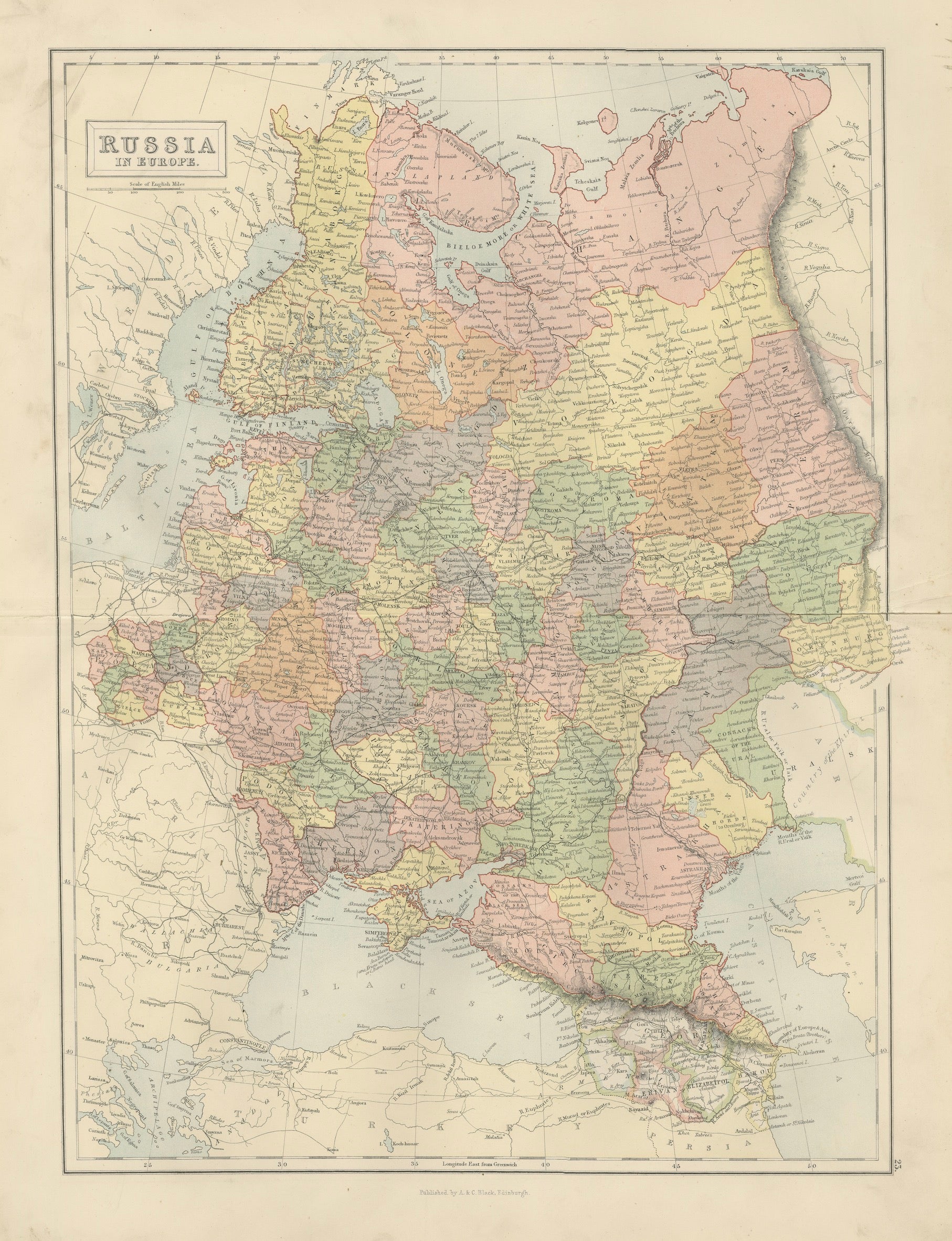
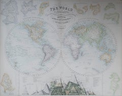
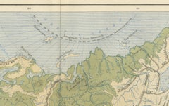
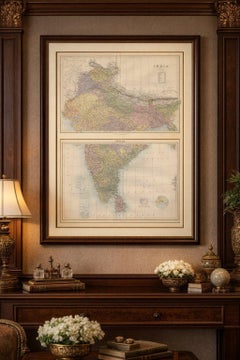
Antique Map Set of India, Two Sheets from Black’s General Atlas, Bartholomew 1884 This detailed two-sheet map of India was published in the New and Revised Edition of Black’s General Atlas of the World, issued in Edinburgh in 1884 by the well-known Scottish publishing house A. & C. Black. When placed together, the two maps form a comprehensive representation of the Indian subcontinent during the late nineteenth century, a period when British India dominated much of South Asia. 
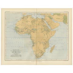
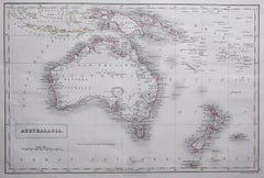
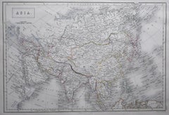
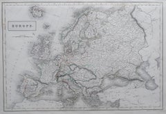
The maps were prepared under the direction of the celebrated cartographer John Bartholomew, whose work helped define the high standards of Victorian atlas production. Bartholomew’s maps were admired for their clarity, accuracy, and refined engraving, combining scientific geographic information with a visually elegant presentation. His work for Black’s atlases became widely respected across Europe and the British Empire and remains highly collectible today. The first sheet illustrates the northern regions of the subcontinent, including the Punjab, Kashmir, Afghanistan frontier, Nepal, Bhutan, and Tibet. The immense Himalayan mountain system is rendered with fine engraved relief, while the plains of northern India reveal an intricate network of rivers, cities, and administrative divisions. Provincial boundaries and political regions are clearly delineated using printed color typical of late nineteenth-century atlas cartography. 
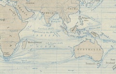
The second sheet depicts southern India and the Deccan Plateau, extending to the southern tip of the peninsula and including the island of Ceylon, now Sri Lanka. Major cities such as Bombay, Madras, and Calcutta appear prominently, while countless smaller towns, railways, and rivers are engraved throughout the landscape. The surrounding waters of the Arabian Sea, Bay of Bengal, and Indian Ocean are clearly marked, and the map also includes offshore island groups such as the Laccadive Islands and the Andaman Islands. Because the maps originate from a major nineteenth-century atlas, the engraving is crisp and densely detailed, containing thousands of place names that document the administrative and geographic structure of British India at the time. Together the two sheets create an impressive large-scale cartographic view of the Indian subcontinent, making the set both historically significant and visually striking. These maps are ideal for collectors of antique cartography, historians of the British Empire, or interior designers seeking a dramatic geographic statement for a study, office, or library wall. 
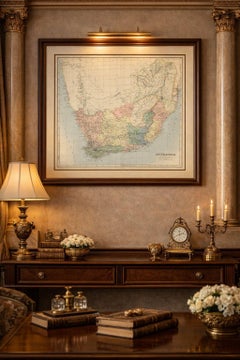
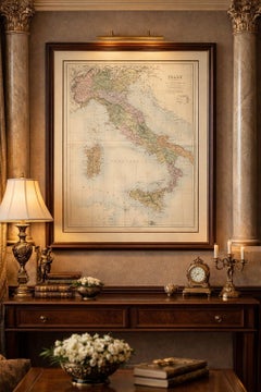
It is not a modern reproduction. Any presentation images showing the prints framed are for visual inspiration only. The maps are supplied unframed. Condition: Very good antique condition. Light age toning and minor handling wear consistent with age. Original center folds visible as issued in the atlas. Small tears at the lower split. The paper remains strong and the printed colors remain clear and attractive. Framing tips: The two sheets frame beautifully as a vertical pair or as a stacked presentation showing the full subcontinent. A generous ivory or museum-white mat combined with a dark walnut or ebonized frame creates a refined and classic presentation suitable for libraries, offices, or sophisticated interiors. Technique: engraving with printed color Maker: J. Bartholomew for A. & C. Black, Edinburgh, 1884 Keywords: India, antique map India, India map 1884, British India map, Bartholomew map India, Black’s General Atlas, India atlas map, Victorian map India, historical map India, South Asia map, Indian subcontinent map, Himalaya map, Punjab, Kashmir, Afghanistan, Nepal, Bhutan, Tibet, Delhi, Calcutta, Bombay, Madras, Hyderabad, Mysore, Bangalore, Nagpur, Agra, Lucknow, Ceylon, Sri Lanka, Bay of Bengal, Arabian Sea, Indian Ocean, Andaman Islands, Laccadive Islands, Deccan Plateau, British Empire map...

Category

Late 19th Century Antique Scottish Wall Decorations

Materials

Paper

Ian Kane, "Untitled" Tryptic, Scotland, 1992

Ian Kane, "Untitled" Tryptic, Scotland, 1992

Located in Catonvielle, FR

Ian Kane, untitled Tryptic, painted steel, rubber, wood and bolts, Dalcross Island, 1992. Exhibition catalog of the moving Space gallery, Brussels provided. U...

Category

20th Century Other Scottish Wall Decorations

Materials

Steel

British Artist George Blackie Sticks Framed Original Oil Painting

British Artist George Blackie Sticks Framed Original Oil Painting

By George Blackie Sticks

Located in Hamilton, Ontario

Painting size - 9.5 x 5.5 x .25 inches frame size - 17 x 13 x 2.75 inches George Blackie Sticks (1843-1936) Landscape painter in oil and watercolor. Son of James Sticks. The most distinguished member of the Sticks family of artists. Born in Newcastle. He had early artistic training as a designer in stained glass manufactory of William Wailes. He was placed under tuition of William Bell...

Category

Early 20th Century Scottish Wall Decorations

Materials

Paint

James Docharty Original Oil on Canvas 1874 Landscape Painting

James Docharty Original Oil on Canvas 1874 Landscape Painting

By James Docharty

Located in Hamilton, Ontario

Scottish artist James Docharty (1829-1878) 1874 oil on canvas painting with a beautiful ornate original gold frame. Actual picture size: 24 inches wide x 36.25 inches long x 1 inch d...

Category

1870s Victorian Antique Scottish Wall Decorations

Materials

Paint

Robert Herdman Painting

Robert Herdman Painting

By Robert Herdman

Located in Hamilton, Ontario

Robert Herdman (Scottish 1829-1888) oil on board. Nicely framed by Robert Herdman depicting woman sitting with keys. Measures: Size without frame 17.5" wide X 23.5" high Size with...

Category

Mid-19th Century Victorian Antique Scottish Wall Decorations

Materials

Paint

Late 19th Century Dunmore Pottery Victorian Green Glazed Ceramic Wall Plaque

Late 19th Century Dunmore Pottery Victorian Green Glazed Ceramic Wall Plaque

Located in Middleburg, VA

Late 19th Century Dunmore Pottery Victorian Green Glazed Ceramic Wall Plaque. This plaque was produced by Dunmore Pottery located on the estate of the Earl of Dunmore in Stilingshire, Scotland and depicts woman and cherub...

Category

Late 19th Century Victorian Antique Scottish Wall Decorations

Materials

Ceramic, Paint

Vintage Landscape Painting of Sligachan Bridge, Scotland – Signed D.S. Duncan

Vintage Landscape Painting of Sligachan Bridge, Scotland – Signed D.S. Duncan

Located in Los Angeles, CA

Condition: Original Vintage Condition Designer: D. S. Duncan Manufacturer: D. S. Duncan Materials: Oil on Canvas, Original Wood Frame Style: Realist This vintage oil painting by D...

Category

1970s Other Vintage Scottish Wall Decorations

Materials

Canvas, Wood

World Map of Ocean Currents by A.K. Johnston, Educational Print 1852

World Map of Ocean Currents by A.K. Johnston, Educational Print 1852

Located in Langweer, NL

World Map of Ocean Currents by A.K. Johnston, Educational Print 1852 This detailed and scientifically rich chart titled 'Chart of the World Showing the Form & Direction of the Ocean...

Category

Mid-19th Century Antique Scottish Wall Decorations

Materials

Paper

Oil On Canvas Landscape Scene 'View of Old and New Lanark'

Oil On Canvas Landscape Scene 'View of Old and New Lanark'

Located in Dublin 8, IE

'View of Old and New Lanark', Scotland, circa 1830. Oil on canvas landscape scene in gilt frame depicting ladies admiring the view of the River Clyde to the foreground with the town...

Category

19th Century Antique Scottish Wall Decorations

Materials

Canvas, Paint

Large Original Antique Map of Poland by Sidney Hall, 1847

Large Original Antique Map of Poland by Sidney Hall, 1847

Located in St Annes, Lancashire

Great map of Poland Drawn and engraved by Sidney Hall Steel engraving Original colour outline Published by A & C Black. 1847 Unframed ...

Category

1840s Antique Scottish Wall Decorations

Materials

Paper

Original circa 1880-90 Robert Gemmell Hutchison Oil on Canvas Painting a New Toy

Original circa 1880-90 Robert Gemmell Hutchison Oil on Canvas Painting a New Toy

By Robert Hutchinson

Located in West Sussex, Pulborough

We are delighted to offer for sale this stunning original circa 1880-1890 Robert Gemmell Hutchinson R.S.A oil on canvas titled “A New Toy” I fell in love with this Gemmell the secon...

Category

1880s Victorian Antique Scottish Wall Decorations

Materials

Canvas

19th Century Romantic English Painting of a Maid and Her Lover, Signed and Dated

19th Century Romantic English Painting of a Maid and Her Lover, Signed and Dated

By John Douglas Michie

Located in Long Island City, NY

19th century painting of a maid and her lover, signed and dated In great condition Ready to hang Size of frame is : 38 inches by 30 inches Size of work is : 28 inches by 20 inches John Douglas...

Category

19th Century Antique Scottish Wall Decorations

Materials

Paint

"Surviving Amateur Champions at Hoylake" Golf Photogravure by Michael Brown 1907

"Surviving Amateur Champions at Hoylake" Golf Photogravure by Michael Brown 1907

Located in Colorado Springs, CO

Presented is a photogravure by Michael Brown entitled “Surviving Amateur Champions- Hoylake 1906.” The print depicts a group of golf championship competitors waiting in the clubhouse...

Category

Early 1900s Edwardian Antique Scottish Wall Decorations

Materials

Paper

Antique Billiard Rules Pool Rules Pyramid Rules Victorian Framed Rules

Antique Billiard Rules Pool Rules Pyramid Rules Victorian Framed Rules

Located in Radstock, GB

This framed and printed sheet Rule frame is very unusual because it actually features the rules of three games Billiards, Life Pool and Pyramid pool. Printed by the famous Glasgo...

Category

Late 19th Century Victorian Antique Scottish Wall Decorations

Materials

Pine

Original Antique Decorative Map of South America-West Coast, Fullarton, C.1870

Original Antique Decorative Map of South America-West Coast, Fullarton, C.1870

Located in St Annes, Lancashire

Great map of Chili, Peru and part of Bolivia Wonderful figural border From the celebrated Royal Illustrated Atlas Lithograph. Original color. Published by Fullarton, Edi...

Category

1870s Antique Scottish Wall Decorations

Materials

Paper

Pair of Original Antique Prints of Decorative Art- Japonisme. C.1880

Pair of Original Antique Prints of Decorative Art- Japonisme. C.1880

Located in St Annes, Lancashire

Wonderful prints of Decorative Art, mainly Japonisme Chromo-lithographs Published by W.Mackenzie. C.1880 Original colour Unframed. Free shipping.

Category

1880s Japonisme Antique Scottish Wall Decorations

Materials

Paper

Ethnographic Map of the World by A.K. Johnston – Races of Man Chart 1852

Ethnographic Map of the World by A.K. Johnston – Races of Man Chart 1852

Located in Langweer, NL

Ethnographic Map of the World by A.K. Johnston – Races of Man Chart 1852 This antique map titled "Ethnographic Map of the World Showing the Present Distribution of the Leading Races...

Category

Mid-19th Century Antique Scottish Wall Decorations

Materials

Paper

Original Antique Map of New Brunswick and Nova Scotia, 1889

Original Antique Map of New Brunswick and Nova Scotia, 1889

Located in St Annes, Lancashire

Great map of New Brunswick and Nova Scotia Drawn and Engraved by W. & A.K. Johnston Published By A & C Black, Edinburgh. Original colour Unfr...

Category

1880s Victorian Antique Scottish Wall Decorations

Materials

Paper

1950s Original Carved Wooden print Block by Pauline Jacobsen Noli me Tangere

1950s Original Carved Wooden print Block by Pauline Jacobsen Noli me Tangere

Located in Stow on the Wold, GB

Original 1950s woodcut wooden print block by Pauline Jacobsen. Very nicely detailed, hand carved lime wood then used for printing. Exceptionally well carved. The artist would often u...

Category

Mid-20th Century Scottish Wall Decorations

Materials

Wood

Botanical Map by A.K. Johnston – Global Plant Distribution Chart 1852

Botanical Map by A.K. Johnston – Global Plant Distribution Chart 1852

Located in Langweer, NL

Botanical Map by A.K. Johnston – Global Plant Distribution Chart 1852 This remarkable antique chart titled "The Distribution of the Most Important Trees, Shrubs, Grains, & Fruits Ac...

Category

Mid-19th Century Antique Scottish Wall Decorations

Materials

Paper

Geological Map of Africa by A.K. Johnston – Mountains and Valleys 1852

Geological Map of Africa by A.K. Johnston – Mountains and Valleys 1852

Located in Langweer, NL

Geological Map of Africa by A.K. Johnston – Mountains and Valleys 1852 This antique map titled "The Mountains, Table Lands, Plains & Valleys of Africa" was produced by the distingui...

Category

Mid-19th Century Antique Scottish Wall Decorations

Materials

Paper

Rain and Snow Map by A.K. Johnston – Global Precipitation Chart 1852

Rain and Snow Map by A.K. Johnston – Global Precipitation Chart 1852

Located in Langweer, NL

Rain and Snow Map by A.K. Johnston – Global Precipitation Chart 1852 This antique meteorological chart titled "The Distribution of Rain and Snow over the Globe" was created by Alexa...

Category

Mid-19th Century Antique Scottish Wall Decorations

Materials

Paper

Large Original Antique Map of The West Indies by Sidney Hall, 1847

Large Original Antique Map of The West Indies by Sidney Hall, 1847

Located in St Annes, Lancashire

Great map of The West Indies Drawn and engraved by Sidney Hall Steel engraving Original colour outline Published by A & C Black. 1847 Unframed Free shipping.  

Category

1840s Antique Scottish Wall Decorations

Materials

Paper

Original Antique Map of the American State of Pennsylvania, 1889

Original Antique Map of the American State of Pennsylvania, 1889

Located in St Annes, Lancashire

Great map of Pennsylvania Drawn and Engraved by W. & A.K. Johnston Published By A & C Black, Edinburgh. Original colour Unframed. Repair to a minor tear on bottom edge.

Category

1880s Victorian Antique Scottish Wall Decorations

Materials

Paper

Large Original Antique Map of Australia by Sidney Hall, 1847

Large Original Antique Map of Australia by Sidney Hall, 1847

Located in St Annes, Lancashire

Great map of Australia Drawn and engraved by Sidney Hall Steel engraving Original colour outline Published by A & C Black. 1847 Unframed Free shipping.

Category

1840s Antique Scottish Wall Decorations

Materials

Paper

Large Original Antique Map of Asia by Sidney Hall, 1847

Large Original Antique Map of Asia by Sidney Hall, 1847

Located in St Annes, Lancashire

Great map of Asia Drawn and engraved by Sidney Hall Steel engraving Original colour outline Published by A & C Black. 1847 Unframed Free shipping

Category

1840s Antique Scottish Wall Decorations

Materials

Paper

Original Antique Map of the American State of Nevada, 1889

Original Antique Map of the American State of Nevada, 1889

Located in St Annes, Lancashire

Great map of Nevada Drawn and Engraved by W. & A.K. Johnston Published By A & C Black, Edinburgh. Original colour Unframed.

Category

1880s Victorian Antique Scottish Wall Decorations

Materials

Paper

Read More

Punk Rock and Rebellion Animate London’s Hit Yoshitomo Nara Show

The exhibition includes his portraits of wide-eyed kids with mayhem on their minds, as well as some of the artist’s personal belongings.

Whether Painted or Papered, Muraled Walls Make Bold Statements in the Home

The ancient practice of covering walls in artistic scenery is back.

In Francks Deceus’s ‘Mumbo Jumbo #5,’ the Black Experience Is . . . Complicated

Despite the obstacles, the piece’s protagonist navigates the chaos without losing his humanity.

12 Floral-Accented Rooms with a Handmade, Folkloric Feel

Who needs a flower garden? Just use your imagination — and some beautifully patterned wallpaper or fabric — to bring the outdoors in.

This Wolf Kahn Pastel Is the Epitome of Beauty at Its Most Essential

A longtime admirer of Kahn’s work, 1stDibs editorial director Anthony Barzilay Freund explores why it’s relevant now more than ever.

Why Jules Chéret Was the King of the Modern Poster

The streets of fin-de-siècle Paris were set aglow with colorful poster ads, thanks to the printing techniques invented by Jules Chéret. Now, the Milwaukee Art Museum is celebrating this undersung talent in America's first solo show dedicated his exuberant works.

Anna Condo’s Multifaceted Career Spans Film, Photography and NFTs

From her historic Manhattan townhouse, the talented creator and curator of 1stDibs' latest NFT exhibition tells us about the art in her home and how she got involved with cryptoart.

How Keith Rivers Went from NFL Linebacker to Blue-Chip Art Aficionado

The former football player is as serious about becoming a great contemporary-art patron as he once was about making tackles. Here, Rivers tells us how he got the collecting bug and how his tastes have evolved over the years.