Netherlands - Collectibles and Curiosities

to
4,820
6,394
15,028
11,538
6,353
28
13
55
25
19
18
16
11
6
5
4
2
1
1
1
3,129
2,486
738
41
337
116
38
79
6
6
10
6
17
32
14
7
5
5,732
361
210
79
79
906
245
212
117
72
6,394
6,393
6,393
104
59
20
14
14
Item Ships From: Netherlands
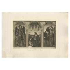
Antique Print of 'Madonna and Child with Saints' Made after Perugino 'c.1890'
Located in Langweer, NL
Antique print titled 'Madonna and Child with Saints'. Original antique print on chine collé, made after the painting by Perugino. Source unknown, to be determined. Published circa 1890.
Category

Late 19th Century Antique Netherlands - Collectibles and Curiosities

Materials

Paper

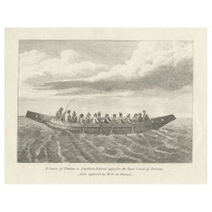
Antique Print of a Canoe of Chukotka, Tartary, 1800
Located in Langweer, NL
Antique print titled 'A Canoe of Tchoka, or Segalian Island, opposite the East Coast of Tartary first explored by M. de la Perouse'. Engraving of a canoe of Chukotka, Russia. Source ...
Category

18th Century Antique Netherlands - Collectibles and Curiosities

Materials

Paper

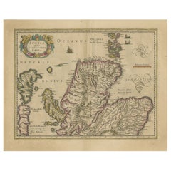
Original Antique Map of the Northern Part of Scotland, circa 1640
Located in Langweer, NL
The antique map, titled 'Scotiae pars septentrionalis,' depicts the northern part of Scotland. Crafted by Hondius around 1640, this map is a historical treasure showcasing the geogra...
Category

Mid-17th Century Antique Netherlands - Collectibles and Curiosities

Materials

Paper

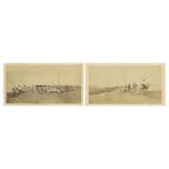
British Army Camp Scenes – Highland and Queen’s Regiments, 19th Century Pair
Located in Langweer, NL
British Army Camp Scenes – Highland and Queen’s Regiments, 19th Century Pair, circa 1870 This is a compelling pair of original 19th-century albumen photographs depicting British Arm...
Category

Late 19th Century English Antique Netherlands - Collectibles and Curiosities

Materials

Paper

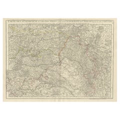
Antique Map of Champagne and surrounding Regions, France
Located in Langweer, NL
Antique map titled 'Carte de la Champagne et des Pays Voisins (..)'. Detailed map of Champagne and surrounding regions of Chalons and Soissons, Reims,...
Category

Mid-18th Century Antique Netherlands - Collectibles and Curiosities

Materials

Paper

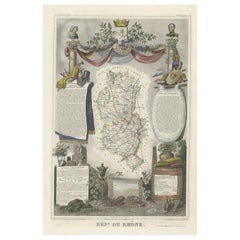
Map of Rhône: Culture and Commerce in Lyon's Silk and Wine Legacy, 1852
Located in Langweer, NL
This original hand-colored map is from the "Atlas National Illustré," a work by Victor Levasseur, a French geographer and cartographer known for his richly illustrated maps. The map...
Category

1850s Antique Netherlands - Collectibles and Curiosities

Materials

Paper

Southern Sweden Provinces Map – Homann’s ‘Nova Tabula Scaniae’, ca. 1730
Located in Langweer, NL
Southern Sweden Provinces Map – Homann’s ‘Nova Tabula Scaniae’, ca. 1730 Antique map titled 'Nova Tabula Scaniae in qua sunt Scania, Blekingia et Hallandia'. This decorative map sho...
Category

Mid-18th Century German Antique Netherlands - Collectibles and Curiosities

Materials

Paper

Antique Map of the Island of Tahiti, Polynesia, 1803
Located in Langweer, NL
Antique map Tahiti titled 'Kaart van het Eiland Otahiti'. Antique map of the Island of Tahiti, Polynesia. Originates from 'Reizen Rondom de Waereld door James Cook (..)'. Artists...
Category

Early 1800s Dutch Antique Netherlands - Collectibles and Curiosities

Materials

Paper

The World in the Assyrian Empire's Era: A Historical Map, Published in 1880
Located in Langweer, NL
This map from the "Spruner-Menke Atlas Antiquus" is titled "ORBIS TERRARVM regni Assyrii tempore," which translates to "The World at the Time of the Assyrian Kingdom." It depicts the...
Category

1880s Antique Netherlands - Collectibles and Curiosities

Materials

Paper

Dutch 19th Century Silver and Crystal Scent or Perfume Bottles
Located in Delft, NL
Dutch 19th century silver and crystal scent or perfume bottles Dutch silver scent perfume bottles, early 19th century with tilt cap and stopper. The bottles are crystal cut, 1 o...
Category

19th Century Dutch Antique Netherlands - Collectibles and Curiosities

Materials

Crystal, Silver

Antique Print of the Malabar Coast of India showing the VOC establishments, 1726
Located in Langweer, NL
Dutch print with the title: Platte Grond van t'Fort Tricoen male met de daar aangelegen Pagoods-Berg (Trincomalee, Sri Lanka) The map is taken from: 'Oud en Nieuw Oost-Indiën' van François Valentyn. 1) Ottens, Frederik (engraver / etcher) 2) Braam, J. van (publisher) 3) Linden, Gerard onder de (publisher) MALABAR COAST...
Category

1720s Antique Netherlands - Collectibles and Curiosities

Materials

Paper

Original Antique Map of Greece and part of Turkey
Located in Langweer, NL
Original antique map titled 'La Grece ou partie meridionale de la Turquie d'Europe'. Small map of Greece and part of Turkey. This map originates from 'Le nouveau et curieux Atlas Geo...
Category

Early 18th Century Antique Netherlands - Collectibles and Curiosities

Materials

Paper

Colonial Elegance and Exotic Charm: A Visual & Poetic Journey through 1910 Burma
Located in Langweer, NL
Title: Pictures from Lotus Land Authors: Photographs by Mrs. Ernest Muriel (Frances Matilda Muriel); Verses described by R.C.J. Swinhoe (Rodway Charles John Swinhoe) Publisher: Row...
Category

1910s Vintage Netherlands - Collectibles and Curiosities

Materials

Paper

Antique Map of The World in Hemispheres by W. G. Blackie, 1859
Located in Langweer, NL
Antique map titled 'The World in Hemispheres with other projections'. Original antique map of The World. This map originates from ‘The Imperial Atlas of Modern Geography’. Published ...
Category

Mid-19th Century Antique Netherlands - Collectibles and Curiosities

Materials

Paper

1855 Colton's Map of Patagonia with South Atlantic Islands Insets
Located in Langweer, NL
Title: 1855 Colton's Map of Patagonia with South Atlantic Islands Insets Description: This is an 1855 map titled "Colton's Patagonia," published by J.H. Colton & Co. in New York. Th...
Category

1850s Antique Netherlands - Collectibles and Curiosities

Materials

Paper

Roman Frontiers Engraved: Germania, Raetia, and Noricum, Published in 1880
Located in Langweer, NL
The map, titled "GERMANIA, RAETIA, NORICUM," depicts the regions of Germania, Raetia, and Noricum, which correspond to parts of modern-day Central and Eastern Europe, including areas of Germany, Austria, Switzerland, and the Balkans. Features of the map include: 1. **Regional Divisions**: The map is divided into the regions of Germania, Raetia, and Noricum, each likely differentiated by color or shading. 2. **Topography**: It details the mountain ranges, rivers, and other geographical features of the region. The Alps, which are central to Raetia, are prominently displayed. 3. **Roman Settlements and Roads**: The map likely marks Roman...
Category

1880s Antique Netherlands - Collectibles and Curiosities

Materials

Paper

Old Genealogy Chart of the Rulers of Margraviate Brandenburg in Germany, 1732
Located in Langweer, NL
Antique print titled 'Genealogie de la Maison de Brandebourg (..)'. Genealogy of the rulers of the Margraviate Brandenburg. This print orginates from 'Atlas Historique'. The Margraviate of Brandenburg (German: Markgrafschaft Brandenburg) was a major principality of the Holy Roman Empire from 1157 to 1806 that played a pivotal role in the history of Germany and Central Europe. Brandenburg developed out of the Northern March founded in the territory of the Slavic Wends. It derived one of its names from this inheritance, the March of Brandenburg (Mark Brandenburg). Its ruling margraves were established as prestigious prince-electors in the Golden Bull...
Category

18th Century Antique Netherlands - Collectibles and Curiosities

Materials

Paper

Antique Original Engraving of Seasons by Le Bas, C.1780
Located in Langweer, NL
Antique astronomy print titled 'L'inégalité des Saisons et des Jours'. Interesting print explaining why there is an inequality in the length of days and seasons. Source unknown, to b...
Category

18th Century Antique Netherlands - Collectibles and Curiosities

Materials

Paper

Ancient Italy: Regions and Rome in the Roman Empire, Published in 1880
Located in Langweer, NL
This print is an original detailed map titled "ITALIAE REGIONES I VII VIII IX XI," representing the regions of ancient Italy. Key Features of the Print: 1. **Regional Demarcations...
Category

1880s Antique Netherlands - Collectibles and Curiosities

Materials

Paper

Map of Northern India & Surrounding Regions, incl Kabul, Candahar & Bhutan, 1710
Located in Langweer, NL
Antique map titled 'Magni Mogolis Imperium de Novo Correctum et Divisum Per F. de Witt Amstelodami.' Map of Northern India and surrounding regions. This includes Kabul and Candah...
Category

1710s Antique Netherlands - Collectibles and Curiosities

Materials

Paper

Antique Religious Print "No. 30" the Denial of Peter, circa 1840
Located in Langweer, NL
Antique print titled ‘Histoire Sainte, Nouveau Testament, Reniement et Pénitence de Saint Pierre.’ This plate shows a scene from the New Testament; The Denial of Peter.’ This prin...
Category

Mid-19th Century Antique Netherlands - Collectibles and Curiosities

Materials

Paper

1684 Mallet Map of Amazon River & Kingdom of Amazons – Hand Colored, Miniature
Located in Langweer, NL
This map, titled 'Royaume des Amazones', was created by Alain Manesson Mallet and published in 1684 in a German edition of *Beschreibung des Gantzen Welt-Kreisses*, a renowned work d...
Category

1680s Antique Netherlands - Collectibles and Curiosities

Materials

Paper

Copper Engraving of a Section of the Royal Botanic Gardens, Kew, London, 1776
Located in Langweer, NL
Antique print titled 'Coupe sur la longueur d'une partie de la Galerie des Antiques dans les jardins de Kew'. Copper engraving showing a section of the Royal Botanic...
Category

1770s Antique Netherlands - Collectibles and Curiosities

Materials

Paper

Antique Engraving of Chinese Costumes, c.1860
Located in Langweer, NL
Antique print titled 'Costume Chinese'. Print of Chinese costumes. Source unknown, to be determined. Artists and Engravers: Anonymous. Condition:...
Category

19th Century Antique Netherlands - Collectibles and Curiosities

Materials

Paper

Dutch Silver Doll House Miniature Cross-Leg Cabinet, Herbert Hooijkaas, 1901
Located in Delft, NL
Dutch Silver Doll House Miniature Cross-Leg Cabinet, Herbert Hooijkaas, 1901 A Dutch silver Doll House 20 cm high miniature cross-leg cabinet on bottl...
Category

Early 20th Century Dutch Netherlands - Collectibles and Curiosities

Materials

Silver

Gold Rush Era Masterpiece: The Tallis & Rapkin Rare Map of Pre-Queensland, 1851
Located in Langweer, NL
The image is an original historical map of Australia from the year 1851, created by John Rapkin with illustrations by J. Marchant and engravings by J. B. Allen. The map was published...
Category

1850s Antique Netherlands - Collectibles and Curiosities

Materials

Paper

Interesting Original Antique Map of South America, 1822
Located in Langweer, NL
Antique map titled 'South America'. Map of South America with attractive topography, surrounded on three sides by text on the history, geography, and economy of the continent. Sh...
Category

19th Century Antique Netherlands - Collectibles and Curiosities

Materials

Paper

Religious Antique Print of a Knight of the Order of Santiago, 1845
Located in Langweer, NL
Antique print titled 'Chevalier de l'Ordre de St. Jaques de l'Epee'. Print of a Knight of the Order of Santiago, Order of St. James of the Sword. This print originates from 'Histoire...
Category

19th Century Antique Netherlands - Collectibles and Curiosities

Materials

Paper

Old Map of the American Railroad Network and All Weather Roads on Verso, 1931
Located in Langweer, NL
This is the “New Census Edition” of Clason’s United States Green Guide. It features two large maps of the United States on a single sheet. The recto map shows the complete road net...
Category

1930s Vintage Netherlands - Collectibles and Curiosities

Materials

Paper

Nicely Hand-colored Antique Print of Embossed Armour, 1842
Located in Langweer, NL
Antique print titled 'Embossed Armour, in the possession of Sir Samuel Meyrick K.H.'. Old print of embossed armour. This print originates from 'A criti...
Category

19th Century Antique Netherlands - Collectibles and Curiosities

Materials

Paper

Antique Map of Sri Lanka with an unusual five-sided shape, circa 1606
Located in Langweer, NL
Antique map titled 'Ins. Ceilan quae incolis Tenarisin dicitur'. This exquisite, early map of Sri Lanka is shown with an unusual five-sided shape. North is oriented to the left by an...
Category

Early 17th Century Antique Netherlands - Collectibles and Curiosities

Materials

Paper

Antique Religious Print "No. 35" the Crucifixion of Jesus, circa 1840
Located in Langweer, NL
Antique print titled ‘Histoire Sainte, Nouveau Testament, Crucifiement.’ This plate shows a scene from the New Testament; The Crucifixion of Jesus...
Category

Mid-19th Century French Antique Netherlands - Collectibles and Curiosities

Materials

Paper

Circa 1686 Daniel Stoopendaal Map: Biblical Sites from Paradise to Canaan
Located in Langweer, NL
Circa 1686 Daniel Stoopendaal Map: Biblical Sites from Paradise to Canaan This circa 1686 hand-colored map by Daniel Stoopendaal, titled "De Gelegentheyt van 't Paradys en 't Landt Canaan," beautifully illustrates the Middle East, extending from the Mediterranean to the Persian Gulf. The map features numerous Biblical locations, such as the Garden of Eden, the wanderings of the Children of Israel, and the story of Jonas and the whale. It is adorned with elaborate decorations, including a banner-style title cartouche and four corner vignettes depicting scenes from Genesis: Paradise, the creation of Adam and Eve, Eve offering the apple, and their expulsion from Eden. The bottom center showcases a dramatic portrayal of Noah's Ark. Measuring 18.3 inches wide by 11.9 inches high, this first state map includes Dutch text on the reverse and is in good condition, with a crisp impression, light toning along the centerfold, and a small chip in the bottom margin. Keywords: - Daniel Stoopendaal map - Biblical map - Garden of Eden - Land of Canaan - Middle East historical map - Noah's Ark map - Adam and Eve - 17th-century Bible...
Category

1680s Antique Netherlands - Collectibles and Curiosities

Materials

Paper

Decorative Vintage Print, Dutch Chart of Australia, 1st Edition, 1952
Located in Langweer, NL
The vintage school chart of Australia titled "Australië," created by W. Bakker & H. Rush and published in 1952: **Title**: Australië **Creators**: W. Bakker & H. Rush **Publication ...
Category

Mid-20th Century European Netherlands - Collectibles and Curiosities

Materials

Canvas

Original Antique Map of the Northern Baltic Region
Located in Langweer, NL
Title: "Livonia: Antique Map of the Northern Baltic Region" Description: This antique map, titled "Livonia," is a detailed representation of the northern Baltic region. Centered on ...
Category

Early 17th Century Antique Netherlands - Collectibles and Curiosities

Materials

Paper

Antique Map of Sweden by Bowen, 1747
Located in Langweer, NL
Antique map titled 'A New & Accurate Map of Sweden'. This map covers Sweden and Finland (shown as part of Sweden) as well as parts of modern day Estonia,...
Category

18th Century Antique Netherlands - Collectibles and Curiosities

Materials

Paper

Antique Print of a Ruin in Peru, South America, 1857
Located in Langweer, NL
Untitled print of a ruin in Peru. This print originates from 'Die Kunstwerke vom Alterthum bis auf die Gegenwart, oder, Wegweiser durch das ganze Gebiet der bildenden Kunst : enthalt...
Category

19th Century Antique Netherlands - Collectibles and Curiosities

Materials

Paper

Original Hand-Colored Antique Print of a Carthusian Nun, 1845
Located in Langweer, NL
Antique print titled 'Religieuse Chartreuse'. Print of a Carthusian Nun. This print originates from 'Histoire et Costumes des Ordres Religieux'. The Carthusians, also known as the...
Category

1840s Antique Netherlands - Collectibles and Curiosities

Materials

Paper

Rare Town Plan of Jerusalem, Includes an Extensive Key to Locations etc, 1708
Located in Langweer, NL
Antique map titled 'Eigentliche Vorstellung der Statt Jerusalem und derselben umliegenden Gegenden zu Salomonis auch zu und kurtz nach Christi Zeiten.' Rare town plan...
Category

Early 1700s Antique Netherlands - Collectibles and Curiosities

Materials

Paper

Detailed Antique Map of Hungary and Transylvania by Tirion, 1753
Located in Langweer, NL
Title: Nieuwe Kaart van’t Koninkryk Hongaryen en Zevenbergen by Isaak Tirion, 1753 – Antique Map of Hungary and Transylvania Description: This is an antique 1753 map titled *Nieuwe Kaart van’t Koninkryk Hongaryen en Zevenbergen*, created by the notable Dutch cartographer and publisher Isaak Tirion. The map showcases the Kingdom of Hungary and the region of Transylvania (referred to as "Zevenbergen") as they appeared in the mid-18th century. Tirion’s maps are well-known for their clarity, precision, and attention to geographic detail, making them highly sought after by collectors of antique maps. This map provides a detailed view of Hungary and Transylvania, including borders, towns, cities, rivers, and mountain ranges. It was created using the latest discoveries and updates of the time and reflects the political landscape of the region, which was part of the Habsburg Empire during a period of territorial changes and consolidations. The map’s borders are highlighted with color to distinguish different regions, and significant cities such as Buda, Pest, and Debrecen are clearly labeled. Isaak Tirion was one of the most prominent Dutch publishers of the 18th century, particularly known for his *Nieuwe en Beknopte Hand-Atlas* (New and Concise Hand Atlas) series, which included a wide range of maps of Europe and beyond. His works were appreciated for their cartographic accuracy and artistic quality. This map is a valuable piece for collectors interested in 18th-century European maps, particularly those that highlight Central Europe, Hungary, Transylvania, and the Habsburg Empire. It is a fine example of the craftsmanship of Isaak Tirion and offers insight into the historical geography of the region. Condition: Excellent for its age, with finely preserved hand-coloring and wide margins. Slight edge wear typical of maps from this period. Effective keywords that may help attract collectors or enthusiasts interested in historical maps of Hungary, Transylvania, and Central Europe: - Antique map of Hungary - Historical map of Transylvania - 18th-century map of Central Europe - Habsburg Empire map - Isaak Tirion map - Nieuwe Kaart van’t Koninkryk Hongaryen en Zevenbergen - Kingdom of Hungary map...
Category

1750s Antique Netherlands - Collectibles and Curiosities

Materials

Paper

Antique Map of Europe by Levasseur, '1875'
Located in Langweer, NL
Antique map titled 'Carte générale de l'Europe'. Large map of Europe. This map originates from 'Atlas de Géographie Moderne Physique et Politique' by A. Levasseur. Published 1875.
Category

Late 19th Century Antique Netherlands - Collectibles and Curiosities

Materials

Paper

Antique Chart of the Passage of Comets in the Southern Sky, circa 1740
Located in Langweer, NL
Antique map titled 'Motus Comtarum in Hemispaerio Australi (..)'. This uncommon chart depicts the passage of comets in the southern sky between the years 1530-1704. Centered on the ecliptic poles and shows the constellation figures based on classical mythology, without showing the stars. The paths of dozens of comets are illustrated, eincluding those sighted by Tycho Brahe...
Category

Mid-18th Century Antique Netherlands - Collectibles and Curiosities

Materials

Paper

Antique Print of Martin Luther, 1701
Located in Langweer, NL
Antique portrait titled 'Martinus Lutherus'. Portrait of Martin Luther with an opened Bible in his hands. This print originates from 'Historie der kerken en ketteren van den beginne des Nieuwen Testaments tot aan het jaar onses Heeren 1688 ... In het Neederduyts vertaald' by G. Arnold. Artists and Engravers: Gottfried Arnold (1666 – 1714) was a German Lutheran...
Category

18th Century Antique Netherlands - Collectibles and Curiosities

Materials

Paper

Antique Map of the Holy Land, with vignette of the Garden of Eden
Located in Langweer, NL
Antique map titled 'Hondius his Map of Paradise'. Beautiful map of the region bounded by the Holy Land. Syria, Mesopotamia, Chaldea and part of Arabia. W...
Category

Mid-17th Century Antique Netherlands - Collectibles and Curiosities

Materials

Paper

Stunning Pharaoh Toetanchamon Golden Coated Brass Bust Sculpture on Marble Base
Located in Lisse, NL
Top quality and condition sculpture. If you are a collector of anything to do with ancient Egypt or if you are decorating a room or business with an Egyptian theme then this rare Pharaoh sculpture...
Category

Mid-20th Century Belgian Egyptian Netherlands - Collectibles and Curiosities

Materials

Marble, Brass

18th Century Brass Bedpan with Original Dark Oak Wooden Turned Steel
Located in Delft, NL
18th century brass bedpan with original dark oak wooden turned steel. A brass bedpan, made in The Netherlands in the 18th Century This bedpan would be f...
Category

18th Century Dutch Antique Netherlands - Collectibles and Curiosities

Materials

Brass

Large 1695 Hand-Colored Engraved Map of Gascony (Gascogna), France
Located in Langweer, NL
This map, created by Giacomo Cantelli da Vignola in 1695, represents the "General Government of Guyenne and Gascony" in southwest France. Cantelli da Vignola was a renowned Italian c...
Category

1690s Antique Netherlands - Collectibles and Curiosities

Materials

Paper

Map of Tartary by Isaak Tirion: Detailed Cartography of Northern Asia, ca.1740
Located in Langweer, NL
This is an antique map titled "Nieuwe Kaart van Tartarie," which translates to "New Map of Tartary." The map was created by Isaak Tirion, a prominent Dutch cartographer and publisher...
Category

1740s Antique Netherlands - Collectibles and Curiosities

Materials

Paper

Antique Print of Cairo in Egypt, 1698
Located in Langweer, NL
Untitled antique print with two views of Cairo, Egypt. 78: Palace of Sultan Gori. 79. Tower and aqueduct. This print originates from 'Reizen van Cornelis de Bruyn, door de vermaardst...
Category

17th Century Antique Netherlands - Collectibles and Curiosities

Materials

Paper

Map of Tasmania with Illustrations of Local Fauna and Colonial Landmarks, 1851
Located in Langweer, NL
John Tallis & Company was renowned for their detailed and ornate maps during the 19th century. Their maps are distinguished by the intricate borders and vignettes that are as informa...
Category

1850s Antique Netherlands - Collectibles and Curiosities

Materials

Paper

Antique Map of the Antilles by Meyer, 1878
Located in Langweer, NL
Antique map titled 'Die Antillen'. Old map of the Antilles, it shows Jamaica, Puerto Rico, the Bahamas and Cuba. With inset maps of the Lesser Antilles and Havana. This map originate...
Category

19th Century Antique Netherlands - Collectibles and Curiosities

Materials

Paper

Antique Religious Print 'No. 7' Presentation of Jesus at the Temple, circa 1840
Located in Langweer, NL
Antique print titled ‘Histoire Sainte, Nouveau Testament, La Présentation de Notre Seigneur.’ This plate shows a scene from the New Testament; The Presentation of Jesus at the Temple...
Category

Mid-19th Century Antique Netherlands - Collectibles and Curiosities

Materials

Paper

Old Engraving of Longvek or Lavek (Eauweck), the Second Capital City of Cambodia
Located in Langweer, NL
Antique print titled 'Eauweck, capitale de Camboye'. Decorative panoramic view of the town of Longvek (or Lavek) in Cambodia. It was the second capital city during the Cambodia's Mid...
Category

18th Century Antique Netherlands - Collectibles and Curiosities

Materials

Paper

Antique Map of the Province of Constantine, Algeria by Migeon, 1880
Located in Langweer, NL
Antique map titled 'Province de Constantine'. Old map of the province of Constantine, Algeria. The Department of Constantine existed from 1848 to 1962 and was one of the three admini...
Category

19th Century Antique Netherlands - Collectibles and Curiosities

Materials

Paper

Antique Print of a Landscape with Rock Formation in New Zealand by Cook, 1803
By Cook
Located in Langweer, NL
Antique print New Zealand titled 'Gezigt van eene doorboorde Rots in Nieuw-Zeeland'. Antique print depicting a landscape with rock formation,...
Category

19th Century Antique Netherlands - Collectibles and Curiosities

Materials

Paper

French Antique Map of Oceania with Details of the Australian Colonies, c.1840
Located in Langweer, NL
Antique map Oceania titled 'Océanie par C.V. Monin'. Old map of Oceania with an inset of New South Wales. Originates from 'Atlas Classique de la Géographie Ancienne (..)'. Artists ...
Category

19th Century Antique Netherlands - Collectibles and Curiosities

Materials

Paper

Mercator's Ptolemaic Map of Ancient Assyria, Media, and Persia
Located in Langweer, NL
This map, "Asiae I Tab:", features the region corresponding to modern-day Iran and Iraq, intricately depicted in Gerard Mercator's edition of Claudius Ptolemy's "Tabulae Geographicae...
Category

16th Century Antique Netherlands - Collectibles and Curiosities

Materials

Paper

Antique Map of Northern Germany, Including Schleswig-Holstein and Hamburg
Located in Langweer, NL
Antique map titled 'Basse Partie de la Basse Saxe ou sont les Duchés de Sleswick, Holsace, Meckelenbourg et Lauvenbourg (..)'. Original old map of northern Germany, including Schlesw...
Category

Mid-17th Century Antique Netherlands - Collectibles and Curiosities

Materials

Paper

Antique Map of England and Wales Depicting the Period of the Saxon Heptarchy
Located in Langweer, NL
Antique map titled 'Britain as divided under the Saxon Heptarchy'. An antique copper engraving map of England and Wales by Joseph Ellis depicting the period of the Saxon Heptarchy. E...
Category

Late 18th Century Antique Netherlands - Collectibles and Curiosities

Materials

Paper

Mapping the Heart of France: Willem Blaeu's 17th Century Île-de-France, ca.1650
Located in Langweer, NL
This original antique map titled "Le Gouvernement de l'Isle de France" represents the Île-de-France region, which historically was one of the provinces of France and contained the ci...
Category

1650s Antique Netherlands - Collectibles and Curiosities

Materials

Paper

Read More

Medal-Worthy Memorabilia from Epic Past Olympic Games

Get into the games! These items celebrate the events, athletes, host countries and sporting spirit.

Ahoy! You’ve Never Seen a Collection of Sailor Art and Kitsch Quite Like This

French trendsetter and serial collector Daniel Rozensztroch tells us about his obsession with objects related to seafaring men.

Pamela Shamshiri Shares the Secrets behind Her First-Ever Book and Its Effortlessly Cool Interiors

The sought-after designer worked with the team at Hoffman Creative to produce a monograph that beautifully showcases some of Studio Shamshiri's most inspiring projects.

Moroccan Artworks and Objects Take Center Stage in an Extraordinary Villa in Tangier

Italian writer and collector Umberto Pasti opens the doors to his remarkable cave of wonders in North Africa.

Montecito Has Drawn Royalty and Celebrities, and These Homes Are Proof of Its Allure

Hollywood A-listers, ex-pat aristocrats and art collectors and style setters of all stripes appreciate the allure of the coastal California hamlet — much on our minds after recent winter floods.

Whaam! Blam! Pow! — a New Book on Pop Art Packs a Punch

Publishing house Assouline and writer Julie Belcove have teamed up to trace the history of the genre, from Roy Lichtenstein, Andy Warhol and Yayoi Kusama to Mickalene Thomas and Jeff Koons.

What Makes a Gem-Encrusted Chess Set Worth $4 Million?

The world’s most opulent chess set, weighing in at 513 carats, is literally fit for a king and queen.

Tauba Auerbach’s Geometric Pop-Up Book Is Mighty Rare, Thanks to a Hurricane

This sculptural art book has an epic backstory of its own.
Recently Viewed

View All