Antique Nautical Maps
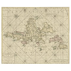
Shetland Islands Sea Chart – Antique Nautical Map by Ottens Brother c.1745
Located in Langweer, NL
Shetland Islands Sea Chart – Antique Nautical Map by Ottens Brothers, c.1740s
This striking
Category
1740s Dutch Antique Nautical Maps
Materials
Paper
$1,480
H 20.48 in W 25.2 in D 0 in
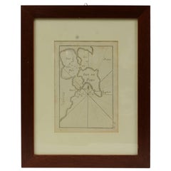
Antique Nautical Portolano of Isle De Poro by Antoine Roux, France, 1844
By Antoine Roux
Located in Milan, IT
Antique portolano, nautical map of Isle De Poro engraved on a copper plate by Antoine Roux
Category
1840s French Antique Nautical Maps
Materials
Paper
$532
H 14.97 in W 12.21 in D 0.79 in
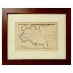
Antique Nautical Portolano of Port St. Antoine by Antoine Roux, France, 1844
By Antoine Roux
Located in Milan, IT
Antique portolano, nautical map of Port St. Antoine engraved on a copper plate by Antoine Roux
Category
1840s French Antique Nautical Maps
Materials
Paper
$532
H 12.21 in W 14.97 in D 0.79 in
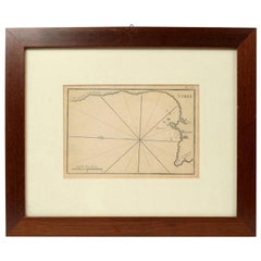
1844 French Antique Nautical print Engraved Portolano of Syrie by Antoine Roux
By Antoine Roux
Located in Milan, IT
Antique portolano, nautical map of Syrie engraved on a copper plate by Antoine Roux, Marseille
Category
1840s French Antique Nautical Maps
Materials
Paper
$532
H 12.21 in W 14.97 in D 0.79 in
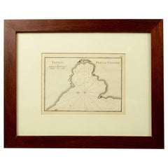
1844 French Nautical Portolano of Port De Chichimé Natolie by Antoine Roux
By Antoine Roux
Located in Milan, IT
Antique portolano, nautical map of Port De Chichimé Natolie engraved on a copper plate by Antoine
Category
1840s French Antique Nautical Maps
Materials
Paper
$532
H 12.21 in W 14.97 in D 0.79 in
1844 French Antique Nautical Portolano of Golfe De St. Drely by Antoine Roux
By Antoine Roux
Located in Milan, IT
Antique portolano, nautical map of Golfe De St. Drely engraved on a copper plate by Antoine Roux
Category
1840s French Antique Nautical Maps
Materials
Paper
$532
H 12.21 in W 14.97 in D 0.79 in
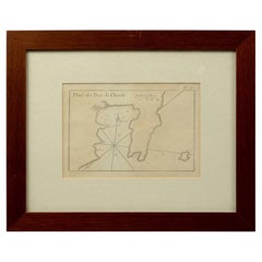
1844 French Antique Nautical Portolan of Plan du Port de Cherfe by Antoine Roux
By Antoine Roux
Located in Milan, IT
Antique portolano, nautical map of Plan du Port de Cherfe engraved on a copper plate by Antoine
Category
1840s French Antique Nautical Maps
Materials
Paper
$532
H 12.21 in W 14.97 in D 0.79 in
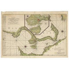
Antique Map: Carte du Détroit du Sond with Copenhagen Inset, 1693
Located in Langweer, NL
chart, Zealand and Scania map, 17th-century nautical map, Copenhagen inset map, La Neptune François map
Category
Late 17th Century Antique Nautical Maps
Materials
Paper
$2,131 Sale Price
20% Off
H 25.79 in W 37.01 in D 0.02 in
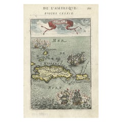
Antique 1683 Map of Hispaniola and Puerto Rico in the Caribbean by Mallet
Located in Langweer, NL
- Vintage Caribbean nautical map
- Historical geography of Hispaniola
- Puerto Rico antique map
- Old maps
Category
1830s Antique Nautical Maps
Materials
Paper
$360 Sale Price
20% Off
H 8.12 in W 5.52 in D 0 in
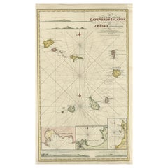
Nautical Chart of Cape Verde Islands by J.W. Norie, 1824 Coastal Map
Located in Langweer, NL
Nautical Chart of Cape Verde Islands by J.W. Norie, 1824 Coastal Map
This beautifully engraved
Category
Early 19th Century English Antique Nautical Maps
Materials
Paper
$2,250
H 28.35 in W 17.52 in D 0.01 in
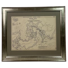
1901 Nautical Chart Showing Woods Hole, Mass
Located in Norwell, MA
Rare 1901 chart of Woods Hole, Mass., showing Buzzards Bay, Penzance Point, Nonamesset Island, Downtown Woods Hole, Parker Neck, Nobska Head, Vineyard Sound, Woods Hole Golf Club, Ra...
Category
Early 1900s North American Antique Nautical Maps
Materials
Paper
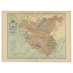
Cádiz 1901: Nautical Crossroads of the Atlantic and Mediterranean
Located in Langweer, NL
The map illustrates the province of Cádiz, located in the autonomous community of Andalusia, Spain
Category
Early 1900s Antique Nautical Maps
Materials
Paper
$397 Sale Price
20% Off
H 14.77 in W 20.08 in D 0 in
Nautical Chart of Skagerrak and Øresund by Johannes van Keulen, 1680
Located in Langweer, NL
, Johannes van Keulen map, 17th-century nautical chart, Skagerrak, Kattegat, Øresund, North Sea to Baltic Sea
Category
Late 17th Century Dutch Antique Nautical Maps
Materials
Paper
$909 Sale Price
20% Off
H 21.07 in W 24.81 in D 0.01 in
Original Hand-Coloured Nautical Chart of West-Africa, c.1680
Located in Langweer, NL
. Blanco tot C. Verde (...). Amsterdam, Johannus van Keulen, c. 1680.
Large folio coloured map in passe
Category
17th Century Dutch Antique Nautical Maps
Materials
Paper
$1,373 Sale Price
20% Off
H 20.08 in W 22.84 in D 0 in
Hand-colored Nautical Chart: St. George's Channel and the Irish Sea, 1744
Located in Langweer, NL
The map was engraved by Richard William Seale, a notable British engraver. This map is a fine
Category
1740s Antique Nautical Maps
Materials
Paper
$625 Sale Price
20% Off
H 20.16 in W 15.56 in D 0 in
Original 1882 Map of Arabia, Red Sea & Persian Gulf
Located in Langweer, NL
significant for navigation and commerce. The map includes nautical lines indicating sea depths and shipping
Category
1880s Antique Nautical Maps
Materials
Paper
Map of Avenches Region Switzerland by Mercator, Original 1585 Engraving
Located in Langweer, NL
Mercator projection, a method of mapmaking that became foundational for nautical navigation. His 1585 map
Category
16th Century Dutch Antique Nautical Maps
Materials
Paper
$639
H 17.52 in W 21.66 in D 0.01 in
Map of Virgin Islands and Lesser Antilles by Rigobert Bonne, c. 1780
Located in Langweer, NL
. Kitts St. Lucia Tobago Barbados Grenada map, maritime nautical atlas plate
Category
1780s French Antique Nautical Maps
Materials
Paper
$390
H 14.38 in W 10.01 in D 0.01 in
Early French Nautical Chart of the Northern Coast of of Java, Indonesia, C.1850
Located in Langweer, NL
Antique map titled Carte de la côte Nord de Java.
Early French nautical chart of the northern
Category
1850s Antique Nautical Maps
Materials
Paper
$1,089 Sale Price
20% Off
H 26.38 in W 38.59 in D 0 in
1773 Map of Persia, Gujarat & Malabar Coasts – Arabia to India, Hand-Colored
Located in Langweer, NL
atlas, Jacques-Nicolas Bellin map, 18th century nautical chart
Category
1780s Antique Nautical Maps
Materials
Paper
$402
H 11.23 in W 9.26 in D 0.01 in
Old Map of the Spice Islands, Moluccas by Bellin, Published in 1771
Located in Langweer, NL
bar in both French and Dutch nautical miles demonstrates the map’s practical use for navigation. The
Category
1770s Antique Nautical Maps
Materials
Paper
$189 Sale Price
20% Off
H 10.36 in W 7.72 in D 0.01 in
1856 U.S. Coast Survey Map of Chesapeake Bay and Delaware Bay
Located in Colorado Springs, CO
Presented is U.S. Coast Survey nautical chart or maritime map of Chesapeake Bay and Delaware Bay
Category
1850s American Antique Nautical Maps
Materials
Paper
Barbados Island at the Height of the Plantation Economy, Circa 1759
Located in Langweer, NL
, as Hydrographer to the King of France, is known for his nautical charts and colonial maps that
Category
1750s Antique Nautical Maps
Materials
Paper
$416 Sale Price
20% Off
H 9.73 in W 7.25 in D 0 in
Cartographic Elegance: The British Raj's India, 1882 Atlas by Blackie and Son
Located in Langweer, NL
British nautical knowledge.
Both maps display an overlay of longitude and latitude lines, indicative of
Category
1880s Antique Nautical Maps
Materials
Paper
$416 Sale Price / set
20% Off
H 14.97 in W 22.45 in D 0 in
Map of the World: An Original 18th Century Hand-colored Map by E. Bowen
Located in Alamo, CA
example of a nautical chart, a type of map that was designed specifically for use by mariners. The map is
Category
Mid-18th Century Old Masters Antique Nautical Maps
Materials
Engraving
$1,275
H 15.75 in W 19.63 in
Recent Sales
Carte de la Rade et des Iles d'Hyeres [...].
Located in Zeeland, Noord-Brabant
decorative sea chart / nautical map / maritime map. Map orientation is north.
Engraving on handlaid (verge
Category
Late 18th Century Antique Nautical Maps
Materials
Engraving
No. 28. Carte reduite du Golfe de Gascoigne [...].
Located in Zeeland, Noord-Brabant
Detailed map of the Gulf of Gascoigne / Biscay.) Decorative sea chart / nautical map / maritime map
Category
Late 18th Century Antique Nautical Maps
Materials
Engraving
Carte reduite des Mers du Nord [...].
By Jacques-Nicolas Bellin
Located in Zeeland, Noord-Brabant
sea chart / nautical map / maritime map of the North Atlantic Ocean and other northern seas with the
Category
Mid-18th Century Antique Nautical Maps
Materials
Engraving
Carte reduite des costes d'Espagne et de Portugal [...].
By Jacques-Nicolas Bellin
Located in Zeeland, Noord-Brabant
decorative sea chart / nautical map / maritime map of the region centered on Portugal with parts of N-W Spain
Category
Mid-18th Century Antique Nautical Maps
Materials
Engraving
H 23.82 in W 35.83 in
Carte reduite de Partie de la Mer du Nord comprise entre l'Ecosse, [...].
By Jacques-Nicolas Bellin
Located in Zeeland, Noord-Brabant
decorative sea chart / nautical map / maritime map of the North Sea, also including parts of Ireland, the
Category
Late 18th Century Antique Nautical Maps
Materials
Engraving
No.27. Carte reduite des Passage de l'Iroise du Four et du Raz [...].
By Jacques-Nicolas Bellin
Located in Zeeland, Noord-Brabant
Detailed map of the Iroise, du Four and du Raz Passages. Highly decorative sea chart / nautical map
Category
1760s Antique Nautical Maps
Materials
Engraving
Carte reduite du Golphe de St. Laurent [...].
By Jacques-Nicolas Bellin
Located in Zeeland, Noord-Brabant
...) Highly decorative sea chart / nautical map / maritime map of the Gulf of St. Lawrence including the
Category
Mid-18th Century Antique Nautical Maps
Materials
Engraving
Sea chart of the Southern Atlantic Ocean - Engraving - 18th century
Located in Zeeland, Noord-Brabant
Southern Atlantic Ocean ...) Highly decorative sea chart / nautical map / maritime map of the South
Category
1750s Old Masters Antique Nautical Maps
Materials
Engraving
Highly decorative sea chart of the Pacific Ocean - Engraving - 18th century
By Jacques-Nicolas Bellin
Located in Zeeland, Noord-Brabant
apelees par les Navigateurs Mer du Sud ou Mer Pacifique [...]' - (Detailed map of Oceans between Asia and
Category
1750s Old Masters Antique Nautical Maps
Materials
Engraving
Sea chart of Santa Domingo and its surroundings - Engraving - 18th century
Located in Zeeland, Noord-Brabant
, to serve for the ships of the King.) Highly decorative sea chart / nautical map / maritime map of the
Category
1750s Old Masters Antique Nautical Maps
Materials
Engraving
Sea chart of Gulf of Saint Laurence and Belle Isle - Engraving - 18th century
Located in Zeeland, Noord-Brabant
detailed map of the Gulf of St. Laurence ...) Highly decorative sea chart / nautical map / maritime map of
Category
1750s Old Masters Antique Nautical Maps
Materials
Engraving
Carte generale des costes de l'Europe sur l'ocean [...].
By Alexis Hubert Jaillot
Located in Zeeland, Noord-Brabant
Strait of Gibraltar.) Highly decorative sea chart / nautical map / maritime map of north-western Europe
Category
Late 17th Century Antique Nautical Maps
Materials
Engraving
H 24.41 in W 36.03 in
Large Nautical Map of New York Entrance, 1870
Located in Haddonfield, NJ
Large rectangular nautical map of the New York Entrance, 1857.
Sandy Hook Bay, Coney Island
Category
19th Century American Antique Nautical Maps
Nautical Map of the Mediterranean Sea from Le petit Neptune françois, 1763
By G. A. Rizzi-zannoni
Located in Milan, IT
Antique nautical map of the Mediterranean sea from La Spezia to Roussillon, from Le petit Neptune
Category
1760s French Antique Nautical Maps
H 12.21 in W 14.18 in D 0.79 in
Pelorus Made in 1920s of Brass, Made in New York with Original Mahogany Box
Located in Milan, IT
visible and distinguishable coastal points, which will subsequently be reported on the nautical map in
Category
1920s American Antique Nautical Maps
Materials
Brass
H 5.91 in W 7.88 in L 5.91 in
1837 "Mercator Projection" Map of the World by James Wyld
Located in Colorado Springs, CO
Mercator in 1569. It became the standard map projection for nautical purposes because of its ability to
Category
1830s English Antique Nautical Maps
Antique Nautical World Map Painted Wood Round Dining Table
Located in LOS ANGELES, CA
Antique Nautical World Map Painted Wood Round Dining Table
Category
1920s American Classical Roman Antique Nautical Maps
Materials
Wood
Detailed Nautical Antique Map of Martinique in the Caribbean, 1762
Located in Langweer, NL
Antique map titled 'Carte de l'Isle de la Martinique'.
Detailed nautical map of the island of
Category
1760s Antique Nautical Maps
Materials
Paper
1763 Nautical Portolano Chart of Guascogna Bay from Le Petit Neptune François
By G. A. Rizzi-zannoni
Located in Milan, IT
Antique nautical map of the Bay of Guascogna from Le petit Neptune françois published in Paris in
Category
1760s French Antique Nautical Maps
Materials
Paper
H 12.21 in W 14.18 in D 0.79 in
Map of Florida, Louisiana and the Bahamas – Set of Rare French Sea Charts, 1777
Located in Langweer, NL
-colored 18th-century nautical maps offers a fascinating glimpse into the colonial geography of the Gulf of
Category
1770s Antique Nautical Maps
Materials
Paper
H 18.9 in W 24.22 in D 0.01 in
Norway to Iceland, Framed Nautical Map
Located in Houston, TX
maps are quite unique. You can actually see markings on them from where captains did their course
Category
Early 20th Century Antique Nautical Maps
Materials
Glass
The North Sea, Antique Nautical Map
Located in Houston, TX
maps are quite unique. You can actually see markings on them from where captains did their course
Category
Early 20th Century Antique Nautical Maps
Materials
Glass
Very Rare Original 18th Century Ottoman Turkish Map - Mustafa II
Located in San Francisco, CA
Extremely rare, original 18th century Ottoman Turkish hand drawn and hand painted map of the
Category
18th Century and Earlier Turkish Antique Nautical Maps
Materials
Paper
Dover to Calais, Antique Nautical Map
Located in Houston, TX
Dover to Calais, Antique Nautical Map custom framed.
Category
Early 20th Century Antique Nautical Maps
Materials
Glass
Carte reduite des Isles Acores [...]. - Detailed map of the Azores Islands [...]
By Jacques-Nicolas Bellin
Located in Zeeland, Noord-Brabant
sea chart / nautical map / maritime map of the Azores. With profiles / coastal views of the islands
Category
Mid-18th Century Antique Nautical Maps
Materials
Engraving
People Also Browsed
Rug & Kilim’s Custom Scandinavian Rug Design With Geometric Patterns
By Rug & Kilim
Located in Long Island City, NY
This custom rug design represents the Scandinavian rug collection by Rug & Kilim—a contemporary reinvention of mid-century Swedish Rollakan and Rya rug styles.
On the Design:
...
Category
21st Century and Contemporary Indian Scandinavian Modern Antique Nautical Maps
Materials
Wool
Handmade Cast Bronze Squared Decorative Wabi-Sabi Tray, Vide Poche, Large
By Alguacil & Perkoff Ltd.
Located in London, London
Graceful bronze tray, vide-poche, inspired by Wabi-Sabi, the ancient Japanese philosophy that views and embraces the world for its imperfections and transient nature. It translates i...
Category
2010s British Organic Modern Antique Nautical Maps
Materials
Bronze
$355 / item
H 0.6 in W 7.09 in D 7.09 in
Frank Lloyd Wright "Barrel" Chair for Cassina, Black Leather, 1937
By Frank Lloyd Wright, Cassina
Located in Lonigo, Veneto
Frank Lloyd Wright "Barrel" chair for Cassina, patinated wood and black leather seat, Italy, 1937.
A timeless design informed by exceptional constructive complexity, the iconic "Ba...
Category
1930s Italian Mid-Century Modern Antique Nautical Maps
Materials
Wood, Leather
$3,931 / item
H 31.89 in W 21.46 in D 21.26 in
Flos Tab 2700K LED Floor Lamp in Aluminum, by Edward Barber & Jay Osgerby
By Flos, Edward Barber and Jay Osgerby
Located in Brooklyn, NY
A brand new edition of the tab family, now with new capabilities in new colors. This new edition of Tab floor lamp has an adjustable head with a 90-degree rotation capability emittin...
Category
21st Century and Contemporary Italian Modern Antique Nautical Maps
Materials
Aluminum
4.8x13.2 ft Vintage Turkish Kilim Runner Flat-woven Organic Wool Rug. Reversible
Located in Spring Valley, NY
A simple yet beautiful wool flat-weave rug handwoven by the nomadic tribes in South Central Turkey that has a design of stripes in beige, brown and madder red and minuscule simple ge...
Category
1960s Turkish Kilim Antique Nautical Maps
Materials
Wool
$923 Sale Price
49% Off
W 57.09 in L 157.49 in
Ego Stengods, Table Lamp, Stoneware, Sweden, 1970s
Located in High Point, NC
A brown and off-white stoneware table lamp produced by Ego Stengods, Sweden, c. 1970s.
Dimensions of Lamp (inches): 10.25“ H x 5.5“ Diameter
Dimensions of Shade (inches): 6“ Top Di...
Category
1970s Swedish Antique Nautical Maps
Materials
Stoneware
Mid-20th Century White Porcelain Opaline Glass Black Enamel Brass Pendant Lights
Located in Amsterdam, NL
Porcelain industrial hanging lamp.
White porcelain, brass and white opaline milk glass.
Black enamel shade
2 conductors, no ground.
Weight: 1.70 kg / 3.7 lb
Priced per individual i...
Category
Mid-20th Century French Mid-Century Modern Antique Nautical Maps
Materials
Brass, Enamel
$318 / item
H 9.85 in Dm 12.21 in
19th century portrait of a young Scottish/British boy in school uniform
Located in Woodbury, CT
Well painted 19th-century portrait of a young boy possible in a School Uniform.
With the label on the reverse being from Scottish panel makers, we believe the piece was painted in ...
Category
1840s Victorian Antique Nautical Maps
Materials
Oil, Board
$2,065 Sale Price
30% Off
H 23 in W 19 in
Henri Matisse Nu Bleu I, Original Lithograph Published 1958
By (after) Henri Matisse
Located in London, GB
Henri Matisse, Nu Bleu I
Printed by Mourlot Freres for Verve Vol IX Nos 35/36, published by Tériade under the title ‘The Last Works of Henri Matisse’ Presented with a double cream m...
Category
1950s Antique Nautical Maps
Materials
Lithograph
$3,286
H 24.02 in W 20.48 in D 0.99 in
Tiffany Studios Lotus Pagoda Lamp
By Tiffany Studios
Located in New Orleans, LA
This Tiffany Studios geometric leaded glass and bronze table lamp features the iconic Lotus Pagoda shade and its complementary original bronze base. The elegant form of the lotus-ins...
Category
20th Century American Art Nouveau Antique Nautical Maps
Materials
Bronze
Pair of Regency Shell Art Floral Bouquets under Glass Domes
Located in Dallas, TX
PRESENTING A ‘FANTASTICALLY’ RARE, EXCEPTIONAL QUALITY and MUSEUM QUALITY Pair of Regency Shell Art Floral Bouquets under Glass Domes.
Made in England, circa 1820, during the ‘Regen...
Category
Early 19th Century English Regency Antique Nautical Maps
Materials
Shell, Glass, Mahogany
STYLISH ANTIQUE ART DECO CIR 1920 BURR WALNUT GREEN VELOUR SOFA PART OF A SUiTE
Located in West Sussex, Pulborough
Royal House Antiques
Royal House Antiques is delighted to offer for sale this exquisite circa 1920’s Art Deco Burr Walnut framed sofa with Green Velour upholstery that is part of a ...
Category
1920s English Art Deco Antique Nautical Maps
Materials
Upholstery, Walnut
$6,503 / set
H 32.49 in W 72.05 in D 34.65 in
Willy Guhl Concrete Loop Chairs, 1960s Switzerland
By Willy Guhl
Located in Los Angeles, CA
Iconic pair of concrete loop chairs by Willy Guhl. This pair of chairs were designed by Willy Guhl in 1954. Guhl watched as the Eternit fiber cement panels were fabricated with a mac...
Category
1960s Swiss Antique Nautical Maps
Materials
Cement
Silent Stump, Side Table / Stool by Made by Choice
Located in Geneve, CH
Silent stump, side table / stool by Made By Choice (Seating object, functioning also as a table)
Nordic Silence Collection with Katrín Ólína
Dimensions: 35 x 35 x 45 cm
Materials:...
Category
2010s Finnish Post-Modern Antique Nautical Maps
Materials
Ash, Cork
Rare Moses Michelangelo Guggenheim & Pauly Cie Et Venice Antique Carved Armoire
By Pauly et Cie, Guggenheim Museum
Located in West Sussex, Pulborough
We are delighted to offer for sale this very rare one of a kind Pauly CIE Et stamped hand carved walnut armoire made by the genius that was Moses Michelangelo Guggenheim 1837-1910
W...
Category
19th Century Italian Victorian Antique Nautical Maps
Materials
Walnut
$341,425
H 100.6 in W 66.93 in D 24.81 in
Swiss Gold and Enamel Musical Vinaigrette
Located in New Orleans, LA
A musical movement distinguishes this wonderful early 19th-century gold vinaigrette box. The vessel is covered in delicate engraving highlighted by blue and white champlevé enamel de...
Category
19th Century Swiss Neoclassical Antique Nautical Maps
Materials
Metal
Get Updated with New Arrivals
Save "Antique Nautical Maps", and we’ll notify you when there are new listings in this category.
Antique Nautical Maps For Sale on 1stDibs
Find a variety of antique nautical maps available on 1stDibs. The range of distinct antique nautical maps — often made from paper and glass — can elevate any home. Antique nautical maps have long been popular, with older editions for sale from the 18th Century and newer versions made as recently as the 20th Century. Many antique nautical maps are appealing in their simplicity, but G. A. Rizzi-zannoni produced popular antique nautical maps that are worth a look.
How Much are Antique Nautical Maps?
Antique nautical maps can differ in price owing to various characteristics — the average selling price at 1stDibs is $1,261, while the lowest priced sells for $444 and the highest can go for as much as $3,800.
More Ways To Browse
Used Furniture Bahamas
Azimuth Compass
Japanese Bronze Rat
Japanese Children 1960s
Japanese Cinnabar
Japanese Door Handle
Japanese Egg
Japanese Espresso
Japanese Foil Art
Japanese Horn
Japanese Imari Box
Japanese Koransha Porcelain
Japanese Moon Vase
Japanese Palm Trees
Japanese Root Carving
Japanese Sake Set Antique
Japanese Satsuma Dragon Vase
Japanese Screen Rinpa

![Carte de la Rade et des Iles d'Hyeres [...]. Antique Carte de la Rade et des Iles d'Hyeres [...].](https://a.1stdibscdn.com/archivesE/upload/a_5923/1509453017426/IMG_0049_2_master.jpg?width=240)
![No. 28. Carte reduite du Golfe de Gascoigne [...]. Antique No. 28. Carte reduite du Golfe de Gascoigne [...].](https://a.1stdibscdn.com/archivesE/upload/a_5923/1509453330717/IMG_0051_2_master.jpg?width=240)


