

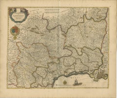
Antique Map of the Holy Land by Van Luchtenburg, c.1720
Located in Langweer, NL
with scale and compass rose. Published in the Netherlands by Covens & Mortier c. 1720. Artists and
Category
18th Century Compass Rose Antique
Materials
Paper
Antique Map of the Holy Land by Van Luchtenburg, c.1720
Located in Langweer, NL
with scale and compass rose. Published in the Netherlands by Covens & Mortier c. 1720. Artists and
Paper
$889Sale Price|40% Off
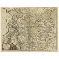
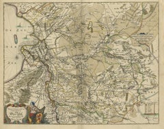
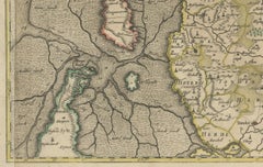
Attractive Original Map of the Province of Overijssel, the Netherlands, Ca.1700
Located in Langweer, NL
handcoloured map of the province of Overijssel, The Netherlands. With beautiful title cartouche, compass rose
Paper
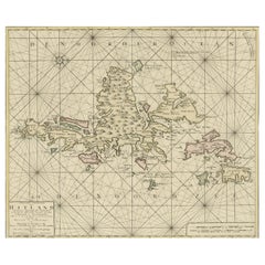
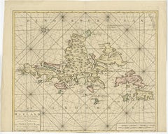
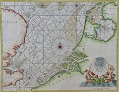
Shetland Islands Sea Chart – Antique Nautical Map by Ottens Brother c.1745
Located in Langweer, NL
, compass roses, coastal soundings, sandbanks, and bays. The surrounding islands and coastal configurations
Paper

$4,000Sale Price|25% Off
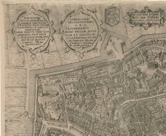
Rare Antique Map of Leeuwarden by P. Bast, 1603, Wall Art, Netherlands
By P. Bast
Located in Langweer, NL
engraved legend identifies key locations within the urban fabric, while the compass rose at the lower right
Paper
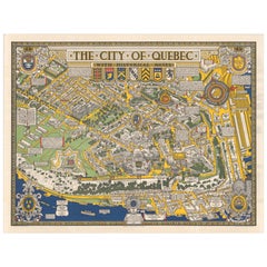
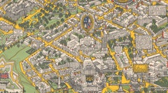
Quebec City Pictorial Map, The City of Quebec with Historical Notes, 1932
Located in Langweer, NL
. North is oriented to the right, indicated by a large and boldly designed compass rose. Throughout the
Paper
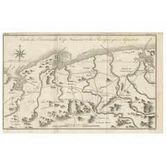
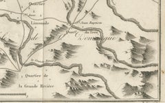
Antique Map of the Environs of Cap-Français, Saint-Domingue, c.1760
Located in Langweer, NL
Carénage and La Caye Vieille. Fortifications, such as Fort Dauphin, are also indicated. A large compass
Paper
Antique Map of the Amazon River – Maragnon or River of the Amazons, c.1760
Located in Langweer, NL
colonial centers of Spanish South America at the time. A large compass rose decorates the lower left
Paper
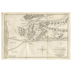
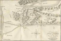
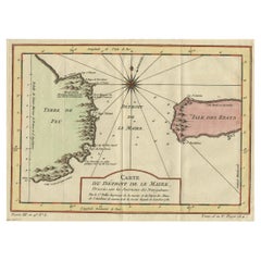
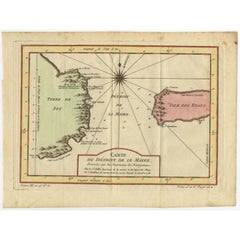
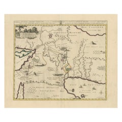
Antique Map of the Route of the Hebrews – Egypt to the Red Sea, 1720
Located in Langweer, NL
engraving also includes a decorative title cartouche in the lower right and a simple compass rose orienting
Paper
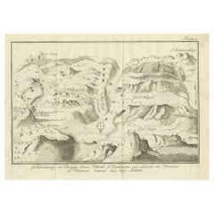
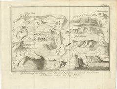
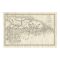
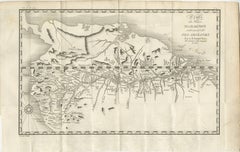
Mount Sinai & St. Catherine's – Antique Map of the Sinai Monasteries, 1776
Located in Langweer, NL
* (monasteries), cells, and ancient ruins A compass rose orients the viewer, and mountain ranges are rendered in
Paper
1728 Map of Batavia Castle & City, Java – Van der Aa after 1669
Located in Langweer, NL
mountains, framed in an elegant cartouche with a compass rose. The lion and globe VOC emblem adorns the
Paper
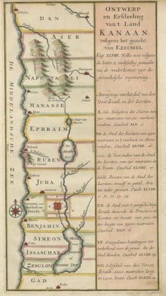
Hand-Colored Dutch Map of Ancient Israel Divided by the Twelve Tribes – c.1730
Located in Langweer, NL
ranges, rivers, and a decorative compass rose. On the right, a wide panel of explanatory text in Dutch
Paper


1720 Maps of the Holy Land: Ancient and Modern by De Fer and Danet
Located in Langweer, NL
cartouches and compass roses, reflecting the artistic style and craftsmanship of early 18th-century
Paper
Stunning Hand-Colored Map of Languedoc in France by Frederik De Wit c. 1688
Located in Langweer, NL
embellishments, adds a touch of artistry to this cartographic masterpiece. De Wit’s map also includes a compass
Paper
$2,220Sale Price|20% Off
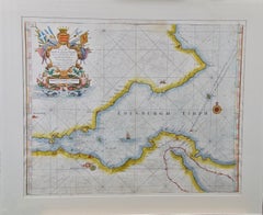
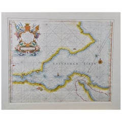
Edinburgh, Scotland: An Original 17th C. Hand-Colored Engraved Sea Chart
By Captain Greenvile Collins
Located in Alamo, CA
, as well as St. Andrews and Dunbar, Scotland. It includes a compass rose, a sailing ship and multiple
Engraving

Antique Map of Martinique with Title Cartouche Garnished with Sugar Cane, c.1760
Located in Langweer, NL
incorporates the distance scales and is garnished with sugar cane. A small compass rose completes the
Paper


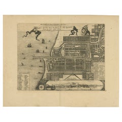
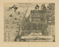
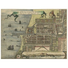
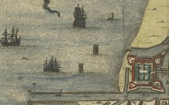
Antique Plan of Batavia, Capital of the Dutch East Indies, by Van Der Aa, 1725
By Pieter Van Der Aa
Located in Langweer, NL
Batavia / Jakarta in Indonesia. With extensive legend, compass rose and scale. This plate originates from
Paper
$218Sale Price|20% Off
Antique Map of the Passage Between the Atlantic and Pacific Oceans, circa 1753
Located in Langweer, NL
trade route for the Dutch. The map is adorned with a fine compass rose.Source unknown, to be determined
Paper

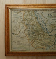
London 1744 Published Watercolour Antique Map of East Africa by Eman Bowen
Located in West Sussex, Pulborough
is highly embellished, including a cartouche showing a wildebeest and a compass rose. The map extends
Paper


$161Sale Price|20% Off
Original Antique Map of the Cape Verde Islands, 1746
Located in Langweer, NL
. Decorative cartouche and compass rose. Extends from Isle de St. Antoine down to Isle de St. Yago (sic
Paper
Antique Map of the Island of Java by Van Der Aa, 1725
By Pieter Van Der Aa
Located in Langweer, NL
island of Java. With compass rose and scale. This plate originates from the very scarse: 'La galerie
Paper

Antique Map of the Roadstead of Bantam by Van der Aa, 1725
By Pieter Van Der Aa
Located in Langweer, NL
city of Banten / Bantam on Java, Indonesia and its roadstead. With compass rose and scale. This plate
Paper

$2,220Sale Price|20% Off
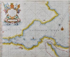
Edinburgh, Scotland Coast: A 17th Century Hand-Colored Sea Chart by Collins
By Captain Greenvile Collins
Located in Alamo, CA
, as well as St. Andrews and Dunbar, Scotland. It includes a compass rose, a sailing ship and multiple
Paper

$2,220Sale Price|20% Off
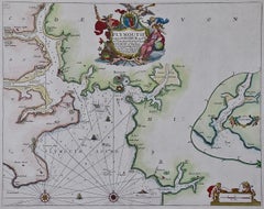
Plymouth, England: A Hand-Colored 17th Century Sea Chart by Captain Collins
By Captain Greenvile Collins
Located in Alamo, CA
and two compass roses. The beautiful and colorful cartouche includes a dedication to the Earle of
Paper
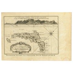

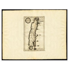
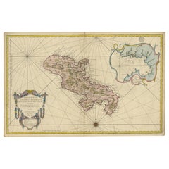
Original Antique Map of Juan Fernandez by Van Schley, 1757
Located in Langweer, NL
adorned with a decorative title cartouche and a compass rose with fleur-de-lys. The map was based on
Paper
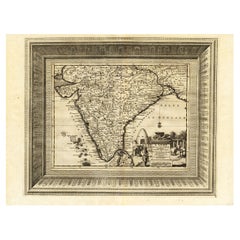

Rare Engraved Antique Map of India with Elephants in the Cartouche, c.1725
Located in Langweer, NL
map of India, with part of Sri Lanka. Compass rose and decorative cartouche lower right with scale and
Paper


$427Sale Price|20% Off
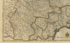
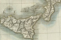
Antique Map of Italy, Showing Corsica, Sardinia, Croatia, Malta and More, C.1740
Located in Langweer, NL
bit of Provence, Malta and the northern coast of Africa. The map is centered on a simple compass rose
Paper
$2,374Sale Price|20% Off
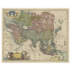
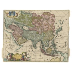
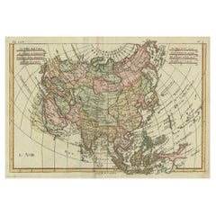
Antique Map of Asia and the East Indies and Korea as a Peninsula, ca.1660
Located in Langweer, NL
. Beautiful detailing throughout with rivers, mountains and forests, as well as sailing vessels and a compass
Paper
$385Sale Price|50% Off
Java, Sumatra & Borneo Map – Bellin & van Schley Decorative Chart, 1750s
Located in Langweer, NL
compass rose dominates the center of the composition, elegantly radiating directional lines across the
Paper
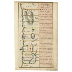
Antique Dutch Map of the Twelve Tribes of Israel – After Ezekiel, circa 1730
Located in Langweer, NL
and annotated with topographical elements such as mountain ranges and rivers. A decorative compass
Paper
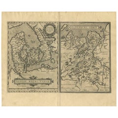

Daniae Regni & Oldenburg – Antique Maps of Denmark and Saxony by Ortelius, 1598
Located in Langweer, NL
compass roses enhances its visual richness. This map helped shape the European understanding of
Paper
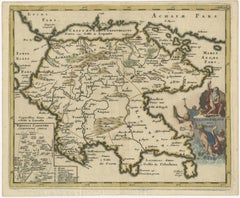
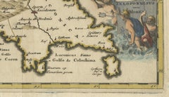
Antique Map of the Peloponnese – Peloponnesus, Morea, by Cluver, ca.1697
Located in Langweer, NL
compass rose provides orientation, while the allegorical title cartouche—populated by classical figures
Paper
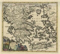
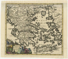
Antique Classical Greece Map – Aegean Sea & Crete, ca.1697
Located in Langweer, NL
compass rose provides orientation, while the allegorical title cartouche—populated by classical figures
Paper
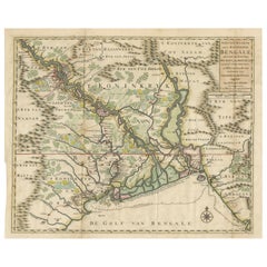
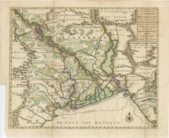
1726 Map of Bengal by Van der Aa after Valentijn – Dutch East Indies
Located in Langweer, NL
officials, referencing Mathijs van den Broecke, a director in Bengal, and Johannes Lennep. A compass rose is
Paper
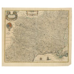

Map of Languedoc by Willem Blaeu, Antique French Copper Engraving 1635
Located in Langweer, NL
region during the reign of Louis XIII. A mileage scale in the upper center and a compass rose in the
Paper
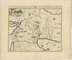
Antique Map of the Location of the Garden of Eden and Travels of the Patriarchs
Located in Langweer, NL
cities, rivers, and mountain ranges, along with maritime features such as ships and compass roses
Paper

Northern Schleswig and Haderslev Map by Johannes Mejer and Johannes Blaeu, 1662
Located in Langweer, NL
. - Compass Rose: Near the cartouche, there is a decorative compass rose, aiding in the orientation of the map
Paper

$142Sale Price|20% Off
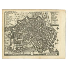
Antique Map of the City of Enkhuizen by Tirion, 1743
Located in Langweer, NL
Dutch legend. Decorated with compass rose, several ships and the city-arms. Artists and Engravers: Isaak
Paper

$540Sale Price|20% Off
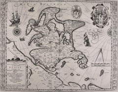
Rugen Island, Germany: An Early 17th Century Map by Mercator and Hondius
By Gerard Mercator
Located in Alamo, CA
compass roses, one mileage scale with dividers and a cartouche with a large coat of arms. The left and
Engraving


Antique Map of the Empire of China by Bonne, c.1780
By Rigobert Bonne
Located in Langweer, NL
cartouches, and compass roses. While mostly focusing on coastal regions, the work of Bonne is highly regarded
Paper

$2,220Sale Price|20% Off
Flanders, Holland & Norfolk: Hand-Colored 17th Century Sea Chart by Collins
By Captain Greenvile Collins
Located in Alamo, CA
several compass roses and extensive rhumb lines. A beautiful and colorful cartouche in the lower right
Paper
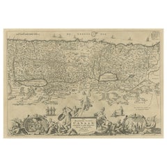
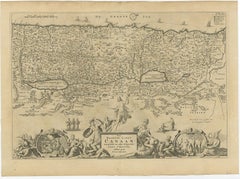
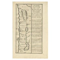
Promised Land of Canaan – Antique Map of Israel with Biblical Scenes, van Jagen
Located in Langweer, NL
geography, tracing the paths and presence of Christ throughout his ministry. A compass rose positioned in
Paper
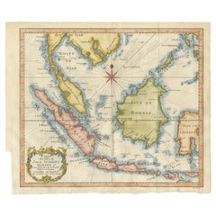
Original Map of the East Indies Including Sumatra, Java, Borneo & Malaysia, 1755
Located in Langweer, NL
, Celebes (Sulawesi) and adjoining seas threaded with rhumb lines from a bold eight-point compass rose
Paper

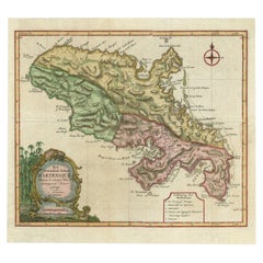
Stunning Large Scale Antique Map of Martinique, Rare, Published 1758
Located in Langweer, NL
cartouche in the opposite corner. Rhumb lines and a compass rose complete the composition. Its meticulous
Paper

Antique Map of Asia, Showing Tradewinds, Silke Route Cities Etc, c.1780
Located in Langweer, NL
, elaborate decorative cartouches, and compass roses. While mostly focusing on coastal regions, the work of
Paper
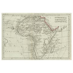

Antique Map of Africa with Ocean Currents and Other Details, C.1780
Located in Langweer, NL
century decorative features such as hand coloring, elaborate decorative cartouches, and compass roses
Paper
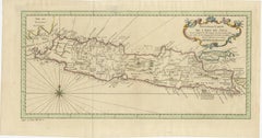
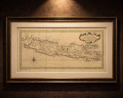
Antique Map of Java Indonesia, VOC Period, Decorative Cartouche, c.1750
Located in Langweer, NL
, a radiating compass rose adds both visual balance and navigational context, reinforcing the maritime
Paper
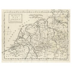
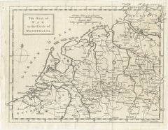
Seat of War Westphalia Map - Antique Military Map Netherlands Germany, 1763
Located in Langweer, NL
British or European mid-18th century cartographic production. The title cartouche, compass rose, and scale
Paper
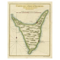
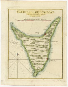
Anjouan Island, Comoros – French Naval Sea Chart by Bellin, c.1765
Located in Langweer, NL
political center of the island at the time. A compass rose and marine scale in lieues marines complete the
Paper
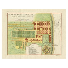
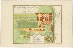
Cape of Good Hope – Fort and City Plan, French Colonial Map, c.1765
Located in Langweer, NL
intelligence. The shoreline, anchorage, landing points, and compass rose emphasize the Cape’s role as a
Paper
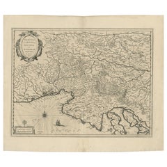
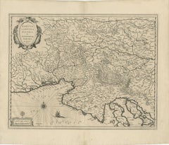
Original Antique Blaeu Map of Karst, Carniola, Istria, and Trieste, circa 1640
Located in Langweer, NL
elegantly engraved with stippled waters, a compass rose, rhumb lines, and a sailing ship, enhancing its
Paper
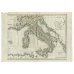
Map of Italy and Neighboring Regions by Delamarche – Antique Map, c.1800
Located in Langweer, NL
engraved compass rose and scale bar in the lower right enhance the map’s utility and aesthetic appeal. The
Paper
Rare 17th Century Map of Batavia and Castle on Java by Isaac de l'Obel
Located in Langweer, NL
coastline in the distance. The map is further embellished with decorative cartouches, a compass rose, and a
Paper
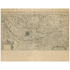
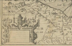
Map of Lake Geneva and Surroundings by Hondius, Geneva Region, circa 1612
Located in Langweer, NL
compass rose, geese along the shoreline, and even a subtle sea monster, lend charm and visual interest
Paper

1698 Mercator Ptolemaic Map of Asia East of the Ganges
Located in Langweer, NL
adorned with a decorative cartouche, a compass rose, and several sailing ships traversing the seas. On
Paper
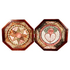
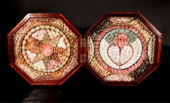
Double Sailor's Valentine of Sea Shells with Heart and Star Designs
Located in Downingtown, PA
pieces typically feature sentimental motifs—like the prominent heart in this example or a compass rose
Shell
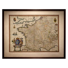
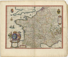
17th Century Blaeu Map of France, Gallia, Hand Colored, c.1642
Located in Langweer, NL
Blaeu’s refined aesthetic. Additional decorative features include sailing ships, a compass rose, and
Paper
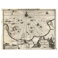

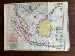
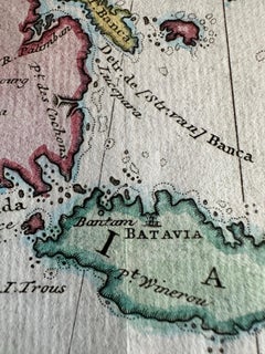
Antique Map of the Islands Near Batavia, Capital of the Dutch East Indies, 1682
Located in Langweer, NL
, Indonesia. With scale, compass rose, cartouche and ships on the sea. Sheet with engraving and text front and
Paper