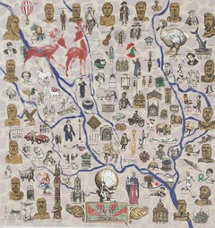
Original Vintage Poster Pictorial Map Of Yorkshire British Railways Train Travel
Located in London, GB
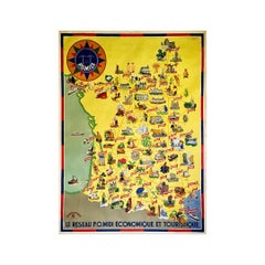
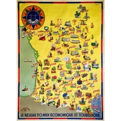
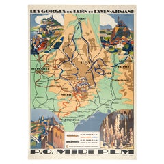
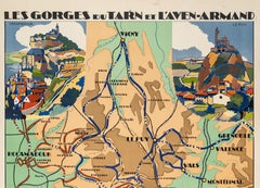
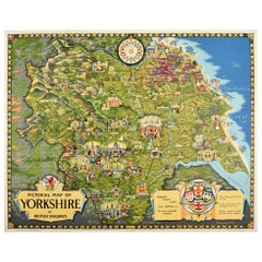
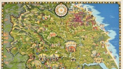
Original vintage train travel poster - Pictorial Map of Yorkshire by British Railways - featuring a colourful and detailed illustrated map of the historic county of Yorkshire in nort...
Category
Vintage 1950s British Posters
Materials
Paper