
Maps Rolled

to
24
56
18
58
36
20
11
9
4
4
4
3
3
2
2
2
2
1
1
1
1
1
1
1
1
1
1
1
Sort By
Vintage Mural Map Rollable Wall Chart Poster Australia New Zealand Indonesia

Vintage Mural Map Rollable Wall Chart Poster Australia New Zealand Indonesia

Located in Berghuelen, DE

Vintage Mural Map Rollable Wall Chart Poster Australia New Zealand Indonesia The vintage pull-down

Category

Vintage 1970s German Country Posters

Materials

Canvas, Wood, Paper

Middle East Saudia Arabia Israel India Map Rollable Mural Vintage Wall Chart

Middle East Saudia Arabia Israel India Map Rollable Mural Vintage Wall Chart

Located in Berghuelen, DE

The pull-down school map is depicting the region of the Middle East (Turkey, Israel, Egypt, Saudi

Category

Late 20th Century German Country Prints

Materials

Canvas, Wood, Paper

Decorative Map of Meuse Department, France – Vuillemin, c. 1850

Decorative Map of Meuse Department, France – Vuillemin, c. 1850

Located in Langweer, NL

Decorative Map of Meuse Department, France – Vuillemin, c. 1850 A beautifully engraved 19th

Category

Antique Mid-19th Century French Maps

Materials

Paper

Large Scale Antique Scroll Map of Lincolnshire, England, Dated 1778

Large Scale Antique Scroll Map of Lincolnshire, England, Dated 1778

Located in St Annes, Lancashire

laid on canvas Original ebonized wood frame with lovely turned finials The map can be rolled up for

Category

Antique 1770s English Georgian Maps

Materials

Wood, Paper

1915 "San Francisco City and County" Hanging Map by W. Bashford Smith

1915 "San Francisco City and County" Hanging Map by W. Bashford Smith

Located in Colorado Springs, CO

past use and storage as a rolled map. Scattered tiny black spots, contained mostly to the index and

Category

Vintage 1910s American Art Deco Maps

Materials

Wood, Paper

United States 50’s Roll Up Map

United States 50’s Roll Up Map

Located in Philadelphia, PA

United States Roll Up Map. In nice original condition. Roll-up Function even works! Great Colors

Category

Vintage 1950s American Mid-Century Modern Posters

Materials

Metal

Vintage Rollable Map Mediterranean Countries Wall Chart Mural Poster

Vintage Rollable Map Mediterranean Countries Wall Chart Mural Poster

Located in Berghuelen, DE

A decorative countrycore pull-down map depiciting countries surrounding the Mediterranean sea

Category

Vintage 1970s German Country Prints

Materials

Canvas, Wood, Paper

Vintage German Map Rhineland Rollable Wall Chart Poster Print

Vintage German Map Rhineland Rollable Wall Chart Poster Print

Located in Berghuelen, DE

A country core vintage pull-down map illustrating the popular German region of the Rhineland

Category

Vintage 1960s German Country Prints

Materials

Canvas, Wood, Paper

Vintage Rollable Map Southeast Asia China Japan Wall Chart

Vintage Rollable Map Southeast Asia China Japan Wall Chart

Located in Berghuelen, DE

A classical pull-down school map showing the popular region of Southeast Asia with China and Japan

Category

Late 20th Century German Country Prints

Materials

Canvas, Wood, Paper

North America Map Economy Wall Chart Rollable Poster Vintage Mural

North America Map Economy Wall Chart Rollable Poster Vintage Mural

Located in Berghuelen, DE

A vintage pull-down map showing the economy of North America, published by Harms. Colorful print on

Category

Late 20th Century German Country Prints

Materials

Canvas, Wood, Paper

Cottagecore Wall Chart Spain Landscape Culture Souvenir Rollable Map Poster

Cottagecore Wall Chart Spain Landscape Culture Souvenir Rollable Map Poster

Located in Berghuelen, DE

A countrycore vintage pull-down wall chart depicting Spain with a map and coloful pictures of

Category

Vintage 1960s German Country Prints

Materials

Canvas, Wood, Paper

Vintage Rollable Map Northern Germany Poland Seaside Wallchart Baltic Sea

Vintage Rollable Map Northern Germany Poland Seaside Wallchart Baltic Sea

Located in Berghuelen, DE

The large impressive cottagecore pull-down map illustrates Northern Germany, Poland and parts of

Category

Late 20th Century German Country Prints

Materials

Canvas, Wood, Paper

Map Mural Rollable Poster Vintage Wall Chart Australia New Zealand Polynesia

Map Mural Rollable Poster Vintage Wall Chart Australia New Zealand Polynesia

Located in Berghuelen, DE

Map Mural Rollable Poster Vintage Wall Chart Australia New Zealand Polynesia A beautiful vintage

Category

Vintage 1970s German Country Posters

Materials

Canvas, Wood, Paper

Vintage Map Wall Chart Countries of North America Rollable Mural Poster

Vintage Map Wall Chart Countries of North America Rollable Mural Poster

Located in Berghuelen, DE

The vintage pull-down school map illustrates the countries / states of North America. Published by

Category

Late 20th Century German Country Prints

Materials

Canvas, Wood, Paper

Vintage Rollable Map Wall Chart South America Brasilia and Neighbour States

Vintage Rollable Map Wall Chart South America Brasilia and Neighbour States

Located in Berghuelen, DE

A classical pull-down school map showing South America with Brasilia and its neighbor states

Category

Mid-20th Century German Country Prints

Materials

Canvas, Wood, Paper

Picture Poster Old Testament Rollable Wall Chart Religious Mural Israel Map

Picture Poster Old Testament Rollable Wall Chart Religious Mural Israel Map

Located in Berghuelen, DE

A traditional pull-down wall chart illustrating picutres of the old testament, published by Ewald Becker, Hamburg. Colorful print on paper reinforced with canvas. Measurements: Width...

Category

Mid-20th Century German Country Prints

Materials

Canvas, Wood, Paper

Religious Bible Mural Journey of Apostle Paul Rollable Vintage Map Wall Chart

Religious Bible Mural Journey of Apostle Paul Rollable Vintage Map Wall Chart

Located in Berghuelen, DE

A colorful picturous map showing the journey of the apostle Paul, published by Becker´s Hamburg

Category

Late 20th Century German Country Prints

Materials

Canvas, Wood, Paper

Vintage Picture Poster Wall Chart Rollable Large Map Peoples Republic of China

Vintage Picture Poster Wall Chart Rollable Large Map Peoples Republic of China

Located in Berghuelen, DE

A vintage wall chart illustrating a map of people's republic of china. Used as teaching material in

Category

Late 20th Century German Country Prints

Materials

Canvas, Wood, Paper

Northern Hemisphere of the Earth Rollable Map Vintage Wall Chart World Mural

Northern Hemisphere of the Earth Rollable Map Vintage Wall Chart World Mural

Located in Berghuelen, DE

A great pull-down map or vintage wall chart illustrating the northern hemisphere of the earth

Category

Mid-20th Century German Country Prints

Materials

Canvas, Wood, Paper

Late 20th Century Educational Geographic Map - Australasia

Late 20th Century Educational Geographic Map - Australasia

Located in Hook, Hampshire

Map – Australasia. Good quality roll up school educational geographic map from the Czech republic. The

Category

Late 20th Century Czech Posters

Materials

Cotton

Late 20th Century Educational Geographic Map - African Climate

Late 20th Century Educational Geographic Map - African Climate

Located in Hook, Hampshire

Geographic Map – African Climate. Good quality roll up school educational geographic map from the Czech

Category

Late 20th Century Czech Posters

Materials

Cotton

Late 20th Century Educational Geographic Map - Earths Lithosphere

Late 20th Century Educational Geographic Map - Earths Lithosphere

Located in Hook, Hampshire

Geographic Map – Earths Lithosphere. Good quality roll up school educational geographic map from the Czech

Category

Late 20th Century Czech Posters

Materials

Cotton

Late 20th Century Educational Geographic Map - Japan - Korea

Late 20th Century Educational Geographic Map - Japan - Korea

Located in Hook, Hampshire

Geographic Map – Japan – Korea. Good quality roll up school educational geographic map from the Czech

Category

Late 20th Century Czech Posters

Materials

Cotton

Late 20th Century Educational Geographic Map - European Countries

Late 20th Century Educational Geographic Map - European Countries

Located in Hook, Hampshire

Geographic Map – European Countries. Good quality roll up school educational geographic map from the Czech

Category

Late 20th Century Czech Posters

Materials

Cotton

Late 20th Century Educational Geographic Map - Atlantic Currents

Late 20th Century Educational Geographic Map - Atlantic Currents

Located in Hook, Hampshire

Geographic Map – Atlantic Currents. Good quality roll up school educational geographic map from the Czech

Category

Late 20th Century Czech Posters

Materials

Cotton

Land Use and Livestock North America Picture Map Wall Chart Poster Mural

Land Use and Livestock North America Picture Map Wall Chart Poster Mural

Located in Berghuelen, DE

The vintage rollable picture map of North- and Middle America shows land use and livestock

Category

Late 20th Century German Country Prints

Materials

Canvas, Wood, Paper

Vintage Mural Pull-Down Map Asia China Japan India Russia Wall Chart Poster

Vintage Mural Pull-Down Map Asia China Japan India Russia Wall Chart Poster

Located in Berghuelen, DE

The impressive rollable wall map shows the continent of Asia (among others China, Japan, India and

Category

Late 20th Century German Country Prints

Materials

Canvas, Wood, Paper

A matched pair of Regency octagonal oak whatnot or etagere or side tables

A matched pair of Regency octagonal oak whatnot or etagere or side tables

Located in Castle Douglas, GB

a library to hold rolled maps, or plans, these whatnots make an unusual pair of side tables, or lamp

Category

Antique Early 19th Century English Regency Side Tables

Materials

Oak

Louis XVI Style Gilt-Bronze Mantel Clock by Henri Picard & Fedinand Barbedienne

Louis XVI Style Gilt-Bronze Mantel Clock by Henri Picard & Fedinand Barbedienne

By F. Barbedienne Foundry

Located in Los Angeles, CA

celestial globe, while on the right, Geography holds a loosely rolled map, below and ovoid gilt-bronze urn

Category

Antique 19th Century French Louis XVI Mantel Clocks

Materials

Bronze, Ormolu

Mid-Century Dutch Topographical Wall Map of Australia and Oceania on Linen

Mid-Century Dutch Topographical Wall Map of Australia and Oceania on Linen

Located in Houston, TX

tears along the edge of the map. This piece can be rolled for shipment, and the rolled dimensions are 89

Category

Vintage 1960s German Mid-Century Modern Maps

Materials

Linen, Wood, Paper

Vintage Roll Up Map by Denoyer Geppart

Vintage Roll Up Map by Denoyer Geppart

By Denoyer-Geppert

Located in New York, NY

Vintage canvas roll up map by Denoyer Geppart. USA, circa 1950. Two-sided, with the world map on

Category

Vintage 1950s American Mid-Century Modern Maps

Materials

Wood

Vintage Map North Pole South Pole Polar Region Rollable Wall Chart

Vintage Map North Pole South Pole Polar Region Rollable Wall Chart

Located in Berghuelen, DE

A classical pull-down wall chart map illustrating the North and South polar region, published by

Category

Mid-20th Century German Country Prints

Materials

Canvas, Wood, Paper

Late 20th Century Educational Geographic Map - Hemispheres

Late 20th Century Educational Geographic Map - Hemispheres

Located in Hook, Hampshire

Map – Hemispheres. Good quality roll up school educational geographic map from the Czech republic. The

Category

Late 20th Century Czech Posters

Materials

Cotton

Late 20th Century Educational Geographic Map - Scandinavian Topography

Late 20th Century Educational Geographic Map - Scandinavian Topography

Located in Hook, Hampshire

Educational Geographic Map – Scandinavian Topography. Good quality roll up school educational geographic map

Category

Late 20th Century Czech Posters

Materials

Cotton

Late 20th Century Educational Geographic Map - USA Topography

Late 20th Century Educational Geographic Map - USA Topography

Located in Hook, Hampshire

Geographic Map – USA Topography. Good quality roll up school educational geographic map from the Czech

Category

Late 20th Century Czech Posters

Materials

Cotton

Late 20th Century Educational Geographic Map - World Atlas

Late 20th Century Educational Geographic Map - World Atlas

Located in Hook, Hampshire

Map – World Atlas . Good quality roll up school educational geographic map from the Czech republic

Category

Late 20th Century Czech Posters

Materials

Cotton

Late 20th Century Educational Geographic Map - Worlds Oceans

Late 20th Century Educational Geographic Map - Worlds Oceans

Located in Hook, Hampshire

Geographic Map – Worlds Oceans. Good quality roll up school educational geographic map from the Czech

Category

Late 20th Century Czech Posters

Materials

Cotton

Late 20th Century Educational Geographic Map - Worlds Resources

Late 20th Century Educational Geographic Map - Worlds Resources

Located in Hook, Hampshire

Geographic Map – Worlds Resources. Good quality roll up school educational geographic map from the Czech

Category

Late 20th Century Czech Posters

Materials

Cotton

Rare Antique Classroom Pull Down Map Cabinet In Oak Case

Rare Antique Classroom Pull Down Map Cabinet In Oak Case

Located in Los Angeles, CA

labeled maps pull down and roll back up on a roller system. A remarkable piece of functional art.

Category

Antique 19th Century American American Craftsman Shelves and Wall Cabinets

Louis XVI Period Gilt-wood Barometer with Globe, c. 1790

Louis XVI Period Gilt-wood Barometer with Globe, c. 1790

Located in Atlanta, GA

A Louis XVI period Gilt-wood Barometer, with an interesting crest design of a Globe & rolled-up map

Category

Antique 1790s French Louis XVI Decorative Art

Materials

Glass, Giltwood

Antique Pine Cylinder Shaped Travel Trunk

Antique Pine Cylinder Shaped Travel Trunk

Located in Round Top, TX

store rolled maps and charts? You will see in the photos nicks, stains and scratches indicative of

Category

Antique Mid-19th Century Danish Trunks and Luggage

Materials

Wood

19th Century English Leather Bound and Brass Locks National Family Holy Bible

19th Century English Leather Bound and Brass Locks National Family Holy Bible

Located in Dallas, TX

with plates from original paintings by eminent artists; it also has colored maps, family register, roll

Category

Antique Late 19th Century English Religious Items

Materials

Leather, Paper

Antique Scroll Map of India by James Rennell, Dated 1786

Antique Scroll Map of India by James Rennell, Dated 1786

Located in St Annes, Lancashire

ebonized wood frame with lovely turned finials The map can be rolled up for easy transport There are

Category

Antique 1780s English Georgian Maps

Materials

Wood, Paper

Portrait Of Fox Terrier As A Sea Captain, early 20th Century

Portrait Of Fox Terrier As A Sea Captain, early 20th Century

Located in Blackwater, GB

a fox terrier anthropomorphised as a sea captain in full uniform with his maps rolled up under his

Category

19th Century Animal Paintings

Materials

Canvas, Oil

  • 1
Get Updated with New Arrivals
Save "Maps Rolled", and we’ll notify you when there are new listings in this category.

Maps Rolled For Sale on 1stDibs

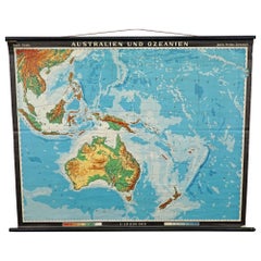
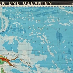
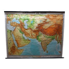
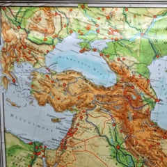
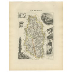
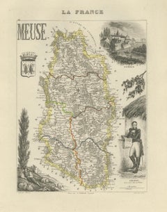
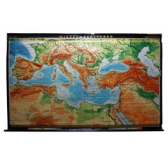
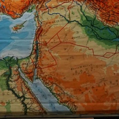
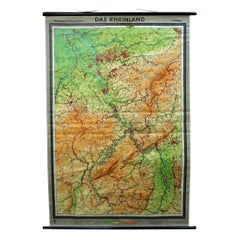
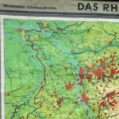
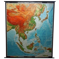
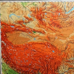
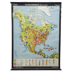
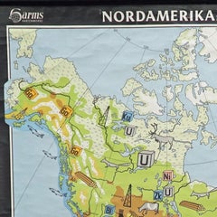
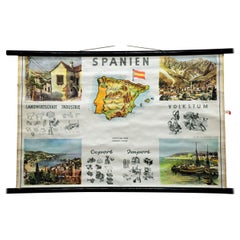
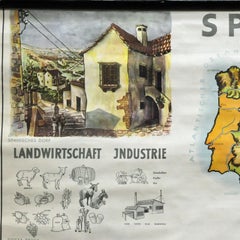
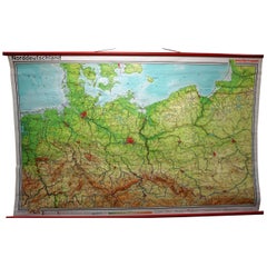
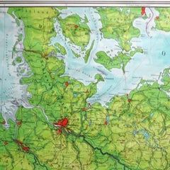
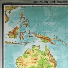
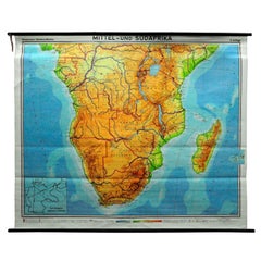
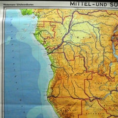
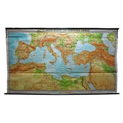
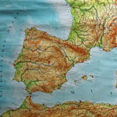
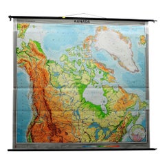
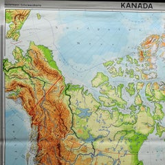
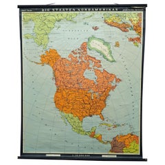
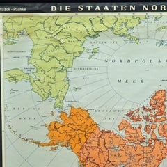
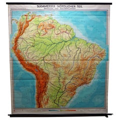
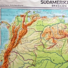
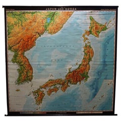
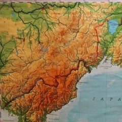
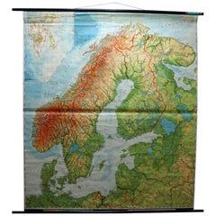
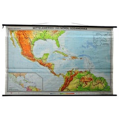
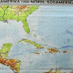
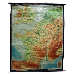
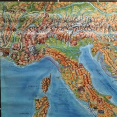
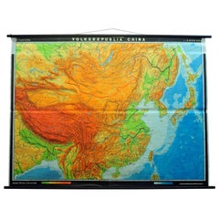
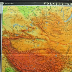
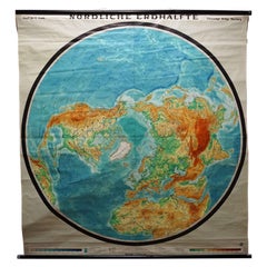
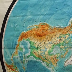
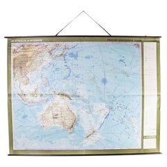
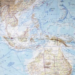
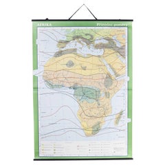
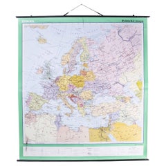
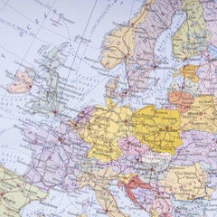
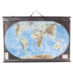
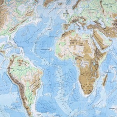
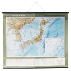
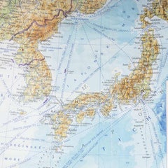
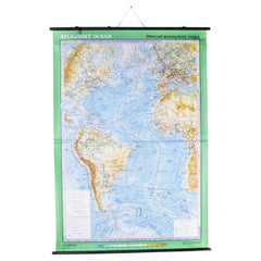
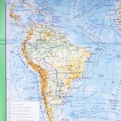
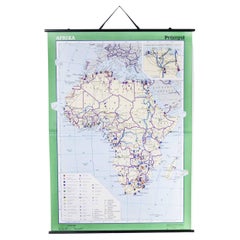
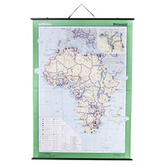
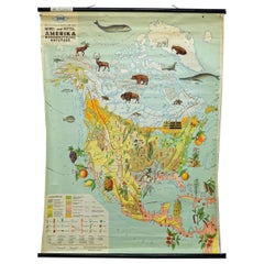
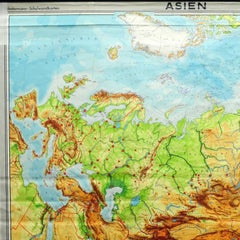
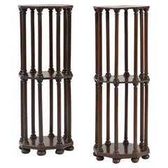
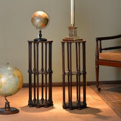
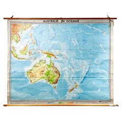
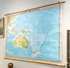
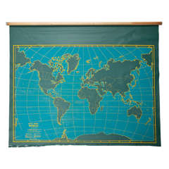
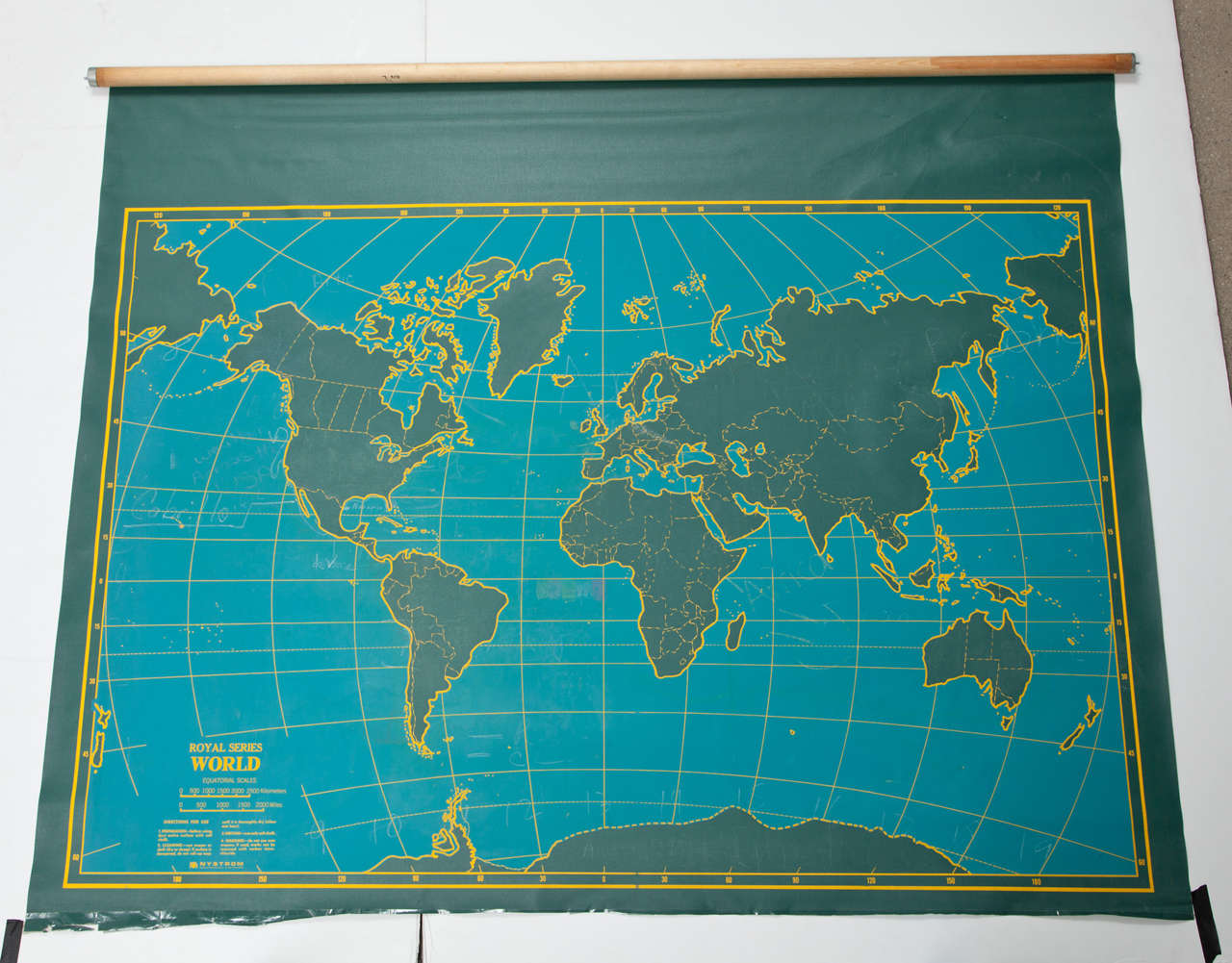
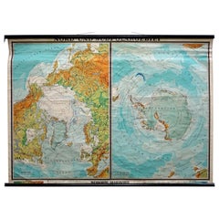
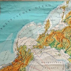
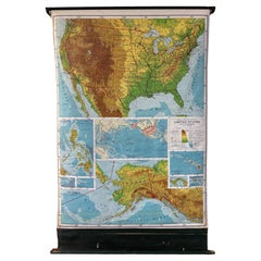
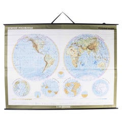
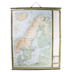
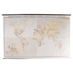
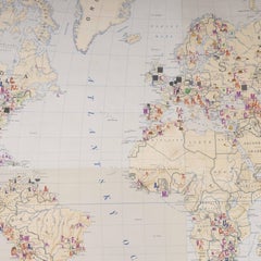
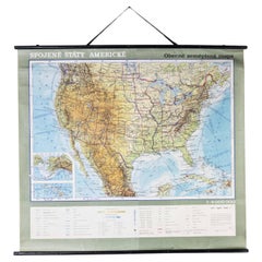
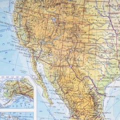
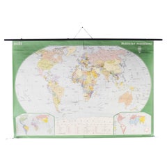
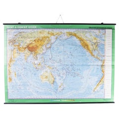
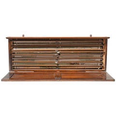
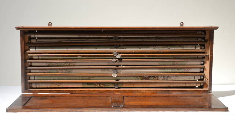
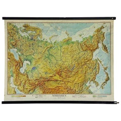
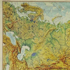
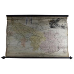
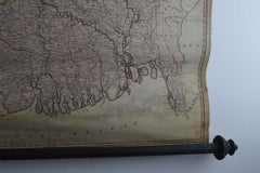
With a vast inventory of beautiful furniture at 1stDibs, we’ve got just the maps rolled you’re looking for. Frequently made of
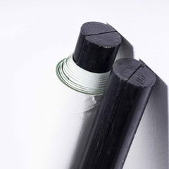
 wood, canvas and fabric, every maps rolled was constructed with great care. You’ve searched high and low for the perfect maps rolled — we have versions that date back to the 20th Century alongside those produced as recently as the 20th Century are available. Each maps rolled bearing Mid-Century Modern hallmarks is very popular. Many designers have produced at least one well-made maps rolled over the years, but those crafted by Denoyer-Geppert are often thought to be among the most beautiful.

How Much is a Maps Rolled?

The average selling price for a maps rolled at 1stDibs is $420, while they’re typically $280 on the low end and $1,200 for the highest priced.

Read More

Punk Rock and Rebellion Animate London’s Hit Yoshitomo Nara Show

The exhibition includes his portraits of wide-eyed kids with mayhem on their minds, as well as some of the artist’s personal belongings.

Whether Painted or Papered, Muraled Walls Make Bold Statements in the Home

The ancient practice of covering walls in artistic scenery is back.

In Francks Deceus’s ‘Mumbo Jumbo #5,’ the Black Experience Is . . . Complicated

Despite the obstacles, the piece’s protagonist navigates the chaos without losing his humanity.

12 Floral-Accented Rooms with a Handmade, Folkloric Feel

Who needs a flower garden? Just use your imagination — and some beautifully patterned wallpaper or fabric — to bring the outdoors in.

This Wolf Kahn Pastel Is the Epitome of Beauty at Its Most Essential

A longtime admirer of Kahn’s work, 1stDibs editorial director Anthony Barzilay Freund explores why it’s relevant now more than ever.

Why Jules Chéret Was the King of the Modern Poster

The streets of fin-de-siècle Paris were set aglow with colorful poster ads, thanks to the printing techniques invented by Jules Chéret. Now, the Milwaukee Art Museum is celebrating this undersung talent in America's first solo show dedicated his exuberant works.

Anna Condo’s Multifaceted Career Spans Film, Photography and NFTs

From her historic Manhattan townhouse, the talented creator and curator of 1stDibs' latest NFT exhibition tells us about the art in her home and how she got involved with cryptoart.

How Keith Rivers Went from NFL Linebacker to Blue-Chip Art Aficionado

The former football player is as serious about becoming a great contemporary-art patron as he once was about making tackles. Here, Rivers tells us how he got the collecting bug and how his tastes have evolved over the years.