18th Century Maps
to
1,514
1,841
36
1,879
26
1
1
2,971
2,233
473
3
288
34
9
126
8
36
9
2
5
4
3
2
1,866
19
11
3
1
166
44
42
41
27
1,879
1,879
1,879
24
16
13
12
12
Period: 18th Century
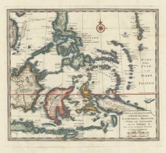
1738 Map of the Philippines & Eastern Indonesia: Spice Islands by Tirion
Located in Langweer, NL
1738 Map of the Philippines & Eastern Indonesia: Spice Islands by Tirion/Albrizzi
This beautifully hand-colored map from circa 1738, created by Tirion and Albrizzi, showcases the Philippines and the eastern part of Indonesia, reflecting the Dutch colonial interests in the region.
The map features a detailed representation of the numerous islands, including the renowned Spice or Banda Islands, pivotal to the Dutch spice trade.
Key regions include the Philippines (Isole Filippine), the Mariana Islands (Ladrones), with Guam, the Caroline and Palau Islands (Nieuwe Fillippynsche Eilenden), the Moluccas (Moluccos) known as the Spice Islands, the eastern tip of Java and Borneo, and a portion of Papua New Guinea.
Measuring 12.8 inches wide by 11.1 inches high, the map is in excellent condition with a crisp impression, slight foxing, and minor printer's creases, printed on a bright sheet with a lion watermark.
Keywords:
- Philippines historical map
- Eastern Indonesia map...
Category
Antique 18th Century Maps
Materials
Paper
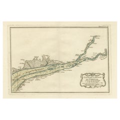
Antique Map of the Gironde, part of the Dordogne and the Garonne, France
Located in Langweer, NL
Antique map titled 'Cours de la riviere de Gironde et parties de la Dordogne et de la Garonne depuis Bourdeaux jusqu'au banc de Bey'. Original old map of the Gironde, part of the Dor...
Category
Antique 18th Century Maps
Materials
Paper
$321 Sale Price
20% Off
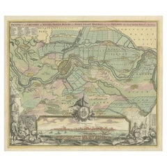
Large Antique Map of the City of Bremen and Surroundings, Germany
Located in Langweer, NL
Original antique map titled 'Prospect und Grundris der Keiserl Freyen Reichs und Ansee Stadt Bremen (..)'. This is a superb chart of the city of Bremen and the surrounding small villages with particular emphasis on the many rivers and canals...
Category
Antique 18th Century Maps
Materials
Paper
$1,275 Sale Price
20% Off
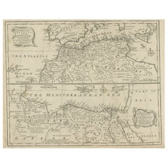
Antique Map of Western and Eastern Barbary in Africa, c.1744
Located in Langweer, NL
Antique map titled 'A New & Accurate Map of the Western Parts of Barbary' and 'A New & Accurate Map of the Eastern Parts of Barbary'. Decorative maps of North Africa and the Southern...
Category
Antique 18th Century Maps
Materials
Paper
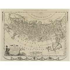
Original Antique Engraved Map of the Russian Empire, 1778
Located in Langweer, NL
Description: Antique map titled 'A New and Correct Map of the Russian Empire'.
Original antique map of the Russian Empire. This map originates from Moore's 'New and Complete Coll...
Category
Antique 18th Century Maps
Materials
Paper
$519 Sale Price
20% Off
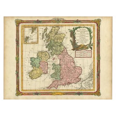
Antique Map of Great Britain and Ireland by Brion de la Tour, 1766
Located in Langweer, NL
Antique map titled 'Les Isles Britanniques (..).'
Attractive map of Great Britain surrounded by an engraved border printed from a separate coppe...
Category
Antique 18th Century Maps
Materials
Paper
$519 Sale Price
20% Off
Antique Chart of the Voyage of Captain Cook by Benard, 1780
Located in Langweer, NL
Antique map titled 'Carte des Découvertes faites dans la Mer Pacifique sur la Vaisse au de Roi, La Resolution, Commandé par le Capitaine Cook en 1774'. Chart detailing the 1774 voyag...
Category
Antique 18th Century Maps
Materials
Paper
$264 Sale Price
20% Off
Antique Map of Belgium and Luxembourg by Homann Heirs, 1747
Located in Langweer, NL
Antique map titled 'Belgium Catholicum seu Decem provinciae Germaniae Inferioris cum confiniis Germaniae sup. et Francia (..).' Detailed map of Belgium and Luxembourg showing parts o...
Category
Antique 18th Century Maps
Materials
Paper
$425 Sale Price
20% Off
Attractive Detailed Authentic Map Showing Bavaria, Germany and Austria, c.1740
Located in Langweer, NL
Antique map titled 'Nieuwe Kaart van de Beyersche en Oostenryksche Kreits (..).' Attractive detailed map showing Bavaria, Germany and Austria. Source unknown, to be determined.
Ar...
Category
Antique 18th Century Maps
Materials
Paper
$567 Sale Price
20% Off
Antique Map of the British Isles and Part of Europe by Chatelain, c.1720
Located in Langweer, NL
Antique map titled 'Carte pour l'Intelligence de l'Histoire d'Angleterre (..)'. Decorative map showing the British Isles and the various regions conquered in Europe. Includese two elaborate family trees for the House of York...
Category
Antique 18th Century Maps
Materials
Paper
Set of Two Antique Maps of Northern Italy by Homann Heirs, 1754
Located in Langweer, NL
Set of two maps of northern Italy showing the position of troups during the war in April and March 1746. The area covered includes the course of the River Po between Valenza (north of Alexandria) and San Benedetto...
Category
Antique 18th Century Maps
Materials
Paper
$841 Sale Price / set
20% Off
Antique Map of Buru Island, Indonesia, c.1725
Located in Langweer, NL
Antique map titled 'Boero'. Original antique map of Buru island. With an inset of the lake on top of the inland mountain. This map originates from Valentyn's 'Oud en Nieuw Oost Indie...
Category
Antique 18th Century Maps
Materials
Paper
$519 Sale Price
20% Off
Antique Map of the Diocese of Toul by Covens & Mortier, circa 1720
Located in Langweer, NL
Antique map titled 'Civitas Leucorum sive Pagus Tullensis'. Detailed map of the Diocese of Toul, France. Centered on the cities of Nancy and Toul and including Metz, Verdun, S. Dizie...
Category
Antique 18th Century Maps
Materials
Paper
$685 Sale Price
20% Off
Rare Map of the Philippines; Joseph Freewills Island & Mindanao South End, 1773
Located in Langweer, NL
Three charts on one sheet titled '1) A Dangerous Shoal 2) Joseph Freewills Island 3) The South End of Mindanao'.
It shows Captain Carteret's voyage: Saint George's Channel to Min...
Category
Antique 18th Century Maps
Materials
Paper
$226 Sale Price
20% Off
18th Century Map of Upper Guinea: Kingdoms and Coastal Regions of West Africa
Located in Langweer, NL
This is an antique map depicting the coastal regions of West Africa, specifically the Gulf of Guinea and surrounding areas, including parts of what is now Senegal, Guinea, Sierra Leo...
Category
Antique 18th Century Maps
Materials
Paper
$226 Sale Price
20% Off
Antique Plan of the City of Paita in Peru, by Anson, 1749
Located in Langweer, NL
Antique map titled 'Plan van de Stad Paita in het Koninkryk Santa Fee (..) - Plan de la Ville de Paita (..)'. Original antique plan of the city of Paita, Peru. This map originates fr...
Category
Antique 18th Century Maps
Materials
Paper
$255 Sale Price
20% Off
Antique Bible Map of the Middle East by A. Schut, 1743
Located in Langweer, NL
Antique map titled 'De Gelegentheyt van 't Paradys en 't Landt Canaan'. Dutch Bible map covering the region between the Mediterranean and the Persian Gulf, ...
Category
Antique 18th Century Maps
Materials
Paper
$519 Sale Price
20% Off
Antique Map of the Region of Martigues, France
Located in Langweer, NL
Title: "Etang de Martigues et Environs: Antique Map of the Martigues Region, France"
Description: This antique map, titled "Etang de Martigue et Environs," offers a detailed view of...
Category
Antique 18th Century Maps
Materials
Paper
$321 Sale Price
20% Off
Large Scale Map of Greece with Inset Map of Macedonia, c.1786
Located in Langweer, NL
Antique map titled 'Graeciae Antiquae'. Large scale map of Greece, extends south to the island of Cythera. Inset map shows details of Macedonia. Publis...
Category
Antique 18th Century Maps
Materials
Paper
Antique Hand-Colored Print of the Common Hazel, 1758
Located in Langweer, NL
Antique print of the common hazel. Originates from 'Pomologia' by J. H. Knoop.
Artists and Engravers: Published by Johann Hermann Knoop (c.1700-1769).
Condition: Good, general ...
Category
Antique 18th Century Maps
Materials
Paper
$311 Sale Price
20% Off
Antique Map of Eastern Mediterranean and Asia Minor by a Benedictine, c.1725
Located in Langweer, NL
Antique map titled 'Byzondere Afbeelding der Landschappen, van de Apostelen bevaren en doorwandelt om het Evangelium J. C. te Prediken.' Map of the lands travelled by the Apostles to...
Category
Antique 18th Century Maps
Materials
Paper
$283 Sale Price
20% Off
Old Bird's Eye View of the European Trading Posts at Sabi, Benin, Africa, 1748
Located in Langweer, NL
Antique print titled 'Vue des comtoirs Europeins de Xavier ou Sabi (..) - Gezigt der Europese Faktooryen, te Xavier of Sabi (..)'.
Bird's eye view of the European trading posts a...
Category
Antique 18th Century Maps
Materials
Paper
$264 Sale Price
20% Off
Antique Map of part of India, the Ganges and Hindustan
Located in Langweer, NL
Antique map titled 'Carte de l'Indoustan'. Original antique map of part of India, the Ganges and Hindustan. This map originates from 'Histoire Generale Des Voyages' by Antoine Franco...
Category
Antique 18th Century Maps
Materials
Paper
$311 Sale Price
20% Off
Antique Map of Upper Saxony in Germany by Tirion, circa 1740
By Isaak Tirion
Located in Langweer, NL
Antique map titled 'Nieuwe Kaart van de Opper Saxise Kreits (..).' Attractive detailed map showing Upper Saxony, Germany with Meissen, Thuringen, Anhalt, Brandenburg, Pommeren etc. S...
Category
Antique 18th Century Maps
Materials
Paper
$453 Sale Price
20% Off
Original Antique Engraving of the Creation of the World According to Mozes, 1725
Located in Langweer, NL
Antique map titled 'De Schepping der Wereldt volgens de Beschryving van Mozes' - This plate shows the creation of the world according to Moses. The upper depiction shows the world wi...
Category
Antique 18th Century Maps
Materials
Paper
$623 Sale Price
20% Off
Antique Map of the Mongol Empire, 1767
Located in Langweer, NL
Antique map titled 'The Moguls Empire divided into its principal governments'. Old map of India, Bangladesh, and parts of eastern China.
Artists and Engravers: Published in the G...
Category
Antique 18th Century Maps
Materials
Paper
$97 Sale Price
20% Off
Old Views of Cabo Santa Maria & Tierra del Fuego, Chile, 1749
Located in Langweer, NL
Antique print titled 'Kaap Sint Maria aan 't begin van de Straat Magellaan (..)'. Coastal views of Cabo Santa Maria and Tierra del Fuego on the Argent...
Category
Antique 18th Century Maps
Materials
Paper
$179 Sale Price
30% Off
Antique Map of France under the Reign of Philip II by Zannoni, 1765
Located in Langweer, NL
Antique map France titled 'Carte de l'accroissement du Domaine sous Philippe Auguste (..)'. Beautiful old map of France. This map originates from 'Atlas Historique de la France Ancie...
Category
Antique 18th Century Maps
Materials
Paper
$139 Sale Price
20% Off
Detailed Map of Southeast Asia From the Tip of Cambodia to Java, 1739
Located in Langweer, NL
Antique map titled 'Nieuwe kaart van de Sundasche Eilanden als Borneo, Sumatra en Groot Iava & c'.
Detailed map of Southeast Asia, extending from the tip of Cambodia to Java. Thi...
Category
Antique 18th Century Maps
Materials
Paper
$611 Sale Price
24% Off
Original Antique Map of England and Wales, with Decorative Cartouche
Located in Langweer, NL
Antique map titled 'England and Wales from the best Authorities'. Original antique map of England and Wales, with decorative cartouche. Engraved by T. Conder. Published circa 1790.
Category
Antique 18th Century Maps
Materials
Paper
$151 Sale Price
20% Off
Antique Map of Africa with Mountain Ranges and other details
Located in Langweer, NL
Antique map titled 'Carte générale et Politique de l'Afrique'. Original antique map of Africa. Highlights numerous mountain ranges, lakes and rivers, regions, countries and places. P...
Category
Antique 18th Century Maps
Materials
Paper
$756 Sale Price
20% Off
Antique Map of the West-Frisian Part of Independant Friesland by Halma, 1718
Located in Langweer, NL
Antique map Friesland titled 'Pars I Frisiae Liberae (..)'. Old map of Friesland, the Netherlands. This map depicts the West-Frisian part of independant Friesland. Originates from 'U...
Category
Antique 18th Century Maps
Materials
Paper
Attractive Antique Hand-Coloured Map of South America, ca.1765
Located in Langweer, NL
Antique map titled 'Kaart van het Onderkoningschap van Peru zig uitstrekkende: over Chile, Paraguay en andere Spaansche Landen als ook van Brazil en verdere Bezittingen van Portugal ...
Category
Antique 18th Century Maps
Materials
Paper
$1,181 Sale Price
20% Off
Old Original Map of Chormandel & Malabar, India & Ceylon, Now Sri Lanka, 1726
Located in Langweer, NL
Antique map titled 'Nieuwe Kaart van Choromandel ende Malabar'.
Antique map depicting the southern part of India and the northern tip of Ceylon, Sri Lanka. This map originates from...
Category
Antique 18th Century Maps
Materials
Paper
$519 Sale Price
20% Off
Antique Map of Carta Soura, Headquarter of the Javanese Nobility, 1706
Located in Langweer, NL
Antique map titled 'Carta Soera de Nigrita'. Early map of the town of Carta Soura, also known as Kartosuro and Karta Soera de Nigrat, located in the interior of central Java, headqua...
Category
Antique 18th Century Maps
Materials
Paper
$236 Sale Price
20% Off
Detailed Antique Map of Friesland, Groningen and Drenthe, The Netherlands, c1735
Located in Langweer, NL
Antique map titled 'Frisia Dominum (?) Friesland, verdeeld in de hoof-delen van Oostergoo, Westergoo en Sevenwolde (?) XXX Grietenijen.' Detailed map of Friesland, Groningen and Dren...
Category
Antique 18th Century Maps
Materials
Paper
$803 Sale Price
20% Off
Antique Print of Horseheath Hall in Cambridgeshire, England, 1725
Located in Langweer, NL
Antique print titled 'General front of Horse heath Hall in Cambridgeshire (..)'.
Old engraving of Horseheath Hall, Cambridgeshire.
The original Hall was the home of the Alington family and was visited by Queen Elizabeth 1...
Category
Antique 18th Century Maps
Materials
Paper
$702 Sale Price
30% Off
Antique Print of Richmond Place by Woolfe, c.1770
Located in Langweer, NL
Antique print titled 'Elevation of Sir Asgill's Villa at Richmond in Surry (..)'. Plan and facade of Richmond Place or Asgill House, Richmond, London. This print originates from 'Vit...
Category
Antique 18th Century Maps
Materials
Paper
Antique Plan of Underground Area of Baths of Emperor Titus, Rome, Italy, 1786
Located in Langweer, NL
Antique print titled 'Plan des Thermes de Titus Partie Superieure'.
Plan of the underground areas of the Baths of Titus. The Baths of Titus or Thermae Titi were public baths (Thermae) built in 81 AD at Rome, by Roman emperor Titus...
Category
Antique 18th Century Maps
Materials
Paper
$226 Sale Price
20% Off
Antique Map of Quinam and the Côn ?ao Islands by Sayer, 1778
Located in Langweer, NL
Antique map titled 'A Chart of a part of the Coast of Cochinchina' and 'Plan of Pulo Condor'. Two maps on one sheet. The upper map shows part of the coast of Cochinchina from Cham Co...
Category
Antique 18th Century Maps
Materials
Paper
$311 Sale Price
20% Off
Antique Map of the Netherlands and Belgium by Keizer & De Lat, 1788
Located in Langweer, NL
Antique map titled 'Nouvelle Carte des XVII Provinces du Païs Bas (..)'. Uncommon antique map of Holland and Belgium. This map originates from ...
Category
Antique 18th Century Maps
Materials
Paper
$309 Sale Price
20% Off
Pl. 2 Antique Print of Pavilion Decorations by Le Rouge, c.1785
Located in Langweer, NL
Antique print titled 'Différentes Décorations de Romainville de l'Ordonnance (..)'. Copper engraving showing various pavilion decorations. This print originates from 'Jardins Anglo-C...
Category
Antique 18th Century Maps
Materials
Paper
Antique Map of Ambon Island in the Moluccas, Indonesia, c.1760
Located in Langweer, NL
Antique map Ambon titled 'Carte Particuliere de l 'Isle Amboine'. Old map showing Ambon, in the Moluccas Islands, better known as the Spice Islands. Ambon was the headquarters of the...
Category
Antique 18th Century Maps
Materials
Paper
$226 Sale Price
20% Off
Antique Map of the Caribbean Island of St Kitts, ca.1750
Located in Langweer, NL
Description: Antique map titled 'Carte de l'Isle St. Christophe pour Servir a l'Histoire Genle. des Voyages.'
Detailed map of the Island of St. Kitts, showing the Parishes, towns, ...
Category
Antique 18th Century Maps
Materials
Paper
$680 Sale Price
20% Off
Antique Map of the Bahia Todos Santos 'Brazil' by Tirion, circa 1750
Located in Langweer, NL
Antique map titled 'Kaart Van De Aller-Heiligen Baay Waar aan de Hoofdstad legt van Brazil.', Detailed map of the Bahia Todos Santos in Brazil, with a lar...
Category
Antique 18th Century Maps
Materials
Paper
$425 Sale Price
20% Off
French Antique Map of France and Western Europe, 1765
Located in Langweer, NL
Antique map titled 'Carte de tous les Lieux, célébres dans l'Histoire (..)'. Beautiful old map of France and western Europe. This map originates from 'Atlas Historique de la France A...
Category
Antique 18th Century Maps
Materials
Paper
$158 Sale Price
20% Off
Antique Map of of Bengal and the mouth of the Ganges River
Located in Langweer, NL
Antique map titled 'Carte du Bengale, avec la partie Septentrionale (..)'. Original antique map of Bengal and the mouth of the Ganges river. This map ori...
Category
Antique 18th Century Maps
Materials
Paper
Antique Architectural Print of Cobham Hall in Kent, England, 1717
Located in Langweer, NL
Antique print titled 'The Elevation of Cobham Hall in Kent (..)'.
Elevation of the entrance facade of Cobham Hall, Kent. This print originates from 'Vitruvius Britannicus' by Colen...
Category
Antique 18th Century Maps
Materials
Paper
Decorative Map of the Empire of China, Korea, Japan, Taiwan, Lucon, Macau, 1780
Located in Langweer, NL
Antique map titled 'Carte de L'Empire de la Chine.'
Decorative map of the Empire of China, depicting China, Corea ( Korea ), Japan, Tonquin and the Philippine island Lucon. Source unknown, to be determined.
Artists and Engravers: Rigobert Bonne (1727-1795 ) was one of the most important cartographers of the late 18th century. In 1773 he succeeded Jacques Bellin as Royal Cartographer to France in the office of the Hydrographer at the Depôt de la Marine. Working in his official capacity Bonne compiled some of the most detailed and accurate maps of the period. Bonne's work represents an important step in the evolution of the cartographic ideology away from the decorative work of the 17th and early 18th century towards a more detail oriented and practical aesthetic. With regard to the rendering of terrain Bonne maps...
Category
Antique 18th Century Maps
Materials
Paper
$614 Sale Price
20% Off
Antique Map of the Kanton Luzerne 'Switzerland' by Homann Heirs, 1763
Located in Langweer, NL
Antique map titled 'Canton Lucern (..)'. Fine decorative copper plate engraved antique map of the Canton of Lucerne in Central Switzerland with pictorial cartouche in top right corne...
Category
Antique 18th Century Maps
Materials
Paper
$463 Sale Price
20% Off
Nice Antique Map of Asia Minor, Turkey, circa 1718
Located in Langweer, NL
Antique map titled 'Antiquae Asiae Minoris & C. Tabula' by Philippo Talbor. This rare antique map is published by Edward Wells, circa 1718.
Category
Antique 18th Century Maps
Materials
Paper
Detailed Old Map showing Spain and Portugal Incl. Majorca, Minorca & Ibiza, 1740
Located in Langweer, NL
Antique map titled 'Nieuwe Kaart van Spanje en Portugal.'
Attractive detailed map showing Spain and Portugal. Including Majorca, Minorca and Ibiza. Title in block-style cartouche...
Category
Antique 18th Century Maps
Materials
Paper
$491 Sale Price
20% Off
Antique Architecture Print of a Composite Portico by Neufforge, c.1770
Located in Langweer, NL
Antique print titled 'Plan et Elevation d'un Portique Composite (..)'. Old print showing the design of a Composite portico. This print originates from 'Recueil Élémentaire d?Architec...
Category
Antique 18th Century Maps
Materials
Paper
Old Map of Awatska Bay on the Coast of Kamchatka Peninsula, Russia by Cook, 1784
Located in Langweer, NL
Antique map Awatska titled 'Plan of the Bay of Awatska (..)'. Antique map of Awatska Bay on the east coast of the Russian peninsula of Kamtschatka. Inset plan of St. Peter’s and St. ...
Category
Antique 18th Century Maps
Materials
Paper
$170 Sale Price
20% Off
Fine Engraving of the 2nd Corps de Garde in the Low Countries 'Holland', 1760
Located in Langweer, NL
Title on page (Dutch and French): TWEEDE CORPS DE GARDE van Hollandsche Officiers / Second Corps de Garde d'Officiers Hollandois". Amst., P. Fouquet, 1760.
An interior with several Dutch officers. On the right a man is sitting at a writing table, on the left a man is working on fire from the fireplace, in the middle three gentlemen are looking at a map. Above the chimney a coat of arms and above it a portrait of a man in profile, surrounded by a laurel wreath.
Fine engraved print depicting an officer's mess by J. Houbraken after a painting by C. Troost, with coat of arms engraved in lower margin and dedication to D. Muilman.
Cornelis Troost...
Category
Antique 18th Century Maps
Materials
Paper
$425 Sale Price
20% Off
Original Antique Bird's Eye View of Banten or Bantam in Java, Indonesia, 1725
Located in Langweer, NL
Antique print titled 'La Ville de Bantam capitale du Roiaume de meme nom'.
A bird's eye view of the city Banten or Bantam near the western end of Java in Indonesia. Several tall ...
Category
Antique 18th Century Maps
Materials
Paper
$680 Sale Price
20% Off
Original Normandy Map by Frederick de Wit, 1705, with Inset of Channel Islands
Located in Langweer, NL
Normandy Map by Frederick de Wit, 1705, with Inset of Channel Islands
Description:
This beautifully engraved and hand-colored map, titled Duché et Gouvernement General de Normandie,...
Category
Antique 18th Century Maps
Materials
Paper
Antique Copper Engraved Map of Germany in the Early 18th Century, c.1740
Located in Langweer, NL
Antique map Germany titled 'Allemagne'.
Rare miniature map of Germany and surroundings. Also depicting the Baltic Sea and the Gulf of Venice. S...
Category
Antique 18th Century Maps
Materials
Paper
1705 Golfe de Mexico and Florida Framed Map
Located in Stamford, CT
Framed map of Mexico & Florida circa 1705, Paris. Small map with Mexico and the Gulf Coast. Inset text indicating Panama, Acapulco, Mexico City and the Mississippi. Extends North to ...
Category
French Spanish Colonial Antique 18th Century Maps
Materials
Glass, Wood, Paper
Old Map of The Kurile Islands, from Hokkaido, Japan to Kamchatka, Russia, c.1750
Located in Langweer, NL
Antique map titled 'Carte des Iles Kouriles'. Original antique map of the Kuril Islands.
The Kuril Islands or Kurile Islands are a volcanic archipelago that stretches approximate...
Category
Antique 18th Century Maps
Materials
Paper
$311 Sale Price
20% Off
