19th Century Maps
to
1,663
2,200
76
2,279
71
9
9
4
2
2
1
1
2,968
2,279
476
3
292
34
10
126
10
37
9
2
5
4
3
3
2,241
70
32
13
11
359
177
110
107
104
2,279
2,279
2,279
104
23
9
8
7
Period: 19th Century
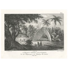
Old Print of a Building Protecting the Warriors of Chief Palu, Tonga Tabu, 1836
Located in Langweer, NL
Antique print titled 'Anischt eines Schoppens der die Kriegspiroguen des Häuptlings Palu beschirmt'.
Old print of a building protecting the warriors of Chief Palu, Tonga Tabu. This print originates from 'Entdeckungs, Reise der Franzosischen Corvette Astrolabe Unternomen auf Befehl Konig Karls...
Category
Antique 19th Century Maps
Materials
Paper
$342 Sale Price
20% Off
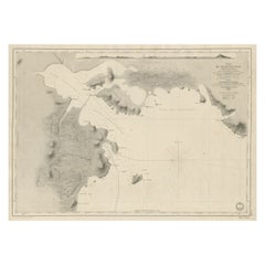
Antique Map of Part of the Chinese Coast, Explored by the French, Ca.1852
Located in Langweer, NL
Antique map titled 'Plan du Golfe D'Anville (Côte de Tartarie)'.
Old map of part of the Chinese coast, explored with the French corvette 'Caprieuse'. The Capricieuse was a late 2...
Category
Antique 19th Century Maps
Materials
Paper
$657 Sale Price
34% Off
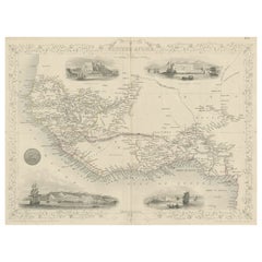
Antique Map of Western Africa with Vignettes of Cape Coast Castle etc, ca.1851
Located in Langweer, NL
Antique map titled ‘Western Africa’. Includes decorative vignettes titled Christiansborg, Cape Coast Castle, Sierra Leone and Bakel. Originates from 'The Illustrated Atlas, And Modern History Of The World Geographical, Political, Commercial & Statistical, Edited By R. Montgomery Martin'. Published; John Tallis London, New York, Edinburgh & Dublin. 1851. Drawn and Engraved by J. Rapkin.
Artists and Engravers: John Tallis (1817-1876) was a British map...
Category
Antique 19th Century Maps
Materials
Paper
$333 Sale Price
20% Off
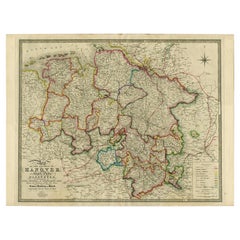
Northern Germany incl Hanover, Oldenburg, Lippe, Bremen, Hamburg & Lubeck, 1854
Located in Langweer, NL
Antique map titled 'Map of the Kingdom of Hanover, with the Grand Duchy of Oldenburg, the principalities of Lippe Detmold and Schauenburg Lippe (..)'.
Map of Northern Germany inclu...
Category
Antique 19th Century Maps
Materials
Paper
$865 Sale Price
25% Off
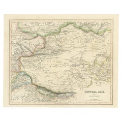
Steel Engraved Map of Central Asia Covering the Chinese Empire, Tibet Etc, C1843
Located in Langweer, NL
Antique map titled 'Central Asia (Middle Division)'.
Steel engraved map of Central Asia covering the Chinese Empire, Tibet and surroundings. This map originates from 'Gilberts Mo...
Category
Antique 19th Century Maps
Materials
Paper
$247 Sale Price
20% Off
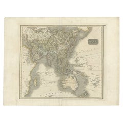
Antique Map of Asia Depicting Asia and Australia, c.1814
Located in Langweer, NL
Antique map titled 'Asia'. This map depicts Asia and Australia. Engraved by J. and G. Menzies and issued for Thomson's 'New General Atlas'.
Artists and Engravers: John Thomson (1...
Category
Antique 19th Century Maps
Materials
Paper
$333 Sale Price
20% Off
Four Physical Maps of the World on One Sheet , 1872
Located in Langweer, NL
Four physical maps of the world on one sheet. The upper map shows lowlands, highlands and highest lands. The other maps show world's races, ocean current and volcanoes, and magnetic ...
Category
Antique 19th Century Maps
Materials
Paper
$333 Sale Price
20% Off
Original Antique Print of a Castle in Madrid, Spain, 1833
Located in Langweer, NL
Antique print titled 'Schloss zu Madrid'.
Lithograph of a castle in Madrid, Spain. This print originates from 'Neuen Bildergalerie für die Jugend'.
Artists and Engravers: Ano...
Category
Antique 19th Century Maps
Materials
Paper
Old Steel Engraved Map of the Western Part of the Madras Presidency, 1831
Located in Langweer, NL
Antique map titled 'India II Madras Presidency'.
Old steel engraved map of the western part of the Madras Presidency. The Madras Presidency, or the Presidency of Fort St. George, a...
Category
Antique 19th Century Maps
Materials
Paper
$275 Sale Price
20% Off
Antique Chart of the Southern Pole, Showing Three Routes of Captain Cook, 1803
Located in Langweer, NL
Antique map titled 'Kaart van het Zuider Halfrond'. Circular chart within a square frame centred on the southern pole. It shows southern parts of South America, South Africa and Mada...
Category
Antique 19th Century Maps
Materials
Paper
$913 Sale Price
20% Off
Antique Map of Peru and Bolivia, 1836
Located in Langweer, NL
Antique map titled 'Pérou et Bolivia'.
Decorative map of Peru and Bolivia with outline coloring. Originates from 'Atlas Complet Du Precis De La Geograp...
Category
Antique 19th Century Maps
Materials
Paper
$323 Sale Price
20% Off
Antique Map of The Dutch West-Stellingwerf Township by Behrns, 1861
Located in Langweer, NL
Antique map titled 'Gemeente West-Stellingwerf'. Old map depicting the West-Stellingwerf township including cities and villages like Noordwolde, Oldeholtwolde and Wolvega. This map o...
Category
Antique 19th Century Maps
Materials
Paper
$114 Sale Price
20% Off
Antique Dutch Map of The Barradeel Township by Behrns, 1861
Located in Langweer, NL
Antique map titled 'Gemeente Barradeel'. Old map depicting the Barradeel township including cities and villages like Midlum, Franeker, Dongjum, Minnertsga, Sexbierum and Harlingen. T...
Category
Antique 19th Century Maps
Materials
Paper
$114 Sale Price
20% Off
Antique Map of Franconia, a region of Germany, '1811'
By John Cary
Located in Langweer, NL
Antique map titled 'A New Map of the Circle of Franconia'. Detailed map of Franconia in Northwestern Germany. Covers from Upper Saxony south to Swabia, west to the Lower Rhine and we...
Category
Antique 19th Century Maps
Materials
Paper
$237 Sale Price
20% Off
Antique Map of Drenthe, The Netherlands, 1864
Located in Langweer, NL
Antique map titled 'De Provincie Drenthe'. Map of the province of Drenthe, the Netherlands. This map originates from 'F. C. Brugsma's Atlas van het Koninkrijk der Nederlanden (..)'. ...
Category
Antique 19th Century Maps
Materials
Paper
$78 Sale Price
20% Off
Antique Map of Dutch Cities Haarlem, Zandvoort, Bloemendaal, Wijk aan Zee, 1884
Located in Langweer, NL
Antique map titled 'Haarlem en Omstreken'. Old map of the region of Haarlem also including cities and villages like Wijk aan Zee, Beverwijk, Bloemendaal and Zandvoort. This map orgin...
Category
Antique 19th Century Maps
Materials
Paper
$228 Sale Price
20% Off
Original Antique Map of Pennsylvania Showing Interesting Statistics Etc, 1825
Located in Langweer, NL
Attractive map of Pennsylvania with bordercoloring of the county and showing the various towns, roads, rivers, bridges, and a host of other details...
Category
Antique 19th Century Maps
Materials
Paper
$333 Sale Price
20% Off
Antique Map of Eastern Canada with an inset Map of Newfoundland, 1882
Located in Langweer, NL
Antique map titled 'Dominion of Canada'. Old map of Eastern Canada with an inset map of Newfoundland. This map originates from 'The Royal Atlas of Modern Geography, Exhibiting, in a ...
Category
Antique 19th Century Maps
Materials
Paper
$266 Sale Price
20% Off
Antique Map of China, Also Depicting Formosa 'Taiwan' and Part of Korea, c.1840
Located in Langweer, NL
Antique map titled 'China'. Old map of China, also depicting Formosa (Taiwan) and part of Korea. Source unknown, to be determined.
Artists and Engravers: Anonymous.
Condition: ...
Category
Antique 19th Century Maps
Materials
Paper
$228 Sale Price
20% Off
Antique Map of the Region of Athens from a German Atlas of 1893
Located in Langweer, NL
Antique map titled 'Umgebung von Athen'. Original antique map of the region of Athens, Greece. This map originates from the 5th edition of 'Meyers Konversations-Lexikon', published 1...
Category
Antique 19th Century Maps
Materials
Paper
$80 Sale Price
20% Off
Antique Map of The Dutch West-Dongeradeel Township by Behrns, 1861
Located in Langweer, NL
Antique map titled 'Gemeente West-Dongeradeel'. Old map depicting the West-Dongeradeel township including cities and villages like Holwerd, Ternaard, Hanrum and Raard. This map orgin...
Category
Antique 19th Century Maps
Materials
Paper
$114 Sale Price
20% Off
Antique Map of the African Continent with Inset of the Nile River Delta, c.1870
Located in Langweer, NL
Antique map titled 'Africa'. Old map of the African continent. This map originates from 'H. Kiepert's Kleiner Atlas der Neueren Geographie für Schule...
Category
Antique 19th Century Maps
Materials
Paper
$304 Sale Price
20% Off
Antique Map of the Province Limburg, The Netherlands, 1864
Located in Langweer, NL
Antique map titled 'De Provincie Limburg'. Map of the province of Limburg, the Netherlands. This map originates from 'F. C. Brugsma's Atlas van het Koninkrijk der Nederlanden (..)'. ...
Category
Antique 19th Century Maps
Materials
Paper
$123 Sale Price
20% Off
Antique Map of Denmark by Hall, circa 1820
Located in Langweer, NL
Antique map titled 'Denmark'. A map of Denmark and the direct surroundings (northern Germany, Baltic Sea, Kattegatt and North Sea, south east Sweden). Sheet XXV from an unidentified ...
Category
Antique 19th Century Maps
Materials
Paper
$114 Sale Price
20% Off
Mid 19th Century Map of the Black Sea with Decorative Vignettes, 1851
Located in Langweer, NL
Map of the Black Sea and contingent lands, including Turkey, Russia, Georgia, Azerbaijan, Bulgaria, Crimea and Armenia, with decorative vignettes views of Sebastopol, Varna, Odessa, Sinope, Constantinople and Silistria.
Fine antique map...
Category
Antique 19th Century Maps
Materials
Paper
$428 Sale Price
20% Off
Antique Map of Flintshire in Wales, United Kingdom, c.1850
Located in Langweer, NL
Antique map titled 'Flintshire'. Antique map of Flintshire with a inlay plan of Flintshire town. Flintshire is a principal area of Wales, known as a county, United Kingdom. Drawn and...
Category
Antique 19th Century Maps
Materials
Paper
$133 Sale Price
20% Off
Antique Map of Brazil with Original Outline Hand-Colouring, c.1844
Located in Langweer, NL
Antique map titled 'Brazil'. Beautiful map with outline color of Brazil, engraved by S. Hall.
Artists and Engravers: Sydney Hall (1788-1831) was one of the most recognised and prolific British map...
Category
Antique 19th Century Maps
Materials
Paper
$228 Sale Price
20% Off
Antique Print of Saint Isaac's Square, in Saint Petersburg, Russia, ca.1810
Located in Langweer, NL
Description: antique print titled 'The Place of St. Isaac'. View of Saint Isaac's Square, in Saint Petersburg or St Petersbourg, Russia. A city square spra...
Category
Antique 19th Century Maps
Materials
Paper
$228 Sale Price
20% Off
Antique Map of England with French Title, 1806
Located in Langweer, NL
Antique map titled 'L'Angleterre.' Map of England by Robert de Vaugondy, revised and published by Delamarche in 1806. Source unknown, to be determined.
...
Category
Antique 19th Century Maps
Materials
Paper
$285 Sale Price
20% Off
Antique Map of Germany from an American 19th Century Atlas, 1846
Located in Langweer, NL
Antique map titled 'Germany'. Old map of Germany. This map originates from 'A New Universal Atlas Containing Maps of the various Empires, Kingdoms, States and Republics Of The World ...
Category
Antique 19th Century Maps
Materials
Paper
$117 Sale Price
20% Off
Antique Map of Asia Minor, Present-day Turkey and Cyprus, 1803
Located in Langweer, NL
Antique map titled 'Asiae Minoris Tabula Geographica'. Uncommon antique map of Asia minor, comprising most of what is present-day Turkey. Source unknown, to be determined.
Artists...
Category
Antique 19th Century Maps
Materials
Paper
$171 Sale Price
20% Off
Antique Map of Asia by with an Inset Map of Turkey in Asia, 1868
Located in Langweer, NL
Antique map Asia titled 'Carte Politique et Ethnographique d'Asie'. Old map of Asia with an inset map of Turkey in Asia. Includes descriptive text box...
Category
Antique 19th Century Maps
Materials
Paper
$152 Sale Price
20% Off
Charming Scarce Small Antique Map of Asia, 1837
Located in Langweer, NL
Antique map titled ‘Asia‘. Scarce and charming little mid-19th century antique map of Asia. Noteworthy for the early date and scarcity factor, from a small pocket sized school atlas ...
Category
Antique 19th Century Maps
Materials
Paper
$228 Sale Price
20% Off
Antique Map of England and Wales with Decorative Vignettes, 1851
Located in Langweer, NL
Antique map titled ‘England and Wales’. Includes decorative vignettes titled The grand stand on the race ground Doncaster, London, Oxford, Entrance to Portsmouth Harbour, Sunderland ...
Category
Antique 19th Century Maps
Materials
Paper
$428 Sale Price
20% Off
Antique Map of Eastern India by Kuyper, C.1880
Located in Langweer, NL
Plate 55 : 'Britsch-Indie, Oost.' (British Indies, East). This lithographed map originates from: 'Wereld-atlas voor Kantoor en Huiskamer' (transl: World Atlas for the office and livi...
Category
Antique 19th Century Maps
Materials
Paper
Antique Map of Old European Russia, 1846
Located in Langweer, NL
Antique map titled 'Russia in Europe'. Old map of European Russia. This map originates from 'A New Universal Atlas Containing Maps of the various Em...
Category
Antique 19th Century Maps
Materials
Paper
$266 Sale Price
20% Off
Antique Map of Brazil, Including Part of Colombia, Peru and Chili, c.1880
Located in Langweer, NL
Antique map South America titled 'Brazil'. This map depicts Brazil and its surroundings including part of Colombia, Peru and Chili. Source un...
Category
Antique 19th Century Maps
Materials
Paper
$237 Sale Price
20% Off
Antique Map of Endeavour River and Botany Bay, New South Wales, Australia, 1803
Located in Langweer, NL
Antique map Australia titled 'Mond van de Endeavour Rivier in Nieuw Zuid Wales' and 'Botanie Baai in Nieuw Zuid Wales'. Antique map of the Endeav...
Category
Antique 19th Century Maps
Materials
Paper
$761 Sale Price
20% Off
Antique Map of the Frisian Tietjerksteradeel Township in the Netherlands, 1861
Located in Langweer, NL
Antique map titled 'Gemeente Tietjerksteradeel'. Old map depicting the Tietjerksteradeel township including cities and villages like Wijns, Oenkerk, Rijperkerk, Hardegarijp, Tietjerk...
Category
Antique 19th Century Maps
Materials
Paper
$133 Sale Price
20% Off
Antique Exploration Map of Australia from Beltana to Perth, 1876
Located in Langweer, NL
Antique map titled 'Thomas Elders' Expedition durch Inner-Australien von Beltana im Osten bis Perth im Western ausgefuhrt durch E. Giles (..)'. Old map of Australia from Bunbury to A...
Category
Antique 19th Century Maps
Materials
Paper
$237 Sale Price
20% Off
Antique Map of The United States and Canada by A & C. Black, 1870
Located in Langweer, NL
Antique map titled 'United States North Eastern Section and Canada'. Original antique map of Map of The United States North Eastern Section and Canada. This map originates from ‘Blac...
Category
Antique 19th Century Maps
Materials
Paper
$237 Sale Price
20% Off
Antique Map of Africa with Decorative Vignette of Saint Helena, 1880
Located in Langweer, NL
Antique map titled 'Afrique'. Old map of Africa, covering the African continent. With decorative vignette of Saint Helena. This map originates from 'Géogr...
Category
Antique 19th Century Maps
Materials
Paper
$228 Sale Price
20% Off
Large Antique Chart of The White Sea, Russa 1854
Located in Langweer, NL
Antique map titled 'The White Sea Index Chart'. Large uncommon map of the White Sea with a smaller inset map of the entrance to the White Sea. The white sea is a southern inlet of th...
Category
Antique 19th Century Maps
Materials
Paper
$903 Sale Price
20% Off
Antique Map of Russia in Europe by Tallis, '1851'
Located in Langweer, NL
Antique map titled 'Russia in Europe'. Map of European Russia. Showing vignettes of the Neoskoi Prospect, St. Petersburg, Polish Captives on their way to Siberia, a Russian Bear...
Category
Antique 19th Century Maps
Materials
Paper
$237 Sale Price
20% Off
A Decorative Detailed Map of the Crimea, with an Inset Map of Sebastopol, c 1851
Located in Langweer, NL
Date: 1851
Artist and Engraver: J Rapkin
Vingettes: Artist and Engraver: H. Winkles
Paper Size: 350 x 270mms
Condition: good
Technique: original steel engraving
Description: ...
Category
Antique 19th Century Maps
Materials
Paper
$523 Sale Price
20% Off
Antique Map of Australia and surrounding Islands by F. von Stülpnagel, 1850
Located in Langweer, NL
Antique map titled 'Festland von Asutralien und benachbarte Inseln'. Map showing Australia, New Zealand, Southern New-Guinea and surrounding islands. This map originates from Stieler...
Category
Antique 19th Century Maps
Materials
Paper
$183 Sale Price
30% Off
Antique Map of the Eastern Hemisphere by Wyld '1845'
Located in Langweer, NL
Antique map titled 'Eastern Hemisphere'. Original antique map of the eastern hemisphere. This map originates from 'An Atlas of the World, Comprehending Separate Maps of its...
Category
Antique 19th Century Maps
Materials
Paper
$333 Sale Price
20% Off
Antique Map of, Northern England and Wales by Johnston, 1882
Located in Langweer, NL
Antique map titled 'England and Wales'.
Old map of England and Wales. This map originates from 'The Royal Atlas of Modern Geography, Exhibiting, in a Series of Entirely Original an...
Category
Antique 19th Century Maps
Materials
Paper
Old German Map Depicting the Central Islands of Polynesia, 1857
Located in Langweer, NL
Antique map Polynesia titled 'Karte der Central-Gruppen von Polynesien'. Old map depicting the central islands of Polynesia. This map originates from 'Petermanns Geographische Mittei...
Category
Antique 19th Century Maps
Materials
Paper
Antique Map of India with Inset of Puducherry by Monin, 1835
Located in Langweer, NL
Antique map India titled 'Presqu'ile de l'Inde en de ca du Gange'. Miniature map depicting India with an inset map of Pondicherry (Puducherry). This ...
Category
Antique 19th Century Maps
Materials
Paper
$104 Sale Price
20% Off
Western Africa Antique Map by W. G. Blackie, 1859
Located in Langweer, NL
The antique map titled 'Western Africa' presents an original depiction of the region. Originating from 'The Imperial Atlas of Modern Geography,' this map was published by W. G. Black...
Category
Antique 19th Century Maps
Materials
Paper
$237 Sale Price
20% Off
Antique Map of Siberia by Reclus, 1881
Located in Langweer, NL
Antique map titled 'Itineraires en Siberie.' This map shows the itineraries of famous explorers in Siberia between 1648 and 1879. This original old antique print / plate originates f...
Category
Antique 19th Century Maps
Materials
Paper
Antique Map of The Wonseradeel Township in Friesland, The Netherlands, 1861
Located in Langweer, NL
Antique map titled 'Gemeente Wonseradeel'. Old map depicting the Wonseradeel township including cities and villages like Kimswerd, Achlum, Arum, Witmarsum, Kornwerd, Hichtum and Bols...
Category
Antique 19th Century Maps
Materials
Paper
$180 Sale Price
20% Off
Antique Map of the East Indies by W. G. Blackie, 1859
Located in Langweer, NL
Antique map titled 'The Indian Archipelago'. Original antique map of the East Indies. This map originates from ‘The Imperial Atlas of Modern Geography’. Published by W. G. Blackie, 1...
Category
Antique 19th Century Maps
Materials
Paper
$261 Sale Price
20% Off
Antique Map of South America by W. G. Blackie, 1859
Located in Langweer, NL
Antique map titled 'South America'. Original antique map of South America. This map originates from ‘The Imperial Atlas of Modern Geography’. Published by W. G. Blackie, 1859.
Category
Antique 19th Century Maps
Materials
Paper
$237 Sale Price
20% Off
Antique Map of the Indian Ocean by W. G. Blackie, 1859
Located in Langweer, NL
Antique map titled 'The Indian Ocean'. Original antique map of the Indian Ocean. This map originates from ‘The Imperial Atlas of Modern Geography’. Published by W. G. Blackie, 1859.
Category
Antique 19th Century Maps
Materials
Paper
$166 Sale Price
20% Off
Antique Map of Celebes and the Maluku Islands by W. G. Blackie, 1859
Located in Langweer, NL
Antique map titled 'Celebes and The Molucca Islands '. Original antique map of Celebes and the Maluku Islands (Moluccas). This map originates from ‘The Imperial Atlas of Modern Geogr...
Category
Antique 19th Century Maps
Materials
Paper
$190 Sale Price
20% Off
The Divided Realms of Syria - North and South as Seen in 1859 by W. G. Blackie
Located in Langweer, NL
The "Antique Map of Syria, North and South Division" by W. G. Blackie, dated 1859, is a significant historical cartographic work. This map, originating fr...
Category
Antique 19th Century Maps
Materials
Paper
$237 Sale Price
20% Off
Antique Map of the Chinese Empire by W. G. Blackie, 1859
Located in Langweer, NL
Antique map titled 'The Chinese Empire'. Original antique map of the Chinese Empire. This map originates from ‘The Imperial Atlas of Modern Geography’. Published by W. G. Blackie, 1859.
Category
Antique 19th Century Maps
Materials
Paper
$237 Sale Price
20% Off
Antique Map of Sumatra by W. G. Blackie, 1859
Located in Langweer, NL
Antique map titled 'Sumatra'. Original antique map of Sumatra with inset map of Java. This map originates from ‘The Imperial Atlas of Modern Geography’. Published by W. G. Blackie, 1...
Category
Antique 19th Century Maps
Materials
Paper
$190 Sale Price
20% Off
