Saturday Sale Maps
to
4,185
18
4,208
1
3
2
2
1
1
1
1
2,325
1,651
232
1
130
12
1
66
1
3
4
2
4,199
10
8
7
7
165
51
41
37
32
4,209
4,209
4,209
104
55
18
12
11
Sale Items
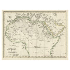
Old Original Map of Africa and Arabia, 1848
Located in Langweer, NL
Antique map titled 'Africa et Arabia'.
Old map of Africa and Arabia originating from 'Orbis Terrarum Antiquus in usum Scholarum'.
Artists and Engravers: Published by Justus P...
Category
Antique 1840s Maps
Materials
Paper
$124 Sale Price
20% Off
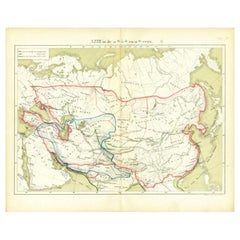
Antique Map of Asia in the 12th, 13th and 14th Century, 1877
Located in Langweer, NL
Antique map titled 'Azie in de 12de, 13de en 14de eeuw.' (Asia in the 12th, 13th and 14th century). Historic map of Asia. This original antique map origi...
Category
Antique 19th Century Maps
Materials
Paper
$71 Sale Price
20% Off
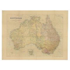
Large Detailed Map of Australia Wint Inset of Tasmania, 1937
Located in Langweer, NL
Antique map titled 'Australia'. Large folding map of Australia. With inset map of Tasmania. Printed by L.F. Johnston, Canberra.
Artists and Engravers: Compiled and drawn by Propert...
Category
20th Century Maps
Materials
Paper
$334 Sale Price
20% Off
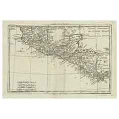
Antique French Engraving of Mexico with Lots of Details, c.1780
Located in Langweer, NL
Antique map titled 'Partie Meridionale, de L'Ancien Mexique ou de la Nouvelle Espagne.'
Detailed map of Mexico, the Yucatan and Central America, prepared under the direction of Rigobert Bonne. Shows towns, rivers, mountains, lakes, etc. Detailed map of the region. Source unknown, to be determined.
Artists and Engravers: Rigobert Bonne (1727-1795 ) was one of the most important cartographers of the late 18th century. In 1773 he succeeded Jacques Bellin as Royal Cartographer to France in the office of the Hydrographer at the Depôt de la Marine. Working in his official capacity Bonne compiled some of the most detailed and accurate maps of the period. Bonne's work represents an important step in the evolution of the cartographic ideology away from the decorative work of the 17th and early 18th century towards a more detail oriented and practical aesthetic. With regard to the rendering of terrain Bonne maps...
Category
Antique 18th Century Maps
Materials
Paper
$334 Sale Price
20% Off
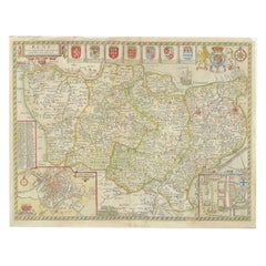
Antique Map of Kent with Inset Plans of Rochester & Canterbury, England, 1676
Located in Langweer, NL
Antique map titled 'Kent with her Cities and Earles described and observed'.
Map of Kent, England. Includes inset town plans of Rochester and Canterbury....
Category
Antique 17th Century Maps
Materials
Paper
$668 Sale Price
20% Off
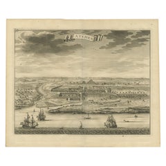
Antique Bird's Eye-view Atjien or Atjeh in Aceh in Northern Sumatra, Indonesia
Located in Langweer, NL
Description: Antique print Indonesia titled 'Atsjien'. Bird's eye-view of the Town of Atjien on the northernmost point of Sumatra. This print originates from 'Oud en Nieuw Oost-Indië...
Category
Antique 1720s Maps
Materials
Paper
$439 Sale Price
20% Off
Antique European War Folding Map, ‘circa 1915’
Located in Langweer, NL
Antique folding map of the European War (1914-1915) titled 'The Eastern Campaign '. From Petrograd to Berlin, geographically colored. Published on linen b...
Category
Early 20th Century Maps
Materials
Paper
$716 Sale Price
20% Off
Antique Map of the United States by Lowry, '1852'
Located in Langweer, NL
Antique map titled 'United States'. Four individual sheets of the United States. This map originates from 'Lowry's Table Atlas constructed and engraved from the most recent Authoriti...
Category
Antique Mid-19th Century Maps
Materials
Paper
$286 Sale Price / set
20% Off
Antique Map of Vienne 'France' by V. Levasseur, 1854
By Victor Levasseur
Located in Langweer, NL
Antique map titled 'Dépt. de la Vienne'. Decorative antique map of the French Department of Vienne, with its capital of Poitiers and small engraved vignette of the battle of Poitiers...
Category
Antique Mid-19th Century Maps
Materials
Paper
$171 Sale Price
20% Off
Antique Map of the Iberian Peninsula with two decorative Cartouches
Located in Langweer, NL
Antique map titled 'Hispaniae et Portugalliae Regna'. Original old map of the Iberian peninsula showing Spain, Portugal and the Balearic Islands. Two beautiful cartouches with severa...
Category
Antique Late 17th Century Maps
Materials
Paper
$1,422 Sale Price
20% Off
Antique Plan of Alicante Bay, Spain
Located in Langweer, NL
Antique map titled 'Plan de la Baye d'Alicant'. Black and white harbor chart /port plan of Alicante Bay, Spain. This map originates from the scarce atlas 'Recueil de Plusiers Plans d...
Category
Antique Mid-18th Century Maps
Materials
Paper
$515 Sale Price
20% Off
Antique Map of Russia and Central Asia, showing the Northeast Passage
Located in Langweer, NL
Antique map titled 'Generalis Totius Imperii Moscovitici (..)'. Decorative map of Russia and Central Asia, showing the Northeast Passage. The map covers the entirety of the Russian Empire at the time, stretching from the Arctic Circle in the north to the "Oceanus Orientalis" and the northern parts China (Chinae Septentrionalis confinia), Mongolia and India in the south. Published by J.B. Homann, circa 1730.
Johann Baptist Homann was born 1664 in Oberkammlach. He founded his business 1702 in Nuremberg, Germany. After a long period of Dutch domination in map publishing, the Homann publishing house became the most important map...
Category
Antique Mid-18th Century Maps
Materials
Paper
$849 Sale Price
20% Off
Antique Map of the Islands in the Atlantic Ocean including Bermuda & Cape Verde
Located in Langweer, NL
Antique map titled 'Islands in the Atlantic'. Steel engraved map of the islands in the Atlantic Ocean. It shows 16 individual maps on one sheet. Covers the Azores or Western Isles, Faeroe Isles, Madeira Isles, Princes Island, Canary Islands, Fernando Po, Anno Bon, St. Thomas, Bermuda Isles, Trinidade Isles, Fernando Noronha, Cape Verde Isles, Ascension Island, St. Helena, Tristan d'Acunha Isles and the Falkland Isles.
Engraved by J. & C. Walker. Published by George Cox...
Category
Antique Mid-19th Century Maps
Materials
Paper
$276 Sale Price
20% Off
Northern Australia Map with The Routes of Explorers Ringwood and McMinn, 1878
Located in Langweer, NL
Antique map titled 'Neue Aufnahmen in Nord-Australien'.
Old map of Northern Australia showing the 'new routes' of the exploration of Ringwood and McMinn. Covers as far east as pa...
Category
Antique 1870s Maps
Materials
Paper
$124 Sale Price
20% Off
Antique Map of Limburg, The Southern Most Province in The Netherlands, c.1870
Located in Langweer, NL
Antique map titled 'Limburg'. Map of the province of Limburg, the Netherlands. This map originates from 'F. C. Brugsma's Atlas van het Koninkrijk der Nederlanden (..)'. Artists and E...
Category
Antique 19th Century Maps
Materials
Paper
$124 Sale Price
20% Off
Print of Garden Pavilions of the Earl of Tilney and Knight Stevenson, c.1785
Located in Langweer, NL
Antique print titled 'Pavillon pour les jardins (..)'. Copper engraving showing the pavilions of the Earl of Tilney and Knight Stevenson.
Earl Tylney, of Castlemaine in the Count...
Category
Antique 18th Century Prints
Materials
Paper
$276 Sale Price
20% Off
Mapping History: The Decorative Cartography of Indre-et-Loire by Levasseur, 1856
Located in Langweer, NL
An original hand-colored map of the Département d'Indre-et-Loire created by Victor Levasseur in 1856. As an antique steel engraved map, it showcases the detailed craftsmanship and technology of mid-19th century map making. The method of steel engraving allowed for precise and intricate details to be captured, making this map not only a navigational tool but also a work of art.
The addition of outline hand colouring is particularly noteworthy. This technique, where colours are applied by hand to the engraved map, was a common practice at the time to highlight certain features such as boundaries, rivers, and cities. The hand colouring on this map would have been done meticulously, adding vibrancy and clarity to the engraved lines and making it easier to differentiate various geographical and political demarcations.
The map's wide margins are characteristic of the period's presentation style, offering space for additional annotations or simply serving to frame the map aesthetically when displayed. Such margins also suggest that the map was intended for a discerning audience, possibly for educational or decorative purposes in a library or study.
Victor Levasseur was renowned for his decorative maps, often embellished with artistic elements that went beyond mere geographical information. These elements could include vignettes, allegorical figures, and detailed illustrations surrounding the map itself, reflecting the cultural, historical, and economic aspects of the depicted area. While the description does not detail these decorative aspects, it's common for Levasseur's works to feature such embellishments, making his maps highly prized among collectors and historians for both their artistic value and cartographic accuracy.
This map of Département d'Indre-et-Loire, with its combination of technical precision in steel engraving and the beauty of hand colouring, represents a fascinating intersection of art and science in the 19th century. It is a testament to the era's dedication to detail, craftsmanship, and the aesthetic presentation of information.
The Département d'Indre-et-Loire, located in the central part of France within the region known as the Centre-Val de Loire, is rich in historical and cultural significance, with numerous important places highlighted on a map from 1856 by Victor Levasseur. Based on the region's known historical sites and cities, the following places are likely to be featured or of importance:
1. **Tours**: As the capital city of the Département d'Indre-et-Loire, Tours is a central hub of history, culture, and architecture. It is known for its old town, the Place Plumereau, Tours Cathedral, and its proximity to the Loire River, making it a likely focal point on the map.
2. **Amboise**: This town is famous for the Château d'Amboise, which is closely linked to French royal history and offers panoramic views of the Loire River. Leonardo da Vinci is buried here in the Chapel of Saint-Hubert, associated with the château.
3. **Chinon**: Known for its medieval fortress, the Château de Chinon, this town has deep historical roots, including connections to Joan of Arc and King Charles VII. The fortress and town would be significant landmarks.
4. **Villandry**: The Château de Villandry is renowned for its beautiful Renaissance gardens, which are some of the most impressive in France. While the château might be less emphasized in an 1856 map compared to cities and towns, it's an important site in the region.
5. **Loches**: This town features the Château de Loches, a medieval castle, and the Royal Lodge, noted for its Renaissance architecture. The town's history and architectural landmarks make it a place of interest.
6. **Azay-le-Rideau**: The Château d'Azay-le-Rideau is set on an island in the middle of the Indre River, showcasing the French Renaissance architectural...
Category
Antique 1850s Maps
Materials
Paper
$229 Sale Price
20% Off
Serene Vista of Messina and its Strait: An Engraved Jewel, circa 1800
Located in Langweer, NL
Title: "Vue de Messine & de Son Détroit"
This evocative print titled "Vue de Messine & de Son Détroit" presents a picturesque view of Messina and its strait, a vital waterway separa...
Category
Antique Early 19th Century Maps
Materials
Paper
$124 Sale Price
20% Off
Original Antique Map the Imperial States of the Habsburg Netherlands, 1609
Located in Langweer, NL
Antique map titled 'Belgii inferioris descriptio (..)'.
Old map of the Seventeen Provinces, the Imperial states of the Habsburg Netherlands in the 16th century. They roughly cove...
Category
Antique Early 1600s Maps
Materials
Paper
$1,193 Sale Price
20% Off
Antique Map of Buckinghamshire in England, 1743
Located in Langweer, NL
Antique map titled 'Buckingham both shyre and shire towne describ'. Map of Buckinghamshire, England. With town plans of Buckingham and Redding. This map originates from Overton's atl...
Category
Antique 18th Century Maps
Materials
Paper
$458 Sale Price
20% Off
Original Antique Print of a Procession of Monks in Ceylon 'Sri Lanka', 1672
Located in Langweer, NL
Antique print, untitled. This original antique print shows a procession of monks in Ceylon. A group of dancing monks, beating drums, in front of the abbot, seated on an elephant. Dut...
Category
Antique 1670s Prints
Materials
Paper
$257 Sale Price
20% Off
Old Map of the French department of Ariège, France
By Victor Levasseur
Located in Langweer, NL
Antique map titled 'Dépt. de l'Ariège'. Map of the French department of Ariege, France. This area of France is known for its production of semi-soft and mild cheeses, such as Bethmal...
Category
Antique Mid-19th Century Maps
Materials
Paper
$324 Sale Price
20% Off
Swiss Splendor: Antique Map of Switzerland and Its Cantons, 1852
Located in Langweer, NL
The antique map titled 'Carte de la Suisse' is an attractive map of Switzerland. Here are the key details and features of the map:
1. **Geographic Coverage**:
- The map provides comprehensive coverage of Switzerland, depicting the entire country.
- It showcases the division of Switzerland by Cantons, including regions from Vaud to Grisons.
- Additionally, the map includes parts of adjacent countries, such as France, Germany, and Italy, providing context for Switzerland's geographical location.
2. **Cartographic Details**:
- The map offers detailed cartographic information, including the delineation of geographic features, rivers, mountains, and the names of Cantons and towns.
- It presents a clear and informative representation of Switzerland's topography.
3. **Origin**:
- This map originates from Maison Basset's 1852 edition of 'Atlas Illustre Destine a l'enseignement de la Geographie elementaire,' indicating its use for educational purposes, particularly in the teaching of geography.
4. **Educational Significance**:
- As part of an educational atlas, the map likely played a role in instructing students about the geography of Switzerland and its political subdivisions.
- It may have been employed as a visual aid to enhance students' understanding of Switzerland's Cantonal divisions.
5. **Aesthetic Appeal**:
- The map is described as attractive, suggesting that it possesses not only educational value but also visual appeal.
- Maps of this era often featured decorative elements that added to their aesthetic charm.
6. **Historical and Geopolitical Significance**:
- Switzerland's unique position in Europe, as a country surrounded...
Category
Antique Mid-19th Century Maps
Materials
Paper
$133 Sale Price
20% Off
Original Antique Engraving of Sakai in the Osaka Prefecture, Japan, 1669
Located in Langweer, NL
Antique print, titled: 'De Stadt Saccai. La Ville de Saccai.' - ('The City Saccai').
This plate shows a view of Sakai in the Osaka Prefecture, Japan. Sakai has been one of the la...
Category
Antique 1660s Maps
Materials
Paper
$620 Sale Price
20% Off
Detailed Antique Map of the Lower Rhine region, Germany
Located in Langweer, NL
Antique map titled 'S.R.I. Circulus Rhanus Inferior sive Electorum Rheni (..)'. Detailed map of the Lower Rhine region, Germany. The title cartouche in the upper left quadrant featur...
Category
Antique Mid-18th Century Maps
Materials
Paper
$429 Sale Price
20% Off
Antique Map of Borneo (Largely Kalimantan), the Largest Island of Asia, 1726
Located in Langweer, NL
Antique map Indonesia titled 'Kaart van het Eyland Borneo'. Early map of the Island of Borneo. This map originates from 'Oud en Nieuw Oost-Indië...
Category
Antique 18th Century Maps
Materials
Paper
$4,058 Sale Price
20% Off
Uncommon Old Map of Lapland to Russia and Denmark to Kazan in the South, 1785
Located in Langweer, NL
Description: Antique map titled 'Kaart van het Noorderdeel van Europa, Bevattende Deenmarken, Noorwegen, Zweden, Lapland en het Grootste Gedeelte van Europeesch Rusland.'
This un...
Category
Antique 1780s Maps
Materials
Paper
$525 Sale Price
20% Off
Antique Plan of Underground Area of Baths of Emperor Titus, Rome, Italy, 1786
Located in Langweer, NL
Antique print titled 'Plan des Thermes de Titus Partie Superieure'.
Plan of the underground areas of the Baths of Titus. The Baths of Titus or Thermae Titi were public baths (Thermae) built in 81 AD at Rome, by Roman emperor Titus...
Category
Antique 18th Century Prints
Materials
Paper
$229 Sale Price
20% Off
Old Map of Part of France: Poitou, Berry, Bourbonnais, and Nivernais in 1768
Located in Langweer, NL
The map with text neatly mounted on both sides of the map on the plate, is a section of an old map with accompanying French text. The map mentions several historical French provinces...
Category
Antique 1760s Maps
Materials
Paper
$343 Sale Price
20% Off
Antique Map of South America by Kelly, 1835
Located in Langweer, NL
Antique map titled 'South America'. Old map of South America engraved by A. Findley. With decorative border. Artists and Engravers: Published by Thomas Kelly, London.
Artist: Publ...
Category
Antique 19th Century Maps
Materials
Paper
$68 Sale Price
20% Off
Antique Map of the City of Groningen by Merian, 1659
Located in Langweer, NL
Antique map titled 'Gröningen'. This print depicts the city of Groningen, the Netherlands. This print originates from 'Topographia Germaniae Inferioris (..)' by C. Merian.
Artist...
Category
Antique 17th Century Maps
Materials
Paper
$87 Sale Price
20% Off
Antique Print of Varanasi in India, c.1850
Located in Langweer, NL
Antique print titled 'Bénarès (Inde)'. View of Varanasi, also known as Benares, Banaras or Kashi. Varanasi a city on the banks of the river Ganges in Uttar Pradesh, India. Source unk...
Category
Antique 19th Century Prints
Materials
Paper
$200 Sale Price
20% Off
1797 Tardieu Map of Southeast Asia: The Malay Archipelago and Beyond
Located in Langweer, NL
An original historical map titled 'Presqu' Île Au Dela Du Gange et Archipel De L'Inde', created by Pierre Francois Tardieu and published in the "Atlas Universel" by Pierre Grégoire C...
Category
Antique 1790s Maps
Materials
Paper
$1,098 Sale Price
20% Off
Pl. 465 Antique Print of Roof Structures by Bell, c.1810
Located in Langweer, NL
Antique print titled 'Plate CCCCLXIV Roofs'. Old print depicting various roof structures. This print originates from 'Encyclopedia Britannica'. Artists and Engravers: Engraved by A. ...
Category
Antique 19th Century Prints
Materials
Paper
$57 Sale Price
20% Off
Lyonnais, Beaujolais, Forez, Mâconnais: A 1644 Depiction of France's Provinces
Located in Langweer, NL
An original antique map from 1644, depicting the French provinces of Lyonnais, Beaujolais, Forez, and Mâconnais. In this map, north is oriented to the right, which is a cartographic ...
Category
Antique 1640s Maps
Materials
Paper
$458 Sale Price
20% Off
Antique Map of the Brazilian Coast by A. Van Krevelt
Located in Langweer, NL
Uncommon edition of this accurate map of part of Brazil, from San Salvador till Rio de Janeiro and S.Paulo. In lower right engraved "29b." Originates from 'Atlas Portatif pour servir...
Category
Antique Late 18th Century Brazilian Maps
Materials
Paper
$230 Sale Price
22% Off
Antique Map of Asia from the Middle East to the Coast of Alaska, 1816
Located in Langweer, NL
Antique map titled ‘L’Asie‘. This is an original antique map of Asia, by Hérisson, taken from atlas ""Nouv. Abrége de Géographie"". An engraved map with coloring of Asia from the Mid...
Category
Antique 19th Century Maps
Materials
Paper
$152 Sale Price
20% Off
Antique Map of Macedonia, Northern Greece and part of Turkey in Europe
Located in Langweer, NL
Antique map titled 'Macedonia Epirus et Achaia'. Original old map of Macedonia, northern Greece, and part of Turkey in Europe. Published by W.J. Blaeu, circa 1640.
Willem Janszoon ...
Category
Antique Mid-17th Century Maps
Materials
Paper
$764 Sale Price
20% Off
Old Map of Southern India and Ceylon 'Sri Lanka', 1882
Located in Langweer, NL
Antique map titled 'India (Southern Sheet)'.
Old map of Southern India and Ceylon (Sri Lanka). With an inset map of the South-Eastern Provinces of India. This map originates from...
Category
Antique 1880s Maps
Materials
Paper
$276 Sale Price
20% Off
Antique Bible Map of the Middle East by A. Schut, 1743
Located in Langweer, NL
Antique map titled 'De Gelegentheyt van 't Paradys en 't Landt Canaan'. Dutch Bible map covering the region between the Mediterranean and the Persian Gulf, ...
Category
Antique Mid-18th Century Maps
Materials
Paper
$525 Sale Price
20% Off
Antique Map of West Sumatra, Indonesia, 1900
Located in Langweer, NL
Antique map titled 'Sumatra, Bangka, Blitoeng en de Riouw-Archipel'. Old map of West Sumatra depicting the various islands and the Strait of Malacca. This map originates from 'Atlas ...
Category
20th Century Maps
Materials
Paper
$276 Sale Price
20% Off
Antique Map of Canada by Johnston '1909'
Located in Langweer, NL
Antique map titled 'Dominion of Canada'. Original antique map of Canada. With inset maps of Niagara, Montreal, Quebec. This map originates from t...
Category
Early 20th Century Maps
Materials
Paper
$238 Sale Price
20% Off
Douro: The River of Tradition and Wine in Portugal, 1903
Located in Langweer, NL
The uploaded image is a historical map of the Beira Baixa region in Portugal. The map details the topography, including mountain ranges and river systems, as well as the transportati...
Category
Antique Early 1900s Maps
Materials
Paper
$276 Sale Price
20% Off
Antique Map of the Empire of the Great Mogol and the Kingdom of Kachimere
Located in Langweer, NL
Antique map titled 'Genealogie des Empereurs Mogols depuis Tamberlan ou Tamerlan'. Two maps, a genealogical tree and three indigenous views of the Mogol Empire on one sheet with desc...
Category
Antique Early 18th Century Maps
Materials
Paper
$553 Sale Price
20% Off
Antique Map of Turkey in Europe with Bulgaria by Johnston '1909'
Located in Langweer, NL
Antique map titled 'Turkey in Europe with Bulgaria'. Original antique map of Turkey in Europe with Bulgaria. With inset maps of The Bosporus & Constantinople, and Crete (or Candia). ...
Category
Early 20th Century Maps
Materials
Paper
$238 Sale Price
20% Off
Old Original Antique German Map of North America, ca.1870
Located in Langweer, NL
Antique map titled 'Nord-America'.
Old map of North America. This map originates from 'H. Kiepert's Kleiner Atlas der Neueren Geographie für Schule und Haus'.
Artists and Engrave...
Category
Antique 1870s Maps
Materials
Paper
$467 Sale Price
20% Off
Detailed Orginal Antique Map of Bengal, India, c.1825
Located in Langweer, NL
Antique map titled 'No. 95 Bengale'. Detailed map of Bengal, Bangladesh. With text about the Ganges river. Originates from 'Atlas Universel' by P.M. Vand...
Category
Antique 19th Century Maps
Materials
Paper
$467 Sale Price
20% Off
Antique Map of Germany and Central Europe
Located in Langweer, NL
Antique map titled 'S. Imperium Romano-Germanicum oder Teutschland mit seinen angrantzenden Königreichen und Provincien'. Original antique map of Germany...
Category
Antique Late 17th Century Maps
Materials
Paper
$1,050 Sale Price
20% Off
Antique Map of North America by Lapie '1842'
Located in Langweer, NL
Antique map titled 'Carte de l'Amérique septentrionale'. Map of North America, with an inset map of the Aleutian Islands. This map originates from 'Atlas universel de géographie anci...
Category
Antique Mid-19th Century Maps
Materials
Paper
$573 Sale Price
20% Off
Antique Map of the Northeast of England by Mercator 'circa 1620'
Located in Langweer, NL
Antique map titled 'Eboracum Lincolnia, Derbia, Staffordia, Notinghamia, Lecestria, Rutlandia, et Norfolcia'. Decorative early map of the northeast of England, comprising the countie...
Category
Antique Early 17th Century Maps
Materials
Paper
$525 Sale Price
20% Off
Antique German Map of India and Sri Lanka or Ceylon, 1902
By Meyer
Located in Langweer, NL
Antique map titled 'Ostindien.' (Map of India with an inset map of East-Bengal.) This attractive original old antique print / plate / map originates from 1885-1907 editions of a famous German encyclopedia: 'Meyers grosses Konversations-Lexikon.', published in Leipzig and Vienna. Meyers Konversations-Lexikon was a major German encyclopedia that existed in various editions from 1839 until 1984, when it merged with the Brockhaus encyclopedia. Several of the plates were also used in Dutch Encyclopedia's like Winkler Prins...
Category
20th Century Maps
Materials
Paper
$65 Sale Price
20% Off
Rare Small Antique Map of Great Britain and Ireland
Located in Langweer, NL
Antique map titled 'La Grande Bretagne et Irlande'. Small antique map of Great Britain and Ireland. Source unknown, to be determined. Publ...
Category
Antique Mid-18th Century Maps
Materials
Paper
$219 Sale Price
20% Off
Antique Map of Asia Showing Its Political Divisions, 1874
Located in Langweer, NL
Antique map titled 'Map of Asia showing its Gt. Political Divisions and also the various routes of Travel between London & India, China & Japan & c'. This map covers from the Arabian...
Category
Antique 19th Century Maps
Materials
Paper
$85 Sale Price
20% Off
Antique Print of the City of Rome, Italy by Münster, C.1580
Located in Langweer, NL
Antique print titled 'Abbildung der Statt Rom/wie sie von Romulo anfänge - Von Italia'. Woodcut of ancient Rome. This print originates from Munster's Cosmographia, one of the most in...
Category
Antique 16th Century Prints
Materials
Paper
$439 Sale Price
20% Off
Antique Map of Eure ‘France’ by V. Levasseur, 1854
By Victor Levasseur
Located in Langweer, NL
Antique map titled 'Dépt. de l'Eure'. Map of the French department of Eure, France. This region of France is home to Giverny, where impressionist Claude Monet’s home and garden can b...
Category
Antique Mid-19th Century Maps
Materials
Paper
$171 Sale Price
20% Off
Antique Map of Part of Flanders 'Belgium' by F. de Wit 'circa 1680'
Located in Langweer, NL
Antique map titled 'Marchionatus Sacri Imperii et Dominii Mechelini Tabula'. Large folio size map of the region around Mechelen, Leuven, Brussels, Dendermonde and Antwerp. Published ...
Category
Antique Late 17th Century Maps
Materials
Paper
$549 Sale Price
20% Off
Asia Minor – Antique Map of Natolia by Ortelius, Theatrum Orbis Terrarum c.1600
Located in Langweer, NL
Asia Minor – Antique Map of Natolia by Ortelius, Theatrum Orbis Terrarum c.1600
This beautifully hand-colored antique map titled Natoliae quae olim Asia Minor nova descriptio presen...
Category
Antique Early 17th Century European Maps
Materials
Paper
$420 Sale Price
20% Off
Antique Map of Westergo, Friesland in the the Netherlands, by Tirion, 1744
By Isaak Tirion
Located in Langweer, NL
Antique map titled 'Westergo'. Original antique map of Westergo, part of the province of Friesland, the Netherlands. Published 1744.
Artists and Engravers: Isaak Tirion (1705 in U...
Category
Antique 18th Century Maps
Materials
Paper
$611 Sale Price
20% Off
Antique Print of the 'Buitenhof' in The Hague, The Netherlands, c.1770
By Georg Balthasar Probst
Located in Langweer, NL
Antique print titled 'Prospectus de Buyten Hof - Gezicht van het Buyten Hof tot Gravenhaghe'. Beautiful view of the Buitenhof, a square in The Hague, the Netherlands. This is an opti...
Category
Antique 18th Century Prints
Materials
Paper
$276 Sale Price
20% Off
Antique Map Showing the Division and Distribution of Reptiles by Johnston '1850'
Located in Langweer, NL
Antique map titled 'Geographical division and distribution of reptilia and ophidia. Original antique map showing the geographical division and distribution of reptiles and serpents. ...
Category
Antique Mid-19th Century Maps
Materials
Paper
$191 Sale Price
20% Off
Recently Viewed
View AllMore Ways To Browse
Statutes And Sculptures
Swedish Gustavian Glass Cabinet
Swiss Chalet Chairs
Tea Cup Art Nouveau
Tea Cup Holder
Teak Buddha
Teak Gentlemans
Thomasville Hollywood Regency
Thomire Clock
Three Legged Vessel
Three Tier Serving Trays
Tibet Earring
Tibetan Antique Cabinet
Tiffany And Co China
Tiffany Blue Rims
Tiffany Sterling Ice Tea Spoons
Torchiere Sculpture
Tortoise Christian Dior
