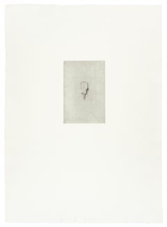
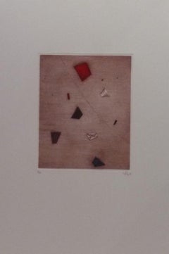
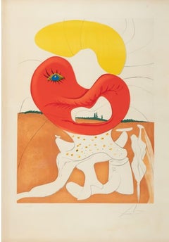
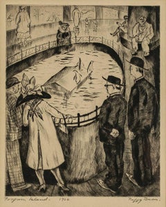
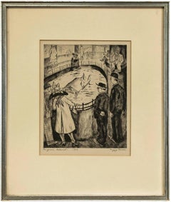
By Peter Takal
Located in Berlin, MD
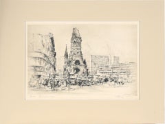
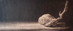
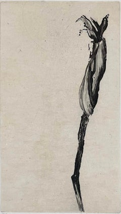
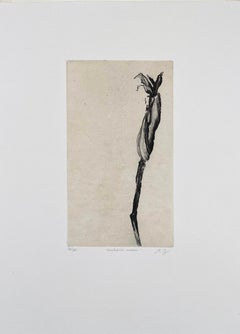
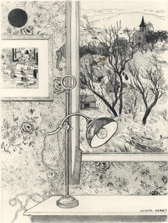
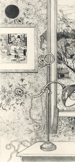
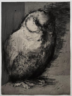
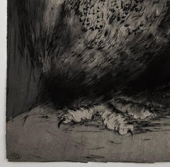
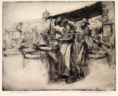
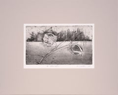
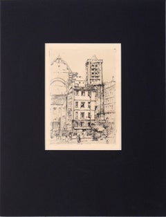
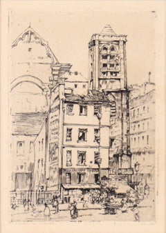
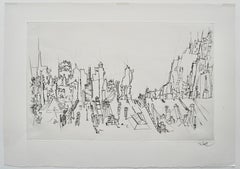
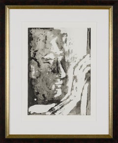
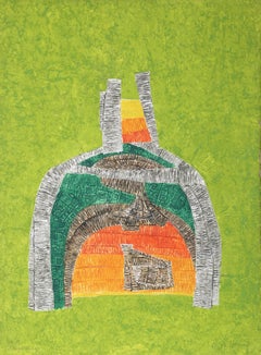
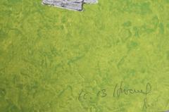
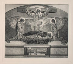
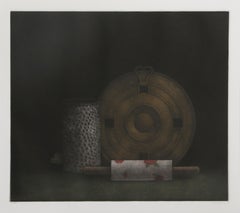
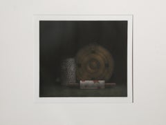
Peter Takal’s original drypoint engraving “City Roofs” is an accomplished work of art created in 1956. It is printed upon fine laid paper with full deckled margins as published in the limited edition of two hundred and fifty impressions. This engraving bears an embossed stamp “The Print Club of Chicago” on verso. This impression is signed by Takal in pencil. “City Roofs” is a fine example of the engraved art created by the 20th century Romanian / German / American artist, Peter Takal.
Peter Takal: Born in Romania in 1905, Peter Takal spent most of his youth in Berlin and was mainly self-taught. His first one-man exhibition took place in the Gurlitt Gallery, Berlin, in 1932. During the following seven years his art was frequently exhibited at galleries in Berlin, Munich, Paris and as well as Casablanca and Algiers. At the beginning of the Second World War (1939), Peter Takal came to the United States for an exhibition of his art at the Katherine Kuhe Gallery, Chicago. He decided to remain in the United States and became an American citizen in 1944.
Living in New York, Peter Takal quickly established himself as a leading printmaker and a modern master of both lithography and drypoint engraving. One-man exhibitions of his art took place in New York City (1942), Chicago (1939 & 1941), Washington (1959) and Los Angeles (1966). International exhibitions of his art were held at the Galeria de Arte Mexicano, Mexico City (1959), the Palazzo Strozzi, Florence, Italy (1960) and at the Kestner-Museum in Germany (1962). Museums to date that include Peter Takal's original prints in their collections are, the Chicago Art Institute, the Library of Congress, Washington, the Los Angeles County Museum of Art, the United States State Department, UCLA, the Berlin National Museum and the Bibliotheque Nationale, Paris. Over the years, the Museum of Modern Art in New York and the Arkansas Arts Center have acquired a very extensive collection of Peter Takal's lithographs and drypoints. The artist died in 1995.
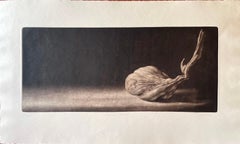
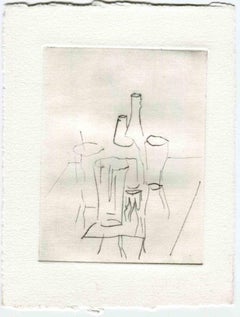
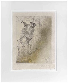
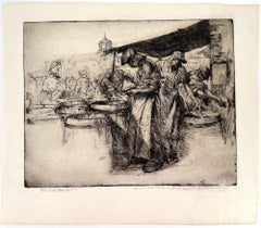
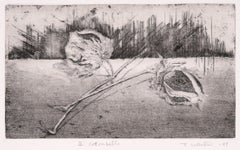
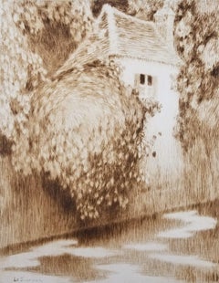
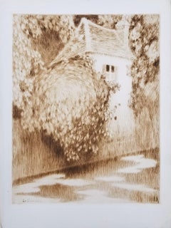
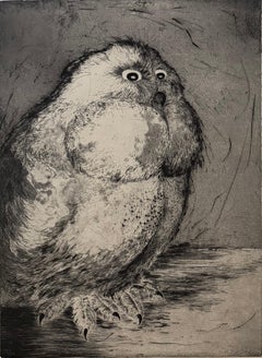
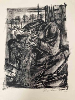
The Print Club of Cleveland: Trees and Fields is an original lithograph commissioned by the Print Club of Cleveland in 1957 and published in a signed edition of 250 impressions. The Print Club of Cleveland is a non-profit adjunct organization and the country's first museum-affiliated print club devoted to the promotion of art and printmaking as a fine art for printmakers and collectors alike. With its creation in 1919, it has helped to support the growth of the department of prints and drawings at the Cleveland Museum of Fine Arts and has also been a source of great enrichment for collectors of fine prints. During the organizations long history, the club has annually commissioned one original etching engraving, lithograph, woodcut and or other form of original graphic art from such fine American artists as John Taylor Arms, Suzanne Anker, Luigi Lucioni, Will Barnet, Mark Tobey, Lyonel Feininger, Henry George Keller, Louis Lozowick, Karl Schrag, David Jansheski, Deborah Remington, and Peter Takal, as well as from leading international artists such as Henri Matisse, Edmund Blampied, Jean-Emile Laboureur, Salvador Dali, Michael di Cerbo, Phyliss Sloane, Paolo Boni, Juvenal Sanso...
Category
Mid-20th Century Abstract Art by Medium: Engraving