Hemispheres Map
to
43
98
48
72
55
50
23
23
22
14
13
12
12
9
6
6
6
6
5
5
5
5
4
4
3
3
3
2
2
2
1
1
1
1
1
1
1
1
1
1
1
1
3
2
2
2
1
Sort By
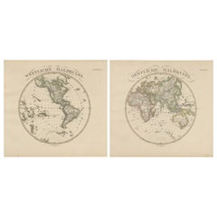
Western & Eastern Hemisphere Maps – World Double Hemisphere Engravings 1857
Located in Langweer, NL
Western & Eastern Hemisphere Maps – World Double Hemisphere Engravings 1857
These beautiful
Category
Antique Mid-19th Century German Maps
Materials
Paper
Triple Extending Fire Screen of Northern Hemisphere Map
Located in Godshill, Isle of Wight
A triple extending fire screen of Northern Hemisphere Map
A wonderful piece the screen has 3
Category
Antique 19th Century Adam Style Screens and Room Dividers
Materials
Silk
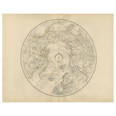
Northern Hemisphere Map Centered on the North Pole, Leiden 1876
Located in Langweer, NL
Title: Northern Hemisphere Map Centered on the North Pole, Leiden 1876
Description:
This 19th
Category
Antique 1870s Dutch Maps
Materials
Paper
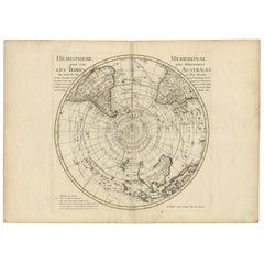
Antique Southern Hemisphere Map by Guillaume De L'Isle, Circa 1783
By Guillaume De L'Isle
Located in Langweer, NL
Title: Southern Hemisphere & Terra Australis Map after Delisle & Buache, Paris c.1782
This
Category
Antique Late 18th Century French Maps
Materials
Paper
$944 Sale Price
20% Off
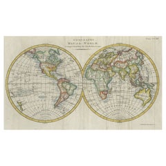
Interesting Original Antique Hemisphere Map Showing the Latest Discoveries, 1786
Located in Langweer, NL
Antique world map titled 'A Map of the World from the best Authorities'. Detailed map of the World
Category
Antique Late 18th Century British Maps
Materials
Paper
$1,044 Sale Price
20% Off
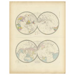
Antique Hemisphere Map of the World 'Two on One Sheet' by Levasseur, '1875'
Located in Langweer, NL
la projection polaire'. Large map with two hemisphere world maps on one sheet. This map originates
Category
Antique Late 19th Century Maps
Materials
Paper
$326 Sale Price
44% Off
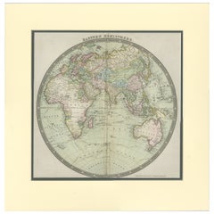
Antique Map of the Eastern Hemisphere by Teesdale, '1831'
Located in Langweer, NL
Antique map titled 'Eastern Hemisphere'. Hemispherical map of eastern hemisphere showing tracks of
Category
Antique Mid-19th Century Maps
Materials
Paper
$237 Sale Price
20% Off
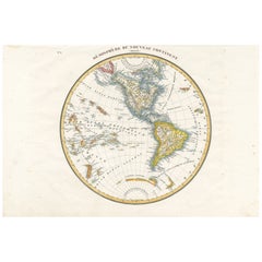
Antique Map of the Western Hemisphere by Lapie, France, circa 1830
Located in Langweer, NL
Antique Map of the Western Hemisphere by Lapie, France, circa 1830
This beautifully engraved and
Category
Antique 1830s Maps
Materials
Paper
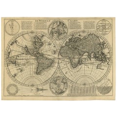
Mid-18th Century Antique World Map by R. & J. Wetstein, Netherlands
Located in Langweer, NL
Antique world map titled 'De Werelt Caart'.
A scarce and richly detailed double hemisphere world
Category
Antique Mid-18th Century Dutch Maps
Materials
Paper
$2,373 Sale Price
20% Off
Original Engraved Antique Map of the World, Colorful and Decorative, C.1780
By Pierre François Tardieu
Located in Langweer, NL
Antique map titled 'Mappemonde en Deux Hemispheres ou l'on a Indique les Nouvelles Decouvertes
Category
Antique 18th Century Maps
Materials
Paper
$446 Sale Price
20% Off
Antique Map of the Northern Hemisphere, 1782
Located in Langweer, NL
Antique map titled 'Hémisphère Septentrional pour voir plus distinctement les Terres Arctiques
Category
Antique 1780s Maps
Materials
Paper
Physical Map of Europe – Nieuwe Hand-Atlas by Frijlink & van Otterloo, 1876
Located in Langweer, NL
Title: Northern Hemisphere Map Centered on the North Pole, Leiden 1876
Description:
This 19th
Category
Antique 1870s Dutch Maps
Materials
Paper
Antique Celestial Star Map – Northern & Southern Hemispheres, 1860
Located in Langweer, NL
Antique Celestial Star Map – Northern & Southern Hemispheres, Andriveau-Goujon 1860
This elegant
Category
Antique Mid-19th Century French Maps
Materials
Paper
Northern Hemisphere Star Map – Constellations & Astronomical Chart, c.1858
Located in Langweer, NL
Northern Hemisphere Star Map – Constellations & Astronomical Chart c.1858
This attractive antique
Category
Antique Mid-19th Century German Maps
Materials
Paper
Antique Map of the Western Hemisphere by Wyld '1845'
Located in Langweer, NL
Antique map titled 'Western Hemisphere'. Original antique map of the western hemisphere. This map
Category
Antique Mid-19th Century Maps
Materials
Paper
$332 Sale Price
20% Off
Antique Map of the Eastern Hemisphere by Wyld '1845'
Located in Langweer, NL
Antique map titled 'Eastern Hemisphere'. Original antique map of the eastern hemisphere. This map
Category
Antique Mid-19th Century Maps
Materials
Paper
$332 Sale Price
20% Off
Antique Map of the Northern Hemisphere by Lowry, '1852'
Located in Langweer, NL
the northern hemisphere. This map originates from 'Lowry's Table Atlas constructed and engraved from
Category
Antique Mid-19th Century Maps
Materials
Paper
$142 Sale Price
20% Off
Very Decorative Original Antique Map of the World, Published in France in c.1780
By Rigobert Bonne
Located in Langweer, NL
Antique map titled 'L'Ancien Monde Et Le Nouveau en Deux Hemispheres' - Double hemisphere map of
Category
Antique 18th Century French Maps
Materials
Paper
$548 Sale Price
40% Off
Antique Map of the Eastern Hemisphere by Wyld, 1842
Located in Langweer, NL
Antique map titled 'Eastern Hemisphere'. Large map depicting the continents Europe, Asia, Afrika
Category
Antique 19th Century Maps
Materials
Paper
Antique Map Depiciting a Horizon or Hemisphere c.1703
Located in Langweer, NL
Antique map depiciting a horizon/hemisphere. Printed for Scherer's 'Atlas Novus' (1702-1710
Category
Antique 18th Century Maps
Materials
Paper
$180 Sale Price
20% Off
Antique Map of a Hemisphere by Scherer, c.1703
Located in Langweer, NL
Antique map depiciting a horizon/hemisphere. Printed for Scherer's 'Atlas Novus' (1702-1710
Category
Antique 18th Century Maps
Materials
Paper
$105 Sale Price
53% Off
Antique World Map in Hemispheres with Delicate Pastel Coloring, 1903
Located in Langweer, NL
Title: Antique World Map in Hemispheres with Delicate Pastel Coloring, 1903
Description:
This
Category
Early 20th Century Scottish Maps
Materials
Paper
World Map in Two Hemispheres: Eastern & Western - 1802 Tardieu Atlas
Located in Langweer, NL
Antique Map with Title: "Mappemonde en Deux Hémisphères"
Publication Details:
- **Atlas Title
Category
Antique Early 1800s Maps
Materials
Paper
$436 Sale Price
20% Off
Antique Map of the World in Hemispheres by Johnson, '1872'
Located in Langweer, NL
Antique map titled 'Johnson's Globular World. Original world map depicting the Eastern Hemisphere
Category
Antique Late 19th Century Maps
Materials
Paper
Antique Map of the Eastern Hemisphere in Frame, 'circa 1683'
Located in Langweer, NL
Antique map titled 'Climats selon les Anciens'. Miniature map of the Eastern Hemisphere showing the
Category
Antique Late 17th Century Maps
Materials
Paper
Rare Original Double Hemisphere World Map with Allegorical Figures, 1785
Located in Langweer, NL
hemisphere world map. Four allegorical figures in the corners represent Europe, Asia, Africa and America
Category
Antique 1780s Maps
Materials
Paper
$2,800 Sale Price
20% Off
Double Hemisphere World Map from the Nieuwe Hand-Atlas, Leiden 1876
Located in Langweer, NL
Title: Double Hemisphere World Map from the Nieuwe Hand-Atlas, Leiden 1876
Description:
This 19th
Category
Antique 1870s Dutch Maps
Materials
Paper
Antique Map of the Eastern Hemisphere by Valk & Chenk '1708'
Located in Langweer, NL
'. Decorative example of Andreas Cellarius's map of the Eastern Hemisphere, illustrating with climatic zones
Category
Antique Early 18th Century Dutch Maps
Materials
Paper
$4,005 Sale Price
25% Off
Original Antique Map of The Eastern Hemisphere by Dower, circa 1835
Located in St Annes, Lancashire
Nice map of the Eastern Hemisphere
Drawn and engraved by J.Dower
Published by Orr & Smith. C
Category
Antique 1830s English Maps
Materials
Paper
Original Antique Map of The Western Hemisphere by Dower, circa 1835
Located in St Annes, Lancashire
Nice map of the Western Hemisphere
Drawn and engraved by J.Dower
Published by Orr & Smith. C
Category
Antique 1830s English Maps
Materials
Paper
Antarctic Exploration Map by Noothoven van Goor with Early Discoveries, c.1876
Located in Langweer, NL
discoveries, southern hemisphere map, antique engraving.
Category
Antique 1870s Dutch Maps
Materials
Paper
Antique Map of the Eastern Hemisphere by Lapie, France, circa 1830
Located in Langweer, NL
Antique Map of the Eastern Hemisphere by Lapie, France, circa 1830
This finely engraved and hand
Category
Antique 1830s Maps
Materials
Paper
Antique Map of The World in Hemispheres on Various Projections, 1882
Located in Langweer, NL
This stunning 1882 'Antique Map of The World in Hemispheres' showcases an exquisite blend of
Category
Antique 1880s Maps
Materials
Paper
$265 Sale Price
20% Off
Antique Map of Eastern Hemisphere from the collection of Thierry Despont
Located in New York, NY
earlier map by Evangelista Azzi (Ev. Azzi). Labeled as such at bottom edge of map.
This piece came from
Category
Antique Late 19th Century Italian Maps
Materials
Canvas, Wood
Antique Map of The World in Hemispheres by W. G. Blackie, 1859
Located in Langweer, NL
Antique map titled 'The World in Hemispheres with other projections'. Original antique map of The
Category
Antique Mid-19th Century Maps
Materials
Paper
$290 Sale Price
30% Off
Antique Map of the World in Hemispheres by Keizer & de Lat, 1788
Located in Langweer, NL
double hemisphere world map on polar projections. In North America, there is a large Island of California
Category
Antique Late 18th Century Maps
Materials
Paper
$474 Sale Price
20% Off
Vincenzo Coronelli's Colored Map of the New World Western Hemisphere Framed 47"
By Vincenzo Coronelli
Located in Dayton, OH
map shows the Western Hemisphere including the discoveries made by Abel Tasman in Australia and an
Category
20th Century Maps
Materials
Paper
$945 Sale Price
30% Off
Beautiful Antique Map of the Northern Hemisphere with California as an Island
By Isaak Tirion
Located in Langweer, NL
tot Amsterdam door Isaak Tirion'. Beautiful map of the Northern Hemisphere and North Pole, which shows
Category
Antique Mid-18th Century Maps
Materials
Paper
$683 Sale Price
20% Off
Framed World Map print showing double hemisphere dating to 1642 originally, New
Located in Lincoln, Lincolnshire
original 1642 double hemisphere map of the world. It includes pictorial relief illustrations and detailed
Category
2010s British Charles II Prints
Materials
Glass, Wood, Paper
Map Silk Embroidered Western Eastern Hemisphere New Old World Asia America Afri
Located in BUNGAY, SUFFOLK
A rare, late-18th century, silk, embroidered, double hemisphere, world map, blackwork, sampler
Category
Antique 18th Century British Georgian Maps
Materials
Silk
Antique Map of the World in two Hemispheres by Keizer & de Lat, 1788
Located in Langweer, NL
Antique map titled 'Kaart van de Twee platte Warelds Bollen (..)'. Interesting world map in two
Category
Antique Late 18th Century Maps
Materials
Paper
$623 Sale Price
30% Off
Antique Map of the Night Skies of the Northern and Southern Hemispheres, 1880
Located in Langweer, NL
northern and southern hemispheres. This map originates from 'Géographie Universelle Atlas-Migeon' by J
Category
Antique 1880s Maps
Materials
Paper
$275 Sale Price
20% Off
Antique Miniature Map of the Western Hemisphere, California as an Island, c.1683
Located in Langweer, NL
the Western Hemisphere, published by Alain Manesson Mallet. The map shows California as an Island, no
Category
Antique Late 17th Century French Maps
Materials
Paper
Antique Map of the Northern Hemisphere and North Pole by Tirion, circa 1754
Located in Langweer, NL
'. Map of the Northern Hemisphere and North Pole, which shows the NE Passage, but no definite NW Passage
Category
Antique Mid-18th Century Dutch Maps
Materials
Paper
$676 Sale Price
24% Off
Rare 1730 Roman Empire Map by Moll - Detailed and Engraved Masterpiece
Located in Langweer, NL
map particularly captivating are the two inset hemispherical maps located on either side of the main
Category
Antique 1730s Maps
Materials
Paper
Original Antique Engraving of the Eastern Hemisphere, c.1700
Located in Langweer, NL
Antique map titled 'Proiectio Optica Aequinoctia lis Hemishaerii Orientalis' - Map of the Eastern
Category
Antique 17th Century Maps
Materials
Paper
$873 Sale Price
20% Off
Western Hemisphere - 1876 Edition by Adolf Stieler, Published by Justus Perthes
Located in Langweer, NL
Map titled "Westliche Halbkugel" (Western Hemisphere), is a copperplate engraving from 1876 by
Category
Antique 1870s Maps
Materials
Paper
$227 Sale Price
20% Off
Interesting Antique Engraving of the World in Hemispheres with 6 Diagrams, 1788
Located in Langweer, NL
Antique map titled 'De Nieuwe en Ouden oppervlakke en doorzigtkundige Aardrykes Bollen (..)'. Twin
Category
Antique Late 18th Century Maps
Materials
Paper
$474 Sale Price
20% Off
A NEW MAP OF THE WORLD from the Latest Observations.
By John Senex
Located in New York, NY
.”
A fine British produced double hemisphere world map. On this map, California is shown as an island
Category
18th Century Other Art Style More Prints
Materials
Watercolor, Engraving
Antique Map of the Southern Hemipshere by Lowry '1852'
Located in Langweer, NL
the southern hemisphere.
This map originates from 'Lowry's Table Atlas constructed and engraved from
Category
Antique Mid-19th Century Maps
Materials
Paper
$142 Sale Price
20% Off
Antique Map Illustrating Solar Eclipses by Scherer, C.1703
Located in Langweer, NL
Antique map of an hemisphere and several figures illustrating the position of the earth, moon and
Category
Antique 18th Century Maps
Materials
Paper
$121 Sale Price
53% Off
1633 Map Entitled "Beauvaisis Comitatus Belova Cium, Ric.0002
Located in Norton, MA
/Ashley) * 1590 World Map in two hemispheres illustrating Drake\\\\\\\\\\\\\\\'s circumnavigation * c
Category
Antique 17th Century Dutch Maps
Materials
Paper
Small Antique World Map in Decorative Old Hand-Colouring, circa 1840
Located in Langweer, NL
Antique map titled 'Wereld Kaart'. Small and very decorative double hemisphere world map. Source
Category
Antique 19th Century Maps
Materials
Paper
$208 Sale Price
20% Off
Antique World Map with Astronomical Spheres by Pierre Mortier, Amsterdam, c.1700
Located in Langweer, NL
distinctive features of this map is the row of five celestial and hemispheric diagrams above the map. These
Category
Antique 17th Century French Maps
Materials
Paper
$872 Sale Price
25% Off
Antique Map of the World with Polar Projections by Keizer & de Lat, 1788
Located in Langweer, NL
Antique map titled 'Schuine Ronde Aard-Klooten (..)'. Interesting double hemisphere world map with
Category
Antique Late 18th Century Maps
Materials
Paper
$445 Sale Price
25% Off
Antique Miniature Map of the Old World and France by Mallet, circa 1683
Located in Langweer, NL
shows a hemisphere of the Old World. The lower map shows France. This map originates from 'Description
Category
Antique Late 17th Century Maps
Materials
Paper
$166 Sale Price
20% Off
1850 Old French Map Depicting the Entire Earth's Surface Divided into Two Parts
Located in Milan, IT
two hemispheres or globes, the map deals with the earth in general. Detailed explanation in French
Category
Antique Mid-19th Century French Maps
Materials
Glass, Wood, Paper
- 1
Get Updated with New Arrivals
Save "Hemispheres Map", and we’ll notify you when there are new listings in this category.
Hemispheres Map For Sale on 1stDibs
With a vast inventory of beautiful furniture at 1stDibs, we’ve got just the hemispheres map you’re looking for. Frequently made of paper, canvas and fabric, every hemispheres map was constructed with great care. You’ve searched high and low for the perfect hemispheres map — we have versions that date back to the 18th Century alongside those produced as recently as the 20th Century are available. Each hemispheres map bearing hallmarks is very popular. You’ll likely find more than one hemispheres map that is appealing in its simplicity, but Antonio Zatta, Guillaume De L'Isle and John Thomson produced versions that are worth a look.
How Much is a Hemispheres Map?
A hemispheres map can differ in price owing to various characteristics — the average selling price 1stDibs is $618, while the lowest priced sells for $185 and the highest can go for as much as $5,562.
More Ways To Browse
Framed World Map
Antique Circus Signs
17th Century World Map
Jere Globe
Antique Clocks Manchester
Jean Marc Vacheron
John Taylor Clock
Vintage Zodiac Map
Vacheron Constantin Mercator
Vacheron Mercator
Finnish Knife
Fireplace Broom
Fireplace Fender Adjustable
First Dips
Fish Poacher
Fish Sculpture Pottery
Fisherman Statue
Flame Mahogany Bed
