
Wales And Wales Furniture

to
97
607
467
465
413
211
176
127
84
80
57
54
54
51
51
43
34
24
22
21
15
14
14
12
11
10
10
9
8
8
8
7
7
6
6
6
6
6
5
5
5
4
4
3
2
2
2
2
2
1
1
1
1
1
24
12
10
5
3
Sort By
Georgian North Wales Low Dresser

Georgian North Wales Low Dresser

Located in Greenwich, CT

Fine mid Georgian oak low cabinet dresser, North Wales circa 1750, the two plank top with molded edge, over two drawers above two cupboard doors with raised tombstone arch panels ove...

Category

Antique Mid-18th Century Welsh Georgian Sideboards

Materials

Oak

Christies 2004 Chirk Castle Wales 1st Ed

Christies 2004 Chirk Castle Wales 1st Ed

Located in valatie, NY

Christies 2004 Chirk Castle Wales. 1st Ed auction catalog. 656 lots on 296pp. color photos and fully described, with results.

Category

21st Century and Contemporary Welsh Books

Materials

Paper

North Wales 8-Leg Potboard Dresser Base

North Wales 8-Leg Potboard Dresser Base

Located in Greenwich, CT

A North Wales dresser base or sideboard having thick single board top with rounded edges over three drawers each with double bail pulls with etched escutcheons over an apron with thr...

Category

Antique Mid-18th Century Welsh Country Sideboards

Materials

Oak

Squared Vase by Phil Rogers - Modern Salt Fired Stoneware from Wales

Squared Vase by Phil Rogers - Modern Salt Fired Stoneware from Wales

Located in Baroda, MI

This squared vase was made by renowned Welsh potter Phil Rogers. The piece is salt fired and features his stamp on the foot. Phil Rogers was born in South Wales in 1951. In 1977 he ...

Category

Late 20th Century Welsh Modern Ceramics

Materials

Pottery, Stoneware

Antique Folding Map of England and Wales

Antique Folding Map of England and Wales

Located in Langweer, NL

Antique map titled 'England and Wales'. Original folding map of England and Wales. Publishes by A. & C. Black, circa 1890.

Category

Antique Late 19th Century Maps

Materials

Paper

Lithographed Antique Map of England and Wales

Lithographed Antique Map of England and Wales

Located in Langweer, NL

Original antique map titled 'Map XXIII England & Wales'. Lithographed map of England and Wales. Published by Fisk & See, circa 1890.

Category

Antique Late 19th Century Maps

Materials

Paper

Original Antique Map of England and Wales

Original Antique Map of England and Wales

Located in Langweer, NL

Antique map titled 'A New and Correct Map of England and Wales from the Latest and Best Improvements'. Original antique map of England and Wales. Printed by Alex Hogg, London for Geo...

Category

Antique Late 18th Century Maps

Materials

Paper

Large Antique Map of England and Wales

Large Antique Map of England and Wales

Located in Langweer, NL

Antique map titled 'An Accurate Map of England and Wales'. Original old map of England and Wales. Engraved by John Cary. Originates from 'New British Atlas' by John Stockdale, publis...

Category

Antique Early 19th Century Maps

Materials

Paper

Miniature Antique Map of England and Wales

Miniature Antique Map of England and Wales

Located in Langweer, NL

Miniature map titled 'England & Wales'. Original antique map of England & Wales. This map originates from 'Darton's New Miniature Atlas' published by William Darton, circa 1820. Maps...

Category

Antique Early 19th Century Maps

Materials

Paper

Map North Wales Robert Marsden Anglesey

Map North Wales Robert Marsden Anglesey

Located in BUNGAY, SUFFOLK

Map of North Wales by Robert Marsden Including Anglesey Charming topography and detail and colouring just purchased more information to follow.

Category

Antique 18th Century English Georgian Maps

Materials

Paper

Antique Map of England and Wales with Roman Numerals

Antique Map of England and Wales with Roman Numerals

Located in Langweer, NL

Untitled original antique map of England and Wales. Drawn & Engraved for Cobbetts 'Geographical Dictionary of England & Wales'. Published by William Cobbett, 1832.

Category

Antique Mid-19th Century Maps

Materials

Paper

Miniature Map of England and Wales with Hand Coloring

Miniature Map of England and Wales with Hand Coloring

Located in Langweer, NL

Antique map titled 'England and Wales'. An attractive miniature map of England and Wales enhanced with hand coloring. Originates from Cary's 'Traveller's Companion', 1789.

Category

Antique Late 18th Century Maps

Materials

Paper

Colorful Detailed Antique Map of England and Wales, 1882

Colorful Detailed Antique Map of England and Wales, 1882

Located in Langweer, NL

Explore the Historic Splendor of 'England and Wales' with this Antique Map! Part of a distinguished collection, this map presents a captivating view of the enchanting landscapes, cit...

Category

Antique 1880s Maps

Materials

Paper

Antique Map of England and Wales by Johnson '1872'

Antique Map of England and Wales by Johnson '1872'

Located in Langweer, NL

Antique map titled 'Johnson's England and Wales'. Original map of England and Wales. This map originates from 'Johnson's New Illustrated Family Atlas of the World' by A.J. Johnson. P...

Category

Antique Late 19th Century American Maps

Materials

Paper

Original Antique Map of England, Ireland, Scotland and Wales

Original Antique Map of England, Ireland, Scotland and Wales

Located in Langweer, NL

Antique map titled 'Les Isles Britanniques, ou sont les Royaumes d Angleterre (..)'. Detailed map of England, Ireland, Scotland and Wales, with French coast and part of the Netherlan...

Category

Antique Early 18th Century Maps

Materials

Paper

Antique Map of England and Wales by Johnston, 1882

Antique Map of England and Wales by Johnston, 1882

Located in Langweer, NL

Antique map titled 'England and Wales'. Old map of England and Wales, with an inset map of Scilly Islands. This map originates from 'The Royal Atlas of Modern Geography, Exhibiting, ...

Category

Antique 19th Century Maps

Materials

Paper

Original Antique Map of England and Wales, with Decorative Cartouche

Original Antique Map of England and Wales, with Decorative Cartouche

Located in Langweer, NL

Antique map titled 'England and Wales from the best Authorities'. Original antique map of England and Wales, with decorative cartouche. Engraved by T. Conder. Published circa 1790.

Category

Antique Late 18th Century Maps

Materials

Paper

Original Antique Map of England and Wales with Large Cartouche

Original Antique Map of England and Wales with Large Cartouche

Located in Langweer, NL

Antique map titled 'Le Royaume d'Angleterre divisé en plusieurs Parties (..)'. Large and rare map of England and Wales by J.B. Nolin after Coronelli. With decorative cartouche, table...

Category

Antique Late 17th Century Maps

Materials

Paper

Antique Map of, Northern England and Wales by Johnston, 1882

Antique Map of, Northern England and Wales by Johnston, 1882

Located in Langweer, NL

Antique map titled 'England and Wales'. Old map of England and Wales. This map originates from 'The Royal Atlas of Modern Geography, Exhibiting, in a Series of Entirely Original an...

Category

Antique 19th Century Maps

Materials

Paper

Antique Map of Northern England and Wales by Zatta, 1784

Antique Map of Northern England and Wales by Zatta, 1784

Located in Langweer, NL

Whether you have a house with Victorian furniture or more contemporary decor an old engraving can enhance your living space.

Category

Antique 18th Century Maps

Materials

Paper

Antique Map of Southern England and Wales by Zatta, 1784

Antique Map of Southern England and Wales by Zatta, 1784

Located in Langweer, NL

Whether you have a house with Victorian furniture or more contemporary decor an old engraving can enhance your living space.

Category

Antique 18th Century Maps

Materials

Paper

Large Antique County Map of North Wales, England

Large Antique County Map of North Wales, England

Located in Langweer, NL

Antique map titled 'A Map of North Wales from the best Authorities'. Original old county map of North Wales, England. Engraved by John Cary. Originates from 'New British Atlas' by Jo...

Category

Antique Early 19th Century Maps

Materials

Paper

Large Antique County Map of South Wales, England

Large Antique County Map of South Wales, England

Located in Langweer, NL

Antique map titled 'A Map of South Wales from the best Authorities'. Original old county map of South Wales, England. Engraved by John Cary. Originates from 'New British Atlas' by Jo...

Category

Antique Early 19th Century Maps

Materials

Paper

Antique Map of England & Wales by Wyld '1845'

Antique Map of England & Wales by Wyld '1845'

Located in Langweer, NL

Antique map titled 'England & Wales'. Original antique map of England & Wales. This map originates from 'An Atlas of the World, Comprehending Separate Maps of its Various Countries, ...

Category

Antique Mid-19th Century Maps

Materials

Paper

Antique Map of England and Wales with Decorative Vignettes, 1851

Antique Map of England and Wales with Decorative Vignettes, 1851

Located in Langweer, NL

Antique map titled ‘England and Wales’. Includes decorative vignettes titled The grand stand on the race ground Doncaster, London, Oxford, Entrance to Portsmouth Harbour, Sunderland ...

Category

Antique 19th Century Maps

Materials

Paper

Original Antique Map of Brecknockshire, Wales, circa 1640

Original Antique Map of Brecknockshire, Wales, circa 1640

Located in Langweer, NL

Antique map titled 'Brecknoc comitaus pars olim silurum'. Original old map of Brecknockshire, Wales. Engraved by R. Vaughan after Christopher Saxton. Published circa 1640.

Category

Antique Mid-17th Century British Maps

Materials

Paper

Antique Map of England and Wales, 1903, with Detailed Counties and Railways

Antique Map of England and Wales, 1903, with Detailed Counties and Railways

Located in Langweer, NL

Title: Antique Map of England and Wales, 1903, with Detailed Counties and Railways Description: This beautifully detailed antique map, titled "England and Wales," was engraved and p...

Category

Early 20th Century Maps

Materials

Paper

Antique Map of England and Wales, with References to the Counties

Antique Map of England and Wales, with References to the Counties

Located in Langweer, NL

Antique map titled 'England and Wales'. Original antique map of England and Wales, with references to the counties. Source unknown, to be determined. Published circa 1820.

Category

Antique Early 19th Century Maps

Materials

Paper

Miniature Antique Map of Glamorganshire, Wales, c.1646

Miniature Antique Map of Glamorganshire, Wales, c.1646

Located in Langweer, NL

Antique map titled 'Glamorganshire'. Miniature map of Glamorganshire, Wales. Later, this map was used for 'England, Scotland and Ireland described and abridge (..)' by J. Speed. Arti...

Category

Antique 17th Century Maps

Materials

Paper

Antique Map of England and Wales, Also Showing the English Channel

Antique Map of England and Wales, Also Showing the English Channel

Located in Langweer, NL

Antique map titled 'England and Wales'. Original antique map of England and Wales. Drawn and engraved by J. Dower. Originates from 'A General Descriptive Atlas Of The Earth, Containi...

Category

Antique Mid-19th Century Maps

Materials

Paper

Colorful Detailed Antique Map of England and Wales (South Part), 1882

Colorful Detailed Antique Map of England and Wales (South Part), 1882

Located in Langweer, NL

Embark on a Journey Through the Southern Part of 'England and Wales' with this Exquisite Antique Map! This map provides a vivid portrayal of the captivating landscapes and cultural h...

Category

Antique 1880s Maps

Materials

Paper

1859 Vintage Maps of England and Wales: Blackie's Imperial Geographic Detail

1859 Vintage Maps of England and Wales: Blackie's Imperial Geographic Detail

Located in Langweer, NL

The "Antique Map of England & Wales" from 'The Imperial Atlas of Modern Geography', published by W. G. Blackie in 1859, is an original antique map that provides a detailed depiction ...

Category

Antique Mid-19th Century English Maps

Materials

Paper

Detailed Antique Map of Britain, Wales and the Coast of Ireland

Detailed Antique Map of Britain, Wales and the Coast of Ireland

Located in Langweer, NL

Antique map titled 'Carta d'Inghilterra e del Principato di Galles'. Detailed map of Britain, Wales and the coast of Ireland with a list of counties. This map originates from 'Nuovo ...

Category

Antique Mid-19th Century Maps

Materials

Paper

Colourful Antique Map of England and Wales Divided in Counties, 1854

Colourful Antique Map of England and Wales Divided in Counties, 1854

Located in Langweer, NL

Antique map titled 'A Map Shewing the Places in England & Wales Sending Members to Parliament with the numbers returned, divisions of counties and population, places of county el...

Category

Antique 19th Century British Maps

Materials

Paper

Antique Map of New South Wales by Lowry, '1852'

Antique Map of New South Wales by Lowry, '1852'

Located in Langweer, NL

Antique map titled 'New South Wales north'. Original map of New South Wales, Australia. This map originates from 'Lowry's Table Atlas constructed and engraved from the most recent Au...

Category

Antique Mid-19th Century Maps

Materials

Paper

Antique Map of New South Wales by Johnston, '1909'

Antique Map of New South Wales by Johnston, '1909'

Located in Langweer, NL

Antique map titled 'South Australia, New South Wales, Victoria and Queensland'. Original antique map of New South Wales. With inset map of Cape York Peninsula. This map originates fr...

Category

Early 20th Century Maps

Materials

Paper

Antique Map of New South Wales by Lowry, 1852

Antique Map of New South Wales by Lowry, 1852

Located in Langweer, NL

Antique map titled 'New South Wales and part of Victoria'. Two individual sheets of New South Wales and part of Victoria. This map originates from 'Lowry's Table Atlas constructed an...

Category

Antique Mid-19th Century Maps

Materials

Paper

Early 20th c. England and Wales Perrier Motor Map c.1910

Early 20th c. England and Wales Perrier Motor Map c.1910

Located in San Francisco, CA

ABOUT Large bright vivid color-printed Perrier Motor Map, featuring the motoring roads of England and Wales. Segmented in two sections and mounted to original linen back, folded int...

Category

Early 20th Century British Victorian Globes

Materials

Paper, Linen

Antique Map of Southern England & Wales, 1903, with Coastal Details and Railways

Antique Map of Southern England & Wales, 1903, with Coastal Details and Railways

Located in Langweer, NL

Title: Antique Map of Southern England and Wales, 1903, with Coastal Details and Railways Description: This detailed antique map, titled "England and Wales (Southern Sheet I)," was ...

Category

Early 20th Century Maps

Materials

Paper

Original Antique Map of England and Wales from the 1909 Royal Atlas

Original Antique Map of England and Wales from the 1909 Royal Atlas

Located in Langweer, NL

The antique map titled 'England and Wales' is a historical cartographic representation of these two nations. This original antique map of England and Wales is sourced from the 'Royal...

Category

Early 20th Century Maps

Materials

Paper

Antique Map of South Australia, New South Wales, Victoria and Queensland, 1903

Antique Map of South Australia, New South Wales, Victoria and Queensland, 1903

Located in Langweer, NL

Title: Antique Map of South Australia, New South Wales, Victoria, and Queensland, 1903 Description: This antique map, titled "South Australia, New South Wales, Victoria, and Queensl...

Category

Early 20th Century Maps

Materials

Paper

1882 Map of Queensland, New South Wales, and Victoria with Detailed Features

1882 Map of Queensland, New South Wales, and Victoria with Detailed Features

Located in Langweer, NL

This 1882 map of Queensland, New South Wales, and Victoria, published by Blackie and Son as part of the 'Comprehensive Atlas and Geography of the World,' provides a detailed depictio...

Category

Antique 1880s Maps

Materials

Paper

The Prince of Wales Silver Cup by Elkington & Co.

The Prince of Wales Silver Cup by Elkington & Co.

By Elkington & Co.

Located in New Orleans, LA

The Prince of Wales Silver Presentation Cup Elkington & Co. Hallmarked London, 1900 This monumental silver presentation cup is a rare surviving object that unites royal patronag...

Category

Early 20th Century English Sterling Silver

Materials

Sterling Silver

Antique Map of England and Wales, Also Including the Isle of Man

Antique Map of England and Wales, Also Including the Isle of Man

Located in Langweer, NL

Antique map titled 'England'. Original antique map of England and Wales from Northumberland to Cornwall from the St. George Channel east as far as the Strait of Dover. The Isle of Ma...

Category

Antique Mid-19th Century Maps

Materials

Paper

Antique Map of England and Wales 'North' by A.K. Johnston, 1865

Antique Map of England and Wales 'North' by A.K. Johnston, 1865

Located in Langweer, NL

Antique map titled 'England and Wales (Northern Sheet)'. This map originates from the ‘Royal Atlas of Modern Geography’ by Alexander Keith Johnston. Published by William Blackwood an...

Category

Antique Mid-19th Century Scottish Maps

Materials

Paper

Small Antique Map of England, Wales, Scotland and Ireland with Original Coloring

Small Antique Map of England, Wales, Scotland and Ireland with Original Coloring

Located in Langweer, NL

Antique map titled 'Les Royaumes d'Angleterre d'Escosse et d'Irlande (..)'. A lovely, small map of England, Wales, Scotland and Ireland with a portion of the coastline of France and ...

Category

Antique Early 18th Century Maps

Materials

Paper

Roman Britain Map, Britannia Romana, Ancient England Wales Wilkinson 1817

Roman Britain Map, Britannia Romana, Ancient England Wales Wilkinson 1817

Located in Langweer, NL

Roman Britain Map, Britannia Romana, Ancient England Wales Wilkinson 1817 This finely engraved and delicately hand-colored map depicts Roman Britain, offering a detailed view of the...

Category

Antique Early 19th Century British Maps

Materials

Paper

Antique Map of Wales, 1885 – County Colors, Railways & Coastal Detail

Antique Map of Wales, 1885 – County Colors, Railways & Coastal Detail

Located in Langweer, NL

Antique Map of Wales, 1885 – County Colors, Railways & Coastal Detail This decorative antique map of Wales was published in 1885 by George W. Bacon in London as part of the *New Lar...

Category

Antique Late 19th Century British Maps

Materials

Paper

English Mahogany Prince of Wales Banjo Barometer, Circa 1820

English Mahogany Prince of Wales Banjo Barometer, Circa 1820

Located in Charleston, SC

English mahogany four dial banjo barometer with broken arch pediment, steel engraved face with Prince of Wales motif, and original rotating bone dial. Barometer can be restored to wo...

Category

Antique 1820s English George III Scientific Instruments

Materials

Steel

England & Wales in 1857 – Decorative Antique Map with Rail Routes

England & Wales in 1857 – Decorative Antique Map with Rail Routes

Located in Langweer, NL

Antique Map of England & Wales – Hand-Colored Engraving by Stülpnagel, 1857 Fine 19th-century map titled "England und Wales", drawn and engraved by Friedrich von Stülpnagel and publ...

Category

Antique Mid-19th Century German Maps

Materials

Paper

Antique Map of New South Wales 'Australia' by Wyld '1845'

Antique Map of New South Wales 'Australia' by Wyld '1845'

Located in Langweer, NL

Antique map titled 'British Settlements in New South Wales'. Original antique map of New South Wales, Australia. This map originates from 'An Atlas of the World, Comprehending Separa...

Category

Antique Mid-19th Century Maps

Materials

Paper

Antique Map of New South Wales by Tallis, circa 1851

Antique Map of New South Wales by Tallis, circa 1851

Located in Langweer, NL

Antique map titled 'New South Wales'. Decorative and detailed map of New South Wales which was drawn and engraved by J. Rapkin (vignettes by H. Warren & J. Rogers) and published in J...

Category

Antique Mid-19th Century English Maps

Materials

Paper

Dresses form the Collection of Diana, Princess of Wales (Book)

Dresses form the Collection of Diana, Princess of Wales (Book)

Located in North Yorkshire, GB

A charity sale conducted by Christie's on a non profit basis Wednesday 25th June 1997. This is a large-format catalogue for the 1997 Christie's charity auction of dresses belonging t...

Category

1990s Books

Materials

Paper

Antique Map of England and Wales by J. Blair, Circa 1779, Wall Art

Antique Map of England and Wales by J. Blair, Circa 1779, Wall Art

Located in Langweer, NL

Antique map titled 'A Map of England and Wales (..)'. Large antique map of England and Wales, with part of the continental and Irish coasts. Published J. Blair, circa 1779.

Category

Antique Late 18th Century British Maps

Materials

Paper

Antique Map of New South Wales and Victoria by W. G. Blackie, 1859

Antique Map of New South Wales and Victoria by W. G. Blackie, 1859

Located in Langweer, NL

Antique map titled 'New South Wales and Victoria'. Original antique map of New South Wales and Victoria. This map originates from ‘The Imperial Atlas of Modern Geography’. Published ...

Category

Antique Mid-19th Century Maps

Materials

Paper

Diana, Princess of Wales by Mario Testino at Kensington Palace

Diana, Princess of Wales by Mario Testino at Kensington Palace

Located in CA, CA

Published by Taschen, accompanying the exhibition Diana Princess of Wales by Mario Testino at Kensington Palace in London, 24 November 2005 - 1 July 2007. 2005 Hardback English text ...

Category

Early 2000s Books

Materials

Paper

Antique English Map – Southern England & Wales, Johnston’s Royal Atlas, 1865

Antique English Map – Southern England & Wales, Johnston’s Royal Atlas, 1865

Located in Langweer, NL

Antique Map of England & Wales (Southern Sheet) – Johnston’s Royal Atlas, 1865 This finely engraved antique map, titled *England and Wales (Southern Sheet)*, was published in 1865 i...

Category

Antique Mid-19th Century Scottish Maps

Materials

Paper

  • 1
  • ...
Get Updated with New Arrivals
Save "Wales And Wales Furniture", and we’ll notify you when there are new listings in this category.

Wales And Wales Furniture For Sale on 1stDibs

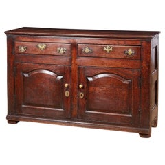
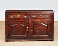
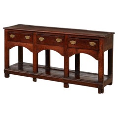
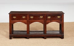
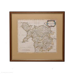
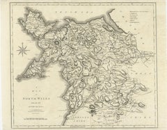
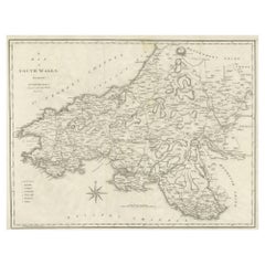
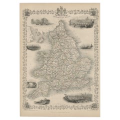
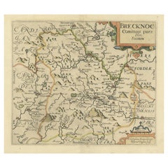
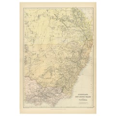
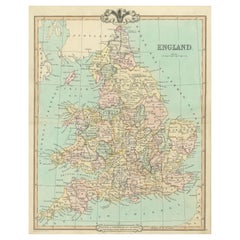
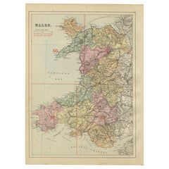
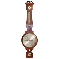
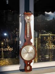
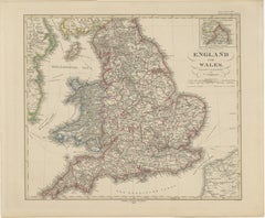
At 1stDibs, there are many versions of the ideal piece of Wales and wales furniture for your home. Frequently made of wood, oak and softwood, every item from our selection of Wales and wales furniture was constructed with great care. If you’re shopping for a choice in our collection of Wales and wales furniture, we have 787 options in-stock, while there are 15 modern editions to choose from as well. Whether you’re looking for newer or older items, there are earlier versions available from the 18th Century and newer variations made as recently as the 21st Century. When you’re browsing for the right object in our assortment of Wales and wales furniture, those designed in Georgian, Victorian and Regency styles are of considerable interest.
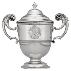
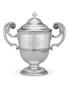
 Emma Wood, Nantgarw Pottery and Swansea Porcelain each produced at least one beautiful option in this array of Wales and wales furniture that is worth considering.

How Much is a Wales And Wales Furniture?

A piece of Wales and wales furniture can differ in price owing to various characteristics — the average selling price 1stDibs is $3,496, while the lowest priced sells for $40 and the highest can go for as much as $89,000.