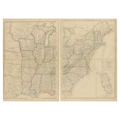
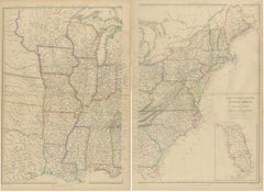
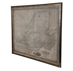
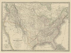
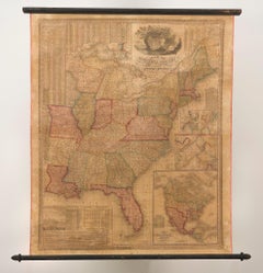
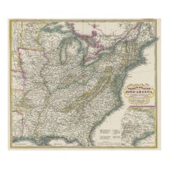
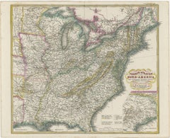
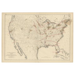
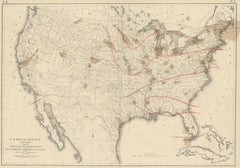
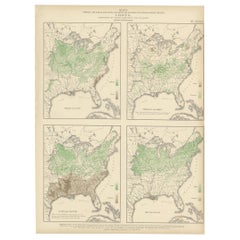
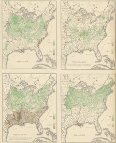
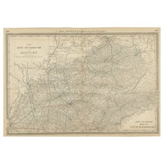
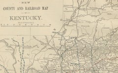
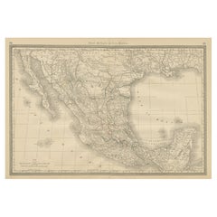
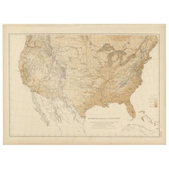
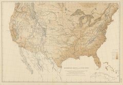
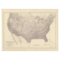
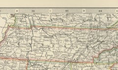
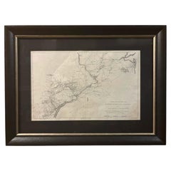
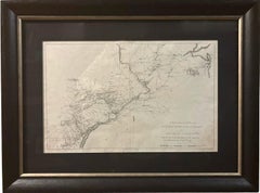
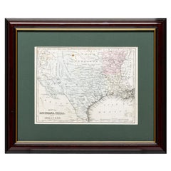
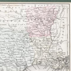
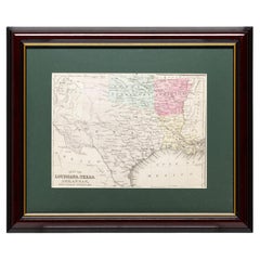
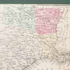
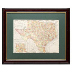
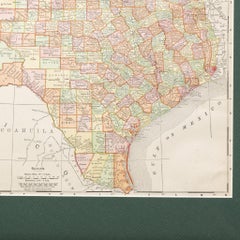
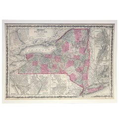
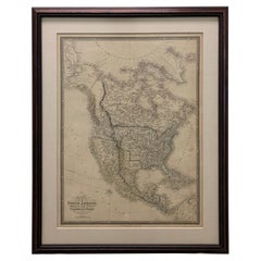
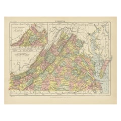
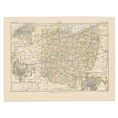
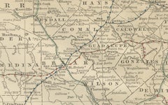
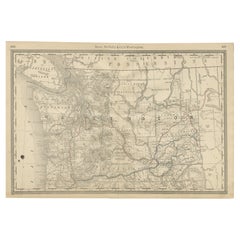
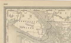
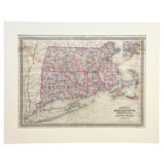
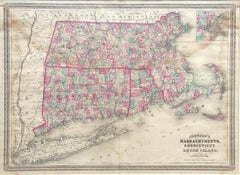
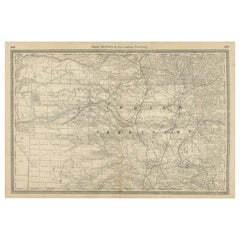
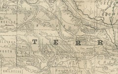
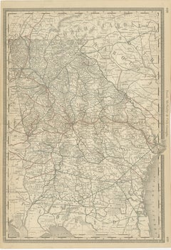
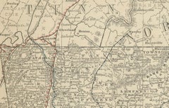
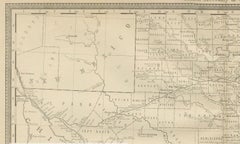
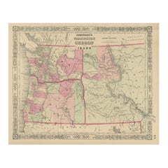
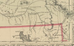
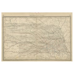
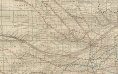
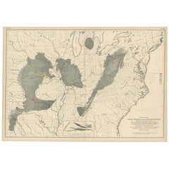
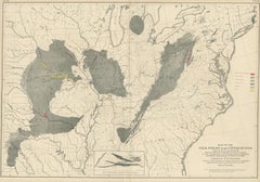
United States Map

to
52
225
139
246
160
93
72
43
39
34
24
12
11
11
10
9
8
8
8
7
7
6
6
6
6
5
5
5
5
4
3
3
3
2
2
1
1
27
12
3
3
2
Set of 2 Antique Maps of the United States by W. G. Blackie, 1859

Set of 2 Antique Maps of the United States by W. G. Blackie, 1859

Located in Langweer, NL

Antique map titled 'The United States of North America, Atlantic States and Valley of the

Category

Antique Mid-19th Century British Maps

Materials

Paper

English Engraved Hand Colored Map of the North Eastern United States, circa 1817

English Engraved Hand Colored Map of the North Eastern United States, circa 1817

Located in Charleston, SC

English copper engraved hand colored map of the North Eastern United States matted under glass in a

Category

Antique 1810s English George III Maps

Materials

Glass, Giltwood, Paint, Paper

Antique Map of the United States by Pierre M. Lapie, Wall Art, 1842

Antique Map of the United States by Pierre M. Lapie, Wall Art, 1842

Located in Langweer, NL

Antique map titled 'Carte des États-Unis d'Amérique'. Map of the United States of America (USA

Category

Antique Mid-19th Century French Maps

Materials

Paper

1812 "United States of North America" Two-Sheet Map by Pierre François Tardieu

1812 "United States of North America" Two-Sheet Map by Pierre François Tardieu

By Pierre François Tardieu

Located in Colorado Springs, CO

Arrowsmith’s 4-sheet map of the United States, this map is completely engraved by Tardieu in Paris and

Category

Antique 1810s French Maps

Materials

Paper

Original Antique Map of The United States of America by Dower, circa 1835

Original Antique Map of The United States of America by Dower, circa 1835

Located in St Annes, Lancashire

Nice map of the USA Drawn and engraved by J.Dower Published by Orr & Smith. C.1835 Unframed

Category

Antique 1830s English Maps

Materials

Paper

Antique Map of the Eastern United States with Only the Northern Part of Florida

Antique Map of the Eastern United States with Only the Northern Part of Florida

$784Sale Price|20% Off

H 14.45 in W 17.92 in D 0.02 in

Antique Map of the Eastern United States with Only the Northern Part of Florida

Located in Langweer, NL

. Inset map of the "southern principal part of Texas." Shows states, major cities, railroads, topography

Category

Antique Mid-19th Century Maps

Materials

Paper

Pl. 9 Antique Map of the Air Movement of the United States by Walker '1874'

Pl. 9 Antique Map of the Air Movement of the United States by Walker '1874'

Located in Langweer, NL

Office of the Chief Signal Officer of the Army'. Antique map of the barometer air movement of the United

Category

Antique Late 19th Century Maps

Materials

Paper

Set of 4 Antique Maps of part of the United States of America, c.1874

Set of 4 Antique Maps of part of the United States of America, c.1874

$714Sale Price / set|35% Off

H 15.16 in W 18.9 in D 0.02 in

Set of 4 Antique Maps of part of the United States of America, c.1874

Located in Langweer, NL

Set of four individual antique maps of part of the United States. Published as part of a set of six

Category

Antique Mid-19th Century German Maps

Materials

Paper

Antique Map of North America by Blackie & Son, Colored, 1882

Antique Map of North America by Blackie & Son, Colored, 1882

Located in Langweer, NL

Title: North America, Antique Map, United States, Canada and Mexico, Blackie 1860 Description

Category

Antique 1880s British Maps

Materials

Paper

Antique US Crop Chart by Francis A. Walker, Lithographed Maps, 1874

Antique US Crop Chart by Francis A. Walker, Lithographed Maps, 1874

Located in Langweer, NL

. Walker, United States, 1870 Keywords: United States map, US agriculture map, crop distribution map

Category

Antique Late 19th Century Maps

Materials

Paper

"Atlas to Accompany Monograph XXXII on the Geology of Yellowstone National Park"

"Atlas to Accompany Monograph XXXII on the Geology of Yellowstone National Park"

By United States Geological Survey

Located in Colorado Springs, CO

the United States Geological Survey’s principal geologists when it was established in 1879. In 1883

Category

Antique Early 1900s American Maps

Materials

Leather, Fabric, Paper

Antique Chart of the Storm Centres of the United States, 1874

Antique Chart of the Storm Centres of the United States, 1874

Located in Langweer, NL

. '. Chart of the frequency of the storm centres of the United States. Originates from 'Statistical Atlas of

Category

Antique Late 19th Century American Maps

Materials

Paper

Antique Map of Kentucky & Tennessee – The Bluegrass & Volunteer States, 1888

Antique Map of Kentucky & Tennessee – The Bluegrass & Volunteer States, 1888

Located in Langweer, NL

Antique Map of Kentucky & Tennessee – The Bluegrass & Volunteer States, 1888 This antique engraved

Category

Antique Late 19th Century American Maps

Materials

Paper

Mexico Antique Railroad Map c.1888 – Cities, States & Land of the Aztecs

Mexico Antique Railroad Map c.1888 – Cities, States & Land of the Aztecs

Located in Langweer, NL

Antique Map of Mexico – Rand McNally, circa 1888 This antique map titled *“Rand, McNally & Co.’s

Category

Antique Late 19th Century American Maps

Materials

Paper

Pl. 9 Antique Hypsometric Sketch of the United States by Walker, 1874

Pl. 9 Antique Hypsometric Sketch of the United States by Walker, 1874

Located in Langweer, NL

Antique chart titled 'Hypsometric sketch of the United States. The level curves of 400 and 800 feet

Category

Antique Late 19th Century Maps

Materials

Paper

Pl. 7 Antique Temperature Chart of the United States by Walker, 1874

Pl. 7 Antique Temperature Chart of the United States by Walker, 1874

Located in Langweer, NL

Antique chart titled 'Temperature chart of the United States. Showing the distribution by

Category

Antique Late 19th Century Maps

Materials

Paper

1873 "Map of the States of California and Nevada" by Chas. Drayton Gibbes

1873 "Map of the States of California and Nevada" by Chas. Drayton Gibbes

Located in Colorado Springs, CO

Presented is Warren Holt and Charles Drayton Gibbes' 1873 “Map of California and Nevada.” This map

Category

Antique 1870s American Maps

Materials

Paper

1868 "Lloyd's Topographical Railway Map of North America..." Hanging Wall Map

1868 "Lloyd's Topographical Railway Map of North America..." Hanging Wall Map

Located in Colorado Springs, CO

Presented is “Lloyd's Topographical Railway Map of North-America, or the United States Continent in

Category

Antique 1860s American Late Victorian Maps

Materials

Linen, Paper

Arkansas Map by Colton, USA Published c.1864 – Hand-Colored County Map

Arkansas Map by Colton, USA Published c.1864 – Hand-Colored County Map

Located in Langweer, NL

networks in the southern United States after the Civil War. County boundaries are outlined in red for

Category

Antique Mid-19th Century American Maps

Materials

Paper

1917 "New Hudson River Map" by Wallace Bruce, Later Edition, Folding Map

1917 "New Hudson River Map" by Wallace Bruce, Later Edition, Folding Map

Located in Colorado Springs, CO

New York Harbor and has played a crucial role in the history and development of the United States

Category

Vintage 1910s American Beaux Arts Maps

Materials

Paper

1854 Map of Massachusetts, Connecticut and Rhode Island, Antique Wall Map

1854 Map of Massachusetts, Connecticut and Rhode Island, Antique Wall Map

Located in Colorado Springs, CO

This striking wall map was published in 1854 by Ensign, Bridgman & Fanning and has both full

Category

Antique 19th Century American Maps

Materials

Paper

Rare 18th C. Newport Map

Rare 18th C. Newport Map

$19,500 / item

H 37 in W 27.5 in D 2 in

Rare 18th C. Newport Map

Located in Sandwich, MA

Rare 18th C, Map titled "A plan of the town of Newport in the province of Rhode Island". Earliest

Category

Antique 1770s American Maps

Materials

Paper

1847 Amerique Septentrionale Framed Map

1847 Amerique Septentrionale Framed Map

$850

H 19.75 in W 26 in D 1.75 in

1847 Amerique Septentrionale Framed Map

Located in Stamford, CT

1847 Amerique Septentrionale Framed Map Illustrated by Raimond Bonheur. As found framed condition.

Category

Antique 1840s American American Classical Maps

Materials

Glass, Wood, Paper

Large 1848 North America & Territories Map

Large 1848 North America & Territories Map

$1,950

H 21.25 in W 18.5 in D 1.5 in

Large 1848 North America & Territories Map

Located in Stamford, CT

. Featuring the United States, Canada (British Territory) and Mexican Territories. As found high end custom

Category

Antique 1840s American American Classical Maps

Materials

Glass, Wood, Paper

Antique Map of Virginia, with Inset Map of the Northern Part, 1888

Antique Map of Virginia, with Inset Map of the Northern Part, 1888

$277Sale Price|20% Off

H 8.27 in W 10.63 in D 0.02 in

Antique Map of Virginia, with Inset Map of the Northern Part, 1888

Located in Langweer, NL

Antique map titled 'West Virginia'. Original antique map of Virginia, United States. With inset map

Category

Antique Late 19th Century British Maps

Materials

Paper

Antique Map of Wisconsin with Inset Geological Map of Wisconsin

Antique Map of Wisconsin with Inset Geological Map of Wisconsin

$277Sale Price|20% Off

H 10.63 in W 8.27 in D 0.02 in

Antique Map of Wisconsin with Inset Geological Map of Wisconsin

Located in Langweer, NL

Antique map titled 'Wisconsin'. Original antique map of Wisconsin, United States. With inset

Category

Antique Late 19th Century Maps

Materials

Paper

1943 "USO Map Guide to Washington"

1943 "USO Map Guide to Washington"

$1,750

H 20 in W 25.63 in D 0.75 in

1943 "USO Map Guide to Washington"

Located in Colorado Springs, CO

This is a WWII map of Washington, DC, issued as a guide for service men and women visiting or

Category

Vintage 1940s American Mid-Century Modern Maps

Materials

Paper

Framed Map of Texas Circa 1880

Framed Map of Texas Circa 1880

$1,725

H 14 in W 17.5 in D 2 in

Framed Map of Texas Circa 1880

Located in Coeur d'Alene, ID

Framed circa 1880 map of Texas with Louisiana and Arkansas. Well detailed. Great for display in any

Category

Antique Late 19th Century American Maps

Materials

Paper

Framed Map of Texas Circa 1886

Framed Map of Texas Circa 1886

$1,725

H 12 in W 17 in D 2 in

Framed Map of Texas Circa 1886

Located in Coeur d'Alene, ID

Framed circa 1886 map of Texas including Louisiana, Texas and Arkansas, with Indian territory. Well

Category

Antique Late 19th Century American Maps

Materials

Paper

Framed Map of Texas Circa 1908

Framed Map of Texas Circa 1908

$2,300

H 15 in W 18.75 in D 2 in

Framed Map of Texas Circa 1908

Located in Coeur d'Alene, ID

Framed circa 1908 map of Texas. Each county separated and colored with panhandle of Texas on same

Category

Early 20th Century American Maps

Materials

Paper

Tony Sarg Map of Nantucket Town, 1937

Tony Sarg Map of Nantucket Town, 1937

$1,200

H 24.25 in W 22.13 in D 0.75 in

Tony Sarg Map of Nantucket Town, 1937

By Tony Sarg

Located in Nantucket, MA

Tony Sarg Map of Residential Main Street, Nantucket, 1937, a black and white printed map of our

Category

Vintage 1930s American Other Maps

Materials

Paper

Huge Europe and Asia Vintage Wall Map

Huge Europe and Asia Vintage Wall Map

$380Sale Price|20% Off

H 73 in W 78 in D 0.2 in

Huge Europe and Asia Vintage Wall Map

Located in San Diego, CA

A huge Europe and Asia vintage wall map, circa 1950s. The map is in fair vintage condition and

Category

Mid-20th Century American Maps

Materials

Paper

Antique Map of Virginia, with Inset Map of the South Western Continuation

Antique Map of Virginia, with Inset Map of the South Western Continuation

$277Sale Price|20% Off

H 8.27 in W 10.63 in D 0.02 in

Antique Map of Virginia, with Inset Map of the South Western Continuation

Located in Langweer, NL

Antique map titled 'Virginia'. Original antique map of Virginia, United States. With inset map of

Category

Antique Late 19th Century Maps

Materials

Paper

Antique Map of Ohio, with Inset Maps of Cleveland, Columbus and Cincinnati

Antique Map of Ohio, with Inset Maps of Cleveland, Columbus and Cincinnati

$277Sale Price|20% Off

H 8.27 in W 10.63 in D 0.02 in

Antique Map of Ohio, with Inset Maps of Cleveland, Columbus and Cincinnati

Located in Langweer, NL

Antique map titled 'Ohio'. Original antique map of Ohio, United States. With inset maps of

Category

Antique Late 19th Century Maps

Materials

Paper

Framed 1838 North America & Recent Discoveries Map

Framed 1838 North America & Recent Discoveries Map

Located in Stamford, CT

1838 map of North America & recent discoveries. Engraved color map by J. Wyld, London, England

Category

Antique 1830s American American Classical Maps

Materials

Glass, Wood, Paper

Kansas Railroad Map 1888 – Rand McNally Antique Lithograph

Kansas Railroad Map 1888 – Rand McNally Antique Lithograph

Located in Langweer, NL

, Midwest maps, or the history of westward expansion in the United States. Condition: Good, with mild

Category

Antique Late 19th Century American Maps

Materials

Paper

Antique Map 1888 – Southern Texas Railroads, Counties & Settlements

Antique Map 1888 – Southern Texas Railroads, Counties & Settlements

Located in Langweer, NL

Texas to both the interior United States and international trade networks. Counties are clearly defined

Category

Antique Late 19th Century American Maps

Materials

Paper

Washington Map 1888 – Antique Railroads, Indian Reservations & Counties

Washington Map 1888 – Antique Railroads, Indian Reservations & Counties

Located in Langweer, NL

agricultural industries with markets across the United States. Important towns and cities such as Seattle

Category

Antique Late 19th Century American Maps

Materials

Paper

Indian Territory Map 1888 – Rand McNally Antique Lithograph

Indian Territory Map 1888 – Rand McNally Antique Lithograph

Located in Langweer, NL

Indian Territory Map 1888 – Rand McNally Antique Lithograph This antique 1888 map of Indian

Category

Antique Late 19th Century American Maps

Materials

Paper

Georgia 1888 Antique Map – Railroads, Settlements & Frontier Counties

Georgia 1888 Antique Map – Railroads, Settlements & Frontier Counties

Located in Langweer, NL

Georgia Map 1888 – Rand McNally Antique Lithograph This antique 1888 map of Georgia, published by

Category

Antique Late 19th Century American Maps

Materials

Paper

Texas Antique Map 1888 – Railroads, Counties & Frontier Settlements

Texas Antique Map 1888 – Railroads, Counties & Frontier Settlements

Located in Langweer, NL

Texas Railroad Map 1888 – Rand McNally Antique Lithograph This antique 1888 map of Texas

Category

Antique Late 19th Century American Maps

Materials

Paper

Nebraska Railroad Map 1888 – Rand McNally Antique Lithograph

Nebraska Railroad Map 1888 – Rand McNally Antique Lithograph

Located in Langweer, NL

Nebraska Railroad Map 1888 – Rand McNally Antique Lithograph This finely detailed map of Nebraska

Category

Antique Late 19th Century American Maps

Materials

Paper

Washington Oregon Idaho Map – Johnson, Hand-Colored, c.1864

Washington Oregon Idaho Map – Johnson, Hand-Colored, c.1864

Located in Langweer, NL

York circa 1864. It shows the northwestern United States with Washington Territory, Oregon, and the

Category

Antique Mid-19th Century American Maps

Materials

Paper

1870 "Johnson's Illinois" Map Published by A. J. Johnson

1870 "Johnson's Illinois" Map Published by A. J. Johnson

Located in Colorado Springs, CO

District Court of the United States for the Southern District of New York". Full margins. Light toning

Category

Antique 1870s American Victorian Maps

Materials

Paper

Large Original Antique Map of North Carolina, USA, 1894

Large Original Antique Map of North Carolina, USA, 1894

By Rand McNally & Co.

Located in St Annes, Lancashire

Fabulous map of North Carolina Original color By Rand, McNally & Co. Published, 1894

Category

Antique 1890s American Maps

Materials

Paper

Physical Relief Map of Africa, 1970s Educational Decor

Physical Relief Map of Africa, 1970s Educational Decor

Located in New Windsor, NY

Physical relief map of Africa. Jerry, our artist, has painstakingly reproduced the desserts, rivers

Category

Late 20th Century American Mid-Century Modern Maps

Materials

Masonite, Paint

Large Original Antique Map of Illinois, USA, 1894

Large Original Antique Map of Illinois, USA, 1894

By Rand McNally & Co.

Located in St Annes, Lancashire

Fabulous map of Illinois Original color By Rand, McNally & Co. Published, 1894 Unframed Free

Category

Antique 1890s American Maps

Materials

Paper

Large Original Antique Map of Mississippi, USA, 1894

Large Original Antique Map of Mississippi, USA, 1894

By Rand McNally & Co.

Located in St Annes, Lancashire

Fabulous map of Mississippi Original color By Rand, McNally & Co. Published, 1894 Unframed

Category

Antique 1890s American Maps

Materials

Paper

Large Original Antique Map of Africa. C.1900

Large Original Antique Map of Africa. C.1900

$90

H 17.25 in W 15 in D 0.07 in

Large Original Antique Map of Africa. C.1900

Located in St Annes, Lancashire

Fabulous map of Africa Original color. Engraved and printed by the George F. Cram Company

Category

Antique 1890s American Maps

Materials

Paper

Large Original Antique Map of Ireland. C.1900

Large Original Antique Map of Ireland. C.1900

$90

H 22 in W 14.5 in D 0.07 in

Large Original Antique Map of Ireland. C.1900

Located in St Annes, Lancashire

Fabulous map of Ireland Original color. Engraved and printed by the George F. Cram Company

Category

Antique 1890s American Maps

Materials

Paper

  • 1
Get Updated with New Arrivals
Save "United States Map", and we’ll notify you when there are new listings in this category.

United States Map For Sale on 1stDibs

Choose from an assortment of styles, material and more with respect to the United states map you’re looking for at 1stDibs. Frequently made of paper, wood and metal, every United states map was constructed with great care. Find 959 options for an antique or vintage United states map now, or shop our selection of 25 modern versions for a more contemporary example of this long-cherished piece. You’ve searched high and low for the perfect United states map — we have versions that date back to the 18th Century alongside those produced as recently as the 21st Century are available. When you’re browsing for the right United states map, those designed in mid-century modern, Victorian and modern styles are of considerable interest. Rand McNally & Co., Luft Tanaka and Arthur Armour each produced at least one beautiful United states map that is worth considering.

How Much is a United States Map?

Prices for a United states map can differ depending upon size, time period and other attributes — at 1stDibs, they begin at $29 and can go as high as $500,000, while the average can fetch as much as $1,439.

Read More

Dickens Fan on Your List? This First Edition of ‘A Christmas Carol’ Is a Treasure

Produced in 1843, the well-preserved volume is evidence of the author's exacting specifications.

Patchwork Quilts Are the Latest Nostalgic Design Trend

New or old, the coverlets add old-time charm to any space.

Medal-Worthy Memorabilia from Epic Past Olympic Games

Get into the games! These items celebrate the events, athletes, host countries and sporting spirit.

Ahoy! You’ve Never Seen a Collection of Sailor Art and Kitsch Quite Like This

French trendsetter and serial collector Daniel Rozensztroch tells us about his obsession with objects related to seafaring men.

39 Incredible Swimming Pools

It's hard to resist the allure of a beautiful pool. So, go ahead and daydream about whiling away your summer in paradise.

Pamela Shamshiri Shares the Secrets behind Her First-Ever Book and Its Effortlessly Cool Interiors

The sought-after designer worked with the team at Hoffman Creative to produce a monograph that beautifully showcases some of Studio Shamshiri's most inspiring projects.

Moroccan Artworks and Objects Take Center Stage in an Extraordinary Villa in Tangier

Italian writer and collector Umberto Pasti opens the doors to his remarkable cave of wonders in North Africa.

Montecito Has Drawn Royalty and Celebrities, and These Homes Are Proof of Its Allure

Hollywood A-listers, ex-pat aristocrats and art collectors and style setters of all stripes appreciate the allure of the coastal California hamlet — much on our minds after recent winter floods.