Maps
to
4,254
5,436
240
5,681
3
77
35
18
13
6
5
4
4
4
3
1
1
2,972
2,236
473
3
288
34
9
126
8
36
9
2
5
4
3
2
5,594
122
55
34
32
714
332
217
146
140
5,684
5,684
5,684
104
63
28
24
16
Maps For Sale
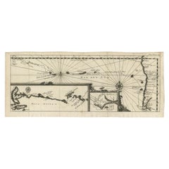
Antique Map of the Pacific Ocean by Renneville, 1702
Located in Langweer, NL
Antique map, untitled. A map of the Pacific Ocean, with the coast of Peru in the right edge and the outline of New Guinea in the left edge. In betwe...
Category
18th Century Antique Maps
Materials
Paper
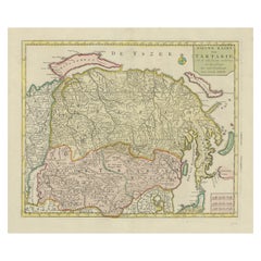
Antique Map op Siberia and Chinese Tartary with original hand coloring, 1732
Located in Langweer, NL
Antique map titled 'Nieuwe Kaart van Tartarie na de alderlaatste ontdekking int ligt gebragt'. Map op Siberia and Chinese tartary. In the north Novaya Zemlya curls back to attach its...
Category
Mid-18th Century Antique Maps
Materials
Paper
$767 Sale Price
20% Off
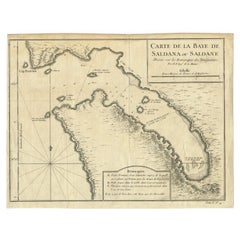
Antique Map of Saldanha Bay 'Near Cape Town, South Africa' by Bellin, 1750
Located in Langweer, NL
Antique map titled ‘Carte De La Baye De Saldana ou Saldane Dressee sur les Remarques des Navigateurs’. Detailed plan of Saldanha Bay, northwest of Cape Town, South Africa. This map o...
Category
18th Century Antique Maps
Materials
Paper
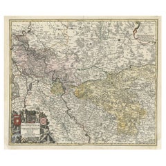
Antique Map of present-day North-Rhine Westphalia, Germany
Located in Langweer, NL
Antique map titled 'Nova et Accurata Ducatus Cliviae et Comitatus Marchiae (..)'. Detailed regional map of Germany showing the region bounded by the Maas River in the west and to par...
Category
Mid-18th Century Antique Maps
Materials
Paper
$508 Sale Price
20% Off
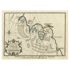
Original Antique Map of the Bay and the Island of Arguin, Mauritania, 1747
Located in Langweer, NL
Antique map titled ’Plan de la Baye et Isle d'Arguim (..) - Oppervlakte van de Baai en 't Eiland van Arguin (..)'.
Original antique map of the bay and the island of Arguin. This ...
Category
1740s Antique Maps
Materials
Paper
$249 Sale Price
20% Off
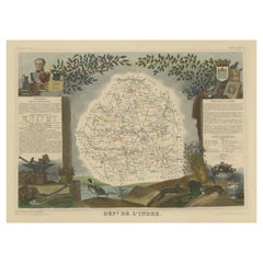
Old Map of the French Department of Indre, France
Located in Langweer, NL
Antique map titled 'Dept. de l'Indre'. Map of the French department of Indre, France. Part of the Loire Valley wine region, this area is known for its production of Chinon wines, typically red, and production of Pouligny-Saint-Pierre, goats'-milk cheese. It is also the birthplace of the great philosopher Rene Descartes...
Category
Mid-19th Century Antique Maps
Materials
Paper
$326 Sale Price
20% Off
Antique Map of Switzerland by Homann Heirs, c.1732
Located in Langweer, NL
Antique map titled 'Potentissimae Helvetiorum Reipublicae (..)'. Beautiful detailed map of Switzerland, showing the 13 cantons. The large title cartouche showing 13 coat of arms of t...
Category
18th Century Antique Maps
Materials
Paper
$377 Sale Price
20% Off
Hand Colored Antique Map of the department of Finistère, France
Located in Langweer, NL
Antique map titled 'Dépt. du Finistère'. Map of the French department of Finistere, Brittany, France. This area of France is known for its cider production and excellent boar hunting...
Category
Mid-19th Century Antique Maps
Materials
Paper
$326 Sale Price
20% Off
Antique Map of the World by D'Urville '1853'
Located in Langweer, NL
Antique map titled 'Voyage Autour du Monde'. Original map of the world. This map originates from volume 1 of 'Voyage Autour du Monde' by Comte-Amiral Dumont D'Urville.
Category
Mid-19th Century Antique Maps
Materials
Paper
$287 Sale Price
20% Off
Antique Map of Westphalia, West Orientation
Located in Langweer, NL
Antique map titled 'Nova totius Westphaliae Descriptio'. Detailed map of Westphalia, Northern Germany. Oriented to the west. The area shown extends from Ha...
Category
Late 17th Century Antique Maps
Materials
Paper
$594 Sale Price
20% Off
Antique North Yorkshire Map, English, Framed Lithography, Cartography, Victorian
Located in Hele, Devon, GB
This is an antique lithography map of North Yorkshire. An English, framed atlas engraving of cartographic interest, dating to the mid 19th century and later.
Superb lithography of ...
Category
Mid-19th Century British Victorian Antique Maps
Materials
Paper
Cemetery on Amsterdam Island, French Territory in the Indian Ocean, ca.1785
Located in Langweer, NL
Antique print titled 'Begraafplaats op het eiland Amsterdam'.
Engraved view of a local cemetery on Amsterdam Island, a small French territory in the southern Indian Ocean. Origin...
Category
1780s Antique Maps
Materials
Paper
$278 Sale Price
20% Off
Antique Map of the Westphalia region of Germany
Located in Langweer, NL
Antique map titled 'Circulus Westphaliae (..)'. Original old map of the Westphalia region, Germany. Published by Justus Danckerts, circa 1696.
Justus Danckerts I (11 November 1635 ...
Category
Late 17th Century Antique Maps
Materials
Paper
$661 Sale Price
20% Off
Old Map of Southern Russia, Incl the Extent of the Kingdom of Poland, 1882
Located in Langweer, NL
Antique map titled 'South-West Russia'.
Old map of southern Russia, also showing the extent of the Kingdom of Poland. This map originates from 'The Royal Atlas of Modern Geography...
Category
1880s Antique Maps
Materials
Paper
$326 Sale Price
20% Off
Antique Map of Tartary and Northeast Asia with Hand Coloring
Located in Langweer, NL
Antique map titled 'Carte de la Tartarie Occidentale'. An interesting map of Tartary and northeast Asia, from Lake Baykal, Partie du Siberia in the north, Pays des Kalkas at the cent...
Category
Mid-18th Century Antique Maps
Materials
Paper
$268 Sale Price
20% Off
Antique Map of Northwestern India by Weller, 1857
Located in Langweer, NL
Antique map titled 'India, The North West Provinces and Oude'.Detailed map of the northwestern part of India, extending to the Himalaya Mountains. Shows part of Nepal including Dharm...
Category
19th Century Antique Maps
Materials
Paper
Antique Map of the Region of Fulda by Homann, c.1730
Located in Langweer, NL
Antique map titled 'S.R.I. Principatus Fuldensis in Buchonia'. Rare edition of the large JB Homann map of the principality of Fulda, Germany.
Artists and Engravers: Johann Baptist...
Category
18th Century Antique Maps
Materials
Paper
$187 Sale Price
20% Off
Rhine Splendor: Antique Map of the Lower Rhine Region, circa 1680
Located in Langweer, NL
The antique map titled 'Novissima et Accuratissima Archiepiscopatus et Electoratus Coloniensis Ducatuum Iuliancensis et Montensis et Meursiae Comitatus' is a handsome and detailed ma...
Category
1680s Antique Maps
Materials
Paper
$920 Sale Price
20% Off
Large Antique Map of Ancient Spain and Portugal, Published in circa 1760
Located in Langweer, NL
Antique map titled 'Hispania Antiqua (..)'. Map of ancient Spain and Portugal. Engraved by G. Delahaye. Published circa 1760, by or after Sanson & Vaugondy.
Category
Mid-18th Century Antique Maps
Materials
Paper
$422 Sale Price
20% Off
Large Decorative Map of the Iberian Peninsula
Located in Langweer, NL
Antique map titled 'L'Espagne (..)'. Large map of the Iberian Peninsula, including the Balearic Islands and part of the north coast of Africa. The map is based on the cartography of ...
Category
Mid-18th Century Antique Maps
Materials
Paper
$757 Sale Price
20% Off
Antique Map of the City of Zwolle by Guicciardini, 1613
Located in Langweer, NL
Antique map titled 'Swolla'. Map of the city of Zwolle, the Netherlands. This map originates from the 1613 edition of 'Discrittione di tutti i Paesi Bassi', by L. Guicciardini, publi...
Category
17th Century Antique Maps
Materials
Paper
$206 Sale Price
20% Off
Old Map of Region Champagne-Ardenne with Reims, Troyes & Épernay in France, 1759
Located in Langweer, NL
Antique map titled 'Tabula Geographica Campaniae (..).'
Detailed map of the Champagne region in France by J. B. Homann, covering the region Champagne-Ardenne with Reims, Troyes a...
Category
1750s Antique Maps
Materials
Paper
$705 Sale Price
30% Off
Antique Map of Part of Borneo 'Kalimantan' Indonesia by Vandermaelen, C.1825
Located in Langweer, NL
Antique map titled 'Partie de l'Ile de Bornéo'. Map of a portion of Borneo, showing Magidara Unsung, Isles Soulous, Mandren and Candepan, along with many other places in the area. Or...
Category
19th Century Antique Maps
Materials
Paper
$594 Sale Price
20% Off
Antique Map of Menorca / Minorca by Homann Heirs '1757'
Located in Langweer, NL
Antique map titled 'Carte Topographique de l'Isle Minorque'. Scarce decorative map of Menorca (or Minorca), with two gorgeous views of Mahon and Fort St. Phillipe at the bottom. Publ...
Category
Mid-18th Century Antique Maps
Materials
Paper
$767 Sale Price
20% Off
Large Original Antique Map of The State of Washington, USA, 1894
Located in St Annes, Lancashire
Fabulous map of Washington.
Original color.
By Rand, McNally & Co.
Published, 1894.
Unframed.
Free shipping.
Category
1890s American Antique Maps
Materials
Paper
Antique Map of the South Part of Great Britain by Tirion, c.1750
By Isaak Tirion
Located in Langweer, NL
Antique map titled 'Nieuwe Kaart van 'T Zuider Gedeelte van Groot Britannie behelzende Het Koningryk Engeland (..).'
Attractive map showing the south part of Great Britain; the K...
Category
18th Century Antique Maps
Materials
Paper
$431 Sale Price
20% Off
Exploring South America's North: Antique Map from the Royal Atlas of 1909
Located in Langweer, NL
The antique map titled 'South America, Northern Sheet' is a historical cartographic representation of the northern part of South America. This original antique map features inset map...
Category
Early 20th Century Maps
Materials
Paper
$239 Sale Price
20% Off
Antique Map of Delfland, Schieland and Islands of Zuid-Holland, the Netherlands
Located in Langweer, NL
Antique map titled 'Delflandia, Schielandia, et Insulae (..)'. Original antique map of Delfland, Schieland and islands of Zuid-Holland, the Netherlands. The 'Zuid-Hollandse Eilanden'...
Category
Mid-17th Century Antique Maps
Materials
Paper
$661 Sale Price
20% Off
Antique Plan of Fort Mardyck Mardijk, France by S. Beaulieu, 1649
Located in Langweer, NL
Plan of Fort Mardyck (Fort Mardijk) and surroundings by Sébastian de Pontault Beaulieu. Mardyck is a former commune in the Nord department in northern France. It is an associated com...
Category
Mid-17th Century Antique Maps
Materials
Paper
$513 Sale Price
20% Off
Old Hand-Colored Print of the Guards of the King of France, 1890
Located in Langweer, NL
Antique print titled 'Gardes-du-Crops du Roi'.
Old print of the Guards of the King of France. This print originates from 'Histoire de la maison militaire du roi de 1814 à 1830 : ...
Category
1890s Antique Maps
Materials
Paper
$182 Sale Price
20% Off
Antique Map of the United States ' South East ' by Johnston '1909'
Located in Langweer, NL
Antique map titled 'United States of North America'. Original antique map of United States of North America ( South East Sheet ). With in...
Category
Early 20th Century Maps
Materials
Paper
$335 Sale Price
20% Off
Antique Print of a Ship Near the Coast of Sumatra, Indonesia, c.1845
Located in Langweer, NL
Antique print titled 'Gezigt aan de Westkust van Sumatra - Vue de la Côte Occidentale de Sumatra'. Lithograph on chine collé with a view of a ship near the coast of Sumatra, Indonesi...
Category
19th Century Antique Maps
Materials
Paper
$402 Sale Price
20% Off
Engraving of Idols of Secotam Village in Virginia 'or now North Carolina', 1721
Located in Langweer, NL
Two religious images on one plate. Upper image 'Kiwasa idole des Virginiens'.
Kiwasa, this Idol is placed in the temple of the town of Secotam, as the keeper of the king's dead c...
Category
1720s Antique Maps
Materials
Paper
$422 Sale Price
20% Off
Large Antique Map of the Netherlands with Original Hand Coloring
Located in Langweer, NL
Original antique map titled 'Belgica Foederata complectens septem Provincias Ducatum Geldriae (..)". Large map of the Netherlands. Title a...
Category
Mid-18th Century Antique Maps
Materials
Paper
$786 Sale Price
20% Off
Antique Map of Germany by Walker, 1820
By R. Walker
Located in Langweer, NL
Antique map Germany titled 'Map of Germany as defined by the Peace of Paris'. Detailed antique map of Germany.
Artists and Engravers: Engrav...
Category
19th Century Antique Maps
Materials
Paper
$62 Sale Price
20% Off
Old Map of the Bourbonnais Region of France, ca.1630
Located in Langweer, NL
Antique map titled 'Bourbonois - Borbonium Ducatus'.
Old map of the Bourbonnais region of France. Bourbonnais was a historic province in the centre of France that corresponds to ...
Category
1630s Antique Maps
Materials
Paper
$604 Sale Price
20% Off
Antique Map of the Township of Smilde, Drenthe in the Netherlands, 1865
Located in Langweer, NL
Drenthe: Gemeente Smilde, Bovensmilde, Hoogersmilde. These scarse detailed maps of Dutch Towns originate from the 'Gemeente-atlas' of Jacob Kuyper. This atlas of all towns in the Net...
Category
19th Century Antique Maps
Materials
Paper
$182 Sale Price
20% Off
Original Copper-Engraving of Westergo, Part of Friesland, the Netherlands, 1744
Located in Langweer, NL
Antique map titled 'Westergo'.
Original antique map of Westergo, part of the province of Friesland, the Netherlands. Published 1744.
Artists and engravers: Isaak Tirion (1705 ...
Category
1740s Antique Maps
Materials
Paper
$613 Sale Price
20% Off
Antique Map of Africa with French Cartouche and Scale, c.1780
Located in Langweer, NL
Antique map titled 'L'Afrique'. Original antique map of Africa. With beautiful title cartouche and scale. Source unknown, to be determined.
Artists and Engravers: Gilles Robert de...
Category
18th Century Antique Maps
Materials
Paper
$335 Sale Price
20% Off
Antique Map of the Maluku Islands 'Ambon' by Stemler, 1874
Located in Langweer, NL
Antique map titled 'Peta deri Poeloe Poeloe Ambon ...' (The Island of Ambon.) This very scarce map shows the Maluku Islands of Ambon, Buru, Banda. South Moluccas. Originates from 'Ti...
Category
19th Century Antique Maps
Materials
Paper
$95 Sale Price
20% Off
Antique Map of Eastern Tartary as Surveyed by the Jesuits, 1746
Located in Langweer, NL
Antique map titled 'A Map of Eastern Tartary as Surveyed by the Jesuits in 1709, 10 & 11'. The map covers much of the course of the Amur River or Heilong Jiang, the world's tenth lon...
Category
18th Century Antique Maps
Materials
Paper
$278 Sale Price
20% Off
German Antique Map of Australia and Polynesia, c.1870
Located in Langweer, NL
Antique map titled 'Inseln des Grossen Oceans, Australien und Polynesien'. Old map of Australia and Polynesia. This map originates from 'H. Kiepert's Kleiner Atlas der Neueren Geogra...
Category
19th Century Antique Maps
Materials
Paper
$143 Sale Price
20% Off
Antique Map of Sumatra and Java by Weller, c.1860
Located in Langweer, NL
Antique map titled 'Sumatra, Java'. A delicately presented and detailed pair of maps of the two islands. The plate appeared in the part-work "Dispatch Atlas" issued in supplements an...
Category
19th Century Antique Maps
Materials
Paper
$118 Sale Price
20% Off
Antique Map of the City of Kampen by Guicciardini, 1613
Located in Langweer, NL
Antique map titled 'Urbis Campensis (..)'. Plan of the city of Kampen, the Netherlands. This map originates from the 1613 edition of 'Discrittione di tutti i Paesi Bassi', by L. Guic...
Category
17th Century Antique Maps
Materials
Paper
Antique Physical Map of the World by Reynolds, 1849
Located in Langweer, NL
Antique physical map of the world, showing the discoveries of the most eminent modern geographers. Originates from 'Geographical Diagrams '.
Artists and Engravers: Published by J...
Category
19th Century Antique Maps
Materials
Paper
$268 Sale Price
20% Off
Antique Map of the Region of Zeitz in Germany, 1749
By Schreiber
Located in Langweer, NL
Antique map titled 'Das Stifft Zeitz (..)'. Map of the region of Zeitz, Germany. Zeitz is a town in the Burgenlandkreis district, in Saxony-Anhalt, Germany. It is situated on the riv...
Category
18th Century Antique Maps
Materials
Paper
$316 Sale Price
20% Off
Set of two Antique Maps of the region of Oregon, Idaho, Wyoming, Nebraska & Iowa
Located in Langweer, NL
Set of two individual antique maps of part of the United States. It shows the region and surroundings of Oregon, Idaho, Wyoming, Nebraska, Iowa, Dakota and Wisconsin. Published as pa...
Category
Late 19th Century Antique Maps
Materials
Paper
$460 Sale Price / set
20% Off
Large Antique Sea Chart of the South-Eastern Coast of Sumatra, Indonesia
Located in Langweer, NL
Antique map titled 'Carte pour aller du Détroit de la Sonde ou de Batavia, au Détroit de Banca'. This uncommon sea chart shows northern Java and eastern Sumatra along with an inset of the small islands in the Detroit Sound. The handsome chart provides detailed navigational information, including the route of Julien Crozet in April 1772, who led a French expedition to the South Pacific after the voyage's commander, Marion De Fresne, and 26 crew members were killed (and allegedly eaten) by a Maori tribe in the Bay of Islands off the coast of New Zealand. With title upper left corner and small inset map of the small isles nearby the south-eastern coast of Sumatra.
J. B. d'Apres de Mannevillette, from his atlas "Neptune orientale". French sailor...
Category
Late 18th Century Antique Maps
Materials
Paper
$450 Sale Price
20% Off
Detailed Original Antique Plan of the City and Fort of Malacca, Malaysia, 1764
Located in Langweer, NL
Description: Antique map titled 'Plan de la Ville et Forteresse de Malaca'. Detailed plan of the city and fort of Malacca on the southern Malay Peninsula, commanding the strategic st...
Category
1760s Antique Maps
Materials
Paper
$182 Sale Price
20% Off
Original Antique Map of the Holy Land with Decorative Cartouche
Located in Langweer, NL
Antique map titled 'Totius Terrae Sanctae'. Original old map of the Holy Land, with a large decorative cartouche. The term "Holy Land" usually refers to a territory roughly correspon...
Category
Late 17th Century Antique Maps
Materials
Paper
$374 Sale Price
20% Off
Antique Map of part of Central and Southern Asia
Located in Langweer, NL
Antique map titled 'Carte de la Partie Superieure de l'Inde en deca du Gange. Comprise entre la Cote du Concan et celle d'Orixa, avec l'Empire du Mogol, le Bengale, le R. d'Asham, pa...
Category
Late 18th Century Antique Maps
Materials
Paper
$374 Sale Price
20% Off
Antique Map of the Strait of Malacca, Malay Peninsula & Dutch Indies, c.1670
Located in Langweer, NL
Antique map titled 'Indiae Orientalis, nec non Insularum Adiacentium Nova Descriptio.'
Map of Southeast Asia. The map centers on the Strait of Malacca and Malay Peninsula. It ext...
Category
1670s Antique Maps
Materials
Paper
$2,254 Sale Price
20% Off
Large Original Antique Map of Iowa, USA, 1894
Located in St Annes, Lancashire
Fabulous map of Iowa.
Original color.
By Rand, McNally & Co.
Published, 1894.
Unframed.
Free shipping.
Category
1890s American Antique Maps
Materials
Paper
Antique Map of the City of Leeuwarden by Bast, 1603
Located in Langweer, NL
Antique map titled 'Leeuwerden de hooft stadt van Frislant. Leoverdia Metropolis Frisiae (…) 1603.' Very rare plan of Leeuwarden, Friesland, The Netherlands. With several carouches a...
Category
17th Century Antique Maps
Materials
Paper
$2,614 Sale Price
20% Off
Large Original Antique Map of Indiana, USA, 1894
Located in St Annes, Lancashire
Fabulous map of Indiana.
Original color.
By Rand, McNally & Co.
Published, 1894.
Unframed.
Free shipping.
Category
1890s American Antique Maps
Materials
Paper
Antique Map of Europe by Levasseur 'c.1840'
Located in Langweer, NL
Antique map titled 'Europe'. Original antique map of Europe. Decorative map of the continent surrounded by allegorical vignettes. Engraved by Raimond Bonheur, father of the famous Fr...
Category
Mid-19th Century Antique Maps
Materials
Paper
$479 Sale Price
20% Off
Antique Map of the Dutch Gold Coast in Africa by Van den Bosch '1818'
Located in Langweer, NL
Antique map titled 'Kaart van de Goud-Kust of Kust van Guina'. A rare and attractive early 19th century Dutch map of the Dutch Gold Coast. The Dutch Gold Co...
Category
Early 19th Century Antique Maps
Materials
Paper
$1,151 Sale Price
20% Off
Old Handcolored Antique Map of Pays De Caux in Normandy, France, ca.1640
Located in Langweer, NL
Antique map titled 'Le Pais de Caux'.
Old map of Pays de Caux, France. Pays de Caux is an area in Normandy occupying the greater part of the French département of Seine Maritime ...
Category
1640s Antique Maps
Materials
Paper
$1,295 Sale Price
20% Off
Original Antique Map of England and Wales with Large Cartouche
Located in Langweer, NL
Antique map titled 'Le Royaume d'Angleterre divisé en plusieurs Parties (..)'. Large and rare map of England and Wales by J.B. Nolin after Coronelli. With decorative cartouche, table...
Category
Late 17th Century Antique Maps
Materials
Paper
$422 Sale Price
20% Off
Very Large Vintage Map of Canada, German, Education, Institution, Cartography
Located in Hele, Devon, GB
This is a very large vintage map of Canada. A German, quality printed educational or institution map, dating to the mid 20th century, circa 1965....
Category
Mid-20th Century German Maps
Materials
Paper
Recently Viewed
View AllMore Ways To Browse
Antique Wellington Chests
Antonio Cassi Ramelli
Archimede Seguso Birds
Art Deco Coasters
Art Deco Footballer
Art Deco Music Cabinet
Art Deco Waterfall Bedroom Furniture
Art Deco Waterfall Bedroom
Art Deco Whisky
Art Foulard
Art Nouveau Sunflower
Arts And Crafts Silver Coffee Pot
Asian Pink Bowl
Avesn Vase
Baccarat Carafe
Bakelite Bird
Bakelite Cocktail Picks
Bamboo Ikebana Vase
