18th Century Maps
to
1,512
1,848
17
1,867
26
1
1
2,936
2,283
475
3
290
34
10
126
10
37
9
2
5
4
3
3
1,854
19
11
3
1
170
52
47
38
35
1,867
1,867
1,867
21
13
12
11
11
Period: 18th Century
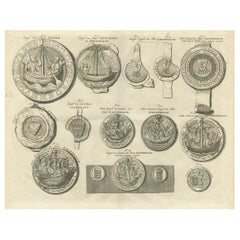
Original Old Copper Engravings of Seals of Lubeck, Stavoren, Amsterdam etc. 1767
Located in Langweer, NL
Antique print titled ‚Zegel der stad Lubek (..)’.
Seals of the city of Lubeck and others: Stavoren, Amsterdam (8x), van Amstel, Persijn (..). This print originates from ‘Amsterda...
Category
Antique 18th Century Maps
Materials
Paper
$323 Sale Price
20% Off
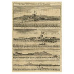
Rare Engraving of Dutch and Danish Forts on the West African Gold Coast, 1744
Located in Langweer, NL
Antique print, titled: 'The Dutch Fort Croevecoeur (…).'
A four panel plate showing forts on the West African Gold Coast, Ghana; a) The Dutch Fort Croevecoeur at Accra, b) The Danish Fort Christiaenburgh at Accra, c) Cape Ruygehoeck or Duyvelsbergh, d) The Prospect of the Village and Coast of Lay, the mount Redonda being at NNE. Ussher Fort is a fort in Accra, Ghana. It was built by the Dutch in 1649 as Fort Crevecoeur. From: "A Collection of Voyages and Travels" published by John and Awnsham Churchill in London in 1744.
Artists and Engravers: Made by 'Johannes Kip' after 'A. Churchill'. Johannes Kip (b Amsterdam, 1653; d London, 1722). Dutch draughtsman, engraver and dealer, active in England. He was a pupil of Bastiaen Stopendaal (1636–1707) from 1668 to 1670. His earliest dated engravings are of 1672 (e.g. the Siege of Groningen , Hollstein, no. 4), and he supplied numerous plates for books published from that date onwards. His work brought him into contact with the court of William of Orange and in 1686 he produced six plates depicting William of Orange, his Wife and Attendants near The Hague (Hollstein, no. 5). Shortly after the Glorious Revolution of 1688 Kip followed the court to England. After settling in Westminster, he worked extensively for London publishers, engraving works after Francis Barlow, Caius Gabriel Cibber (e.g. Interior of the Danish Church in London , 1697; Hollstein, no. 6) and other London-based artists. His engravings were principally destined for book illustrations. The work for which Kip is best remembered is his large corpus...
Category
Antique 18th Century Maps
Materials
Paper
$427 Sale Price
20% Off
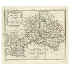
Beautiful Antique Map of Southeastern France with Decorative Cartouche, ca.1790
Located in Langweer, NL
Antique map titled 'Languedoc, Dauphiné, Province'.
Beautiful antique map of Southeastern France with decorative cartouche. Map includes topographical detail as well as a referen...
Category
Antique 18th Century Maps
Materials
Paper
$361 Sale Price
20% Off
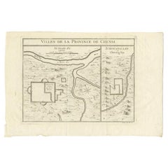
Antique Map of Two Cities in the Province of Shanxi or Chensi, China, 1748
Located in Langweer, NL
Antique map China titled ‘Villes de la Province de Chensi’. Interesting set of two local town plans of ""Si-Ngan-Fu: Capitale."" and ""Tchang Lan, Ou...
Category
Antique 18th Century Maps
Materials
Paper
$294 Sale Price
20% Off
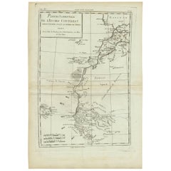
Antique Map of West Africa by R. Bonne, 1780
Located in Langweer, NL
Antique map titled 'Partie Occidentale De L'Ancien Continent Depuis Lisbonne Jusqua La Riviere De Sierra Leona Avec L'Isle de Madere, les Isles Canaries et celles Du Cap Verd'. Parts...
Category
French Antique 18th Century Maps
Materials
Paper
$171 Sale Price
20% Off
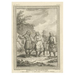
Copper Engraving of Kamchadal Men from Kamchatka, Russia, 1770
Located in Langweer, NL
Description: Antique print titled 'Habillemens des Kamtchadals'. Copper engraving of Kamchadal men. This print originates from volume 19 of 'Histoire generale des voyages (..)' by Antoine Francois Prevost d'Exile.
Artists and Engravers: Published by Panckoucke.
The Kamchadals inhabit Kamchatka, Russia. The name "Kamchadal" was applied to the descendants of the local Siberians and aboriginal peoples (the Itelmens, Ainu, Koryaks and Chuvans) who assimilated with the Russians. The descendants of the mixed-blood Russian settlers in 18th-19th century are called Kamchadals these days. The Kamchadals speak Russian with a touch of local dialects of the aboriginal languages of Kamchatka. The Kamchadals engage in fur trading...
Category
Antique 18th Century Maps
Materials
Paper
$323 Sale Price
20% Off
Beautiful Hand-Coloured Miniature Map of the Island of Java, Indonesia, ca.1702
Located in Langweer, NL
Antique map of Java titled‚ Iava Maior‘.
Beautiful hand-coloured miniature map of the island of Java. This map originates from ‘Recueil des Voyages qui ont servi a l'etablissemen...
Category
Antique 18th Century Maps
Materials
Paper
$451 Sale Price
20% Off
Antique Print of a New Building Design in Dorset, England by Campbell, 1717
Located in Langweer, NL
Antique print titled 'The Elevation of one end of a new design for a person of quality in Dorset-Shire (..)'.
View of new building design in Dorset (formerly known as Dorsetshire...
Category
Antique 18th Century Maps
Materials
Paper
$399 Sale Price
20% Off
Old Map of Persia, incl the Caspian Sea and Part of the Arabian Peninsula, 1726
Located in Langweer, NL
Antique map of Persia. It covers from the Gulf of Suez eastward to Ahmedabad (Amadabad) in modern day western India.
This map, centered on Persia, includes the Caspian Sea and part of the Arabian...
Category
Antique 18th Century Maps
Materials
Paper
$1,045 Sale Price
20% Off
Antique Engraving of Tinian, an Island of the Northern Mariana Islands, 1757
Located in Langweer, NL
Antique print titled 'Vue de la Rde de Tinian
Gezigt van de Rheede van Tinian (..)'. Views of the south-west side of the island of Tinian and a view of the anchorage of Tinian, w...
Category
Antique 18th Century Maps
Materials
Paper
$342 Sale Price
20% Off
Views of Saunders, Osnaburg, Boscawens, Admiral Keppel's & Wallis Island, c.1774
Located in Langweer, NL
Antique print titled 'Isles de Sir Charles Saunder Latitude (..)'.
Coastal views of Sir Charles Saunders Island ; Osnaburg Island [Mehetia, in French Polynesia] ; Boscawens Islan...
Category
Antique 18th Century Maps
Materials
Paper
$389 Sale Price
20% Off
Original Antique Engraved Map of Part of the Red Sea, Arabia, 1775
Located in Langweer, NL
Antique map titled 'Carte de l'Entrée du Golfe de la Mer Rouge'. Uncommon sea chart of the entrance to the Red Seas as far as Mocha, with rhumb lines and soundings. Two insets of the...
Category
Antique 18th Century Maps
Materials
Paper
$451 Sale Price
20% Off
Antique Map of South America by J. Cook (1775)
Located in Langweer, NL
Antique map titled 'Kaart van het Zuidlyk Eind van Amerika'. Map of the sourthern part of South America, focusing on Cook's tracks around the Cape Horn and Tierra del Fuego in 1775. ...
Category
Antique 18th Century Maps
Materials
Paper
$560 Sale Price
20% Off
Antique View of The N.W. side of Saypan and one of The Ladrones Islands, 1757
Located in Langweer, NL
Antique print titled 'Vue de deux des Iles des Larrons - Gezigt van twee der Eilanden Ladrones (..)'.
View of two Ladrones Islands; View of the N.W. side of Saypan, one of the La...
Category
Antique 18th Century Maps
Materials
Paper
$342 Sale Price
20% Off
Antique Print of East African Island of Quiloa or Kilwa Kisiwani, Tanzania, 1749
Located in Langweer, NL
Antique print titled 'Plan de l'Isle et Ville de Quiloa, Grondtékening van 't Eiland en de Stad Quiloa'.
This bird's-eye view show the East African island of Quiloa, now known as...
Category
Antique 18th Century Maps
Materials
Paper
$399 Sale Price
20% Off
Highly Detailed Antique Map of Brabant, Province of the Netherlands, ca.1700
Located in Langweer, NL
Antique print, titled: 'Brabantiae Batavae Pars Occidentalis : sive Antuerpiensis Tetrarchiae Pars Septentrionalis comprehendens Baroniam Bredanam, Marchionatum Bergensem ad Zoman al...
Category
Antique 18th Century Maps
Materials
Paper
$1,093 Sale Price
20% Off
Antique Detailed Map of Papua New Guinea and the Regions to the West, ca.1780
Located in Langweer, NL
Antique map titled 'Carte des Decouvertes du Capite. Carteret dans La Nlle. Bretagne avec une parte du passage du Capite. Cook Par Le Detroit De L'Endeavor ...
Category
Antique 18th Century Maps
Materials
Paper
$313 Sale Price
20% Off
Beautiful Old View of Spice Island Banda Neira with Fort Nassau, Indonesia, 1726
Located in Langweer, NL
Antique print titled 'Het Eyland Neira, en het Casteel Nassau mitsgaders Belgica'.
Beautiful view of Banda Neira with Fort Nassau, Indonesia. This print originates from 'Oud en Nie...
Category
Antique 18th Century Maps
Materials
Paper
$903 Sale Price
20% Off
Antique Map of Eastern Tartary, now the Primorsky Krai Area, Russia, 1758
Located in Langweer, NL
Antique map titled 'Carte de la Tartarie orientale.' A map of Eastern Tartary. East Tartary is an old names for the Manchu-inhabited territory extending from the River Amur to Sakhal...
Category
Antique 18th Century Maps
Materials
Paper
$617 Sale Price
20% Off
Antique Map of the Region of Paris ‘France’ by H. Heirs, circa 1720
Located in Langweer, NL
Antique map titled 'Agri Parisiensis Tabula particularis, qua maxima Pars Insulae Franciae (..)'. Incredibly detailed map showing everything from tiny villages to forests, farmland, ...
Category
Antique 18th Century Maps
Materials
Paper
$1,045 Sale Price
20% Off
Antique Map of Hangzhou, Capital of the Province of Zheijang, China, 1748
Located in Langweer, NL
Antique map titled 'Plan de la ville de Hang-Tcheou-Fou ou Hang-Chew-Fu Capitale de la Province de Che-Kiang’.
This original print shows a map of the city of Hangzhou, capital of...
Category
Antique 18th Century Maps
Materials
Paper
$323 Sale Price
20% Off
Large Antique Detailed Map of a Part of the Spice Islands, Indonesia, 1726
Located in Langweer, NL
Antique matitled 'De Landvoogdy der Moluccos met de aangrenzende Eylanden'.
Large detailed map of a part of the Spice Islands. It includes Baru (Boero), Ambon, Seram and part of Ma...
Category
Antique 18th Century Maps
Materials
Paper
$1,378 Sale Price
20% Off
Antique Map of Friesland after the Floods of the 13th Century, 1718
Located in Langweer, NL
Antique map Friesland titled 'Pars II et III Frisiae Libera(..)'. Old map of Friesland, the Netherlands, after the floods of the 13th century. Originates from 'Uitbeelding van de Hee...
Category
Antique 18th Century Maps
Materials
Paper
$332 Sale Price
20% Off
Antique Map of West Russia, with Title a New Map of Moskovy, 1741
Located in Langweer, NL
Antique map Russia titled 'A New Map of Moscovy from the latest observations'.
Muscovy is an alternative name for the Grand Duchy of Moscow (126...
Category
Antique 18th Century Maps
Materials
Paper
Decorative Original Old Map of Nova Zembla and the Russian Mainland, ca.1760
Located in Langweer, NL
Antique map titled 'Carte Des Pais Habites par les Samojedes et Ostiacs.'
Map of Novaya Zemlya and the Russian mainland. Source unknown, to be determined.
Artists and Engraver...
Category
Antique 18th Century Maps
Materials
Paper
$427 Sale Price
20% Off
Antique Map of Friesland During Its Widest Spread, 1718
Located in Langweer, NL
Antique map Friesland titled 'Summaria descriptio Fresiae Universae (..)'. Old map of Friesland, the Netherlands. Depicts the general delineation of Friesland during its widest sprea...
Category
Antique 18th Century Maps
Materials
Paper
$209 Sale Price
20% Off
Antique Map of France under the Second Race by Zannoni, 1765
Located in Langweer, NL
Antique map France titled 'Tableau du Domaine Royal (..)'. Beautiful old map of France. This map originates from 'Atlas Historique de la France Ancienne et Moderne' by M. Rizzi Zanno...
Category
Antique 18th Century Maps
Materials
Paper
$142 Sale Price
20% Off
Antique Map of France under the Reign of Francois I, 1765
Located in Langweer, NL
Antique map France titled 'Etat des Possessions de la Couronne (..)'.
Beautiful old map of France. This map originates from 'Atlas Historique de la France Ancienne et Moderne' by...
Category
Antique 18th Century Maps
Materials
Paper
$140 Sale Price
20% Off
Antique Map of Batavia 'Jakarta, Indonesia', the Dutch East-Indies, 1782
Located in Langweer, NL
Antique map titled 'Batavia zo als het was in den Jaare 1731.' (Batavia as it was in the year 1731.) Map of the city of Batavia (Jakarta) in Indonesia. With legend and scale. This pr...
Category
Antique 18th Century Maps
Materials
Paper
$608 Sale Price
20% Off
Antique Map of Western Russia by Covens & Mortier, 1740
Located in Langweer, NL
Antique map titled 'Carte de Moscovie'. Antique map of the western portion of Russia. The map centers on Moscow (shown near the top of the lower sheet) and spans from the Sea of Azov...
Category
Antique 18th Century Maps
Materials
Paper
$903 Sale Price
20% Off
Antique Engraved Map of Saxonia in Northern Germany, ca.1721-1750
Located in Langweer, NL
Duitsland, Sassonia; Johannes Baptist Homann - Circulus Saxoniae Inferioris in omnes suos Status et Principatus accurate divisus ex conatibus -
A large map of Lower Saxony, exten...
Category
Antique 18th Century Maps
Materials
Paper
$808 Sale Price
20% Off
Antique Map of Cayenne and Cassepouri, French Guinea, South America, c.1730
Located in Langweer, NL
Antique map titled 'A Map of the Island Cayenne (..)’. A set of interesting copper engravings of Cayenne and Cassepouri, French Guinea, South America, and Martinique in the West Indies. The map of Cayenne, home of Cayenne pepper, has a key of symbols identifying the sugar works, petty plantations, indian carbet or village, woody country and palmetto trees. The plan of Fort Lewis, Cayenne also has a lettered key including; A. the fort on a pretty high hill...
Category
Antique 18th Century Maps
Materials
Paper
$361 Sale Price
20% Off
Antique Map of Macjan or Makian Island in the Moluccas, Indonesia, c.1740
Located in Langweer, NL
Antique map titled 'Isle de Machian ou Maquien'. Map of the island of Macjan, Moluccas. Source unknown, to be determined. Artists and Engravers: Anonymous.
Artist: Anonymous.
Con...
Category
Antique 18th Century Maps
Materials
Paper
$218 Sale Price
20% Off
Antique Map of Herefordshire by Morden, c.1700
Located in Langweer, NL
Antique map titled 'Herefordshire'. Detailed map of the county of Herefordshire embellished with a decorative title cartouche. Three scales. Imprint of Abel Swale, Awnsham Churchill ...
Category
Antique 18th Century Maps
Materials
Paper
$380 Sale Price
20% Off
Detailed Old Map of the Seven Provinces of the Belgian/Dutch Federation, ca.1748
Located in Langweer, NL
Antique map titled 'Septem Provinciae seu Belgium Foederatum quod generliter Hollandia (..).' Detailed antique map of the seven provinces of the Belgian Federation (Dutch Federation)...
Category
Antique 18th Century Maps
Materials
Paper
$427 Sale Price
20% Off
Antique Chart of Dundee, Aberdeen and Montrose in Scotland, C.1774
Located in Langweer, NL
Antique map titled 'To the Honble the Magistrates of the Citty of Aberdeene'. Sea chart of Tay Estuary depictinging Dundee, with two further inset charts of Aberdeen and Montrose, wi...
Category
Antique 18th Century Maps
Materials
Paper
$256 Sale Price
20% Off
Antique Frontispiece by Tirion, Showing a Map of Africa, an Elephant Etc, 1731
Located in Langweer, NL
Antique frontispiece of the 3rd volume of 'Hedendaagsche historie of tegenwoordige staat van allen volkeren (..)' by Thomas Salmon. This volume describes Peg...
Category
Antique 18th Century Maps
Materials
Paper
$133 Sale Price
20% Off
Antique Map of Cities in the Region of Hubei in China, 1758
Located in Langweer, NL
Antique map titled 'Plans de Quelques villes de la province de Hou-Quang.' Three plans of cities in a region named Hou-Quang (currently Hubei). While these maps by Van Schley after B...
Category
Antique 18th Century Maps
Materials
Paper
$304 Sale Price
20% Off
Antique Map of Celebes 'Sulawesi, Indonesia' by Bellin, ciarca 1755
Located in Langweer, NL
Antique map titled 'Carte de l'Isle Celebes ou Macassar'. Map of Celebes (Sulawesi, Indonesia), showing Makassar, which was the most important trading city of eastern Indonesia in th...
Category
European Antique 18th Century Maps
Materials
Paper
$142 Sale Price
20% Off
Old Original Antique Map of the Islands of East Indonesia, 1756
Located in Langweer, NL
Title: Isles Moluques.
Old and rare, this decorative map of the Maluku Islands in the period it was still controlled by the Dutch colonial power. It also shows the island of Bali, Lombok, part of Borneo (Kalimantan), Celebes (Sulawesi), Timor, The Lesser Sunda Islands, West Papua...
Category
Antique 18th Century Maps
Materials
Paper
$427 Sale Price
20% Off
Antique Map of Asia, Showing Tradewinds, Silke Route Cities Etc, c.1780
Located in Langweer, NL
Antique map titled 'L'Asie.' Map of Asia. Offers considerable detail considering the size, showing the tradewinds in the Pacific and Indian Oceans as well as numerous Silk Route citi...
Category
Antique 18th Century Maps
Materials
Paper
$427 Sale Price
20% Off
Antique Miniature Map of the Maluku Islands by Lasor a Varea, 1713
Located in Langweer, NL
Antique map titled 'Isole Molucche'. Rare miniature map of the Maluku Islands or the Moluccas, Indonesia. This map originates from 'Universus Terrarum Orbis...
Category
Antique 18th Century Maps
Materials
Paper
$570 Sale Price
20% Off
Antique Map of Asia and Australia with a Speculative Coastline, 1777
Located in Langweer, NL
Antique map titled 'A New & Accurate Map of Asia'. Detailed map of Asia and Australia, shows a still largely speculative Southern Australian coastline. Originates from Middleton's 'C...
Category
Antique 18th Century Maps
Materials
Paper
$399 Sale Price
20% Off
Remarkable Antique Map of Central Africa by Scherer, c.1703
Located in Langweer, NL
Untitled map of Central Africa depicting Tarodant, Lempta, Guber, Borno, Chaxumo, Tombut, Melegvete, Benin, S. Salvator, Zaire, Gondar, S. Helena and Mozambique. Printed for Scherer'...
Category
Antique 18th Century Maps
Materials
Paper
$247 Sale Price
20% Off
Antique Map of Turkmenistan, Uzbekistan, Tajikistan and Kyrgyzstan, 1749
Located in Langweer, NL
Antique map titled ‘Carte de la Petite Bukharie et Pays Voisins – Tirée des Auteurs Anglois pour server a l ‘Histoire Generale des Voyages. Par N. Bellin Ing. D la Mar. 1749.’ Dutch title: ‘Kaart van Klyn-Bukharia, en de Nabuurige Landen, volgens de Afmeetinge der Jezuïten, en der Kaart van ’t Russiese Ryk van den Hr. Kyrillow. Op de Engelsche in dit Bestek gebragt door N.B. 1749’.
An attractive mid-18th century French black and white map...
Category
Antique 18th Century Maps
Materials
Paper
$380 Sale Price
20% Off
Antique Map of Africa with Ocean Currents and Other Details, C.1780
Located in Langweer, NL
Antique map titled 'Afrique.' Detailed map of Africa, showing towns, rivers, some topographical features, ocean currents, ports and political boundaries. Source unknown, to be determ...
Category
Antique 18th Century Maps
Materials
Paper
$228 Sale Price
20% Off
Antique Map of Anjouan or Ndzuani Island, Part of The Comoros, 1749
Located in Langweer, NL
Antique map titled ‘Carte de L’Isle D’Anjouan - Kaart van 't Eiland Anjouan’. Original antique map of Anjouan, also known as Ndzuwani or Nzwani, or, historically, as Johanna, an auto...
Category
Antique 18th Century Maps
Materials
Paper
$342 Sale Price
20% Off
Small Detailed Antique Map of France, c.1780
Located in Langweer, NL
Antique map titled 'France'. Small, detailed map of France with legend. Also depicting the English Channel, Bay of Biscay, Part of Spain, the Mediterranean Sea, Part of Italy, Switze...
Category
Antique 18th Century Maps
Materials
Paper
$104 Sale Price
20% Off
Antique Map of France with a Nice Cartouche of a Distance Scale, c.1756
Located in Langweer, NL
Antique map titled 'France'. Engraved map of France with a small, decorative title cartouche and distance scale. Originates from 'A New Geographical and Historical Grammar (..)', by ...
Category
Antique 18th Century Maps
Materials
Paper
$261 Sale Price
20% Off
Antique Map of France by Kitchin, c.1770
Located in Langweer, NL
Antique map titled 'France'. Original antique map of France. Source unknown, to be determined.
Artists and Engravers: Thomas Kitchin (or Thomas Kitchen (1718 - 1784) was an Englis...
Category
Antique 18th Century Maps
Materials
Paper
Antique Map of Three Chinese Cities in Chensi and Koei Tcheou, c.1758
Located in Langweer, NL
Antique map titled 'Lan-Tcheou ou Lan-Chew dan la province Chensi; Can Tcheou ou Kan-Chew dan la province de Chensi; Tchin-Ywe-Fou ou Chin-Ywen-Fu dans la province de Koei-Tcheou ou Quey-chew.' Three plans of old Chinese cities...
Category
Antique 18th Century Maps
Materials
Paper
$266 Sale Price
20% Off
Antique Map of Batavia by Van Schley 'c.1750'
Located in Langweer, NL
Antique map titled 'Batavia'. Original antique map of Batavia, Jakarta, Indonesia. This print originates from the Dutch edition of Prevost's 'Histoire Generale des Voyages' (Paris 17...
Category
Antique 18th Century Maps
Materials
Paper
$427 Sale Price
20% Off
Antique Map of France with the English Channels, 1754
Located in Langweer, NL
Antique map France titled 'An Accurate Map of France drawn from the best authorities'. Small, detailed map of France. With decorative title cartouche.
Ar...
Category
Antique 18th Century Maps
Materials
Paper
$237 Sale Price
20% Off
Antique Map of Cities of the Province of Che-Kiang in China, 1738
Located in Langweer, NL
Antique map titled 'Cities of the Province of Che-Kyang'. Old map depicting four walled cities of the Chinese Qing dynasty province of Che-Kiang (modern day CHEKIANG): Hang Chew Fu (...
Category
Antique 18th Century Maps
Materials
Paper
$332 Sale Price
20% Off
Antique Map of European Russia by Tirion, c.1725
Located in Langweer, NL
Antique map titled 'Nieuwe Kaart van Muskovie of Rusland na de laatste ondekking int licht gebracht te Amsterdam by Isaak Tirion'. Detailed map of European Russia.
Artists and En...
Category
Antique 18th Century Maps
Materials
Paper
$903 Sale Price
20% Off
Finely Engraved Antique Map of Europe with inset of America, c.1745
Located in Langweer, NL
Antique map titled 'Theatrum Historicum pars Occidentalis.' Finely engraved historical map with a profusion of details. It shows western Europe and the northern Mediterranean basin a...
Category
Antique 18th Century Maps
Materials
Paper
$1,378 Sale Price
20% Off
Antique Hand-Colored Engraved Map of Denmark, 1790
Located in Langweer, NL
Published by Russell (J. C.). Denmark. Divided into Dioceses and Prefectures compiled from the best Authorities, 1790, hand-coloured engraved map on handmade paper with watermark. 41...
Category
Antique 18th Century Maps
Materials
Paper
$427 Sale Price
20% Off
Antique Map of Cities in the Province of Shanxi in China, 1749
Located in Langweer, NL
Antique print titled 'Villes de la Province de Chensi - Steden van 't Landschap Shensi of Shansi'. Interesting set of two local town plans of ""Si-Ngan-Fu: Capitale."" and ""Tchang L...
Category
Antique 18th Century Maps
Materials
Paper
$275 Sale Price
20% Off
Antique Map of Central Asia Wiht Nova Zembla as an Island, C.1700
Located in Langweer, NL
Antique map titled 'Asiae Pars Potissima.' Attractive map focusing on the central part of Asia but extending to include much of Eastern Europe and Northeastern Africa. The Caspian Se...
Category
Antique 18th Century Maps
Materials
Paper
$522 Sale Price
20% Off
Antique Map of Northern Africa "Barbary Coast" by R. Bonne, circa 1780
Located in Langweer, NL
A fine example of Rigobert Bonne and Guilleme Raynal’s 1780 map of northwestern Africa or the Barbary Coast. Includes the modern day countries of Morocco, Algeria, Tunisia, Libya, and parts of adjacent Spain, Italy and Greece. This map was made in response to European interest in the region due to coastal attacks and incursions by the Barbary Pirates...
Category
French Antique 18th Century Maps
Materials
Paper
