19th Century Maps
to
1,667
2,202
74
2,279
71
9
9
4
2
2
1
1
2,969
2,279
474
3
290
34
10
126
10
37
9
2
5
4
3
3
2,241
70
32
13
11
358
175
108
105
102
2,279
2,279
2,279
104
23
9
8
7
Period: 19th Century
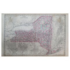
1858 Colton's Map of New York, Ric.B011
Located in Norton, MA
An 1858 Colton's map of New York
Ric.b011
Colton’s New York, 1858 - A large original color engraved and very detailed map of the state of New York,...
Category
Unknown Antique 19th Century Maps
Materials
Paper
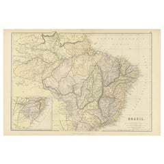
1882 Map of Brazil: Historic Borders, River Systems, and Coastal Regions
Located in Langweer, NL
Title: 1882 Map of Brazil: Historic Borders, River Systems, and Coastal Regions
Description:
This 1882 map presents a detailed cartographic view of Brazil, the largest country in S...
Category
Antique 19th Century Maps
Materials
Paper
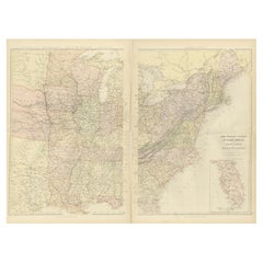
1882 Blackie Atlas Maps: Atlantic States and Mississippi Valley Compilation
Located in Langweer, NL
These two maps from the 1882 Blackie Atlas provide a detailed view of the eastern half of the United States, highlighting key geographical, political, and infrastructural features of...
Category
Antique 19th Century Maps
Materials
Paper
1853 Map of "Russia in Europe Including Poland" Ric.r016
Located in Norton, MA
Description
Russia in Europe incl. Poland by J Wyld c.1853
Hand coloured steel engraving
Dimension: Paper: 25 cm W x 33 cm H ; Sight: 22 cm W x 28 cm H
Condition: Good ...
Category
Unknown Antique 19th Century Maps
Materials
Paper
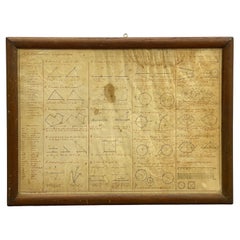
1852 Geometrical Constructions Chart by C. W. Knudsen
Located in Garnerville, NY
Twenty two (22) meticulously rendered hand written and drawn geometrical constructions by C. W. Knudsen, circa 1952. The piece is inscribed in red lower left, C. W. Knudsen, August 1...
Category
American Schoolhouse Antique 19th Century Maps
Materials
Glass, Wood, Paper, Parchment Paper
$708 Sale Price
20% Off
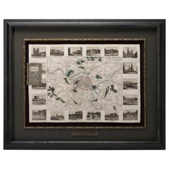
Antique Map of Paris, "Carte Routiere des Environs de Paris" 1841
Located in Colorado Springs, CO
This beautiful hand-colored road map of Paris was published in 1841. The map shows Paris and the surrounding area in a folding pocket map. Organized and detailed for travelers, this ...
Category
French Antique 19th Century Maps
Materials
Paper
Decorative Map of the Royal Württemberg District of Welzheim, Germany, ca.1880
Located in Langweer, NL
The Royal Württemberg District of Welzheim is located in Germany. Welzheim is a town in the state of Baden-Württemberg, which was historically part of the Kingdom of Württemberg. The...
Category
Antique 19th Century Maps
Materials
Paper
Map of the Dutchy of Holstein and the Territories of Hamburg & Lübek, 1875
Located in Langweer, NL
Title: Map of the Dutchy of Holstein and the Territories of Hamburg & Lübek by James Wyld, ca. 1875
Description: This is an antique map titled "A Map of the Dutchy of Holstein, with...
Category
Antique 19th Century Maps
Materials
Paper
$896 Sale Price
20% Off
Prussian Dominions Map by John Pinkerton, 1818 - Detailed Copperplate Engraving
Located in Langweer, NL
Prussian Dominions Map by John Pinkerton, 1818 - Detailed Copperplate Engraving
Description: This detailed map by John Pinkerton depicts the Prussian Dominions as of 1818, including...
Category
Antique 19th Century Maps
Materials
Paper
1862 Johnson's Map of New York State by Johnson & Browning
Located in Langweer, NL
Title: 1862 Johnson's Map of New York State by Johnson & Browning
Description:This is an 1862 map of New York State, titled "Johnson's New York," created by Johnson & Browning. The ...
Category
Antique 19th Century Maps
Materials
Paper
$266 Sale Price
20% Off
Scarce U.S. Coast Survey Map Depicting Entrance to San Francisco Bay Dated 1856
Located in San Francisco, CA
A fine example of the 1856 U.S. Coast lithographic survey nautical chart of the entrance to San Francisco bay and the city. Published in 1856 by the Office of the Coast Survey the of...
Category
American Antique 19th Century Maps
Materials
Paper
1868 Map of the Upper Part of the Island of Manhattan Above 86th Street
Located in San Francisco, CA
This wonderful piece of New York City history is over 150 years old. It depicts 86th street and above. It was lithographed by WC Rogers and company. It was made to show what was the Battle of Harlem during the Revolutionary war...
Category
American American Colonial Antique 19th Century Maps
Materials
Paper
Large Original Antique Map of Afghanistan. Edward Weller, 1861
Located in St Annes, Lancashire
Great map of Afghanistan
Lithograph engraving by Edward Weller
Original colour
Published, 1861
Unframed
Good condition
Category
English Victorian Antique 19th Century Maps
Materials
Paper
1817 Large Northern Hindostan Map by J. Thomson – New General Atlas
Located in Langweer, NL
1817 Thomson Map of Northern Hindoostan – Detailed British Cartography of India
This map, titled "A New Map of Hindoostan from the Latest Authorities," was drawn and engraved for Jo...
Category
Antique 19th Century Maps
Materials
Paper
$505 Sale Price
20% Off
1821 Map of the Rhine River Region by Vandermaelen – from Duisburg to Wesel
Located in Langweer, NL
This is an antique map titled "Carte de la Belgique d'après Ferraris", which translates to "Map of Belgium according to Ferraris." The map, created around 1821, covers the course of ...
Category
Antique 19th Century Maps
Materials
Paper
$400 Sale Price
20% Off
Western Hemisphere - 1876 Edition by Adolf Stieler, Published by Justus Perthes
Located in Langweer, NL
Map titled "Westliche Halbkugel" (Western Hemisphere), is a copperplate engraving from 1876 by Adolf Stieler, a renowned German cartographer. Here's an expanded analysis based on the...
Category
Antique 19th Century Maps
Materials
Paper
$228 Sale Price
20% Off
1855 "New-York City & County Map" by Charles Magnus
By Charles Magnus
Located in Colorado Springs, CO
This is a beautiful hand-colored map titled “New York City & County Map with Vicinity entire Brooklyn, Williamsburgh, Jersey City &c.” The work was published in 1855 by Charles Magnu...
Category
American Antique 19th Century Maps
Materials
Paper
Antique Map of Italy by Andriveau-Goujon, 1843
By Andriveau-Goujon
Located in New York, NY
Antique Map of Italy by Andriveau-Goujon, 1843. Map of Italy in two parts by Andriveau-Goujon for the Library of Prince Carini at Palazzo Carini i...
Category
French Antique 19th Century Maps
Materials
Linen, Paper
$3,350 / set
Map of the United Provinces & Low Countries: Early 19th Century - 1802
Located in Langweer, NL
Antique Map with Title: 'Carte Générale des Provinces Unies et des Pays-Bas'
**Publication Details:**
- **Atlas Title:** Nouvel Atlas Universel de Géographie Ancienne et Moderne
- *...
Category
Antique 19th Century Maps
Materials
Paper
1864 Map of North America, Antique Hand-Colored Map, by Adolphe Hippolyte Dufour
Located in Colorado Springs, CO
Offered is a map of North America entitled Amerique du Nord from 1864. This rare, separately published wall map was produced by Adolphe Hippolyte Dufour. This map includes vibrant an...
Category
French Antique 19th Century Maps
Materials
Paper
Mid-19th Century Decorative Map of Asia with Cultural and Natural Vignettes
Located in Langweer, NL
John Tallis & Company, known for their decorative mid-19th-century maps, created this map of Asia. These maps were distinctive for their elaborate borders and detailed vignettes. The...
Category
Antique 19th Century Maps
Materials
Paper
$305 Sale Price
20% Off
Antique Decorative Coloured Map Egypt, Nubia, Abyssinia and more, 1882
Located in Langweer, NL
This image contains two maps, with the left one being labeled "Egypt" and the right one "Nubia, Abyssinia and the Adjacent Lands." These maps highlight the Nile Valley and surrounding regions.
The maps from the Blackie & Son atlas published in 1882 are interesting for several reasons:
1. **Historical Context**: The year 1882 is significant because it falls within the period of European imperial expansion in Africa. It was also just before the British occupation of Egypt, which began that year. Therefore, the maps serve as historical documents showing the geopolitical state of the region just before a major shift in its colonial status.
2. **Cartographic Style**: The maps reflect the cartographic style of the late 19th century, which often featured detailed engravings and fine detail. They provide a snapshot of the cartographic knowledge and aesthetic of the time.
3. **Geographical Knowledge**: These maps were created during a time when much of Africa's interior was still being explored by Europeans. The representation of features like rivers, mountains, and settlements can tell us about the extent of geographical knowledge at the time.
4. **Cultural Representation**: The way the map represents different regions, peoples, and geographical features can give insights into the cultural and political views of the era. It may reflect the European understanding and biases towards these regions.
5. **Educational Purpose**: Blackie & Son were known for their educational materials...
Category
Antique 19th Century Maps
Materials
Paper
Antique 19th Century Map of China by Blackie & Son, 1882
Located in Langweer, NL
This map is an 1882 Blackie & Son map of China. The title "CHINA." is prominently displayed at the bottom. The map is colored to differentiate various regions, possibly indicating di...
Category
Antique 19th Century Maps
Materials
Paper
$238 Sale Price
20% Off
1889 Sea Chart Map of Delaware Bay by George Eldridge, Chart No. 11
Located in Colorado Springs, CO
Presented is an original Eldridge's Chart No. 11, Delaware Bay and River, from The United States Coast and George Eldridge's Surveys, published in 1889. The sea chart shows the Delaw...
Category
Antique 19th Century Maps
Materials
Paper
Rare Set of 3 Map Samplers by A Charles. Italy, Spain & France
Located in Chelmsford, Essex
Set of 3 Map Samplers by A Charles. All depict countries, cities, seas and landmarks of the respective countries. The first entitled, 'SPAIN and PORTUGAL'. The second, 'MAP OF FRANCE...
Category
English Antique 19th Century Maps
Materials
Linen
The World After the Battle of Corupedium: Hellenistic Kingdoms Map, 1880
Located in Langweer, NL
The map is titled "ORBIS TERRARUM post proelium Corupedinse," which translates to "The World after the Battle of Corupedium." This battle, which took place in 281 BC in Lydia, was th...
Category
Antique 19th Century Maps
Materials
Paper
$352 Sale Price
20% Off
Detailed German Map of Australia Including Statistics of 1841, Published in 1854
Located in Langweer, NL
Title: "Detailed Map of Austral Land - 1854"
This historic map, titled "Australland," was published in Glogau in 1854 by cartographer Carl Flemming. It's an intricately detailed dep...
Category
Antique 19th Century Maps
Materials
Paper
$190 Sale Price
20% Off
Detailed Antique Cartography of Asian Russia, 1882
Located in Langweer, NL
This exquisite map, hailing from the year 1882, is a remarkable historical cartographic artifact, which was included as part of the prestigious 'Comprehensive Atlas and Geography of ...
Category
Antique 19th Century Maps
Materials
Paper
$314 Sale Price
20% Off
Original Antique English County Map, Cambridgeshire, J & C Walker, 1851
Located in St Annes, Lancashire
Great map of Cambridgeshire
Original colour
By J & C Walker
Published by Longman, Rees, Orme, Brown & Co. 1851
Unframed.
Category
English Other Antique 19th Century Maps
Materials
Paper
Original Antique English County Map, Buckinghamshire, J & C Walker, 1851
Located in St Annes, Lancashire
Great map of Buckinghamshire
Original colour
By J & C Walker
Published by Longman, Rees, Orme, Brown & Co. 1851
Unframed.
Category
English Other Antique 19th Century Maps
Materials
Paper
Original Antique English County Map, Durham, J & C Walker, 1851
Located in St Annes, Lancashire
Great map of Durham
Original colour
By J & C Walker
Published by Longman, Rees, Orme, Brown & Co. 1851
Unframed.
Category
English Other Antique 19th Century Maps
Materials
Paper
Original Antique English County Map - Monmouthshire. J & C Walker. 1851
Located in St Annes, Lancashire
Great map of Monmouthshire
Original colour
By J & C Walker
Published by Longman, Rees, Orme, Brown & Co. 1851
Unframed.
Category
English Other Antique 19th Century Maps
Materials
Paper
Original Antique English County Map, Herefordshire, J & C Walker, 1851
Located in St Annes, Lancashire
Great map of Herefordshire
Original colour
By J & C Walker
Published by Longman, Rees, Orme, Brown & Co. 1851
Unframed.
Category
English Other Antique 19th Century Maps
Materials
Paper
Original Antique English County Map, Derbyshire, J & C Walker, 1851
Located in St Annes, Lancashire
Great map of Derbyshire
Original colour
By J & C Walker
Published by Longman, Rees, Orme, Brown & Co. 1851
Unframed.
Category
English Other Antique 19th Century Maps
Materials
Paper
Original Antique English County Map - Middlesex. J & C Walker. 1851
Located in St Annes, Lancashire
Great map of Middlesex
Original colour
By J & C Walker
Published by Longman, Rees, Orme, Brown & Co. 1851
Unframed.
Category
English Other Antique 19th Century Maps
Materials
Paper
Original Antique English County Map, Staffordshire, J & C Walker, 1851
Located in St Annes, Lancashire
Great map of Staffordshire
Original colour
By J & C Walker
Published by Longman, Rees, Orme, Brown & Co. 1851
Unframed.
Category
English Other Antique 19th Century Maps
Materials
Paper
Original Antique English County Map, Rutland, J & C Walker, 1851
Located in St Annes, Lancashire
Great map of Rutland
Original colour
By J & C Walker
Published by Longman, Rees, Orme, Brown & Co. 1851
Unframed.
Category
English Other Antique 19th Century Maps
Materials
Paper
Antique Engraved Map with Original Hand Colour of French Guiana, 1876
Located in Langweer, NL
The 1876 map of French Guiana from the "Grand Atlas Départemental de la France de L'Algérie et des colonies" by H. Fisquet, published by A. Le Vasseur in Paris, is a significant piec...
Category
Antique 19th Century Maps
Materials
Paper
$266 Sale Price
20% Off
Large Original Antique City Plan of Dublin, Ireland, circa 1880
Located in St Annes, Lancashire
Great city plan of Dublin
Published circa 1880
Unframed
Free shipping.
.
Category
Scottish Antique 19th Century Maps
Materials
Paper
Antique Map of The German Empire (East Sheet), 1882
Located in Langweer, NL
Step into history with an authentic Antique Map of The German Empire (East Sheet) from the esteemed 'Comprehensive Atlas and Geography of the World,' meticulously crafted in 1882. Th...
Category
Antique 19th Century Maps
Materials
Paper
$181 Sale Price
20% Off
Colorful Detailed Antique Map of England and Wales (South Part), 1882
Located in Langweer, NL
Embark on a Journey Through the Southern Part of 'England and Wales' with this Exquisite Antique Map! This map provides a vivid portrayal of the captivating landscapes and cultural h...
Category
Antique 19th Century Maps
Materials
Paper
$162 Sale Price
20% Off
Colorful Detailed Antique Map of England and Wales, 1882
Located in Langweer, NL
Explore the Historic Splendor of 'England and Wales' with this Antique Map! Part of a distinguished collection, this map presents a captivating view of the enchanting landscapes, cit...
Category
Antique 19th Century Maps
Materials
Paper
$162 Sale Price
20% Off
Large Original Antique Map of North Dakota, USA, circa 1900
Located in St Annes, Lancashire
Fabulous map of North Dakota
Original color
Engraved and printed by the George F. Cram Company, Indianapolis.
Published, circa 1900
Unframed
Free shi...
Category
American Antique 19th Century Maps
Materials
Paper
Original Antique Map of Zuid-Holland by Brugsma, 1864
Located in Langweer, NL
Antique map titled 'De Provincie Zuid-Holland'. Map of the province of Zuid-Holland, the Netherlands. This map originates from 'F. C. Brugsma's Atlas van het Koninkrijk der Nederland...
Category
Antique 19th Century Maps
Materials
Paper
$79 Sale Price
20% Off
Original Antique Map of the township of Warffum in The Netherlands, 1862
Located in Langweer, NL
Groningen: Gemeente Rottumeroog-Warffum. These scarse detailed maps of Dutch Towns originate from the 'Gemeente atlas van de Provincie Groningen in 62 kaarten.' by C. Fehse. This atl...
Category
Antique 19th Century Maps
Materials
Paper
$152 Sale Price
20% Off
Original Antique Map of the Township of Uithuizermeeden, the Netherlands, 1862
Located in Langweer, NL
Groningen: Gemeente Oldenzijl-Oosternieland-de Roode School-Uithuizermeeden. These scarse detailed maps of Dutch Towns originate from the 'Gemeente atlas van de Provincie Groningen i...
Category
Antique 19th Century Maps
Materials
Paper
$152 Sale Price
20% Off
Original Antique Map of Township Ulrum in Groningen, The Netherlands, 1862
Located in Langweer, NL
Groningen: Gemeente Houwerzijl-Niekerk-Vierhuizen-Ulrum-Zoutkamp. These scarse detailed maps of Dutch Towns originate from the 'Gemeente atlas van de Provincie Groningen in 62 kaarte...
Category
Antique 19th Century Maps
Materials
Paper
$152 Sale Price
20% Off
Large Original Antique Map of Java and Borneo, Fullarton, C.1870
Located in St Annes, Lancashire
Great map of Java and Borneo
Wonderful figurative borders
From the celebrated Royal Illustrated Atlas
Lithograph. Original color.
Published by Fullarton, Edinburgh. C.1870
Unfr...
Category
Scottish Antique 19th Century Maps
Materials
Paper
1873 Martha's Vineyard and Nantucket Chart
Located in Norwell, MA
Original chart of Nantucket and Martha's Vineyard by George Eldridge, Cartographer, 125 State Street, Boston. Dated 1873. Mounted to canvas. Also showing the coast of Cape Cod includ...
Category
North American Antique 19th Century Maps
Materials
Paper
Large Original Antique Map of Oregon, USA, 1894
Located in St Annes, Lancashire
Fabulous map of Oregon.
Original color.
By Rand, McNally & Co.
Published, 1894.
Unframed.
Free shipping.
Category
American Antique 19th Century Maps
Materials
Paper
Antique Map of the Township of Het Zandt in The Netherlands, 1862
Located in Langweer, NL
Groningen: Gemeente Het Zandt. These scarse detailed maps of Dutch Towns originate from the 'Gemeente atlas van de Provincie Groningen in 62 kaarten.' by C. Fehse. This atlas of all ...
Category
Antique 19th Century Maps
Materials
Paper
$162 Sale Price
20% Off
Antique Map of the Township of Winsum, Groningen in The Netherlands, 1862
Located in Langweer, NL
Groningen: Gemeente Obergum-Winsum. These scarse detailed maps of Dutch Towns originate from the 'Gemeente atlas van de Provincie Groningen in 62 kaarten.' by C. Fehse. This atlas of...
Category
Antique 19th Century Maps
Materials
Paper
$162 Sale Price
20% Off
Antique Map of the Township of Dalen, Schoonebeek in The Netherlands, 1865
Located in Langweer, NL
Drenthe - Gemeente Dalen, Schoonebeek. These scarse detailed maps of Dutch Towns originate from the 'Gemeente-atlas' of Jacob Kuyper. This atlas of all towns in the Netherlands was p...
Category
Antique 19th Century Maps
Materials
Paper
$162 Sale Price
20% Off
Antique Map of The Province of Drenthe in the Northern Netherlands, 1865
Located in Langweer, NL
Antique map titled 'Provincie Drenthe'. Original antique map of Drenthe, the Netherlands. These scarse detailed maps of Dutch Towns originate from the 'Gemeente-atlas' of Jacob Kuype...
Category
Antique 19th Century Maps
Materials
Paper
$209 Sale Price
20% Off
Antique Map of the Township of Anloo in the Netherlands, 1865
Located in Langweer, NL
Drenthe - Gemeente Anloo, Eext, Gasteren, Annen, Schipborg. These scarse detailed maps of Dutch Towns originate from the 'Gemeente-atlas' of Jacob Kuyper. This atlas of all towns in ...
Category
Antique 19th Century Maps
Materials
Paper
$133 Sale Price
20% Off
Antique Map of the Township of Gasselte in The Netherlands, 1865
Located in Langweer, NL
Drenthe: Gemeente Gasselte, Gasseltternijeveen. These scarse detailed maps of Dutch Towns originate from the 'Gemeente-atlas' of Jacob Kuyper. This atlas of all towns in the Netherla...
Category
Antique 19th Century Maps
Materials
Paper
$123 Sale Price
20% Off
Antique Map of the Township of Diever, Drenthe in The Netherlands, 1865
Located in Langweer, NL
Drenthe: Gemeente Diever, Veenhuizen, Aendiever, Wittelte. These scarse detailed maps of Dutch Towns originate from the 'Gemeente-atlas' of Jacob Kuyper. This atlas of all towns in t...
Category
Antique 19th Century Maps
Materials
Paper
$133 Sale Price
20% Off
Antique Map of the Township of Eelde in Drenthe, The Netherlands, 1865
Located in Langweer, NL
Drenthe: Gemeente Eelde. These scarse detailed maps of Dutch Towns originate from the 'Gemeente-atlas' of Jacob Kuyper. This atlas of all towns in the Netherlands was published from ...
Category
Antique 19th Century Maps
Materials
Paper
$171 Sale Price
20% Off
Antique Map of West Flanders in Belgium, c.1840
Located in Langweer, NL
Antique map titled 'Kaart van West Vlaanderen'. Original antique map of West Flanders, Belgium. Source unkown, to be determined. Published circa 1840.
Artis...
Category
Antique 19th Century Maps
Materials
Paper
$276 Sale Price
20% Off
Antique Map of Turkey and Greece by Petri, c.1873
Located in Langweer, NL
Antique map titled 'Europisch Turkije en Griekenland'. Old map depicting Turkey in Europe and Greece. This map originates from 'School-Atlas van alle Deelen der Aarde'.
Artists and...
Category
Antique 19th Century Maps
Materials
Paper
