17th Century Collectibles and Curiosities

to
818
1,096
152
1,256
85
3
1
1
1
4,374
6,588
13,315
2,714
3,517
4,605
3,016
517
314
588
735
463
895
874
896
655
569
1,029
120
111
35
31
297
61
54
48
43
1,256
1,256
1,256
63
12
11
11
6
Period: 17th Century
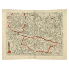
Antique Map of the Region of Aire-sur-L'Adour by Janssonius, 1657
Located in Langweer, NL
Antique map of France titled 'L'Evesche d'Aire'. Decorative map of the Aire-sur-L'Adour region, a commune in the Landes department in Nouvelle-Aquitaine in southwestern France. This ...
Category

Antique 17th Century Collectibles and Curiosities

Materials

Paper

Antique Map of the Koblentz Region by Moll, 1695
Located in Langweer, NL
Antique map Koblentz titled 'Coblentz'. Rare antique map of the Koblentz region in Germany. On verso, an antique map of the Mont Royal fortress, Germany. Originates from 'Thesaurus Geographicus. A New Body of Geography: or a Compleat Description of the Earth 'by H. Moll. Artists and Engravers: Herman Moll...
Category

Antique 17th Century Collectibles and Curiosities

Materials

Paper

Antique Map of the Hainaut Region by Visscher, c.1690
Located in Langweer, NL
Antique map titled 'Comitatus Hannoniae et Archiepiscopatus Cameracensis Tabula'. Large map of the Hainaut region, France. Artists and Engravers: Nicolaes Visscher II (1649, Amst...
Category

Antique 17th Century Collectibles and Curiosities

Materials

Paper

Antique Map of the Islands of Macian and Bacian by De Bry, 1619
Located in Langweer, NL
Antique map titled 'Delineatio Insularum Macian et Bacian'. Depicts the islands Macian and Bacian. Originates from 'Americae pars Undecima (..) by J.T. de Bry, 1619. Artists and E...
Category

Antique 17th Century Collectibles and Curiosities

Materials

Paper

Antique Map of the Maluku Islands by Blaeu, c.1640
Located in Langweer, NL
Antique map titled 'Moluccae Insulae Celeberrimae'. Decorative map of the Maluku Islands, also known as the Moluccas or the Spice Islands. Inset of the island of Bachian (Batjan) in ...
Category

Antique 17th Century Collectibles and Curiosities

Materials

Paper

Antique Map of the City of Harlingen by Janssonius, c.1657
Located in Langweer, NL
Antique map titled ‘Harlingen‘. This map depicts the city of Harlingen (Friesland, The Netherlands). Published by J. Janssonius, Amsterdam, c.1657. Artists and Engravers: Johannes...
Category

Antique 17th Century Collectibles and Curiosities

Materials

Paper

Antique Map of the City of Harlingen by Merian, c.1655
Located in Langweer, NL
Antique map titled 'Harlingen'. Original antique map of the city of Harlingen, Friesland, the Netherlands. With German legend. This map originates from 'Topographia Circuli Burgundic...
Category

Antique 17th Century Collectibles and Curiosities

Materials

Paper

Antique Map of the City of Goch by Blaeu, 1649
Located in Langweer, NL
Antique map titled 'Gochum vernacule Goch'. Old map of the city of Goch, Germany. This map originates from 'Novum Ac Magnum Theatrum Urbium Belgicæ Liberæ ac Foederatæ' by J. Blaeu. ...
Category

Antique 17th Century Collectibles and Curiosities

Materials

Paper

Antique Map of the City of Groningen by Merian, 1659
Located in Langweer, NL
Antique map titled 'Gröningen'. This print depicts the city of Groningen, the Netherlands. This print originates from 'Topographia Germaniae Inferioris (..)' by C. Merian. Artist...
Category

Antique 17th Century Collectibles and Curiosities

Materials

Paper

Antique Map of the City of Gorinchem by Merian, c.1659
Located in Langweer, NL
Antique map titled 'Gorckum'. This print depicts the city of Gorinchem (or Gorcum/Gorkum, The Netherlands). This print originates from 'Topographia Germaniae Inferioris (..)'. Art...
Category

Antique 17th Century Collectibles and Curiosities

Materials

Paper

Antique Map of the City of Muiden by Merian, 1659
Located in Langweer, NL
Antique map titled 'Muyden'. Original antique map of the city of Muiden, the Netherlands. This map originates from 'Topographia Germania Inferioris' by C. Merian. Published 1659. ...
Category

Antique 17th Century Collectibles and Curiosities

Materials

Paper

Antique Map of the City of Stavoren by Merian, 1659
Located in Langweer, NL
Antique map titled 'Staveren'. Original antique map of the city of Stavoren, Friesland, the Netherlands. This map originates from 'Topographia Germania Inferioris' by C. Merian. Publ...
Category

Antique 17th Century Collectibles and Curiosities

Materials

Paper

Antique Map of the City of Oudewater by Merian, 1659
Located in Langweer, NL
Antique map titled 'Oudewater'. Plan of the city of Oudewater, the Netherlands. This map originates from 'Topographia Germania Inferioris' by C. Merian, 1659. Artists and Engraver...
Category

Antique 17th Century Collectibles and Curiosities

Materials

Paper

Antique Map of the Coast of Artois by Janssonius, 1657
Located in Langweer, NL
Antique map of France titled 'Descriptio Boloniae, Pontieu'. Detailed map of the coast of Artois featuring the fortified cities of St. Valery-sur-Somme, Le Crotoy, Rue, Estaples, and...
Category

Antique 17th Century Collectibles and Curiosities

Materials

Paper

Antique Map of the City of Sint-Maartensdijk by Smallegange, c.1696
Located in Langweer, NL
Antique map titled 'St. Maertensdyk'. Original antique map of the city of Sint-Maartensdijk, the Netherlands. Source unknown, to be determined. Artists and Engravers: Published b...
Category

Antique 17th Century Collectibles and Curiosities

Materials

Paper

Antique Map of the City of Harlingen by Janssonius, c.1657
Located in Langweer, NL
Antique map titled ‘Harlingen‘. This map depicts the city of Harlingen (Friesland, The Netherlands). Published by J. Janssonius, Amsterdam, c.1657. Artists and Engravers: Johannes...
Category

Antique 17th Century Collectibles and Curiosities

Materials

Paper

Antique Map of the City of Oldenzaal by Orlers, 1615
Located in Langweer, NL
Antique map depicting the Siege of Oldenzaal, the Netherlands. The Siege of Oldenzaal was a short siege that took place during the Eighty Years' War and the Anglo–Spanish War by a Du...
Category

Antique 17th Century Collectibles and Curiosities

Materials

Paper

Antique Map of the City of Muiden by Merian, 1659
Located in Langweer, NL
Antique map titled 'Muyden'. Original antique map of the city of Muiden, the Netherlands. This map originates from 'Topographia Germania Inferioris' by C. Merian. Published 1659. ...
Category

Antique 17th Century Collectibles and Curiosities

Materials

Paper

Antique Map of the City of Sneek by Blaeu, 1649
Located in Langweer, NL
Antique map Friesland titled 'Sneeck'. Bird's-eye view plan of Sneek, the Netherlands. This map originates from 'Toneel der Steeden' published by Joan Blaeu, 1649. Artists and Eng...
Category

Antique 17th Century Collectibles and Curiosities

Materials

Paper

Antique Map of the City of Leeuwarden by Merian, 1659
Located in Langweer, NL
Antique map titled 'Leurwaerden'. This print depicts the city of Leeuwarden (Friesland, The Netherlands). This print originates from 'Topographia Germaniae Inferioris (..)' by C. Mer...
Category

Antique 17th Century Collectibles and Curiosities

Materials

Paper

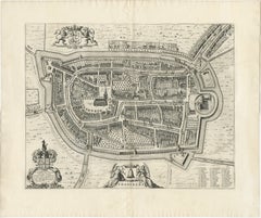
Antique Map of the City of Tiel by Blaeu, 1649
Located in Langweer, NL
Antique map titled 'Tyel'. Beautiful map of the city of Tiel, The Netherlands. With a coat of arms and key of various locations. Originates from 'Toneel der Steeden' published by Joa...
Category

Antique 17th Century Collectibles and Curiosities

Materials

Paper

Antique Map of the City of Leeuwarden by Merian, 1659
Located in Langweer, NL
Antique map titled 'Leurwaerden'. This print depicts the city of Leeuwarden (Friesland, The Netherlands). This print originates from 'Topographia Germaniae Inferioris (..)' by C. Mer...
Category

Antique 17th Century Collectibles and Curiosities

Materials

Paper

Antique Map of the City of Workum by Merian, 1654
Located in Langweer, NL
Antique map titled 'Worcum'. Old map of the city of Workum, Friesland. Originates from 'Topographia Germaniæ Inferioris' by C. Merian. Artists and Engravers: Caspar Merian (1627-1...
Category

Antique 17th Century Collectibles and Curiosities

Materials

Paper

Antique Map of the Course of the Elbe River by Janssonius, c.1650
Located in Langweer, NL
Antique map titled 'Nobilis Flubius Albis (..)'. Old map of the course of the Elbe river, large inset view of the city of Hamburg. Source unknown, to be determined. Artists and En...
Category

Antique 17th Century Collectibles and Curiosities

Materials

Paper

Antique Map of the Empire of the Assyriens by Mallet, 1683
Located in Langweer, NL
Antique map titled 'Empire des Assyriens' and 'Assyrie Chaldee et Mesopotamie selon les Anciens'. Two maps on one sheet, the upper sheet showing the Empire of the Assyriens and the second showing the region of the Tigres and Euphrates Rivers. This map originates from Alain Manesson Mallet's 'Description de l 'Univers'. Artists and Engravers: Alain Manesson Mallet (1630–1706) was a French cartographer and engineer. He started his career as a soldier in the army of Louis XIV, became a Sergeant-Major in the artillery and an Inspector of Fortifications. He also served under the King of Portugal, before returning to France, and his appointment to the court of Louis XIV. His military engineering and mathematical background led to his position teaching mathematics at court. His major publications were Description de L'Univers (1683) in 5 volumes, and Les Travaux de Mars ou l'Art de la Guerre (1684) in 3 volumes. His Description de L'Universe contains a wide variety of information, including star maps...
Category

Antique 17th Century Collectibles and Curiosities

Materials

Paper

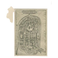
Antique Map of the City of Franeker by Guicciardini, 1613
Located in Langweer, NL
Antique map titled 'Franicher'. Plan of the city of Franeker, Friesland, the Netherlands. This map originates from the 1613 edition of 'Discrittione di tutti i Paesi Bassi', by L. Gu...
Category

Antique 17th Century Collectibles and Curiosities

Materials

Paper

Antique Map of the City of Franeker by Guicciardini, 1612
Located in Langweer, NL
Antique map titled 'Franicher'. Original antique map of the city of Franeker, Friesland, the Netherlands. This map originates from 'Beschryvinghe van alle de Neder-landen, anderssins...
Category

Antique 17th Century Collectibles and Curiosities

Materials

Paper

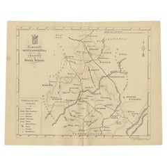
Antique Map of the Region of Utingeradeel in Friesland, The Netherlands, 1664
Located in Langweer, NL
Antique map titled 'De Grietenye van Utingeradeel (..)'. Map of the Grietenij of Utingeradeel, Friesland, The Netherlands. Multiple cartouches, key and coat of arms. "Beschrijvinge e...
Category

Antique 17th Century Collectibles and Curiosities

Materials

Paper

Antique Map of the City of Dokkum by Blaeu, c.1650
Located in Langweer, NL
Antique map titled 'Dockum'. Large map of the city of Dokkum, Friesland, The Netherlands. Originates from 'Toneel der Steden', published by Joan Blaeu, Amsterdam. Artists and Engrave...
Category

Antique 17th Century Collectibles and Curiosities

Materials

Paper

Antique Map of the Region of Vermandois and Cappelle, France by Janssonius, 1657
Located in Langweer, NL
Antique map of France titled 'Descriptio Veromanduorum - Gouvernement de la Cappelle'. Two detailed maps of France on one sheet. The Vermandois map is centered on the Oyse and So...
Category

Antique 17th Century Collectibles and Curiosities

Materials

Paper

Antique Map of the Region of Zutphen in The Netherlands by Janssonius, 1647
Located in Langweer, NL
Antique map titled 'Ducatus Gelriae pars tertia Quae est Comitatus Zutphaniensis'. Antique map of the region of Zutphen, Gelderland, the Netherlands. This map originates from 'Atlas ...
Category

Antique 17th Century Collectibles and Curiosities

Materials

Paper

Antique Map of the Seine-et-Marne / Champagne Region by Janssonius, 1657
Located in Langweer, NL
Antique map of France titled 'Valesium Ducatus Valois'. Oriented to the north of the Picardy region with Compiegne, Senlis, Meaux, Chateau-thierry and Soissons around the perimeter. ...
Category

Antique 17th Century Collectibles and Curiosities

Materials

Paper

Antique Map of the Region of Wonseradeel, Friesland in the Netherlands, 1664
Located in Langweer, NL
Antique map titled 'De Grietenije van Wonsera-deel (..).' Map of the Grietenij of Wonseradeel, Friesland, The Netherlands. Multiple cartouches, key and coat of arms. "Beschrijvinge e...
Category

Antique 17th Century Collectibles and Curiosities

Materials

Paper

Antique Map of the Region of Zutphen, Netherlands by Janssonius, c.1680
Located in Langweer, NL
Antique map titled 'Ducatus Gelriae pars tertia Quae est Comitatus Zutphaniensis.' Map of region around Zutphen in the historic Duchy Gelre in the Netherlands. Cities included in...
Category

Antique 17th Century Collectibles and Curiosities

Materials

Paper

Large Copper Engraved Map of the Coastline of Friesland and Terschelling, c.1670
Located in Langweer, NL
Antique print, titled: 'Dominii Frisiae Tabula, inter Flevum et Lavicum (…)' This large copper engraved map details the coastline of Friesland and Terschelling. At east is a part...
Category

Antique 17th Century Collectibles and Curiosities

Materials

Paper

The Iron Duke of Alva of Spain Planning the Atrocities Against the Dutch, c.1680
Located in Langweer, NL
Antique print titled ‘Afbeeldinge van de Spaansche Bloedraad in den Jaare 1567 door den Hartog van Alva aangestelt’. The Duke of Alva and his entourage seated at a table planning...
Category

Antique 17th Century Collectibles and Curiosities

Materials

Paper

Decorative Original Antique Map of the North of Flanders, Belgium, 1697
Located in Langweer, NL
Antique map titled 'Fiandra Parte Occidentale (..)'. Depicts northern part of Flanders, from North Sea, extends through the northern region of France to the cities of Douai and V...
Category

Antique 17th Century Collectibles and Curiosities

Materials

Paper

Old Map of the Province of Groningen, the Netherlands & inset of Islands, C.1680
Located in Langweer, NL
Antique map titled 'Tabulae dominii Groeningae quae et complecitur maximam partem Drentiae Emendata'. Old map of the province of Groningen, the Netherlands. With an inset map of ...
Category

Antique 17th Century Collectibles and Curiosities

Materials

Paper

Old Detailed Map of the Historical Regions of the Duchy of Saxony, Germany, 1680
Located in Langweer, NL
Antique map titled 'Circuli Saxoniae Superior Pars Meridionalis in qua sunt Ducatus Saxoniae, Comitatus Mansfeldiae, et Voitlandiae, Landgraviat Thuringiae, Marchionatus Misniae Prin...
Category

Antique 17th Century Collectibles and Curiosities

Materials

Paper

Detailed Map of the South of the The Netherlands & The North of Belgium, ca.1680
Located in Langweer, NL
Antique map titled 'Tabula Ducatus Brabantiae.' - Detailed map of the southern part of The Netherlands and the northern part of Belgium with Antwerp and Brussels. In the corner top l...
Category

Antique 17th Century Collectibles and Curiosities

Materials

Paper

Splendid Detailed Map of the Province of Overijssel in the Netherlands, ca.1692
Located in Langweer, NL
Antique map titled 'Tran-siselana'. Splendid detailed and decorative map of the province of Overijssel in the Netherlands by Vincenzo Coronelli. An elaborate title cartouche garlande...
Category

Antique 17th Century Collectibles and Curiosities

Materials

Paper

Map of Friesland with Terschelling, Vlieland, Ameland En Schiermonnikoog, C.1670
Located in Langweer, NL
Antique print, titled: 'Tabula Comitatus Frisiae …' Map of Friesland with the island Terschelling, Vlieland, Ameland en Schiermonnikoog. With a cartouche and a compass rose. Publ...
Category

Antique 17th Century Collectibles and Curiosities

Materials

Paper

Old Print Titled from War Comes Peace, City Amara in Africa in Background, C1630
Located in Langweer, NL
Antique print, titled: 'Amara in Africa.' Caption above the image reads: 'Ex bello Pax' (From War comes Peace). A lance is used as a roost for chickens. In the background the cit...
Category

Antique 17th Century Collectibles and Curiosities

Materials

Paper

Two Antique Views of the Ruins of the Tower of Babel, Babylon, 1683
Located in Langweer, NL
Antique print titled 'Ruines De La Tour De Babel (Aspect Septentrional and Aspect Meridional)'. Two views of the ruins of the Tower of Babel, Babylon. This print originates from Alain Manesson Mallet's 'Description de l 'Univers'. Artists and Engravers: Alain Manesson Mallet (1630–1706) was a French cartographer and engineer. He started his career as a soldier in the army of Louis XIV, became a Sergeant-Major in the artillery and an Inspector of Fortifications. He also served under the King of Portugal, before returning to France, and his appointment to the court of Louis XIV. His military engineering and mathematical background led to his position teaching mathematics at court. His major publications were Description de L'Univers (1683) in 5 volumes, and Les Travaux de Mars ou l'Art de la Guerre (1684) in 3 volumes. His Description de L'Universe contains a wide variety of information, including star maps...
Category

Antique 17th Century Collectibles and Curiosities

Materials

Paper

Antique Print with a View of the Temple of Daibuth, Japan, 1683
Located in Langweer, NL
Antique print titled 'Temple de Daibuth'. View of the temple of Daibuth, Japan. Originates from 'Description de l'Univers'. Artists and Engravers: Alain Manesson Mallet, a Fr...
Category

Antique 17th Century Collectibles and Curiosities

Materials

Paper

Early Antique Map of the Dutch Provinces of Friesland and Groningen, 1604
Located in Langweer, NL
Antique map titled 'Frisiae Occidentalis.' This attractive map shows the Dutch Provinces of Friesland and Groningen. Embellished with strapwork tit...
Category

Antique 17th Century Collectibles and Curiosities

Materials

Paper

Original Map of the Military Situation After the Dutch Blockade of Antwerp, 1648
Located in Langweer, NL
Antique map titled 'Tabula Castelli ad Sandflitam (..)'. This map depicts the complex military situation that had developed after the Dutch blockade of Antwerp. All entrenchment'...
Category

Antique 17th Century Collectibles and Curiosities

Materials

Paper

Original Colored Antique Map of Utrecht & Surroundings, The Netherlands, c1690
Located in Langweer, NL
Antique map titled 'Tabula nova Provinciae Ultrajectinae quam jussu Nob: hujus Dominij Ordinum Emensus est Bernardus du Roy'. Map of the region of Utrecht, The Netherlands. This ...
Category

Antique 17th Century Collectibles and Curiosities

Materials

Paper

Engraved Map of Northern England, Focusing on Northumberland, 1658
Located in Langweer, NL
Antique map titled 'Ancien Royaume de Northumberland, aujourdhuy Provinces de Nort (..)'. Engraved map of northern England, focusing on Northumber...
Category

Antique 17th Century Collectibles and Curiosities

Materials

Paper

Governor of Miaco (Kyoto, Japan), Leaving the City in a Carriage, 1669
Located in Langweer, NL
Antique print, titled: 'Sortie pompeuse du Gouverneur de Miaco. 't Uytreyden des Gouverneurs van Miaco.' The governor of Miaco (Kyoto), in a carriage as part of a long procession...
Category

Antique 17th Century Collectibles and Curiosities

Materials

Paper

Map of Southeast Asia, Extending from India to Tibet & Japan to New Guinea, 1640
Located in Langweer, NL
Antique map titled 'India quae Orientalis dicitur et Insulae adiacentes'. Map of Southeast Asia, extending from India to Tibet to Japan to New Guinea. This map is one of the firs...
Category

Antique 17th Century Collectibles and Curiosities

Materials

Paper

Original Antique Detailed Map of the Rhine and Moselle River Regions, ca.1680
Located in Langweer, NL
Antique map titled 'Tabula Geographica qui Pars Meridionalis sive Superior Rheni, Mosae et Mosellae (..).' Detailed map of the Rhine and Moselle River regions and contigous parts...
Category

Antique 17th Century Collectibles and Curiosities

Materials

Paper

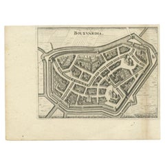
Nice Hand-Colored Plan by Blaeu of Bolsward in Friesland, the Netherlands, 1652
Located in Langweer, NL
Antique print, titled: 'Bolswaert' - (Town plan of Bolsward). Plan of Bolsward in Friesland, the Netherlands. A cartouche and two coats of arms. From the town atlas 'Toneel der S...
Category

Antique 17th Century Collectibles and Curiosities

Materials

Paper

Charming Decorative Miniature Map of Russia, from an Old Pocket Atlas, 1685
Located in Langweer, NL
Antique map titled 'Russia cum Consinijs'.' Charming miniature map of Russia, from the pocket atlas 'Introductionis in Universam Geographiam tam Veterem quam novam .. Acessit P. ...
Category

Antique 17th Century Collectibles and Curiosities

Materials

Paper

Detailed Map of Southern Holland, Incl the Hague, Rotterdam, Delft, Gouda, c1680
Located in Langweer, NL
Antique map titled 'Delflandia, Schielandia et circumjacentes Insulae ut Voorna, Overflackea, Goerea, Yselmonda et aliae.' Detailed map of Southern Holland, which includes the ci...
Category

Antique 17th Century Collectibles and Curiosities

Materials

Paper

Antique Map of Austria, Centered Around the Danube from Passau to Vienna, C.1690
Located in Langweer, NL
Antique map of Austria titled 'Circuli Austriaci pars septentrionalis in quia archiducatus Austriae et Ducatus Stiriae accuratissime divisi ostenduntur per F. de Wit'. Detailed m...
Category

Antique 17th Century Collectibles and Curiosities

Materials

Paper

Decorative and Detailed Original Antique Map of Switzerland, 1657
Located in Langweer, NL
Antique map of Switzerland titled 'Helvetiae Rhetiae & Valesiae'. Decorative and detailed map of Switzerland. This map originates from 'Atlas Novus, Sive Theatrum Orbis Orbis Ter...
Category

Antique 17th Century Collectibles and Curiosities

Materials

Paper

Antique Handcolored Map of the Dutch Province Groningen, Incl. Emden, Ca.1680
Located in Langweer, NL
Antique print, titled: 'Groningae et Omlandiae Dominium vulgo de Pronvicie van Stadt en Lande …' A map of the Dutch province Groningen. A small part of Germany is also shown (Emd...
Category

Antique 17th Century Collectibles and Curiosities

Materials

Paper

Read More

Medal-Worthy Memorabilia from Epic Past Olympic Games

Get into the games! These items celebrate the events, athletes, host countries and sporting spirit.

Ahoy! You’ve Never Seen a Collection of Sailor Art and Kitsch Quite Like This

French trendsetter and serial collector Daniel Rozensztroch tells us about his obsession with objects related to seafaring men.

Pamela Shamshiri Shares the Secrets behind Her First-Ever Book and Its Effortlessly Cool Interiors

The sought-after designer worked with the team at Hoffman Creative to produce a monograph that beautifully showcases some of Studio Shamshiri's most inspiring projects.

Moroccan Artworks and Objects Take Center Stage in an Extraordinary Villa in Tangier

Italian writer and collector Umberto Pasti opens the doors to his remarkable cave of wonders in North Africa.

Montecito Has Drawn Royalty and Celebrities, and These Homes Are Proof of Its Allure

Hollywood A-listers, ex-pat aristocrats and art collectors and style setters of all stripes appreciate the allure of the coastal California hamlet — much on our minds after recent winter floods.

Whaam! Blam! Pow! — a New Book on Pop Art Packs a Punch

Publishing house Assouline and writer Julie Belcove have teamed up to trace the history of the genre, from Roy Lichtenstein, Andy Warhol and Yayoi Kusama to Mickalene Thomas and Jeff Koons.

The Sparkling Legacy of Tiffany & Co. Explained, One Jewel at a Time

A gorgeous new book celebrates — and memorializes — the iconic jeweler’s rich heritage.

What Makes a Gem-Encrusted Chess Set Worth $4 Million?

The world’s most opulent chess set, weighing in at 513 carats, is literally fit for a king and queen.
Recently Viewed

View All