18th Century and Earlier More Furniture and Collectibles

to
2,901
4,126
1,101
5,274
300
154
137
81
56
53
50
27
16
5
3
3
2
2
2
2
1
10,575
31,674
15,214
6,681
13,727
6,697
929
565
1,134
1,406
1,048
2,867
2,925
2,583
1,204
819
3,357
949
712
500
284
1,919
411
369
360
255
5,274
5,274
5,274
59
21
14
13
12
Period: 18th Century and Earlier
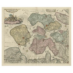
Decorative Antique Sea Chart of Zeeland, a Province of the Netherlands, ca.1730
Located in Langweer, NL
Antique map titled 'Comitatus Zelandiae Tabula emendata a Frederico De Wit'. Decorative sea chart of Zeeland, a province of the Netherlands. Although the title reads F. de Wit, thi...
Category

Antique 18th Century and Earlier More Furniture and Collectibles

Materials

Paper

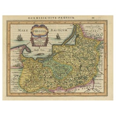
Original Decorative Antique Map of Prussia, 1628
Located in Langweer, NL
Antique map titled 'Prussia'. Original antique map of Prussia, a historically prominent German state that originated in 1525 with a duchy centered on th...
Category

Antique 18th Century and Earlier More Furniture and Collectibles

Materials

Paper

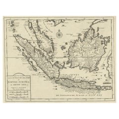
Detailed Map of Southeast Asia From the Tip of Cambodia to Java, 1739
Located in Langweer, NL
Antique map titled 'Nieuwe kaart van de Sundasche Eilanden als Borneo, Sumatra en Groot Iava & c'. Detailed map of Southeast Asia, extending from the tip of Cambodia to Java. Thi...
Category

Antique 18th Century and Earlier More Furniture and Collectibles

Materials

Paper

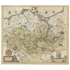
Antique Hand-colored Map of Brandenburg, Germany
Located in Langweer, NL
Antique map titled 'Marchionatus Brandenburgicus'. Original antique map of Brandenburg, with Königsberg and Stettin, Germany. Published by J. Janssonius, circ 1650. Jan Janssonius ...
Category

Antique 18th Century and Earlier More Furniture and Collectibles

Materials

Paper

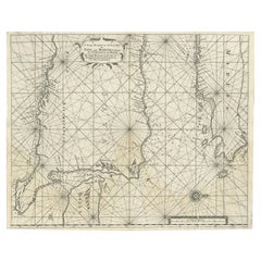
Rare Old English Sea Chart of Part of Indonesia with Java, Madura and Bali, 1711
Located in Langweer, NL
Antique map titled 'A Large Draught of the East End of Java and Madura shewing the Streights of Bally.' Rare early example of this working English Sea Chart of part of Indonesia ...
Category

Antique 18th Century and Earlier More Furniture and Collectibles

Materials

Paper

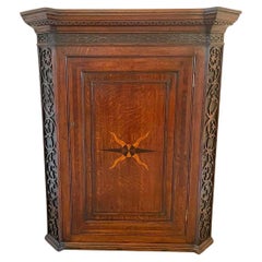
Outstanding Antique George III Quality Oak Inlaid Hanging Corner Cabinet Out
Located in Suffolk, GB
Outstanding antique George III quality oak inlaid hanging corner cabinet having an attractive stepped and dental moulded cornice above a quality oak crossbanded moulded door with an ...
Category

European George III Antique 18th Century and Earlier More Furniture and Collectibles

Materials

Other

Antique Bible Map of the Middle East by A. Schut, 1743
Located in Langweer, NL
Antique map titled 'De Gelegentheyt van 't Paradys en 't Landt Canaan'. Dutch Bible map covering the region between the Mediterranean and the Persian Gulf, ...
Category

Antique 18th Century and Earlier More Furniture and Collectibles

Materials

Paper

Decorative Early Hand-Colored Map of the Northeast of England, ca.1620
Located in Langweer, NL
Antique map titled 'Eboracum, Lincolnia, Derbia, Staffordia, Notinghamia, Lecestria, Rutlandia et Norfolcia'. Decorative early map of the northeast of England, comprising the cou...
Category

Antique 18th Century and Earlier More Furniture and Collectibles

Materials

Paper

Antique Map of the West-Frisian Part of Independant Friesland by Halma, 1718
Located in Langweer, NL
Antique map Friesland titled 'Pars I Frisiae Liberae (..)'. Old map of Friesland, the Netherlands. This map depicts the West-Frisian part of independant Friesland. Originates from 'U...
Category

Antique 18th Century and Earlier More Furniture and Collectibles

Materials

Paper

Antique Map of the Artois Region of France by Ortelius, 'circa 1590'
Located in Langweer, NL
Antique map titled 'Artesia'. Original antique map of the Artois region, France. Published by A. Ortelius, circa 1590.
Category

Antique 18th Century and Earlier More Furniture and Collectibles

Materials

Paper

Antique 18th Century Gilt Gothic Art Carved Wood Angel Sculpture Candlestick
Located in Lisse, NL
Beautiful and sizeable Church altar candelabra in the form of a winged Angel. This hand-carved Church altar piece is carved out of wood and the gilt finishing gives this piece it's ...
Category

Dutch Gothic Antique 18th Century and Earlier More Furniture and Collectibles

Materials

Wood

Attractive Antique Hand-Coloured Map of South America, ca.1765
Located in Langweer, NL
Antique map titled 'Kaart van het Onderkoningschap van Peru zig uitstrekkende: over Chile, Paraguay en andere Spaansche Landen als ook van Brazil en verdere Bezittingen van Portugal ...
Category

Antique 18th Century and Earlier More Furniture and Collectibles

Materials

Paper

Old Original Map of Chormandel & Malabar, India & Ceylon, Now Sri Lanka, 1726
Located in Langweer, NL
Antique map titled 'Nieuwe Kaart van Choromandel ende Malabar'. Antique map depicting the southern part of India and the northern tip of Ceylon, Sri Lanka. This map originates from...
Category

Antique 18th Century and Earlier More Furniture and Collectibles

Materials

Paper

Antique Print of Richmond Place by Woolfe, c.1770
Located in Langweer, NL
Antique print titled 'Elevation of Sir Asgill's Villa at Richmond in Surry (..)'. Plan and facade of Richmond Place or Asgill House, Richmond, London. This print originates from 'Vit...
Category

Antique 18th Century and Earlier More Furniture and Collectibles

Materials

Paper

Antique Map of Carta Soura, Headquarter of the Javanese Nobility, 1706
Located in Langweer, NL
Antique map titled 'Carta Soera de Nigrita'. Early map of the town of Carta Soura, also known as Kartosuro and Karta Soera de Nigrat, located in the interior of central Java, headqua...
Category

Antique 18th Century and Earlier More Furniture and Collectibles

Materials

Paper

Antique Print of Horseheath Hall in Cambridgeshire, England, 1725
Located in Langweer, NL
Antique print titled 'General front of Horse heath Hall in Cambridgeshire (..)'. Old engraving of Horseheath Hall, Cambridgeshire. The original Hall was the home of the Alington family and was visited by Queen Elizabeth 1...
Category

Antique 18th Century and Earlier More Furniture and Collectibles

Materials

Paper

Natives from Pegu, the Moluccan Islands, Penequais Indians and St Thomas, c.1605
Located in Langweer, NL
Antique print titled 'Provincie Pegu incola (..) - Incola ex Insulis Moluco (..) - Penequais familiae (..)'. Old print showing various figures including a man from Pegu, a man fr...
Category

Antique 18th Century and Earlier More Furniture and Collectibles

Materials

Paper

Detailed Antique Map of Friesland, Groningen and Drenthe, The Netherlands, c1735
Located in Langweer, NL
Antique map titled 'Frisia Dominum (?) Friesland, verdeeld in de hoof-delen van Oostergoo, Westergoo en Sevenwolde (?) XXX Grietenijen.' Detailed map of Friesland, Groningen and Dren...
Category

Antique 18th Century and Earlier More Furniture and Collectibles

Materials

Paper

Attractive Hand-Tinted Antique Map of Japan, Published in 1752
Located in Langweer, NL
Nice decorative hand tinted map of Japan with the title (in French): Carte de L'Empire du Japon Bellin, 1752 This antique map is engraved with very attractive title cartouche. ...
Category

Antique 18th Century and Earlier More Furniture and Collectibles

Materials

Paper

Original Antique Bird's-Eye View of Colmar, Alsace, France, 1552
Located in Langweer, NL
Antique map titled 'La Paincture de la cité de Colmar & du pais circonuoisin'. Original antique bird's-eye view of Colmar, Alsace, France. This map originates from 'La Cosmograph...
Category

Antique 18th Century and Earlier More Furniture and Collectibles

Materials

Paper

Decorative Antique Map of the Region of Cambrai, France, ca.1630
Located in Langweer, NL
Antique map titled 'l'Archevesche de Cambray'. Decorative map of the region of Cambrai, France. Includes the cities of Cambrai, Valencienes, Douai, and Bouchain. Artists and Engravers: Henricus...
Category

Antique 18th Century and Earlier More Furniture and Collectibles

Materials

Paper

Antique Map of Nova Zembla by Janssonius, c.1650
Located in Langweer, NL
Antique map titled 'Nova Zemla, waygats fretum Nassovi cum et terra Samoiedum singula omnium emendatissime descripta'. This map depicts Nova Zembla and the northern continental coast...
Category

Antique 18th Century and Earlier More Furniture and Collectibles

Materials

Paper

Coloured Antique Map of Sicily, Sardinia, Corfu, Elba, Malta and Zerbi (Jerba)
Located in Langweer, NL
Antique map titled 'Insularum Aliquot Maris Mediterranei Descriptio'. A very attractive example of Ortelius' map combining, on one page, maps of the islands of Sicily, Sardinia, Corfu, Elba, Malta and Zerbi (Jerba, off the coast of Tunisia.) The maps detail fortifications on the islands and other major features. (Jerba, for instance, is shown connected to the mainland by a causeway.) The waters are attractively engraved and are sailed by ships. A shipwreck, north of Malta, indicates the point at which St. Paul is thought to have shipwrecked. Volcanoes are indicated in the Sicily map...
Category

Antique 18th Century and Earlier More Furniture and Collectibles

Materials

Paper

Antique Map of Quinam and the Côn ?ao Islands by Sayer, 1778
Located in Langweer, NL
Antique map titled 'A Chart of a part of the Coast of Cochinchina' and 'Plan of Pulo Condor'. Two maps on one sheet. The upper map shows part of the coast of Cochinchina from Cham Co...
Category

Antique 18th Century and Earlier More Furniture and Collectibles

Materials

Paper

Old Map of the East Indonesian Islands Borneo, Celebes, New Guinea, Bali, 1792
Located in Langweer, NL
Antique map titled 'Partie de la Nouvelle Grande Carte des Indes Orientales, contenant les Isles de Borneo, Iava, Celebes, Mindanao (..)'. Detailed map of the Indonesian islands ...
Category

Antique 18th Century and Earlier More Furniture and Collectibles

Materials

Paper

Antique Maps of Manipa, Nusa-Laut, Saparua and Haruku in Maluku, Indonesia 1726
Located in Langweer, NL
Antique map titled 'Caart van het Eyland Manipa, Noessa-Laoet, Honimoa, Oma. Der Manipesen dracht, een Orangkaya van Manipa.' Four maps of islands and two figures in native dress. Th...
Category

Antique 18th Century and Earlier More Furniture and Collectibles

Materials

Paper

Antique Map of the Netherlands and Belgium by Keizer & De Lat, 1788
Located in Langweer, NL
Antique map titled 'Nouvelle Carte des XVII Provinces du Païs Bas (..)'. Uncommon antique map of Holland and Belgium. This map originates from ...
Category

Antique 18th Century and Earlier More Furniture and Collectibles

Materials

Paper

Rare and Very Old Antique Map of South East Asia, Published circa 1574
Located in Langweer, NL
A very fine impression of this map of the Malay Peninsula, Sumatra, Java, with Singapore denoted as 'Cinca Pula'. Highly distorted and inaccurate map by Girolamo Ruscelli after J...
Category

Antique 18th Century and Earlier More Furniture and Collectibles

Materials

Paper

1752 Vaugoundy Map of Flanders : Belgium, France, and the Netherlands, Ric.a002
Located in Norton, MA
Large Vaugoundy Map of Flanders: Belgium, France, and the Netherlands Colored -1752 Ric.a002 Description: This is a 1752 Didier Robert de Vaugondy map of Flanders. The map de...
Category

Unknown Antique 18th Century and Earlier More Furniture and Collectibles

Materials

Paper

Antique Map of Zeeland, The Netherlands, by Jaillot, 1693
Located in Langweer, NL
Antique map titled 'Le Comte de Zeelande (..).' Detailed map of the province of Zeeland, The Netherlands. Details shown include fortified towns, roads, sandbanks and marshlands. Base...
Category

Antique 18th Century and Earlier More Furniture and Collectibles

Materials

Paper

Decorative Antique Map of Central Asia
Located in Langweer, NL
Antique map titled 'Carte de la Tartarie Indépendante (..)'. Decorative map of Central Asia (Tartary). Covers from the Black Sea south to China, north to Russia, and south to Persia ...
Category

Antique 18th Century and Earlier More Furniture and Collectibles

Materials

Paper

Antique Architectural Print of Cobham Hall in Kent, England, 1717
Located in Langweer, NL
Antique print titled 'The Elevation of Cobham Hall in Kent (..)'. Elevation of the entrance facade of Cobham Hall, Kent. This print originates from 'Vitruvius Britannicus' by Colen...
Category

Antique 18th Century and Earlier More Furniture and Collectibles

Materials

Paper

Antique Roman Battle Print of Scipio's Front by Duncan, c.1753
Located in Langweer, NL
Antique battle map showing Scipio's Front. With detailed legend explaining the various elements of the print. This print most likely originates fro...
Category

Antique 18th Century and Earlier More Furniture and Collectibles

Materials

Paper

Joseph GLANVILL. The Vanity of Dogmatizing. FIRST EDITION - 1661 - HIS 1st BOOK!
Located in Hillsborough, NJ
AUTHOR: GLANVILL, Joseph. TITLE: The Vanity of Dogmatizing: Or Confidence in Opinions Manifested in a Discourse of the Shortness and Uncertainty of Our Knowledge, and Its Causes, w...
Category

British Antique 18th Century and Earlier More Furniture and Collectibles

Materials

Leather

Antique Map of Ambon Island in the Moluccas, Indonesia, c.1760
Located in Langweer, NL
Antique map Ambon titled 'Carte Particuliere de l 'Isle Amboine'. Old map showing Ambon, in the Moluccas Islands, better known as the Spice Islands. Ambon was the headquarters of the...
Category

Antique 18th Century and Earlier More Furniture and Collectibles

Materials

Paper

Antique Map of the Northeast of England by Mercator 'circa 1620'
Located in Langweer, NL
Antique map titled 'Eboracum Lincolnia, Derbia, Staffordia, Notinghamia, Lecestria, Rutlandia, et Norfolcia'. Decorative early map of the northeast of England, comprising the countie...
Category

Antique 18th Century and Earlier More Furniture and Collectibles

Materials

Paper

French Antique Map of France and Western Europe, 1765
Located in Langweer, NL
Antique map titled 'Carte de tous les Lieux, célébres dans l'Histoire (..)'. Beautiful old map of France and western Europe. This map originates from 'Atlas Historique de la France A...
Category

Antique 18th Century and Earlier More Furniture and Collectibles

Materials

Paper

Old Antique Print of the City of Groningen, The Netherlands, by Münster, c.1600
Located in Langweer, NL
Antique print titled 'Groeninga'. View of the city of Groningen, the Netherlands. This map originates from 'Cosmographia' published by Münster. Artists and Engravers: Sebastian Münster...
Category

Antique 18th Century and Earlier More Furniture and Collectibles

Materials

Paper

Decorative Map of the Empire of China, Korea, Japan, Taiwan, Lucon, Macau, 1780
Located in Langweer, NL
Antique map titled 'Carte de L'Empire de la Chine.' Decorative map of the Empire of China, depicting China, Corea ( Korea ), Japan, Tonquin and the Philippine island Lucon. Source unknown, to be determined. Artists and Engravers: Rigobert Bonne (1727-1795 ) was one of the most important cartographers of the late 18th century. In 1773 he succeeded Jacques Bellin as Royal Cartographer to France in the office of the Hydrographer at the Depôt de la Marine. Working in his official capacity Bonne compiled some of the most detailed and accurate maps of the period. Bonne's work represents an important step in the evolution of the cartographic ideology away from the decorative work of the 17th and early 18th century towards a more detail oriented and practical aesthetic. With regard to the rendering of terrain Bonne maps...
Category

Antique 18th Century and Earlier More Furniture and Collectibles

Materials

Paper

Antique Print of Caesar's Camp, A Roman Battle Print, c.1753
Located in Langweer, NL
Antique battle map of Caesar's Camp. With detailed legend explaining the various elements of the print. This print most likely originates from an edition of 'The Commentaries of Caesar, Translated into English. To Which is Prefixed a Discourse Concerning The Roman Art of War...
Category

Antique 18th Century and Earlier More Furniture and Collectibles

Materials

Paper

Old Map of Awatska Bay on the Coast of Kamchatka Peninsula, Russia by Cook, 1784
Located in Langweer, NL
Antique map Awatska titled 'Plan of the Bay of Awatska (..)'. Antique map of Awatska Bay on the east coast of the Russian peninsula of Kamtschatka. Inset plan of St. Peter’s and St. ...
Category

Antique 18th Century and Earlier More Furniture and Collectibles

Materials

Paper

Antique Map of of Bengal and the mouth of the Ganges River
Located in Langweer, NL
Antique map titled 'Carte du Bengale, avec la partie Septentrionale (..)'. Original antique map of Bengal and the mouth of the Ganges river. This map ori...
Category

Antique 18th Century and Earlier More Furniture and Collectibles

Materials

Paper

Antique Map of the Duchy of Saxony by De Wit, c.1680
Located in Langweer, NL
Antique map titled 'Circuli Saxoniae Superior Pars Meridionalis in qua sunt Ducatus Saxoniae, Comitatus Mansfeldiae, et Voitlandiae, Landgraviat Thuringiae, Marchionatus Misniae Prin...
Category

Antique 18th Century and Earlier More Furniture and Collectibles

Materials

Paper

Original Engraved Map of Saint Lucia in the West Indies by Bellin, 1758
Located in Langweer, NL
The "Carte de L’Isle de Sainte Lucie" by Jacques Nicolas Bellin, a prominent figure as the Royal Hydrographer and engineer of the French Navy, is a remarkable antique map showcasing ...
Category

Antique 18th Century and Earlier More Furniture and Collectibles

Materials

Paper

Antique Map of the British Isles and Part of Europe by Chatelain, c.1720
Located in Langweer, NL
Antique map titled 'Carte pour l'Intelligence de l'Histoire d'Angleterre (..)'. Decorative map showing the British Isles and the various regions conquered in Europe. Includese two elaborate family trees for the House of York...
Category

Antique 18th Century and Earlier More Furniture and Collectibles

Materials

Paper

Rare Antique Engraving of Mount Fuji During an Earthquake in Tokyo, Japan, 1669
Located in Langweer, NL
Antique print, titled: 'Aertbeevinge tot Jedo.' - ('Earthquake in Edo'). A temple falls to ruins because of an earthquake in Yedo (or Edo, Jeddo; now Tokyo). Men and women lament...
Category

Antique 18th Century and Earlier More Furniture and Collectibles

Materials

Paper

South German “man Of Sorrows” – Carved Pinewood Devotional Figure (17th Century)
Located in Bilzen, BE
"South German “man Of Sorrows” – Carved Pinewood Devotional Figure (17th Century)" Region: South Germany (likely Bavaria or Swabia) Date: Mid to late 17th century (circa 1650–1700) M...
Category

Austrian Baroque Antique 18th Century and Earlier More Furniture and Collectibles

Materials

Wood

French Statue of Jesus Christ
Located in Round Top, TX
An absolutely stunning 15th century statue of Christ from the Provenance region of France. Masterly hand carved from polychromed wood. Wonderful patin...
Category

French Antique 18th Century and Earlier More Furniture and Collectibles

Materials

Wood

Antique Map of Greece from Ortelius's Theatrum Orbis Terrarum, 1595
Located in Langweer, NL
Original antique map titled "Graecia Sophiani." This is a very detailed and decorative engraved map, with two decorative cartouches and a hand-colored initial on the verso, from Abra...
Category

Antique 18th Century and Earlier More Furniture and Collectibles

Materials

Paper

Antique Engravring of Different Artillery like Bullets, Cannons, Bombs, c.1769
Located in Langweer, NL
Antique print titled ‚Tab IX. von der Artillerie‘. This print depicts many different artillery like bullets, cannons, bombs and many more. German subtitles. Artists and Engra...
Category

Antique 18th Century and Earlier More Furniture and Collectibles

Materials

Paper

Antique Map of the Region of Oldenburg, Germany
Located in Langweer, NL
Antique map titled 'Oldenburg Comitatus'. Detailed old map of Oldenburg, Germany. The map also shows Bremen and the Jade Bight. Published by W. Blaeu, circa 1640. Willem Jansz. Blaeu...
Category

Antique 18th Century and Earlier More Furniture and Collectibles

Materials

Paper

Large German Chart of the Islands of the Philippines with Hand-Colored Borders
Located in Langweer, NL
Original antique map titled 'Karte von dem Canal in den Philippinischen Inseln (..)'. Large detailed chart of the islands of the Philippines. One of the most detailed charts of the Philippines of the era. Shows Islands, bays, reefs, soundings tracks of the Manila Galleon route, etc. Includes a large compass rose and rhumb lines. Originates from a German edition of "Voyage around the World...
Category

Antique 18th Century and Earlier More Furniture and Collectibles

Materials

Paper

Dutch 18th Century Fob seal with coat of arms
Located in Delft, NL
Dutch 18th Century Fob seal with coat of arms A Dutch 18th Century silver fob seal with coat of arms. A lacquer seal/signet to seal a letter or deed. Signets are wax stamps, also ca...
Category

Dutch Antique 18th Century and Earlier More Furniture and Collectibles

Materials

Silver

Antique Map of Flanders, Belgium, 1630
Located in Langweer, NL
Antique map titled 'Comitatus Flandria'. Original antique map of Flanders, Belgium. This map originates from 'Vyerige Colom verthonende de 17 Nederlandsche Provintien' published 1630...
Category

Antique 18th Century and Earlier More Furniture and Collectibles

Materials

Paper

Old Print of William Cavendish, First Duke of Newcastle, on Horseback, ca.1740
Located in Langweer, NL
Antique print titled 'Apres l'homme le Cheval (..)'. Antique print depicting William Cavendish, first Duke of Newcastle, on horseback on an inscr...
Category

Antique 18th Century and Earlier More Furniture and Collectibles

Materials

Paper

Ikat 1850 Antique pillow 18" x 11"
Located in Los Angeles, US
This bold 1850 Ikat pillow showcases heritage weaving techniques, featuring a mesmerizing pattern in earthy and vibrant tones. The striking design highlights traditional craftsmanshi...
Category

Unknown Mid-Century Modern Antique 18th Century and Earlier More Furniture and Collectibles

Materials

Wool, Cotton

Rare Handcolored Map of Isle de Juan Fernandes 'Robinson Crusoe Island', Chili
Located in Langweer, NL
Antique map titled 'Die Insel Iuan Fernandes in der Sudsee (..)'. This map depicts Robinson Crusoe, one of the Juan Fernández Islands. Robinson Crusoe Island, formerly known as Más a Tierra, is the second largest of the Juan Fernández Islands. From 1704 to 1709, the island was home to the marooned sailor Alexander Selkirk, who at least partially inspired novelist Daniel Defoe's fictional Robinson Crusoe in his 1719 novel, although the novel is explicitly set in the Caribbean. This was just one of several survival stories from the period of which Defoe would have been aware. To reflect the literary lore associated with the island and attract tourists, the Chilean government renamed the place Robinson Crusoe Island in 1966. This map originates from a German edition of 'Voyage around the World...
Category

Antique 18th Century and Earlier More Furniture and Collectibles

Materials

Paper

Antique Map of the Duchy of Westphalia, Germany
Located in Langweer, NL
Original antique map titled 'Westphalia Ducatus'. Fine map of the Duchy of Westphalia, Germany. The map is centered on Meschede and includes Arensberg, Beelick, and Brilon. Published...
Category

Antique 18th Century and Earlier More Furniture and Collectibles

Materials

Paper

Large Antique Lithography Map, Northamptonshire, Framed Cartography, John Speed
Located in Hele, Devon, GB
This is a large antique lithography map of Northamptonshire. An English, framed atlas engraving of cartographic interest by John Speed, dating to the early 17th century and later. Superb lithography reproduction of Northamtonshire - place names are written in 17th century English Displays a desirable aged patina and in very good order Fascinating Jacobean period cartography, set within a quality, later frame Reproduced here from its appearance in the 'Theatre of Great Britain' of 1627 published by George Humble Marked for John Speed as cartographer and George Humbell (sic) as seller Exceptional detail, as expected from a John Speed map...
Category

British Other Antique 18th Century and Earlier More Furniture and Collectibles

Materials

Glass, Wood, Paper

Original Antique Bird's Eye View of Banten or Bantam in Java, Indonesia, 1725
Located in Langweer, NL
Antique print titled 'La Ville de Bantam capitale du Roiaume de meme nom'. A bird's eye view of the city Banten or Bantam near the western end of Java in Indonesia. Several tall ...
Category

Antique 18th Century and Earlier More Furniture and Collectibles

Materials

Paper

Read More

Medal-Worthy Memorabilia from Epic Past Olympic Games

Get into the games! These items celebrate the events, athletes, host countries and sporting spirit.

Ahoy! You’ve Never Seen a Collection of Sailor Art and Kitsch Quite Like This

French trendsetter and serial collector Daniel Rozensztroch tells us about his obsession with objects related to seafaring men.

39 Incredible Swimming Pools

It's hard to resist the allure of a beautiful pool. So, go ahead and daydream about whiling away your summer in paradise.

Pamela Shamshiri Shares the Secrets behind Her First-Ever Book and Its Effortlessly Cool Interiors

The sought-after designer worked with the team at Hoffman Creative to produce a monograph that beautifully showcases some of Studio Shamshiri's most inspiring projects.

Moroccan Artworks and Objects Take Center Stage in an Extraordinary Villa in Tangier

Italian writer and collector Umberto Pasti opens the doors to his remarkable cave of wonders in North Africa.

Montecito Has Drawn Royalty and Celebrities, and These Homes Are Proof of Its Allure

Hollywood A-listers, ex-pat aristocrats and art collectors and style setters of all stripes appreciate the allure of the coastal California hamlet — much on our minds after recent winter floods.

Whaam! Blam! Pow! — a New Book on Pop Art Packs a Punch

Publishing house Assouline and writer Julie Belcove have teamed up to trace the history of the genre, from Roy Lichtenstein, Andy Warhol and Yayoi Kusama to Mickalene Thomas and Jeff Koons.

What Makes a Gem-Encrusted Chess Set Worth $4 Million?

The world’s most opulent chess set, weighing in at 513 carats, is literally fit for a king and queen.
Recently Viewed

View All