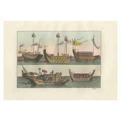
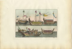
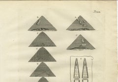
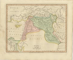
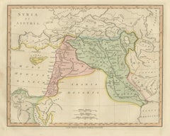
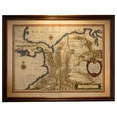
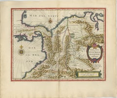
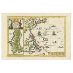
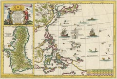
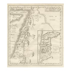
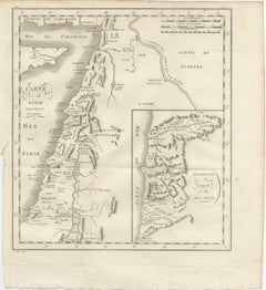
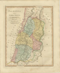
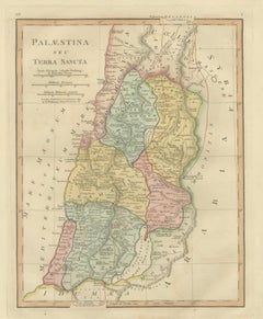
Ancient Syria & Assyria Map — Biblical Near East, Wilkinson London 1815
This finely engraved and original hand-colored antique map titled Syria et Assyria presents a detailed reconstruction of the ancient Near East, published in London in 1815 by the noted cartographer and publisher Robert Wilkinson. Created during the early nineteenth century’s renewed scholarly interest in classical and biblical geography, the map illustrates the historical landscapes of Syria, Mesopotamia, and surrounding regions as described by Greek, Roman, and early historical sources.
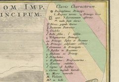
The map extends from the eastern Mediterranean coastline across the Levant and deep into Mesopotamia, encompassing territories that today include Syria, Lebanon, Israel, Iraq, and parts of Turkey and Iran. Regions such as Syria, Assyria, Babylonia, Chaldea, Mesopotamia, and Media are clearly defined through delicate original hand coloring, allowing viewers to distinguish ancient political and cultural divisions at a glance.
Important historical cities appear throughout the composition, including Damascus, Palmyra, Babylon, Nineveh, Antioch, and Jerusalem, alongside rivers fundamental to early civilization such as the Euphrates and Tigris. Cyprus is shown prominently offshore, reinforcing the map’s eastern Mediterranean context and trade connections of antiquity. Desert regions labeled *Arabia Deserta* evoke the classical geographic understanding of the Near Eastern frontier.
Wilkinson’s historical atlas sought not to depict contemporary borders but to visualize the ancient world itself — an intellectual endeavor shaped by Enlightenment scholarship, archaeology, and growing European fascination with biblical history. The elegant engraving style, restrained pastel palette, and balanced typography give the map both academic authority and refined decorative appeal.
Today, maps from Wilkinson’s classical atlas are highly appreciated for their clarity, historical atmosphere, and suitability for interior display, particularly in studies, libraries, or spaces inspired by classical or Middle Eastern history.
Condition: Good antique condition overall. Light age-related toning with scattered spotting and minor handling wear mainly to the margins. Plate mark visible.
Framing tips: Particularly striking in a dark walnut or warm gilt frame with an ivory mount. A generous mat enhances the subtle hand coloring and emphasizes the map’s panoramic horizontal composition.
Technique: Copperplate engraving with original hand color
Maker: Robert Wilkinson, London, 1815
Keywords:
Syria et Assyria map, ancient Syria map, Assyria antique map, Mesopotamia map, Babylonia, Chaldea, Media, Nineveh, Babylon, Damascus, Palmyra, Antioch, Jerusalem, Judea, Cyprus antique map...
Category
Early 19th Century British Antique Engraved Furniture