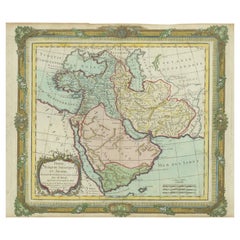
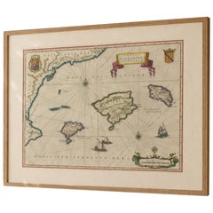
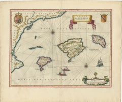
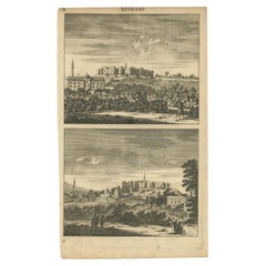
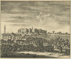
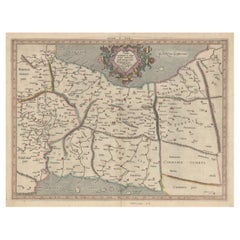
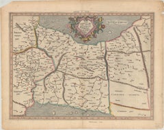
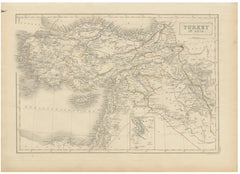
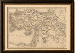
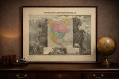
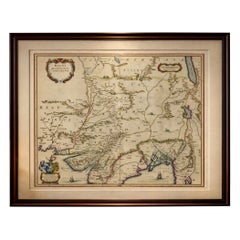
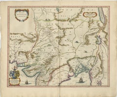
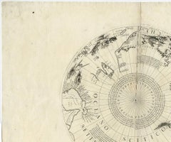
Imperial Mughal India Blaeu Map, Ganges Delta & Persia c.1642
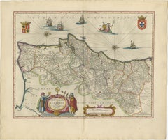
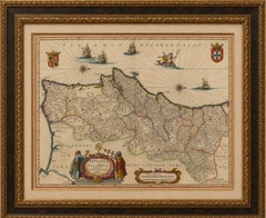
A richly detailed and highly decorative map of the Mughal Empire, centered on northern India and extending from Persia to the Ganges delta, engraved and published by Willem Jansz. Blaeu in Amsterdam around 1642. This impressive composition captures one of the most powerful and culturally significant regions of the early modern world at the height of the Mughal period.
The map presents a sweeping view of the Indian subcontinent, with the Indus and Ganges river systems clearly delineated, alongside a dense network of cities including Agra, Delhi, Lahore, and Patna. To the west, Persia and the surrounding regions are shown, while the eastern section reveals Bengal and the intricate river delta flowing into the Bay of Bengal.
Blaeu’s engraving is both precise and visually refined, enhanced by original hand coloring that highlights political boundaries, rivers, and coastal outlines. The composition is enriched with decorative elements including a bold title cartouche, a heraldic shield, and finely engraved ships navigating the seas. Subtle pictorial details such as animals and terrain further animate the landscape, offering insight into European perceptions of the Mughal world.
Published in the renowned Toonneel des Aerdrycx atlas, this map represents the pinnacle of Dutch Golden Age cartography. Maps of India and the Mughal Empire are particularly sought after due to their historical importance and strong decorative appeal.
A striking and historically significant piece, ideal for collectors of Asian cartography or as a sophisticated focal point in an interior.
Condition: Very good overall with strong original hand color. Central fold as issued. Light age toning and minor spotting in the margins. Plate mark visible.
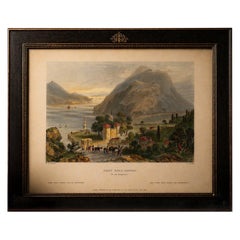
Framing tips: Beautiful in a dark walnut or ebonized frame with a wide ivory mat, allowing the cartouches and river systems to stand out clearly.
Technique: Copper engraving with original hand color
Maker: Willem Jansz. Blaeu, Amsterdam, circa 1642
Authenticity note:
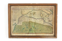
This is an original 17th-century engraving, not a reproduction. All items we offer are authentic period works of art over 100 years old. The map is sold unframed; any framed images are shown for presentation and interior inspiration only.
Keywords: India, Mughal Empire, Mogol, Hindustan, Ganges, Indus, Bengal, Persia, Pakistan, Afghanistan, Delhi, Agra, Lahore, Patna, Gujarat, Deccan, Orissa, Bengal delta, Bay of Bengal, Arabian Sea, Indian Ocean, Tibet, Kashmir, Kabul, Kandahar, Multan, Surat, Goa, Calcutta, Dhaka, Myanmar, Burma, Southeast Asia, Central Asia, Mughal India map, Mongolia, Blaeu India map, antique India map, Dutch Golden Age map, 17th century Asia, decorative cartouche, ships engraving, Asian trade routes, spice trade, VOC routes, historic India geography, collectors Asia map, interior wall map India, decorative antique map, historic Asia geography, European view of India, rare India map, museum quality map, hand colored map India, fine engraving India, classical cartography Asia, antique wall decor India, designer interior map, high end wall art India, Blaeu Mughal map...
Category
Mid-17th Century Dutch Antique Engraved Furniture