Maps on Sale
to
4,210
18
4,233
1
3
2
2
1
1
1
1
2,334
1,667
232
1
130
12
1
67
1
3
4
2
4,224
10
8
7
7
143
41
37
32
27
4,234
4,234
4,234
104
55
18
13
11
Sale Items
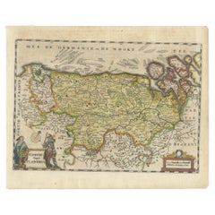
Antique Map of Flanders, Belgium, 1630
Located in Langweer, NL
Antique map titled 'Comitatus Flandria'. Original antique map of Flanders, Belgium. This map originates from 'Vyerige Colom verthonende de 17 Nederlandsche Provintien' published 1630...
Category
Antique 17th Century Maps
Materials
Paper
$429 Sale Price
20% Off
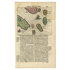
Antique 17th Century Map of the Islands Near Ceylon or Sri Lanka, 1672
Located in Langweer, NL
Antique map titled 'Eyland Ceylon.' Map of the islands near Ceylon or Sri Lanka. Dutch text on verso. Source unknown, to be determined.
Artists and Engravers: Philip Baldaeus (1632-...
Category
Antique 17th Century Maps
Materials
Paper
$238 Sale Price
20% Off
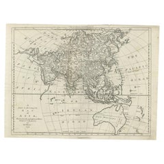
Antique Map of Asia and Australia with a Speculative Coastline, 1777
Located in Langweer, NL
Antique map titled 'A New & Accurate Map of Asia'. Detailed map of Asia and Australia, shows a still largely speculative Southern Australian coastline. Originates from Middleton's 'C...
Category
Antique 18th Century Maps
Materials
Paper
$401 Sale Price
20% Off
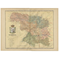
Zamora: A Mosaic of Romanesque Heritage and Natural Wonders in Spain, 1901
Located in Langweer, NL
This authentic antique print is a historical map of the province of Zamora, Spain, from the year 1901. The title on the map is "ZAMORA. 1901." As with the previous map, it displays t...
Category
Antique Early 1900s Maps
Materials
Paper
$305 Sale Price
20% Off
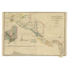
Antique Map of Central America Showing the Communication Lines, 1850
Located in Langweer, NL
Antique map titled 'Map of Central America Shewing the Different Lines of Atlantic & Pacific Communication'. A most unusual U.S. Government edition of this handsome map of Central Am...
Category
Antique 19th Century Maps
Materials
Paper
$1,671 Sale Price
20% Off
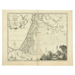
Antique Map of the Biblical Kingdom of Israel by Lindeman, c.1758
Located in Langweer, NL
Antique map titled 'De IVde Landkaart vertoonende het Koningryk Israels benevens deszelfs overheerde Landschappen (..).' Map of the biblical Kingdom of Israel under the Kings Saul, D...
Category
Antique 18th Century Maps
Materials
Paper
$236 Sale Price
20% Off
Antique Map of Kerguelens Island Coast by Cook, 1784
By James Cook
Located in Langweer, NL
Antique print titled 'Kerguelen's Land (..)'. Antique map of Kerguelens island coast, known today as the Desolation islands. Originates from 'A Voyage to the Pacific Ocean: Undertaken, by the Command of His Majesty, for Making Discoveries in the Northern Hemisphere (..)' published in Dublin.
Artists and Engravers: James Cook...
Category
Antique 18th Century Prints
Materials
Paper
$322 Sale Price
25% Off
Barados and St Christopher or St Kitts and Nevis Islands in the Caribbean, 1748
Located in Langweer, NL
This original map, a copperplate engraving by Le Rouge, presents two significant areas in the Caribbean. Titled "Isle St. Christophle une des Antilles aux anglois" and "La Barbade. d...
Category
Antique Mid-18th Century Maps
Materials
Paper
$343 Sale Price
20% Off
Antique Map of the Region of Batavia by Van Schley, c.1750
Located in Langweer, NL
Antique map titled 'Carte des environs de Batavia - Kaart van de Buitenstreken van Batavia'. Map of the Batavia area (Jakarta) in Indonesia. With cartouche, scale and compass rose. P...
Category
Antique 18th Century Maps
Materials
Paper
$160 Sale Price
20% Off
Antique Map of the Region Around the Baltic Sea by Cordier, c.1670
Located in Langweer, NL
Antique map titled 'Illyricum Orientis: In quo Partes II Moesia et Thracia'. Engraved map of the area west of the Baltic Sea, present day Bulgaria, Romania, and Turkey. The map is ba...
Category
Antique 17th Century Maps
Materials
Paper
Map of Constantinople, Bosphorus, the Coasts of Greece and the Archipelago, 1785
Located in Langweer, NL
This is a large 1785 map titled "Carte de la Ville de Constantinople et du Bosphore de Thrace", which includes detailed maps of Constantinople (modern-day Is...
Category
Antique 1780s French Maps
Materials
Paper
$1,751 Sale Price
40% Off
Cuenca 1901: A Historical Cartographic Detailing of High Plains and Mountains
Located in Langweer, NL
The original antique map displays the province of Cuenca, located in the autonomous community of Castilla-La Mancha in central Spain, as of 1901. Here are some of its features:
It i...
Category
Antique Early 1900s Maps
Materials
Paper
$276 Sale Price
20% Off
Anrtique Map of the Province of Valladolid, Central Spain, 1902
Located in Langweer, NL
A historical or archival map of the province of Valladolid, Spain, from the year 1902. Valladolid is a province located in the central part of Spain, within the autonomous community ...
Category
Antique Early 1900s Maps
Materials
Paper
$305 Sale Price
20% Off
Antique Print of the Feeding Chair of King James VI by Gibb, 1890
Located in Langweer, NL
Antique print titled 'Feeding Chair of King James VI'. Chromolithographic plate originating from 'The Royal House of Stuart. Illustrated By a Series of F...
Category
Antique 19th Century Prints
Materials
Paper
$81 Sale Price
20% Off
Antique Print of Hagley Hall in Worcestershire, England, ca.1770
Located in Langweer, NL
Antique print titled 'Principal Front of Hagley'. Main facade of Hagley Hall, Worcestershire.
Hagley Hall is a Grade I listed 18th-century house in Hagley, Worcestershire, the ho...
Category
Antique 18th Century Prints
Materials
Paper
$592 Sale Price
20% Off
Old Map of Asia Depicting Asia in the 6th through the 9th Centuries, ca. 1855
Located in Langweer, NL
Antique map Asia titled 'Asien vom VIten bis in die erste Haelfte des IXten Jahrhundert’s Zeit der grossfen Ausdehnung des Ralifen Reiches; des Reiche...
Category
Antique 19th Century Maps
Materials
Paper
$238 Sale Price
20% Off
Historical Map Depicting the Continent of Asia, 1882
Located in Langweer, NL
This 1882 map presents a meticulously detailed representation of the continent of Asia, a testament to the cartographic skills of the era. Published as a...
Category
Antique 1880s Maps
Materials
Paper
$275 Sale Price
30% Off
Albacete, Spain - 1902: A Cartographic Depiction of Landscape and Infrastructure
Located in Langweer, NL
Albacete, Spain - 1902: A Cartographic Depiction of Landscape and Infrastructure
An original and historical map of the province of Albacete, dated 1902, from the "Atlas Geográfico I...
Category
Antique Early 1900s Maps
Materials
Paper
$276 Sale Price
20% Off
Burgos 1902: Geographic Map of Castile's Historic Heartland in Spain
Located in Langweer, NL
The map of the province of Burgos in the autonomous community of Castile and León in Spain, dated 1902. It includes the following features:
The map highlights the varied terrain wit...
Category
Antique Early 1900s Maps
Materials
Paper
$276 Sale Price
20% Off
Antique Map of the Indonesian and Philippine Archipelagos by R. de Vaugondy
Located in Langweer, NL
Striking and highly detailed map of the region from Sumatra and Malaca and Southern China to the Philipines, New Guinea and Northern Australia, centered on Borneo. Includes a large i...
Category
Antique Mid-18th Century Maps
Materials
Paper
$1,112 Sale Price
20% Off
Antique Map of England & Wales by Wyld '1845'
Located in Langweer, NL
Antique map titled 'England & Wales'. Original antique map of England & Wales. This map originates from 'An Atlas of the World, Comprehending Se...
Category
Antique Mid-19th Century Maps
Materials
Paper
$134 Sale Price
24% Off
Antique Map of the World in 12 Globe Gores by Scherer, 'circa 1702'
Located in Langweer, NL
Antique map titled 'Typus Totius Orbis Terraquei Geographice Delineatus, Et Ad Usum Globo Materiali Superinducendus'. Beautiful example of Scherer's map of the World, configured in 12 globe gores. California is shown as an island. Fascinating Northwest Passage...
Category
Antique Early 18th Century Maps
Materials
Paper
$1,790 Sale Price
25% Off
Navarra in Cartographic Detail: A 1902 Map of the Crossroads of Northern Spain
Located in Langweer, NL
The original antique map for sale shows the Spanish province of Navarra as it was in 1902. Here's a brief description and a potential title for the map:
Description:
- The map detai...
Category
Antique Early 1900s Maps
Materials
Paper
$324 Sale Price
20% Off
Old Map of the Kingdom of Tonga, Also Known as the Friendly Islands, ca.1780
Located in Langweer, NL
Antique print, titled: 'Carte des Isles des Amis.'
Map of the Kingdom of Tonga, also known as the Friendly Islands, and one of the last hereditary monarchies. Cook named this gro...
Category
Antique 1780s Maps
Materials
Paper
$248 Sale Price
20% Off
Victorian Visions of the New World: A Detailed Tallis Map of North America, 1851
Located in Langweer, NL
The map presented here is an intricate example from the series of maps produced by John Tallis & Company. Tallis maps are known for their detailed and elaborate style, often includin...
Category
Antique 1850s Maps
Materials
Paper
$343 Sale Price
20% Off
Antique Map of New Zealand by A & C. Black, 1870
Located in Langweer, NL
Antique map titled 'New Zealand'. Original antique map of New Zealand with inset Maps of Australia, New Zealand and Tasmania. This map origi...
Category
Antique Late 19th Century Maps
Materials
Paper
$167 Sale Price
20% Off
Ávila in a Historical Map of 1902: A Geographic and Administrative Overview
Located in Langweer, NL
The map is of the province of Ávila, one of the provinces of the autonomous community of Castile and León in Spain, and it is dated from 1902. The map illustrates several geographic ...
Category
Antique Early 1900s Maps
Materials
Paper
$276 Sale Price
20% Off
Original Antique Map Showing the Mountain Ranges in Asia and Europe, 1849
Located in Langweer, NL
Antique map titled 'Bergketten in Asien und Eüropa'. Original antique map showing the mountain ranges in Asia and Europe. In outline color with inset maps of Java, Luzon, and Reguain...
Category
Antique 1840s Maps
Materials
Paper
$267 Sale Price
20% Off
Antique Map of the Burgundy Region by Merian '1646'
Located in Langweer, NL
Antique map titled 'Utriusque Burgundiae tum Ducatus tum Comitatus descriptio'. Old map of the Burgundy (Bourgogne) region of France. This map originates from 'Neuwe Archontologia co...
Category
Antique Mid-17th Century Maps
Materials
Paper
$238 Sale Price
20% Off
1864 Johnson's Map of the West Indies and Bermuda
Located in Langweer, NL
Title: 1864 Johnson's Map of the West Indies and Bermuda
Description: This is an 1864 map titled "Johnson's West Indies," published by Johnson and Ward. The map provides a detailed ...
Category
Antique 1860s Maps
Materials
Paper
$305 Sale Price
20% Off
Antique Map of Paraguay by A. Montanus, circa 1671
By Arnoldus Montanus
Located in Langweer, NL
Antique map titled 'Paraquaria Vulgo Paraguay Cum adjacentibus'. Antique map extending from Rio de Janiero to the Rio de la Plata basin. The map include...
Category
Antique Mid-17th Century Maps
Materials
Paper
$572 Sale Price
20% Off
Antique Bird's-Eye Plan of Tutecoryn (Tuticorin or Thoothukudi), India, 1672
Located in Langweer, NL
Antique map, titled: 'Tutecoryn.'
Bird's-eye plan of map of Tutecoryn (Tuticorin or Thoothukudi), India. This map originates from 'Naauwkeurige Beschryvinge van Malabar en Choroman...
Category
Antique 1670s Maps
Materials
Paper
$343 Sale Price
20% Off
Antique Map of Greece and Ionian Islands by A & C. Black, 1870
Located in Langweer, NL
Antique map titled 'Hellas or Greece'. Original antique map of Greece and Ionian Islands with inset map of Corfu. This map originates from ‘Black's General Atlas of The World’. Publi...
Category
Antique Late 19th Century Maps
Materials
Paper
$167 Sale Price
20% Off
Large Scale Map of Greece, Extending to Cythera with Inset of Macedonia, ca.1786
Located in Langweer, NL
Antique map titled 'Graeciae Antiquae'.
Large scale map of Greece, extends south to the island of Cythera. Inset map shows details of Macedonia. Pu...
Category
Antique 1780s Maps
Materials
Paper
$592 Sale Price
20% Off
Large Sea Chart of the Zuyder Zee & The Northsea with the Wadden Islands, 1773
By H. van Loon
Located in Langweer, NL
The copper engraving by Herman van Loon, published by Pieter Mortier in 'Le Neptune François' in Amsterdam, is a remarkable piece within the realm of seventeenth-century cartography....
Category
Antique Late 18th Century Maps
Materials
Paper
$1,169 Sale Price
30% Off
Antique Map of Alentejo: Land of Tradition and Tranquility, 1903
Located in Langweer, NL
The image is a historical original antique map of the Alentejo region in Portugal. This map includes the topographical layout of the region, with its complex network of roads and wat...
Category
Antique Early 1900s Maps
Materials
Paper
$372 Sale Price
20% Off
Interesting Map of Great Britain and Northern Europe with various Illustrations
Located in Langweer, NL
Antique map titled 'Itinera Varia Auctoris'. Very interesting map of Great Britain and Northern Europe. The map shows Edwards' journeys between 1716-1730 to study his beloved birds a...
Category
Antique Mid-18th Century Maps
Materials
Paper
$420 Sale Price
20% Off
Antique Map of the Malay Archipelago by Walker, 1911
Located in Langweer, NL
Antique map titled 'Malay Archipelago'. Old map of the Malay Archipelago including Borneo, Celebes, New Guinea, Java, Timor and others. This map ...
Category
Early 20th Century Maps
Materials
Paper
$85 Sale Price
20% Off
Original Antique Map of the Region of Picardy, France, ca.1602
Located in Langweer, NL
Antique map titled 'Picardiae Belgicae regionis descriptio'.
Original antique map of the region of Picardy, France. Superb example of the decorative style of Ortelius and filled ...
Category
Antique Early 1600s Maps
Materials
Paper
$620 Sale Price
20% Off
Original Steel Engraved Map of French Colonies in America, 1854
Located in Langweer, NL
Antique map titled 'Colonies Francaises (en Amerique)'. Detailed map bordered by vignettes showing local animals, produce and activities of the various French Colonies in America. Th...
Category
Antique Mid-19th Century Maps
Materials
Paper
$305 Sale Price
20% Off
Antique Map of the Netherlands by Brugsma, 1864
Located in Langweer, NL
Antique map titled 'Het Koningrijk der Nederlanden'. Map of the Netherlands. This map originates from 'F. C. Brugsma's Atlas van het Koninkrijk ...
Category
Antique 19th Century Maps
Materials
Paper
$94 Sale Price
20% Off
Antique Map of Southern Asia, the East Indies and the Indian Ocean, ca.1840
Located in Langweer, NL
Original antique map of Southern Asia, the East Indies and the Indian Ocean. Also shows part of Australia. Published circa 1840.
Artists and Engravers: ...
Category
Antique 1840s Maps
Materials
Paper
$305 Sale Price
20% Off
Antique Map of Peloponnesus, Greece by Pierre Antoine Tardieu, 1797
Located in Langweer, NL
This antique map, titled "Carte Ancienne d'Allemagne," represents ancient Germany and surrounding regions. It was published by the well-known Parisian mapmakers and publishers Jean-Baptiste-Louis Clouet and Alexandre Aimé Vuillemin in the late 18th century, specifically in 1787.
The map covers the extensive geographical area of ancient Germany, highlighting various tribes and regions known at the time. Key features include:
1. **Geographical Boundaries**: The map outlines the territorial extents of ancient Germany, bordered by Gallia (France) to the west, Sarmatia (parts of Eastern Europe) to the east, and the Italian regions to the south. The northern boundary reaches the Oceanus Germanicus (North Sea) and the Sarmatian Sea (Baltic Sea).
2. **Tribal Regions**: It details numerous ancient Germanic...
Category
Antique 1790s Maps
Materials
Paper
$324 Sale Price
20% Off
Old Map of the Russian Empire, with English Language Text, Ca.1820
Located in Langweer, NL
Antique map titled 'Geographical, Statistical and Historical Map of Russia'.
Old map of the Russian Empire, encompassed on three sides by English language text. Originates from L...
Category
Antique 1820s Maps
Materials
Paper
$515 Sale Price
20% Off
Antique Map of Barradeel, a County in Friesland, The Netherlands, 1868
Located in Langweer, NL
Antique map titled 'Provincie Friesland - Gemeente Barradeel or Barradiel. Map of the township Barradeel including Sexbierum, Harlingen and many other villages. This map originates f...
Category
Antique 19th Century Maps
Materials
Paper
$133 Sale Price
20% Off
Antique Map of Germany by Johnston '1909'
Located in Langweer, NL
Antique map titled 'Empire of Germany'. Original antique map of Germany. With inset maps of Frankfurt and Munich. This map originates from the ‘...
Category
Early 20th Century Maps
Materials
Paper
$238 Sale Price
20% Off
Antique Map of Fortification of Bellingwolderschans, The Netherlands, 1673
Located in Langweer, NL
Antique map titled 'Bellingwolderschans'. Original map of the fortification of Bellingwolderschans, the Netherlands. This map originates from 'Teatro del Belgio', by G. Gualdo Priora...
Category
Antique 17th Century Maps
Materials
Paper
$191 Sale Price
20% Off
Old Map of the Western Region of the Kingdom of Algiers, Algeria, 1773
Located in Langweer, NL
Antique map titled 'Kaart van het Westelyk Gedeelte van het Ryk van Algiers'.
Old map of the western region of the Kingdom of Algiers, Algeria. Originates from the first Dutch ed...
Category
Antique 1770s Maps
Materials
Paper
$362 Sale Price
20% Off
Antique Map of the Arabian Peninsula by Bonne 'c.1780'
Located in Langweer, NL
Antique map titled 'Carte de l'Arabie, du Golfe Persique, et de la Mer Rouge (..)'. Original antique map of the Arabian Peninsula, including the horn...
Category
Antique Late 18th Century Maps
Materials
Paper
$525 Sale Price
20% Off
Antique Map of the Mediterranean and the Persian Gulf by Danckerts, c.1718
Located in Langweer, NL
Antique map titled 'De Gelegentheyt Van't Paradys en 't Landt Canaan.' Dutch Bible map covering the region between the Mediterranean and the Persian Gulf, f...
Category
Antique 18th Century Maps
Materials
Paper
$390 Sale Price
20% Off
Imperial Frontiers: A 19th Century Map of Southern Russia and the Caucasus, 1882
Located in Langweer, NL
This map, sourced from the comprehensive 1882 atlas by Blackie & Son, delineates the southern part of Russia and the Caucasus region, reflecting the geopolitical contours and topogra...
Category
Antique 1880s Maps
Materials
Paper
$305 Sale Price
20% Off
Antique Print of Kupang or Koepang in the East Indies, Now West-Timor, Indonesia
Located in Langweer, NL
Antique print Timor titled 'De Stad Koepang, La Ville de Koepang'. View of the town of Koepang / Concordia / Kupang on the Island of Timor, Indonesia. Originates from 'Gezigten uit Neerlands Indie, naar de natuur geteekend en beschreven.', by C.W.M. van de Velde, published in Amsterdam, Frans Buffa en Zonen (1844-1845).
Artists and Engravers: Charles William Meredith van de Velde (1818-1898) was a Dutch...
Category
Antique 19th Century Prints
Materials
Paper
$391 Sale Price
20% Off
Antique Map of the Region of Namen by Veelwaard, c.1840
Located in Langweer, NL
Antique map titled 'Kaart van Namen'. Original antique map of the region of Namen (Namur), Belgium. Source unkown, to be determined. Published circa 1840.
Artists and Engravers:...
Category
Antique 19th Century Maps
Materials
Paper
$119 Sale Price
20% Off
Beautiful Decorative Hand-Colored Antique Map of West Canada, 1851
Located in Langweer, NL
Description: Antique map of Canada titled 'West Canada'.
With decorative vignettes titled Kingston and Falls of Niagara. Originates from 'The Illustrated Atlas, And Modern History Of The World Geographical, Political, Commercial & Statistical, Edited By R. Montgomery Martin'. Published; John Tallis London, New York, Edinburgh & Dublin. 1851.
Drawn and Engraved by J. Rapkin.
Artists and Engravers: John Tallis (1817-1876) was a British map...
Category
Antique 1850s Maps
Materials
Paper
$907 Sale Price
20% Off
Detailed Antique Map of the Region of Gujarat and Mumbai in India, C.1825
Located in Langweer, NL
Antique map titled 'No. 93 Guzerate, Chandeish et Aurungabad'. Detailed map of the region of Gujarat and the region of Mumbay. Originates from 'Atlas Universel' by P.M. Vandermaelen....
Category
Antique 19th Century Maps
Materials
Paper
$467 Sale Price
20% Off
Old Engraving of The Catching of Horses on Jafnapatnam, Ceylon 'Sri Lanka', 1672
Located in Langweer, NL
Antique print, titled: 'Paardevangst op Jafnapatnam' - This plate shows the catching of horses on Jafnapatnam. The province of Jaffna , and specially the fort at Jaffnapatnam were th...
Category
Antique 1670s Prints
Materials
Paper
$506 Sale Price
20% Off
Original Antique Print of Decorative Art in the Middle Ages, 1869
Located in Langweer, NL
Old print of decorative art in the Middle Ages. This print originates from 'L'Ornement polychrome'. A beautiful work containing about...
Category
Antique 19th Century Prints
Materials
Paper
$143 Sale Price
20% Off
Original Old Composite of Several Maps of the Ancient World on One Sheet, 1880
Located in Langweer, NL
This original antique map is from Karl Spruner von Merz's "Atlas Antiquus", later edited by Theodorus Menke. The map is a detailed depiction of the ancient world. The atlas it comes ...
Category
Antique 1880s Maps
Materials
Paper
$352 Sale Price
20% Off
Antique Map of the Region of Sarlat in France by Janssonius, 1657
By Johannes Janssonius
Located in Langweer, NL
Antique map of France titled 'Le Diocese de Sarlat dioccesis Sarlatensis'. Decorative map of the Sarlat region, part of the Dordogne department. This map originates from 'Atlas Novus...
Category
Antique 17th Century Maps
Materials
Paper
$525 Sale Price
20% Off
Johannes Janssonius' 17th-Century Map of the Duchy of Bremen in Germany
Located in Langweer, NL
The map titled "Ducatus olim Episcopatus Bremensis et ostiorum Albis et Visurgis Fluviorum novissima Descriptio" by Johannes Janssonius provides a rich historical and geographical il...
Category
Antique 1650s Maps
Materials
Paper
$735 Sale Price
20% Off
Recently Viewed
View AllMore Ways To Browse
Statutes And Sculptures
Swedish Gustavian Glass Cabinet
Swiss Chalet Chairs
Tea Cup Art Nouveau
Tea Cup Holder
Teak Buddha
Teak Gentlemans
Thomasville Hollywood Regency
Thomire Clock
Three Legged Vessel
Three Tier Serving Trays
Tibet Earring
Tibetan Antique Cabinet
Tiffany And Co China
Tiffany Blue Rims
Tiffany Sterling Ice Tea Spoons
Torchiere Sculpture
Tortoise Christian Dior
