
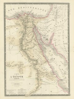
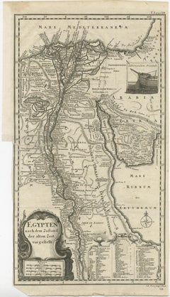
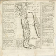
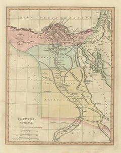
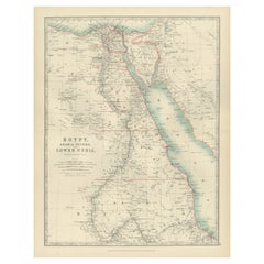
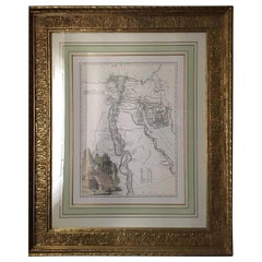
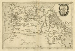
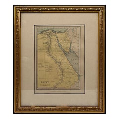
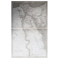
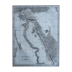
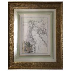
Antique Map of Egypt, '1875'
Located in Langweer, NL
Antique map titled 'Carte des l'Égypte'. Large map of Egypt. This map originates from 'Atlas de
Category
Antique Late 19th Century Maps
Materials
Paper
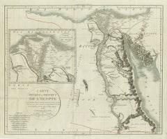
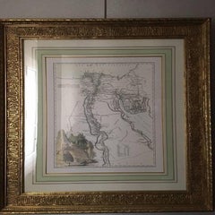
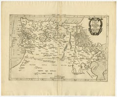
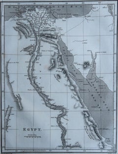
Antique Map of Egypt, '1875'
Located in Langweer, NL
Antique map titled 'Carte des l'Égypte'. Large map of Egypt. This map originates from 'Atlas de
Paper

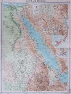
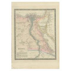
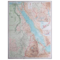
Large Original Vintage Map of Egypt, circa 1920
Located in St Annes, Lancashire
Great map of Egypt Unframed Original color By John Bartholomew and Co. Edinburgh Geographical
Paper

$244Sale Price|25% Off
H 10.63 in W 9.85 in D 0.02 in
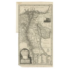
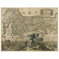
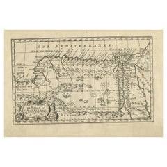
Original Antique Map of Egypt by Van Dùren '1749'
Located in Langweer, NL
rare original antique map of Egypt. This map originates from 'Neue Sammlung der merkwürdigsten
Paper
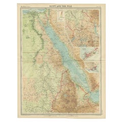
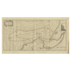
Antique Map of Egypt and the Nile River
Located in Langweer, NL
detailed map of Egypt features hundreds of place names along the Nile. The Sinai Peninsula is shown with a
Paper

$94Sale Price|20% Off
H 9.65 in W 12.21 in D 0.02 in
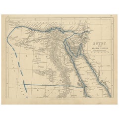
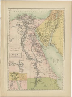
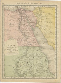
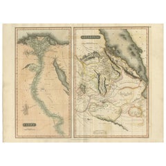
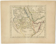
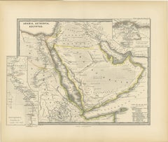
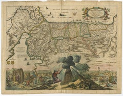
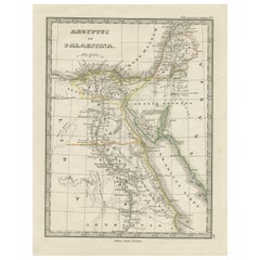
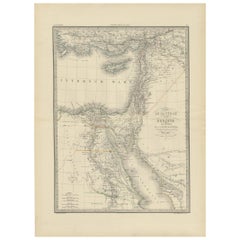
Antique Map of Egypt and Arabia Petraea by Lowry, '1852'
Located in Langweer, NL
Antique map titled 'Egypt and Arabia Petrea'. Original map of Egypt and Arabia Petraea. This map
Paper
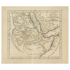
Antique Map of Egypt and Abyssinia by W. G. Blackie, 1859
Located in Langweer, NL
Antique map titled 'Egypt and Abyssinia'. Original antique map of Egypt and part of Nubia and Nubia
Paper

$144Sale Price|30% Off
H 17.52 in W 13 in D 0.02 in
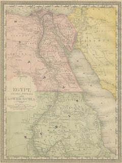
Antique Map of Egypt and Arabia Petraea by A & C. Black, 1870
Located in Langweer, NL
Antique map titled 'Egypt and Arabia Petraea'. Original antique map of Egypt and Arabia Petraea
Paper

$222Sale Price|24% Off
H 24.41 in W 19.49 in D 0.02 in
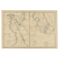
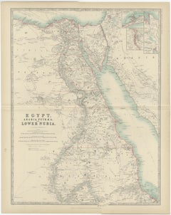
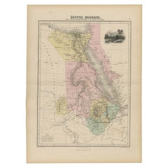
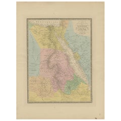
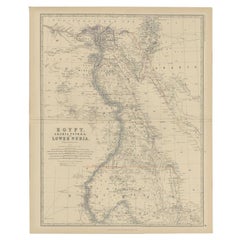
Antique Map of Egypt, Arabia Petraea and Lower Nubia by Johnston '1909'
Located in Langweer, NL
Antique map titled 'Egypt, Arabia Petraea and Lower Nubia'. Original antique map of Egypt, Arabia
Paper

$953Sale Price|30% Off
H 23.04 in W 31.74 in D 0 in
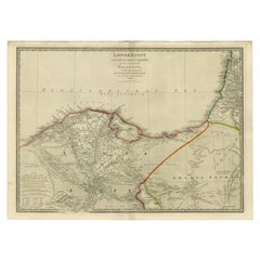
Large Antique Map of Egypt and the Nile Delta by Wyld, 1854
Located in Langweer, NL
Antique map titled 'Lower Egypt and the adjacent desert, with a part of Palestine to which has been
Paper
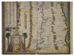
Antique Map of Egypt and the Nile Valley with City Index, 1715
Located in Langweer, NL
Antique map of Egypt, titled "Essay d'une Carte d'Égypte Fait au Caire en 1715". This finely
Paper

$544
H 20.56 in W 25.6 in D 0.01 in
Antique Map of Egypt with Detailed Inset of the Nile Delta, ca. 1799
Located in Langweer, NL
Antique Map of Egypt with Detailed Inset of the Nile Delta, ca. 1799 This finely engraved antique
Paper

$151Sale Price|20% Off
H 14.38 in W 18.31 in D 0.02 in
Antique Map of Egypt and Palestina by H. Kiepert, circa 1870
By Heinrich Kiepert
Located in Langweer, NL
Antique map titled 'Aegyptus, Phoenice et Palestina'. With inset maps of Tyrus, Alexandria and
Paper
$865Sale Price|25% Off
H 27.56 in W 24.41 in D 0.99 in
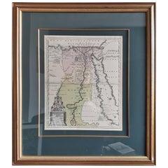
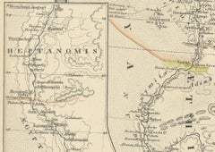
Original Antique Map of Egypt in Frame by C. Weigel, circa 1720
Located in Langweer, NL
The map is an antique depiction of ancient Egypt, divided into its regions and nomes, also
Paper

$272
H 18.71 in W 13.59 in D 0 in
Antique Map of The Nile, Egypt, Nubia and Abyssinia and Inset of Jerusalem, 1880
Located in Langweer, NL
Antique map titled 'Égypte Moderne'. Old map of Egypt, Nubia and Abyssinia (Ethiopia), Kordofan and
Paper


$426Sale Price|20% Off
H 26.78 in W 19.89 in D 0.01 in
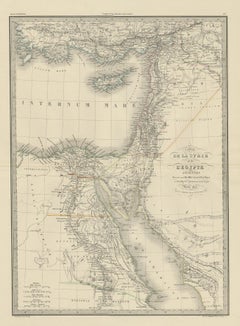
Large Antique Map of the Lower Nile Valley Including Egypt and Nubia, 1842
Located in Langweer, NL
Antique map titled 'Carte de l'Égypte, de la Nubie, de l'Abissinie'. Map of Egypt, covering the
Paper
$817
H 12.72 in W 19.49 in D 0 in
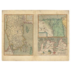
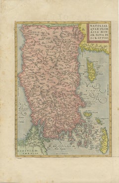
Antique Map of Asia Minor, Egypt & Carthage – Ortelius Theatrum 1572
Located in Langweer, NL
Antique Map of Asia Minor, Egypt & Carthage – Ortelius Theatrum 1572 This rare and beautifully
Paper
$461
H 27.64 in W 20.91 in D 0.01 in
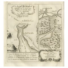
Egypt & Red Sea Antique Map – Detailed 1865 Chart of Nubia and Nile Regions
Located in Langweer, NL
Antique Map of Egypt, Nubia & Red Sea Coast – Andriveau-Goujon, Paris 1865 This delicately colored
Paper
$461
H 14.18 in W 10.44 in D 0.01 in
Egypt & Lower Nubia – Elegant Antique Atlas Map of the Nile, ca.1888
Located in Langweer, NL
Egypt & Lower Nubia – Elegant Antique Atlas Map of the Nile, ca.1888 This elegant antique atlas
Paper
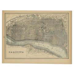

Rare Antique Map of Calcutta 'Kolkata' in India, 1893
Located in Langweer, NL
Antique map titled 'Calcutta (India)'. Old map of Calcutta/Kolkata, India. On verso, a map of Egypt
Paper
$416Sale Price|20% Off
H 17.41 in W 11.19 in D 0.02 in
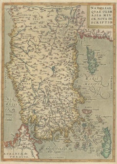
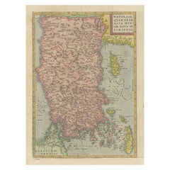
Asia Minor – Antique Map of Natolia by Ortelius, Theatrum Orbis Terrarum c.1600
Located in Langweer, NL
maps (of Egypt and Carthage), this example has been trimmed to feature the Natolia map alone
Paper

$414
H 13.47 in W 11.03 in D 0.01 in
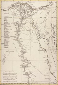
Aegyptus Antiqua — Ancient Egypt Classical Map of the Nile, Wilkinson 1823
Located in Langweer, NL
Aegyptus Antiqua — Ancient Egypt Classical Map of the Nile, Wilkinson 1823 This finely engraved
Paper
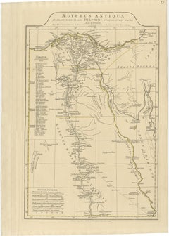
$686
H 20.6 in W 16.34 in D 0.01 in
Antique Map of Ancient Egypt – Nile Valley & Red Sea, Engraving c.1818
Located in Langweer, NL
Antique Map of Ancient Egypt – Nile Valley & Red Sea, Engraving c.1818 Elegant antique map
Paper
$651
H 21.26 in W 28.15 in D 0.01 in
Egypt & Abyssinia – Original Nile Valley and Horn of Africa Maps, c.1817
Located in Langweer, NL
Egypt & Abyssinia – Nile Valley and Horn of Africa Maps, c.1817–1820 This refined early 19th
Paper
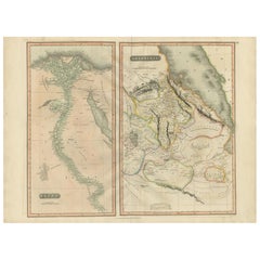
$663
H 21.26 in W 28.15 in D 0.01 in
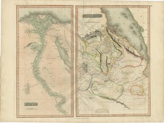
Egypt and Abyssinia – Nile Valley & Horn of Africa Maps, c.1817–1820
Located in Langweer, NL
Egypt and Abyssinia – Nile Valley & Horn of Africa Maps, c.1817–1820 This refined early 19th
Paper
$461
H 11.03 in W 13.47 in D 0.01 in
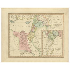
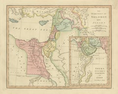
The Dominions of Solomon — Biblical Map of the Ancient Near East and Egypt, 1827
Located in Langweer, NL
The Dominions of Solomon — Biblical Map of the Ancient Near East and Egypt, London 1827 This
Paper
$360Sale Price|20% Off
H 8.59 in W 12.8 in D 0 in
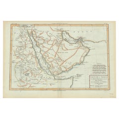
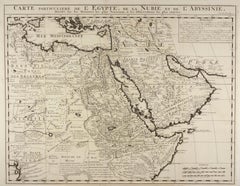
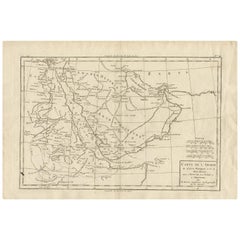
Old Map of the Arabian Peninsula with Parts of Egypt, Sudan, Eritrea & Ethiopia
Located in Langweer, NL
du Globe Terrestre This handsome map of the Arabian Peninsula extends to show parts of Egypt, Sudan
Paper
$544
H 7.88 in W 11.74 in D 0.01 in
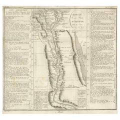
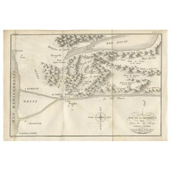
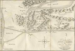
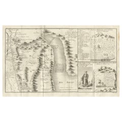
Antique Map of the Route of the Hebrews – Egypt to the Red Sea, 1720
Located in Langweer, NL
Map of the Route of the Hebrews – Egypt to the Red Sea, 1720 This finely engraved 18th-century map
Paper

$225
H 23.23 in W 17.92 in D 0 in
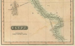
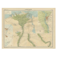
Antique Map of Lower Egypt, Showing Port Said, Suez and Surroundings, 1922
Located in Langweer, NL
Antique map of Africa titled 'Lower Egypt '. Old map of Africa depicting Egypt, Port Said, Suez
Paper

$213Sale Price|20% Off
H 5.63 in W 5.12 in D 0 in
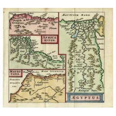
Antique Map of North Africa showing Egypt, Mauritania and Africa Minor, 1672
Located in Langweer, NL
, showing Egypt, Mauritania and Africa Minor. This map originates from the pocket atlas 'Introductionis in
Paper

$580
H 11.62 in W 16.93 in D 0.01 in
Antique Map of the Red Sea & Basse Thebaide with Monastery Plans, Egypt, 1777
Located in Langweer, NL
Antique Map of the Red Sea & Basse Thebaide with Monastery Plans, Egypt, 1777 This finely detailed
Paper

Antique Map of The Nile, Egypt and the Red Sea by Bachiene, 1765
Located in Langweer, NL
of Biblical Egypt and the Red Sea. With title cartouche, compass rose and scale. This map originates
Paper
$414
H 8.67 in W 10.24 in D 0 in
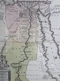
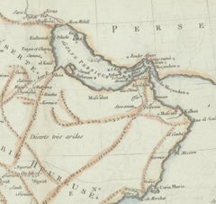
Antique Map of Abyssinia, Sudan and the Red Sea, Arabia and Egypt South, 1749
Located in Langweer, NL
Antique map titled 'Nubie, Abissinie et Cote d'Ajan'. Map of Abyssinia, Sudan and the Red Sea by
Paper
$331
H 18.51 in W 14.49 in D 0.01 in
Egypt and Lower Nubia, 1903 - Historical Map Highlighting Nile and Red Sea
Located in Langweer, NL
Egypt and Lower Nubia, 1903 - Historical Map Highlighting Nile and Red Sea This beautifully
Paper
$1,302
H 19.49 in W 22.45 in D 0 in
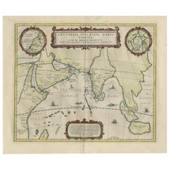
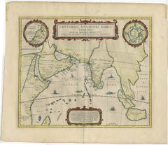
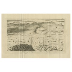
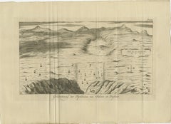
Old Map of Ancient Times covering Egypt Towards Arabia and India to Java, c.1660
Located in Langweer, NL
Description: Antique map titled 'Erythraei Sive Rubri Maris Periplus olim ab arriano descriptus
Paper

$142Sale Price|20% Off
H 9.06 in W 11.23 in D 0.02 in
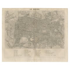
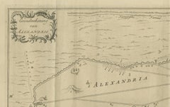
Antique Map of Cairo and Surroundings by Balbi '1847'
Located in Langweer, NL
Antique map titled 'Le Kaire'. Original antique map of Cairo and surroundings, Egypt. This map
Paper
$106
H 5.91 in W 10.2 in D 0.01 in
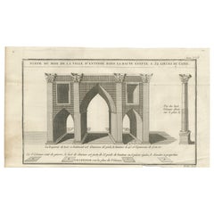
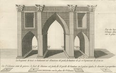
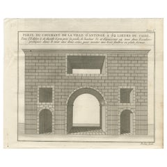
South Gate of Antinoë – Architectural Engraving, Upper Egypt, c.1790
Located in Langweer, NL
South Gate of Antinoë – Architectural Engraving, Upper Egypt, c.1790 This finely detailed 18th
Paper
Antique Map of the Region of the Nile River by Bartholomew, 1922
Located in Langweer, NL
Antique map of Africa titled 'Egypt and the Nile'. Old map of Africa depicting Egypt, the Nile
Paper
$445Sale Price|20% Off
H 15.56 in W 18.51 in D 0 in
Ancient Realms of Northeast Africa: Arabia, Ethiopia, and Egypt, Published 1880
Located in Langweer, NL
, and Egypt. Features that make this map interesting include: 1. **Geographical Span**: It covers a
Paper
$248
H 6.11 in W 7.49 in D 0.01 in
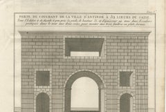
Western Gate of Antinoë, Egypt – Antique French Architectural Engraving, c.1790
Located in Langweer, NL
Western Gate of Antinoë, Egypt – Antique French Architectural Engraving, c.1790 This antique
Paper

$165
H 10.44 in W 8.27 in D 0.02 in
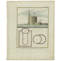
Antique Print of the Fortress at the Nile 'Damietta, Egypt' by C. Niebuhr, 1774
Located in Langweer, NL
the estuary of the Nile near Damietta, Egypt'. This print originates from 'Reisebeschreibung nach
Paper


$775
H 27 in W 21.38 in D 0.75 in
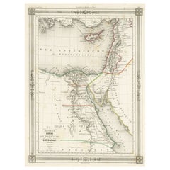
Map of the Holy Land "Carte de la Syrie et de l'Egypte" by Pierre M. Lapie
By Pierre M. Lapie
Located in Alamo, CA
An early 19th century map of ancient Syria and Egypt entitled "Carte de la Syrie et de l'Egypte
Paper
$1,200
H 13.5 in W 10.5 in D 4 in
19th Century English Victorian Illustrated National Family Bible with Gilt Pages
Located in Dallas, TX
original photographs taken expressly for this edition, and detailed hand-colored maps of Egypt, Canaan, and
Paper
$213
H 10.63 in W 14.77 in D 0.01 in
Antique Map of the Pyramids of Saqqara and Dahshur – Egypt, c.1770s
Located in Langweer, NL
Antique Map of the Pyramids of Saqqara and Dahshur – Egypt, c.1710s Description: This rare early
Paper
$272
H 10.63 in W 18.82 in D 0.01 in
Antique Map of Alexandria Egypt – Plan of Vetus & Nova, Inset of Patriarch Seat
Located in Langweer, NL
Antique Map of Alexandria Egypt – Plan of Vetus & Nova with Inset of Patriarch Seat This finely
Paper

$2,600
H 14 in W 14 in D 3 in
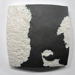
"Choke II: Straits of Tiran (Saudi Arabia & Sinai, Egypt)" - ceramic - map
By Gregor Turk
Located in Atlanta, GA
This ceramic wall sculpture features a topographic map in black and white. Gregor is inspired by
Ceramic

$1,975
H 21.5 in W 28 in D 0.75 in
Northern Italy: A 16th Century Hand-colored Map by Abraham Ortelius
By Abraham Ortelius
Located in Alamo, CA
of the world in 1564. Ortelius also published a map of Egypt in 1565, a map of the Holy Land, a plan
Engraving
$284
H 10.75 in W 9.85 in D 0.01 in
Monastery Maps of St. Paulus and St. Antonius in the Egyptian Desert – c.1776
Located in Langweer, NL
Monastery Maps of St. Paulus and St. Antonius in the Egyptian Desert – c.1776 Description: This
Paper


$775
H 27 in W 21.38 in D 0.75 in
Map of the Holy Land "Carte de la Syrie et de l'Egypte" by Pierre Lapie
By Pierre M. Lapie
Located in Alamo, CA
This is an early 19th century map of ancient Syria and Egypt entitled "Carte de la Syrie et de
Engraving
Map of Egypt in a Beautiful Orientalist Gold Leaf Frame
Located in Bordeaux, FR
Map of Egypt beautifully framed. Egypt, country located in the northeastern corner of Africa
Paper
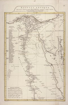
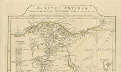
1784 Map of Egypt
Located in New York, NY
1784 D'Anville map of Ancient Egypt, full title: "AEgyptus Antiqua. Mandato Serenissimi Delphini
Engraving
Map of Egypt, Nubia and Part of Abyssinia
By Henri-Abraham Chatelain
Located in New York, NY
Original 1719 map by Henri Abraham Chatelain full title in French" Carte particuliere de l'Egypte
Engraving
Unavailable
H 17.33 in W 20.87 in
Ptolemaic map of North Africa, Libya, Egypt by Mercator - Engraving - 17th c
By Gerard Mercator
Located in Zeeland, Noord-Brabant
(…).' - A beautiful Ptolemaic map covering ancient North Africa, specifically Libya and part of Ethiopia but
Engraving
Unavailable
H 17.33 in W 20.87 in
Ptolemaic map of east Libya, Egypt and the Nile by Mercator - Engraving - 17th c
By Gerard Mercator
Located in Zeeland, Noord-Brabant
(…).' - A beautiful Ptolemaic map covering ancient eastern Libya and Egypt with numerous ancient place names
Engraving

Woman With Hat
By Leopold Dietmann
Located in Brussels & Antwerp, BE
and 1888 the first map of Egypt, Soudan and the Central African Republic of Tchad. In Paris, the

Sold
H 24.41 in W 21.07 in D 0 in
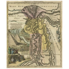
Antique Map of Egypt and the Nile River with Sphinx, Pyramids, Etc, c.1720
Located in Langweer, NL
Antique map titled 'Aegyptus Hodierna Ex itinerario Celeberrimi (..)'. Original antique map of
Paper

Antique Map of Egypt, John Bartholomew & Sons Ltd C. 1880
Located in Atlanta, GA
Egypt Map - The Edinburgh and Geographical Institute, John Bartholomew & Son LTD, W & R Chambers
Giltwood, Paper
Sold
H 17.72 in W 22.84 in D 0 in
Antique Map of the Departure of the Children of Israel for Egypt, 1669
Located in Langweer, NL
Antique map titled 'Sortie des Enfans D'Israel hors D'Egypte leur Passage Par la Mer Rouge
Paper

Rare Antique Map of Yam Suph, Egypt and Red Sea, 1773
Located in Langweer, NL
Antique print with two maps titled 'Uittreksel van de Kaart van Egipten en de Roode Zee' and
Paper
Sold
H 15.16 in W 19.1 in D 0.04 in
Aegypti Map - Original Etching by Abraham Ortelius - 1584
By Abraham Ortelius
Located in Roma, IT
Aegypti Map (Map of Egypt) is an original Artwork realized in 1584 by Abraham Ortelius (also Ortels
Watercolor, Etching

17th century Ancient and Modern Egyptian Map, 1762s
Located in LEGNY, FR
Very beautiful map of ancient and modern Egypt in French dating from 1762 very well framed by a
Paper
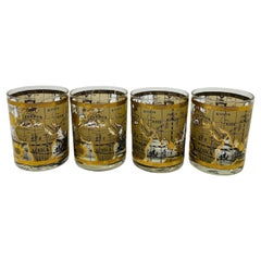
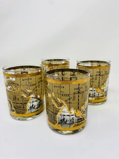
Vintage MCM Set of 4 Old World Maps Glasses by Cera
By Cera
Located in San Diego, CA
world maps in 22K gold are classic and inspiring. Glasses measure approximately 4.25” tall with a
Glass

Original Antique Map of Egypt, Arrowsmith, 1820
Located in St Annes, Lancashire
Great map of Egypt Drawn under the direction of Arrowsmith. Copper-plate engraving. Published by
Paper

Antique Map of Egypt by Wyld, '1845'
Located in Langweer, NL
Antique map titled 'Egypt'. Original antique map of Egypt. This map originates from 'An Atlas of
Paper

Large Original Vintage Map of Egypt, circa 1920
Located in St Annes, Lancashire
Great map of Egypt Unframed Original color By John Bartholomew and Co. Edinburgh Geographical
Paper
Sold
H 10.25 in W 8.25 in D 0.07 in
Original Antique Map of Egypt, Sherwood, Neely & Jones, Dated 1811
Located in St Annes, Lancashire
Great map of Egypt Copper-plate engraving by Cooper Published by Sherwood, Neely & Jones
Paper

Antique Map of Egypt and Eastern Libya, c.1680
Located in Langweer, NL
Antique map titled 'Royaume et Desert de Barca, et l'Aegypte (..)'. Map of Egypt and Eastern Libya
Paper

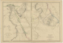
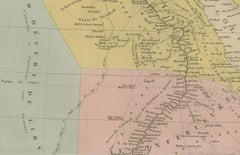
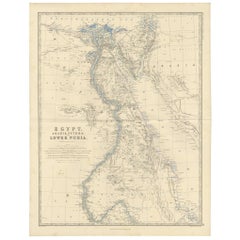
Antique Map of Egypt, Arabia and Lower Nubia, 1882
Located in Langweer, NL
Antique map titled 'Egypt, Arabia Petraea and Lower Nubia'. Old map of Egypt, Arabia and Lower
Paper

Antique Hand-Colored Map of Egypt and Palestine, 1848
Located in Langweer, NL
Egypt and Palestine. Here's a description of this map: - **Title**: Aegyptus et Palaestina - **Date
Paper

Sold
H 13.27 in W 10.24 in D 0.02 in
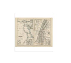
Antique Map of Egypt and Palestine, with Frame Style Border, 1852
Located in Langweer, NL
in the south, including various notable geographical features. The map includes Egypt with the Nile
Paper

Sold
H 24.41 in W 19.1 in D 0.02 in
Antique Map of Egypt, Araba Petraea and Lower Nubia by A.K. Johnston, 1865
Located in Langweer, NL
Antique map titled 'Egypt Arabia Petraea, and Lower Nubia'. Depicting Egypt, Arabia, Nubia, the Red
Paper
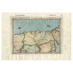

Antique Map of Early Egypt and the Nile Delta, Published in c.1598
Located in Langweer, NL
One of the earliest obtainable modern maps of Egypt and the Nile. Title and maker: Egitto Nuova
Paper


Sold
H 22.84 in W 17.92 in D 0 in
Antique Map of Ancient Egypt Also Depicting the Nile River and Red Sea, 1845
Located in Langweer, NL
Antique map Egypt titled 'General Karte von Alt Aegypten von A.H. Brué'. Large map of Egypt also
Paper

Sold
H 9.97 in W 14.69 in D 0.02 in
Antique Map of the Arabian Peninsula "Egypt, Nubia, Abyssinia" by R. Bonne
Located in Langweer, NL
A finely engraved and attractive late 18th century map of the Arabian peninsula (with Egypt, Nubia
Paper
Antique Map of Syria by Lapie, 1842
Located in Langweer, NL
Antique map titled 'Carte de la Syrie et de l'Egypte'. Map of Syria and Egypt. This map originates
Paper

Sold
H 16.62 in W 19.41 in D 0 in
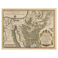
The Perigrination Showing Routes of the Israelites from Egypt to Jordan, ca.1725
Located in Langweer, NL
Antique map tited 'Kaarte van de Reize en Togten der Israeliten in de Woestyne sedert der zelver
Paper

Abraham Ortelius Map of Greece Hand Colored Engraving Circa 1579
By Abraham Ortelius
Located in Atlanta, GA
a map of Egypt and a map of the Holy Land, a large map of Asia followed. In 1568 the production of
Paper

Map of Egypt in a Beautiful Orientalist Gold Leaf Frame
Located in Bordeaux, FR
Map of Egypt beautifully framed.
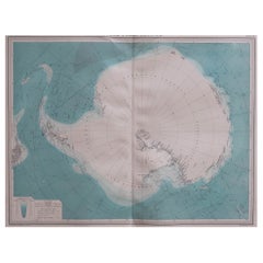
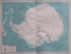
Large Original Vintage Map of the South Pole, circa 1920
Located in St Annes, Lancashire
Great map of the South pole. Unframed. Original color. By John Bartholomew and Co. Edinburgh Geographical Institute. Published, circa 1920.
Paper

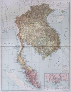
Large Original Vintage Map of S.E Asia, with a Vignette of Singapore
Located in St Annes, Lancashire
Great map of South East Asia Original color. Good condition Published by Alexander Gross Unframed.
Paper
Produced in 1843, the well-preserved volume is evidence of the author's exacting specifications.
New or old, the coverlets add old-time charm to any space.
Get into the games! These items celebrate the events, athletes, host countries and sporting spirit.
French trendsetter and serial collector Daniel Rozensztroch tells us about his obsession with objects related to seafaring men.
It's hard to resist the allure of a beautiful pool. So, go ahead and daydream about whiling away your summer in paradise.
The sought-after designer worked with the team at Hoffman Creative to produce a monograph that beautifully showcases some of Studio Shamshiri's most inspiring projects.
Italian writer and collector Umberto Pasti opens the doors to his remarkable cave of wonders in North Africa.
Hollywood A-listers, ex-pat aristocrats and art collectors and style setters of all stripes appreciate the allure of the coastal California hamlet — much on our minds after recent winter floods.