18th Century and Earlier Maps
to
2,336
2,863
64
2,930
26
12
1
1
2,930
2,261
475
3
290
34
10
126
10
37
9
2
5
4
3
3
2,916
30
20
3
3
293
110
72
53
43
2,930
2,930
2,930
59
21
13
12
12
Period: 18th Century and Earlier
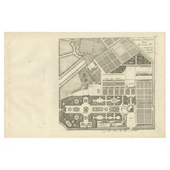
Pl. 20 Antique Print of a Garden Planted by Louis XV by Le Rouge, c.1785
Located in Langweer, NL
Antique print titled 'Nouveau Trianon planté par Louis XV'. Copper engraving showing a garden planted by Louis XV. This print originates from 'Jardins Anglo-Chinois à la Mode' by Geo...
Category
Antique 18th Century and Earlier Maps
Materials
Paper
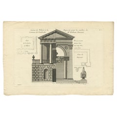
Pl. 10 Antique Print of a Garden Casino and Repository by Le Rouge, c.1785
Located in Langweer, NL
Antique print titled 'Casine de Wilton à la Comtesse de Pembroke (..)'. Copper engraving showing the casino of Pembroke and repository of Mr. Hotham Baronet. This print originates fr...
Category
Antique 18th Century and Earlier Maps
Materials
Paper
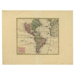
Very Attractive Map of North and South America and Western Part of Africa, 1744
Located in Langweer, NL
Antique map titled 'Nieuwe Kaart van America.' Very attractive map of North and South America, the western part of Africa and south west Europe. With full contemporary hand colouring...
Category
Antique 18th Century and Earlier Maps
Materials
Paper
$903 Sale Price
20% Off
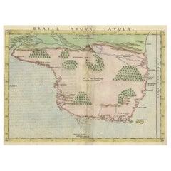
Original Antique Map of Brasil, Published in the 16th Century, 1561
Located in Langweer, NL
This important Ruscelli map of Brazil, from his work La Geografia di Claudio Tolomeo Alessandrino, is one of the earliest obtainable modern maps of the re...
Category
Antique 18th Century and Earlier Maps
Materials
Paper
$523 Sale Price
20% Off
Antique Plan of the City of Paita in Peru, by Anson, 1749
Located in Langweer, NL
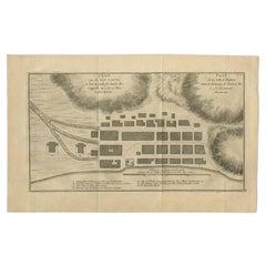
Antique map titled 'Plan van de Stad Paita in het Koninkryk Santa Fee (..) - Plan de la Ville de Paita (..)'. Original antique plan of the city of Paita, Peru. This map originates fr...
Category
Antique 18th Century and Earlier Maps
Materials
Paper
$256 Sale Price
20% Off
Attractive Original Map of the Province of Overijssel, the Netherlands, Ca.1700
Located in Langweer, NL
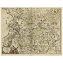
Antique print, titled: 'Transisalania Provincia vulgo Over-yssel.'
Attractive original handcoloured map of the province of Overijssel, The Netherlands. With beautiful title cartouc...
Category
Antique 18th Century and Earlier Maps
Materials
Paper
$891 Sale Price
40% Off
Antique Map of part of India, the Ganges and Hindustan
Located in Langweer, NL
Antique map titled 'Carte de l'Indoustan'. Original antique map of part of India, the Ganges and Hindustan. This map originates from 'Histoire Generale Des Voyages' by Antoine Franco...
Category
Antique 18th Century and Earlier Maps
Materials
Paper
$313 Sale Price
20% Off
Antique Map of South America by J. Cook, 1775
Located in Langweer, NL
Antique map titled 'Kaart van het Zuidlyk Eind van Amerika'. Map of the sourthern part of South America, focusing on Cook's tracks around the Cape Horn and T...
Category
Antique 18th Century and Earlier Maps
Materials
Paper
$808 Sale Price
20% Off
Original Antique Map Southeast of the Banda or Spice Islands, Indonesia, 1726
Located in Langweer, NL
Antique map titled 'Kaart van de Zuyd-Ooster Eylanden van Banda'.
Map of the southeastern part of the Banda islands. This map originates from 'Oud en Nieuw Oost-Indiën' by F. Valen...
Category
Antique 18th Century and Earlier Maps
Materials
Paper
$732 Sale Price
20% Off
Antique Map of Western and Eastern Barbary in Africa, c.1744
Located in Langweer, NL
Antique map titled 'A New & Accurate Map of the Western Parts of Barbary' and 'A New & Accurate Map of the Eastern Parts of Barbary'. Decorative maps of North Africa and the Southern...
Category
Antique 18th Century and Earlier Maps
Materials
Paper
Old Map Focusing on the Wine Region of Metz, the Moselle Region of France, 1657
Located in Langweer, NL
Antique map of France titled 'Territorium Metense'.
Old map focusing on the wine region surrounding Metz, in the Moselle region of France. This map originates from 'Atlas Novus, ...
Category
Antique 18th Century and Earlier Maps
Materials
Paper
$599 Sale Price
20% Off
Beautiful Antique Map of the Moluccas or Spice Islands, Indonesia, ca.1650
Located in Langweer, NL
Antique map titled 'Insularum Moluccarum Nova Descriptio.'
Beautiful map of the Moluccas. The famous Spice Islands, the cornerstone of the Dutc...
Category
Antique 18th Century and Earlier Maps
Materials
Paper
$704 Sale Price
20% Off
Original Antique Map of the City of Stavoren, Friesland, The Netherlands, 1649
Located in Langweer, NL
Antique map titled 'Staveren'. Original antique map of the city of Stavoren, Friesland, The Netherlands. This map originates from 'Toonneel der Steden van de Vereenighde Nederlanden'...
Category
Antique 18th Century and Earlier Maps
Materials
Paper
$903 Sale Price
20% Off
Detailed Map of Southern Holland, Incl the Hague, Rotterdam, Delft, Gouda, c1680
Located in Langweer, NL
Antique map titled 'Delflandia, Schielandia et circumjacentes Insulae ut Voorna, Overflackea, Goerea, Yselmonda et aliae.'
Detailed map of Southern Holland, which includes the ci...
Category
Antique 18th Century and Earlier Maps
Materials
Paper
$966 Sale Price
34% Off
Antique Map of Germany by Hederichs 'circa 1740'
Located in Langweer, NL
Antique map titled 'Germania'. Rare miniature map of Germany and surroundings. This map covers the entirety of those lands traditionally occupied by Germanic peoples, from the Blatic...
Category
Antique 18th Century and Earlier Maps
Materials
Paper
$237 Sale Price
20% Off
Antique Map of the City of Rotterdam by Guicciardini, C.1600
Located in Langweer, NL
Antique map titled 'Rotterdam'. Bird's eye view plan of Rotterdam in the province of Zuid-Holland, The Netherlands, Holland. This map originates from one of the editions of 'Discritt...
Category
Antique 18th Century and Earlier Maps
Materials
Paper
$375 Sale Price
20% Off
Antique Map of Upper Saxony in Germany by Tirion, circa 1740
By Isaak Tirion
Located in Langweer, NL
Antique map titled 'Nieuwe Kaart van de Opper Saxise Kreits (..).' Attractive detailed map showing Upper Saxony, Germany with Meissen, Thuringen, Anhalt, Brandenburg, Pommeren etc. S...
Category
Antique 18th Century and Earlier Maps
Materials
Paper
$456 Sale Price
20% Off
Antique Hand-Colored Print of the Common Hazel, 1758
Located in Langweer, NL
Antique print of the common hazel. Originates from 'Pomologia' by J. H. Knoop.
Artists and Engravers: Published by Johann Hermann Knoop (c.1700-1769).
Condition: Good, general ...
Category
Antique 18th Century and Earlier Maps
Materials
Paper
$313 Sale Price
20% Off
Antique Map of Africa with Mountain Ranges and other details
Located in Langweer, NL
Antique map titled 'Carte générale et Politique de l'Afrique'. Original antique map of Africa. Highlights numerous mountain ranges, lakes and rivers, regions, countries and places. P...
Category
Antique 18th Century and Earlier Maps
Materials
Paper
$761 Sale Price
20% Off
Original Antique Engraved Map of the Russian Empire, 1778
Located in Langweer, NL
Description: Antique map titled 'A New and Correct Map of the Russian Empire'.
Original antique map of the Russian Empire. This map originates from Moore's 'New and Complete Coll...
Category
Antique 18th Century and Earlier Maps
Materials
Paper
$523 Sale Price
20% Off
Detailed Antique Map of Southeast England, incl Warwickshire and Hampshire, 1690
Located in Langweer, NL
Antique map titled 'Orientalior districtus Regni Angliae (..)'.
Detailed map of southeast England encompassing the country from Lincolnshire and the Wash south and including Warw...
Category
Antique 18th Century and Earlier Maps
Materials
Paper
$808 Sale Price
20% Off
Antique Map of Great Britain and Ireland by Brion de la Tour, 1766
Located in Langweer, NL
Antique map titled 'Les Isles Britanniques (..).'
Attractive map of Great Britain surrounded by an engraved border printed from a separate coppe...
Category
Antique 18th Century and Earlier Maps
Materials
Paper
$523 Sale Price
20% Off
Bird’s-Eye View Map of Gallipoli: Fortified Ionian Gem by Mattheus Merian, 1688
Located in Langweer, NL
Bird’s-Eye View Map of Gallipoli: Fortified Ionian Gem by Mattheus Merian
Description:
This exquisitely detailed map of Gallipoli, crafted by the renowned engraver Mattheus Merian,...
Category
German Antique 18th Century and Earlier Maps
Materials
Paper
Antique Map of South East Asia, Australia and the Indian Ocean, 1726
By F. Valentijn
Located in Langweer, NL
Antique map titled 'Tabula Indiae Orientalis'.
Beautiful detailed map of Australia, Southeast Asia and the Indian Ocean. The map features a fine depiction of the outlines of the western two-thirds of Australia, based on the discoveries of explorers working for the Dutch East India Company (the VOC). These include Willem Jansz's discoveries in the Gulf of Carpentaria in 1606; the encounters of Dirk...
Category
Dutch Antique 18th Century and Earlier Maps
Materials
Paper
$6,853 Sale Price
20% Off
Attractive Detailed Authentic Map Showing Bavaria, Germany and Austria, c.1740
Located in Langweer, NL
Antique map titled 'Nieuwe Kaart van de Beyersche en Oostenryksche Kreits (..).' Attractive detailed map showing Bavaria, Germany and Austria. Source unknown, to be determined.
Ar...
Category
Antique 18th Century and Earlier Maps
Materials
Paper
$570 Sale Price
20% Off
Antique Map of Buru Island, Indonesia, c.1725
Located in Langweer, NL
Antique map titled 'Boero'. Original antique map of Buru island. With an inset of the lake on top of the inland mountain. This map originates from Valentyn's 'Oud en Nieuw Oost Indie...
Category
Antique 18th Century and Earlier Maps
Materials
Paper
$523 Sale Price
20% Off
Rare Map of the Philippines; Joseph Freewills Island & Mindanao South End, 1773
Located in Langweer, NL
Three charts on one sheet titled '1) A Dangerous Shoal 2) Joseph Freewills Island 3) The South End of Mindanao'.
It shows Captain Carteret's voyage: Saint George's Channel to Min...
Category
Antique 18th Century and Earlier Maps
Materials
Paper
$228 Sale Price
20% Off
Original Antique Engraving of the Creation of the World According to Mozes, 1725
Located in Langweer, NL
Antique map titled 'De Schepping der Wereldt volgens de Beschryving van Mozes' - This plate shows the creation of the world according to Moses. The upper depiction shows the world wi...
Category
Antique 18th Century and Earlier Maps
Materials
Paper
$627 Sale Price
20% Off
Original Antique Map of England and Wales, with Decorative Cartouche
Located in Langweer, NL
Antique map titled 'England and Wales from the best Authorities'. Original antique map of England and Wales, with decorative cartouche. Engraved by T. Conder. Published circa 1790.
Category
Antique 18th Century and Earlier Maps
Materials
Paper
$152 Sale Price
20% Off
Antique Plan of the Siege of Grave by Guicciardini, c.1608
Located in Langweer, NL
Antique map titled 'Hic est situs oppidi Grauiae (..)'. Bird's eye view plan of Grave, The Netherlands, Holland. Showing the siege of Grave in the year 1602. Source unknown, to be de...
Category
Antique 18th Century and Earlier Maps
Materials
Paper
$456 Sale Price
20% Off
Large Scale Map of Greece with Inset Map of Macedonia, c.1786
Located in Langweer, NL
Antique map titled 'Graeciae Antiquae'. Large scale map of Greece, extends south to the island of Cythera. Inset map shows details of Macedonia. Publis...
Category
Antique 18th Century and Earlier Maps
Materials
Paper
Old Bird's Eye View of the European Trading Posts at Sabi, Benin, Africa, 1748
Located in Langweer, NL
Antique print titled 'Vue des comtoirs Europeins de Xavier ou Sabi (..) - Gezigt der Europese Faktooryen, te Xavier of Sabi (..)'.
Bird's eye view of the European trading posts a...
Category
Antique 18th Century and Earlier Maps
Materials
Paper
$266 Sale Price
20% Off
Antique Map of Lower Silesia of The Famous Mapmaker Blaeu, c.1650
Located in Langweer, NL
Antique map titled 'Ducatus Silesiae Wolanus'. \
Antique map depicting lower Silesia with the cities of Wolow (Wohlau), Winsko (Winzig), Herrnstadt, Chobie (Koben), Lubin (Lüben), R...
Category
Antique 18th Century and Earlier Maps
Materials
Paper
$808 Sale Price
20% Off
Old Views of Cabo Santa Maria & Tierra del Fuego, Chile, 1749
Located in Langweer, NL
Antique print titled 'Kaap Sint Maria aan 't begin van de Straat Magellaan (..)'. Coastal views of Cabo Santa Maria and Tierra del Fuego on the Argent...
Category
Antique 18th Century and Earlier Maps
Materials
Paper
$180 Sale Price
30% Off
Antique Map of Eastern Mediterranean and Asia Minor by a Benedictine, c.1725
Located in Langweer, NL
Antique map titled 'Byzondere Afbeelding der Landschappen, van de Apostelen bevaren en doorwandelt om het Evangelium J. C. te Prediken.' Map of the lands travelled by the Apostles to...
Category
Antique 18th Century and Earlier Maps
Materials
Paper
$285 Sale Price
20% Off
Antique Map of the Diocese of Toul by Covens & Mortier, circa 1720
Located in Langweer, NL
Antique map titled 'Civitas Leucorum sive Pagus Tullensis'. Detailed map of the Diocese of Toul, France. Centered on the cities of Nancy and Toul and including Metz, Verdun, S. Dizie...
Category
Antique 18th Century and Earlier Maps
Materials
Paper
$689 Sale Price
20% Off
Antique Map of the Mongol Empire, 1767
Located in Langweer, NL
Antique map titled 'The Moguls Empire divided into its principal governments'. Old map of India, Bangladesh, and parts of eastern China.
Artists and Engravers: Published in the G...
Category
Antique 18th Century and Earlier Maps
Materials
Paper
$98 Sale Price
20% Off
Antique Map of France under the Reign of Philip II by Zannoni, 1765
Located in Langweer, NL
Antique map France titled 'Carte de l'accroissement du Domaine sous Philippe Auguste (..)'. Beautiful old map of France. This map originates from 'Atlas Historique de la France Ancie...
Category
Antique 18th Century and Earlier Maps
Materials
Paper
$140 Sale Price
20% Off
Decorative Antique Sea Chart of Zeeland, a Province of the Netherlands, ca.1730
Located in Langweer, NL
Antique map titled 'Comitatus Zelandiae Tabula emendata a Frederico De Wit'.
Decorative sea chart of Zeeland, a province of the Netherlands. Although the title reads F. de Wit, thi...
Category
Antique 18th Century and Earlier Maps
Materials
Paper
$1,094 Sale Price
20% Off
Antique Hand-colored Map of Brandenburg, Germany
Located in Langweer, NL
Antique map titled 'Marchionatus Brandenburgicus'. Original antique map of Brandenburg, with Königsberg and Stettin, Germany. Published by J. Janssonius, circ 1650.
Jan Janssonius ...
Category
Antique 18th Century and Earlier Maps
Materials
Paper
$399 Sale Price
20% Off
Original Decorative Antique Map of Prussia, 1628
Located in Langweer, NL
Antique map titled 'Prussia'. Original antique map of Prussia, a historically prominent German state that originated in 1525 with a duchy centered on th...
Category
Antique 18th Century and Earlier Maps
Materials
Paper
$523 Sale Price
20% Off
Rare Old English Sea Chart of Part of Indonesia with Java, Madura and Bali, 1711
Located in Langweer, NL
Antique map titled 'A Large Draught of the East End of Java and Madura shewing the Streights of Bally.'
Rare early example of this working English Sea Chart of part of Indonesia ...
Category
Antique 18th Century and Earlier Maps
Materials
Paper
$1,569 Sale Price
20% Off
Detailed Map of Southeast Asia From the Tip of Cambodia to Java, 1739
Located in Langweer, NL
Antique map titled 'Nieuwe kaart van de Sundasche Eilanden als Borneo, Sumatra en Groot Iava & c'.
Detailed map of Southeast Asia, extending from the tip of Cambodia to Java. Thi...
Category
Antique 18th Century and Earlier Maps
Materials
Paper
$616 Sale Price
24% Off
Antique Bible Map of the Middle East by A. Schut, 1743
Located in Langweer, NL
Antique map titled 'De Gelegentheyt van 't Paradys en 't Landt Canaan'. Dutch Bible map covering the region between the Mediterranean and the Persian Gulf, ...
Category
Antique 18th Century and Earlier Maps
Materials
Paper
$523 Sale Price
20% Off
Decorative Early Hand-Colored Map of the Northeast of England, ca.1620
Located in Langweer, NL
Antique map titled 'Eboracum, Lincolnia, Derbia, Staffordia, Notinghamia, Lecestria, Rutlandia et Norfolcia'.
Decorative early map of the northeast of England, comprising the cou...
Category
Antique 18th Century and Earlier Maps
Materials
Paper
$637 Sale Price
20% Off
Antique Map of the Artois Region of France by Ortelius, 'circa 1590'
Located in Langweer, NL
Antique map titled 'Artesia'. Original antique map of the Artois region, France. Published by A. Ortelius, circa 1590.
Category
Antique 18th Century and Earlier Maps
Materials
Paper
$570 Sale Price
20% Off
Attractive Antique Hand-Coloured Map of South America, ca.1765
Located in Langweer, NL
Antique map titled 'Kaart van het Onderkoningschap van Peru zig uitstrekkende: over Chile, Paraguay en andere Spaansche Landen als ook van Brazil en verdere Bezittingen van Portugal ...
Category
Antique 18th Century and Earlier Maps
Materials
Paper
$1,189 Sale Price
20% Off
Old Original Map of Chormandel & Malabar, India & Ceylon, Now Sri Lanka, 1726
Located in Langweer, NL
Antique map titled 'Nieuwe Kaart van Choromandel ende Malabar'.
Antique map depicting the southern part of India and the northern tip of Ceylon, Sri Lanka. This map originates from...
Category
Antique 18th Century and Earlier Maps
Materials
Paper
$523 Sale Price
20% Off
Antique Print of Richmond Place by Woolfe, c.1770
Located in Langweer, NL
Antique print titled 'Elevation of Sir Asgill's Villa at Richmond in Surry (..)'. Plan and facade of Richmond Place or Asgill House, Richmond, London. This print originates from 'Vit...
Category
Antique 18th Century and Earlier Maps
Materials
Paper
Natives from Pegu, the Moluccan Islands, Penequais Indians and St Thomas, c.1605
Located in Langweer, NL
Antique print titled 'Provincie Pegu incola (..) - Incola ex Insulis Moluco (..) - Penequais familiae (..)'.
Old print showing various figures including a man from Pegu, a man fr...
Category
Antique 18th Century and Earlier Maps
Materials
Paper
$342 Sale Price
20% Off
Antique Map of Carta Soura, Headquarter of the Javanese Nobility, 1706
Located in Langweer, NL
Antique map titled 'Carta Soera de Nigrita'. Early map of the town of Carta Soura, also known as Kartosuro and Karta Soera de Nigrat, located in the interior of central Java, headqua...
Category
Antique 18th Century and Earlier Maps
Materials
Paper
$237 Sale Price
20% Off
Antique Print of Horseheath Hall in Cambridgeshire, England, 1725
Located in Langweer, NL
Antique print titled 'General front of Horse heath Hall in Cambridgeshire (..)'.
Old engraving of Horseheath Hall, Cambridgeshire.
The original Hall was the home of the Alington family and was visited by Queen Elizabeth 1...
Category
Antique 18th Century and Earlier Maps
Materials
Paper
$707 Sale Price
30% Off
Detailed Antique Map of Friesland, Groningen and Drenthe, The Netherlands, c1735
Located in Langweer, NL
Antique map titled 'Frisia Dominum (?) Friesland, verdeeld in de hoof-delen van Oostergoo, Westergoo en Sevenwolde (?) XXX Grietenijen.' Detailed map of Friesland, Groningen and Dren...
Category
Antique 18th Century and Earlier Maps
Materials
Paper
$808 Sale Price
20% Off
Attractive Hand-Tinted Antique Map of Japan, Published in 1752
Located in Langweer, NL
Nice decorative hand tinted map of Japan with the title (in French): Carte de L'Empire du Japon Bellin, 1752
This antique map is engraved with very attractive title cartouche.
...
Category
Antique 18th Century and Earlier Maps
Materials
Paper
$532 Sale Price
20% Off
Antique Map of the West-Frisian Part of Independant Friesland by Halma, 1718
Located in Langweer, NL
Antique map Friesland titled 'Pars I Frisiae Liberae (..)'. Old map of Friesland, the Netherlands. This map depicts the West-Frisian part of independant Friesland. Originates from 'U...
Category
Antique 18th Century and Earlier Maps
Materials
Paper
Original Antique Bird's-Eye View of Colmar, Alsace, France, 1552
Located in Langweer, NL
Antique map titled 'La Paincture de la cité de Colmar & du pais circonuoisin'.
Original antique bird's-eye view of Colmar, Alsace, France. This map originates from 'La Cosmograph...
Category
Antique 18th Century and Earlier Maps
Materials
Paper
$627 Sale Price
20% Off
Decorative Antique Map of the Region of Cambrai, France, ca.1630
Located in Langweer, NL
Antique map titled 'l'Archevesche de Cambray'. Decorative map of the region of Cambrai, France. Includes the cities of Cambrai, Valencienes, Douai, and Bouchain.
Artists and Engravers: Henricus...
Category
Antique 18th Century and Earlier Maps
Materials
Paper
$704 Sale Price
20% Off
Coloured Antique Map of Sicily, Sardinia, Corfu, Elba, Malta and Zerbi (Jerba)
Located in Langweer, NL
Antique map titled 'Insularum Aliquot Maris Mediterranei Descriptio'. A very attractive example of Ortelius' map combining, on one page, maps of the islands of Sicily, Sardinia, Corfu, Elba, Malta and Zerbi (Jerba, off the coast of Tunisia.) The maps detail fortifications on the islands and other major features. (Jerba, for instance, is shown connected to the mainland by a causeway.) The waters are attractively engraved and are sailed by ships. A shipwreck, north of Malta, indicates the point at which St. Paul is thought to have shipwrecked. Volcanoes are indicated in the Sicily map...
Category
Antique 18th Century and Earlier Maps
Materials
Paper
$1,569 Sale Price
40% Off
Old Map of the East Indonesian Islands Borneo, Celebes, New Guinea, Bali, 1792
Located in Langweer, NL
Antique map titled 'Partie de la Nouvelle Grande Carte des Indes Orientales, contenant les Isles de Borneo, Iava, Celebes, Mindanao (..)'.
Detailed map of the Indonesian islands ...
Category
Antique 18th Century and Earlier Maps
Materials
Paper
$1,189 Sale Price
20% Off
Antique Map of Nova Zembla by Janssonius, c.1650
Located in Langweer, NL
Antique map titled 'Nova Zemla, waygats fretum Nassovi cum et terra Samoiedum singula omnium emendatissime descripta'. This map depicts Nova Zembla and the northern continental coast...
Category
Antique 18th Century and Earlier Maps
Materials
Paper
$377 Sale Price
20% Off
