17th Century Collectibles and Curiosities

to
808
1,133
126
1,269
92
3
2
1
1
1
4,431
6,787
13,467
2,724
3,525
4,678
3,076
513
301
606
745
481
898
888
898
659
595
1,029
122
118
42
33
331
69
60
52
46
1,269
1,269
1,269
59
12
11
6
3
Period: 17th Century
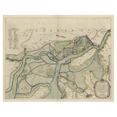
Original Map of the Military Situation After the Dutch Blockade of Antwerp, 1648
Located in Langweer, NL
Antique map titled 'Tabula Castelli ad Sandflitam (..)'. This map depicts the complex military situation that had developed after the Dutch blockade of Antwerp. All entrenchment'...
Category

Antique 17th Century Collectibles and Curiosities

Materials

Paper

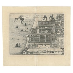
Antique Map of Batavia 'Jakarta', Indonesia by Montanus, circa 1669
Located in Langweer, NL
Antique map Batavia titled 'Ware Affbeeldinge wegens het Casteel ende Stadt Batavia'. Antique print of the castle and city of Batavia on the Island of Java'. Rare edition with Englis...
Category

Antique 17th Century Collectibles and Curiosities

Materials

Paper

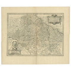
Antique Map of the Region of Étampes and Sens by Janssonius, c.1650
Located in Langweer, NL
Antique map titled 'Gastinois et Senonois'. Old map of the region of Étampes and Sens, France. It shows the cities of Sens, Melun, Étampes, Orleans, Fontainebleau, Montargis and othe...
Category

Antique 17th Century Collectibles and Curiosities

Materials

Paper

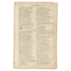
Shakespeare. Love's Labour's Lost - FOURTH FOLIO - 1685 - page 111-112.
Located in Hillsborough, NJ
AUTHOR: SHAKESPEARE, William. TITLE: The Works of William Shakespeare. (Love's Labour's Lost) - page 111-112. PUBLISHER: London: Printed for H. Herringman, E. Brewster and R. Bent...
Category

British Antique 17th Century Collectibles and Curiosities

Materials

Paper

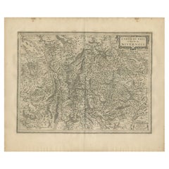
Antique Map of the Region of Nivernais by Janssonius, 1657
Located in Langweer, NL
Antique map of France titled 'Carte du Païs et Duché de Nivernois'. Decorative map of the Nivernais region, part of Burgundy, France. This map originates from 'Atlas Novus, Sive Thea...
Category

Antique 17th Century Collectibles and Curiosities

Materials

Paper

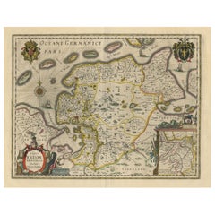
Map of East Friesland, The Netherlands & the Area Emden & Norden, Germany, 1635
Located in Langweer, NL
Antique map titled 'Typus Frisiae Orientalis.' Map of East Friesland and the area around Emden and Norden. Large inset map of the mouth of the Amasis River. The map is decorated with a large title cartouche and two large coats of arms...
Category

Antique 17th Century Collectibles and Curiosities

Materials

Paper

Antique Map of Madagascar by N. Sanson, circa 1680
Located in Langweer, NL
Antique map titled 'Isle de Madagascar ou de St. Laurens. Tiree de Sanutu &c'. Antique map of Madagascar, first published by Sanson in 1657. Sanson n...
Category

Antique 17th Century Collectibles and Curiosities

Materials

Paper

Antique Map of Berkshire, South East England
Located in Langweer, NL
Antique map titled 'Bercheria vernacule Barkshire'. Original old map of Berkshire, a historic county in South East England. Published circa 1665 by J. Blaeu. Willem Jansz. Blaeu and ...
Category

Antique 17th Century Collectibles and Curiosities

Materials

Paper

Antique Map of the Niederrhein region, Germany
Located in Langweer, NL
Antique map titled 'Circulus Electorum Rheni sive Rhenanus Inferior (..)'. Original antique map of the Niederrhein region, Germany. By F. de Wit, circa 1690. Frederick de Wit (1629-...
Category

Antique 17th Century Collectibles and Curiosities

Materials

Paper

Antique Map of Celtic Europe by Cluver, 1678
Located in Langweer, NL
Antique map Europe titled 'Europam sive Celticam Veterem'. Rare map of Celtic Europe. Made after A. Ortelius, originates from 'Introductionis in uni...
Category

Antique 17th Century Collectibles and Curiosities

Materials

Paper

Original Antique Map of the Duchy of Holstein
Located in Langweer, NL
Antique map titled 'Ducatus Holsatiae Nova Tabula'. Original old map of the Duchy of Holstein, the northernmost territory of the Holy Roman Empire, from the mid-17th Century. To the ...
Category

Antique 17th Century Collectibles and Curiosities

Materials

Paper

Antique Detailed Map of Jerusalem in Israël with Extensive Key and Scale, 1698
Located in Langweer, NL
Antique map titled 'Jerusalem.' Plan of the ancient city of Jerusalem. With extensive key and scale. Source unknown, to be determined. Artists and Engravers: Made by 'Cornelis de...
Category

Antique 17th Century Collectibles and Curiosities

Materials

Paper

Old Original Antique Engraved Portrait of Pope Bonifacius / Boniface, 1678
Located in Langweer, NL
Antique portrait titled 'XLIV S. Bonifacius'. Old portrait of Pope Bonifacius / Boniface. Originates from 'Triomph der Pausen van Roomen over alle hare Benyders ende Bestryders met eene volkomen, ende overtuyghende wederlegginghe van alle de lasteringhen, en valscheden van de sectarisen (..)' published in Antwerpen. Artists and Engravers: Cornelius Hazart (1617-1690) was a Dutch Jesuit controversialist, orator, and writer of polemical history. Saint Boniface I, (born, Rome—died Sept. 4, 422, Rome; feast day September 4), pope from 418 to 422, whose reign was markedly disrupted by the faction of the antipope Eulalius. Boniface was a priest, believed to have been ordained by Pope St. Damasus I and to have served Pope St. Innocent I at Constantinople. When Boniface was chosen pope by a majority of the Roman electors, his rival Eulalius, a deacon, was simultaneously chosen by a clerical faction. The two claims and the fifth schism that resulted caused chaos in Rome. Eulalius lost the support of the West Roman emperor Flavius Honorius for violating an agreement that both claimants leave Rome pending a council’s decision. Boniface’s reentry into Rome ended the 15-week schism. Thereafter his pontificate was noted for his peaceful, yet firm, diplomacy and for his zealous support of Bishop St. Augustine of Hippo...
Category

Antique 17th Century Collectibles and Curiosities

Materials

Paper

Antique Map of Nottinghamshire by Speed, 1676
Located in Langweer, NL
Antique map titled 'The Countie of Nottingham (..)'. Map of Nottinghamshire, England. Includes an inset town plan of Nottingham. This map originates from 'Theatre of Great Britaine' ...
Category

Antique 17th Century Collectibles and Curiosities

Materials

Paper

Map of the Region of Basel and Northern Switzerland by Ortelius, circa 1603
Located in Langweer, NL
Two original antique maps on one sheet titled 'Basiliensis Territorii Descriptio Nova [with] Circulus sive Liga Sueviae'. The first centers on Basel, Switzerland, located on the Rhine River...
Category

Antique 17th Century Collectibles and Curiosities

Materials

Paper

Antique Map of the City of Geldern by Blaeu, 1649
Located in Langweer, NL
Antique map titled 'Gelre'. Old map of the city of Geldern, Germany. This map originates from 'Toonneel der Steden van de Vereenighde Nederlanden' by J. Blaeu. Artists and Engrav...
Category

Antique 17th Century Collectibles and Curiosities

Materials

Paper

Old Copper Engraving of the City of Kajutsiu in China, 1668
Located in Langweer, NL
Antique print China titled ‘Kajutsiu'. This plate shows a view on the Chinese city of Kajutsiu. This print originates from the Latin edition of Nie...
Category

Antique 17th Century Collectibles and Curiosities

Materials

Paper

Antique Map of the region of Lennep, Blankenburg and Dortmund, Germany
Located in Langweer, NL
Antique map titled 'Berge Ducatus Marck Comitatus'. Original antique map of the region of Lennep, Blankenburg and Dortmund, Germany. Published by Hondius, circa 1644.
Category

Antique 17th Century Collectibles and Curiosities

Materials

Paper

Original Antique Map of the Road from Andover to Crewkerne
Located in Langweer, NL
Antique map titled 'The Continuations of the Road from London to the Lands End'. Original antique map of the road from Andover to Crewkerne. Plate 26 from Ogilby's 'Britannia', the f...
Category

Antique 17th Century Collectibles and Curiosities

Materials

Paper

1656 "La Souverainete de Sedan et de Raucourt, et la Prevoste de Doncheri Ric004
Located in Norton, MA
1656 map entitled "La Souverainete de Sedan et de Raucourt, et la Prevoste de Doncheri," Hand Colored Ric0004. Description: Lovely map centered on Sedan and Doncheri an...
Category

Dutch Antique 17th Century Collectibles and Curiosities

Materials

Paper

Antique Map of the Westphalia region of Germany
Located in Langweer, NL
Antique map titled 'Circulus Westphaliae (..)'. Original old map of the Westphalia region, Germany. Published by Justus Danckerts, circa 1696. Justus Danckerts I (11 November 1635 ...
Category

Antique 17th Century Collectibles and Curiosities

Materials

Paper

Antique Map of the City of Brielle 'The Netherlands' by L. Guicciardini, 1625
Located in Langweer, NL
Plan of Brielle, Briel, Den Briel in the Province of Zuid-Holland, The Netherlands, Holland. This map originates from the 1625 edition of 'Discrittione di tutti i Paesi Bassi', by L....
Category

Antique 17th Century Collectibles and Curiosities

Materials

Paper

Rare Original Handcolored Miniature Map of Malaysia and Singapore, 1600
Located in Langweer, NL
Very handsome original old coloured copper engraving of Malaysia and Singapore, with parts of Sumatra, inc the island of Bangka and Bintam. Title of the map 'Description Malacca'. On...
Category

Antique 17th Century Collectibles and Curiosities

Materials

Paper

Antique Print of a Naval Vessel by Mortier '1695'
Located in Langweer, NL
Antique print titled 'Vaisseau du premier rang portant pavillon d'Admiral'. Beautiful copper engraving of a naval vessel. From Mortier's famous maritime Atlas "Neptune François". Eng...
Category

Antique 17th Century Collectibles and Curiosities

Materials

Paper

Antique Map of the City of Goch by Blaeu, 1649
Located in Langweer, NL
Antique map titled 'Gochum vernacule Goch'. Old map of the city of Goch, Germany. This map originates from 'Novum Ac Magnum Theatrum Urbium Belgicæ Liberæ ac Foederatæ' by J. Blaeu. ...
Category

Antique 17th Century Collectibles and Curiosities

Materials

Paper

Antique Map of Brabant, the Netherlands, with Original Hand Coloring
Located in Langweer, NL
Original antique map titled 'Novissima et Accuratissima Brabantiae Ducatus Tabula'. Old map of Brabant, the Netherlands. North is to the right. Like all other maps of Brabantiae Duca...
Category

Antique 17th Century Collectibles and Curiosities

Materials

Paper

America Septentrionalis by Carroli Allard (1648-1709) Copper Plate Engraving
Located in San Francisco, CA
"Recentissuma Novi Orbis Sive Americae Septentrionale et Meriodionalis" A hand-colored copper plate engraving of North and South America by Carel Allard depicting recent discoveries...
Category

Dutch Antique 17th Century Collectibles and Curiosities

Materials

Paper

Antique Map of Delfland, Schieland and Islands of Zuid-Holland, the Netherlands
Located in Langweer, NL
Antique map titled 'Delflandia, Schielandia, et Insulae (..)'. Original antique map of Delfland, Schieland and islands of Zuid-Holland, the Netherlands. The 'Zuid-Hollandse Eilanden'...
Category

Antique 17th Century Collectibles and Curiosities

Materials

Paper

Antique Map of the Cape Verde Islands, Africa, ca.1670
Located in Langweer, NL
Antique map titled 'Pascaert van de Soute Eylanden ofte Ilhas de Cabo Verde'. This map depicts the Cape Verde Islands (Africa). Islands titled 'Ile de B...
Category

Antique 17th Century Collectibles and Curiosities

Materials

Paper

Original Antique Engraving of a Horse Race at a Japanese Racing Track, 1669
Located in Langweer, NL
Description: Antique print, titled: 'Japansche Ren-baanen.' - View of a race at a Japanese (horse) racing track. A man runs beside a horse (the horse's rein in his hand). A man w...
Category

Antique 17th Century Collectibles and Curiosities

Materials

Paper

Original Antique Map of the Holy Land with Decorative Cartouche
Located in Langweer, NL
Antique map titled 'Totius Terrae Sanctae'. Original old map of the Holy Land, with a large decorative cartouche. The term "Holy Land" usually refers to a territory roughly correspon...
Category

Antique 17th Century Collectibles and Curiosities

Materials

Paper

Rare Antique Miniature Map of Pakistan, India and Cambaia, ca.1616
Located in Langweer, NL
Old 17th century miniature antique map of 'Cambaia' , from the 1616 edition of Jadocus Hondius Atlas by Petrus Bertius. Original copperplate engraving with hand coloring. Carto...
Category

Antique 17th Century Collectibles and Curiosities

Materials

Paper

Antique Map of Westphalia, West Orientation
Located in Langweer, NL
Antique map titled 'Nova totius Westphaliae Descriptio'. Detailed map of Westphalia, Northern Germany. Oriented to the west. The area shown extends from Ha...
Category

Antique 17th Century Collectibles and Curiosities

Materials

Paper

Map of Languedoc-Roussillon and Provence in France and Piedmont in Italy, c1680
Located in Langweer, NL
Title: Antique map titled 'La basse Partie du Gouvernement de Languedoc, environne des Frontiers des Gouverns de Provence, de Dauphine de Lyonnais et de Guienne et Gascogne ; Les Fro...
Category

Antique 17th Century Collectibles and Curiosities

Materials

Paper

Rare 16th Century Original Handcolored Miniature Map of Java, Indonesia, 1616
Located in Langweer, NL
Very handsome original old coloured copper engraving by Bertius of the island of Java in the early days of the Dutch colonisation - at that time named The Dutch East Indies or nowada...
Category

Antique 17th Century Collectibles and Curiosities

Materials

Paper

Antique Map of the Islands Near Ceylon by Baldaeus, 1672
Located in Langweer, NL
Antique print, untitled. This original antique print shows the islands Leyden, Middelburg, Hammenhiel, Bramines, Dona Clara and Deserta near Ceylon / Sri Lanka, with their Dutch name...
Category

Antique 17th Century Collectibles and Curiosities

Materials

Paper

Antique Map of India and the Gulf of Bengal by Mallet, c.1686
Located in Langweer, NL
Antique map titled ?Partie Orientale de la Terre Ferme de l'Inde Moderne. Small map of India and the Gulf of Bengal. This map originates from a German edition of 'Description de l' Univers'. Artists and Engravers: Alain Manesson Mallet (1630-1706) was a French cartographer and engineer. He started his career as a soldier in the army of Louis XIV, became a Sergeant-Major in the artillery and an Inspector of Fortifications. He also served under the King of Portugal, before returning to France, and his appointment to the court of Louis XIV. His military engineering and mathematical background led to his position teaching mathematics at court. His 'Description de L'Universe' contains a wide variety of information, including star maps...
Category

Antique 17th Century Collectibles and Curiosities

Materials

Paper

Old Map of Prussia, Embellished with a Large Cartouche and Compass Rose, ca.1680
Located in Langweer, NL
Antique map titled 'Prussiae nova Tabula'. Later edition of Blaeu's map of Prussia, embellished with a large cartouche and compass rose. Prussia was a historically prominent Germ...
Category

Antique 17th Century Collectibles and Curiosities

Materials

Paper

Antique Map of the Burgundy Region by Mallet, c.1683
Located in Langweer, NL
Antique map titled 'Cercle de Bourgogne'. Detailed miniature map of the Burgundy region, France. Also shows the Netherlands and Belgium. Originates from Mallet's 'Description de l'Un...
Category

Antique 17th Century Collectibles and Curiosities

Materials

Paper

Rare Map of Kildin Island in Russia Plus Engraving of Seal Hunting, 1614
Located in Langweer, NL
Insula Kilduyn. Orig. copper-engraving after details from J. H. van Linschoten's map taken from his account of the three expeditions undertaken by Willem Barents in 1594, in an attem...
Category

Antique 17th Century Collectibles and Curiosities

Materials

Paper

Original Engraving of Japanese Musicians Playing Native Music Instruments, 1669
Located in Langweer, NL
Antique print, titled: 'Japansche kamerspeelders.' - ('Japanese musicians'). Four chamber musicians are playing on native instruments outside. Arnol...
Category

Antique 17th Century Collectibles and Curiosities

Materials

Paper

Antique Print of Brittenburg 'Near Katwijk' in the Netherlands by Blaeu, 1649
Located in Langweer, NL
Antique print titled 'Arx Britannica'. View of De Brittenburg, a Roman ruin on the Dutch coast near Katwijk, The Netherlands. Originates from 'Toneel der Steeden' published by Joan B...
Category

Antique 17th Century Collectibles and Curiosities

Materials

Paper

Antique Map of the City of Leeuwarden by Priorato, 1673
Located in Langweer, NL
Antique map titled 'Leverden'. This map depicts the city of Leeuwarden (Friesland, The Netherlands). This original antique print originates from 'Teatro del Belgio (…)', published in...
Category

Antique 17th Century Collectibles and Curiosities

Materials

Paper

Original Antique Hand- Map of Africa by Allard '1697'
Located in Langweer, NL
Antique map titled 'Novissima et Perfectissima Africae (..)'. Beautiful large map of Africa. This is the 3rd state of the map, with climate notation add...
Category

Antique 17th Century Collectibles and Curiosities

Materials

Paper

Original Antique Map of England and Wales with Large Cartouche
Located in Langweer, NL
Antique map titled 'Le Royaume d'Angleterre divisé en plusieurs Parties (..)'. Large and rare map of England and Wales by J.B. Nolin after Coronelli. With decorative cartouche, table...
Category

Antique 17th Century Collectibles and Curiosities

Materials

Paper

Antique Map of the City of Zwolle by Guicciardini, 1613
Located in Langweer, NL
Antique map titled 'Swolla'. Map of the city of Zwolle, the Netherlands. This map originates from the 1613 edition of 'Discrittione di tutti i Paesi Bassi', by L. Guicciardini, publi...
Category

Antique 17th Century Collectibles and Curiosities

Materials

Paper

Antique Map of the City of Kampen by Guicciardini, 1613
Located in Langweer, NL
Antique map titled 'Urbis Campensis (..)'. Plan of the city of Kampen, the Netherlands. This map originates from the 1613 edition of 'Discrittione di tutti i Paesi Bassi', by L. Guic...
Category

Antique 17th Century Collectibles and Curiosities

Materials

Paper

Antique Print of the City of Leeuwarden, Friesland in The Netherlands, 1680
Located in Langweer, NL
Antique print titled 'Leeuwaerd'. Old bird's eye view of the city of Leeuwarden, Friesland. This print originates from 'Thooneel der Steden ende Sterckten van 't Vereenight Nederland...
Category

Antique 17th Century Collectibles and Curiosities

Materials

Paper

Rhine Splendor: Antique Map of the Lower Rhine Region, circa 1680
Located in Langweer, NL
The antique map titled 'Novissima et Accuratissima Archiepiscopatus et Electoratus Coloniensis Ducatuum Iuliancensis et Montensis et Meursiae Comitatus' is a handsome and detailed ma...
Category

Antique 17th Century Collectibles and Curiosities

Materials

Paper

Antique Map of the City of Leeuwarden by Bast, 1603
Located in Langweer, NL
Antique map titled 'Leeuwerden de hooft stadt van Frislant. Leoverdia Metropolis Frisiae (…) 1603.' Very rare plan of Leeuwarden, Friesland, The Netherlands. With several carouches a...
Category

Antique 17th Century Collectibles and Curiosities

Materials

Paper

Leicestershire – Antique Map of Leicester by Richard Blome, Britannia 1673
Located in Langweer, NL
Leicestershire – Antique Map of Leicester by Richard Blome, Britannia 1673 This original antique map titled A Mapp of the Country of Leicester presents a detailed and decorative dep...
Category

English Antique 17th Century Collectibles and Curiosities

Materials

Paper

Antique Map by Janssonius of the Dutch Province of Overijsel, ca.1650
Located in Langweer, NL
Very good, given the age. Center fold as issued with wide margins. Sharp print with beautiful old-fashioned colouring, carbon copy on verso. Paper in the margins somewhat browned.
Category

Antique 17th Century Collectibles and Curiosities

Materials

Paper

Old Map of the Bourbonnais Region of France, ca.1630
Located in Langweer, NL
Antique map titled 'Bourbonois - Borbonium Ducatus'. Old map of the Bourbonnais region of France. Bourbonnais was a historic province in the centre of France that corresponds to ...
Category

Antique 17th Century Collectibles and Curiosities

Materials

Paper

Antique Map of the Island of Djerba by Coronelli '1691'
Located in Langweer, NL
Antique map titled 'Isola e Castello di Gerbi'. Original antique map of the Island of Djerba, Tunisia, in Africa. Includes an inset of the Djerba Castle in upper right. This map orig...
Category

Antique 17th Century Collectibles and Curiosities

Materials

Paper

Antique Plan of Emden in Germany by Guicciardini, 1612
Located in Langweer, NL
Antique map Emden titled 'Civitas Embda, eo modo situata cum essit controversia inter ipsam et suum Comitem anno'. Small plan of the city of Emden, Germany, Also depicted is part of ...
Category

Antique 17th Century Collectibles and Curiosities

Materials

Paper

Antique Map of the Cape Verde Islands and Part of Senegal, West Africa, 1690
Located in Langweer, NL
Antique map titled 'Bocche del Fivme Negro et Isole di Capo Verde'. Beautiful double-page map of the Cape Verde Islands and part of the coast of Senegal, with large decorative cartou...
Category

Italian Antique 17th Century Collectibles and Curiosities

Materials

Paper

Italian Rare Edition of Historia Dell'Armi Imperiali from Venice 1687
Located in Sofia, BG
Rare antique Italian edition of HISTORIA DEGL'AVENIMENTI DELL'ARMI IMPERIALI CONTRO A'RIBELLI, ET OTTOMANI published in Venice at 1687. Italy
Category

Italian Antique 17th Century Collectibles and Curiosities

Materials

Paper

Old Handcolored Antique Map of Pays De Caux in Normandy, France, ca.1640
Located in Langweer, NL
Antique map titled 'Le Pais de Caux'. Old map of Pays de Caux, France. Pays de Caux is an area in Normandy occupying the greater part of the French département of Seine Maritime ...
Category

Antique 17th Century Collectibles and Curiosities

Materials

Paper

Antique Map of the City of Workum by Blaeu, 1649
Located in Langweer, NL
Antique map titled 'Worckum'. Old map of the city of Workum, Friesland. Originates from J. Blaeu's 'Town Book'. Artists and Engravers: Joan Blaeu (23 September 1596 - 28 May 1673...
Category

Antique 17th Century Collectibles and Curiosities

Materials

Paper

1640 Flandriae Partes Duae Quarum Altera Proprietaria, Ric0016
Located in Norton, MA
1640 Willem and Joan Blaeu map entitled "Flandriae Partes duae quarum altera Proprietaria, altera Imperialis vulgo dictur," Ric0016 (Mounted on Carboard) Willem Janszoon Blaeu...
Category

Dutch Antique 17th Century Collectibles and Curiosities

Materials

Paper

Read More

Medal-Worthy Memorabilia from Epic Past Olympic Games

Get into the games! These items celebrate the events, athletes, host countries and sporting spirit.

Ahoy! You’ve Never Seen a Collection of Sailor Art and Kitsch Quite Like This

French trendsetter and serial collector Daniel Rozensztroch tells us about his obsession with objects related to seafaring men.

Pamela Shamshiri Shares the Secrets behind Her First-Ever Book and Its Effortlessly Cool Interiors

The sought-after designer worked with the team at Hoffman Creative to produce a monograph that beautifully showcases some of Studio Shamshiri's most inspiring projects.

Moroccan Artworks and Objects Take Center Stage in an Extraordinary Villa in Tangier

Italian writer and collector Umberto Pasti opens the doors to his remarkable cave of wonders in North Africa.

Montecito Has Drawn Royalty and Celebrities, and These Homes Are Proof of Its Allure

Hollywood A-listers, ex-pat aristocrats and art collectors and style setters of all stripes appreciate the allure of the coastal California hamlet — much on our minds after recent winter floods.

Whaam! Blam! Pow! — a New Book on Pop Art Packs a Punch

Publishing house Assouline and writer Julie Belcove have teamed up to trace the history of the genre, from Roy Lichtenstein, Andy Warhol and Yayoi Kusama to Mickalene Thomas and Jeff Koons.

What Makes a Gem-Encrusted Chess Set Worth $4 Million?

The world’s most opulent chess set, weighing in at 513 carats, is literally fit for a king and queen.

Tauba Auerbach’s Geometric Pop-Up Book Is Mighty Rare, Thanks to a Hurricane

This sculptural art book has an epic backstory of its own.
Recently Viewed

View All