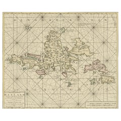
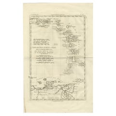
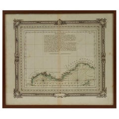
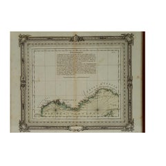
Shetland Islands Sea Chart – Antique Nautical Map by Ottens Brother c.1745
Located in Langweer, NL
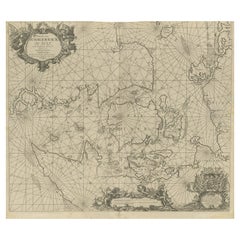
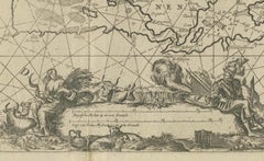
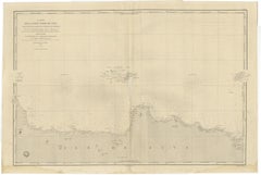
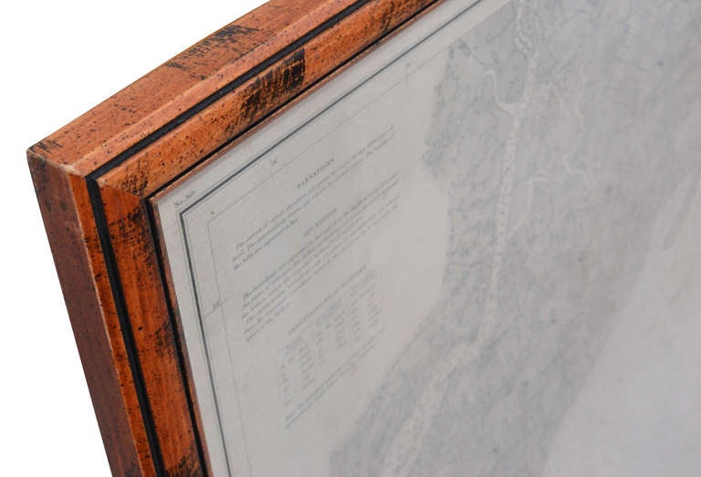
Shetland Islands Sea Chart – Antique Nautical Map by Ottens Brothers, c.1740s This striking
Category
1740s Dutch Antique Nautical Maps
Materials
Paper
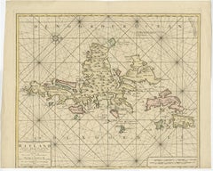
Shetland Islands Sea Chart – Antique Nautical Map by Ottens Brother c.1745
Located in Langweer, NL
Shetland Islands Sea Chart – Antique Nautical Map by Ottens Brothers, c.1740s This striking
Paper

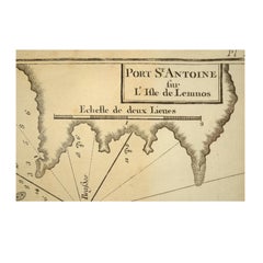
Antique Nautical Portolano of Port St. Antoine by Antoine Roux, France, 1844
By Antoine Roux
Located in Milan, IT
Antique portolano, nautical map of Port St. Antoine engraved on a copper plate by Antoine Roux
Paper
Antique Nautical Portolano of Isle De Poro by Antoine Roux, France, 1844
By Antoine Roux
Located in Milan, IT
Antique portolano, nautical map of Isle De Poro engraved on a copper plate by Antoine Roux
Paper
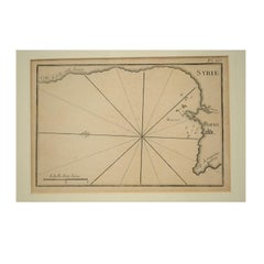
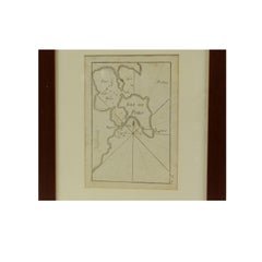
1844 French Antique Nautical print Engraved Portolano of Syrie by Antoine Roux
By Antoine Roux
Located in Milan, IT
Antique portolano, nautical map of Syrie engraved on a copper plate by Antoine Roux, Marseille
Paper
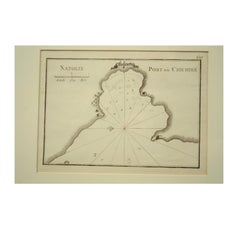
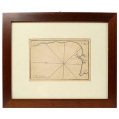
1844 French Nautical Portolano of Port De Chichimé Natolie by Antoine Roux
By Antoine Roux
Located in Milan, IT
Antique portolano, nautical map of Port De Chichimé Natolie engraved on a copper plate by Antoine
Paper

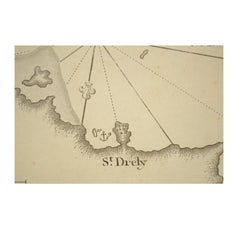
1844 French Antique Nautical Portolano of Golfe De St. Drely by Antoine Roux
By Antoine Roux
Located in Milan, IT
Antique portolano, nautical map of Golfe De St. Drely engraved on a copper plate by Antoine Roux
Paper

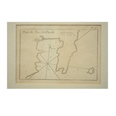
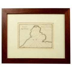
1844 French Antique Nautical Portolan of Plan du Port de Cherfe by Antoine Roux
By Antoine Roux
Located in Milan, IT
Antique portolano, nautical map of Plan du Port de Cherfe engraved on a copper plate by Antoine
Paper
$2,114Sale Price|20% Off
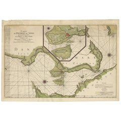
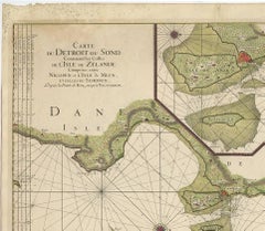
Antique Map: Carte du Détroit du Sond with Copenhagen Inset, 1693
Located in Langweer, NL
chart, Zealand and Scania map, 17th-century nautical map, Copenhagen inset map, La Neptune François map
Paper
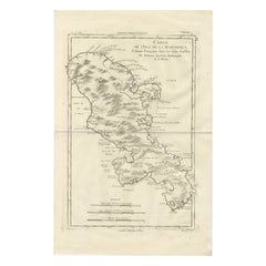
Antique Map Martinique Caribbean Island Chart, Rigobert Bonne French Map, c.1780
Located in Langweer, NL
Bonne, Caribbean island engraving, antique nautical map Caribbean, Martinique historical map, decorative
Paper
$357Sale Price|20% Off
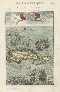
Antique 1683 Map of Hispaniola and Puerto Rico in the Caribbean by Mallet
Located in Langweer, NL
- Vintage Caribbean nautical map - Historical geography of Hispaniola - Puerto Rico antique map - Old maps
Paper
Antique Map of Cordes Bay, Port Famine & Fortescue Bay – Patagonia, 1774
Located in Langweer, NL
Antique Map of Cordes Bay, Port Famine & Fortescue Bay – Patagonia, 1774 Antique engraved nautical
Paper
Antique Map of Cape Providence & St. David’s Cove – Strait of Magellan, 1774
Located in Langweer, NL
nautical map depicting a series of detailed coastal charts along the shores of southern Patagonia
Paper

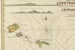
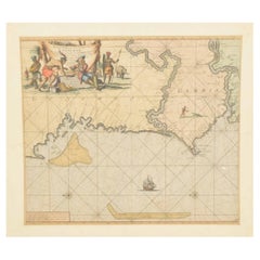
Nautical Chart of Cape Verde Islands by J.W. Norie, 1824 Coastal Map
Located in Langweer, NL
Nautical Chart of Cape Verde Islands by J.W. Norie, 1824 Coastal Map This beautifully engraved
Paper
Antique Sea Chart Java Indonesia – Mannevillette Neptune Oriental 1775
Located in Langweer, NL
chart, East Indies sea chart, Indian Ocean navigation, 18th century nautical map, antique Indonesia map
Paper
$280Sale Price|43% Off
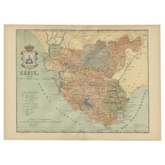
Cádiz 1901: Nautical Crossroads of the Atlantic and Mediterranean
Located in Langweer, NL
The map illustrates the province of Cádiz, located in the autonomous community of Andalusia, Spain
Paper
Antique Blaeu Maps, Indonesia & Moluccas – VOC Era, c.1642
Located in Langweer, NL
colored map, copperplate engraving, maritime map, nautical chart, historical map Asia, colonial map
Paper
$904Sale Price|20% Off
Nautical Chart of Skagerrak and Øresund by Johannes van Keulen, 1680
Located in Langweer, NL
, Johannes van Keulen map, 17th-century nautical chart, Skagerrak, Kattegat, Øresund, North Sea to Baltic Sea
Paper
$1,362Sale Price|20% Off
Original Hand-Coloured Nautical Chart of West-Africa, c.1680
Located in Langweer, NL
. Blanco tot C. Verde (...). Amsterdam, Johannus van Keulen, c. 1680. Large folio coloured map in passe
Paper
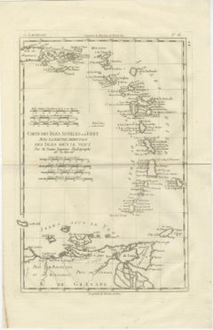
Caribbean & Lesser Antilles – Enlightenment Map by Rigobert Bonne, c.1780
Located in Langweer, NL
measurement, and the synthesis of contemporary nautical and colonial intelligence. This map exemplifies
Paper
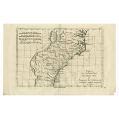
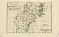
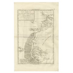
Antique Map Southern United States — Carolina & Georgia, Bonne c.1780
Located in Langweer, NL
map, antique nautical chart Atlantic coast, early American geography map, Bonne hydrographic chart
Paper
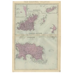
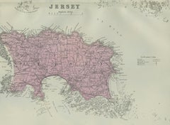
Channel Islands Map, Jersey Guernsey Alderney Sark, Bacon London, 1885
Located in Langweer, NL
’ strategic and nautical importance. Maps from Bacon’s large-scale atlases are increasingly sought after by
Paper
$620Sale Price|20% Off
Hand-colored Nautical Chart: St. George's Channel and the Irish Sea, 1744
Located in Langweer, NL
The map was engraved by Richard William Seale, a notable British engraver. This map is a fine
Paper
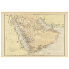

Original 1882 Map of Arabia, Red Sea & Persian Gulf
Located in Langweer, NL
significant for navigation and commerce. The map includes nautical lines indicating sea depths and shipping
Paper
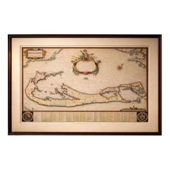
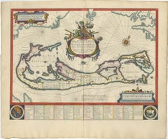
Blaeu Bermuda Map, Somers Isles, Atlantic Chart, Hand-Colored, c.1642
Located in Langweer, NL
, antique cartography, copperplate engraving, hand colored map, original color map, maritime map, nautical
Paper
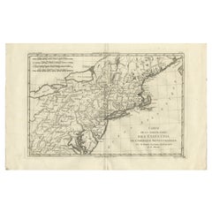
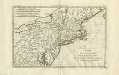
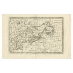
Antique Northeastern United States Map — New England & Mid-Atlantic, Bonne, 1780
Located in Langweer, NL
nautical coast map, Bonne hydrographic chart, early American geography map, decorative antique USA map
Paper
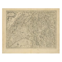

Map of Avenches Region Switzerland by Mercator, Original 1585 Engraving
Located in Langweer, NL
Mercator projection, a method of mapmaking that became foundational for nautical navigation. His 1585 map
Paper
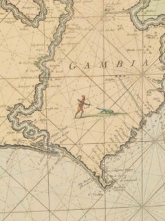
Antique Map West Africa Morocco Canary Islands Lisbon Sierra Leone Bonne, c1780
Located in Langweer, NL
Africa map, historical Atlantic coast map, antique nautical cartography, Bonne engraving map, French
Paper

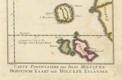
Antique Map of the Moluccas (Maluku Islands), Indonesia – Bellin, 18th Century
Located in Langweer, NL
hundreds of authoritative nautical charts and geographic maps worldwide. Bellin’s work is emblematic of
Paper
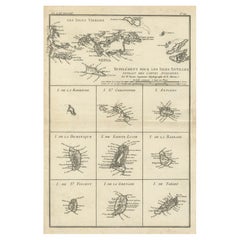
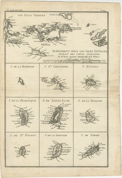
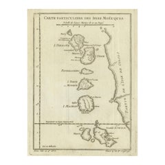
Map of Virgin Islands and Lesser Antilles by Rigobert Bonne, c. 1780
Located in Langweer, NL
. Kitts St. Lucia Tobago Barbados Grenada map, maritime nautical atlas plate
Paper
$1,080Sale Price|20% Off
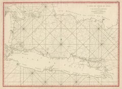
Early French Nautical Chart of the Northern Coast of of Java, Indonesia, C.1850
Located in Langweer, NL
Antique map titled Carte de la côte Nord de Java. Early French nautical chart of the northern
Paper
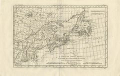
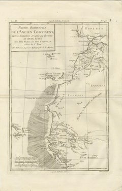
Antique Map of Canada, Newfoundland & Acadia — Gulf of St Lawrence, Bonne c.1780
Located in Langweer, NL
Island antique map, Nova Scotia historical map, early Canadian cartography, antique nautical chart
Paper
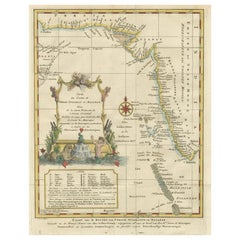
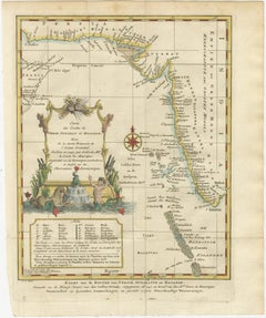
1773 Map of Persia, Gujarat & Malabar Coasts – Arabia to India, Hand-Colored
Located in Langweer, NL
atlas, Jacques-Nicolas Bellin map, 18th century nautical chart
Paper
$188Sale Price|20% Off
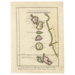
Old Map of the Spice Islands, Moluccas by Bellin, Published in 1771
Located in Langweer, NL
bar in both French and Dutch nautical miles demonstrates the map’s practical use for navigation. The
Paper

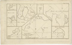
Antique Map of New Ireland (Pacific) with Coastal Profiles – Cook Voyages, 1774
Located in Langweer, NL
Antique Pacific Map of New Ireland with Coastal Profiles – Cook Voyages, 1774 Antique engraved map
Paper

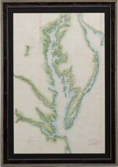
1856 U.S. Coast Survey Map of Chesapeake Bay and Delaware Bay
Located in Colorado Springs, CO
Presented is U.S. Coast Survey nautical chart or maritime map of Chesapeake Bay and Delaware Bay
Paper
$414Sale Price|20% Off
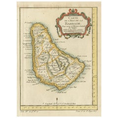
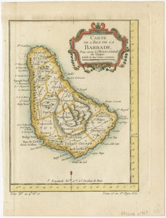
Barbados Island at the Height of the Plantation Economy, Circa 1759
Located in Langweer, NL
, as Hydrographer to the King of France, is known for his nautical charts and colonial maps that
Paper
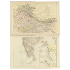
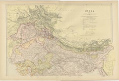
Cartographic Elegance: The British Raj's India, 1882 Atlas by Blackie and Son
Located in Langweer, NL
British nautical knowledge. Both maps display an overlay of longitude and latitude lines, indicative of
Paper

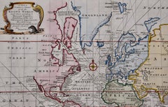
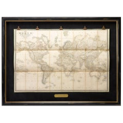
Map of the World: An Original 18th Century Hand-colored Map by E. Bowen
Located in Alamo, CA
example of a nautical chart, a type of map that was designed specifically for use by mariners. The map is
Engraving
![Carte de la Rade et des Iles d'Hyeres [...].](https://a.1stdibscdn.com/archivesE/upload/a_5923/1509453017426/IMG_0049_2_master.jpg?width=240)
![Carte de la Rade et des Iles d'Hyeres [...].](https://a.1stdibscdn.com/archivesE/upload/a_5923/a_22615931509453026342/IMG_0050_a_master.jpg?width=240)
Unavailable|$610
Carte de la Rade et des Iles d'Hyeres [...].
Located in Zeeland, Noord-Brabant
decorative sea chart / nautical map / maritime map. Map orientation is north. Engraving on handlaid (verge
Engraving
![No. 28. Carte reduite du Golfe de Gascoigne [...].](https://a.1stdibscdn.com/archivesE/upload/a_5923/1509453330717/IMG_0051_2_master.jpg?width=240)
![No. 28. Carte reduite du Golfe de Gascoigne [...].](https://a.1stdibscdn.com/archivesE/upload/a_5923/a_22616131509453342160/IMG_0052_a_master.jpg?width=240)
Unavailable|$428
No. 28. Carte reduite du Golfe de Gascoigne [...].
Located in Zeeland, Noord-Brabant
Detailed map of the Gulf of Gascoigne / Biscay.) Decorative sea chart / nautical map / maritime map
Engraving
![Carte reduite des Mers du Nord [...].](https://a.1stdibscdn.com/archivesE/upload/a_5923/1508839571071/cb3800_master.jpg?width=240)
Unavailable|$1,791
Carte reduite des Mers du Nord [...].
By Jacques-Nicolas Bellin
Located in Zeeland, Noord-Brabant
sea chart / nautical map / maritime map of the North Atlantic Ocean and other northern seas with the
Engraving
![Carte reduite des costes d'Espagne et de Portugal [...].](https://a.1stdibscdn.com/archivesE/upload/a_5923/1508838060305/cb3804_master.jpg?width=240)
Unavailable|$2,143
Carte reduite des costes d'Espagne et de Portugal [...].
By Jacques-Nicolas Bellin
Located in Zeeland, Noord-Brabant
decorative sea chart / nautical map / maritime map of the region centered on Portugal with parts of N-W Spain
Engraving
![Carte reduite de Partie de la Mer du Nord comprise entre l'Ecosse, [...].](https://a.1stdibscdn.com/archivesE/upload/a_5923/1509452708990/IMG_0047_2_master.jpg?width=240)
![Carte reduite de Partie de la Mer du Nord comprise entre l'Ecosse, [...].](https://a.1stdibscdn.com/archivesE/upload/a_5923/a_22615731509452717459/IMG_0048_a_master.jpg?width=240)
Unavailable|$1,233
Carte reduite de Partie de la Mer du Nord comprise entre l'Ecosse, [...].
By Jacques-Nicolas Bellin
Located in Zeeland, Noord-Brabant
decorative sea chart / nautical map / maritime map of the North Sea, also including parts of Ireland, the
Engraving
![No.27. Carte reduite des Passage de l'Iroise du Four et du Raz [...].](https://a.1stdibscdn.com/archivesE/upload/a_5923/1508763082730/IMG_0045_2_master.jpg?width=240)
Unavailable|$951
No.27. Carte reduite des Passage de l'Iroise du Four et du Raz [...].
By Jacques-Nicolas Bellin
Located in Zeeland, Noord-Brabant
Detailed map of the Iroise, du Four and du Raz Passages. Highly decorative sea chart / nautical map
Engraving
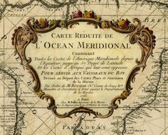
![Carte reduite du Golphe de St. Laurent [...].](https://a.1stdibscdn.com/archivesE/upload/a_5923/1508840070256/cb3803_master.jpg?width=240)
Carte reduite du Golphe de St. Laurent [...].
By Jacques-Nicolas Bellin
Located in Zeeland, Noord-Brabant
...) Highly decorative sea chart / nautical map / maritime map of the Gulf of St. Lawrence including the
Engraving
Unavailable|$3,465
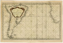
Sea chart of the Southern Atlantic Ocean - Engraving - 18th century
Located in Zeeland, Noord-Brabant
Southern Atlantic Ocean ...) Highly decorative sea chart / nautical map / maritime map of the South
Engraving
Unavailable|$3,465
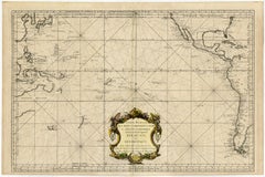
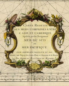
Highly decorative sea chart of the Pacific Ocean - Engraving - 18th century
By Jacques-Nicolas Bellin
Located in Zeeland, Noord-Brabant
apelees par les Navigateurs Mer du Sud ou Mer Pacifique [...]' - (Detailed map of Oceans between Asia and
Engraving

Unavailable|$4,052
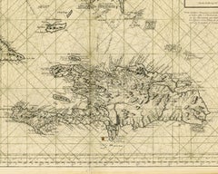
Sea chart of Santa Domingo and its surroundings - Engraving - 18th century
Located in Zeeland, Noord-Brabant
, to serve for the ships of the King.) Highly decorative sea chart / nautical map / maritime map of the
Engraving


Unavailable|$1,168
Sea chart of Gulf of Saint Laurence and Belle Isle - Engraving - 18th century
Located in Zeeland, Noord-Brabant
detailed map of the Gulf of St. Laurence ...) Highly decorative sea chart / nautical map / maritime map of
Engraving
![Carte generale des costes de l'Europe sur l'ocean [...].](https://a.1stdibscdn.com/archivesE/upload/a_5923/1508837429054/cb3798_master.jpg?width=240)
Unavailable|$1,233
Carte generale des costes de l'Europe sur l'ocean [...].
By Alexis Hubert Jaillot
Located in Zeeland, Noord-Brabant
Strait of Gibraltar.) Highly decorative sea chart / nautical map / maritime map of north-western Europe
Engraving
Large Nautical Map of New York Entrance, 1870
Located in Haddonfield, NJ
Large rectangular nautical map of the New York Entrance, 1857. Sandy Hook Bay, Coney Island
Nautical Map of the Mediterranean Sea from Le petit Neptune françois, 1763
By G. A. Rizzi-zannoni
Located in Milan, IT
Antique nautical map of the Mediterranean sea from La Spezia to Roussillon, from Le petit Neptune
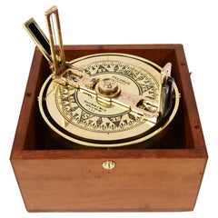
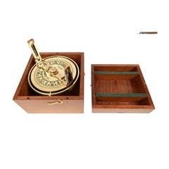
Pelorus Made in 1920s of Brass, Made in New York with Original Mahogany Box
Located in Milan, IT
visible and distinguishable coastal points, which will subsequently be reported on the nautical map in
Brass
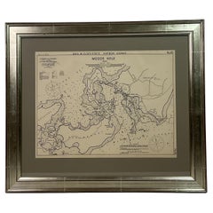
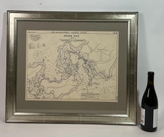
1901 Nautical Chart Showing Woods Hole, Mass
Located in Norwell, MA
Rare 1901 chart of Woods Hole, Mass., showing Buzzards Bay, Penzance Point, Nonamesset Island, Downtown Woods Hole, Parker Neck, Nobska Head, Vineyard Sound, Woods Hole Golf Club, Ra...
Paper
1837 "Mercator Projection" Map of the World by James Wyld
Located in Colorado Springs, CO
Mercator in 1569. It became the standard map projection for nautical purposes because of its ability to
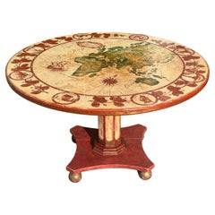
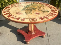
Antique Nautical World Map Painted Wood Round Dining Table
Located in LOS ANGELES, CA
Antique Nautical World Map Painted Wood Round Dining Table
Wood
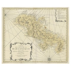
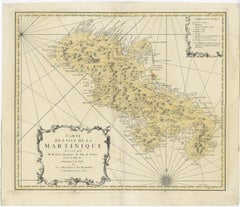
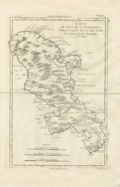
Detailed Nautical Antique Map of Martinique in the Caribbean, 1762
Located in Langweer, NL
Antique map titled 'Carte de l'Isle de la Martinique'. Detailed nautical map of the island of
Paper
Produced in 1843, the well-preserved volume is evidence of the author's exacting specifications.
New or old, the coverlets add old-time charm to any space.
Get into the games! These items celebrate the events, athletes, host countries and sporting spirit.
French trendsetter and serial collector Daniel Rozensztroch tells us about his obsession with objects related to seafaring men.
It's hard to resist the allure of a beautiful pool. So, go ahead and daydream about whiling away your summer in paradise.
The sought-after designer worked with the team at Hoffman Creative to produce a monograph that beautifully showcases some of Studio Shamshiri's most inspiring projects.
Italian writer and collector Umberto Pasti opens the doors to his remarkable cave of wonders in North Africa.
Hollywood A-listers, ex-pat aristocrats and art collectors and style setters of all stripes appreciate the allure of the coastal California hamlet — much on our minds after recent winter floods.