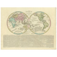
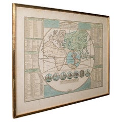
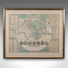
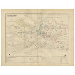
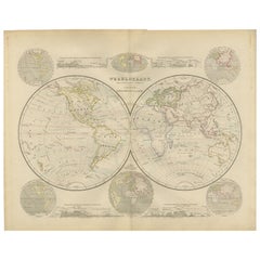
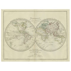
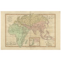
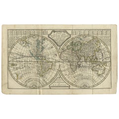
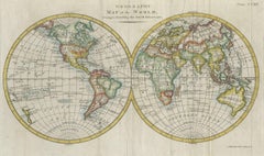
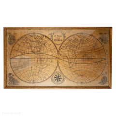
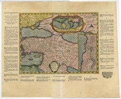
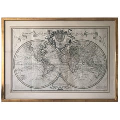
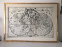
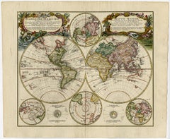
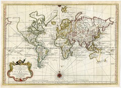
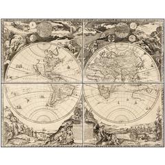
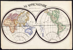
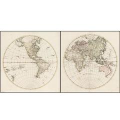
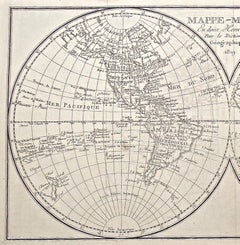
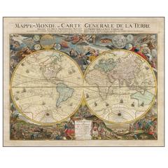
Antique World Map by Lesage, 1823
Located in Langweer, NL
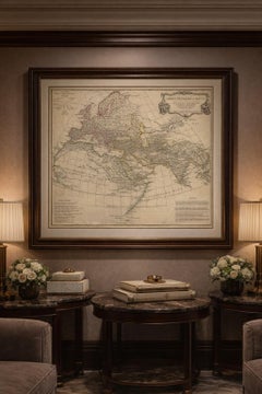
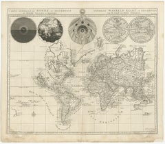
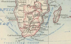
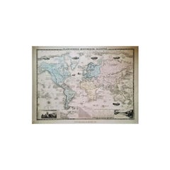
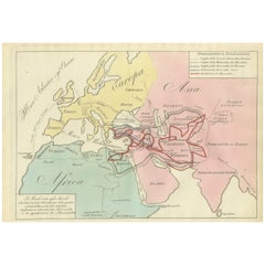
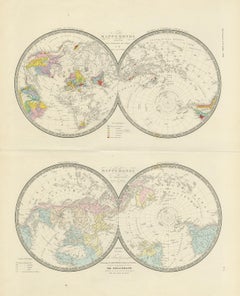
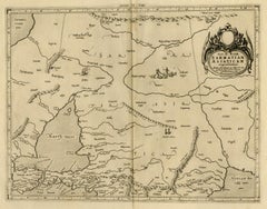
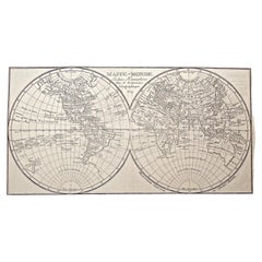
Antique world map titled 'Mappe Monde Historique'. The map depicts both the Eastern and Western
Category
Early 19th Century Antique World Maps
Materials
Paper
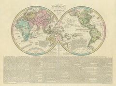
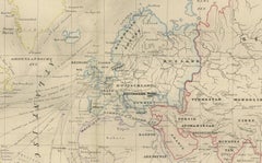
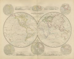
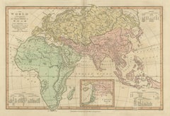
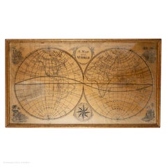
Antique World Map by Lesage, 1823
Located in Langweer, NL
Antique world map titled 'Mappe Monde Historique'. The map depicts both the Eastern and Western
Paper

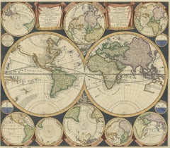
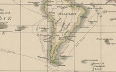
Antique World Map by P. Schenk '1706'
By Peter Schenk
Located in Langweer, NL
Aert-klooten (..)'. One of the earliest Dutch World Maps to focus on a more modern cartographic style
Paper

$4,329Sale Price|20% Off
H 28.75 in W 33.67 in D 1.58 in
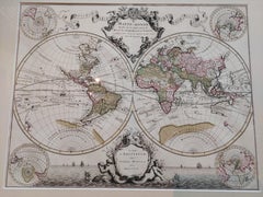
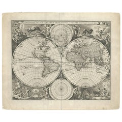
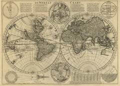
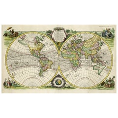
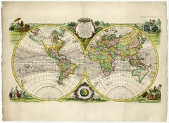
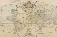
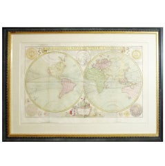
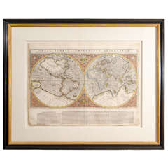
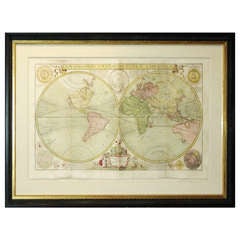
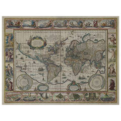
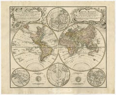
Original Antique Hand-colored World Map with or without Frame, '1696'
Located in Langweer, NL
Antique world map titled 'Mappe-Monde dressee sur les Observations de Mrs. de l'Academie Royale des
Paper
$1,623
H 21.42 in W 29.77 in D 0.01 in
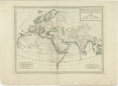
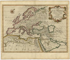
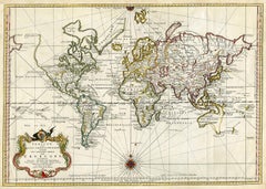
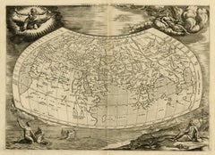
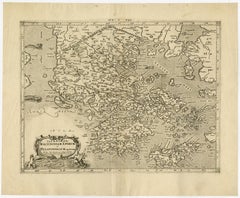
Antique Ancient World Map – Orbis Veteribus Notus, Engraving c.1818
Located in Langweer, NL
Antique Ancient World Map – Orbis Veteribus Notus, Engraving c.1818 Striking antique map depicting
Paper
$7,936
H 20.79 in W 25.2 in D 0.02 in
Gorgeous Antique World Map by the Dutch Mapmaker Visscher, published circa 1679
Located in Langweer, NL
example of Nicholas Visscher's World map, which appeared in his Atlas Minor after 1679. The map is
Paper

$456
H 14.77 in W 17.88 in D 0.01 in
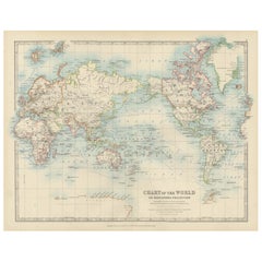
World Map – Mercator Projection with Global Sea Routes, Published in 1857
Located in Langweer, NL
World Map – Mercator Projection with Global Sea Routes 1857 This attractive antique print shows a
Paper


Antique Mercator Projection World Map by Petri, c.1873
Located in Langweer, NL
Antique world map titled 'Wereldkaart naar Mercator's Projectie'. Old map of the world. This map
Paper
$1,699
H 17.52 in W 21.46 in D 0.79 in
Antique Plan de l'Historie Universelle World Map, Framed Cartography, Circa 1730
Located in Hele, Devon, GB
This is an antique Plan de l'Historie Universelle World Map. A Dutch, framed atlas engraving by
Glass, Paper

$3,006
H 15.52 in W 21.26 in D 0.02 in
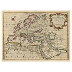
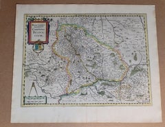
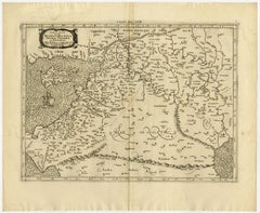
Mid-18th Century Antique World Map by R. & J. Wetstein, Netherlands
Located in Langweer, NL
Antique world map titled 'De Werelt Caart'. A scarce and richly detailed double hemisphere world
Paper
$276
H 17.33 in W 21.66 in D 0.01 in
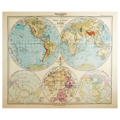
World Map in Mercator’s Projection – Nieuwe Hand-Atlas, Leiden 1876
Located in Langweer, NL
World Map in Mercator’s Projection – Nieuwe Hand-Atlas, Leiden 1876 This 19th-century Dutch world
Paper
$2,837Sale Price|20% Off
H 17.05 in W 23.23 in D 0 in
Rare Original Double Hemisphere World Map with Allegorical Figures, 1785
Located in Langweer, NL
hemisphere world map. Four allegorical figures in the corners represent Europe, Asia, Africa and America
Paper
$360
H 17.33 in W 21.66 in D 0.01 in
Double Hemisphere World Map from the Nieuwe Hand-Atlas, Leiden 1876
Located in Langweer, NL
Title: Double Hemisphere World Map from the Nieuwe Hand-Atlas, Leiden 1876 Description: This 19th
Paper
$312
H 11.03 in W 13.47 in D 0.01 in
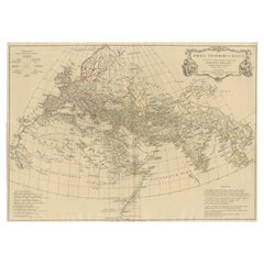
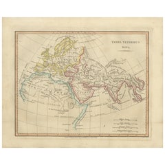
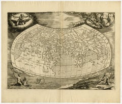
Terra Veteribus Nota — Classical World Map of Antiquity, Wilkinson 1814
Located in Langweer, NL
Terra Veteribus Nota — Classical World Map of Antiquity, Wilkinson 1827 This elegant antique map
Paper
$1,443
H 28.55 in W 21.46 in D 0.01 in
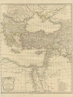
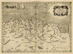
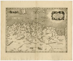
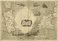
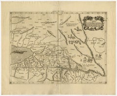
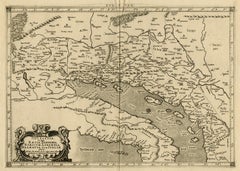
Eastern Roman World Map, Black Sea & Levant, Antique Engraving c.1818
Located in Langweer, NL
Eastern Roman World Map, Black Sea & Levant, Antique Engraving c.1818 Antique engraved map of the
Paper

$230Sale Price|20% Off
H 13.59 in W 18.71 in D 0 in
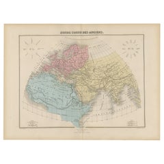
Antique World Map before the Voyages of Christopher Columbus, 1880
Located in Langweer, NL
Antique world map titled 'Monde Connu des Anciens'. Antique map of the World and continents before
Paper
$211Sale Price|20% Off
H 6.19 in W 7.41 in D 0 in
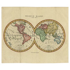
Small Antique World Map in Decorative Old Hand-Colouring, circa 1840
Located in Langweer, NL
Antique map titled 'Wereld Kaart'. Small and very decorative double hemisphere world map. Source
Paper

$442Sale Price|20% Off
H 16.34 in W 22.13 in D 0.01 in
World Map in Two Hemispheres: Eastern & Western - 1802 Tardieu Atlas
Located in Langweer, NL
Revolutionary Calendar) **Geographical Scope:** This antique map illustrates a double-hemisphere world map
Paper

$432
H 17.84 in W 24.1 in D 0.01 in
1884 Antique Decorative World Map – Mercator Projection, Victorian Era Print
Located in Langweer, NL
Antique World Map on Mercator’s Projection – Black’s Atlas, 1884 This finely engraved and colored
Paper
$288
H 14.49 in W 18.9 in D 0.01 in
Antique World Map in Hemispheres with Delicate Pastel Coloring, 1903
Located in Langweer, NL
Title: Antique World Map in Hemispheres with Delicate Pastel Coloring, 1903 Description: This
Paper

$883Sale Price|25% Off
H 16.93 in W 20.08 in D 0 in
Antique World Map with Astronomical Spheres by Pierre Mortier, Amsterdam, c.1700
Located in Langweer, NL
Antique World Map with Astronomical Spheres by Pierre Mortier, Amsterdam, circa 1700 This
Paper
Ancient World Map
Located in Houston, TX
Over 150 year old engraved map of the world as it was known during the antiquities by cartographer
Ink, Watercolor, Handmade Paper
$432
H 13.47 in W 20.6 in D 0.01 in
Biblical World Map of the Descendants of Noah — Wilkinson Atlas Classica, 1827
Located in Langweer, NL
Antique Biblical World Map Descendants of Noah Asia Europe Africa Wilkinson 1827 This fascinating
Paper
$541
H 9.45 in W 14.57 in D 0 in
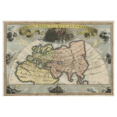
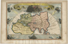
Veteris Orbis Climata – Ancient World Map after Strabo by Cellarius, 1731
Located in Langweer, NL
Veteris Orbis Climata – Ancient World Map after Strabo by Cellarius, 1731 This fascinating hand
Paper
$336
H 14.49 in W 18.9 in D 0.01 in
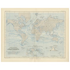
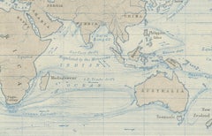
Antique World Map on Mercator's Projection, Ocean Currents and Trade Routes 1903
Located in Langweer, NL
Title: Antique World Map on Mercator's Projection, 1903, Showing Ocean Currents and Trade Routes
Paper

$4,750
H 20.5 in W 23.5 in
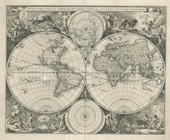
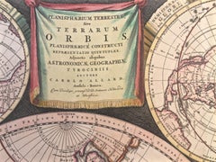
WORLD MAP - Planisphaerium Terrestre Sive Terrarum Orbis... 1696
By Carel Allard
Located in Santa Monica, CA
) Engraving, 20 ½ x 23 ½”, sheet 21 x 24 1/8". A stunning double hemisphere World Map with sphere projections
Engraving
$423Sale Price|20% Off
H 16.3 in W 22.33 in D 0.01 in
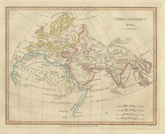
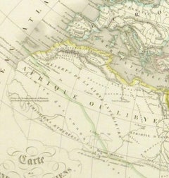
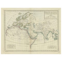
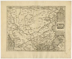
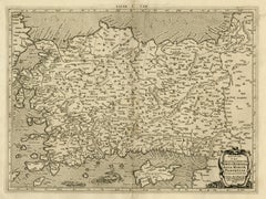
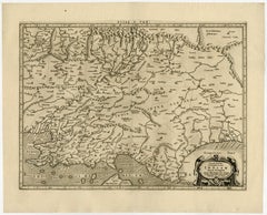
Ancient World Map: Europe, Africa & Asia - 1802 Tardieu Atlas
Located in Langweer, NL
Revolutionary Calendar) Geographical Scope: This antique map illustrates the "known world" of the ancients
Paper

$1,827Sale Price|20% Off
H 17.13 in W 20.08 in D 0.01 in
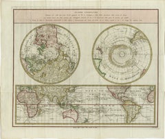
Old World Map Featuring Captain Cook's Exploration Routes and Polar Views, 1787
Located in Langweer, NL
1786 World Map with Polar Projections - "Globo Terrestre" by Giovanni Maria Cassini This 1786
Paper

$1,034
H 18.51 in W 26.38 in D 1.58 in
World Map - Etching by Hubert Nicholas-Jaillot - 1719
Located in Roma, IT
World map is an original modern artwork realized by Hubert Nicholas - Jaillot, printed by Louis
Etching
$1,126Sale Price|25% Off
H 15.75 in W 18.51 in D 0.01 in
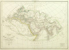
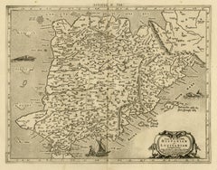
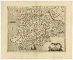
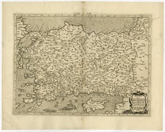
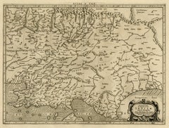
Ancient World Map of Europe, Asia & Northern Africa with Ancient Names, 1725
Located in Langweer, NL
ancient world depicting Europe, Asia, and northern Africa with ancient place names. This map originates
Paper

$4,208
H 32.29 in W 44.49 in
1864 Original illustrated planisphere - World Map - Geography
Located in PARIS, FR
relive the great discoveries that shaped our world. A true collector's item, this cartographic
Linen, Paper, Lithograph

$444
H 19.3 in W 13.39 in D 0 in
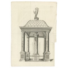
Monumental Design with World Map Pillar – Engraving after Volckamer, c.1780
Located in Langweer, NL
Monumental Design with World Map Pillar – Engraving after Volckamer, c.1780 This antique engraving
Paper
$288 / item
H 10.79 in W 13.59 in D 0.01 in
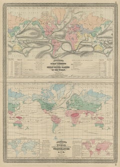
World Map of Ocean Currents by A.K. Johnston, Educational Print 1852
Located in Langweer, NL
World Map of Ocean Currents by A.K. Johnston, Educational Print 1852 This detailed and
Paper
$589
H 9.73 in W 14.02 in D 0.01 in
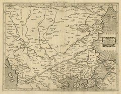
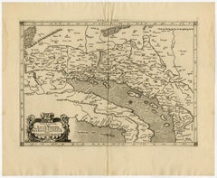
Ancient World Map, Roman Macedonian Persian Empires, Ferrario 1815
Located in Langweer, NL
Antique Map of Asia 1815 – Carta Generale dell’Asia, Ferrario, Italy This refined early 19th
Paper

Antique Map of the World by Johnson, '1872'
Located in Langweer, NL
Antique map titled 'Johnson's World. Original world map. This map originates from 'Johnson's New
Paper


Antique Map of the World in Hemispheres by Johnson, '1872'
Located in Langweer, NL
Antique map titled 'Johnson's Globular World. Original world map depicting the Eastern Hemisphere
Paper


$336Sale Price|20% Off
H 10.24 in W 14.18 in D 0.02 in
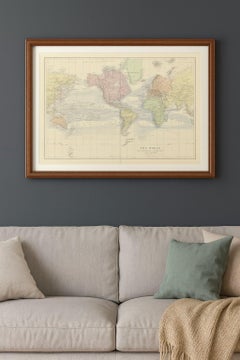
Antique Map of the World, Mercator Projection, by Wyld, '1845'
Located in Langweer, NL
Antique map titled 'The World'. Original antique world map, on Mercator's projection. This map
Paper

$1,750
H 14.25 in W 20.125 in
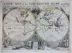
New Map of the Terraqueous Globe - WORLD MAP - CALIFORNIA AS AN ISLAND
By Edward Wells
Located in Santa Monica, CA
EDWARD WELLS (British 1667- 1727) A NEW MAP of the TERRAQUEOUS GLOBE - according to the latest
Engraving


$721Sale Price|20% Off
H 8.08 in W 12.8 in D 0.02 in
Antique Map of the World on Mercator's Projection, 1788
Located in Langweer, NL
Antique map titled 'Kaart van de Geheele Wereld (..)'. Uncommon small world map on Mercator's
Paper


$192Sale Price|20% Off
H 13.39 in W 16.93 in D 0.02 in
Antique Map of the World Showing the Distribution of Plants and Minerals, 1872
Located in Langweer, NL
Antique map titled 'Johnson's World showing the distribution of the Characteristic Forest Trees
Paper

$330Sale Price|44% Off
H 24.02 in W 18.71 in D 0.02 in
Antique Hemisphere Map of the World 'Two on One Sheet' by Levasseur, '1875'
Located in Langweer, NL
la projection polaire'. Large map with two hemisphere world maps on one sheet. This map originates
Paper
$695
H 1.12 in W 0.8 in D 0.72 in
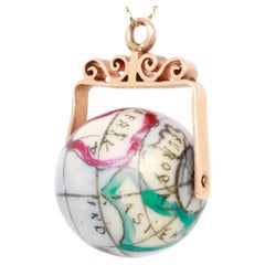
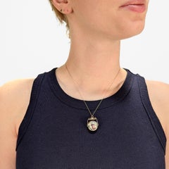
Antique 10K Rose Gold & Porcelain Globe / World Map Spinner Charm or Pendant
Located in Philadelphia, PA
porcelain bead decorated with a polychrome, simplified map of the world. Set with a 10 karat rose gold yoke
Rose Gold
$631Sale Price|30% Off
H 8.08 in W 13 in D 0.02 in
Antique Map of the World in two Hemispheres by Keizer & de Lat, 1788
Located in Langweer, NL
Antique map titled 'Kaart van de Twee platte Warelds Bollen (..)'. Interesting world map in two
Paper


$481Sale Price|20% Off
H 8.08 in W 11.03 in D 0.02 in
Antique Map of the World in Hemispheres by Keizer & de Lat, 1788
Located in Langweer, NL
double hemisphere world map on polar projections. In North America, there is a large Island of California
Paper


$450Sale Price|25% Off
H 8.08 in W 11.03 in D 0.02 in
Antique Map of the World with Polar Projections by Keizer & de Lat, 1788
Located in Langweer, NL
Antique map titled 'Schuine Ronde Aard-Klooten (..)'. Interesting double hemisphere world map with
Paper

$1,352Sale Price|25% Off
H 16.15 in W 20.08 in D 0.02 in
Attractive Antique Map of the World as Planisphere, Shows Cook's Voyages, 1799
Located in Langweer, NL
Antique map titled 'Chart of the World, according to Mercators Projection'. This world map shows
Paper

$336Sale Price|20% Off
H 26.78 in W 18.12 in D 0.02 in
Antique Map Showing the Ocean Currents and Temperature of Air, '1872'
Located in Langweer, NL
Two maps on one sheet titled 'Johnson's Oceans Currents (..)' and 'Johnson's World showing the
Paper

Antique Map of the World with California as an Island, 1788
Located in Langweer, NL
Wareld verbeeld in de gedaante van een hard'. This interesting composition contains three world maps on
Paper
$278Sale Price|20% Off
H 13.59 in W 18.71 in D 0 in
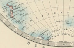
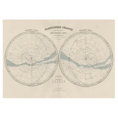
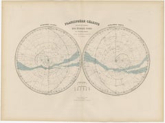
Antique Map of the Night Skies of the Northern and Southern Hemispheres, 1880
Located in Langweer, NL
Antique world map titled 'Planisphère en Céleste'. This map depicts the night skies of both the
Paper

$1,058Sale Price|20% Off
H 13.39 in W 22.05 in D 0.02 in
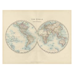
Interesting Original Antique Hemisphere Map Showing the Latest Discoveries, 1786
Located in Langweer, NL
Antique world map titled 'A Map of the World from the best Authorities'. Detailed map of the World
Paper
$8,252
H 0.4 in W 0.4 in D 0.4 in
Map Silk Embroidered Western Eastern Hemisphere New Old World Asia America Afri
Located in BUNGAY, SUFFOLK
A rare, late-18th century, silk, embroidered, double hemisphere, world map, blackwork, sampler
Silk
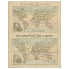

Antique Zoological Map, 1843
Located in Langweer, NL
Two antique world maps on one sheet. The upper map shows the distribution of animals over the world
Paper
Antique Map of Macedonia by the Famous Mapmaker Blaeu, c.1650
Located in Langweer, NL
started producing map and sea charts, including his first world map in 1605. His most famous work was the
Paper

$1,142
H 16.54 in W 20.28 in D 0 in
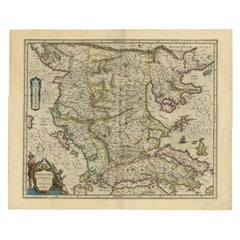
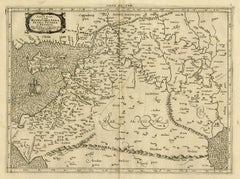
Scarce Antique Map of the Middle East, Surrounded by Latin Text, 1624
Located in Langweer, NL
, surrounded by Latin text. The two insets show Israel and an oval world map. This map (from the last edition
Paper

$875 / set
H 18.9 in W 22.45 in D 0.4 in
1633 Map Entitled "Beauvaisis Comitatus Belova Cium, Ric.0002
Located in Norton, MA
/Ashley) * 1590 World Map in two hemispheres illustrating Drake\\\\\\\\\\\\\\\'s circumnavigation * c
Paper
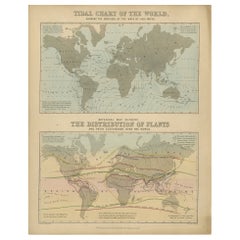

Antique Tidal Chart and Botanical Map, 1843
Located in Langweer, NL
Two antique world maps on one sheet. The upper map is a tidal chart of the world and shows the
Paper
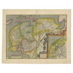

Antique Map of Friesland Also Know as the Peacock Map, C.1580
Located in Langweer, NL
established a business in dealing with books and drawing maps. His first remarkable map was a 8 sheet world
Paper
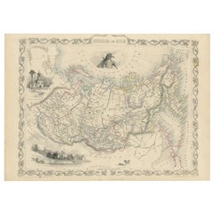

Antique Map of Russia in Asia by Tallis, c.1851
Located in Langweer, NL
of the last series of decorative world maps ever produced. The maps were engraved by John Rapkin, a
Paper
Large Framed Eighteenth Century World Map
By Herman Moll
Located in New York, NY
Herman Moll (1654-1732) A New and Correct Map of the World London, c. 1730 Engraving with hand
Paper, Watercolor
Unavailable
H 22.45 in W 31.5 in D 0.79 in
Extremely Rare Mappemonde a l'usage World Map Delisle, Guillaume Buache, 1730
Located in Drottningholm, SE
World Map. Delisle, Guillaume - Buache. Mappemonde a l'Usage du Roy par Guillaume Delisle I.er
Paper
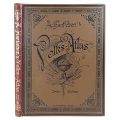
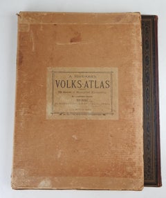
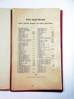
Antique German Hartleben's Volks Atlas Book World Maps
Located in Seguin, TX
Antique circa 1900 A. Hartleben's Volks-Atlas. Published by A. Hartleben's, Germany. Folio hardcover with decorated olive cloth binding and brown leather spine. Gilt title to spine...
Paper
Unavailable
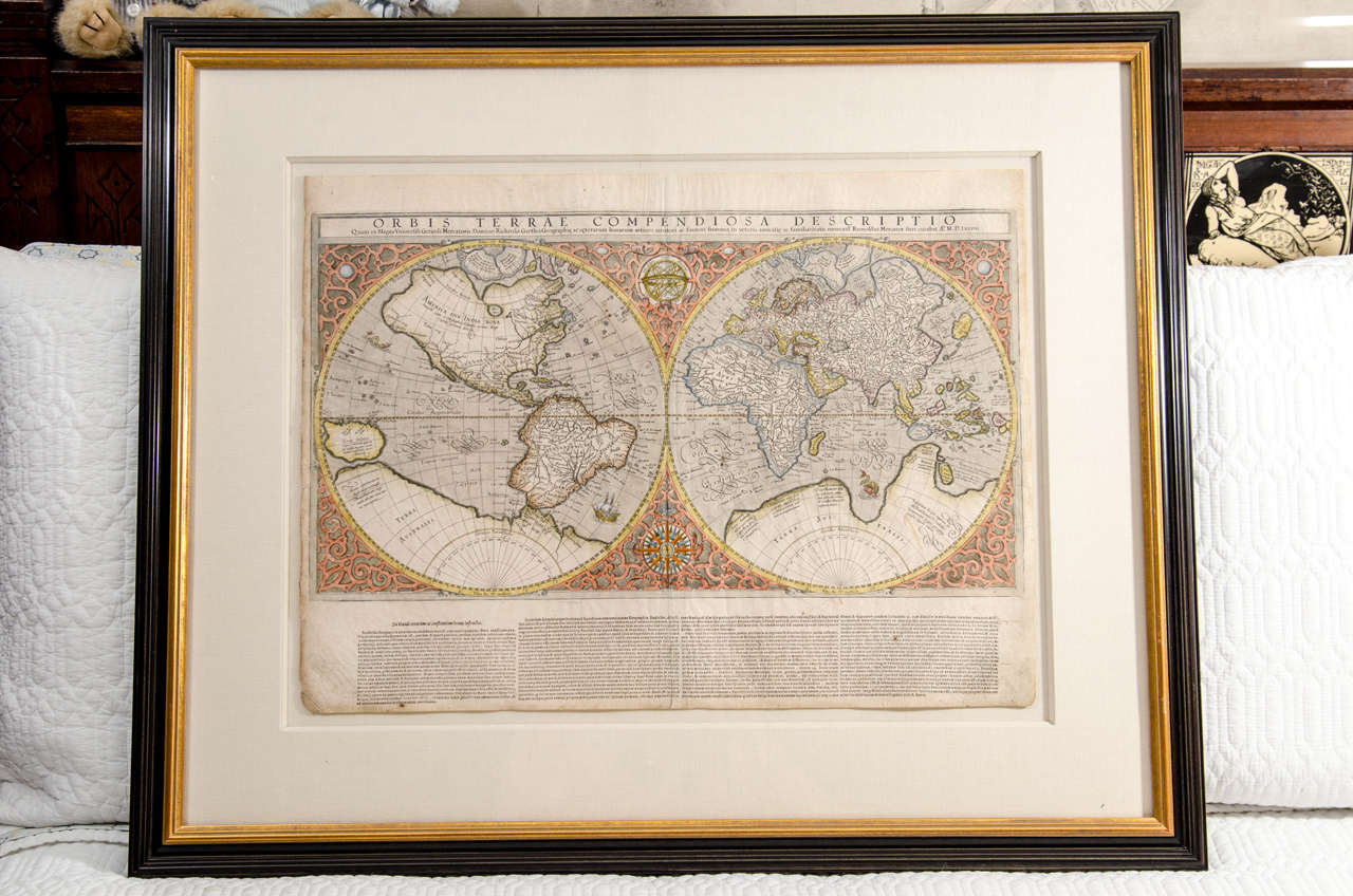
Mercator's Double Hemisphere World Map
By Gerard Mercator
Located in New York, NY
Gerard (1512 - 1594) and Rumold (1545 - 1599) Mercator Orbis Terrae Compendiosa Descriptio. . . Engraving with original hand-color from Strabonis Rerum Geographicarum 15 1/2 x 2...
Unavailable
H 11.5 in W 7.5 in
c. 1750 Double-Hemisphere World Map showing California as an Island
Located in New York, NY
c. 1750 beautifully hand-colored engraved double hemisphere world map, showing California as an
Engraving
Unavailable
H 21.07 in W 25.2 in
Antique world map - Mappe Monde by Lowitz - Handcoloured engraving - 18th c.
Located in Zeeland, Noord-Brabant
, titled: 'Planiglobii Terrestris. Mappe-Monde.' - Double hemisphere world map. Several small insep maps
Engraving
Unavailable
H 11.03 in W 16.26 in
World map on Mercator's projection by Bonne - Engraving - 18th Century
Located in Zeeland, Noord-Brabant
Terre (…).' - World map on Mercator's projection. Greenland and the Arctic are attached to North America
Engraving
Large Scale Double-Hemisphere World Map; Wall Map
By Herman Moll
Located in New York, NY
Herman Moll A New and Correct Map of the World... Published, London c. 1709 Engraving with
Unavailable
H 20.56 in W 28.55 in
Antique world map - Erdkugel and compass by Bellin - Handcol. engraving - 18th c
By Jacques-Nicolas Bellin
Located in Zeeland, Noord-Brabant
Erdkugel enthaelt …' - Detailed world map in Mercator projection showing the known parts of the globe, with
Engraving
Unavailable
H 17.72 in W 20.48 in
Very decorative world map of the ancient world by Mercator - Engraving - 17th c.
By Gerard Mercator
Located in Zeeland, Noord-Brabant
of the ancient world. Surrounded by allegorical figures representing the four elements: Fire (Zeus
Engraving
Unavailable
H 19 in W 24 in D 0.2 in
Nova Totius Terrarum Orbis Geographica Ac Hydrographica Tabula, 1638
By Willem Blaeu
Located in Houston, TX
New Geographical and Hydrographical Map of the World. Beautifully hand-colored, this 1638
Unavailable
H 23.63 in Dm 13 in
Terrestrial Globe in Lithographed Paper and Cast Iron, J.Lebègue & Cie – Late 19
By J. Lebegue & Cie
Located in HÉRIC, FR
showing a detailed world map with 'International Railways', 'Telegraph Lines', 'Steam Navigation Lines
Iron
Map: Set of 7 Maps: The World and Continents
By Victor Levasseur
Located in Florham Park, NJ
Millican, Inc. IN DEALER DETAILS Exceptionally attractive, these maps also contain much useful
Highly Decorative Italian Wall Map of the World
By Paolo Petrini
Located in La Jolla, CA
Exceedingly rare separately-issued wall map of the World, by the Neapolitan mapmaker Paolo Petrini
Paper
1900s Stielers Hand Atlas 100 Maps
Located in Seguin, TX
100 folded individual loose leaf maps of the world, text in german. Box made to look like a book, and
Paper
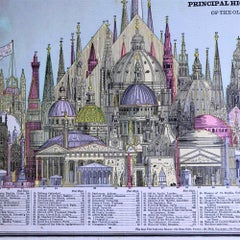
1887 Engraving of Old World Buildings Framed
By George F. Cram
Located in Pataskala, OH
Unrivaled Family Atlas of the World. We have used glare reducing Museum Glass and archival matting and
Paper
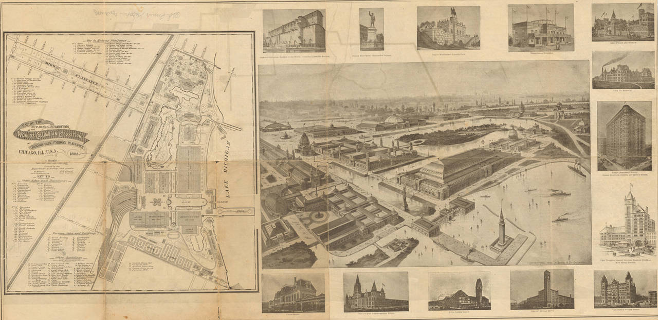
Bird's-Eye View of Chicago, 1893
By Peter Roy
Located in Houston, TX
the "Map of the Buildings and Grounds of the World's Columbian Expostion." This map is a delight for
Mappe Monde.
By Valentine Francoise Dumont
Located in Zeeland, Noord-Brabant
Pen and ink drawing, handcoloured, on vellin paper. Manuscript double hemisphere world map, with
Ink, Pen
Unavailable
H 13 in W 10.38 in D 0.07 in
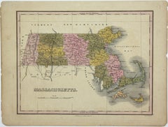
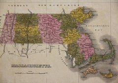
6, 19th Century hand-colored maps printed by Anthony Finley of Philadelphia 1824
Located in San Antonio, TX
nascent American cartographic world. Maps in series: Maryland, Vermont, Maine, Massachusetts, Ohio and
Pastel, Lithograph
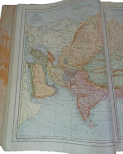
Rare Reynolds' After-War Atlas and Gazetteer of the World 1919
Located in Mississauga, CA
World Maps Remade After the World’s Peace Treaty, Paris, 1919. This historically significant volume
Paper
Rare 1790s Russian Map of the World
Located in La Jolla, CA
only thirty years. Overall, the two maps show a view of the world at a crucial turning point in the
Paper
Unavailable
H 17.33 in W 21.66 in
Ptolemaic map of Italy by Mercator - Engraving - 17th c.
By Gerard Mercator
Located in Zeeland, Noord-Brabant
he moved to Duisburg, Germany where he published his famous 18-sheet world map in 1569 with his own
Engraving
Unavailable
H 17.33 in W 21.26 in
Ptolemaic map - Balkan Peninsula, Greece, Crete by Mercator - Engraving - 17th c
By Gerard Mercator
Located in Zeeland, Noord-Brabant
world map in 1569 with his own new projection, today called Mercator projection. Later he decided to
Engraving
Unavailable
H 17.33 in W 20.87 in
Ptolemaic map of ancient Tunesia, Malta, Lybia by Mercator - Engraving - 17th c.
By Gerard Mercator
Located in Zeeland, Noord-Brabant
Ptolemaic map covering ancient Tunesia with Malta and parts of Lybia. Embellished with sea monsters, wild
Engraving
Unavailable
H 16.93 in W 20.87 in
Ptolemaic map of ancient Spain and Portugal by Mercator - Engraving - 17th c.
By Gerard Mercator
Located in Zeeland, Noord-Brabant
where he published his famous 18-sheet world map in 1569 with his own new projection, today called
Engraving
Unavailable
H 17.33 in W 21.26 in
Ptolemaic map of Bulgaria, Rumania, Bosporus by Mercator - Engraving - 17th c
By Gerard Mercator
Located in Zeeland, Noord-Brabant
where he published his famous 18-sheet world map in 1569 with his own new projection, today called
Engraving
Unavailable
H 17.33 in W 20.87 in
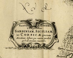
Map of Sardinia, Sicily and part of Corsica by Mercator - Engraving - 17th c.
By Gerard Mercator
Located in Zeeland, Noord-Brabant
he moved to Duisburg, Germany where he published his famous 18-sheet world map in 1569 with his own
Engraving
Unavailable
H 15.75 in W 20.87 in
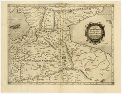
Old map of Georgia, Armenia and Azerbaijan by Mercator - Engraving - 17th c.
By Gerard Mercator
Located in Zeeland, Noord-Brabant
maker. In 1552 he moved to Duisburg, Germany where he published his famous 18-sheet world map in 1569
Engraving
Unavailable
H 17.33 in W 21.26 in
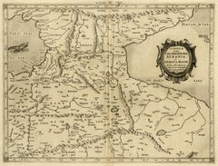
Map of Syria, Libanon, Palestine, Iraq, Israel by Mercator - Engraving - 17th c.
By Gerard Mercator
Located in Zeeland, Noord-Brabant
Deserta. (…).' - A beautiful Ptolemaic map of of the region between the Mediterranean Sea and Persian Gulf
Engraving
Unavailable
H 17.33 in W 20.87 in
Ptolemaic map of North Africa, Libya, Egypt by Mercator - Engraving - 17th c
By Gerard Mercator
Located in Zeeland, Noord-Brabant
where he published his famous 18-sheet world map in 1569 with his own new projection, today called
Engraving
Unavailable
H 16.93 in W 20.87 in
Ancient map of South Russia and Black Sea by Mercator - Engraving - 17th c
By Gerard Mercator
Located in Zeeland, Noord-Brabant
where he published his famous 18-sheet world map in 1569 with his own new projection, today called
Engraving
Unavailable
H 17.72 in W 21.26 in
Ptolemaic map - Persian Gulf to the Caspian Sea by Mercator - Engraving - 17th c
By Gerard Mercator
Located in Zeeland, Noord-Brabant
world map in 1569 with his own new projection, today called Mercator projection. Later he decided to
Engraving
Unavailable
H 17.33 in W 21.26 in
Old map of Himalayas, N. India and Afghanistan by Mercator - Engraving - 17th c.
By Gerard Mercator
Located in Zeeland, Noord-Brabant
world map in 1569 with his own new projection, today called Mercator projection. Later he decided to
Engraving
Unavailable
H 17.33 in W 20.87 in
Ptolemaic map of Turkey and Cyprus - Tab I - by Mercator - Engraving - 17th c.
By Gerard Mercator
Located in Zeeland, Noord-Brabant
he moved to Duisburg, Germany where he published his famous 18-sheet world map in 1569 with his own
Engraving
Unavailable
H 17.33 in W 21.26 in
Ptolemaic map of Balkan coast extending north by Mercator - Engraving - 17th c.
By Gerard Mercator
Located in Zeeland, Noord-Brabant
published his famous 18-sheet world map in 1569 with his own new projection, today called Mercator
Engraving
Unavailable
H 17.33 in W 20.87 in
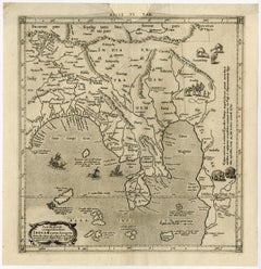
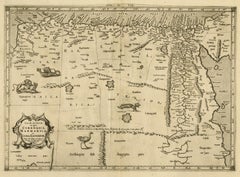
Ptolemaic map of India and Himalayan mountains by Mercator - Engraving - 17th c.
By Gerard Mercator
Located in Zeeland, Noord-Brabant
maker. In 1552 he moved to Duisburg, Germany where he published his famous 18-sheet world map in 1569
Engraving
Unavailable
H 17.33 in W 20.87 in
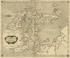
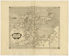
Map of ancient Great Britain, Scotland, Ireland by Mercator - Engraving - 17th c
By Gerard Mercator
Located in Zeeland, Noord-Brabant
published his famous 18-sheet world map in 1569 with his own new projection, today called Mercator
Engraving
Unavailable
H 14.97 in W 14.57 in
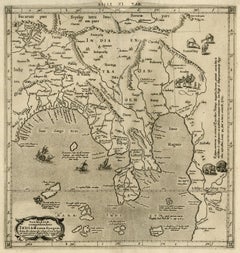
Ptolemaic map of Asia east of the river Ganges by Mercator - Engraving - 17th c.
By Gerard Mercator
Located in Zeeland, Noord-Brabant
where he published his famous 18-sheet world map in 1569 with his own new projection, today called
Engraving


Unavailable
H 16.93 in W 21.26 in
Map of Vistula river, Sea of Azov, Baltic Sea by Mercator - Engraving - 17th c
By Gerard Mercator
Located in Zeeland, Noord-Brabant
published his famous 18-sheet world map in 1569 with his own new projection, today called Mercator
Engraving
Unavailable
H 17.33 in W 20.87 in
Ptolemaic map of east Libya, Egypt and the Nile by Mercator - Engraving - 17th c
By Gerard Mercator
Located in Zeeland, Noord-Brabant
where he published his famous 18-sheet world map in 1569 with his own new projection, today called
Engraving
Unavailable
H 16.93 in W 20.87 in
Ptolemaic map of NW Africa, Morocco and Algeria by Mercator - Engraving - 17th c
By Gerard Mercator
Located in Zeeland, Noord-Brabant
published his famous 18-sheet world map in 1569 with his own new projection, today called Mercator
Engraving
Unavailable
H 8 in W 14.83 in D 0.13 in
1800s French Map of the World in Two Hemispheres - Le Dictionnaire Géographique
Located in Montréal, CA
Mappe-Monde. En deux Hemispheres Pour le Dictionnaire Géographique. Author: Vosgien and Caillot Source / Publication: Le Dictionnaire Géographique, ou Description de toutes les Parti...
Paper
Planiglobii Terrestris.
By Johann Baptist Homann
Located in Zeeland, Noord-Brabant
Original handcoloured etching/engraving on laid paper. Double hemisphere world map. Several small
Engraving, Etching
Unavailable
H 2.76 in W 29.53 in D 21.26 in
Atlas Minor Du Monde World Geography 1695 17th Century in Hand Colored
By Pierre Mortier
Located in Diest, Vlaams Brabant
World Atlas Minor world107 detailed maps and overviews Hand colored 17th century, dated 1695
Paper

Unavailable
H 35.04 in W 22.45 in
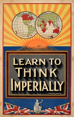
Original Antique Poster Learn to Think Imperially British Empire Chamberlain UK
Located in London, GB
quote in the centre of a great design depicting a globe map of the world showing the countries of the
Paper
Unavailable
H 11.93 in W 16.58 in
Das Unterquartier Kempenland. Nro. 662.
By Franz Joseph Johann von Reilly
Located in Zeeland, Noord-Brabant
' (Wien: Reilly, 1791-1806), a world atlas in 830 maps by Franz Joseph Johann von Reilly. Made by Franz
Engraving, Etching

Unavailable
H 17.52 in W 19.53 in
Algemeene Kaart der Vereenigde Nederlanden.
By Zacharias Chatelain
Located in Zeeland, Noord-Brabant
, heraldry, and costumes of the world. The maps in the Atlas Historique were mainly based on those of the
Engraving
Unavailable
H 19.61 in W 23.23 in
Ducatus Gelriae pars prima quae est Neomagensis.
By Johannes Janssonius
Located in Zeeland, Noord-Brabant
in 33 maps), and of the Ancient World (60 maps). The eleventh volume was the Atlas of the Heavens by
Engraving, Etching
Platte Kaart van de geheele werelt.
By Jacob Keyser
Located in Zeeland, Noord-Brabant
whole world. This map shows the known world at the time of publication. California is shown as an island
Engraving, Etching
Unavailable
H 34 in W 40 in D 1 in
Mappe-Monde Ou Carte Generale De La Terre Divisee En Deux Hemispheres
By Louis Charles Desnos
Located in La Jolla, CA
A remarkable wall map of the world by Densos, in an unrecorded variant state, with an unusual
Paper
Trasisalania vulgo Overyssel.
Located in Zeeland, Noord-Brabant
cities of the world" (Townatlas), of the waterworld (Atlas Maritimus in 33 maps), and of the Ancient
Engraving, Etching
Unavailable
H 19.61 in W 23.35 in
Ducatus Gelriae pars quarta quae est Arnhemiensis, sive Velavia.
By Johannes Janssonius
Located in Zeeland, Noord-Brabant
" (Townatlas), of the waterworld (Atlas Maritimus in 33 maps), and of the Ancient World (60 maps). The eleventh
Engraving, Etching
![Tabula Castelli ad Sandflitam, qua simul inundati agri, alluviones, [...].](https://a.1stdibscdn.com/archivesE/upload/a_5923/1509441013669/cb3408_master.jpg?width=240)
Unavailable
H 19.53 in W 23.31 in
Tabula Castelli ad Sandflitam, qua simul inundati agri, alluviones, [...].
By Johannes Janssonius
Located in Zeeland, Noord-Brabant
in 33 maps), and of the Ancient World (60 maps). The eleventh volume was the Atlas of the Heavens by
Engraving, Etching
![Nouvelle Carte pour Conduire a la Connoissance de la Marine [...].](https://a.1stdibscdn.com/archivesE/upload/a_5923/1504613785940/ab4698_master.jpg?width=240)
Unavailable
H 21.46 in W 24.22 in
Nouvelle Carte pour Conduire a la Connoissance de la Marine [...].
By Henri-Abraham Chatelain
Located in Zeeland, Noord-Brabant
the world. The maps in the Atlas Historique were mainly based on those of the French cartographer
Engraving, Etching
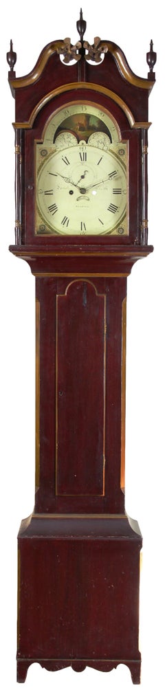
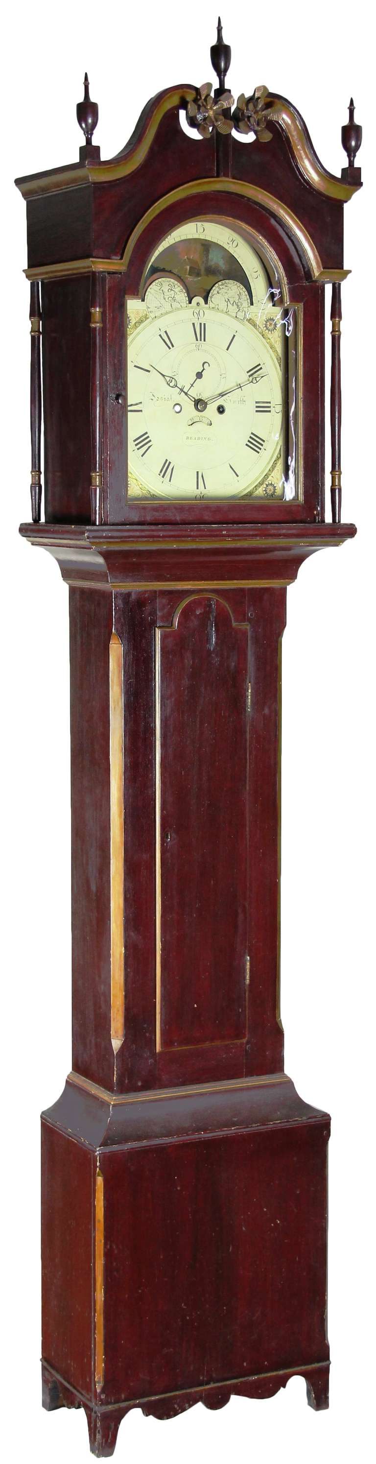
Painted Tall Case Clock, Eight-Day Moon Dial Works
Located in Providence, RI
signed works, we take notice. Note the intricate map of the world and painted moon dial with boat, et al
Unavailable
H 85 in W 18.5 in D 9 in
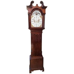
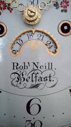
Early 19th Century Belfast Chippendale Longcase by Robert Neill, circa 1820
By Robert Neill
Located in Dublin, IE
full sail and maps of the world. Elegant Arabic numerals on the dial. Robert Neill - 1775-1857
Mahogany
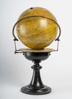
World Map of 19th Century
Located in Saint-Ouen, FR
World map signed Maison Delamarche Paris. 19th century. Measures: D: 30 cm, H: 45 cm.
Wood
$35,028
H 6.3 in W 15.75 in D 5.91 in
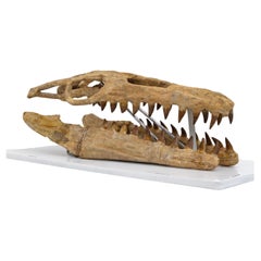
Fossilised Skull of Prehistoric Marine Reptile the Mosasaur, 70Million Years Ago
Located in Puglia, Puglia
Upper Cretaceous, about 70-65 million years ago (Maastrichtian) Morocco The skull is reconstructed in good proportions with fossil pieces found in a phosphate mine in Morocco. I att...
Bone
$39,683
H 8.67 in W 19.69 in D 19.69 in
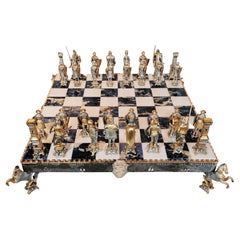
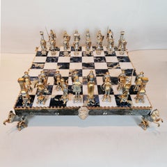
Italian Sterling Silver Chess Board, Chess Game, Sodalite Marble
By Arval Argenti Valenza
Located in VALENZA, IT
Impressive sterling silver chess board medieval style chess set. The chess board, made by ARVAL ARGENTI VALENZA, was made in white marble and sodalite is supported by a STERLING SIL...
Marble, Sterling Silver
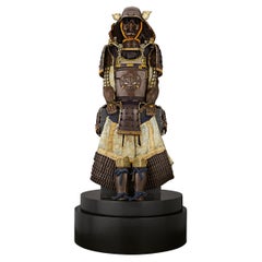
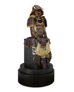
Edo Period Samurai Suit Of Armor
Located in New Orleans, LA
This exquisite Tetsusabiji Uchidashi Gomai Dou Gusoku (Five-Plate Russet Iron Embossed Cuirass Armor), crafted in the 18th century, exemplifies the pinnacle of Edo-period samurai arm...
Copper, Iron

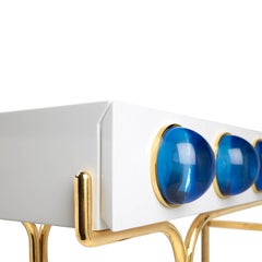
Globo Console
By Jonathan Adler
Located in New York, NY
Futuristic elegance. A glossy, white lacquer cabinet cradled by a sinuous brass framework and capped with blue solid acrylic cabochons. Small footprint but big impact, our Globo cons...
Brass
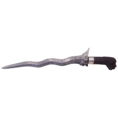
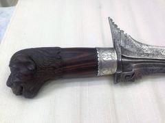
19th Century Steel and Sterling Silver Malaysian Dagger
Located in Miami, FL
19th century sterling silver Malaysian Dagger. Original carved mahogany wood handle. Sterting silver carved crown. Damascene steel. The kris is an asymmetrical dagger with distincti...
Mahogany
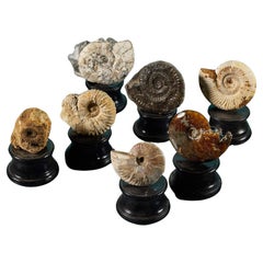
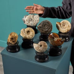
Collection of 7 Ammonite Fossils
Located in Wormelow, Herefordshire
A superb set of 7 ancient prehistoric ammonite fossils presented on our small turned painted plaster bases. This group showcases ammonites of varying tone, texture and tactile finish...
Stone

$29,600Sale Price|20% Off
H 70 in W 68.5 in D 20 in
17th Century Large Mantle Louis XIII Chateau Hand Carved Stone Antique Fireplace
Located in West Hollywood, CA
Extremely Rare 17th Century Louis XIII Chateau Fireplace, 1610-1643 Rare and unique French antique castle fireplace Louis XIII period Limestone Chimney with a magnificent Trumeau T...
Stone, Limestone
$446,984
H 70.87 in W 125.99 in D 2.17 in
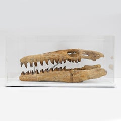
Giant Crocodile Fossil Wall Plate, Germany. 180 Million Years Old.
Located in London, GB
This outstanding fossilised skeleton is that of the ancestral crocodile species Steneosaurus bollensis that lived during the early Jurassic period. The skeleton, complete with armour...
Other
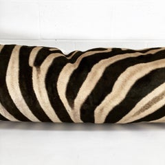
Forsyth Luxury Zebra Hide King Pillow
Located in SAINT LOUIS, MO
Our Luxury King Pillow makes a show-stopping statement on a couch or an incredibly luxurious feel on the bed. Our Forsyth craftsmen use a single hide for this beautiful pillow. The z...
Zebra Hide, Cotton, Down
$769
H 19.3 in W 22.52 in D 0.01 in
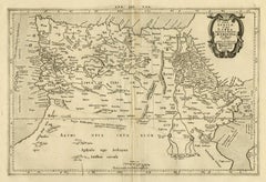
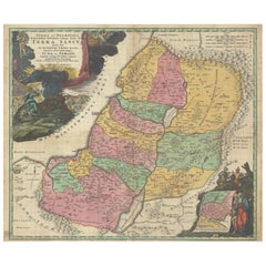
Hand-Colored Map of the Holy Land Divided Among the Twelve Tribes, c.1720
Located in Langweer, NL
Hand-Colored Map of the Holy Land Divided Among the Twelve Tribes, c.1720 This striking antique map, titled "Iudaea seu Palaestina ob Sacratissima Redemtoris Vestigia Hodie Dicta Te...
Paper
$45,000 / item
H 0.75 in W 12 in D 15 in
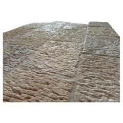
Antique Stone Flooring - Rustic Salvaged Reclaimed Ancient Tile - Old Pavers
Located in Costa Mesa, CA
Our exclusive Pietra Andalusia reclaimed tile is a 17th century natural-stone flooring like no other. This extremely rare "masterpiece" represents one of the most refined grades of a...
Limestone
$17,940 / item
H 29.14 in W 116.54 in D 50.01 in
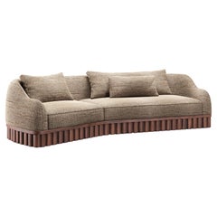
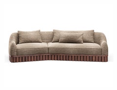
Ripple Sofa – Angular Curved Silhouette with Sculptural Carved Wood Base
Located in NEW YORK, NY
The Ripple sofa draws from the soft rhythm of water and air, vertical lines echoing ripples, pillars and sculpted silence. Its base anchors the form, while the upholstered seat float...
Upholstery, Wood
$29,311Sale Price|25% Off
H 13 in W 10.63 in D 4.34 in
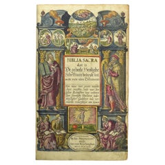
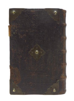
Hand-colored 16th century copy of the famous Moerentorf Bible
By Henry Moret
Located in ZWIJNDRECHT, NL
Publisher: Daniel Vervliet and Hendrik Swingen for Jan I Moretus & Jan I van Keerberghen Place / Date: Antwerp, 1599 Biblia sacra. Dat is de geheele heylighe schrifture bed...
Wood, Paper
$150,000 / set
H 105 in W 136 in D 46 in
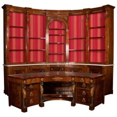
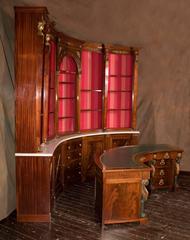
Rare and Stunning Empire Mahogany Curved Desk and Bookshelf, 19th Century French
Located in New Orleans, LA
This very unusual pairing features a curved desk and a curved bookshelf with a variety of decorative elements on each. It is quite rare to find curved antique items of large furnitur...
Marble, Bronze, Gold
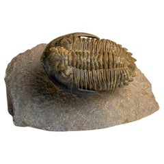
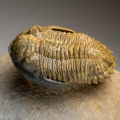
Genuine Hollardops Trilobite Fossil from Ofaten, Morocco (261.3 grams)
Located in New York, NY
Trilobites, an early arthropod relative of spiders, horseshoe crabs, and scorpions, preserved in this level of detail only occurred as a result of very sudden underwater landslides c...
Cement, Other

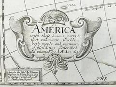
AMERICA
By John Speed
Located in Santa Monica, CA
IMPORTANT AMERICAN MAP - ONE OF THE FIRST TO SHOW CALIFORNIA as an ISLAND JOHN SPEED (1552-1629) AMERICA - With Those Known Parts In That Unknown Worlde (sic), 1626-(76) (Burden 2...
Engraving
Produced in 1843, the well-preserved volume is evidence of the author's exacting specifications.
New or old, the coverlets add old-time charm to any space.
Get into the games! These items celebrate the events, athletes, host countries and sporting spirit.
French trendsetter and serial collector Daniel Rozensztroch tells us about his obsession with objects related to seafaring men.
It's hard to resist the allure of a beautiful pool. So, go ahead and daydream about whiling away your summer in paradise.
The sought-after designer worked with the team at Hoffman Creative to produce a monograph that beautifully showcases some of Studio Shamshiri's most inspiring projects.
Italian writer and collector Umberto Pasti opens the doors to his remarkable cave of wonders in North Africa.
Hollywood A-listers, ex-pat aristocrats and art collectors and style setters of all stripes appreciate the allure of the coastal California hamlet — much on our minds after recent winter floods.