Early 20th Century Maps
to
129
267
21
288
3
3
2
1
2,974
2,229
473
3
288
34
9
126
8
36
9
2
5
4
3
2
278
13
9
9
3
82
77
64
22
15
288
288
288
5
1
1
1
1
Period: Early 20th Century
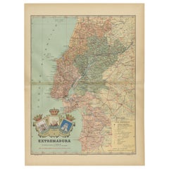
An Antique Map of Extremadura: Crossroads of History and Nature, 1903
Located in Langweer, NL
The image is a historical map of Extremadura, an autonomous community of Spain, from an unspecified year. The map features the region's topography, including mountain ranges, river systems, and road networks. Extremadura is bordered by Portugal to the west and is situated to the southwest of Madrid. The map also includes the coat of arms of Lisbon (Lisboa), possibly indicating the historical connections between the two regions, as Lisbon is close to the border of Extremadura.
Extremadura is known for its:
1. **Natural Landscapes**: The region has diverse landscapes, including the mountainous areas in the north and the fertile plains (known as the dehesa) used for grazing pigs, which produce the famous Iberian ham.
2. **Historical Significance**: Extremadura was the birthplace of many famous conquistadors, such as Hernán Cortés...
Category
Antique Early 20th Century Maps
Materials
Paper
$433 Sale Price
20% Off
Large Original Vintage Map of China, circa 1920
Located in St Annes, Lancashire
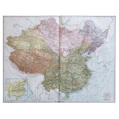
Great map of China.
Original color. Good condition.
Published by Alexander Gross
Unframed.
Category
English Edwardian Vintage Early 20th Century Maps
Materials
Paper
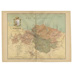
Cartographic Heritage: The 1901 Map of the Vizcaya Province in Spain
Located in Langweer, NL
This is a historical map of the province of Vizcaya (Biscay) in Spain, dated 1901. The title on the map is "VIZCAYA. 1901." It shows the topographical details of the region with cont...
Category
Antique Early 20th Century Maps
Materials
Paper
$301 Sale Price
20% Off
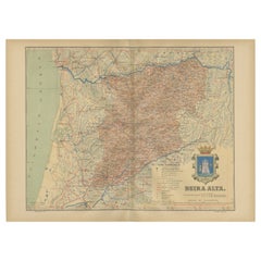
Beira Alta: A Cartographic Journey Through Portugal's Heartland in 1903
Located in Langweer, NL
The uploaded image is a historical map of the Beira Alta region in Portugal. The map is detailed, showing the topography, hydrography, and transportation networks of the region, incl...
Category
Antique Early 20th Century Maps
Materials
Paper
$273 Sale Price
20% Off
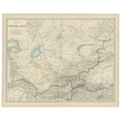
Antique Map of Central Asia by Johnston '1909'
Located in Langweer, NL
Antique map titled 'Central Asia'. Original antique map of Central Asia. This map originates from the ‘Royal Atlas of Modern Geography’. Published by W. & A.K. Johnston, 1909.
Category
Early 20th Century Maps
Materials
Paper
$235 Sale Price
20% Off
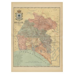
Huelva 1901: A Cartographic Presentation of Andalusia's Atlantic Frontier
Located in Langweer, NL
The map displays the province of Huelva, located in the southwestern part of the autonomous community of Andalusia in Spain, as of the year 1901. It outlines various geographic and m...
Category
Antique Early 20th Century Maps
Materials
Paper
$339 Sale Price
20% Off
Map of Sevilla Province, 1901: A Depiction of The Spanish Cultural Heartland
Located in Langweer, NL
The print for sale here depicts a historical map of the province of Sevilla (Seville) from the year 1901. Sevilla is located in the southern part of Spain and is part of the autonomo...
Category
Antique Early 20th Century Maps
Materials
Paper
$264 Sale Price
30% Off
Topographical and Infrastructure Map of the Province of Valencia, 1901
Located in Langweer, NL
A historical map of the province of Valencia, dated 1901. The map includes intricate details such as topographical features, with mountain ranges and river systems prominently marked...
Category
Antique Early 20th Century Maps
Materials
Paper
$491 Sale Price
20% Off
Original Antique Map of Palencia Province, in Northern Spain, 1901
Located in Langweer, NL
This historical map is of Palencia, a province in the northern part of Spain.
Palencia is situated within the autonomous community of Castilla y León. It is bordered by the provinc...
Category
Antique Early 20th Century Maps
Materials
Paper
$367 Sale Price
20% Off
Echoes of Empire: Spanish Territories in West Africa, 1903
Located in Langweer, NL
This is a historical map showing Spanish possessions in West Africa from the year 1903. The map includes the islands of Fernando Póo (now known as Bioko), part of the modern-day country of Equatorial Guinea, Annobón Island, and the Elobey Islands, along with the Spanish-controlled areas on the continental region near Rio Muni.
These territories were part of Spain's colonial empire and are situated in the Gulf of Guinea, off the coast of Central Africa. Fernando Póo (Bioko) is particularly notable for its volcanic origins and as a center of cocoa production during the colonial period. Annobón, lying further southwest of Bioko, is a small volcanic island. The Elobey Islands are very small and located near the coast of Gabon.
Here's a brief overview of their significance:
1. **Bioko Island (Fernando Póo)**: The island has a rich biodiversity and is known for its unique flora and fauna, including several endemic species. Malabo, the capital city of Equatorial Guinea, is located here.
2. **Annobón Island**: This remote island has a small population and is known for its isolation and distinctive Creole culture, which has developed independently from the mainland.
3. **Elobey Islands**: These consist of Elobey Grande and Elobey Chico and are situated near the mouths of the Muni and Campo rivers. They were historically important as transit points in river trade...
Category
Antique Early 20th Century Maps
Materials
Paper
$377 Sale Price
20% Off
Huesca 1901: A Geographic Overview of Aragon's Northern Frontier in Spain
Located in Langweer, NL
The map provided is of the province of Huesca, located in the northeastern part of Spain, within the autonomous community of Aragon, as of the year 1901. Here are some of the key fea...
Category
Antique Early 20th Century Maps
Materials
Paper
$301 Sale Price
20% Off
Cuenca 1901: A Historical Cartographic Detailing of High Plains and Mountains
Located in Langweer, NL
The original antique map displays the province of Cuenca, located in the autonomous community of Castilla-La Mancha in central Spain, as of 1901. Here are some of its features:
It i...
Category
Antique Early 20th Century Maps
Materials
Paper
$273 Sale Price
20% Off
Anrtique Map of the Province of Valladolid, Central Spain, 1902
Located in Langweer, NL
A historical or archival map of the province of Valladolid, Spain, from the year 1902. Valladolid is a province located in the central part of Spain, within the autonomous community ...
Category
Antique Early 20th Century Maps
Materials
Paper
$301 Sale Price
20% Off
Cádiz 1901: Nautical Crossroads of the Atlantic and Mediterranean
Located in Langweer, NL
The map illustrates the province of Cádiz, located in the autonomous community of Andalusia, Spain, from the year 1901. It displays various geographic and man-made features:
The map...
Category
Antique Early 20th Century Maps
Materials
Paper
$396 Sale Price
20% Off
Volcanic Eden: The Canary Islands’ Tapestry of Land and Sea in 1902
Located in Langweer, NL
The map is the second sheet (2ª HOJA) of a historical map series of the Canary Islands from 1902. It depicts three of the major islands: Gran Canaria, Fuerteventura, and Lanzarote, a...
Category
Antique Early 20th Century Maps
Materials
Paper
$349 Sale Price
20% Off
Zaragoza: Crossroads of Heritage - The 1901 Cartographic Chronicle
Located in Langweer, NL
The print on sale is a historical map of the province of Zaragoza, Spain, dated 1901. The title on the map is "ZARAGOZA. 1901." This map details the geo...
Category
Antique Early 20th Century Maps
Materials
Paper
$301 Sale Price
20% Off
Islands of Diversity: Portugal's Atlantic Archipelagos in 1903
Located in Langweer, NL
The image is an original historical map from 1903 depicting Portuguese possessions in the Atlantic Ocean, specifically the islands of Cape Verde and the islands of São Tomé and Prínc...
Category
Antique Early 20th Century Maps
Materials
Paper
$321 Sale Price
35% Off
Albacete, Spain - 1902: A Cartographic Depiction of Landscape and Infrastructure
Located in Langweer, NL
Albacete, Spain - 1902: A Cartographic Depiction of Landscape and Infrastructure
An original and historical map of the province of Albacete, dated 1902, from the "Atlas Geográfico I...
Category
Antique Early 20th Century Maps
Materials
Paper
$273 Sale Price
20% Off
A Catalonian Cartographic Depiction of Tarragona Province, 1901
Located in Langweer, NL
This image depicts a historical map of the province of Tarragona, which is in the northeastern part of Spain, within the autonomous community of Catalonia. The map is dated 1901, sug...
Category
European Antique Early 20th Century Maps
Materials
Paper
Almería 1901: Coastal Contours and Landscapes in a Map of Southeastern Spain
Located in Langweer, NL
An original antique map of the province of Almería, Spain, from the year 1901.
The Mediterranean Sea, labeled as "Mar Mediterraneo," forms the southeastern boundary of the province...
Category
Antique Early 20th Century Maps
Materials
Paper
$301 Sale Price
20% Off
Burgos 1902: Geographic Map of Castile's Historic Heartland in Spain
Located in Langweer, NL
The map of the province of Burgos in the autonomous community of Castile and León in Spain, dated 1902. It includes the following features:
The map highlights the varied terrain wit...
Category
Antique Early 20th Century Maps
Materials
Paper
$273 Sale Price
20% Off
Empire's Tapestry: Mapping Portugal's Global Legacy in 1903
Located in Langweer, NL
This map is an original antique map that showcases Portuguese possessions around the turn of the 20th century, with a focus on Guinea-Bissau (referred to on the map as "Guiné Portugu...
Category
Antique Early 20th Century Maps
Materials
Paper
$320 Sale Price
20% Off
Islands of Fire and Whispers: The Canary Islands in 1902
Located in Langweer, NL
This is a authentic historical map of the Canary Islands, specifically the "1A HOJA" or first sheet, from the year 1902. The title on the map is "ISLAS CANARIAS 1902." This map featu...
Category
Antique Early 20th Century Maps
Materials
Paper
$349 Sale Price
20% Off
Navarra in Cartographic Detail: A 1902 Map of the Crossroads of Northern Spain
Located in Langweer, NL
The original antique map for sale shows the Spanish province of Navarra as it was in 1902. Here's a brief description and a potential title for the map:
Description:
- The map detai...
Category
Antique Early 20th Century Maps
Materials
Paper
$320 Sale Price
20% Off
1902 Cartographic View of Salamanca: The Golden Province of Spain
Located in Langweer, NL
This map showcases the province of Salamanca in the year 1902. Salamanca is located in the autonomous community of Castile and León in western Spain. It is bordered by the provinces ...
Category
Antique Early 20th Century Maps
Materials
Paper
$260 Sale Price
35% Off
Ciudad Real 1902: A Detailed Cartographic Survey of La Mancha in Spain
Located in Langweer, NL
This original antitque map presents the province of Ciudad Real, located in the autonomous community of Castilla-La Mancha in central Spain, as of 1902. It includes several notable f...
Category
Antique Early 20th Century Maps
Materials
Paper
$320 Sale Price
20% Off
Castellón de la Plana 1901: A Cartographic Perspective of the Valencian Coast
Located in Langweer, NL
The authentic map depicts the province of Castellón de la Plana, often referred to simply as Castellón, situated in the eastern part of Spain in the Valencian Community, and the map ...
Category
Antique Early 20th Century Maps
Materials
Paper
$396 Sale Price
20% Off
Ávila in a Historical Map of 1902: A Geographic and Administrative Overview
Located in Langweer, NL
The map is of the province of Ávila, one of the provinces of the autonomous community of Castile and León in Spain, and it is dated from 1902. The map illustrates several geographic ...
Category
Antique Early 20th Century Maps
Materials
Paper
$273 Sale Price
20% Off
Lugo 1901: A Cartographic Chronicle of Galicia's Ancient Roman Walled City
Located in Langweer, NL
The map presents the province of Lugo, located in the autonomous community of Galicia in northwestern Spain, as it was in 1901. Notable features include:
- **Topography**: The provi...
Category
Antique Early 20th Century Maps
Materials
Paper
$292 Sale Price
20% Off
Lleida 1902: A Cartographic Perspective of Catalonia's Gateway to the Pyrenees
Located in Langweer, NL
The map for sale shows the province of Lleida, located in the western part of Catalonia, Spain, as of 1902. Here are the key features depicted on the map:
- **Topography**: The map ...
Category
Antique Early 20th Century Maps
Materials
Paper
$283 Sale Price
20% Off
Large Original Vintage Map of Mexico, circa 1920
Located in St Annes, Lancashire
Great map of Mexico
Original color.
Good condition
Published by Alexander Gross
Unframed.
Category
English Edwardian Vintage Early 20th Century Maps
Materials
Paper
Badajoz 1901: A Cartographic Record of Extremadura's Largest Province in Spain
Located in Langweer, NL
This original antique map for sale is of the province of Badajoz, part of the autonomous community of Extremadura in Spain, dated 1901. It illustrates several important features:
Th...
Category
Antique Early 20th Century Maps
Materials
Paper
$292 Sale Price
20% Off
Córdoba 1901: A Cartographic Journey Through Andalusia’s Heartland in Spain
Located in Langweer, NL
The map provided is of the province of Córdoba, part of the autonomous community of Andalusia in southern Spain, as of the year 1901. It details various elements:
The map displays the varied terrain of Córdoba, including the Sierra Morena to the north and the beginning of the Subbaetic Range to the south. It shows blue lines indicating rivers, most likely including the Guadalquivir River, which runs through the province. Red lines represent the transportation network of roads and railways, detailing how the province is interconnected.
Symbols on the map mark the locations of cities, towns, and villages, with the capital city of Córdoba highlighted. Dotted lines suggest the borders of the province within the region of Andalusia. A legend (Signos Convencionales) details the symbols used for provincial capitals, roads, railways, and other features. A scale in kilometers is included to assist in measuring distances between points on the map.
The coat of arms of Córdoba is prominently featured, displaying a castle and a lion, which are common heraldic symbols with historical significance to the region.
About the province of Córdoba:
Córdoba is historically significant, known for its cultural heritage, particularly during the time when it was the capital of the Islamic Emirate and then Caliphate of Córdoba. This period left a lasting architectural mark, notably the Mezquita-Catedral (Mosque-Cathedral), which is a UNESCO World Heritage site. The province's geography is diverse, with fertile valleys in the Guadalquivir basin and extensive olive groves, making it one of the most important areas for olive oil production...
Category
Antique Early 20th Century Maps
Materials
Paper
$320 Sale Price
20% Off
Antique Map of New South Wales by Johnston, '1909'
Located in Langweer, NL
Antique map titled 'South Australia, New South Wales, Victoria and Queensland'. Original antique map of New South Wales. With inset map of Cape York Pe...
Category
Early 20th Century Maps
Materials
Paper
$235 Sale Price
20% Off
Large Original Vintage Map of India, circa 1920
Located in St Annes, Lancashire
Great map of India
Original color.
Good condition / repair to some minor damage just above Sri Lanka. Shown in the last image.
Published by Alexander Gross
Unframed.
Category
English Vintage Early 20th Century Maps
Materials
Paper
Antique Map of Alentejo: Land of Tradition and Tranquility, 1903
Located in Langweer, NL
The image is a historical original antique map of the Alentejo region in Portugal. This map includes the topographical layout of the region, with its complex network of roads and wat...
Category
Antique Early 20th Century Maps
Materials
Paper
$367 Sale Price
20% Off
Large Original Vintage Map of Spain, circa 1920
Located in St Annes, Lancashire
Great map of Spain
Original color.
Good condition
Published by Alexander Gross
Unframed.
Category
English Vintage Early 20th Century Maps
Materials
Paper
Douro: The River of Tradition and Wine in Portugal, 1903
Located in Langweer, NL
The uploaded image is a historical map of the Beira Baixa region in Portugal. The map details the topography, including mountain ranges and river systems, as well as the transportati...
Category
Antique Early 20th Century Maps
Materials
Paper
$273 Sale Price
20% Off
Colonial Crossroads: Angola and Mozambique in 1903
Located in Langweer, NL
The image for sale is an original historical map from 1903 that shows the Portuguese colonies of Angola on the left and Mozambique on the right. These two territories on the African ...
Category
Antique Early 20th Century Maps
Materials
Paper
$301 Sale Price
20% Off
Zamora: A Mosaic of Romanesque Heritage and Natural Wonders in Spain, 1901
Located in Langweer, NL
This authentic antique print is a historical map of the province of Zamora, Spain, from the year 1901. The title on the map is "ZAMORA. 1901." As with the previous map, it displays t...
Category
Antique Early 20th Century Maps
Materials
Paper
$301 Sale Price
20% Off
Jaén 1902: A Cartographic Depiction of Andalusia's Olive Heartland
Located in Langweer, NL
This original antique map displays the province of Jaén, located in the autonomous community of Andalusia in southern Spain, as of the year 1902. It contains various geographic and i...
Category
Antique Early 20th Century Maps
Materials
Paper
$273 Sale Price
20% Off
Large Original Vintage Map of Switzerland, circa 1920
Located in St Annes, Lancashire
Great map of Switzerland
Original color.
Good condition
Published by Alexander Gross
Unframed.
Category
English Vintage Early 20th Century Maps
Materials
Paper
Large Original Vintage Map of The North Pole, circa 1920
Located in St Annes, Lancashire
Great maps of The North Pole.
Unframed.
Original color.
By John Bartholomew and Co. Edinburgh Geographical Institute.
Published, circa 1920.
Free shipp...
Category
British Vintage Early 20th Century Maps
Materials
Paper
Large Original Vintage Map of the South Pole, circa 1920
Located in St Annes, Lancashire
Great map of the South pole.
Unframed.
Original color.
By John Bartholomew and Co. Edinburgh Geographical Institute.
Published, circa 1920.
Category
British Vintage Early 20th Century Maps
Materials
Paper
Large Original Antique City Plan of Montreal, Canada, circa 1900
Located in St Annes, Lancashire
Fabulous colorful map of Montreal
Original color
By Rand, McNally & Co.
Published, circa 1900
Unframed
Minor edge tears
Free shipping.
Category
American Antique Early 20th Century Maps
Materials
Paper
Large Original Vintage Map of the South Eastern States Inc. Florida, circa 1920
Located in St Annes, Lancashire
Great map of The South Eastern States
Original color. Good condition
Published by Alexander Gross
Unframed.
Category
English Vintage Early 20th Century Maps
Materials
Paper
Large Original Antique Map of Arkansas by Rand McNally, circa 1900
Located in St Annes, Lancashire
Fabulous monochrome map with red outline color
Original color
By Rand, McNally & Co.
Published, circa 1900
Unframed
Minor edge tears.
Category
American Edwardian Antique Early 20th Century Maps
Materials
Paper
Large Original Vintage Map of British Island Possessions, circa 1920
Located in St Annes, Lancashire
Great map of British Island Possessions
Original color. Good condition
Published by Alexander Gross
Unframed.
Category
English Vintage Early 20th Century Maps
Materials
Paper
Antique Map of the United States ' South East ' by Johnston '1909'
Located in Langweer, NL
Antique map titled 'United States of North America'. Original antique map of United States of North America ( South East Sheet ). With in...
Category
Early 20th Century Maps
Materials
Paper
$330 Sale Price
20% Off
Antique Map of the British Isles by Johnston '1909'
Located in Langweer, NL
Antique map titled 'The British Isles'. Original antique map of the British Isles. With inset maps of the Shetland Islands, Chanel Islands, and London. T...
Category
Early 20th Century Maps
Materials
Paper
$235 Sale Price
20% Off
Exploring South America's North: Antique Map from the Royal Atlas of 1909
Located in Langweer, NL
The antique map titled 'South America, Northern Sheet' is a historical cartographic representation of the northern part of South America. This original antique map features inset map...
Category
Early 20th Century Maps
Materials
Paper
$235 Sale Price
20% Off
Large Wall Map of Europe by George Philip & Son, circa 1920
Located in Langweer, NL
Antique map titled 'Philips' New Commercial Map of Europe'. Very large wall map of Europe including the North African coast and Turkey. Decorative bord...
Category
Early 20th Century Maps
Materials
Linen, Paper
$2,063 Sale Price
30% Off
Large Original Vintage Map of New Zealand, South Island, circa 1920
Located in St Annes, Lancashire
Great map of South Island, New Zealand
Original color.
Good condition / repair to a minor tear on right edge
Published by Alexander Gross
Unframed.
Category
English Edwardian Vintage Early 20th Century Maps
Materials
Paper
Heliograph of Tin Mining in Tronoh, Perak and Tambun in Sabah, Malaysia, 1907
Located in Langweer, NL
Three views of the Mining Industry in Malaysia around 1907.
1. Lankshuts at Tronoh, Perak
2. Puddling Machinery, Tambun in Sabah
3. Shaking Machinery at Red Hill
This helio...
Category
Antique Early 20th Century Maps
Materials
Paper
$613 Sale Price
20% Off
Antique Map of N.W. Africa & Central Africa by Johnston (1909)
Located in Langweer, NL
Antique map titled 'N.W. Africa & Central Africa'. Original antique map of N.W. Africa & Central Africa. This map originates from the ‘Royal Atlas of Modern Geography’. Published by ...
Category
Early 20th Century Maps
Materials
Paper
$235 Sale Price
20% Off
The Astronomer Unique Historical Folk Art Painting Signed 1918
Located in South Burlington, VT
Unique Historical Work of Art Dated 1918 "L' Astronome (The Astronomer) by Fedinant Roybet.
This is an original and one-of-a-kind artistic presentation- a superb pyrography incis...
Category
French Early 20th Century Maps
Materials
Wood
$716 Sale Price
20% Off
Cortesi's Masterpiece: A Comprehensive and Authoritative Map of Uruguay, 1903
Located in Langweer, NL
Antique map titled 'Mapa de la Republica Oriental del Uruguay'. Large and detailed folding map of Uruguay. This monumental map depicts all of Uruguay with unprecedented accuracy and detail. Impressively, it serves the multiple roles of being an advanced topographic, economic and political map, as well as being a meticulous sea chart of the Rio de la Plata and the adjacent waters of the Atlantic. The republic's 20 departments are defined in various colors, while a legend, 'Referencias' identifies symbols representing the locations of departmental capitals, town, roads, railways, public schools and lighthouses, amongst other details. Every single river and stream is delineated and named and the ridges of hills are delicately expressed. The map features four insets, including a large map of the capital, Montevideo, as well as maps of Colonia, Maldonado and Punta del Este and the Island of Flores. The hydrographical information provided is truly profound, and renders the map fit for use in maritime commerce.
In 1901, the Uruguayan House of Representatives commissioned the geographer Saturnino Cortesi to employ the most progressive geographical sources, both military and civilian, to devise an authoritative national map of the republic. Cortesi clearly had access to a vast archive of topographical surveys...
Category
Early 20th Century Maps
Materials
Paper
$5,188 Sale Price
20% Off
Antique Map of Germany by Johnston '1909'
Located in Langweer, NL
Antique map titled 'Empire of Germany'. Original antique map of Germany. With inset maps of Frankfurt and Munich. This map originates from the ‘...
Category
Early 20th Century Maps
Materials
Paper
$235 Sale Price
20% Off
Antique Map of the German Empire by Johnston, '1909'
Located in Langweer, NL
Antique map titled 'Empire of Germany'. Original antique map of the German Empire. With inset maps of Berlin and Potsdam. This map originates from the ‘R...
Category
Early 20th Century Maps
Materials
Paper
$235 Sale Price
20% Off
Large Sea Chart of the British Islands, 1918
Located in Langweer, NL
Antique map titled 'The British Islands'.
Large sea chart of the British Islands. It shows Ireland, Scotland, England, the Shetland Islands and part of Fra...
Category
Vintage Early 20th Century Maps
Materials
Paper
$528 Sale Price
20% Off
Recently Viewed
View AllMore Ways To Browse
Bavarian Porcelain Vases
Beer Tankard
Bjorn L
Black Cabinet With Flowers And Birds
Black Tansu Chest
Blue Morpho
Blue Opaline Crystal Vases
Bow Front Buffet
Boy And Girl Statues
Brass Donkey
Brass Hound
Bread Oven
Bronze Atlas Sculpture
Bronze Door Stop
Bronze Shakespeare Sculpture
Buddha Bell
Bull Terrier
Butlers Chest
