Items Similar to Volcanic Eden: The Canary Islands’ Tapestry of Land and Sea in 1902


Want more images or videos?
Request additional images or videos from the seller
1 of 7
Volcanic Eden: The Canary Islands’ Tapestry of Land and Sea in 1902
About the Item
The map is the second sheet (2ª HOJA) of a historical map series of the Canary Islands from 1902. It depicts three of the major islands: Gran Canaria, Fuerteventura, and Lanzarote, along with smaller islets like La Graciosa near Lanzarote.
The map of Gran Canaria shows a varied topography with a central mountainous region, while Fuerteventura and Lanzarote are characterized by less elevation and smoother contours, indicative of their more arid and volcanic landscapes. Notable features of these islands include:
1. **Gran Canaria**: Known for its diverse climates and landscapes, Gran Canaria is sometimes referred to as a "miniature continent." The capital city, Las Palmas de Gran Canaria, is a cultural and economic hub in the archipelago.
2. **Fuerteventura**: The island is famous for its extensive sandy beaches and is a popular destination for wind sports like windsurfing and kitesurfing due to the strong winds.
3. **Lanzarote**: Recognized for its unique volcanic landscapes, Lanzarote has been declared a UNESCO Biosphere Reserve. The island's Timanfaya National Park is a significant attraction, showcasing the raw beauty of its volcanic terrain.
4. **La Graciosa**: This small island near Lanzarote is known for its tranquility and beautiful beaches. It is part of the Chinijo Archipelago Natural Park, the largest marine reserve in Europe.
- Dimensions:Height: 20.08 in (51 cm)Width: 14.77 in (37.5 cm)Depth: 0 in (0.02 mm)
- Materials and Techniques:
- Period:1900-1909
- Date of Manufacture:1902
- Condition:Good condition. Central vertical folding lines as issued. Aged paper with typically warm, yellowish-brown hue, especially around the edges and folding lines, adding to its patina. Check the images carefully.
- Seller Location:Langweer, NL
- Reference Number:
About the Seller
5.0
Platinum Seller
These expertly vetted sellers are 1stDibs' most experienced sellers and are rated highest by our customers.
Established in 2009
1stDibs seller since 2017
1,922 sales on 1stDibs
Typical response time: <1 hour
- ShippingRetrieving quote...Ships From: Langweer, Netherlands
- Return PolicyA return for this item may be initiated within 14 days of delivery.
More From This SellerView All
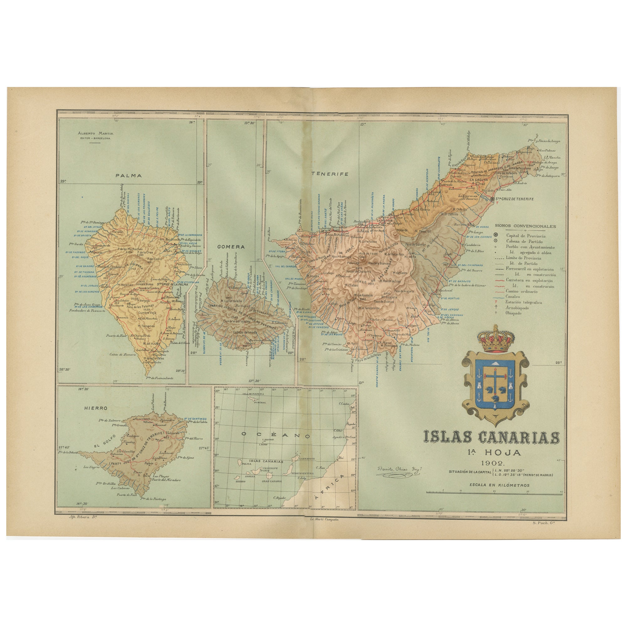
- Islands of Fire and Whispers: The Canary Islands in 1902Located in Langweer, NLThis is a authentic historical map of the Canary Islands, specifically the "1A HOJA" or first sheet, from the year 1902. The title on the map is "ISLAS CANARIAS 1902." This map featu...Category
Antique Early 1900s Maps
MaterialsPaper
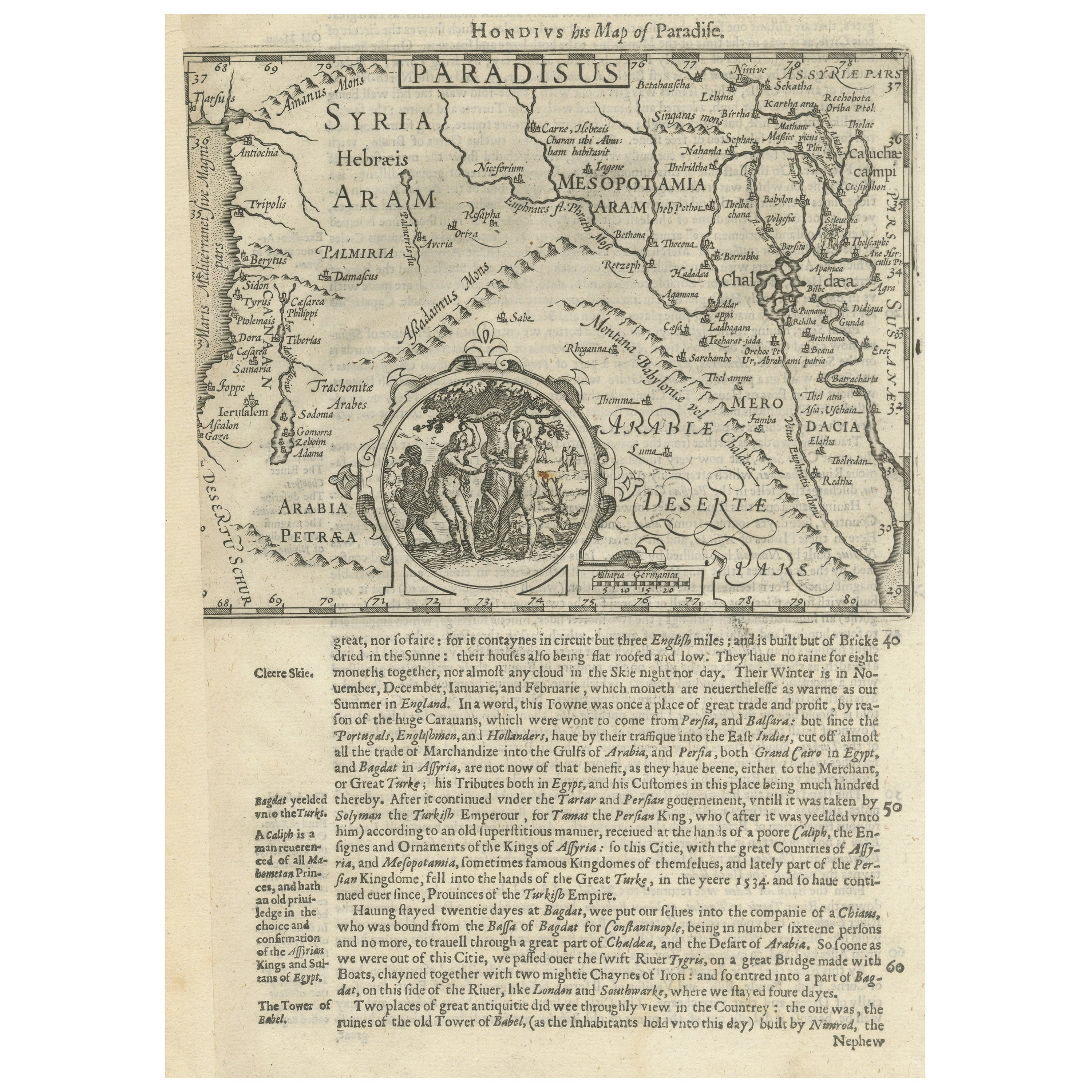
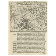
- Antique Map of the Holy Land, with vignette of the Garden of EdenLocated in Langweer, NLAntique map titled 'Hondius his Map of Paradise'. Beautiful map of the region bounded by the Holy Land. Syria, Mesopotamia, Chaldea and part of Arabia. With decorative vignette of th...Category
Antique Mid-17th Century Maps
MaterialsPaper
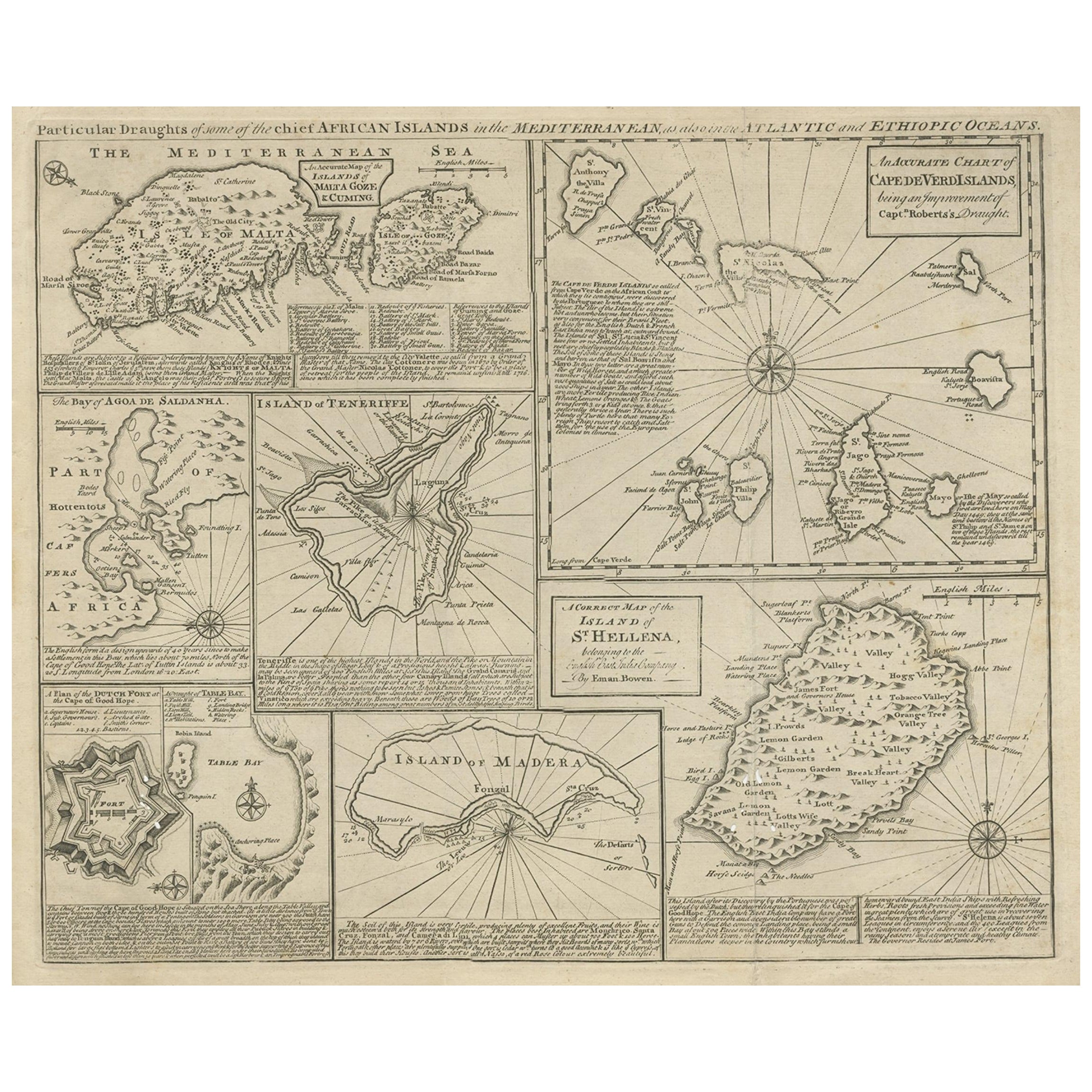
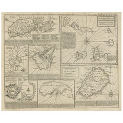
- Antique Map of 'African' Islands in the Mediterranean Sea and The Atlantic, 1747Located in Langweer, NLAntique map titled 'Particular draughts of some of the chief African Islands in the Mediterranean (..)'. Detailed set of eight maps, including a large and detailed Malta, the Bay of Agoa de Saldanha, Tenerife, the Dutch Fortress at the Cape of Good Hope, Table Bay...Category
Antique 18th Century Maps
MaterialsPaper
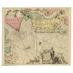
- Large Chart of the island and sea of Java, IndonesiaLocated in Langweer, NLAntique map titled 'Carte Esférica de la Isla Y Mar de Java'. Large chart of the island and sea of Java, Indonesia. Beautiful nautical chart, published 1863 in Spain.Category
Antique Mid-19th Century Maps
MaterialsPaper
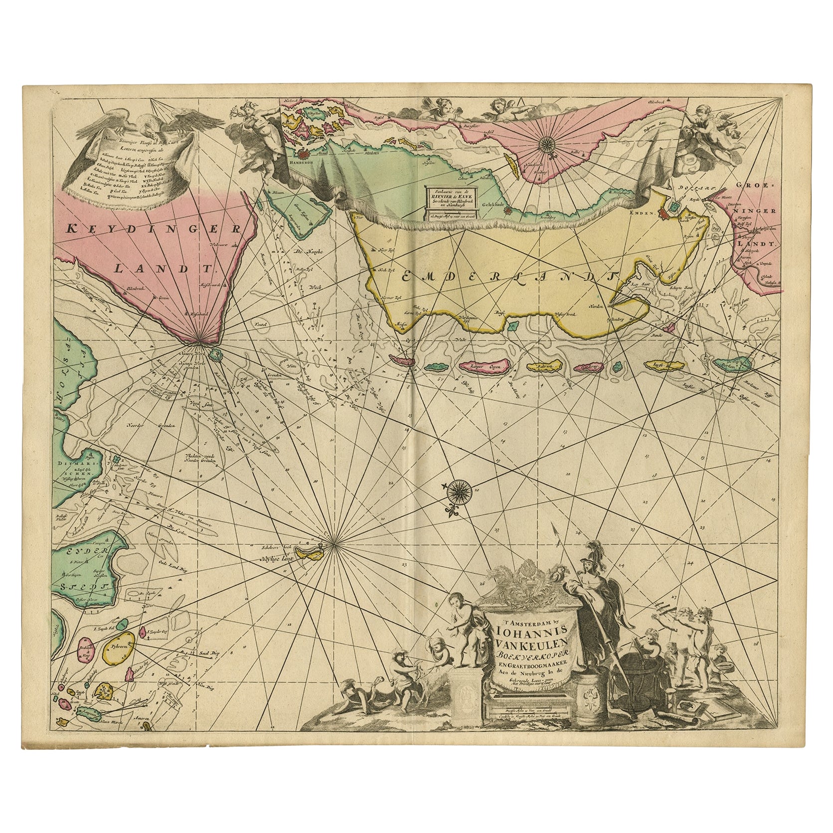
- Rare Sea Chart of the East Frisian Islands or Watten and the North Sea, c.1700Located in Langweer, NLDescription: Antique map titled 'Paskaarte van de rievier de Elve streckende van Oldenbroek tot Hamburgh.' Rare and interesting chart of the East Frisian Islands (or Watten) and ...Category
Antique Early 1700s Maps
MaterialsPaper
- Large Sea Chart of the British Islands, 1918Located in Langweer, NLAntique map titled 'The British Islands'. Large sea chart of the British Islands. It shows Ireland, Scotland, England, the Shetland Islands and part of Fra...Category
Vintage 1910s Maps
MaterialsPaper


You May Also Like
- Hand-Colored 18th Century Homann Map of Denmark and Islands in the Baltic SeaBy Johann Baptist HomannLocated in Alamo, CAAn 18th century copper plate hand-colored map entitled "Insulae Danicae in Mari Balthico Sitae utpote Zeelandia, Fionia, Langelandia, Lalandia, Falstria, Fembria Mona" created by Joh...Category
Antique Early 18th Century German Maps
MaterialsPaper
- Island Whimsy Designing a Paradise by the SeaBy Rizzoli International PublicationsLocated in New York, NYAuthor Celerie Kemble A house by the sea should be a house of dreams. Where windows and doors are thrown open to the ocean, and gusts of cool, salty air turn us all into kids again--buoyant and joyful. Spending childhood days on the beach and in the magical, romantic chaos of her family's rambling house internationally renowned interior designer Celerie Kemble has a deep-rooted connection to the sun and surf. However, in the summer of 2004, Kemble laid eyes on a wild swath of jungle in the Dominican Republic next to minty-blue water and an endless stretch of golden sand, she fell madly in love. Over many years, she designed a home away from home there, an island retreat--a clubhouse and a grouping of family homes and guesthouses--suffused with light and air, full of indoor and outdoor rooms for relaxation. In her latest book, Island Whimsy, Kemble recounts the deeply personal and creative journey of designing Playa Grande and bringing this labor of love to life. The chapters of this book are organized around the different ways Kemble sought to braid her family's story into the larger landscape of Playa Grande and to provide inspiration, joy, and respite to all who come. "Fantasy" looks at the way she used whimsical, dreamlike elements--from the latticework cabanas by the pool to the lamb statues...Category
21st Century and Contemporary North American Books
MaterialsPaper
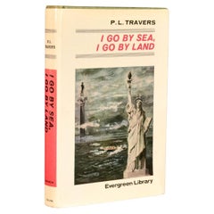
- 1966 I Go By Sea, I Go By LandBy P. L. TraversLocated in Bath, GBAn uncommon to see signed novel by P. L. Travers, a touching war novel inscribed by Travers. The author's presentation copy, signed to the recto of the front endpaper, 'Mary Cadogan...Category
Vintage 1960s British Books
MaterialsPaper
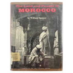
- The Land and People of Morocco by William Spencer, 1973Located in North Hollywood, CAThe land and people of Morocco (Portraits of the nations series) Hardcover – January 1, 1973 by William Spencer (Author) Introduces the land, histo...Category
20th Century Moroccan Moorish Books
MaterialsPaper
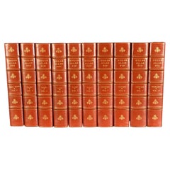
- 1902 The Complete Works of Edgar Allan PoeLocated in Bath, GBA beautiful limited edition set of the complete works of Edgar Allan Poe, illustrated with ten plates to each volume, and signed by the publisher. The Arnheim Edition of Poe's works...Category
Antique Early 1900s Books
MaterialsPaper
- 1865 Chart of the Islands of MadeiraLocated in Norwell, MARare James Imray chart from 1865 titled "Chart of the Islands of Madeira, Porto Santo and Dezerea" drawn from the survey made by Captain Ate Vidal Royal Navy, London. Published by Ja...Category
Antique 1860s European Maps
MaterialsPaper


Recently Viewed
View AllMore Ways To Browse
Map Of Old Armenia
Teak Wood Sphere
Nova Guinea Maps
Antique Map Of Illinois
Petite Point Hand Bag
Antique Map Of Southeastern Us
Antique Map Alabama
Antique Map Of Sydney
Malay Archipelago Map
Gambia Antique Map
Uruguay Antique Map
Guyana Antique Map
Ruscelli Map
Masque Theatre No
Nova Scotia Map
Antique Map Tuscany
Berkshire Antique Map
Cornwall Map