Collectibles and Curiosities on Sale

to
5,745
1,411
7,122
73
52
445
180
174
91
82
52
46
40
37
27
25
17
15
10
8
7
5
4
2,720
2,365
2,037
125
569
833
346
123
39
87
139
85
236
140
116
73
49
4,997
1,292
672
299
249
1,496
519
469
284
282
7,247
7,221
7,242
104
56
21
21
18
Sale Items
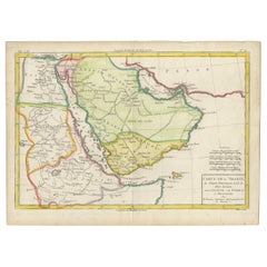
Antique Map of the Arabian Peninsula by Bonne 'c.1780'
Located in Langweer, NL
Antique map titled 'Carte de l'Arabie, du Golfe Persique, et de la Mer Rouge (..)'. Original antique map of the Arabian Peninsula, including the horn...
Category

Antique Late 18th Century Maps

Materials

Paper

Pair of Articulated Toys / Rabbit & Bear in Pale Oak by Kay Bojesen
By Kay Bojesen
Located in San Diego, CA
Great pair of articulated toys; both a rabbit and a bear by Kay Bojesen, circa 1990s. #2036 Kay Bojesen's toys are world-famous Classic for childre...
Category

20th Century Danish Scandinavian Modern Toys and Dolls

Materials

Oak

Historical Map Depicting the Continent of Asia, 1882
Located in Langweer, NL
This 1882 map presents a meticulously detailed representation of the continent of Asia, a testament to the cartographic skills of the era. Published as a...
Category

Antique 1880s Maps

Materials

Paper

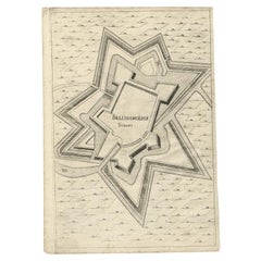
Antique Map of Fortification of Bellingwolderschans, The Netherlands, 1673
Located in Langweer, NL
Antique map titled 'Bellingwolderschans'. Original map of the fortification of Bellingwolderschans, the Netherlands. This map originates from 'Teatro del Belgio', by G. Gualdo Priora...
Category

Antique 17th Century Maps

Materials

Paper

Old Map of the Margraviate of Brandenburg by Giacomo Cantelli da Vignola, 1687
Located in Langweer, NL
Historical Map of the Margraviate of Brandenburg by Giacomo Cantelli da Vignola - 1687 This magnificent map, titled Marchesato, et Elettorato di Brandeburgo con una gran Porzione ...
Category

Antique 1680s Maps

Materials

Paper

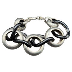
Avant Garde Sterling Silver Pomellato Link Chain Contored Gourmette Bracelet
Located in Van Nuys, CA
Mid-century Sterling Silver Pomellato link chain, Contoured gourmette bracelet. Elegant and bold, this 1960s Avant Garde gourmette bracelet features contoured chain links crafted in ...
Category

Vintage 1960s Italian Modern Collectible Jewelry

Materials

Silver

Limited Edition Thornton's Temple of Flora by Dr. Robert John Thornton '1951'
Located in Langweer, NL
'Thornton's Temple of Flora' by dr. Robert John Thornton. With bibliographical notes by Handasyde Buchanan. London: Collins, 1951. Printed in the Nethe...
Category

20th Century Books

Materials

Paper

Albacete, Spain - 1902: A Cartographic Depiction of Landscape and Infrastructure
Located in Langweer, NL
Albacete, Spain - 1902: A Cartographic Depiction of Landscape and Infrastructure An original and historical map of the province of Albacete, dated 1902, from the "Atlas Geográfico I...
Category

Antique Early 1900s Maps

Materials

Paper

Old Map of the Western Region of the Kingdom of Algiers, Algeria, 1773
Located in Langweer, NL
Antique map titled 'Kaart van het Westelyk Gedeelte van het Ryk van Algiers'. Old map of the western region of the Kingdom of Algiers, Algeria. Originates from the first Dutch ed...
Category

Antique 1770s Maps

Materials

Paper

Interesting Map of Great Britain and Northern Europe with various Illustrations
Located in Langweer, NL
Antique map titled 'Itinera Varia Auctoris'. Very interesting map of Great Britain and Northern Europe. The map shows Edwards' journeys between 1716-1730 to study his beloved birds a...
Category

Antique Mid-18th Century Maps

Materials

Paper

Beautiful Decorative Hand-Colored Antique Map of West Canada, 1851
Located in Langweer, NL
Description: Antique map of Canada titled 'West Canada'. With decorative vignettes titled Kingston and Falls of Niagara. Originates from 'The Illustrated Atlas, And Modern History Of The World Geographical, Political, Commercial & Statistical, Edited By R. Montgomery Martin'. Published; John Tallis London, New York, Edinburgh & Dublin. 1851. Drawn and Engraved by J. Rapkin. Artists and Engravers: John Tallis (1817-1876) was a British map...
Category

Antique 1850s Maps

Materials

Paper

Bay of Saint Helena: French Naval Chart by N.B. Ingénieur de la Marine, ca.1770
Located in Langweer, NL
Bay of Saint Helena: French Naval Chart by N.B. Ingénieur de la Marine, 18th Century This meticulously detailed copper engraving, titled 'Carte de la Baye de Sainte Helene' (Map of the Bay of Saint Helena), was drawn by N.B., an engineer of the French Navy (*Ingénieur de la Marine*). The map was created based on the navigational observations of mariners and published in the 18th century, most likely in France. It offers a precise and practical representation of Saint Helena Bay, a crucial anchorage point in the South Atlantic Ocean. Saint Helena Bay, located on the island of Saint Helena, was an important stopover for ships sailing between Europe and Asia, particularly for Dutch and British vessels during the Age of Exploration and the later colonial period. Its significance was further heightened when the island became the final exile location of Napoleon Bonaparte from 1815 to 1821. The map shows the bay with impressive attention to detail, depicting the coastline with numerous soundings marked in French and English leagues (*Lieues Marines de France et d'Angleterre*), allowing navigators to gauge the water depth and avoid hazards. The bay’s natural topography, including hills and coastal elevations, is rendered in delicate engraving lines. A large central peak dominates the landscape, surrounded by rugged terrain, while a smaller inlet and river (*Riviere*) are also shown, highlighting the complex geography of the bay. A decorative fleur-de-lis compass rose marks the left side of the chart, indicating orientation and providing a clear sense of direction for mariners. The map's clean and elegant design reflects the French cartographic tradition of combining functional navigation aids with aesthetic appeal. The chart includes practical features such as scale indicators and coastal profiles that help sailors recognize the bay from a distance. The detailed soundings marked throughout the bay make this map an invaluable tool for understanding the navigational challenges of the area, particularly for large, heavily laden ships. This rare chart belongs to a series of marine maps...
Category

Antique 1770s Maps

Materials

Paper

Antique Original Engraving of Chinese Vessels in the 18th Century, 1765
Located in Langweer, NL
Description: Plate no.34: 'Vaisseaux chinois.' (Chinese vessels.) This original auhentic plate originates from: 'Reize rondom de werreld, Gedaan in de jaaren 1740 tot 1744, door den ...
Category

Antique 1760s Prints

Materials

Paper

Midcentury Modern Porcelain Ashtray Cigarette Holder Set
Located in New York, NY
A Hungarian porcelain ashtray and loose cigarette vessel holder set, Mid-Century Modern, circa early to mid-20th century, Hungary by Hollohaza. Set has a triangular shape with gold a...
Category

Mid-20th Century Hungarian Mid-Century Modern Ashtrays

Materials

Porcelain

Antique Map of the Mediterranean and the Persian Gulf by Danckerts, c.1718
Located in Langweer, NL
Antique map titled 'De Gelegentheyt Van't Paradys en 't Landt Canaan.' Dutch Bible map covering the region between the Mediterranean and the Persian Gulf, f...
Category

Antique 18th Century Maps

Materials

Paper

Post World War II South African Hebrew Inscribed Metal School Supply Box
Located in New York, NY
Metal school supply box sent by the South Africa Jewish Wars Appeal to the Wels displaced persons (DP) camp in Austria, 1947. Painted blue and white with th...
Category

Vintage 1940s South African Decorative Boxes

Materials

Metal

Old Engraving of The Catching of Horses on Jafnapatnam, Ceylon 'Sri Lanka', 1672
Located in Langweer, NL
Antique print, titled: 'Paardevangst op Jafnapatnam' - This plate shows the catching of horses on Jafnapatnam. The province of Jaffna , and specially the fort at Jaffnapatnam were th...
Category

Antique 1670s Prints

Materials

Paper

Burgos 1902: Geographic Map of Castile's Historic Heartland in Spain
Located in Langweer, NL
The map of the province of Burgos in the autonomous community of Castile and León in Spain, dated 1902. It includes the following features: The map highlights the varied terrain wit...
Category

Antique Early 1900s Maps

Materials

Paper

Antique Spanish Coin Dated 1882
Located in Miami, FL
Fine Spanish coin that was previously on a silver bracelet (sold separately). Spain, Alphonse XII (1874-1885), 5 Peseta, 1882, Year: 1882 Metal: Silver.
Category

Antique 19th Century Spanish Collectible Jewelry

Materials

Silver

Antique Spanish Coin Dated 1882
$232 Sale Price
20% Off
Antique Map of the Region of Namen by Veelwaard, c.1840
Located in Langweer, NL
Antique map titled 'Kaart van Namen'. Original antique map of the region of Namen (Namur), Belgium. Source unkown, to be determined. Published circa 1840. Artists and Engravers:...
Category

Antique 19th Century Maps

Materials

Paper

Original Antique Print of Decorative Art in the Middle Ages, 1869
Located in Langweer, NL
Old print of decorative art in the Middle Ages. This print originates from 'L'Ornement polychrome'. A beautiful work containing about...
Category

Antique 19th Century Prints

Materials

Paper

Early 20th Century Algerian Palace-Shaped Brass Hanukkah Lamp
Located in New York, NY
Hanukkah lamp shaped like a palace, surmounted by Islamic crescent. Made in Laghouat, Algeria. The Hanukkah lamp is made of two parts: a pierced and engraved brass in the shape of ...
Category

Vintage 1930s Algerian Islamic Religious Items

Materials

Brass, Copper

Antique Print of the Dutch VOC Bombing Palembang, Sumatra (Indonesia), ca.1700
By Pieter Van Der Aa
Located in Langweer, NL
Antique print titled 'La Ville de Palimbang dans L’Ile de Sumatra.' A very decorative, impressive engraving of Palembang in Sumatra. Two views on one sheet. In the upper part the ove...
Category

Antique Early 18th Century Prints

Materials

Paper

Northern Schleswig and Haderslev Map by Johannes Mejer and Johannes Blaeu, 1662
Located in Langweer, NL
The map shows the Duchy of Schleswig, which spans the area between the North Sea coast, Kolding, and Flensburg. The maps were originally published by Johannes Mejer in the regional a...
Category

Antique 1660s Maps

Materials

Paper

Navarra in Cartographic Detail: A 1902 Map of the Crossroads of Northern Spain
Located in Langweer, NL
The original antique map for sale shows the Spanish province of Navarra as it was in 1902. Here's a brief description and a potential title for the map: Description: - The map detai...
Category

Antique Early 1900s Maps

Materials

Paper

Plaster Traditional Figure of a Saint, circa 1950
Located in Barcelona, ES
Traditional religious plaster figure of a saint. Made in traditional Catalan atelier in Olot, Spain, circa 1950. In original condition, with minor wear consistent with age and use,...
Category

Vintage 1950s Spanish Modern Religious Items

Materials

Plaster

Antique Print of Kupang or Koepang in the East Indies, Now West-Timor, Indonesia
Located in Langweer, NL
Antique print Timor titled 'De Stad Koepang, La Ville de Koepang'. View of the town of Koepang / Concordia / Kupang on the Island of Timor, Indonesia. Originates from 'Gezigten uit Neerlands Indie, naar de natuur geteekend en beschreven.', by C.W.M. van de Velde, published in Amsterdam, Frans Buffa en Zonen (1844-1845). Artists and Engravers: Charles William Meredith van de Velde (1818-1898) was a Dutch...
Category

Antique 19th Century Prints

Materials

Paper

Ávila in a Historical Map of 1902: A Geographic and Administrative Overview
Located in Langweer, NL
The map is of the province of Ávila, one of the provinces of the autonomous community of Castile and León in Spain, and it is dated from 1902. The map illustrates several geographic ...
Category

Antique Early 1900s Maps

Materials

Paper

Antique Map of the United States of North America by Wyld '1845'
Located in Langweer, NL
Antique map titled 'Map of The United States of North America'. Original antique map of the United States of North America. This map originates from 'An Atlas of the World, Comprehen...
Category

Antique Mid-19th Century Maps

Materials

Paper

Antique Map of the Region of Sarlat in France by Janssonius, 1657
By Johannes Janssonius
Located in Langweer, NL
Antique map of France titled 'Le Diocese de Sarlat dioccesis Sarlatensis'. Decorative map of the Sarlat region, part of the Dordogne department. This map originates from 'Atlas Novus...
Category

Antique 17th Century Maps

Materials

Paper

Rare WWII Vulcano "Démarreur" Machined Aluminum Lighter, Made in Eritrea Africa
Located in Van Nuys, CA
The Vulcano Aluminum "Démarreur" Lighter Made in Eritrea Africa is a rare collectible from Wartime WWII production. It is crafted from machined aluminum with tortoiseshell cataline c...
Category

Vintage 1940s Eritrean Art Deco Tobacco Accessories

Materials

Aluminum

Detailed Antique Map of the Region of Gujarat and Mumbai in India, C.1825
Located in Langweer, NL
Antique map titled 'No. 93 Guzerate, Chandeish et Aurungabad'. Detailed map of the region of Gujarat and the region of Mumbay. Originates from 'Atlas Universel' by P.M. Vandermaelen....
Category

Antique 19th Century Maps

Materials

Paper

Twenty-Seven Woods for a Chinese Artificial Flower Vase L by Ettore Sottsass
By Ettore Sottsass, Design Gallery Milano
Located in Barcelona, Barcelona
Twenty-seven woods for a Chinese artificial flower vase L by Ettore Sottsass, Edited by Design Gallery Milano, 1995. Limited edition of 12 signed and numbered pieces, number 3/12...
Category

1990s European Modern Vases

Materials

Glass, Wood

Kay Bojesen, Vintage Painted Zebra Figure, 1950s
By Kay Bojesen
Located in Esbjerg, DK
A wooden toy zebra made from Danish beech and hand painted white and black. It was designed by Kay Bojesen in 1936. This particular example was manufactured in the 1950s. It has bee...
Category

Vintage 1930s Danish Mid-Century Modern Toys and Dolls

Materials

Beech

Antique Map of Alentejo: Land of Tradition and Tranquility, 1903
Located in Langweer, NL
The image is a historical original antique map of the Alentejo region in Portugal. This map includes the topographical layout of the region, with its complex network of roads and wat...
Category

Antique Early 1900s Maps

Materials

Paper

Three Village Buddha Statues from Laos
Located in Atlanta, GA
A trinity installation of three antique "village" Buddha from Laos. Carved in an informal village style, the execution of the craftsmanship and pigment decoration is noticeably folky...
Category

Antique 19th Century Religious Items

Materials

Wood

Three Village Buddha Statues from Laos
$7,000 Sale Price / set
22% Off
Antique Map of the Gulf of Tomini by Winkler Prins, 1878
Located in Langweer, NL
Antique map titled 'Kaart van de Golf van Tomini of Gorontalo.' (Map of the Gulf of Tomini or Gorontalo.) This map shows the Gulf of Tomini near the Island of Sulawesi, Indonesia. Wi...
Category

Antique 19th Century Maps

Materials

Paper

Small Detailed Antique Map of France, with Decorative Title Cartouche, 1754
Located in Langweer, NL
Antique map France titled 'An Accurate Map of France drawn from the best authorities'. Small, detailed map of France. With decorative title cartouche. ...
Category

Antique 1750s Maps

Materials

Paper

Victorian Visions of the New World: A Detailed Tallis Map of North America, 1851
Located in Langweer, NL
The map presented here is an intricate example from the series of maps produced by John Tallis & Company. Tallis maps are known for their detailed and elaborate style, often includin...
Category

Antique 1850s Maps

Materials

Paper

Antique Map of the Lemsterland Township 'Friesland' by Halma, 1718
Located in Langweer, NL
Antique map Friesland titled 'Lemsterland de Seste Grietenije der Zevenwolden (..)'. Old map of Friesland, the Netherlands. This map depicts the region of Lemsterland and includes ci...
Category

Antique 18th Century Maps

Materials

Paper

Antique Map of Russia and Surroundings by Stieler, 1874
Located in Langweer, NL
Antique map titled 'Nord- & Mittal-Asien, Ubersicht des Russischen Reiches.' A map of Russia in scale 1:20.000.000. The depicted area spans from Iran and Sweden in the left edge of t...
Category

Antique 19th Century Maps

Materials

Paper

Antique Map of the County of Hainaut by Jaillot, 1692
Located in Langweer, NL
Antique map titled 'Le Comté de Haynaut divisé en Chateliensis, Balliages, Prevoste's (..)'. Large map of the county of Hainaut (France) with its most important cities, Mons (Bergen)...
Category

Antique 17th Century Maps

Materials

Paper

Antique Map of Europe in the Year 800 and 1500, Published in 1842
Located in Langweer, NL
Antique map titled 'Carte de l'Europe'. Two maps of Europe. The upper map depicts Europe in the year 800, the lower map depicts Europe in 1500. This map originates from 'Atlas univer...
Category

Antique 19th Century Maps

Materials

Paper

Antique Map of the Dordogne ‘France’ by V. Levasseur, 1854
Located in Langweer, NL
Antique map titled 'Dépt. de la Dordogne'. Map of the French department of Dordogne, France. This area is best known for its production of Monbazillac, a sweet white wine, and Cabéco...
Category

Antique Mid-19th Century Maps

Materials

Paper

Original Steel Engraved Map of French Colonies in America, 1854
Located in Langweer, NL
Antique map titled 'Colonies Francaises (en Amerique)'. Detailed map bordered by vignettes showing local animals, produce and activities of the various French Colonies in America. Th...
Category

Antique Mid-19th Century Maps

Materials

Paper

Old Print of Nature Godess Sibyl and Puzza of China on a Lotus Flower, ca.1725
Located in Langweer, NL
Antique print, titled: 'Puzza ou la Cybele des Chinois (…)' - This plates hows Puzza, Sibyl of China and Puzza sitting on a Lotus flower. Source unknown, to be determined. Artists...
Category

Antique 1720s Prints

Materials

Paper

Antique Detailed Map of Jerusalem in Israël with Extensive Key and Scale, 1698
Located in Langweer, NL
Antique map titled 'Jerusalem.' Plan of the ancient city of Jerusalem. With extensive key and scale. Source unknown, to be determined. Artists and Engravers: Made by 'Cornelis de...
Category

Antique 17th Century Maps

Materials

Paper

Rare Small Map of Sumatra, Java, Borneo, Macassar, Madura, Bali, 1614
Located in Langweer, NL
One of the first maps of the Indonesia islands of Java, Bali, Sumbawa etc. in early days of the Dutch Indies. Also showing Banten, Jakarta (Jacatra), Indr...
Category

Antique Early 17th Century Maps

Materials

Paper

Antique Map of East Asia by Coronelli, circa 1690
Located in Langweer, NL
Antique map of East Asia showing New Holland and parts of Van Diemens Land and New Zealand. This map is the right hand part of a two sheet map, but is complete on its own. This map o...
Category

Antique Late 17th Century Maps

Materials

Paper

Large Antique Map of the City of Bremen and Surroundings, Germany
Located in Langweer, NL
Original antique map titled 'Prospect und Grundris der Keiserl Freyen Reichs und Ansee Stadt Bremen (..)'. This is a superb chart of the city of Bremen and the surrounding small villages with particular emphasis on the many rivers and canals...
Category

Antique Early 18th Century Maps

Materials

Paper

Old Print of the Governor-General's Residence in Batavia, Indonesia, 1739
Located in Langweer, NL
Antique print titled 'Ein Prospect Sr. Hoch-Edelheit des Herrn Gen: Gouverneurs Hoff und Wohnhausses in dem Castel Batavia wie dasselbe von innen anzusehen'. Old print with a view of the Governor-General's residence in Batavia. This print originates from from 'Allerneuester Geographische- und Topographischer Schau-platz, von Africa und Ost-Indien'. Artists and Engravers: Johann Wolfgang Heydt, a German artist who worked for the Dutch East India...
Category

Antique 1730s Prints

Materials

Paper

Antique Print of the House of Richard Rooth The Elms, in Surrey, England, 1717
Located in Langweer, NL
Antique print titled 'The Elevation of Richard Rooth his House at Epsom in Surrey (..)'. Elevation of the house of Richard Rooth, The Elms. This print ori...
Category

Antique 18th Century Prints

Materials

Paper

Imperial Frontiers: A 19th Century Map of Southern Russia and the Caucasus, 1882
Located in Langweer, NL
This map, sourced from the comprehensive 1882 atlas by Blackie & Son, delineates the southern part of Russia and the Caucasus region, reflecting the geopolitical contours and topogra...
Category

Antique 1880s Maps

Materials

Paper

Original Antique Engraving of a Horse Race at a Japanese Racing Track, 1669
Located in Langweer, NL
Description: Antique print, titled: 'Japansche Ren-baanen.' - View of a race at a Japanese (horse) racing track. A man runs beside a horse (the horse's rein in his hand). A man w...
Category

Antique 1660s Prints

Materials

Paper

Antique Map of the Islands of Banda, Indonesia from a Very Rare Edition, 1725
Located in Langweer, NL
Antique map titled 'Les Iles de Banda (..).' (The islands of Banda, Indonesia.) Extremely rare in this edition. This plate originates from the very scarse: 'La galerie agreable d...
Category

Antique 1720s Maps

Materials

Paper

Antique Map of South American, The West Indies & Most of Africa, Ca.1775
Located in Langweer, NL
Antique map titled 'Carte pour Servir a l' Histoire Philosophique et Politique des Etablissemens et du Commerce des Europeens dans les deux Indes'. This map is roughly centered o...
Category

Antique 1770s Maps

Materials

Paper

Rare Antique Map of Friesland in Roman Times, Published 1778
Located in Langweer, NL
Antique map titled 'Carte de la Frise, entre les Embouchures du Rhin & de l'Eems, ij compris l'isle Bataves, dressée selon leur ancienne position le Gouvernement des Romains & des Fr...
Category

Antique 18th Century Maps

Materials

Paper

Rare City View of London and Westminster, Showing Many Battles Ships, 1804
Located in Langweer, NL
Title: The Cities of London & Westminster, accurately copied from the table of the Camera Obscura in the Royal Observatory at Greenwich This is a rare plate from a serie of 22 landmarks taken from Modern London, published in 1804 by Richard Phillips...
Category

Antique Early 1800s Prints

Materials

Paper

Antique Map of Province Friesland, The Netherlands, 1787
Located in Langweer, NL
Antique map titled 'Nieuwe Kaart van Friesland behoorende tot het Vaderlandsch Woordenboek van Jacobus Kok'. Original antique map of the province of Friesland, the Netherlands. This ...
Category

Antique 18th Century Maps

Materials

Paper

Antique Map of Friesland, A Dutch Province, c.1780
Located in Langweer, NL
Antique map titled 'Dominii Frisiae (..)'. Original antique map of Friesland. 3rd state, most likely published after 1775 (De Rijke, 46.3). Artists and Engravers: Published by P. Sch...
Category

Antique 18th Century Maps

Materials

Paper

Read More

Medal-Worthy Memorabilia from Epic Past Olympic Games

Get into the games! These items celebrate the events, athletes, host countries and sporting spirit.

Ahoy! You’ve Never Seen a Collection of Sailor Art and Kitsch Quite Like This

French trendsetter and serial collector Daniel Rozensztroch tells us about his obsession with objects related to seafaring men.

Pamela Shamshiri Shares the Secrets behind Her First-Ever Book and Its Effortlessly Cool Interiors

The sought-after designer worked with the team at Hoffman Creative to produce a monograph that beautifully showcases some of Studio Shamshiri's most inspiring projects.

Moroccan Artworks and Objects Take Center Stage in an Extraordinary Villa in Tangier

Italian writer and collector Umberto Pasti opens the doors to his remarkable cave of wonders in North Africa.

Montecito Has Drawn Royalty and Celebrities, and These Homes Are Proof of Its Allure

Hollywood A-listers, ex-pat aristocrats and art collectors and style setters of all stripes appreciate the allure of the coastal California hamlet — much on our minds after recent winter floods.

Whaam! Blam! Pow! — a New Book on Pop Art Packs a Punch

Publishing house Assouline and writer Julie Belcove have teamed up to trace the history of the genre, from Roy Lichtenstein, Andy Warhol and Yayoi Kusama to Mickalene Thomas and Jeff Koons.

What Makes a Gem-Encrusted Chess Set Worth $4 Million?

The world’s most opulent chess set, weighing in at 513 carats, is literally fit for a king and queen.

Tauba Auerbach’s Geometric Pop-Up Book Is Mighty Rare, Thanks to a Hurricane

This sculptural art book has an epic backstory of its own.
Recently Viewed

View All